BWCA Entry Point, Route, and Trip Report Blog
June 01 2024
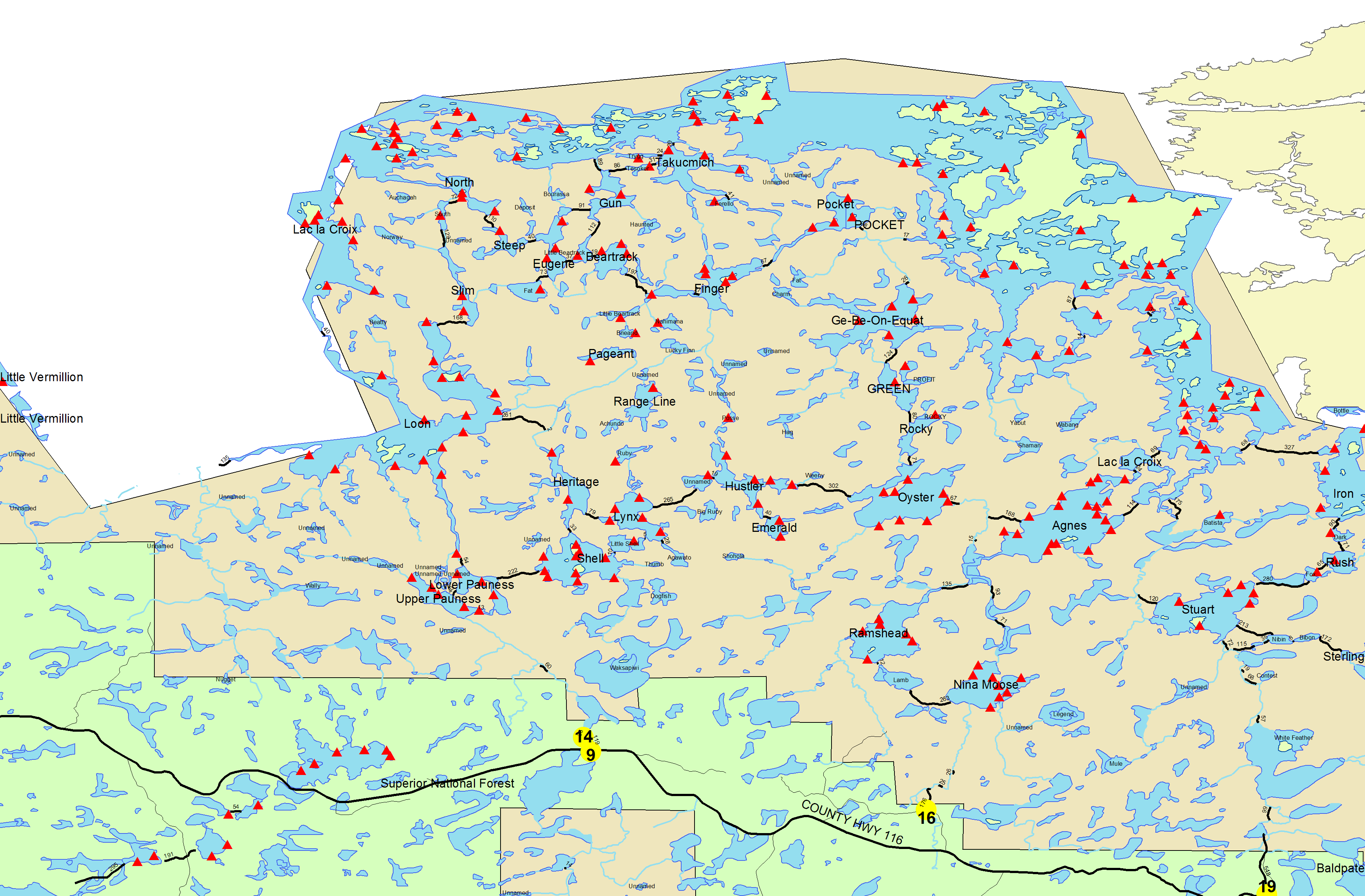
Entry Point 14 - Little Indian Sioux River North
Number of Permits per Day: 6
Elevation: 1364 feet
Latitude: 48.1466
Longitude: -92.2103
The Storm / Bushwack to Rangeline / A Trip to Warpaint / Lynx Lake
Entry Date:
July 18, 2014
Entry Point:
Little Indian Sioux River (north)
Number of Days:
8
Group Size:
9
Four years ago I visited Lynx Lake with my son Josh. We had an incredibly long one day trip. While passing through we stopped at the 5* campsite on Lynx and that was enough to set me hoping on a return someday. That day arrived this year and much to my delight the campsite was open when we arrived. The balance of our party arrived on Saturday and we ended up with the two best campsites on the lake, both on the eastern shore.
Today we went back to Shell Lake to help guide the other group to Lynx. If you keep the white rock (pictured) and the point near it you'll have no trouble locating the way to get to the Little Shell portage. Though a short portage it has a nasty rock landing. 
Later on Saturday we took a trip to Agawato Lake which is accessed by a short and pretty portage on the south side of Lynx. We nicknamed the lake Agaswampo. It appears that a fallen tree made a breach in the dam at the entrance to the lake. This had drained about 18" height of water out of the lake. This made the first 300 yards appear to be a large swamp. We walked around it and made our way to the main body of the lake. This lake and lone campsite on the eastern shore is probably accessed mostly by hikers on the Sioux Hustler Trail. A very high rock area sits above and to the north of the campsite affording some beautiful views and was totally loaded with ripe blueberries. 
 The Lynx campsite affords a tremendous view of the lake. It has multiple viewing areas, a great campsite, many places for tents and hammocks. The landing is not the greatest but the site more than compensates for it.
  In the afternoon Luke, Evie & I decided to see if we could find Warpaint Lake. We had heard that it did not have a portage and no one had seemed to have been there. We did find it and it is a hidden gem located to the south of Ruby Lake. I have a short trip report related to that trip posted on this site as well. This picture shows the island you see as you enter the lake.
 [paragraph break]We ate and packed up to head out of Lac La Croix into Boulder River. We portaged twice with a lot of other people. I didn’t like all the traffic we were around during the last day in here. It kind of ruins that feeling of seclusion. Mark had been talking about possibly going up to Quetico to escape the crowds. This idea is becoming more enticing as the trip goes on. After getting to Agnes, we decided to continue on to Nina Moose via the Nina Moose River. We had to hunt for a decent site and found one right near tomorrow’s exit spot. We laid out the solar shower and took a rest lying out in the sun. I needed to even out my crazy suntan. The fronts of my legs were about five shades darker than the backs due to my canoeing the past week or so. We enjoyed our last dinner of the trip and had a few chipmunks join us. One even got brave enough to climb up and lick my plate clean. [paragraph break]
  [paragraph break]We retired for the evening with visions of pizza and beer that we would be enjoying tomorrow in Ely.
 [paragraph break]The temperature warmed quickly and it became a beautiful day. We piddled around so long that we soon realized it was 11:00! Holy cow! We threw everything together and hopped in the canoe. We headed down Moose River North. It reminded me of last year’s exit with us following a stream through marsh areas with lots of evidence of muskrats, beavers, and other wildlife. We came upon a deer feeding in the stream and waited for her to move on. [paragraph break]
  [paragraph break]The deer flies were very annoying and seemed to really think I looked tasty. Thank God for Off. We had to drag over or pull around numerous beaver dams and dodge a lot of rocks. The water level was low and it was challenging to keep clear. As we portaged out, we came across 4-5 college students repairing one of the landings. They were from the MCC (Minnesota Conservation Corps). These portages probably see a lot of traffic and need maintenance. The last portage of the trip took us out to the parking lot. It was a nice gradual uphill path and a nice ending to a beautiful day. We were picked up only minutes after emerging and taken back to Ely. Year two was under our belt. Overall, it had been very pleasant and uneventful. Our love for the BWCA was growing and our curiosity of Quetico was also growing. Maybe we should start thinking about going farther and longer next year. I couldn’t wait!
Thanks for reading![paragraph break]Pixie Paddler[paragraph break]

Today we head up to Heritage Lake. We explore the trail that leads to Loon Lake and find that it has sustained much damage ...so we turn back. Earlier in the trip one excellent swimmer in our group expressed the desire to trip up this way to Loon and then swim from the USA to Canada. Some things don't happen when teenagers sleep in. Back on Heritage I did manage to catch a nice 4 lb. smallmouth and then lose another one just as big on the next cast. We head back to camp for a group meal and start to pack up for an early exit on Friday. 
