|
||||
 Boundary Waters Quetico Forum Quetico Forum Trant, Payne and Keewatin Pictos Reply Boundary Waters Quetico Forum Quetico Forum Trant, Payne and Keewatin Pictos Reply
|
| Previous Messages: | |
| Author | Message Text |
| Turnpike |
04/08/2015 08:09PMquote Kiporby: "Here are the locations I've found. This matches what I remember when I saw them last summer. |
| Kiporby |
04/06/2015 09:45AM Here are the locations I've found. 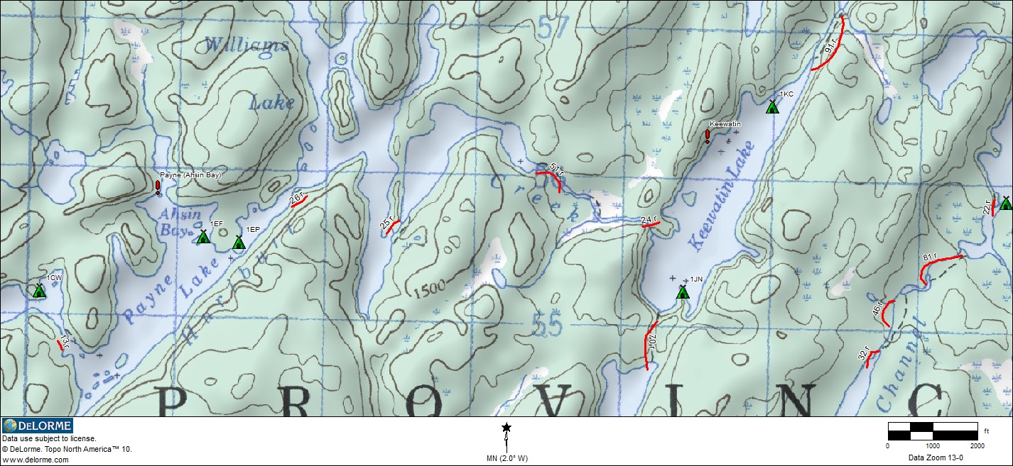 
|
| dentondoc |
04/06/2015 09:14AMquote Kiporby: "Thanks Rob. I think that Trant one was marked wrong on most maps. " I stand corrected. I was using my McKenzie Maps for the trip down this set of lakes and had no problem finding the specified picto's. However, upon actually inspecting those maps I discover that the red dots marking the picto's are not printed on the maps, but rather hand drawn red dots. This means that I likely transferred their location based to the maps based on the contents of Furtman's "Magic on the Rocks" material. dd |
| Kiporby |
04/05/2015 08:35PM Thanks Rob. I think that Trant one was marked wrong on most maps. |
| bojibob |
04/05/2015 11:02AM Dan, This may be helpful for Trant Uncle Moose Quetico 19 Day Solo Trip Report |
| dentondoc |
04/05/2015 09:26AMquote Kiporby: "Are the locations on the Fisher Maps / McKenzie Maps fairly accurate?" Yep. Although I'd spend a little time searching close to the waterline on Keewatin. I believe there are a few more picto's there than are widely documented. dd |
| Kiporby |
04/05/2015 07:02AM Are the locations on the Fisher Maps / McKenzie Maps fairly accurate? |
Community Links
 Search BWCA.com
 Donate
 Featured Sponsor
