|
 Boundary Waters Quetico ForumGroup Forum: WabakimiWabakimi tent sites
|
 Forum Sponsor

Author
Text
")
01/04/2012 02:55PM
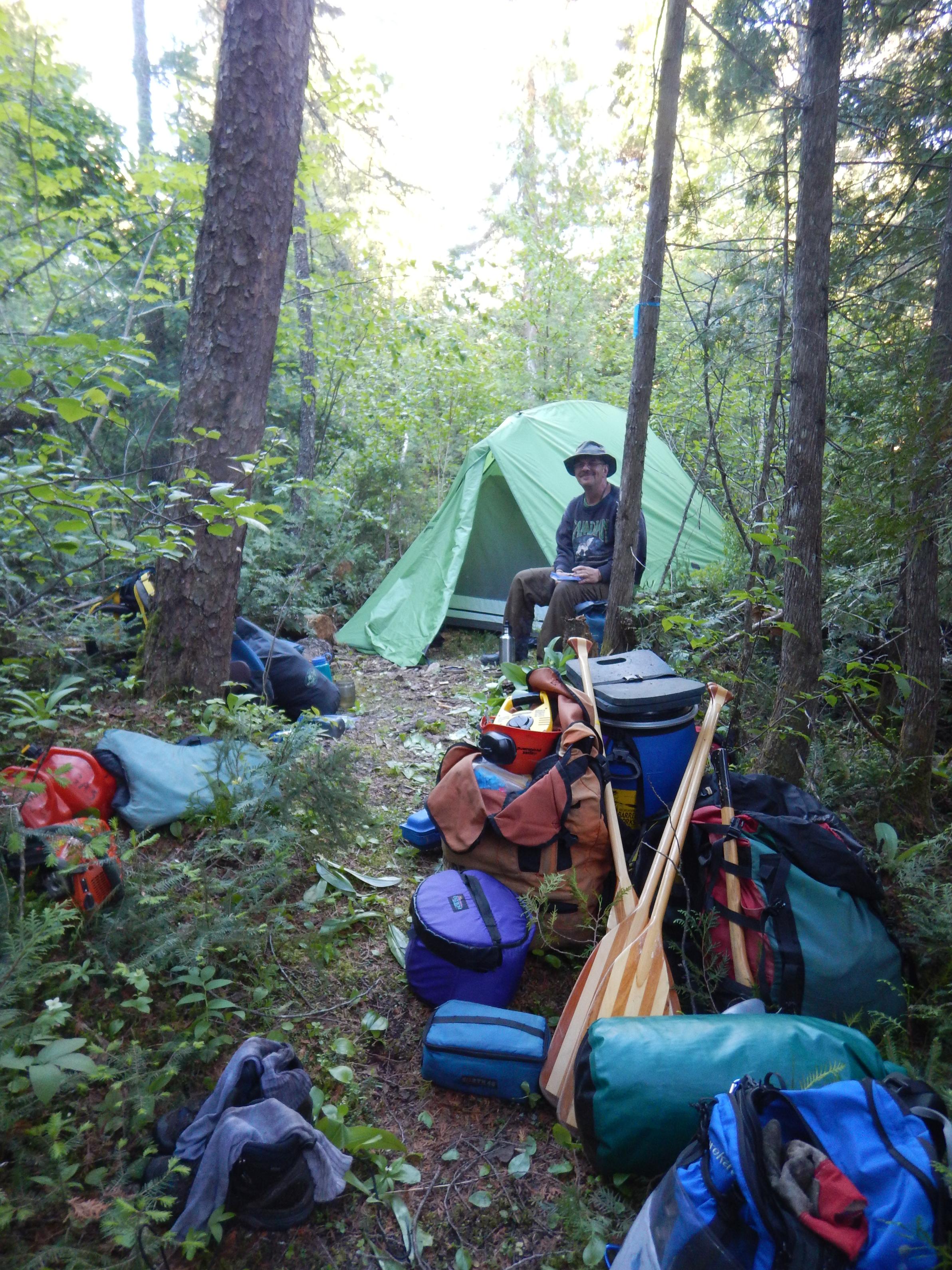
The portage thread inspired me to show some of our tent sites. I'd enjoy seeing yours as well.
Kenoji Lake, Island site. Very small tent pad on very small, flat point.
Ogoki/Berg River site. Sloped campsite with very small tent pad above it.
Nice protected island site on Whitewater Lake. Mossy tent pad.
Caribou Lake/River site. Our favorite-faced the sun. Water on three sides with great trees to hang stuff from.
Little Caribou River. Heavily used point near exit. Not bad, but you could put multiple tents here.
Kenoji Lake, Island site. Very small tent pad on very small, flat point.

Ogoki/Berg River site. Sloped campsite with very small tent pad above it.

Nice protected island site on Whitewater Lake. Mossy tent pad.

Caribou Lake/River site. Our favorite-faced the sun. Water on three sides with great trees to hang stuff from.

Little Caribou River. Heavily used point near exit. Not bad, but you could put multiple tents here.

01/05/2012 07:05AM
campsites are somewhat analogous to portages in some areas in that you need to know in advance where they are, maps, trip reports, print literature, regardless of the source. ok, you've done the legwork, and despite your efforts, you're still faced with bushwhack camps for a variety of reasons.
i had a "reported" campsite marked, but there wasn't one, at least we never saw even a hint that there had ever been one within miles.

we were stuck in an area where i didn't have reports of any campsites. we didn't intend to be there, but it was getting dark and we had to stop. cleared an area with the saws just big enough for the tents, hard freeze that night, there was ice in the boat, my map case was frozen shut. tough night in the boreal camped on a moose track.

no campsites marked until the other side of the next portage, we were out of time and out of daylight, stopped to look at a couple possibilities, then bushwhacked two tent pads. the next morning we found an unmarked campsite at the end of the first portage, but we wouldn't have been able to cross in daylight to reach it. the "reported" campsite was there but unused and we would have needed to clear it to fit two tents.

i had a "reported" campsite marked, but there wasn't one, at least we never saw even a hint that there had ever been one within miles.
we were stuck in an area where i didn't have reports of any campsites. we didn't intend to be there, but it was getting dark and we had to stop. cleared an area with the saws just big enough for the tents, hard freeze that night, there was ice in the boat, my map case was frozen shut. tough night in the boreal camped on a moose track.
no campsites marked until the other side of the next portage, we were out of time and out of daylight, stopped to look at a couple possibilities, then bushwhacked two tent pads. the next morning we found an unmarked campsite at the end of the first portage, but we wouldn't have been able to cross in daylight to reach it. the "reported" campsite was there but unused and we would have needed to clear it to fit two tents.
Wabakimi Project: Proud participant and contributor. http://wabakimi.org.- "Tell me once again what you plan to do with your one wild and precious life."

01/05/2012 09:15AM
Campsite maps just indicate where there MIGHT be a campsite.
As thirty percent of the boreal forest is on its side at any time, there is a good chance that a campsite on a map has been obliterated when you get there and require some saw work.
Even on the main routes where paddlefamily was there is no guarantee a prior campsite is not buried. Laurent Lake has a little island with a very used campsite. I had used it twice before. The third time we tried,we found it had been the target of a microburst and required a saw. And a LOT of time.
Its always a possibility that a site exists though not visible from the water. The Berg has a couple of native sites for example. They are buried with cedars screening them. FN for hunting never want an open campsite.
01/05/2012 10:17AM
we had just come through a difficult couple days, and needed to stop earlier in the day, dry out, reorganize, and generally regroup...plus, eat until stuffed, we were working on a big calorie deficit.
i didn't have any campsites marked in the immediate area, but stopped at a location that had the look, even though it showed no use. we found the old fire ring, then a rusted out can dump, the place had seen regular use, but not for maybe 50 years or more.

i didn't have any campsites marked in the immediate area, but stopped at a location that had the look, even though it showed no use. we found the old fire ring, then a rusted out can dump, the place had seen regular use, but not for maybe 50 years or more.
Wabakimi Project: Proud participant and contributor. http://wabakimi.org.- "Tell me once again what you plan to do with your one wild and precious life."
01/06/2012 08:06PM
jdrocks- Those are quite the sites. Sure made for an interesting story. What area where you in at these sites?
We never had it that rough, a couple of times we had to paddle further than planned because a site we expected never appeared, but it was never a concern. If it was in question, we'd hop out of the canoe and check the shoreline. Some were obvious, with propane tanks and hacked together chairs/tables, while others were more secluded and unused. Personally, I liked scanning the shore for subtle details of occupation- the odd shift of a few rocks or maybe general open feel to a spot. Kept it pretty interesting.
We never had it that rough, a couple of times we had to paddle further than planned because a site we expected never appeared, but it was never a concern. If it was in question, we'd hop out of the canoe and check the shoreline. Some were obvious, with propane tanks and hacked together chairs/tables, while others were more secluded and unused. Personally, I liked scanning the shore for subtle details of occupation- the odd shift of a few rocks or maybe general open feel to a spot. Kept it pretty interesting.


01/07/2012 09:11PM
quote paddlefamily: "jdrocks- Those are quite the sites. Sure made for an interesting story. What area where you in at these sites?
"
those sites are off the beaten track, and you don't have to go far before you encounter plenty of unused campsites, or find yourself in an area where there aren't any, at least that we could find. i suppose it's possible something was there and we just didn't find it, but with 100 years of combined paddling experience in the boat, i judge it unlikely, we knew what we were looking for.
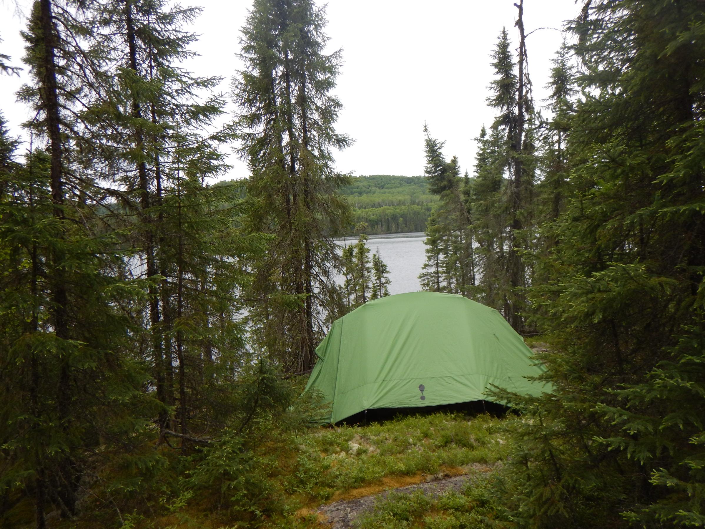
packing up after a night at this 5 star elevated site, i wish i had better photos. you could not see the moss covered fire ring from the water, but the site faced the preferred westerly direction, and looked likely. it was located on a small island, covered with old blowdowns, maybe 30 years or more of no use. we approached from the back side, and when i saw on old trail walked down in the moss, i knew there had to be something. saw and axe work to clear two tent pads, and we were in business. rained all night.

Wabakimi Project: Proud participant and contributor. http://wabakimi.org.- "Tell me once again what you plan to do with your one wild and precious life."

01/12/2012 10:26AM
man, that is one great photo. home is where ya find it.

i've had sleet and light snow in all the summer months up there, no real accumulation until 2005 or 06 when there was almost 1.5" the second week in august. 20 miles south, it didn't snow at all that day.
i've had sleet and light snow in all the summer months up there, no real accumulation until 2005 or 06 when there was almost 1.5" the second week in august. 20 miles south, it didn't snow at all that day.
Wabakimi Project: Proud participant and contributor. http://wabakimi.org.- "Tell me once again what you plan to do with your one wild and precious life."
01/13/2012 10:02PM
that is why a Timberline makes for a less than ideal tent in the winter, it sags under the weight of the snow that does accumulate on it. And once the snow starts accumulating, it only gets worse unless you clear it off. But yes, the lines should have been tightened, it wouldn't have sagged so much with such a small amount of snow.
let science, not politics decide, ... but whose science?


07/07/2016 03:42PM
I know, with the Wabakimi Project, we will map sites if they have reasonable pads for two "4-person" Timberline tents and a decent situation for a rain fly as well as reasonable landing and a safe spot for a fireplace. That means, we don't map it if it is covered with blowdown (but, then, that is a fluid situation). Sometimes the mapped site will have a current fireplace; sometimes it will have an old one with a birch growing in it; sometimes none, unless we stay there and build/reconstitute a fireplace. While we certainly camp at some of the mapped sites, there are others that meet the criteria for mapping but are "unimproved". The map books use one symbol for these mapped campsites, so results will vary. We have also had to bivouac in various places when caught by time and conditions; these were not mapped, unless they met the above criteria.
Here is a site on Vale Lake (crown land southeast of the park). This one was an old fish camp; the gravity filter is hung on an old fish rack.
Here is a site on Vale Lake (crown land southeast of the park). This one was an old fish camp; the gravity filter is hung on an old fish rack.

10/13/2017 04:54PM
Kinda, sorta fits in on this thread...
Flindt Lake campsite
I stayed at this site 2015 and 2016.
I was the only person to use this site during those 2 years.
Flindt Lake campsite
I stayed at this site 2015 and 2016.
I was the only person to use this site during those 2 years.
LNT - The road to success is always under construction. http://hikingillinois.blogspot.com/
10/13/2017 07:40PM
quote jcavenagh: "Kinda, sorta fits in on this thread...
Flindt Lake campsite
I stayed at this site 2015 and 2016.
I was the only person to use this site during those 2 years."
Looks like a nice site. Thanks for sharing. I've gotten into hammock camping in the last couple of years and really like it. I do miss some of the little used campsites we encountered in Wabakimi. I recall a couple of instances in which the site clearly had not been used in years, due to the growth in the area as well as the moss in the fire pit - really made you wonder how long it had been since somebody had last been there.
10/13/2017 07:48PM
quote rtallent: "I know, with the Wabakimi Project, we will map sites if they have reasonable pads for two "4-person" Timberline tents and a decent situation for a rain fly as well as reasonable landing and a safe spot for a fireplace. That means, we don't map it if it is covered with blowdown (but, then, that is a fluid situation). Sometimes the mapped site will have a current fireplace; sometimes it will have an old one with a birch growing in it; sometimes none, unless we stay there and build/reconstitute a fireplace. While we certainly camp at some of the mapped sites, there are others that meet the criteria for mapping but are "unimproved". The map books use one symbol for these mapped campsites, so results will vary. We have also had to bivouac in various places when caught by time and conditions; these were not mapped, unless they met the above criteria.
Here is a site on Vale Lake (crown land southeast of the park). This one was an old fish camp; the gravity filter is hung on an old fish rack.
And a nice site it was after about an hour of rehab work. The only drawback was its lack of shade in the intense afternoon June sun.
10/15/2017 08:11PM
pf - Yes. The moss in the firepit on Flindt was 2-3 inches deep.
I had to cut some underbrush to get my hammock spot.
It really is a tent pad.
I would think this particular campsite had not been used for at least 2 years before 2015.
In 2011 our campsite at Sunrise Falls had not been used for many seasons. We had to clear out small trees from the fire pit and some of the grass was 2-3 feet tall.
LNT - The road to success is always under construction. http://hikingillinois.blogspot.com/
12/19/2017 02:06PM
A couple more, from Wabakimi area but adjacent to the park itself, on Crown Land...
one right along a portage trail next to the Wabinosh River we were working on (it was near summer solstice and we were bushed... you would not do that in the BWCA...).
the other up on a nice patch of moss and lichen with a view of Pillar Lake.

one right along a portage trail next to the Wabinosh River we were working on (it was near summer solstice and we were bushed... you would not do that in the BWCA...).
the other up on a nice patch of moss and lichen with a view of Pillar Lake.
12/19/2017 02:41PM
Very nice, rt.
Of course, the odds of even one person using that particular portage on that particular day and time were slim and none....
.
.
.
and Slim just left town.
Of course, the odds of even one person using that particular portage on that particular day and time were slim and none....
.
.
.
and Slim just left town.
LNT - The road to success is always under construction. http://hikingillinois.blogspot.com/


Subscribe to Thread
Become a member of the bwca.com community to subscribe to thread and get email updates when new posts are added. Sign up Here
 Search BWCA.com
 Donate