|
12/15/2017 09:59AM |
: "Michwall2: "I like the Sawbill Lake Campground. There is an outfitter right there. However, these are not necessarily small lakes. Sawbill can act as a larger lake in the open areas and Alton Lake is anything but small in the wind. That being said:
Day trips
West along the "Lady Lakes Chain" to Grace or Phoebe as a day trip is possible.
East to the Fire Lakes (Smoke, Flame, & Burnt) is an excellent day trip.
Northwest through Kelso River, Kelso Lake, Kelso River (make sure you see the dolman here) to Lujenida Lake makes for a nice day.
For the overnight I would start at Baker Lake (get a shuttle from the Sawbill Outfitters) and paddle north to Jack or Weird Lake for the first night. For the second night I would head north to North Temperance Lake and then west to Cherokee Lake for the second night. Then back south through Cherokee Creek, Skoop Lake and Ada Lake and Creek to Sawbill Lake.Michwall2: "I like the Sawbill Lake Campground. There is an outfitter right there. However, these are not necessarily small lakes. Sawbill can act as a larger lake in the open areas and Alton Lake is anything but small in the wind. That being said:
Day trips
West along the "Lady Lakes Chain" to Grace or Phoebe as a day trip is possible.
East to the Fire Lakes (Smoke, Flame, & Burnt) is an excellent day trip.
Northwest through Kelso River, Kelso Lake, Kelso River (make sure you see the dolman here) to Lujenida Lake makes for a nice day.
For the overnight I would start at Baker Lake (get a shuttle from the Sawbill Outfitters) and paddle north to Jack or Weird Lake for the first night. For the second night I would head north to North Temperance Lake and then west to Cherokee Lake for the second night. Then back south through Cherokee Creek, Skoop Lake and Ada Lake and Creek to Sawbill Lake.
.
Have a great trip!"
I found all of that on my new shiney map! Are those trips a novice can do in the time frames you mentioned?"
Yes. The day trips are all relatively easy. The toughest would be to the west. Watch your weather report and choose the day you travel to the west (over Alton Lake) wisely. This route to Grace Lake or Phoebe has the longest portages of the day trip options. The 280 into Grace has some ups and downs. Grace is a beautiful lake. Nice hills and a beautiful water fall into the Phoebe river on the west end.
On your overnight - I love the route up the Temperance River that starts at Baker Lake. The lakes are long and narrow (river like). It is just a beautiful route. Portages are easy the first day to Jack or Weird Lakes. Many people just head on up to South Temperance Lake for the first night, but there have been lots of reports of moose in the Jack/Weird area over the years. Pick the peninsula site on Jack Lake. It is the best of the 3 in the Jack/Weird area.
Day two will be the toughest. The 280 from the pond to South Temperance is relatively flat. It is just long. It follows the Temperance River. There are some nice views through here. I love the view from the portage end on South Temperance Lake. Just a quintessential BW lake with beautiful islands. The portage from South to North Temperance is flat. North Temperance has some beautiful hills. It feels like you have to paddle a long ways west, but the portage is all the way to the end of the west arm of N. Temperance. The portage to Sitka Lake has a couple of ups and downs. The portage end out of Sitka is hidden behind a little spit of grass and trees. Head out past the little island of rock and grass and then head to about 2 o'clock . You will discover it along the northwest shoreline. This portage will kick your butt. There are no flat places along here. It is always moving up or down. The Cherokee end has a staging area that is about 20 ft. above the lake. They have built some rock steps down to the water now. But it is very steep. Cherokee is a destination lake and you will most likely have to travel some to find a campsite. Check the maps on here for some campsite descriptions/ratings. I personally love the north end of the lake. Beautiful hills and a little more solitude. Others will tell you the best campsites are on the southern end.
The route out of Cherokee back to Sawbill starts with a beautiful creek paddle. You will most likely encounter a beaver dam or two here (and maybe a moose?). Read a couple of trip reports or watch a youtube about pulling over beaver dams. Some people complain about the 180 from Cherokee Creek to Skoop Lake. I actually don't mind this one. The route from Skoop Lake to Sawbill seems to change almost yearly due to the work of beavers. Sometimes you can paddle, other times you have to portage the same stretch. Check with Sawbill Outfitters about the status of this route before you leave. The Sawbill Lake paddle is just beautiful. The northern end of the lake seems to me to be more rocky, but the huge pines and hills are just gorgeous. I always have to remind myself to slow down here (I get focused on the shower and pizza waiting instead of being in that moment.).
Sorry for the long reply, but yes I think it is a good route for novices. A little bit of everything the BW has to offer in one of the most scenic routes available. Especially if you get a couple good day trips in first, the route finding and portages finding will be less of a concern.
|
12/14/2017 05:03PM |
You might also look at Poplar Lake off the Gunflint Trail. Lots of small lake possibilities for short trips and day trips. Good Fishing. There are several outfitters at or near the lake.
Another alternative would be the campground at Trails End on the Gunflint Trail. I think there's an outfitter there next to the cafe.
|
12/14/2017 05:48PM |
|
12/12/2017 08:27PM |
|
12/13/2017 12:34PM |
Day trips
West along the "Lady Lakes Chain" to Grace or Phoebe as a day trip is possible.
East to the Fire Lakes (Smoke, Flame, & Burnt) is an excellent day trip.
Northwest through Kelso River, Kelso Lake, Kelso River (make sure you see the dolman here) to Lujenida Lake makes for a nice day.
For the overnight I would start at Baker Lake (get a shuttle from the Sawbill Outfitters) and paddle north to Jack or Weird Lake for the first night. For the second night I would head north to North Temperance Lake and then west to Cherokee Lake for the second night. Then back south through Cherokee Creek, Skoop Lake and Ada Lake and Creek to Sawbill Lake.
I also like the suggestion of the Gunflint Trail. There are several forest service campgrounds along the trail. Plenty of entry points from which to day trip along here. Overnight also has a lot of short trips. Again, not all are on smaller lakes.
E.g.
Entry 47 Lizz Lake - (Starts on Poplar Lake). Head to Horseshoe or Gaskin for your first night. Make a loop down to Winchell to see the cliffs and then head back north to Omega, Henson and Pilsbury on your way to Meeds. Then back out through Caribou, Lizz. and Poplar Lake.
Entry 55 - Seagull Lake - Head west to Alpine lake for night 1, Then head north to Red Rock Lake and Red Rock Bay for night 2 then head out through entry 55 which is just a short walk from entry 54.
There are also plenty of 2 night trips on the eastern side of the Gunflint that would be just as pretty.
Have a great trip!
|
12/13/2017 02:55PM |
Did a nonstop drive, once. That wasn't a smart move. My back hurt for a full 24 hrs. after my arrival at Sawbill Campground. Zero gain.
I'd recommend Sawbill Campground/Sawbill Lake (Entry Point #38). Hot showers available ($5 per shower/$6 shower & towel). It's sooo nice to shower upon your return from the woods--and a cold brew from their cooler if ya'll like. Sawbill Outfitter folks are nice. Campground rules are enforced so nights are quiet. (no yahoos!) Sites are affordable. (no elec sites/hand pumps for drinking water). The parking area across (north) from the store is open/free parking. It is not under the wing of Sawbill Outfitters management as is the campground. Many options for day or 2-day trips.
It's bear country. Do store food properly. Ya gotta watch chipmunks and squirrels more than bears. The cuties will snatch food left unattended. A large banana left sitting on a table is not beyond their abilities. :-(
|
12/12/2017 06:08PM |
1. 6-7 days total, mid-September.
2. Campgrounds with my truck parked in the area.
3. Campgrounds at or within close paddle to an entry point
4. Day trips with portages
5. One trip lasting 2 overnights into the BWCA moving camp every night.
Now all I have to do is find a campground at/near an entry point that has multiple lakes within reach on multiple day trips and a 3 day/ 2 night route.
I think this will be an excellent way to have our first time in the BW and let her decide if she has a future in canoe trips. I believe she will like it once she experiences it. She is reading and getting more enthusiastic about it.
We are from Ohio so I guess we will be approaching from the south.
Looking for a bunch of smaller lakes to give us different spots to visit each day and a new route for the overnite adventure within easy reach without paddling the same lakes the whole week.
Is there such a spot?
|
12/12/2017 08:36PM |
butthead
|
12/12/2017 08:44PM |
https://www.fs.usda.gov/activity/superior/recreation/camping-cabins/?recid=36905&actid=29
|
12/12/2017 09:12PM |
|
12/13/2017 10:14AM |
Bill
|
12/12/2017 06:48PM |
|
01/04/2018 04:41AM |
Since we're in the planning stages, I love the Gunflint. If you've never been there, Grand Marais will NOT disappoint you as a jumping off place. I would probably recommend East Bearskin for a campsite or Iron Lake (near Poplar Lake) and Trails End Campground. Pick any two.
From Iron and East Bearskin you have paddling options as well as short drives to Honeymoon Bluff, day paddle over to the Palisades overlooking Rose Lake, and close to Lizz entry point, Clearwater entry point, East Bearskin, West Bearskin, etc. Also, close to excellent meals at Trail Center. Lots of options and beautiful scenery. Plus I have a secret little paddling spot that I've only once seen someone else (and that's in several dozen trips to the spot). I've actually seen more moose than people. I'll disclose this spot only in private e-mails.
We really enjoyed Iron Lake even though it burned in the 2007 Ham Lake Fire, but it is growing back nicely and there are very nice morning and evening paddles to be had. Of course, Trails end is beautiful, although, the constant rain last year kept paddling to a minimum. Plus you have Chik Wauk Museum near Trails end. Here's a few photos.
"Artist's Point" Grand Marais is aptly named:
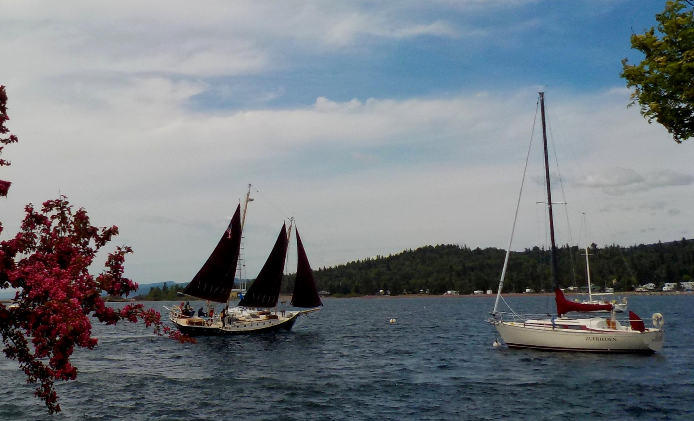
Palisades on Rose Lake:

Iron Lake:

Trails End:


Secret paddling spot on the GF


Me paddling my buddy's Spitfire back in 2003 or 2004:

|
01/04/2018 06:23AM |
ozarkpaddler: "Well, that emerald color is beautiful on that boat! Of course, every color I've seen looks beautiful on a Placid. My buddy had a blue 12' Spitfire and a Red Rapidfire that I tried. Just a little small for my frame. I would love to try one of the Spitfire 13's sometime though.
Plus I have a secret little paddling spot that I've only once seen someone else (and that's in several dozen trips to the spot). I've actually seen more moose than people. I'll disclose this spot only in private e-mails.
Secret paddling spot on the GF
I hope to be paddling the spitfire in sept. Since I have never paddled it yet, this summers paddling will decide between it and my prism. I hope to get along good with the spitfire since it will save me 10-12 lbs. If you see me there, jump in and take a paddle! I got it because it was a 13ft, and I think we are about the same body type from your pics. What did you think was too small in the 12ft? Width?
I won't ask for the secret spot unless we decide on that area! We do want to see a moose. Neither of us has ever seen a live one. Those pics are exactly what we are wanting, narrow water. Big lakes do not entice us too much. We can do that locally. The shore lines are the scenery.
|
01/02/2018 06:11PM |
WHendrix: "Wick. I agree with mjm. "There are no stupid questions". I don't mean to discourage you from more questions, but there are a lot of good books out there that you might want to look at. I have an extra copy of Cliff Jacobson's Expedition Canoeing that I would be happy to give to you if you send me your address. It has a whole lot of really good information and I've found it to be very useful.
Bill"
I would be happy to get it!
|
01/02/2018 06:11PM |
|
01/02/2018 06:22PM |
Wick: "Bill, How do i give you my address without posting it?"
Click the envelope icon under his name for his email address.
|
01/02/2018 06:30PM |
Bill
|
01/02/2018 10:11AM |
Bill
|
01/01/2018 04:39PM |
So what is with the boardwalk at Smoke Lake? Get in from dock and don’t touch the water, or just don’t go to the end of the dock and get in? Run and jump into canoe? :)
|
01/01/2018 07:37PM |
And thank you!
|
01/01/2018 07:51PM |
Bill
|
01/01/2018 08:22PM |
You are situated parallel to the dock--port side alongside dock--if you're approaching in an east to west orientation. It's plenty long & wide enough. (landing is at the SW corner of Smoke Lake) You don't need to step foot in the water at this landing. You'd load & unload standing on the dock. There is a bit of ground on other side. If you have Google Earth installed on your desktop/laptop search "Sawbill Outfitters", then scroll northward a bit and zoom in at the east end of the 105 portage to Smoke Lake. You'll see the wooden dock.
The one map that will cover your Cherokee loop well (either loop direction) is "McKenzie Maps #21. Sawbill." I think you will like this map and find it easy to read with its colors and contrast. (2 inches to a mile). "
Installed google earth on ipad. I see it! I can trace the whole route on there. I wonder how old the satellite pics are.
|
01/02/2018 05:23AM |
Wick: "You guys are making me feel stupid! How did you figure out what maps cover the area?
And thank you!"
There are no stupid questions when one is learning. Just a phone call away to the particular map maker or a retailer to get the map(s) for the desired route(s). Or....fellow members on BWCA forum. I have ordered many maps thru the years--some of which I may not use. Ever. I have those Voyageurs maps 8 & 9, as well. ;-) The #21 McKenzie would allow you to carry just one map concentrated for your particular paddle in September but those two Voyageur maps would cover a broader area eastward & westward--for future trips. A trade-off, of a sort. So many lakes to explore, eh?
Google Earth: The growth of reeds at the dock doesn't show up on Google Earth which surprised me. Appears to be open water right up to the dock but it isn't anymore. All I know is, on my return to Sawbill Lake & campground in 2014, I was searching for entrance gap into a thick growth of reeds--but it was made easier as a canoer was paddling out to open water at that moment. It's not a straight shot nor that deep of a stand but just deep enough not to have a clear view of the dock from lakeside.
As a sidenote, y'all are going to love September canoe tripping. I did my first Autumn trip last year and the absence of bugs was notable. Mornings brisk and daylight hours were beautiful blue skies and comfortably warm. No rain encountered. (Luck?) Key is be prepared for variations of weather and dress in layers without overpacking. My toes got cold on one morning of a 4-night trip and I wish I had packed a thick pair of wool socks. (Am 67 & diabetes-2) On one portage I encountered a small group of young guys wearing open toe sandals. (Not recommended!) It was an awesome time of year to be in the BWCA.
|
01/01/2018 09:27AM |
Wick: "It isnt new, but it has been taken care of by previous owner! There are a couple small repairs from bouncing off a couple rocks. Those squares are heel pads on the bottom, i guess to take the abuse of hard boot heels.
Seriously, waist deep?,,or are you pulling my leg, laughing at me knowing i’ll be scared to step in the water? :)
"
No, he's not just pulling your leg, although waist deep is rare. The deepest I've stepped in was crotch deep on Copper Lake while wearing a canoe hat - awkward situation :). Calf to knee deep "boot-sucking mud" is more common.
|
01/01/2018 09:35AM |
|
01/01/2018 12:10PM |
I'm not sure where he took that picture, but I don't think it was on your route . . . :) It may have been Oyster River. You might want to click on "Maps and Entry Points" at the top to see any portage comments.
Not barefoot unless that "boot-sucking" mud sucks a shoe off - almost lost a Keen sandal that way one time in knee-deep mud going up Kawishiwi River.
That's why I got some ankle-high OTB Abyss boots that tie on tight and drain. I usually just keep on slogging along, although I did stop at the other end of Copper Lake to empty out some mud and crud and swish the socks off a little :).
|
01/01/2018 02:48PM |
For footwear suggestions, lots of reads and suggestions if you use 'Search' feature located at the top part these posting pages-->next to 'Chat Rooms'.
|
01/01/2018 04:50PM |
Edit: i just found the list! No help needed.
2nd edit: i was wrong, i thought the list would tell which section map to buy for that lake. It does not. So where does give that info? Should i just call sawbill and ask?
|
01/01/2018 06:23PM |
|
01/01/2018 05:52PM |
Wick: "Yes, i have been thru the reading on boots/shoes. That gets confusing too. I decided tonite i would just wear my Rocky s2v jungle boots instead of buying tennis shoe type.
So what is with the boardwalk at Smoke Lake? Get in from dock and don’t touch the water, or just don’t go to the end of the dock and get in? Run and jump into canoe? :)
"
You are situated parallel to the dock--port side alongside dock--if you're approaching in an east to west orientation. It's plenty long & wide enough. (landing is at the SW corner of Smoke Lake) You don't need to step foot in the water at this landing. You'd load & unload standing on the dock. There is a bit of ground on other side. If you have Google Earth installed on your desktop/laptop search "Sawbill Outfitters", then scroll northward a bit and zoom in at the east end of the 105 portage to Smoke Lake. You'll see the wooden dock.
The one map that will cover your Cherokee loop well (either loop direction) is "McKenzie Maps #21. Sawbill." I think you will like this map and find it easy to read with its colors and contrast. (2 inches to a mile).
|
12/31/2017 05:05PM |
|
12/31/2017 05:33PM |
mjmkjun: "
edit: forgot a tip. bring a double blade paddle for the 13 footer. You'll be glad you did. "
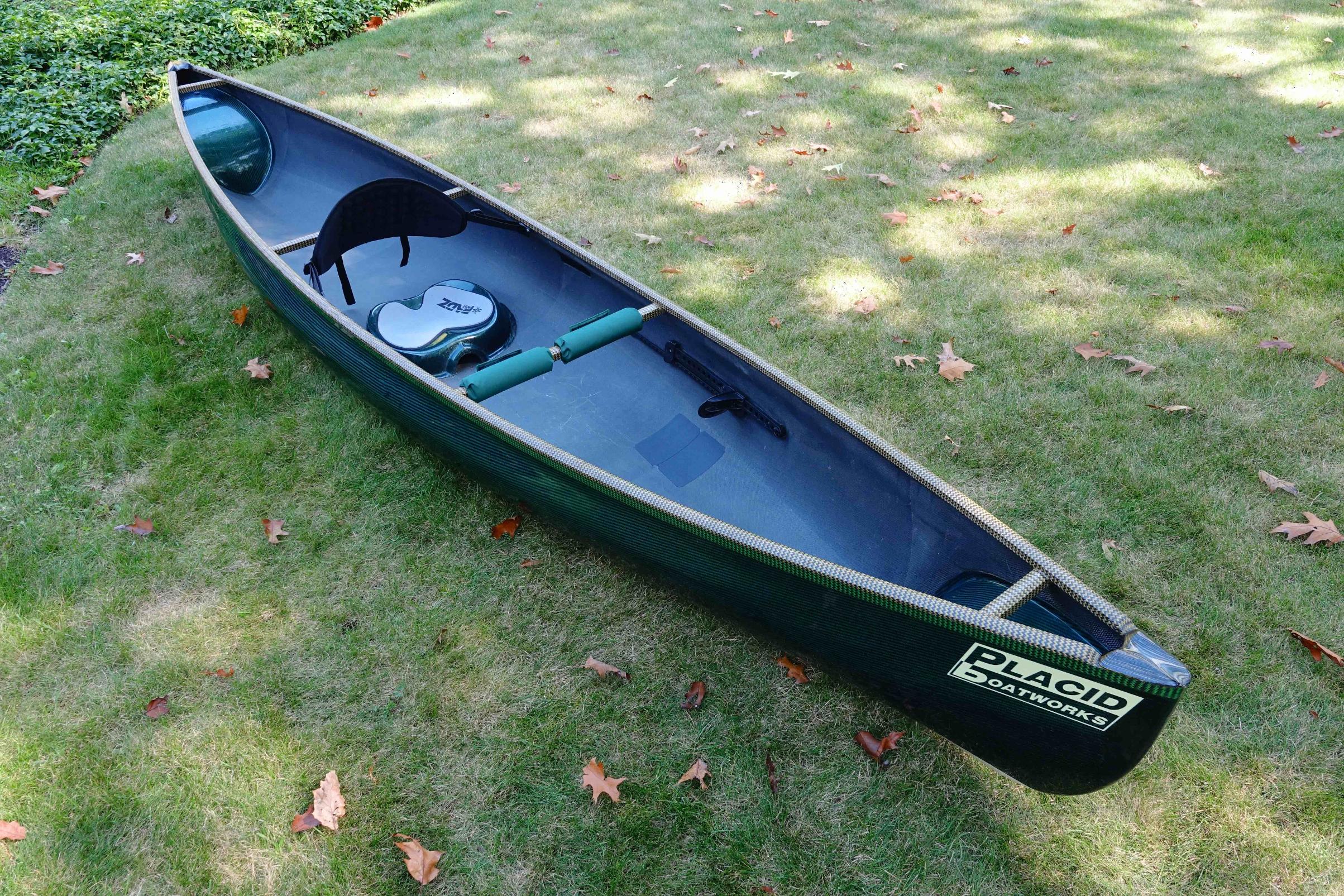
When i bought the spitfire, i was offered a carbon fiber double paddle with it at a price that could not be refused.
I am thinking of starting and ending at sawbill, going counterclockwise. I think the advice given on checking with the outfitters before leaving may decide the direction we finally go.
I do like the thought of the straight run down sawbill lake for steak and beer the last day! On the other hand, we could get the long paddle done while fresh and full of energy if we go clockwise.
Added pics just cause i am going crazy wanting to show my “new to me” canoe to someone. My wife is tired of me showing it to her,,,,,


|
12/31/2017 09:53PM |
|
01/01/2018 02:33AM |
I've done both clockwise & counterclockwise routes to Cherokee Lake from Sawbill. I have a slight preference for clockwise for no other reason than I'm fresh when paddling the long Sawbill Lake
If you do clockwise..........at the tail end of your loop...be aware that there is a thick stand of reeds at the Smoke Lake take-out/west shoreline. It would be the final portage. You have to locate the opening of slightly winding water path thru a thick stand of reeds to get to the boardwalk dock. Don't step off the boardwalk dock into shallow water at landing else you'll be up to your waist in the muck. ;-)
I love that Cherokee loop. Have done it three times, solo.
|
01/01/2018 06:47AM |
Seriously, waist deep?,,or are you pulling my leg, laughing at me knowing i’ll be scared to step in the water? :)
|
01/01/2018 07:54AM |
Wick: "It isnt new, but it has been taken care of by previous owner! There are a couple small repairs from bouncing off a couple rocks. Those squares are heel pads on the bottom, i guess to take the abuse of hard boot heels.
Seriously, waist deep?,,or are you pulling my leg, laughing at me knowing i’ll be scared to step in the water? :)
"
nah. nothing scary about smelly muck up to your waist. ;-)
|
01/01/2018 08:07AM |
you can't go wrong there
dr bob
|
01/01/2018 11:06AM |
I did laugh,,since it wasn’t me in the mud. Where was that?
Are you usually barefoot after mud like that? I am deciding on shoe purchases.
|
12/31/2017 01:35PM |
|
12/31/2017 02:22PM |
boonie: "Current is basically not an issue on BW streams, except in very high water maybe, but basically you'll portage around any brief swift water. Wind is much more likely to be a problem than current. "
Do winds come from certain direction there, or do they vary a lot?
|
12/31/2017 01:53PM |
Wick: "I saw that i could make a complete loop, which is why i ask if it mattered which way i went. I thought maybe it would be harder paddling one way? Currents?
We also think we will be 3 nights out instead of just 2."
With 3 nights, the loop will be no problem.
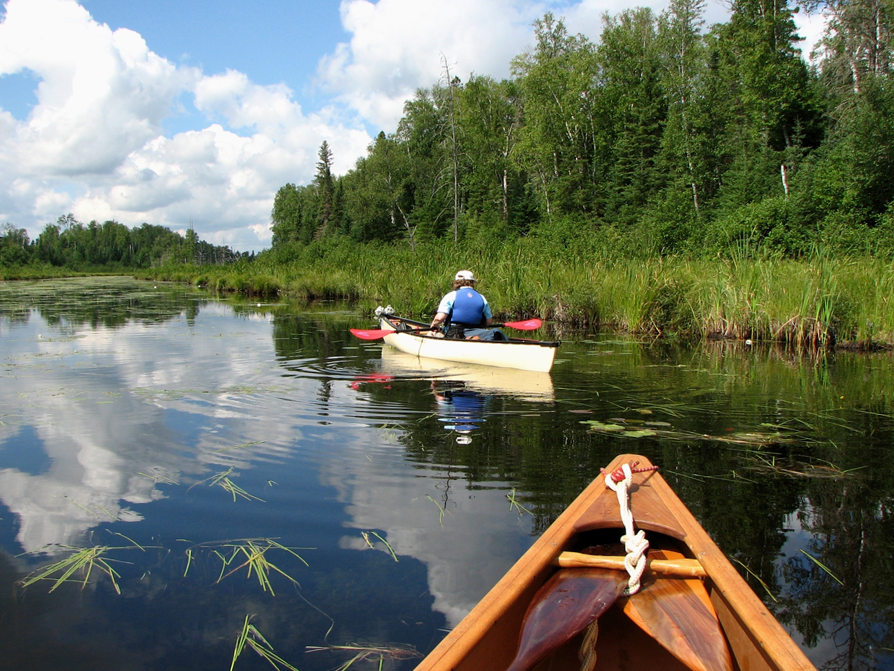
Boonie is correct about the rivers/creeks. I think of them more as pencil lakes. The streams then fall over a natural or beaver made obstruction. You portage around to the next segment of long thin lake. You can run into choke points or rock gardens where there can be a little current. But it is usually easily paddled through. All that being said, the beavers can and do change the conditions on sreams. It is always a good plan to discuss your route with the outfitter. They are most likely to have the latest conditions out there.
There are many spots where the streams create beautiful little waterfalls just as the streams enter the next long narrow sections or the lakes. There are nice opportunities for photos/fishing there. You can encounter tricky little currents in these places.
I know many people love to head right to Cherokee Lake. It is a beautiful spot. Everyone has their own reasons for turning left or right. Go and have fun out there!
|
12/31/2017 02:45PM |
Wick: "boonie: "Current is basically not an issue on BW streams, except in very high water maybe, but basically you'll portage around any brief swift water. Wind is much more likely to be a problem than current. "
Do winds come from certain direction there, or do they vary a lot?"
The prevailing winds are from the southwest. However, the weather can override those.
You will likely encounter what we call “the afternoon blow”. As the sun warms the land the wind will pick up into about 1-3pm. (10-20mph depending on the day) It will then gradually decrease as the temps decrease into evening. Again, this is usually a southwesterly wind.
|
12/31/2017 03:41PM |
-->If you happen to be on a bigger lake (Cherokee) when wind kicks in, hug the western shoreline where you'll have calm paddling.
-->Sawbill L. isn't bad even with a chop. Alton L. is a different animal.
-->Portage between Kelly & Burnt lakes a little easier with less weight in packs.
-->As the crow flies, Baker Lake #39 isn't that far from Sawbill Outfitters but cell phones may not work to reach Sawbill for a shuttle pick-up. Might want to check with the outfitter.
-->Sawbill Outfitters hotspot: Just to the right of store entrance doors are wooden benches with a wall-mounted Verizon antenna for cellular usage.
edit: forgot a tip. bring a double blade paddle for the 13 footer. You'll be glad you did.
|
12/31/2017 09:12AM |
Michwall2: "
For the overnight I would start at Baker Lake (get a shuttle from the Sawbill Outfitters) and paddle north to Jack or Weird Lake for the first night. For the second night I would head north to North Temperance Lake and then west to Cherokee Lake for the second night. Then back south through Cherokee Creek, Skoop Lake and Ada Lake and Creek to Sawbill Lake.
Have a great trip!"
Michwall2, i am almost sure this is where i am going. Thanks for the great descriptions!
Is there a problem doing it backwards? Should it be ran your direction for currents?
We finalized our dates and both of us are signed up for vacation in sept. Its a go!
I did buy another canoe this week too! I bought a Placid Boatworks 13 ft spitfire. Saves me 10-12 pounds over my prism.
|
12/31/2017 09:49AM |
I would start at Sawbill. It will take you about 6 hours to reach Cherokee. From Sawbill to Cherokee each portage is just a little bit tougher than the last. Like others have said, the portage out of Cherokee will be the toughest of the trip.
|
12/31/2017 12:17PM |
We also think we will be 3 nights out instead of just 2.
|
12/31/2017 11:09AM |
If you finish at Baker, will you shuttle a vehicle there or arrange for a pickup?
If you complete the loop, it adds an extra half day of paddling/portaging to your trip. You can do it, but it makes for longer days and a little less relaxing trip.
On this route, I like to head counter-clockwise because it offers places to pull up for a shorter first day. (Going clockwise, once you leave Sawbill there is no place to camp until you get to Cherokee.). Starting from Sawbill or Baker Lake headed counter-clockwise the lakes all have at least one campsite until you get north of Weird Lake.
I like to plan my trip to finish at Sawbill. There is a very large parking area. The outfitter has showers. I can get cleaned up without having to ride in the car with my wilderness funk. If I rent any equipment, I don’t have to transport it back to the outfitter before I can head out. So I’m cleaned up and stowed away right at my exit from the wilderness.
|
12/16/2017 06:43AM |
Wick: "Well, we finally bargained our way to the finish line. The cabin is cancelled. Here is what the wife unit has agreed to for our introductory trip to the BWCA.
1.6-7 days total, mid september.
2. campgrounds with my truck parked in the area.
3. Campgrounds at or within close paddle to an entry point
4. Day trips with portages
5. One trip lasting 2 overnights into the bwca moving camp every night.
Now all i have to do is find a campgrounds at/near an entry point, that has multiple lakes within reach on multiple day trips, and a 3 day/ 2 night route.
I think this will be an excellent way to have our first time in the bw, and let her decide if she has a future in canoe trips. I believe she will like it once she experiences it. She is reading and getting more enthusiastic about it.
We are from ohio, so i guess we will be approaching from the south.
Looking for a bunch of smaller lakes to give us different spots to visit each day, and a new route for the overnite adventure within easy reach without paddling the same lakes the whole week.
Is there such a spot?
"
|
12/16/2017 06:44AM |
Wick: "Well, we finally bargained our way to the finish line. The cabin is cancelled. Here is what the wife unit has agreed to for our introductory trip to the BWCA.
1.6-7 days total, mid september.
2. campgrounds with my truck parked in the area.
3. Campgrounds at or within close paddle to an entry point
4. Day trips with portages
5. One trip lasting 2 overnights into the bwca moving camp every night.
Now all i have to do is find a campgrounds at/near an entry point, that has multiple lakes within reach on multiple day trips, and a 3 day/ 2 night route.
I think this will be an excellent way to have our first time in the bw, and let her decide if she has a future in canoe trips. I believe she will like it once she experiences it. She is reading and getting more enthusiastic about it.
We are from ohio, so i guess we will be approaching from the south.
Looking for a bunch of smaller lakes to give us different spots to visit each day, and a new route for the overnite adventure within easy reach without paddling the same lakes the whole week.
Is there such a spot?
"
What if the campground was primitive and you explored an area just outside BWCA with portages available? Take a look at South Kawishiwi campground. You can reserve a site so you know where you will be camping. The campground is on Birch Lake in an area where the lake is quite narrow so wind isn't going to be a problem unless it really blows. The south branch of the Kawishiwi river flows into Birch lake near the campground and you can access a portion of this which is outside BWCA but is still remote and unlikely to have any motor boats on it as it requires some portaging. Since it is outside BWCA you won't have to worry about getting a permit. You can easily take day trips from here, either by loading the canoe and driving or day trip into BWCA with a day-trip permit.
|
12/15/2017 11:43AM |
|
12/14/2017 05:44PM |
Paddle down the LIS river will put at several small lakes that should have open sites during your time frame.
|
12/14/2017 06:29PM |
Michwall2: "I like the Sawbill Lake Campground. There is an outfitter right there. However, these are not necessarily small lakes. Sawbill can act as a larger lake in the open areas and Alton Lake is anything but small in the wind. That being said:
Day trips
West along the "Lady Lakes Chain" to Grace or Phoebe as a day trip is possible.
East to the Fire Lakes (Smoke, Flame, & Burnt) is an excellent day trip.
Northwest through Kelso River, Kelso Lake, Kelso River (make sure you see the dolman here) to Lujenida Lake makes for a nice day.
For the overnight I would start at Baker Lake (get a shuttle from the Sawbill Outfitters) and paddle north to Jack or Weird Lake for the first night. For the second night I would head north to North Temperance Lake and then west to Cherokee Lake for the second night. Then back south through Cherokee Creek, Skoop Lake and Ada Lake and Creek to Sawbill Lake.
.
Have a great trip!"
I found all of that on my new shiney map! Are those trips a novice can do in the time frames you mentioned?
|
12/15/2017 08:16AM |