|
01/12/2018 11:46AM |
|
04/07/2016 06:17PM |
|
04/07/2016 08:02PM |
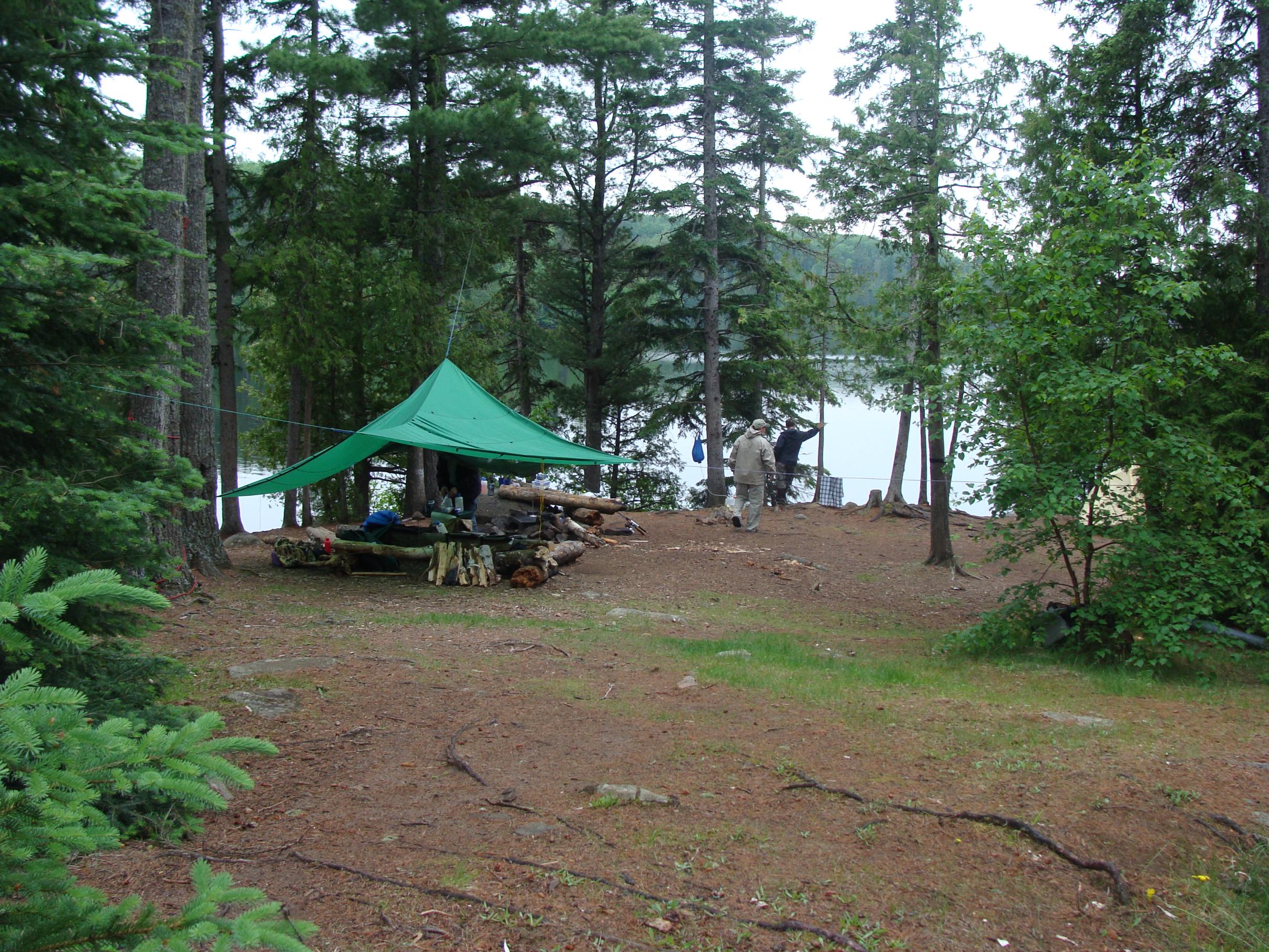
Mondale stayed there, so the secret service came in and "clear cut" that big site for better vision/safety/security??
|
04/07/2016 06:21PM |
quote ParkerMag: "We stayed at the 628 site several have already mentioned - very nice.

Loved the entire area."
i think this is also known as the Mondale site.
|
01/15/2018 07:42PM |
Tomster
|
04/06/2016 08:40PM |
|
04/04/2016 08:41PM |
|
01/04/2016 10:30PM |
2) I'm also wondering, are there any sweet "points of interest" on the route that goes from Poplar-Lizz-Caribou-Horseshoe-Gaskin-Winchell-Omega-Henson-Pilsbery-Allen-Jump? I'm especially interested in history and cliffs, and I'm planning a day trip to cliff lake and a bushwhack to the unnamed lake to the east of Wanihigan lake, since it looks like it would have cliffs. I already know about...
-The banadad ski trail
-The Winchell cliffs, waterfall, and pictographs
-The Omega cliffs and Omega's beauty in general
-The sweet 60 yr old overgrown logging trail on the Pilsbery-Allen portage :D
3) An outfitter claims that there were once cabins on Gaskin and Winchell. Is this true? If so, where would they have been located?
4) Did the voyageurs only stick to the border lakes or did they ever travel further into the "interior," to lakes like Winchell? Or would have smaller "interior" lakes like these only be visited by the indigenous fur trappers who knew the portages and where the beaver dams were?
Y'all are the best, thank you so much! I <3 the bwca.com forums... so much knowledge and so many laughs!
|
01/19/2016 11:39AM |
I've gone in EP47 the last 4 consecutive years. Have traveled the surrounds lakes quite a bit.
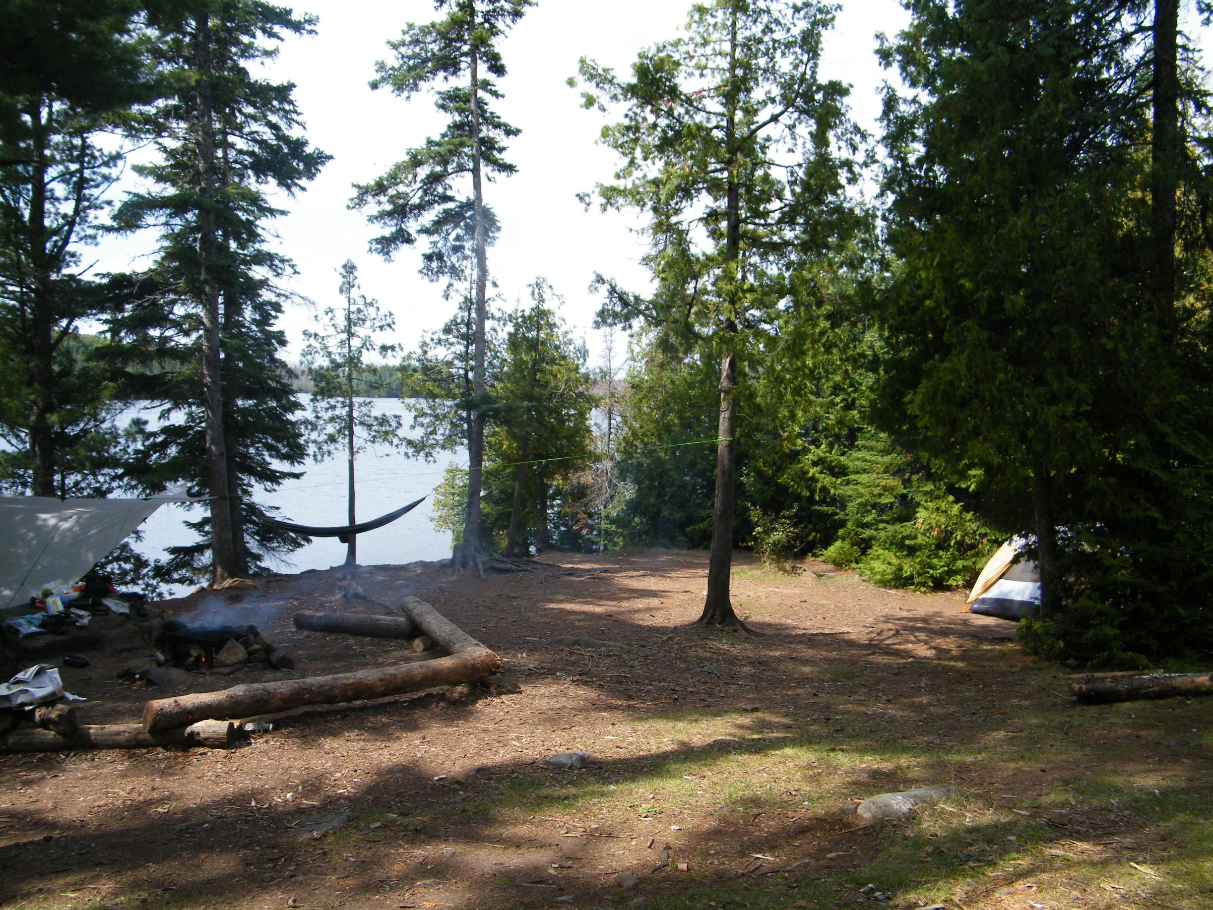
628 is a phenomenal campsite. The first island site appears to be quite nice as well. What I liked about 628 was the very shallow lead up, you can swim, fish, and paddle around nicely. The stairs up to the portage are nice too because it's elevated and offers great views looking west. My group had planned on camping on 634, which is a 5-start site, but opted to take 628.
Wiith regards to…
2) I'm also wondering, are there any sweet "points of interest" on the route that goes from Poplar-Lizz-Caribou-Horseshoe-Gaskin-Winchell-Omega-Henson-Pilsbery-Allen-Jump? I'm especially interested in history and cliffs, and I'm planning a day trip to cliff lake and a bushwhack to the unnamed lake to the east of Wanihigan lake, since it looks like it would have cliffs. I already know about...
-The banadad ski trail
-The Winchell cliffs, waterfall, and pictographs
-The Omega cliffs and Omega's beauty in general
-The sweet 60 yr old overgrown logging trail on the Pilsbery-Allen portage
There is a little waterfall feature from Gaskin into Jump, nothing spectacular, but something to look at if you're heading into Jump—which is a neat little lake.
We tried for the Winchell cliffs last year, but vastly underestimated how long that lake is, and how unrelenting the wind is. We were able to make it to the waterfall on the southern side of the lake which was rewarding. Just hug the shoreline and you'll hear it. If you're camping on Gaskin, I would give yourself 1.5-2 hours to reach it depending on how hard you're digging and how much gear you have. I believe it took us a good 4 hours to round trip it from our campsite on Horseshoe.
Something else to consider would be to check out Horseshoe, we saw a Moose with two calves tucked back in the bay by campsite 675. The paddle into Vista is nice as well. This gets you closer to the Misquah hills which I believe offer hiking opportunities. Keep in mind that the portage from Vista to Misquah is one of the hardest in the entire BWCA.
My 2016 trip in June will likely involve heading down to Omega, since we weren't able to make that last year (the plan was to camp on Meeds one night and then attempt to camp on Omega).
Hope that helps a little.
|
01/19/2016 05:00PM |
Winchell cliffs. You need to park canoes quite a ways to the right (west)....about where all the rocks stop and you see it gets flatter. The trail/s angle back in towards the east/SE and you actually go up the back SW side of the cliff. Once on top, the trails get a little confusing and hard to follow (it's bigger up there than you think) Just keep your directions straight and you eventually work out to the open spots on the cliff top.
|
01/15/2018 11:11AM |
DPH: "This is indeed the Mondale site. We stayed there last summer and about a month ago one member of our group met Mondale and asked. They talked in length about not only that site but also how pleased he is that young people (we're in our upper 30's so not that young) are still enjoying BWCA. After their talk she had him sign one of the pictures we had taken from the site."
|
01/15/2016 10:09AM |
|
01/19/2016 01:09PM |
I agree that Camp 628 is nice as is Camp 627 on an island near the portage to Horseshoe. Camp 634 is for sure very nice, but it was taken when I was there.
|
04/18/2016 08:40PM |
quote Mocha: "quote cowdoc: "Mocha?....any truth to that old tale?
Mondale stayed there, so the secret service came in and "clear cut" that big site for better vision/safety/security??
the truth. i guess the usfs bends the rules at times."
Not to be a dick, but how do you know for sure? I just want to know the source :-D I can ask the people at NorWester outfitters, I bet they would know details :D
|
04/18/2016 09:14PM |
quote TuscaroraBorealis: "quote NoahDaBoa: "Anthony Lane thank you! You're making me want to do that portage from Vista to Misquah as a day trip!
"
I'm pretty sure he meant the Misquah - Little Trout portage."
I would have to agree with TB. Vista to Misquah was a piece of cake compared to the Little Trout to Misquah adventure!
|
04/18/2016 10:05PM |
I might still try to hike this portage just to see it, since it seems like its a legend
|
04/17/2016 12:01PM |
quote NoahDaBoa: "Anthony Lane thank you! You're making me want to do that portage from Vista to Misquah as a day trip!
"
I'm pretty sure he meant the Misquah - Little Trout portage.
|
04/17/2016 04:57PM |
 That's easily my wife's favorite campsite that she's been to in the bwca. She wishes every campsite was that big and open.
|
01/16/2018 06:21AM |
quark2222: "Hmm - I looked on the BWCA.Com lake maps for Gaskin, and could not find campsite No. 628. I did find a 627 and 629. Is it possibly a closed site now? Thanks.
Tomster"
It shows up on there for me. Half way between 627 and 629. Southern shore at the tip of the big peninsula.
|
01/16/2018 06:56PM |
"working". I use Firefox at home and at work. Oh well, now I know where it is. Thanks for your assistance.
Tomster
|
01/06/2016 07:24AM |
See this Wikipedia page for more information on the Voyageur’s canoe route through Quetico.
|
04/16/2016 07:50PM |
|
04/17/2016 12:14PM |
quote cowdoc: "Mocha?....any truth to that old tale?
Mondale stayed there, so the secret service came in and "clear cut" that big site for better vision/safety/security??
the truth. i guess the usfs bends the rules at times.
|
04/28/2016 11:37AM |
|
01/05/2016 07:58AM |
The Voyageurs were being paid to do a job. They would have taken the easiest and most efficient route to their destination. At the time of the North West Company’s rendezvous post at Grand Portage, they would have taken the border route. When the post was moved north to Fort William they used a route further north in Canada with a connection to the Kaministiquia River.
|
01/05/2016 08:14PM |
|
01/26/2016 10:29AM |
Kiporby thank you! <3 Morrissey. Also, if you google search "Winchell pictographs" you'll find a discussion about the possibility of there being pictos there...
Thanks cowdoc and everybody else! I've been to the Winchell waterfall and cliffs and I'm excited to show the newcomers who will be coming this year!
|
04/05/2016 08:21AM |
Loved the entire area.