|
08/20/2021 11:01AM |
|
08/19/2021 05:47PM |
|
07/23/2021 10:13AM |
|
08/19/2021 08:48PM |
Banksiana: "Horror show for sure.
"
Ahhhh. This is painful to see. I lament and cry out.
|
07/05/2021 12:22PM |
|
08/19/2021 07:53PM |
|
07/21/2021 05:05PM |
|
10/12/2021 08:48AM |
Pinetree: " Quetico is big enough to have the policy they do have at present. Let them burn, but too much at one time really isn't good for anything. A lot of edge and mixture of age class forests is best. This year may be way too much."
It will be interesting to see how hot the fires burned across the landscape, and what was spared. The fuels were DRY, so I suspect most areas burned hot.
Historically, huge fires coincided with drought years, and fires would burn hundreds of thousands of acres in the Quetico-Superior.
|
07/31/2018 04:52PM |
|
07/31/2018 03:55PM |
Interactive Quetico Fire Map
And if that link doesn't work, here is the main page: Ontario Fire
|
08/19/2021 12:06PM |
|
08/12/2021 07:27PM |
Any day in the Quetico is better than a day at work.
|
08/12/2021 04:31PM |
It's been pretty quiet lately but the maps still show fires. Does anyone have any updates on the current situation up there?
|
08/13/2021 01:17PM |
|
09/03/2021 09:28PM |
toothfairy: "That is very sad. I've been to quite a few of them and left notes. Ted, McIntyre, Delahey. "
The Ted jar is inside a rock cairn. Last time I was there was 2011 and it was a plastic coffee can. Probably melted but you never know until we see it.
|
08/26/2018 09:16PM |
August 26, 2018
There are currently 8 active wildfires in Quetico Provincial Park.
Area Closures: The eastern portion of Upper Sturgeon Lake, Olifaunt Lake, Fern Lake, Bisk Lake, Beg Lake, Bud Lake, Kendall Lake, Gahn Lake, The northern portion of Chatterton lake and the northern portion of Russell Lake, Alice Lake, Buckingham Lake, and Rawn Lake are closed to camping. The Russell Rapids Portage, Bonhomme Portage and Sauvage Portages are closed to travel. In addition, check wind forecasts and avoid camping downwind from the fire to avoid smoke.
Please consult with a park ranger when you pick up your park permit for up to date fire information, or call the park information line at 807-597-2735. An interactive map with up to date fire conditions can viewed at: https://www.ontario.ca/page/forest-fires
|
10/05/2021 07:42AM |
|
10/05/2021 01:43PM |
AmarilloJim: "Is any of the park closed to use right now? I could not find a closure notice on their web site."
Most of it is closed. See the Park's Facebook page for the closure map. They also posted a fascinating maps showing an analysis of how intensely the fires burned in the various areas.
|
08/27/2018 12:29PM |
|
08/27/2018 12:37PM |
|
07/19/2021 01:23PM |
cyclones30: "Dang, the B chain and Russell and all those were the areas we wanted to check out for our first Q trip (last year that never happened) "
This thread is pretty old. That report was from 2018.
I was on Russell in 2019 and there was not any extensive damage that I could see on my route through the lake. So keep it on your list for this year. It’s a beautiful lake. All the ‘action’ (crowding) is over by Chatterton Falls and the central islands, but the rest of the lake is just gorgeous and unpeopled.
By the B-chain, you mean Bud, Beg, Bisk, Fern? There was post-fire regrowth on the North side of Fern, if I recall correctly, when I passed through there in 2019, but it seemed to be from a much much older fire. No scenes of devastation jumped out at me. So I wouldn’t avoid that area either. [Edit: Well, I would avoid it because it gave me the creeps for some reason, but that was probably just low blood sugar and weird weather, and that’s just me.]
|
08/19/2021 01:24PM |
|
09/04/2021 09:55AM |
|
07/25/2021 01:41PM |
I’m guessing the Ontario govt. fire map site is likely not updated as frequently as the firesmoke.ca one.
I’m anxious as I have a trip planned right through there staring on the 12th. Hoping the smoke situation is under control by then.
|
10/12/2021 07:32PM |
After going to the Facebook page for Quetico Park, I decided to email the person who was a part of doing the aerial mapping of the fires that was depicted in the Facebook post. His name is Brian Jackson and he is a biologist for Quetico Provincial Park. I asked him if he could supply me with a high resolution of the graphic from the Facebook post as well as any further clarifications on the graphic. He graciously did and I am including the higher resolution image as well as two others. I have also summarized his email as well as included a portion of it in his own words. Please see below.
Quotes are his own words.
“This mapping was done by a program that compares satellite imagery from just prior to the fire to just after the fire (September 11th). By estimating the change in tree density, it assigned a ranking of how severe the fire was in that location.”
Black is High Severity fires. 20% of the fire area was classified this way, mostly in the northern section of the fire and away from larger lakes.
Lighter colors are low severity to low-moderate severity. Usually not noticed unless an individual was on the ground walking among the trees. This classification made up about 36% of the fire and mostly in the southern portion of the fire that had more lakes and red and white pine tree stands.
White is no observable change in tree cover and are considered unburnt. 24% of the fire is under this classification.
Photo 1 depicts a black high severity burn area. It is North of Tanner Lake.
Photo 2 depicts a low severity burn area. It is North of Argo Lake toward Darkwater Lake.
Photo 3 is the higher image quality of the graphic originally posted to Quetico Facebook page.
The following is Brian’s words exactly and I didn’t want to summarize because he says it best.
“Although I understand some peoples concerns about fires, from the view as a biologist and forest ecologist, the fires in Quetico are seen as a very good thing. Fire is a critical process to maintain and regenerate the natural forests of this area. It has been recognized for over 50 years that the lack of fires in Quetico has been resulting in environmental issues including the decline of main tree species such as pines and loss of wildlife habitat. Management plans since the 70’s have encouraged allowing fires to resume their historical natural role. The fires this past summer were very diverse. Low intensity surface fires occurred in much of the area that was dominated by red pines removing undergrowth and allowing opportunity for regeneration of these stands so they can be maintained in the future. As the fires moved north in later July and August, they moved into areas that were typically dominated by jack pine and spruce that regenerate most successfully after intense fires have removed most of the mature trees. This is how these forests have regenerated and renewed themselves for centuries. Studies have shown that approximately 80% of wildlife species either require or prefer the young forests that result from fires and we can expect to see increases in animals such as moose that feed on young browse resulting from fires. This in turn will support wolf populations and scavengers such as eagles, ravens, foxes, etc that depend on wolf kills. Burnt areas also result in an increase in plants such as blueberries which support many species that require them including campers looking for blueberries for their morning pancakes. Studies also show that fish populations in northern Ontario lakes generally increase in abundance following fires as a result of the added nutrients from the ash being added into lakes.”


One observation I had was that the Death March Portage is going to be a lot more difficult.
|
10/23/2021 07:57PM |
God willing
|
09/01/2021 09:41PM |
TomT: "Springer2: "Can't imagine what it's like on Ted Lake right now.
"
Was just chatting with paddling partners. Lots of message jars are no more. Not to mention all the campsites. It’s all pretty sad and I feel the other “green” areas will see a lot more use now. "
Hi Tom,
Been awhile since I've been here... Yes, I've been watching the fire map closely and it was a painful couple of nights after learning that a very special place for me in the park has burned and likely the message jar that went with it. It was bound to happen sooner or later and I know that fire can be beneficial for the ecosystem, but it still hurts.
|
09/21/2021 06:31PM |
|
09/01/2021 06:24AM |
Springer2: "Can't imagine what it's like on Ted Lake right now.
"
Was just chatting with paddling partners. Lots of message jars are no more. Not to mention all the campsites. It’s all pretty sad and I feel the other “green” areas will see a lot more use now.
|
10/13/2021 06:45AM |
Minnesotian: "Hey all,
After going to the Facebook page for Quetico Park, I decided to email the person who was a part of doing the aerial mapping of the fires that was depicted in the Facebook post. His name is Brian Jackson and he is a biologist for Quetico Provincial Park. I asked him if he could supply me with a high resolution of the graphic from the Facebook post as well as any further clarifications on the graphic. He graciously did and I am including the higher resolution image as well as two others. I have also summarized his email as well as included a portion of it in his own words. Please see below.
Quotes are his own words.
“This mapping was done by a program that compares satellite imagery from just prior to the fire to just after the fire (September 11th). By estimating the change in tree density, it assigned a ranking of how severe the fire was in that location.”
Black is High Severity fires. 20% of the fire area was classified this way, mostly in the northern section of the fire and away from larger lakes.
Lighter colors are low severity to low-moderate severity. Usually not noticed unless an individual was on the ground walking among the trees. This classification made up about 36% of the fire and mostly in the southern portion of the fire that had more lakes and red and white pine tree stands.
White is no observable change in tree cover and are considered unburnt. 24% of the fire is under this classification.
Photo 1 depicts a black high severity burn area. It is North of Tanner Lake.
Photo 2 depicts a low severity burn area. It is North of Argo Lake toward Darkwater Lake.
Photo 3 is the higher image quality of the graphic originally posted to Quetico Facebook page.
The following is Brian’s words exactly and I didn’t want to summarize because he says it best.
“Although I understand some peoples concerns about fires, from the view as a biologist and forest ecologist, the fires in Quetico are seen as a very good thing. Fire is a critical process to maintain and regenerate the natural forests of this area. It has been recognized for over 50 years that the lack of fires in Quetico has been resulting in environmental issues including the decline of main tree species such as pines and loss of wildlife habitat. Management plans since the 70’s have encouraged allowing fires to resume their historical natural role. The fires this past summer were very diverse. Low intensity surface fires occurred in much of the area that was dominated by red pines removing undergrowth and allowing opportunity for regeneration of these stands so they can be maintained in the future. As the fires moved north in later July and August, they moved into areas that were typically dominated by jack pine and spruce that regenerate most successfully after intense fires have removed most of the mature trees. This is how these forests have regenerated and renewed themselves for centuries. Studies have shown that approximately 80% of wildlife species either require or prefer the young forests that result from fires and we can expect to see increases in animals such as moose that feed on young browse resulting from fires. This in turn will support wolf populations and scavengers such as eagles, ravens, foxes, etc that depend on wolf kills. Burnt areas also result in an increase in plants such as blueberries which support many species that require them including campers looking for blueberries for their morning pancakes. Studies also show that fish populations in northern Ontario lakes generally increase in abundance following fires as a result of the added nutrients from the ash being added into lakes.”
One observation I had was that the Death March Portage is going to be a lot more difficult. "
Excellent post. Thank you!
|
10/13/2021 07:25AM |
|
10/13/2021 08:03AM |
|
10/13/2021 08:07AM |
|
08/22/2018 09:58AM |
|
08/22/2018 08:33PM |
mapsguy1955: "Does anyone know how often they update this map? The sizes of these fires have not changed in a few days. Depending on the forecast I look at, it may not moisten up for a while. It seems like the entire western half of North America is in trouble. "Thanks for posting the link -- I was just going to do the same. I was in contact with QPP today, as my husband is near the worst fire (100 acres as of earlier today). To paraphrase, the website is updated as soon as they have info from reconnaissance flights or from info from crews on the ground. Flight intervals vary depending on need. Today's NW wind fed the Russell Lake fire -- my husband reports it's shooting big fireballs and a huge smoke plume. He's 2 lakes away now (5 mi?) and heading out early tomorrow morning to hopefully increase that distance significantly.
|
08/02/2018 12:41AM |
|
10/24/2021 01:10PM |
TZ
|
10/24/2021 06:01PM |
|
10/25/2021 01:05PM |
|
10/25/2021 01:23PM |
For me, I have had a northern Q trip planned for a few years, cancelled twice due to covid and then the fires. I'm not sure if my trip will include burn areas. But I will have others!
tom
|
10/25/2021 03:32PM |
tumblehome: "This might be a good opportunity for the Q campers to start planning trips and reporting back info on lakes, the burn, campsites.
tom"
I agree Tom. I think the campsite reviews on this site for Quetico might be very important going forward if someone is traveling through the burn areas.
Looking at my list for earlier in the year, just some thoughts:
1. Ted Lake - Very questionable on what it may look like. Maybe the pickle jar survived?
2. McIntyre Lake Creek - I'm guessing this portage/creek is going to be a mess of downed trees.
3. Robinson Lake - Might not be as bad as originally feared.
4. Brent Lake - Looks like Brent and Suzzanette got hit pretty bad in spots. It really looks like a high possibility that Hilton site got taken out.
5. Conmee - Looks like the north side got the most of it.
6. Memory Lane Portages - The fire looks the blackest right on this portage. I think this might be a really difficult portage for a couple of years, especially as the new growth starts up.
7. Hoare Lake - South side got burnt pretty bad, making the bushwack there more difficult.
8. Montgomery Lake - I think the fire missed that island campsite, I hope. But that is a swath of the darkest of the fires right through there. I think the remote pictograph survived.
9. Death March Portage - This area got hit hard it looks like, again might make this portage really difficult, especially for anyone going through there first and before any clearing can happen.
|
10/28/2021 09:57PM |
|
08/13/2021 08:37AM |
wyopaddler: "The park closed another big section today. The entire poets chain to Kawnipi. Can’t get there from the north unless you want take on the cache lake portages. We’re rerouting and launching tomorrow. Guess we’ll stay north. Border was no problem.
Any day in the Quetico is better than a day at work."
So if I am reading this correctly, Russell, Chatterton, Keats, Shelly and Montgomery are all closed? Damn it.
|
08/13/2021 10:09AM |
I was at the bottom end of Sturgeon a couple of weeks ago on the border of the restricted area. No smoke, no sign of fire. My conclusion is that the park authority is providing a very large safety buffer.
|
09/21/2021 12:08PM |
Anyway...there look to be some moonscape areas and many that aren't as bad. Still...that's viewing from the air but still something of note
|
09/21/2021 12:52PM |
Banksiana: "My hope is that the history of relatively frequent fire events in this area and the diverse forest and landscape will make the burn more a mosaic than a moonscape of total destruction."
I agree. Quetico is big enough to have the policy they do have at present. Let them burn, but too much at one time really isn't good for anything. A lot of edge and mixture of age class forests is best. This year may be way too much.
|
09/01/2021 08:20AM |
|
09/10/2021 10:24AM |
|
09/06/2021 03:01PM |
HighnDry: "I was wondering if there is any way to verify that fire actually destroyed much of the forest on Ted? Or was the fire perimeter surrounding Ted with fire located in hotspots away from say, the message jar campsite? Is there any way to tell from this map. "
If you click on the overlay drop down and select season-to-date hotspots it might provide some insight. I would think the areas with denser "dots" would have more complete burns. Perhaps there are some patches of green remaining, though it's hard to fathom with the dry conditions.
That map doesn't show any active (M3) hotspots in Quetico since August 27th. I'm not sure what to make of that. Has the fire slowed or has reporting stopped?
|
09/06/2021 03:11PM |
I tell myself, heck, I remember fires from 50 years ago and the areas have recovered. It is a marvel to watch that process unfold over dozens and dozens of years.
I tell myself it is for the better in the long run.
Unfortunately, at my age--for me, the long run is in the next few years.
|
09/05/2021 09:21PM |
I have been taking a break from watching the Q fires, but tonight I just took a peak and I am just blown away.
1. Ted Lake - what does it look like? Pickle jar gone?
2. McIntyre Lake Creek - got to be completely different now. I can't imagine.
3. Robinson Lake - Well, at least now I'll be able to climb Gardner's Peak and have a good view. Maybe like what Sig Olsen saw years ago.
4. Brent Lake - Did that Hilton survive? One of my favorite sites ever.
5. Conmee - Going to be even spookier now.
6. Memory Lane Portages - Those are probably going to be even more memorable now.
7. Hoare Lake - Will I ever get back there again? And will that special spot be melted?
8. Montgomery Lake - Is that amazing island campsite ok? How is the hike to the pictograph now?
9. Death March Portage - I can only imagine this will be extremely difficult until it is cleared.
Those are just some of the places that jump to my mind as I look at the burn map and weep. I'll get back to some if not most of those places in the future, but like I have said, it is going to be with a heavy heart, and telling myself this is life.
|
09/02/2021 07:49PM |
|
09/01/2021 07:44PM |
QUETICO PROVINCIAL PARK— Even as the North Country’s attention turned in recent days to the Greenwood fire, wildfire is literally reshaping the 1.2 million-acre provincial park backcountry just north of the border.
The Crooked Lake fire, known as FOR035 to provincial authorities, has been burning at least since it was first spotted back on June 9. From its start along the far northwestern shore of Crooked Lake, the fire has burned in fits and starts for months. As of this week, the fire was estimated at 45,712 hectares, which translates to 112,956 acres, dwarfing the fires south of the border.
The Crooked Lake fire was one of several separate fires that had been burning in the south-central portion of the Quetico, but those fires have since merged into one enormous blaze, fueled by the same drought conditions and winds that allowed the Greenwood fire to explode. The fire’s perimeter is enormous, extending approximately 25 miles across, winding past dozens of lakes. It now reaches almost two-thirds of the way across the vast Quetico, from the U.S. border in the south as far north as Lonely Lake, in the northern part of the park.
Several other fires are still being monitored elsewhere in the park, but most are relatively small. The largest of the other fires, labeled FOR055, is currently estimated at 11,000 acres.
While provincial authorities were able to keep the Quetico open for much of the summer, rapidly increasing fire activity last month prompted park authorities to close the park’s backcountry to visitors on Aug. 17, a closure that remains in place despite recent rains that have at least temporarily eased the fire danger. The park’s developed Dawson Trail Campground, in the far northeastern corner of the park, has remained open throughout the summer. The rest of the park is considered backcountry, accessible primarily by canoe.
The fires in the Quetico prompted the U.S. Forest Service to close the northwestern portion of the Boundary Waters Canoe Area Wilderness in late July, out of concern that the Canadian fires could spread south of the border. The Forest Service, on Aug. 21, extended that closure to the entire Boundary Waters due to a rash of wildfires south of the border, including the 26,000-acre Greenwood fire.
Unlike earlier in the summer, Ontario fire officials are now making efforts to suppress the fires in the Quetico. “For a long time, those park fires were under observation while we addressed higher priority fires,” said Chris Marchand, a fire information officer with the province’s Aviation, Forest Fire and Emergency Services, based in Dryden. “We had several communities under risk from fire,” said Marchand, although significant rains in other parts of northwestern Ontario have since eased the fire risks in those locations. “We’re now turning our attention to the park fires,” he said. “It’s sort of the hot spot of the region at the moment.”
Currently, the province has nine crews of four firefighters each stationed at various locations in the Quetico. While it’s not a large contingent by U.S. standards, Marchand said the crews are positioned at a variety of chokepoints, typically between lakes, where they are working to check the spread of the fire. They’re being assisted by some aerial resources as well, primarily medium to heavy helicopters to conduct strategic water drops.
If the province is demonstrating a more subdued response to the fires than what’s been seen south of the border, it’s all part of the provincial policy. “The management strategy in remote parks is generally to let things burn,” said Marchand, to allow fire do its thing on the landscape.” But given the length of time the Quetico fires have been burning, Marchand said it’s time to shift more toward suppression.
Park officials say it’s too early to discuss the impact that the fire will have on the Quetico ecosystem, but fire is traditionally beneficial in the long run, prompting new growth that benefits a number of species, particularly moose. “All that will be assessed at the end of the season,” said Quetico park superintendent Trevor Gibb. “Right now, were just concentrating on the current fire situation. And there’s still more fire season to come.”
|
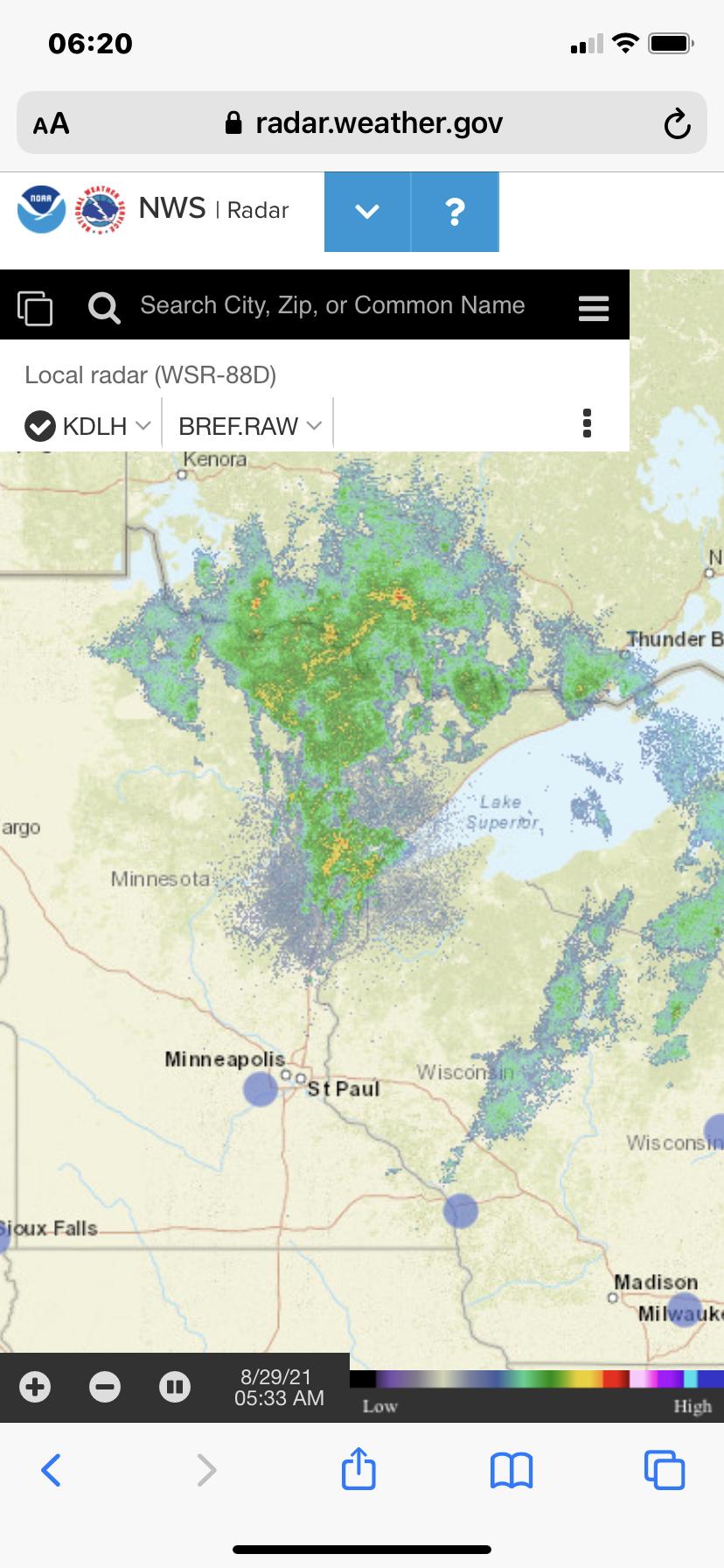
08/29/2021 06:31AM |
|
08/27/2021 08:31PM |
|
07/09/2021 12:21PM |
|
07/20/2021 12:54PM |
Acipenser: "This thread is pretty old. That report was from 2018."
But the map link is live and active, updated often.
Some concerning growth in the Crooked Lake area wildfires over 3 days time:
July 17, 2021

July 20, 2021
(had to zoom out to get the new fire perimeter surrounding Roland Lake)

|
07/20/2021 03:18PM |
schweady: "Acipenser: "This thread is pretty old. That report was from 2018."
But the map link is live and active, updated often.
Some concerning growth in the Crooked Lake area wildfires over 3 days time:
July 17, 2021
July 20, 2021
(had to zoom out to get the new fire perimeter surrounding Roland Lake)
"
I just chatted with a lady from the park office. They are letting those fires burn. The park biologist reported to her that 1% of Quetico is currently burning. The images of the fires in the SW quadrant may give the impression that the entire mass of land within each perimeter is burning but that is not the case. Each perimeter is really a hand-drawn border of a cluster of fires with.
Another fire began with a lightning strike a bit SE of Doré Lake but that one will be quickly extinguished given that if left to run its course it could threaten major exit routes.
The MNR fire map is also showing a fire SE of French Lake that was extinguished a month ago.
An interesting statistic that she quoted is that a forest will burn on average every 70 years. That is healthy for the bigger pines. By suppressing forest fires a lot of less desirable florae are allowed to flourish that would not ordinarily do so. An much of this tends to be more flammable.
Here is another site with an animation of the direction of the smoke.
|
07/20/2021 09:00PM |
That's a really fascinating website. Thanks for posting.