|
07/20/2014 11:54AM |
SunCatcher
|
07/21/2014 07:50AM |
quote SunCatcher: "Nice trip! I hate the rock art though...pisses me off!!!! Wish folks would leave those rocks natural! Anyway, thanks for sharing.
SunCatcher"
SunCatcher
The people who most frequently use this area do not think of it as a pristine wilderness. It’s there hunting ground. Like a farmer in Illinois when his old tractor won’t run any more he parks it on the back of the farm in case he needs a part for his newer tractor. We found snowmobiles, boats, outboard motors, and a generator covered with a plastic garbage can.
|
07/17/2014 08:51PM |
|
07/18/2014 06:34AM |
quote OneMatch: What kind of mapping did you use?
"
Wayne printed them on water proof paper. He starts with a topo map similar to Garmin maps and add all the information he can before printing. He prints on both sides of 11 X17 paper so we only needed 3 pieces of paper to cover out rout.
|
07/15/2014 09:11PM |
|
07/15/2014 06:21PM |
|
07/15/2014 03:51PM |
don't use photobucket
|
07/19/2014 07:53PM |
quote MagicPaddler: "quote OneMatch: What kind of mapping did you use?
"
Wayne printed them on water proof paper. He starts with a topo map similar to Garmin maps and add all the information he can before printing. He prints on both sides of 11 X17 paper so we only needed 3 pieces of paper to cover out rout. "
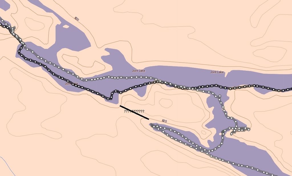
Actually, the paper was 13" X 19" ... I use an non-standard 1:35,000 scale, which provides better shoreline detail. I print them so that there is a slight sheet-to-sheet overlap so you can layout a larger area for planning purposes. So, you can achieve something like this:

Although this particular one if from a section of Woodland Caribou PP, this is the kind of detail I typically try to incorporate (provided I can find it)

Once the "paper" maps are finished (actually, they are maps that can be digitally manipulated to add details), I would typically transfer relevant material into a file format that can be accepted by my Garmin GPS unit (and accompanying software). So, much of what is printed winds up on my GPS, less a fair amount of what I feel is unnecessary clutter (e.g., I generally translate portages into beginning and ending points rather than place the entire route on my GPS).
|
07/16/2014 01:47AM |
|
07/16/2014 04:41PM |
|
07/15/2014 07:45AM |
Trip Name: Opasquia 2014.
Entry Point: Other
Click Here to View Trip Report
|
07/15/2014 10:02AM |
|
06/30/2016 04:22PM |
|
06/30/2016 10:17AM |
|
06/30/2016 12:41PM |
I read somewhere that someone had come up through East Lake and gone through this portage. Martin could give you a lot of information on the area.
http://www.bighookcamps.com/ is the best source for transportation.
Going to Opasquia! I’m jealous!
|
06/30/2016 02:45PM |
http://www.myccr.com/canoeroutes/opasquia-pp-ontario Marten's Opasquia Trip Report 2013
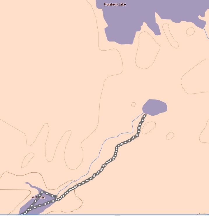
Mike K. also traveled Opasquia in 2014 for three weeks. He did do Mossberry to Joint portage but used the route that put him on the pond in the middle. He noted he had a hard time finding the trail as it left the pond and headed toward Joint Lake.