|
04/22/2016 03:56PM |
|
04/22/2016 10:24AM |
|
04/22/2016 11:58AM |
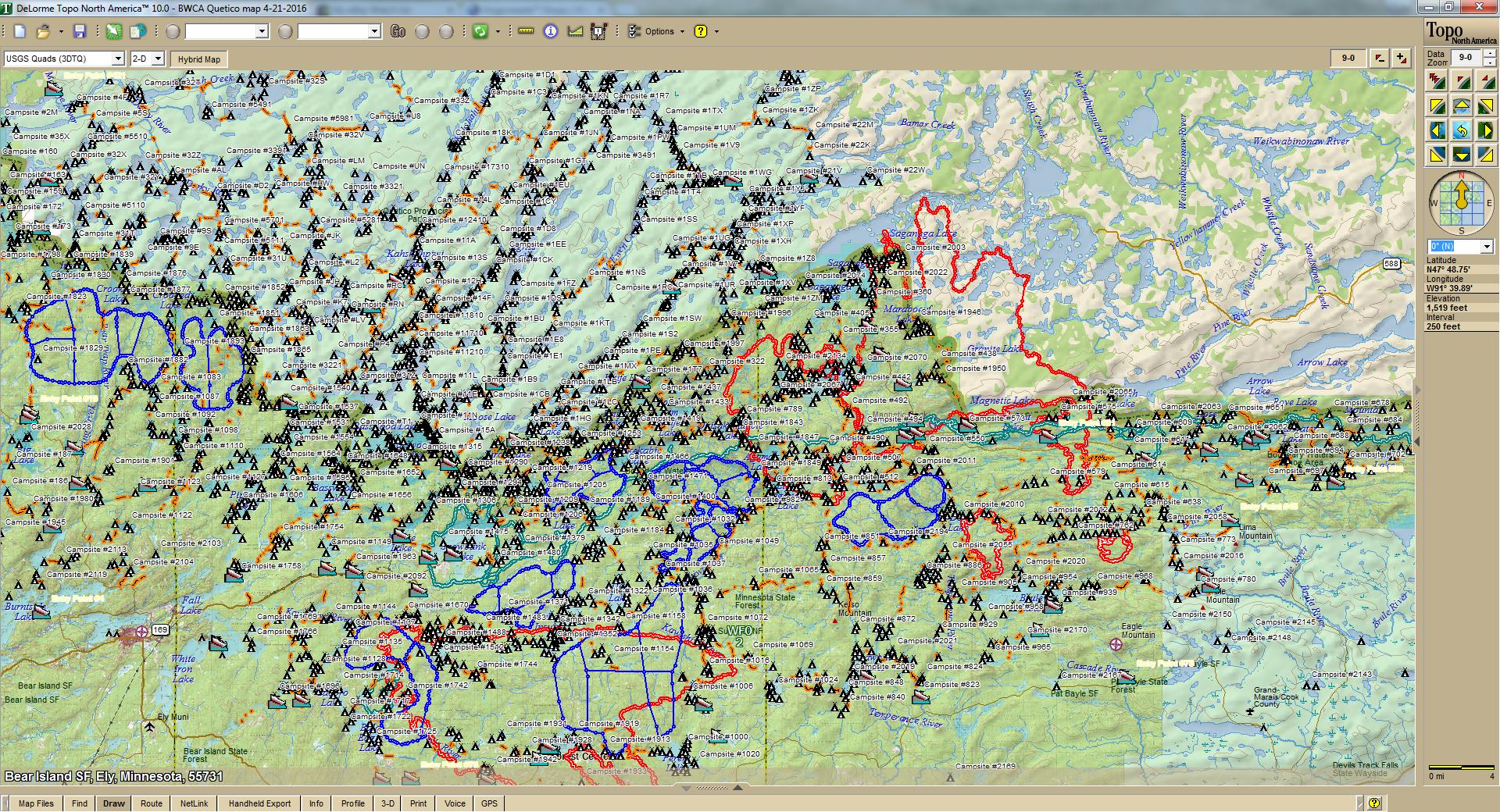
May just have to play with that. If I remember, took them from .kmz files, should be simple to make a custom map overlay.
Lot of possibilities in BaseCamp, the files linked were customized in Topo10, saved as .gpx and should work across platforms.
butthead
PS: Been looking for a way to link files for sharing here. Started video linking thru my OneDrive, looks to work well. Any problems I am missing? bh
|
04/21/2016 06:07PM |
Just plied a bunch of files .kmz/.gpx/.gdb into BaseCamp and started separating location types. Saved the results as .gpx.
PMA camping permits specify section.
Just another item to keep me busy!
butthead
|
04/21/2016 09:27PM |
|
04/22/2016 09:37AM |
quote butthead: "...PMA camping permits specify section..."
Thanks.
Turns out, I did have that entire set of stuff in another BaseCamp list folder, found on another site. Seems like it would be neat to have the fire maps and PMA zones in custom maps rather than track outlines, like the Lake Depths map from that same source.
|
04/21/2016 01:01PM |
butthead
|
04/21/2016 03:56PM |
Question: why the different sections within the individual PMA units? Am I just not familiar with how those areas are set up?
Comment: Does it drive you as batty as it does me that each track and waypoint in BaseCamp must have its own unique name? On my Garmin unit, all of my walleye spots are named 'W.' When importing into BaseCamp, they get numbers appended. Moving them back and forth between computer and unit means a lot of renaming or else living with the screen clutter (like the '001' attached to your track names here). It shows up again when I want to use the non-unique (usually single digit) lake-specific campsite numbers on my gps to reduce screen clutter and it becomes quite the pain when moving a group of them from the computer to my Garmin before a trip.