BWCA Entry Point, Route, and Trip Report Blog
April 11 2025
Entry Point 6 - Slim Lake
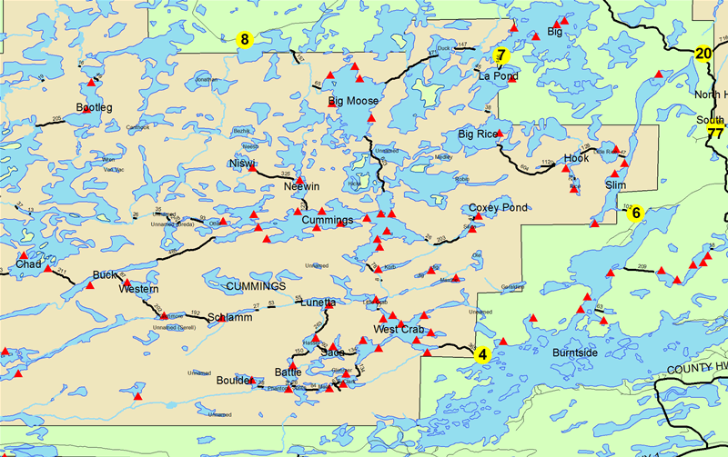
Slim Lake entry point allows overnight paddle only. This entry point is supported by Kawishiwi Ranger Station near the city of Ely, MN. The distance from ranger station to entry point is 23 miles. Access is a 90-rod portage to Slim Lake Portages to three additional lakes.
Number of Permits per Day: 2
Elevation: 1210 feet
Latitude: 47.9958
Longitude: -91.9599
Slim Lake - 6
Number of Permits per Day: 2
Elevation: 1210 feet
Latitude: 47.9958
Longitude: -91.9599
Slim Lake - 6
Kettle Falls
by whyzata
Trip Report
Entry Date:
June 05, 2021
Entry Point:
Little Vermilion Lake (Crane Lake)
Number of Days:
7
Group Size:
2
Trip Introduction:
Crane Lake to Kettle falls and back down to Crooked Lake.
Report
Nothing like a seven day trip on big water with 5 of the days enjoying flat water. Wow. We were the only canoe out. Trip was about 70 miles in distance as we did about 10 miles a day. Reservations were required in the National Park. The small mouth bass fishing was excellent Crane Lake to Sand Point to Namakan to Rainy and back down to Crooked for a night before exiting on Crane lake. Having lunch and a beer at the hotel and camping near Kettle Falls was a treat. Saw bear, deer and moose pretty much every day. Drank about a gallon of lake water a day as the weather was hot. Just a great, great run. Stormed on Namakan the evening of the 9th. Had strong SouthEast winds on the 6th but Namakan has many, many islands to chart a course around. Would love to do this trip again, but weather and winds need to be on our side.
discuss this trip report (1 comments) - last post on June 13, 2021