BWCA Entry Point, Route, and Trip Report Blog
January 07 2025
Entry Point 8 - Moose River South
Number of Permits per Day: 1 permit every other day
Elevation: 1349 feet
Latitude: 48.0720
Longitude: -92.1312
Moose River South - 8
2020 Voyageurs Challenge
Entry Date:
September 11, 2020
Entry Point:
Little Vermilion Lake (Crane Lake)
Number of Days:
6
Group Size:
2
After nearly 18 months of planning, it seemed that our first huddle in this challenge would be getting to the starting point. I blew out my back in January after rowing 2,300 miles (for a separate challenge), recovered from COVID in July, and dislocated my left knee in the gym about a month prior to the starting. Adding further insult to injury my two brothers had to cancel due to travel restrictions and our big mission for the year was pushed back to September. I was having flash backs of 2019 again and was afraid that I would have to postpone our trip one more year. Luckily however, I was granted permission to take my leave and scrambled to find a light weight canoe (I figured that if I was going to do this trip while recovering from my injuries I would need to trade my 73lb Royalex for a 43lb Kevlar).
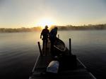
It’s funny, that for all the mess that 2020 has been so far, I forgot about all my injuries and setbacks. Standing with my boy, on a dock in Crane Lake, I saw nothing but a loaded canoe, the sun rising over open water, and the adventures that laid ahead. Day One… Bring it on!
We shoved off under the tradition of first light with high hopes. Evan adjusted himself to trim for the weight difference between us and I slammed my finger against the gunnel not even an hour into it; It quickly became apparent that we would need to get used to paddling with each other and our new boat as soon as possible if we were going to make it. Aside from this incident all went well and we were even accompanied by a family of otters for a while (we may have run one over). Luckily for us we decided before leaving Ely that we would never be lost at any point on this trip… so as we didn’t have a map for this portion of our trip and Evan was still figuring out our GPS, we were very “Confused” when we found ourselves at a beaver damn on Vermilion Narrows wondering how all the fishing boats got through.
Evan died some time after betty portage and Lilly paddled for the next 10 miles until he caught his second wind and carried us into to our camp site about halfway through Lac La Croix. We had a sandy beach to ourselves and quickly took advantage of it for a hot meal while watching the sun set… 35 and a ½ miles into our trip and I haven’t killed the kid yet… It’s been a GREAT trip so far!
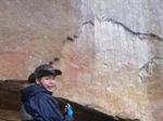
4 AM came fast on Day 2. We started off our day the same way we would for the rest of this trip, with coffee and a 400 Calorie Cookie (AMAZING WAY TO BEGIN THE DAY by the way). We shoved off before first light and it wasn’t before long that we arrived at our first planned detour… the great Pictographs on Lac La Croix. We took about an hour putzing around and taking photos before we remembered that we had a lot of distance to cover if we wanted to get to one of our favorite campsites on Basswood River, about 26 miles ahead. So, we put our heads down and paddled like stink only to be slowed down by the next set of pictographs about 3 miles from camp (luckily we took all the photos we needed in August of 2019, so we snapped a couple to prove we were there and paddled on).
Our campsite was every bit as beautiful as we remembered it… We toured it for a while just reliving the memories that took place 13 months earlier. Evan who was hell bent on a starting a fire, took off and left me to set up camp; why the hell not I figured he deserved it. In his haste, he hung my life jacket on a tree branch saturated in Pine Sap, and while stoking the fire stepped in our dinner flinging food all over the place… THAT KID IS BEAR BAIT! If it wasn’t for the fact that I needed him to help me portage our gear, I may have left him there to winter over. After a stern talking to about growing up and paying attention we went on to make more pleasant memories… He had always wanted to see the Milky Way and that night, there wasn’t a cloud in the sky; so we enjoyed our hot tea and coco while doing our best to point out the constellations of September (making up about 98% of them). The wind was blowing from the North now, and I wondered if would be able to finish our trip before the temps dropped too much.
Day 3 began like the others before it but with a greater sense of urgency… Having been windbound on this leg of the trip last time, I wanted to get into Basswood Lake while the atmospheric conditions were still stabilized. We splashed in around 5:40 am and went like stink until hitting Basswood Lake about 2 hours later. The wind was light and in our favor, but as the sun began to rise… so did the wind speed. We managed well enough until things opened up at Bailey Bay… With the wind blowing from the North at 20 MPH now, there was some major chop that we had to contend with… It got hairy for a bit with a few rollers splashing over the gunnels.
We made it through and soon enough found ourselves on Knife Lake. I’m sure this lake is a pleasurable paddle under calm conditions, but that wasn’t in the cards for us; Knife Lake like Basswood would be a grueling 12 mile slog. I just wanted to put this lake under our belts before calling it a day. Evan, who had less ambitious goals started pointing out every camp site in the last 6 miles of this stretch… He was done for the day and wanted off this ride; when we finally arrived at camp, he had looked like death warmed over. It was a hot dinner and straight to bed for us. Neither of us found any trouble falling asleep. Staying asleep however, would be a different story. Evan, awoke to the sound of me digging for the emergency blanket sometime around midnight… It soon became apparent to me that perhaps, we should have brought warmer sleeping bags.
The start of day 4 was slow and cold; nothing like thawing frozen boots with warm feet to get you moving in the morning. Nevertheless, there’s nothing like hot coffee and a delicious cookie to raise your spirits (again, I think we’re on to something here). We were socked in under a heavy fog but needed to get moving to shake off the cold. So, we set an azimuth with our compass and did our best to not get “confused”. The fog began to lift at the end of Otter Track; with easy navigating Evan and I made great time flying through glassy water. With 32 miles in front of us (and 10 portages) I knew we had to dig deep to find the motivation needed to get to Gunflint Lake by sundown… I could think of no better way than some cheeseburgers and beers at Gunflint Lodge.
These portages were nasty, muddy, vertical in places, and riddled with ankle twisting boulders. Had it not been for the promise of a hot meal and a cold beer we may have considered maintaining a slower pace. We remained resilient and pushed on straight through to a retired USFS campsite for the night. To Evan’s credit, he didn’t die until after we got to the restaurant where after ordering, laid his head on the table to rest before a hard-earned meal… One more quick point here, despite looking like we just went through Hell, Evan received a very nice smile and wave from an attractive blonde in the restaurant (yup… takes after his old man alright)!
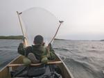
The forecast on Day 5 promised 30 MPH winds… but in what direction? Gunflint Lake can be a long paddle against a head wind. Luckily for us it was in our favor, as we were now too fat and lazy after our calorie splurge the night prior (I blame the brownie skillet with ice cream for my state of lethargy). So rather than paddling, we elected to erect a sail from our tent’s footprint. Our GPS showed us maintaining speeds over 4 MPH with a top speed of 7.8 MPH at one point… It was awesome, we crossed Gunflint in 1 hour and 38 mins and didn’t have to paddle once to get there!
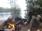
We knew that we had to slow down if we were going to make it to Grand Portage on Friday to link up with Missy and Ayden (Our Support Crew), so we elected for an easy day on the water and a long enjoyable day in camp. After 11 miles we pulled over into a campsite at the height of land, struck up a fire, and just enjoyed ourselves for a little father and son bonding (we even had a bushcraft competition; who could make the best clothes pin… I won by the way).
Day 6 and there was a beautiful sun rise over Rat Lake. We had been on the water for over an hour by now with the intent of getting into Fowl Lake before dusk if we were to nab one of only two campsites (Yes I understand that there are a bunch of sites on Moose Lake, but NO…. Not after an incident with some racoons a few years ago… completely different story, I know). There wasn’t much to report on this leg… by now the forecast that I had written and kept in my pocked since shoving off was way off; highs in the 60’s, lows in the 40’s and 5 MPH Winds… Complete Bull Ship! It was a cold blow from the North now. We found white caps on every lake from Rose to Fowl, but what we didn’t find was anyone else crazy enough to be on the water that day. We were however greeted by a bull moose with impressive antlers on Long Portage… There was an awkward standoff for a bit, but I never once felt in danger; this is largely because of my parental instincts to place my son directly between me and 1,400 pounds of rage.
Aalst, we arrived at our campsite… A little spit of land, on a very exposed island; there was no refuge from the wind. We erected wind blocks around our tent using our canoe, fallen trees, anything we could find. But the cold wind still found its way in and took our heat with it as it left. Our wind blocks did however grant some relief to the local mice population that stayed koozie next to our tent; those bastards, waking me up with the amplified sounds of their running up and down our Kevlar canoe! Oddly enough the mice did bring some entertainment into our lives… Every now and then you’d find one in the bottom of the latrine… Which made a perfect target for those attending the shooting gallery (if you know what I mean).
Sleep was difficult at first, but obtainable once the wind died down around 10:00 pm. That is until, it came back. At 1:30 AM, I woke up and sat shivering until 4:00AM. Our sleeping bags had an emergency rating of 32 degrees, and it was definitely colder than that outside (we later discovered that the mercury dropped to 27 degrees that night… ooftah). Stuff just got real.
Day 7 brought with it hot coffee, cookies, and a chance to warm up a bit. Today would be special… We saved only the most difficult parts of this trip for this final stretch. Fowl Lake (I had a religious experience there once), Fowl (FOUL) Portage, and the infamous Pigeon River. Add in the destroyer of men known as the Grand Portage for your grand finale, and you liken yourself to Dante, traversing though the multiple levels of Hell; We had to get through all these obstacles and make our way to the casino for the night… Although disappointing, our sleeping bags simply would no longer keep us warm.
No religious experiences on Fowl Lake this time, unless you count what could only be described as a UFO buzzing by prior to sunrise (true story, I swear… And besides, what BWCA trip isn’t complete without a close encounter of the third kind?). Anyway, the sun was still working its way over the massive overlook as we began navigating Fowl (“FOUL”) Portage, and no sooner than we started we soon found ourselves at the end of the portage, just staring at the Pigeon River... Too Shallow to Paddle… Too deep to walk… Still staring… What a God-awful river.
Had it not been for the fact that it was cold and we needed to get moving, I probably could have delayed splashing in for a while. Evan had no idea what laid ahead, but he knew I was serious when I said that this would make the Grand Portage look easy. Luckily, having suffered through this before, I came ready with a new plan on tackling this obstacle. Having watched a Bill Mason video a few months prior, I was immediately reminded of how Bill and his Son straddled the ends of their canoes and propelled it forward in a bouncing motion; lets give it a shot!
This new technique worked surprisingly well, and we were through the nastiest parts of this river in no time flat. Although it was a successful run, there is a major price to pay when using this technique (at least for me). If you were lucky enough to keep the pointiest end of a canoe from smashing into your you know what, you still had to contend with the discomfort of sitting on the gunnels (your inner thighs turn a special color of purple). Nevertheless, we flew though the worst parts of this river and arrived at Fort Charlotte at Noon. Is 4 hours a respectable time for this river? Not sure. Anyway, we were just happy to be able to change into a dry pair of socks (if you were lucky enough not to lose them… Evan).
There’s not much to report after the Pigeon; the Grand Portage is what it is. I did however witness something that I thought I never would see in a million years. Evan who had knocked the safety clip off of his bear spray, had bent down for it, and in the process of picking it up, had actuated his bear spray, engulfing him in a fine orange cloud. Thinking quickly, he grabbed the clip off the ground and ran down the trail a bit before stopping to cough his lungs out while expressing himself in a language no one could understand. I who had witnessed everything, found myself completely helpless, immobilized by an explosive and uncontrollable laughter. I laughed until my eyes filled with tears. I laughed until I could feel my internal organs compress into a tight ball. I laughed until it hurt. I laughed, that is… until I inhaled the bear spray… It hurt…I stopped laughing. Not funny anymore.
Aside from that, the Grand Portage was just a long walk… The experience of shuffling your feet grew to become rhythmic… almost meditative. Of course, in this weird trance, your mind begins to wonder. You start questioning every bad decision you ever made that lead up to walking 8.5 miles with a canoe on your shoulders… but at the same time you begin to wrestle with the idea of doing it all again next year.
And just like that, it was over. We broke through the trail and found ourselves at the Historic Fur Training Headquarters on the banks Gitche Gumee (Lake Superior). Having been a full day ahead of schedule, there was no familiar faces to greet us with warm hugs and a truck with a heater. Just a father and a son; cold, sore, and exhausted… Just sitting in the silent afterglow… already looking forward to a hot shower, and if we’re lucky enough… perhaps… the chance to do it all over again.
* Mahalo to those who helped to make this event a reality and much Aloha to those who completed the challenge this year!


