BWCA Entry Point, Route, and Trip Report Blog
October 31 2025
Entry Point 14 - Little Indian Sioux River North
Number of Permits per Day: 6
Elevation: 1364 feet
Latitude: 48.1466
Longitude: -92.2103
Fall Color Surprise
Entry Date:
October 16, 2025
Entry Point:
Little Indian Sioux River (north)
Number of Days:
5
Group Size:
7
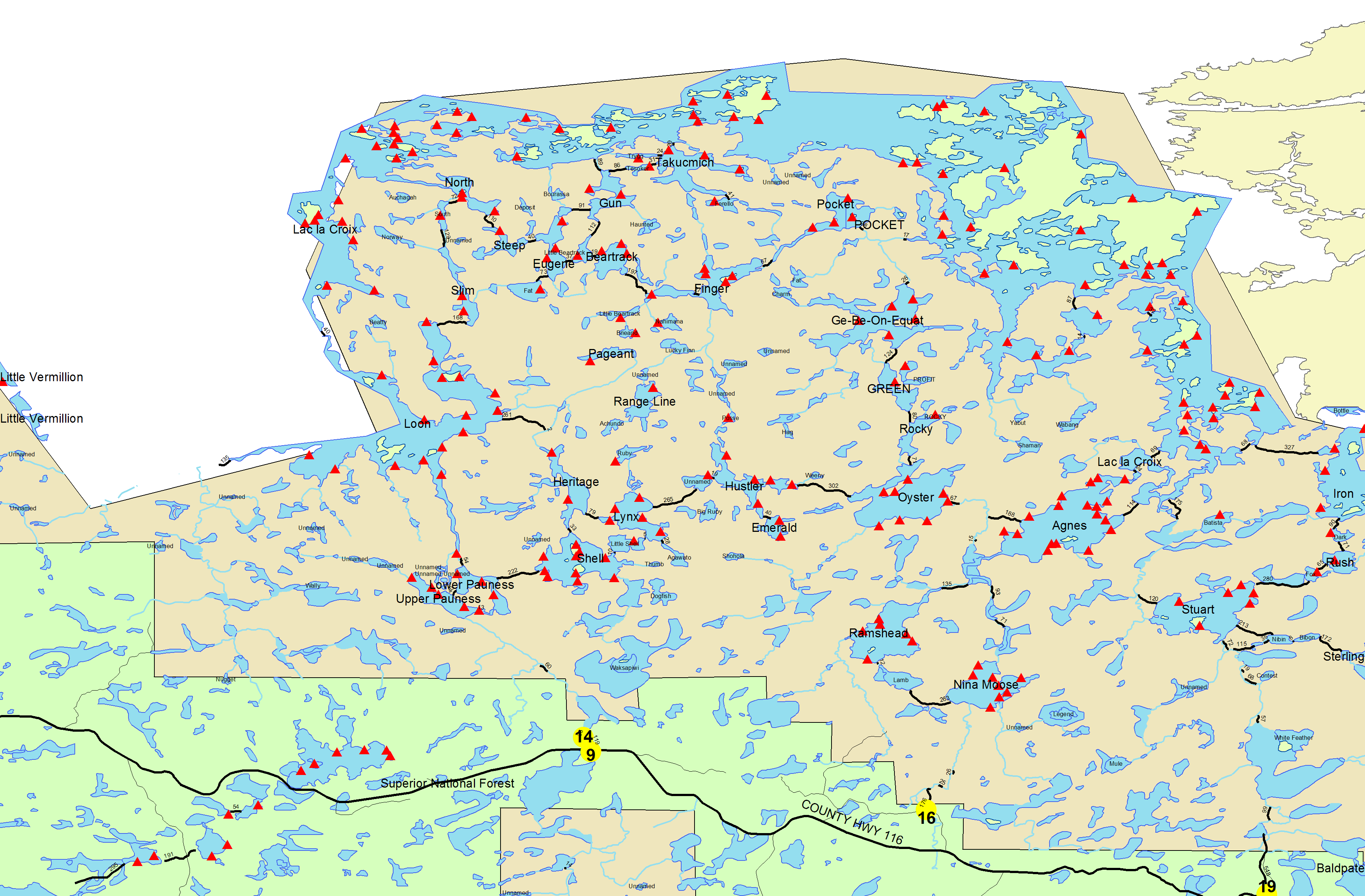
 "RAINY DAY!" Midnight arrival on the 15th into Lodge of Whispering Pines and their bunkhouse was a great way to catch quick sleep and then use their base lodge room to organize our gear. We had a mix-up with canoes but they were quick to get it sorted and we were paddling by 11am. Rained all day but it was a good test of our gear and we were all amazed at the amount of fall colors still around. All the indications and reports were that it was way past prime so we were ready for bare trees but had great colors throughout. Day 1 took us through the Pauness Lakes and Little Loon Lake into Slim. The portage to Slim was the hardest of the day and was a bit of a rainy mess but the crew knew they were heading to camp so it went quick! Rain throughout the night kept us away from the big rock that is the kitchen site for #81 but we pitched tarps in the tree and kept dry. [paragraph break] Day 2 was up perfect for a big lake trip - light winds from the sw so we headed up through Section 3 pond and into LLC, using the unmarked portages (all easy to find right where they should be) and just enjoying a great mixed sunshine day. Had not seen a person since the parking lot and that continued through our entry into Takumich Lake where we then saw one person occupying the bigger group site on the island. The wind difference from LLC to Takumich was incredible - we had not noticed how much wind protection we were getting from the south. Launching directly into Takumich was almost too much and then paddling the east arm of that lake was tricky for a couple boats getting a beam wind. Finding that site occupied was a bit of a gut punch as it was 3pm by them and people wanted to camp and fish. We took a chance on the unrated wide on the north middle edge and it worked great. Enough space for 5 tents even with a little maneuvering and a fairly protected kitchen once we put up a windbreak tarp. Caught a few fish along the shore to the west from a slow trolling boat and that livened up a good dinner.
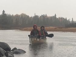
 GREAT COLORS STILL [paragraph break]
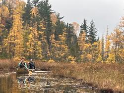
 THE CARNAGE AFTER THE PORTAGE FROM FAT LAKE [paragraph break]Day 3 took us through Gun Lake to Eugene Lake - we should have portaged right into Eugene from Gun but instead went to Little Beartrack. Nothing wrong with that decision except that portage was a tough one. Beautiful for everyone not carrying a canoe but the portagers struggled with the rocky terrain. Everyone made it through with a couple breaks (we singled portaged everything btw). Eugene was a great lake and the site at the narrows was perfect for many reasons. Good fishing in the portion to the north got us enough to supplement dinner. Short days meant the sun was down by 7pm...
Day 4 was a bear but we knew it going in and that helped. We went from Eugene into Fat Lake - gorgeous and perfect in the morning, but then dealt with the monster portage to Slim. This is unmarked but well-known and you can find the location on the online maps out-there. The access from Fat is to the lookers-left of the exit creek about 150 feet away on a bald rock area. A little tricky but you will know you are in the right place as you get close. The portage is long (almost a mile) and had several blowdowns, big rock drops and many twists and turns. The twists and turns were probably the most interesting and new aspect -instead of generally straight trails this one twisted within small segments so on a few occassions the canoe-carriers were doing multi-point turns. All in all a good one to do early in the day and we took a good break afterwards. Continuing back over our path now we camped a final night on Upper Pauness, and got an early start in a beautiful sunrise to finish the trip by 10am back at the cars.