BWCA Entry Point, Route, and Trip Report Blog
December 27 2025
Entry Point 16 - Moose/Portage River (North of Echo Trail)
Number of Permits per Day: 5
Elevation: 1348 feet
Latitude: 48.1230
Longitude: -92.0991
A favorite route offering many trip options and memorable things to see including;
World Class fishing for all four BWCA Species
Pictographs
Soaring granite hills and cliffs
Small lakes
Small rivers
Tumbling rapids and waterfalls
Wildlife, including Moose
Vistas from high points across the region if you're willing to climb. Rating Easy to Moderate. Day One. Get to EP16 off of the Echo Trail early. The initial portage is long, but well worn and smooth, sloping gently downgrade to the launch area. Load your canoe and head North. You'll be paddling with the slight current on this narrow winding river. The water is clear and make sure to tell the bowperson to watch for looming rocks!
little indian souix to nina moose
Entry Date:
August 11, 2007
Entry Point:
Little Indian Sioux River (north)
Exit Point:
Moose/Portage River (north) (16)
Number of Days:
8
Group Size:
6
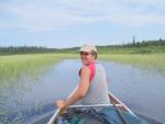
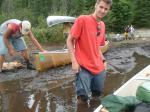
Arriving at Little Indian Souix River that morning, we find it pretty busy, with a couple other groups loading in at the same time. We seem to be more organized, and get our stuff down the portage, load em up and shove off into a cloudless day of fun and sun
Matthew and Henry chug on ahead up the river, for most of the trip they are the scout party, no substitution for the endless energy of a 22 and 17 year old paddling like the canoes was on fire.
Nathan and I follow along, knowing we wont keep up the whole time, so we meander up the river pondering how many boxes of rice a roni we could make with all the rice we are paddling through.
last but not least Scott and Mare bring up the rear, zigging and zagging their way down the river, discussing the best way to canoe as only a married couple can
after paddling up stream and taking the mostly uneventful portage(uneventful except a buckle on my fancy new harness for the food pack broke) we come to Upper Prauness. Here we decide, its only day one and decide to stop, after checking out a couple empty campsites that would not accommodate our group, and a couple full ones, we grabbed the one directly out from the entrance to lake. Nathan, and Scott and I decide fishing is in order. we grab our rods, tied on some Lindy rigs and went to grab the leeches............ummmm the leeches that we bought and the outfitter did not deliver, and to our own fault we weren't thinking of at the time we shoved off. So there we were with a couple of rapalas and spoons and a ton of Lindy rigs and no leeches. fishing wasn't looking so good, but with weather clear and upper 80's and a lake full of swimming we were not disheartened for too long, our relaxing, sight seeing, fishing trip had become a relaxing, sight seeing trip that we would feebly attempt to fish on. So we spend the evening with a few cocktails and call it good


we paddle off for Upper Prauness. take the quick 13 rods and head to Loon Lake. As we paddle Upper Prauness, Nathan astutely points out how windy it is getting............ Matthew, Henry, Nathan, and I arrive at the portage that takes us up by the falls and off to Loon Lake, looking around, no sign of Scott and Marilyn...maybe they saw something cool to look at, no biggy, grab the canoes and over to loon to hang out and wait for them, and wait, and wait, and wait, after what seems like and eternity (and may have been) they come strolling down the portage, to be barraged with questions of "where the heck ya been". As it turns out they misread the map and took the portage back to Lower Prauness.....ok, Sorry Mare, but that had to be told, but nothing like an unneeded portage
Paddle up the creek to Loon lake.........white capping Loon lake, eying the whitecaps, PFDs go on and zipped up and we fight the wind across to Canada side in search of one of our goals for this trip, to find an International Boundary marker. After a somewhat tough paddle against the whitecaps we hit Canada.....yaaaa we are here!!!!!! We walk around for a while snapping pictures like some tourists first time in New York City, but no boundary marker to be found. Somewhat sadly we start back cause we still need to stop at the falls and get some photos. Back across Loon Lake (has the wind shifted into our face again??). We see a Ranger or DNR or whatever cruising around on his boat, and with a friendly wave Nathan and I continue leading the charge across, glancing back occasionally to be sure the others are still on the way. Then we notice Matthew and Henry are not wearing PFD's in white capping water (dumb if you ask me) The Rangers stops them(prolly to see if they even got em, which they did of course) and because of that stop, they drifted close to this little rock (I hesitate to say island) and lo and behold on that rock is our international boundary marker. Good fortune comes in strange packages.


that evening we were were all brought to tears from the ghost stories book that Marilyn brought with.......words to the wise, pre-read your ghost stories books before bringing them. tears of "oh my god did we really carry that stupid arse book with us" prevailed amongst the camp???
we stay up late to try and catch some shooting stars, but lucky for us the clouds roll in as the sun rolls out......no stars tonight :O( 


this trip will long be remembered for many things on the fishing scale it was a 1 on the sightseeing and R and R scale a 10 on wildlife scale it is an 11 


