BWCA Entry Point, Route, and Trip Report Blog
January 07 2025
Entry Point 24 - Fall Lake
Fall Lake entry point allows overnight paddle or motor (25 HP max). This entry point is supported by Kawishiwi Ranger Station near the city of Ely, MN. The distance from ranger station to entry point is 7 miles. "Access is a boat landing at Fall Lake. Several trip options to Newton, Basswood, & Mud Lakes with additionalportages." This area was affected by blowdown in 1999.
Number of Permits per Day: 14
Elevation: 1324 feet
Latitude: 47.9527
Longitude: -91.7213
"This trip will be taking off from Fall Lake up through Newton Falls portage onto Pipestone Bay campsites. 3 day, 2 night trip into the wilderness.
Number of Permits per Day: 14
Elevation: 1324 feet
Latitude: 47.9527
Longitude: -91.7213
"This trip will be taking off from Fall Lake up through Newton Falls portage onto Pipestone Bay campsites. 3 day, 2 night trip into the wilderness.
Mudrow, Crooked, Iron, LaCroix, and Nina Moose
by ktoivola
Trip Report
Entry Date:
May 08, 2008
Entry Point:
Mudro Lake
Exit Point:
Moose/Portage River (north) (16)
Number of Days:
6
Group Size:
6
Trip Introduction:
This was a large loop made over fishing opener in 2008. I learned alot and had a great time. I hope everyone enjoys our adventure!
Part 1 of 6
Day one, we picked up our permits in Ely at 11am and headed toward Mudrow Lake entry point. After what seemed like an eternity, we arrive at Mudrow and unload our equipment. Two guys stayed there while the other four of us went to drop off the truck at Moose River entry point for the way back. An hour later, we were all back and started on our way to across Mudrow. As soon as I hit the water, it seemed like ages since I had paddled a canoe, and before I knew it, we were on the portage to Sandpit. The portage was memorable since the last time I had been on it was my solo trip last year. For anyone who hasn’t taken this portage, it’s up and down with rocks all over, making for some fancy legwork. After Sandpit, we headed to Tin Can Mike Lake. There was still snow on the portages, at this point, the new guys were starting to wonder what they had gotten themselves into. The plan was to make each portage in one shot, and we seemed to be making it happen. Paddled across Horse Lake and onto Horse River. The water was high and the current strong, but we safely made our way to Basswood River in about 4 hours. At the Upper Basswood falls, we took a MRE break. I was really surprised how filling those things were. Back to paddling with only a brief stop to at the crooked pictographs. By 7 pm we were in Wed bay, tired, but almost to our camp. We hadn’t seen many people up to this point, but we were surprised to see our desired camp taken….plan B. We ended up taking a different one and arrived as the sun was going down and temps were falling. 


Part 2 of 6
The next day was a perfect day, lots of sun, little wind, and no bugs. We fixed up the camp some more, collected firewood and enjoyed some great meals. There was a lot of anticipation for the fishing opener. After several years of carrying in bait, we came to the conclusion a seine was much easier to carry, so around noon we went looking for a spot in a back bay. It was a blast seining with six guys and three canoes. We made a catamaran system with two poles to prevent the two canoes from coming together. Two guys holding the seine in the front with the two back guys paddling. We had the other two guys chase minnows toward us as we made our seining run. I guess it was more like minnow herding, but it was a blast to seine a ton of bait without ever getting wet…the cocktails weren’t bad either. Finally, fishing opener! Walleye fishing was pretty slow to begin with, but by the end of the day, we had some nice keepers, one 28 inches released, and a lot of fun overall. The fish were caught in the current areas with jigs and minnows. A great walleye meal, cocktails, and good laughs made for a great day.
Part 3 of 6
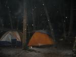
We woke to dark clouds and snow flurries, not ideal weather for paddling. We broke camp and started for Iron lake. Paddling was pretty hard into a progressively strengthening headwind, so progress was slow. After a few hours, we decided to take lunch and formulate a plan for the big water. We found two long poles and made a 3-canoe catamaran to help ease paddling and avoid the big water hazards of Saturday and Sunday bays. The guys in the middle canoe had about three feet either side of the canoe to paddle. It looked ridiculous, but it worked really well…you could take a short paddle break without losing steam and it was nice talking without raising your voice. Our vessel was cruising now toward Sunday bay. The weather wasn’t looking good, and before we knew, it was raining hard. As the weather deteriorated, so did our progress. Several hours later, we rounded the corner toward the north end of Sunday bay and the curtain falls portage. Well just our luck, we ran into a huge sheet of ice. It was detached and floating, but too thick to break through. We ended up paddling about a half mile out of the way to reach open water behind the ice. Another mile or so later, our hearts sank when we saw that the whole north end of Sunday bay was still frozen over. You could hear the roar of the falls only a mile away. We knew that ice would be a problem, but now was not the time to deal with ice. It was now raining, getting dark, and we were cold, wet, and exhausted. A quick look at the map revealed the nearest campsite was two miles back around an obstacle course of ice. An executive decision was made that we head to the nearest shore and camp there. I’m not one to disobey the rules, but in this circumstance we needed to settle in for the night whether it was a designated campsite or not. Thankfully, our tarps protected us from the rain, sleet and heavy snow that we endured that night. 


Part 4 of 6
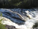
The next morning, the sun was shining, and we hoped that the ice receded during the night. Well, the ice was still there! Time for Plan B! I saw that there was a creek leading to a river that came into the southeast side of Iron from Sunday bay. After a much needed breakfast, we headed for the creek. Luckily, the ice had broken away from the shore enough to let us get to it. Well, it was more like a raging river with the water being as high as it was. We hiked along it and discovered a series of rapids to bushwhack around…not too bad, about a quarter mile. This portage we doubled to make things easier. Two hours later, we were paddling easy and made our way into Iron lake. Camp was made and we headed toward Curtain falls for some fishing. The bite was definitely not on yet. We managed to catch a few walleye, and one northern, but it was disappointing after all we had gone through to get to Iron. Another group was on the lake as well and they confirmed our slow bite. We hiked up to Curtain falls. It was amazing with the volume of water moving. 


Part 5 of 6
The next morning, we decided to head to La Croix for lake trout since the walleyes were not biting well. After several hours we were on La Croix and paddling north. There was no one on the lake. We trolled with spoons, but only caught one pike. Camp was made on an island across from the pictographs. Not ten minutes after camp was made, a strong wind and steady rain kicked in from the south. It pretty much blew us out of camp. With no protection, we decided to head to fish stake narrows and camp on the islands there. At this point, there were white caps and the rain was coming in sheets. Some of the first timers were feeling a little awkward on the water. At the last point before turning west toward our proposed camp, we ran into ice again. For several hundred yards, it was broken into ice cube sized pieces and made an eerie sound. I started to wonder what we had gotten ourselves into. We had to get around the point to get to camp, but there was 30 feet of four inch thick iced to break. It was slow going, very slow, indeed. I grabbed a large stick to break the ice rather than lose a paddle, but it still was difficult. Finally, we all made it around the point only to see the rest of fish steak narrows completely frozen. Plan C at this point. We all were cold, weary, tired, and starting to get frustrated. I found a new protected camp two miles back, but it was against the wind and rain to reach it. Out of options, we retreated. As we tuned around to go back through our path through the ice, it had completely closed off!!!! This was not good. More ice breaking to come…As we started going through the gap, the ice started to pinch our canoe. Then I saw the side of our Kevlar canoe starting to buckle in at the sides!!! It was time to get out…..The shoreline next to us was really steep, but I managed to get out of the canoe and pull it while my partner climbed out as well. All three canoes had to be pulled along the rugged shoreline! Thirty yards later we were back in and paddled to the new campsite. Tarps and tents were set up in the rain and the task of warming up started. 


Part 6 of 6
The last day we woke up to rain…no surprise. It was time to leave. We paddled down La Croix to Boulder river, to Agnes, to Nina moose and the Nina moose river, which was raging. Two miles of nonstop up current paddling and we were back at the truck…..soaked….What a trip!!!
Things learned:
Water resistant clothes under no circumstance mean water proof Don’t mess with ice and wind Bring a tarp Think outside the box
Enjoy!


