BWCA Entry Point, Route, and Trip Report Blog
January 07 2025
Entry Point 29 - North Kawishiwi River
Number of Permits per Day: 1
Elevation: 1249 feet
Latitude: 47.9543
Longitude: -91.5641
North Kawishiwi River - 29
The Great 2010 BWCA Adventure EP31/34
Entry Date:
June 06, 2010
Entry Point:
Farm Lake
Exit Point:
Island River (34)
Number of Days:
12
Group Size:
3
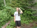
Done with that, headed back to the bunkhouse to relax before the sun came up start our trip. The boy and I decided to do a bit of fishing off the dock. Withing minutes, we caught a very nice small mouth, a medium size Pike and a Sunfish that had to be in the record books, no kidding, t was HUGE. Threw them all back, went and told my buddy who said, yeah whatever”. He did not believe us.
Spent some time in the main office shooting pool and drinking coffee before retiring for the evening.
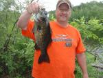
Woke at 6am and headed into town to grab a quick bite to eat. Back at the landing, we loaded up and headed out. Paddled North from the entry point till we hit the entrance of the Kawishiwi River. Headed East to the first campsite, which was open so we took it. Did not feel like going further as there was a 210 rod portage. Did some fishing were we hammered the small mouths.
Spent 2 days there before breaking down camp and continued East. 210 rod portage. My biggest so far but it was not difficult. Had a borrowed Alumacraft, the one made with .035 aluminum so it was light. I’d say it was every bit the weight of the Souris River I used the previous year. Tried to do the entire portage but set it down about 2 yards before the end. Went back and got the remainder of my gear and took that to the end, came back and got the canoe. We stopped at the second camp site, right on the trail that leads up to lake Conchu. Again, more great fishing. Did a quick trip up to Conchu where we were hoping to land some Trout but no luck. Did catch bass after bass. Beautiful scenery.
2 days here, we broke camp and headed East to where the Kawishiwi meets up with the South Kawishiwi. About this time, it stated to rain, and rain, and rain. At the first portage, it rained so hard, we stopped on the portage where we set up a Hennessy Tarp and took shelter for about an hour. It let up a bit so we continued. Still raining and wet, we looked for a campsite. My buddy who was in a kayak, was faster than we were so he took off from the portage to see if one of the two site to the West of that portage were open. He came back in about 20 minutes and said lets go, so off we went.
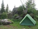
Still raining, we set up camp an quickly as we could. His hammock and our Timberline went up quickly and our gear stowed inside my tent. Used his large tarp to create a lean to style shelter near the fire grate where we quickly got a fire going. My buddy was getting into bad shape as he was the wettest and on the verge of hypothermia. Started shivering pretty bad. Got the fire going, got some of our wet clothes off and dried. The heat really radiated off the tarp well, so well in fact it was almost too hot. We were about 6 feet from the fire and it was HOT. Rained for the next 2 days here. Ok fishing, caught some Pike, but not a campsite we wanted to stay at so on day 3, the weather broke and we were off again.
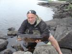
Broke camp and headed ESE. Here you have the option of either taking a right, NW or keep going SW. According to the map ,Voyaguer Map#7 going up and around would take us on a 121 rod portage. If we continued SW, it looked like we would tie into the portage at the half way mark. WRONG.....It was a dead end. We came to find out the portage was so close, it was only about 50 feet from the water so it just looked like it tied it. No problem, we just turn around and go up and around and do the 121 rod portage. Pretty easy one. Made the portage and continued East into Gabbro Lake and hit the camp site North side in the middle, the one that is on the penninsula. A great view and some great fishing were by buddy caught the largest small mouth ever. This camp did however have LOTS of trash. Several purple tampon applicators, what looked like blue shop towels where people were squatting in the treeline. Yes, there knew there was a toilet there because it was filled with blue paper. Numerous candy bar wrapper corners, slim Jim wrappers and drink mix wrappers littered the campsite. Not to mention several live trees cut down. Fire ring was also moved into the center of the camp. Several small fires were also made along the trail leading to the toilet? What’s up with that?
The day we left, 2 U.S. Forest service people stopped to check our permits. Both women and extremely good looking. One had a name that was very strange. I think there were models moonlighting as park rangers LOL. Looking back, I wish I would have had some violations so they could cuff me and take me away. Did I just say that out loud? Back on track.....
Showed the women the mess that was there where they apologized and offered to take some of the trash with them. Told them they were not responsible and no apology was need and that we had most of it bagged up already and packed it out ourselves.
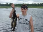
Spent 2 days here and broke camp and headed SE into Bald eagle lake where we did some fishing in the weed beds along the SW shoreline. Nailed some nice Pike. Spent a couple hours taking our time paddling this area before leaving the lake and entering the Isabella River. A 178 rod portage was ahead, not looking forward to it, but it had to be done. Took the first campsite after the portage. A beautiful area, but again, trash. A large can of half eaten beans say on the fire grate along with chew can lids in the fire and pistachio shells everywhere. Packed that stuff out with us as well. This was the only time we had any issues with mosquitoes and the first time on the trip where I used bug spray. I think due to the location as it was marshy. Them blood suckers only lasted a bit before they left and were not really an issue after that. Fishing was good for perch but the bass fishing was non stop. If your at this camp, head back towards Bald Eagle lake about 100 yards. You will see a few large rocks in the water on the right hand side. Throw within a 10 yard range of the rocks and the shore and you will catch them. One after the other, non stop.
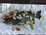
Spent 2 days here and broke camp. Headed upstream, yes upstream, I know, I know. Why are you paddling upstream? Well like we told a group of guys from Chicago we met on one of the portages, they asked us, “Why are you paddling upriver?” We told them, paddling with the current is for pussies, but it takes a real idiot to paddle upriver. They all laughed. Turns out, we were just going to do a loop trip, but hated the fact that we would have to see the same scenery twice, so at the last minute, my buddy and I decided to do a one way trip and the girl from the outfitter was going to do the same trip, only she was going to enter where we wanted to come out, entry point 34 and offered to drop our car off if she could use to transport her canoe. No problem. Worked out well for both of us. Anyhow, we left this camp and hit the other small portages before hitting the first camp site on rice lake. A fantastic camp and not a trace of garbage. Awesome. Not much use and I think that is because this camp is so close to entry point 34, that most people pass right thru to get deeper into the BWCA. Worked for us. Lots of river Otter kept up entertained. Swimming around like a pod of Dolphins. Some of the best fishing was here. Several Pike, some really nice Jumbo Perch and of course, Bass. I’m getting pretty tired of eating Bass by now LOL. Spent the remainder of our trip here before breaking camp and hitting our exit, where the trusty van was waiting for us. Only been to the BWCA 2 times so I can’t say this is the best trip ever, but it is far better than last years. I have a good feel for the BWCA now, and have learned what I need to bring, vs what I would like to bring. Already making plans for next years trip. Think it will be somewhere in the Gunflint area. 