Boundary Waters Trip Reports, Blog, BWCA, BWCAW, Quetico Park

BWCA Entry Point, Route, and Trip Report Blog

January 07 2025

Entry Point 61 - Daniels Lake

Daniels Lake entry point allows overnight paddle only. This entry point is supported by Gunflint Ranger Station near the city of Grand Marais, MN. The distance from ranger station to entry point is 33 miles. Access is from W. Bearskin Lake with a 60-rod portage to Daniels Lake and 460-rod portage to Rose Lake. This area was affected by blowdown in 1999.

Number of Permits per Day: 1
Elevation: 1427 feet
Latitude: 48.0727
Longitude: -90.4358
Daniels Lake - 61

First Solo - Baker Lake Loop Photo Essay

by lmislinski
Trip Report

Entry Date: June 19, 2009
Entry Point: Baker Lake
Number of Days: 3
Group Size: 1

Trip Introduction:
I had the stars align at the last minute for a quick weekend trip to try my hand at going solo. After searching for available permits and tapping into the great members on this site, I decided to enter EP 39, Baker Lake on Friday evening and loop up through Sawbill and Cherokee before coming back to Baker lake via the Temperance River flowage through Jack and Kelly. I'm not a big trip report type of guy, but I do like to take photos. What follows is a brief photo essay of my trip. Note that I took far fewer photos than anticipated since I needed to cover a lot of ground in basically 2 travel days.

Day 1 of 3


Friday, June 19, 2009

Route: Baker Lake - Peterson Lake - Kelly Lake

Kelly Lake:


Day 2 of 3


Saturday, June 20, 2009

Route: Kelly Lake - Burnt Lake - Smoke Lake - Sawbill Lake - Ada Creek - Ada Lake - Ada Creek - Skoop Lake - Cherokee Creek - Cherokee Lake

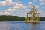
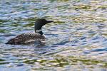
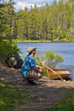
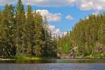
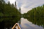
Morning at my campsite on Kelly Lake: [paragraph break] Burnt Lake: This was a great day with lots of slow moving fluffy clouds. I love how these type of clouds lend themselves to interesting lighting patterns on landscape features. [paragraph break] Loon on Burnt: This loon was completely fine with me getting in close for a nice portrait. Usually they aren't so vain. [paragraph break] The recent thread on solo self-portraits got me thinking. I'm glad I brought the tripod ;-) [paragraph break] Ada Creek - very beautiful and intimate feeling. [paragraph break] Cherokee Creek - one of my favorite areas of the trip. Unfortunately I didn't see any Moose... I did, however, notice some stowaways on the bottom of my canoe when I got to the camp on Cherokee Lake. A couple of leaches were trying as hard as they could to suck the blood out of my kevlar Wenonah C1W. [paragraph break] [paragraph break] Cherokee Lake Campsite - this site had amazing 360-degree views from a nice elevated point. This was a much nicer place to star-gaze than the bug-infested site on Kelly.
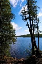
[paragraph break] A few sunset photos from Cherokee Lake. I didn't have any of the drop-dead, blow your mind, dramatic sunsets I've seen on previous trips. With that said, there was something elegant about this subdued sunset. Looking SE from my site: Looking W from my site:


Day 3 of 3


Sunday, June 21, 2009 Route: Cherokee Lake - Sitka Lake - N. Temperance - S. Temperance - Weird Lake - Jack Lake - Kelly Lake - Peterson Lake - Baker Lake - Home to St. Paul

This was a perfectly still morning - a true BWCA classic. I only took photos on Cherokee Lake this day as I had a lot of water/ground to cover before driving back to St. Paul. [paragraph break] Morning on Cherokee: [paragraph break] Quite the Rocky Portage Landing from Cherokee to Sitka - a true indicator of the nature of the trail ahead:


Routes
Trip Reports
a
.
Routes
Trip Reports
Routes
Trip Reports
.
Routes
Trip Reports
a
.
Routes
Trip Reports
a
.
Routes
Trip Reports
Routes
Trip Reports
Routes
Trip Reports
.
Routes
Trip Reports
Routes
Trip Reports
x
Routes
Trip Reports
a
.
Routes
Trip Reports
a
.
Routes
Trip Reports
Routes
Trip Reports
Routes
Trip Reports
.
Routes
Trip Reports
Routes
Trip Reports
x
Routes
Trip Reports
fd
hgc
Routes
Trip Reports
Routes
Trip Reports
Routes
Trip Reports