BWCA Entry Point, Route, and Trip Report Blog
January 07 2025
Entry Point 16 - Moose/Portage River (North of Echo Trail)
Number of Permits per Day: 5
Elevation: 1348 feet
Latitude: 48.1230
Longitude: -92.0991
A favorite route offering many trip options and memorable things to see including;
World Class fishing for all four BWCA Species
Pictographs
Soaring granite hills and cliffs
Small lakes
Small rivers
Tumbling rapids and waterfalls
Wildlife, including Moose
Vistas from high points across the region if you're willing to climb. Rating Easy to Moderate. Day One. Get to EP16 off of the Echo Trail early. The initial portage is long, but well worn and smooth, sloping gently downgrade to the launch area. Load your canoe and head North. You'll be paddling with the slight current on this narrow winding river. The water is clear and make sure to tell the bowperson to watch for looming rocks!
44 Miles, 72 Fish
Entry Date:
June 01, 2019
Entry Point:
Stuart River
Exit Point:
Mudro Lake (23)
Number of Days:
7
Group Size:
5
The 480 rod portage turned out to be much easier than anticipated. Thankfully my canoe partner took the canoe and a bag the entire way (I offered to take it many times but he refused) so it was even easier for me. We saw the largest beaver damn I had ever seen, it was at least 4 feet tall. Stuart falls were beautiful and so was Stuart Lake. We took the Island campsite because we always look first for island campsites. While fishing we checked out the other campsites on the lake and none were significantly better than the campsite on the island in our opinion. We caught a bunch of walleye and pike which we ate for dinner that night.
After waking up to a foggy Stuart Lake, getting our normal breakfast and coffee in, we headed off towards Iron. The portage out of Stuart was ROUGH. Lots of downed trees, we almost lost the path at one point. We all agreed that this portage was harder than the first portage of 480 rods even though this one was shorter. We thought we might stop at a lake in between depending on how we were feeling and if we liked a campsite we saw. We ended up liking the one on Rush so we stayed there.
The next day we wanted to spend on Iron. We got an early start and still every single site we passed on Iron was taken. Luckily we have all stayed on Iron before so we weren't too upset, we just kept going to Crooked. We fished curtain falls on the way and caught some nice walleye and bass directly in whitewater rapids just under the initial falls. The first 3 sites we passed on Crooked were also taken so we ended up at the island site north of Saturday Bay where we caught more fish and had another feast.
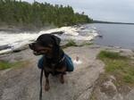
The island site in Friday Bay that we wanted was taken, so we took the one south of it for the next night. This site was very wide open with lots of room to throw Frisbee around and play fetch with my dog. We caught some VERY nice walleye around this site and also had to take cover under the tarp for an intense thunderstorm.
Now we were left with a decision, go south towards Gun Lake to Mudro, or go around to Lower Basswood Falls to Mudro. Since we were a lot further than planned by now due to all the taken campsites along the way, we decided to go the long way around towards Lower Basswood Falls. We stopped for the night at another island campsite in between Thursday and Wednesday bay. It was a pretty cool site with great views of narrow waterways. Big open water was getting old after the last 3 nights. For almost 24 hours after the storms, it was cloudy and dreary, but luckily eventually cleared up.
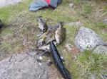
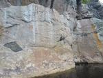
The next day we paddled past the pictographs to lower basswood falls hoping at least one campsite would be available. We got the northernmost site by the falls where you could sort of see them in the distance and just barely hear them. It was a great site with good hammock trees. The weather had cleared up and it was getting a little hot so a few of us went for a swim in the cold early June water. We caught and ate fish again making it 7/7 fish dinners for our trip!
The next day we decided to send it from Lower Basswood falls to the car parked at Mudro EP. It was a long day, Horse river has a bunch of unmarked portages and was much more difficult than we expected. We also had a headwind pretty much the whole way back.
Overall the trip was a huge success. This pretty much finished western BWCA for us so we are going to try a trip on the East side next year with goals of 50 miles and 100 fish. Let the planning for our 2020 trip begin!


