Thunder Point Loop
by RT
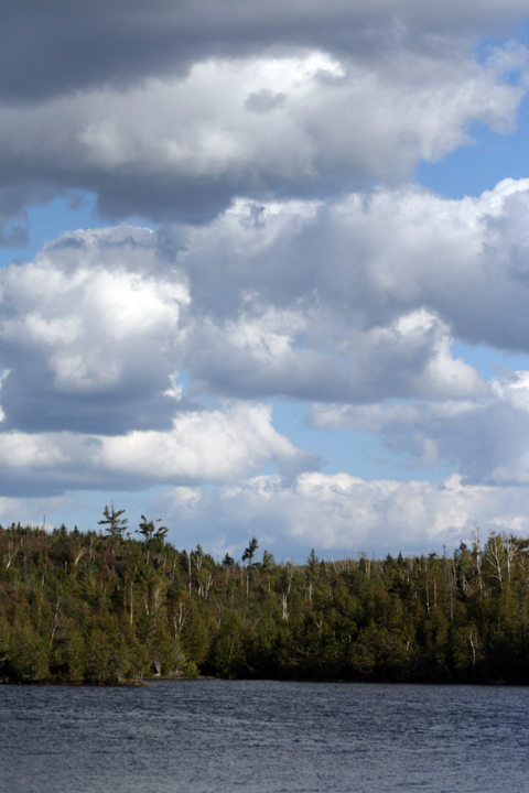
The wind had started back up when we awoke so I once again fashioned a sail using found, dead trees, and one of our tarps. After breakfast we loaded up the canoe and hit the water. Again we were viewed by other people who were no doubt jealous of our BWCA skills (yes, that statement is a joke), and we hardly dipped a paddle as we traveled the length of Ogish Lake to the north.
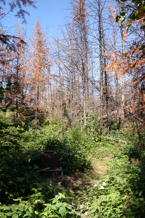
We entered the burn area (from the Seagull Lake ‘07 and Cavity Lake ‘06 fires) on the north side of Ogish Lake. I find the burn areas intriguing; they have a unique beauty that I find fascinating to look at and photograph. Matt and Gopher on the other hand; no so much.
We had a bit of a time trying to find the portage into Kingfisher Lake. With all of the fire damage in that area that year all of the shoreline looked the same. It was not until we spotted what looked to be another canoe (it ended up being a canoe pack) that we discovered the portage trail. The pack at the end belonged to a person who was taking a week long solo trip with his dog and he let us know that pretty much all of the rest of our journey was going to be in burn areas.
After Kingfisher Lake we entered into Jasper Lake. What was once a fantastic lake (I am sure) was now a burned out shell. I made it point to take pictures of the toilets on two of the campsites as we passed. The Forest Service is apparently in the process of installing a different style of toilet because in all of the burn areas the “shitters” (as we referred to them) were square and had a flip-down lid; as opposed to the round, lidless type that we had been seeing and using.
We hit the portage into Alpine Lake early so we decided to eat our lunch on the portage while exploring the small waterfall / rapids that connected the two lakes. After lunch we decided, since we could see the top peak of a nearby hill (due to the loss of the trees) that we would climb up to the top of the highest hill and take in the view of the surrounding area.
Nothing but burn for as far as the eye could see; save for a strip of green on the horizon far to the south and west. It took us some time to climb up in all the detriment of the area but it was relatively easy. At the top of the hill Matt decided to start pushing rocks down the hill, laughing at the way the tumbled and smashed into dead trees. For some reason we all found this funny and spent a little while doing the same. At one point we were aiming for a particular tree, seeing who could knock it down first. If I remember correctly, Matt won.
We pushed on. Once on Alpine Lake the wind decided to change direction again and was blowing straight into our faces. This did not make our journey on Alpine Lake, which is a maze of islands and dead-end bays, easier to navigate. We skipped from island to island, bay to bay, in order to keep out of the wind. We visited a few sites, so I could get some more “shitter” pictures, before hitting a weird shaped bay on the northeast side of the lake.
We had hoped to be as close to Seagull Lake as possible (which would make our final day a short trip indeed) but all of the sites in that area of Alpine Lake were taken. We considered paddling into Seagull Lake via the little river that connects the two lakes but when we arrived we saw that the water level was too low to make that possible. We turned around after walking that little river and went back the way we came, took the first site that we found open (which ended up being very close to the Seagull lake portage) and set up camp.
Camping in the burn areas is a strange feeling. The view is so foreign that it makes you feel like you are camping on a different planet. We made due however and passed the time by cooking up dinner, eating more GORP and generally talked into the evening before hitting the tents. The site we stayed on had the flattest tent pads that I can recall and it made that night one of the best I have ever spent while sleeping on the ground.


 Donate - BWCA.com