June, 2011 King of Quetico Trip
by OldGreyGoose
Trip Type:
Paddling Canoe
Entry Date:
06/04/2011
Entry & Exit Point:
Quetico
Number of Days:
9
Group Size:
2
Discuss Trip:
View Discussion Thread (10 messages)
Day 6 of 9
Thursday, June 09, 2011:
Sark Lake to Yum Yum Lake, via Keefer, Kahshahpiwi, McNiece, & Shan Walshe. (About 10.5 miles) 5 portages of 320m., 8 rods, 1120m., short & 20 rods. (Note: portages in rods from McKenzie map.)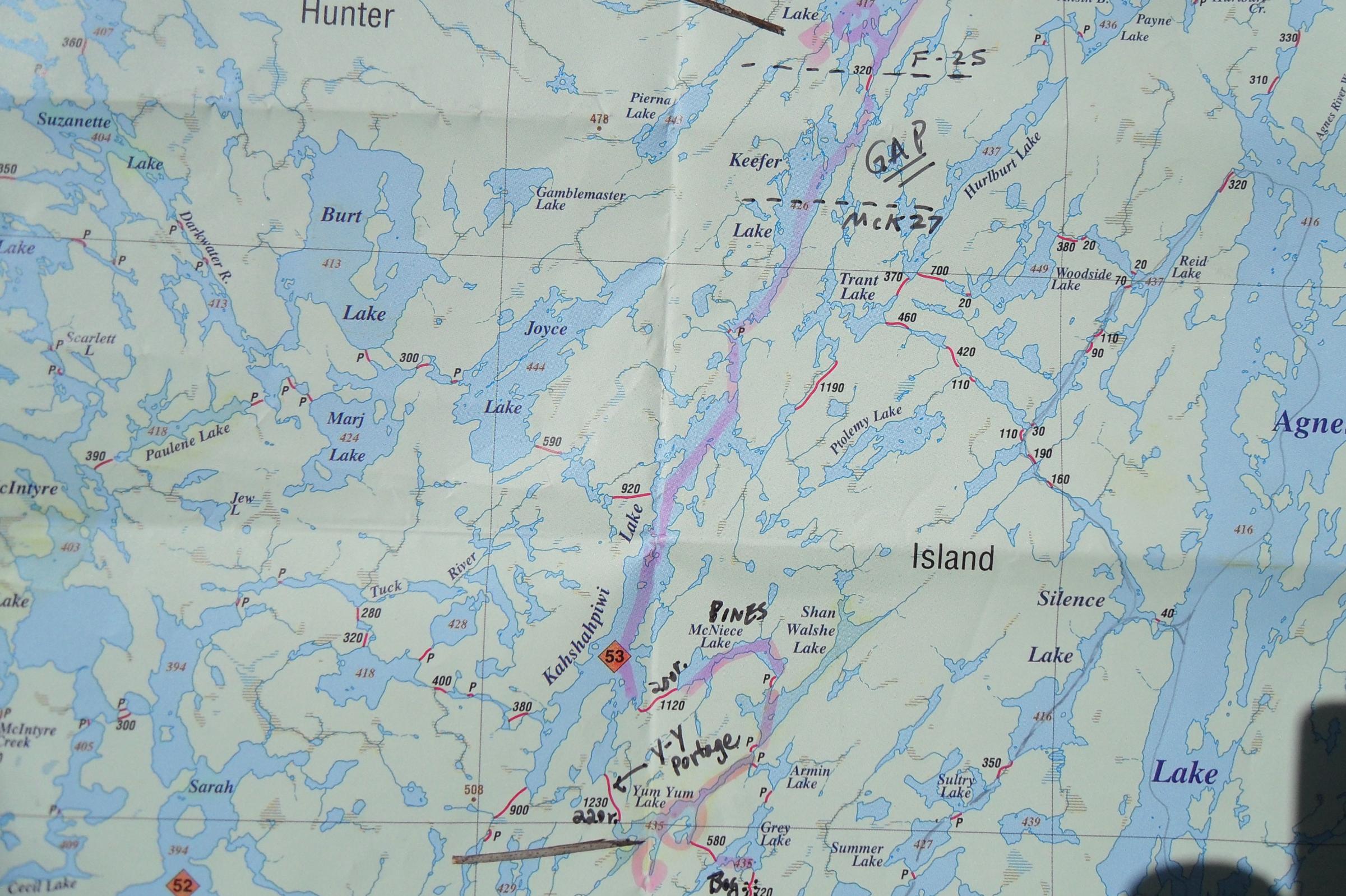
Note: The ballpoint pen I’d used to write notes broke and I tried to use the skinny tube of ink as a pen, but it became a pain in the @ss, so from here on I am reporting from “recall,” not notes.
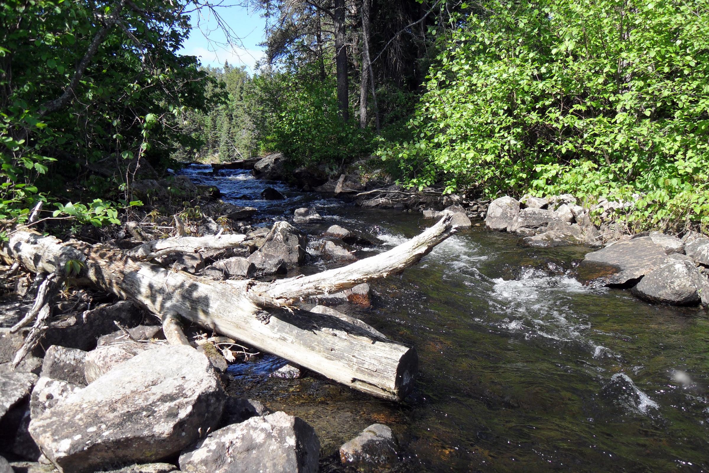
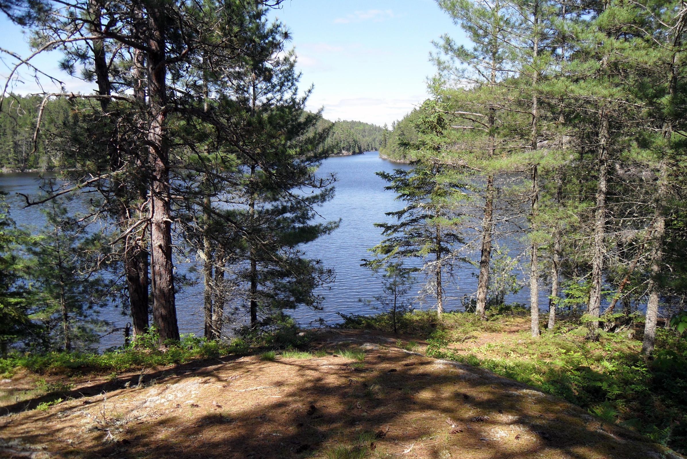
The weather looked promising as we got started, heading for the 320m. portage to Keefer. This portage was nothing remarkable and we were soon headed south on Keefer. We negotiated the upper segment and after entering the main body we kept to the left (east) side, avoiding the big western bay. We enjoyed Keefer’s rocky shores and the views of bigger water and more distant horizons than we’d paddled for many days.
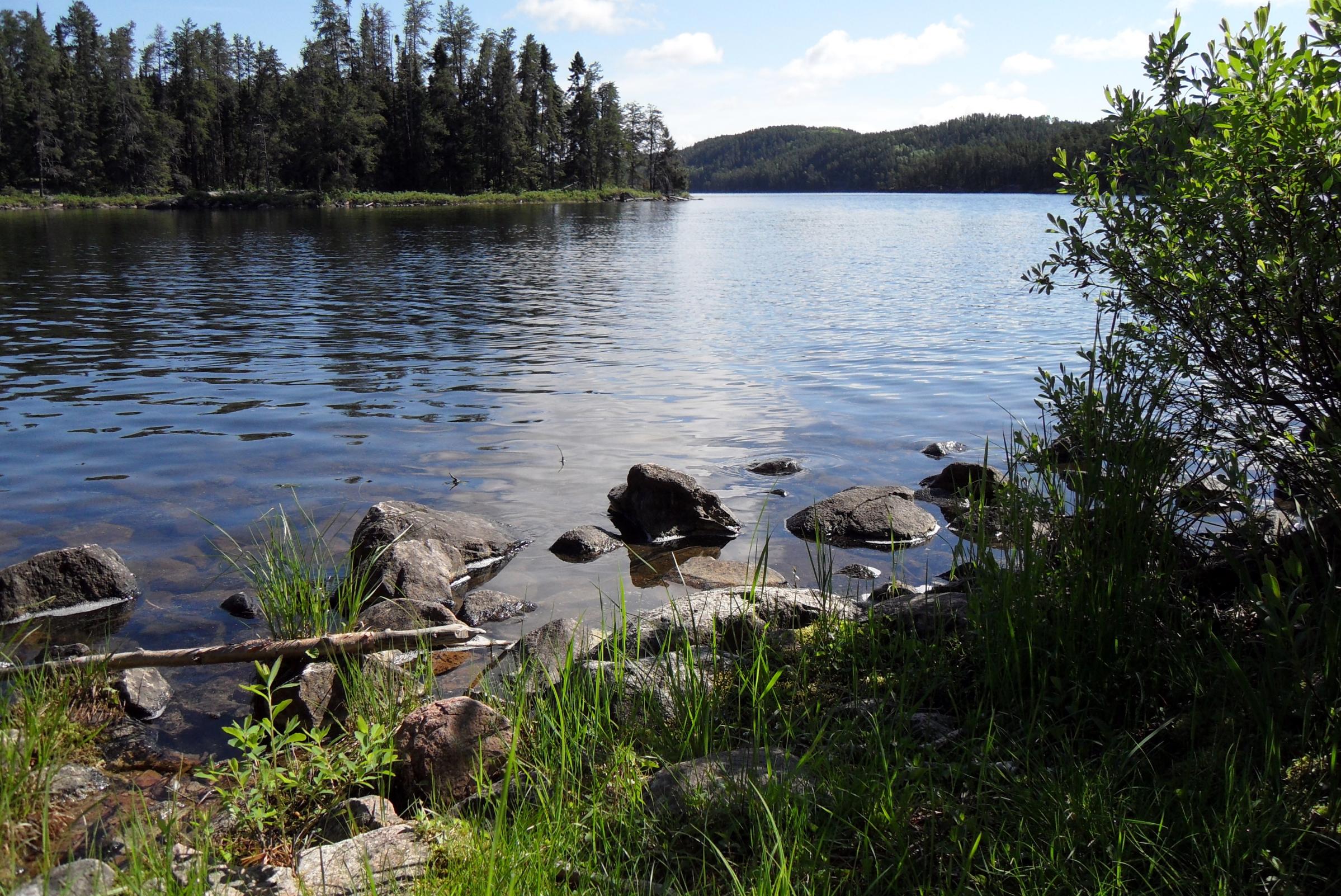
At the southern end of Keefer, we located the portage landing and decided to take a break on a nice grassy spot. We scarfed down some trail mix and water, took some pictures of either side of the portage and the neat little flow between the lakes. Moving on, we were kind of surprised at how the very upper end of Kahshahpiwi resembles a small lake of its own. The “narrows” is so thin that until we neared it we couldn’t tell where it was. After passing through this pinch point and paddling a bit we were on big, beautiful “Kahsh.” What a great name and great lake.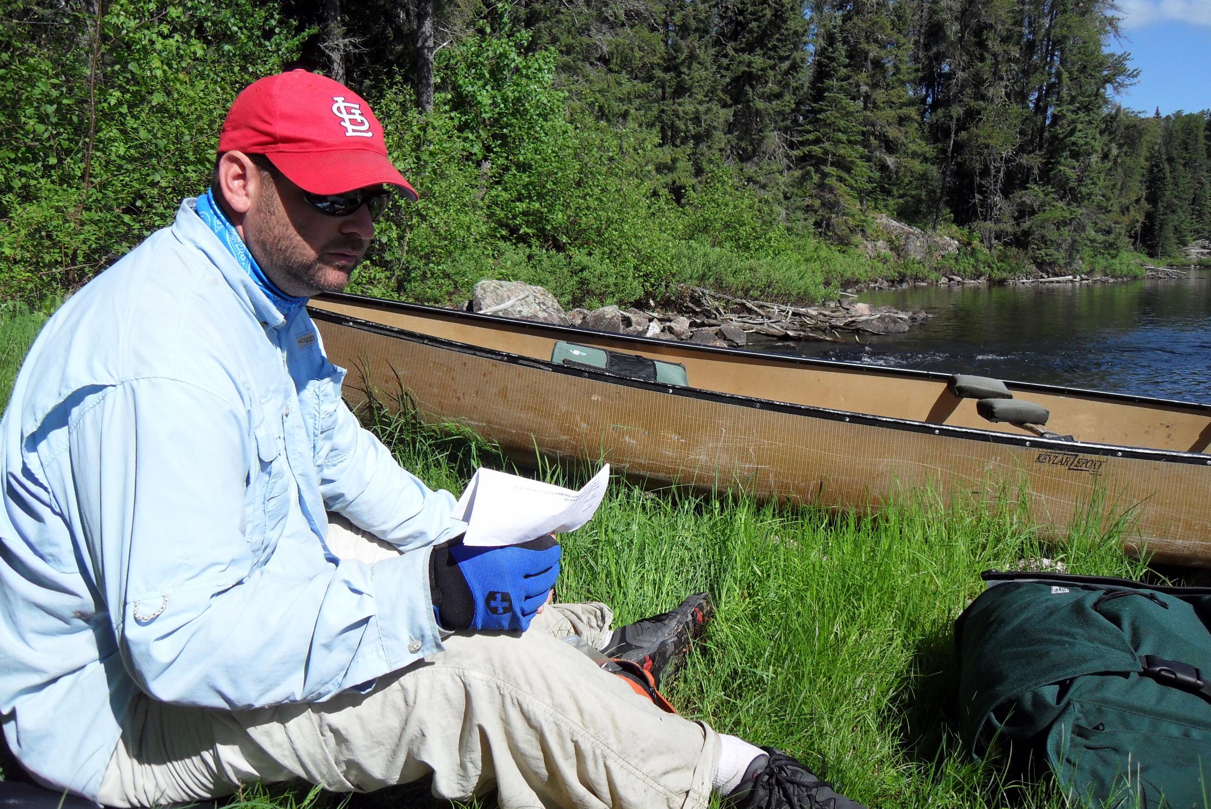
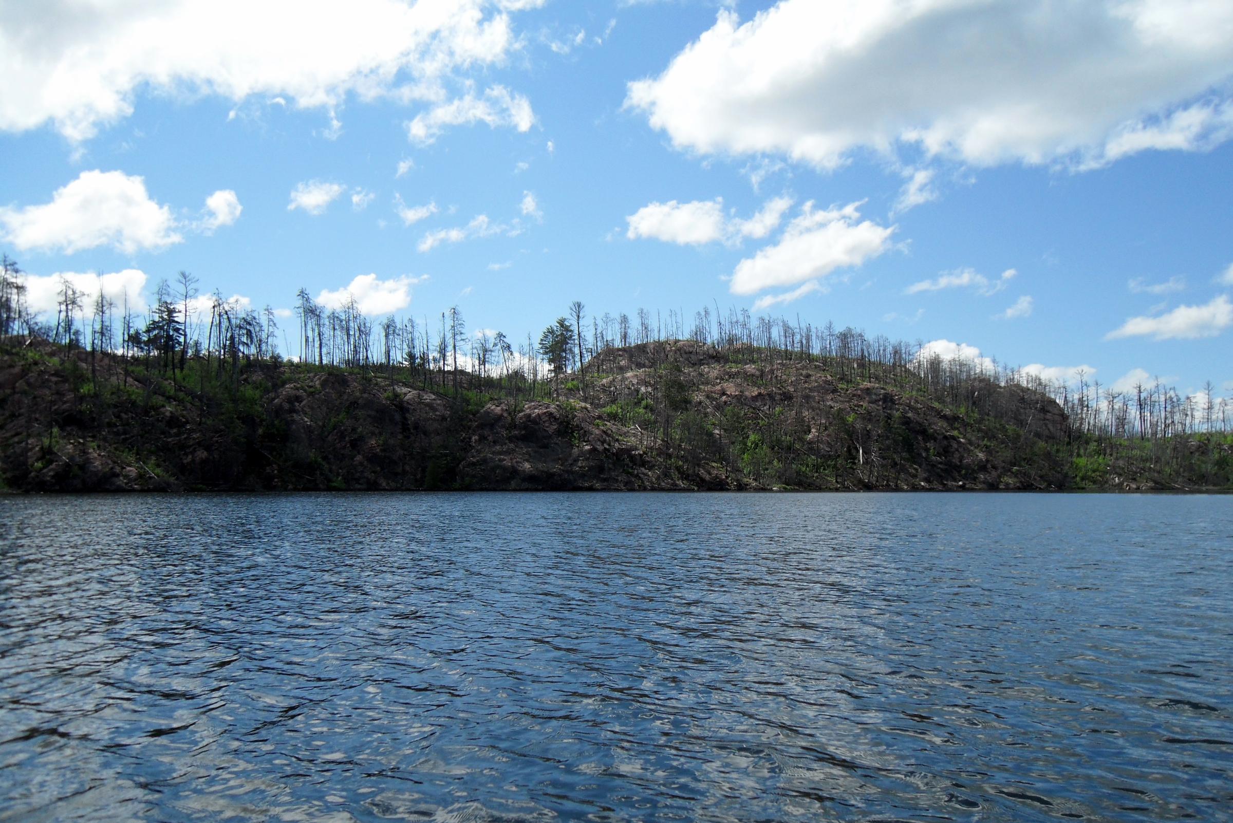
It was now mostly sunny with puffy white clouds scudding across the sky and the lake surface had a little chop to it as we approached the large burned area. We took some pictures and I remarked how devastated it looked and wondered how long it would take for sizable trees to grow and “improve” the views. As someone who visits the north woods so infrequently, it’s hard for me to get really “comfortable” with a fire-ravaged landscape, even though I know it’s completely natural.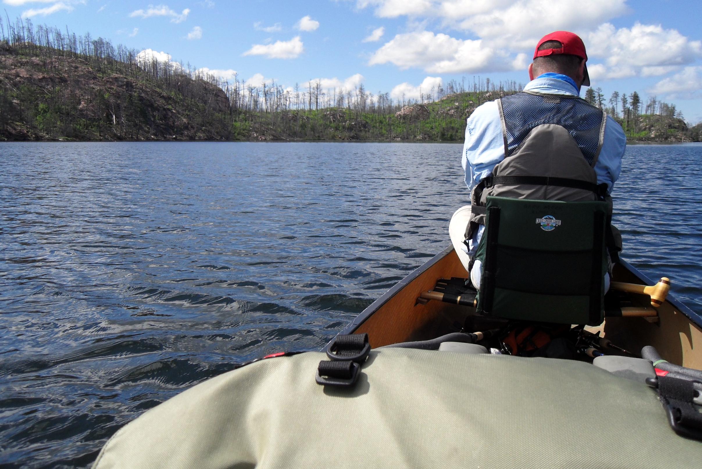
Before long – and to my surprise, because it seemed we were paddling so leisurely – we reached a spot where I kind of did a “double take” looking at the map and then at the real world. We seemingly had reached the opening we needed to turn into to hit the McNiece portage. I told Joe we should paddle over to a rocky point where he could take a look at the map too. So we did, and we were “here” already, and it was only a little after 11 a.m. We decided to have our lunch, and then paddle down to where we should find the portage. By the way, this “campsite” does not appear to be usable for a tent (or hammock.)
We ate our summer sausage and cheese and washed it down then got going toward the portage. We paddled about 15 minutes down the east shore and found it a little more tucked away than we would have thought from the map. (We knew it was well south of where McKenzie maps show it.) So we found it, now what? I wish we’d had a camera out as we eased the Le Tigre up against the sloping rock “shore” that is over about 8 feet of water. And I wish you could have seen the broad slick of algae-rich water running out of a little pool down this rock slope.
Anyway, we figured out that if I could hold the canoe jammed against the rock and Joe could get out without either falling in or upsetting the canoe, we’d be all right. He did and we were. Then he held the canoe while I got out, almost losing my footing and sliding in, and we were okay. I’m not going to dwell on the actual 1100-meter portage, because others have described it well. Suffice it to say, this was the most interesting portage of the trip and maybe of all trips. It had everything. It was challenging. We were in awe of the way the trail went up and down and hugged the edge of a marsh and the foot of a cliff. I can think of several portages that I have done that about did me in, but this is not one of them. I felt good afterwards and was glad we had decided to come this way.
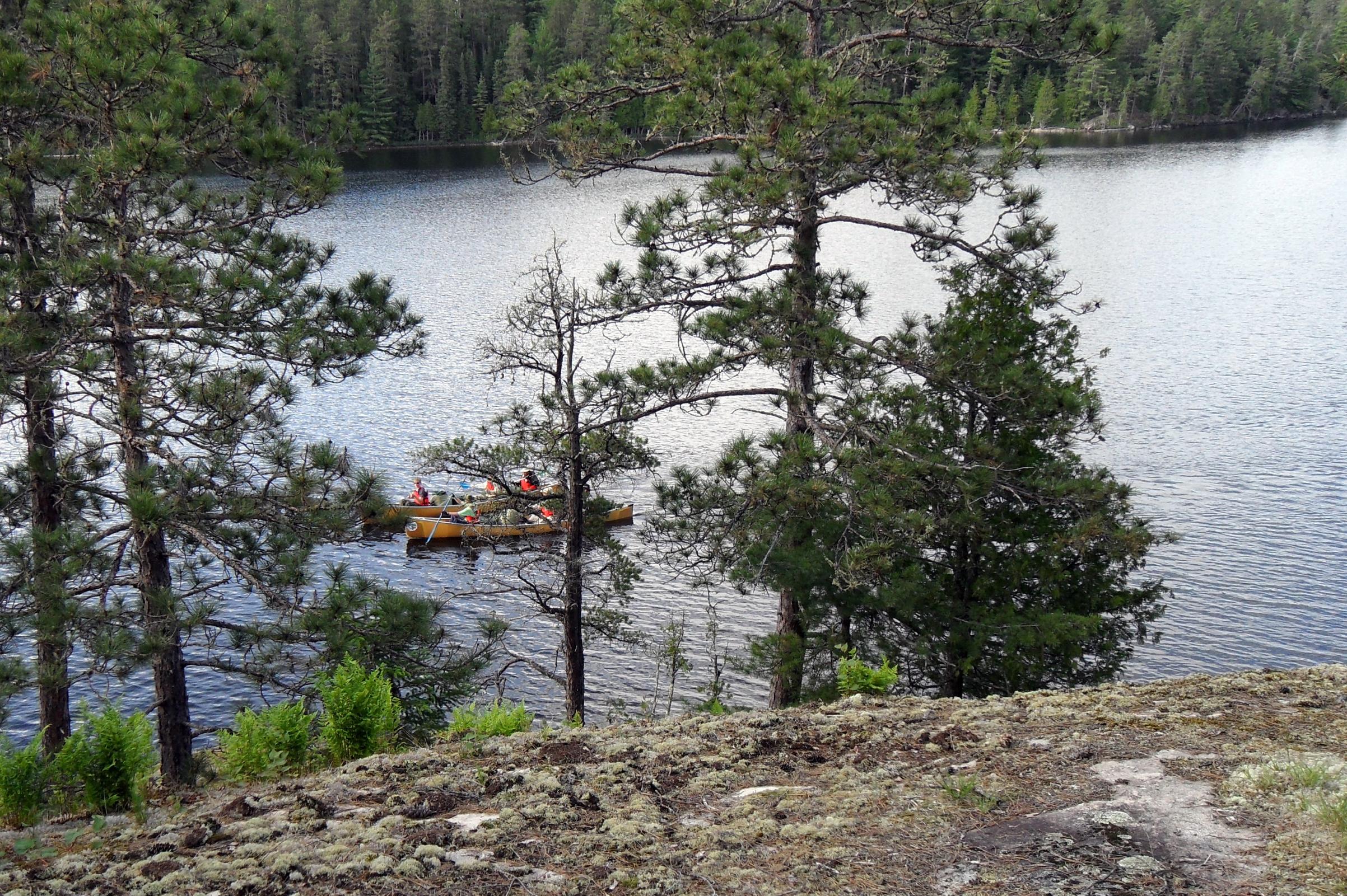
At the McNiece end, on our first trip over, we spotted three canoes with 9 persons a couple hundred yards away and headed our way. (The first people seen for 2 ½ days.) We decided to hustle back to the other side and get the rest of our gear, expecting to meet them on the return trip. We didn’t. When we got back to McNiece, they were all on the rocks waiting for us. We stopped and talked for a bit and found out they were Northern Tier Scouts on their third day, heading north. We told them they shouldn’t have waited for us, but they said it was just as well because a few of the boys fished off the landing and found a “honey hole.” We forgot to ask them what they caught. We wished each other a good trip and off we went.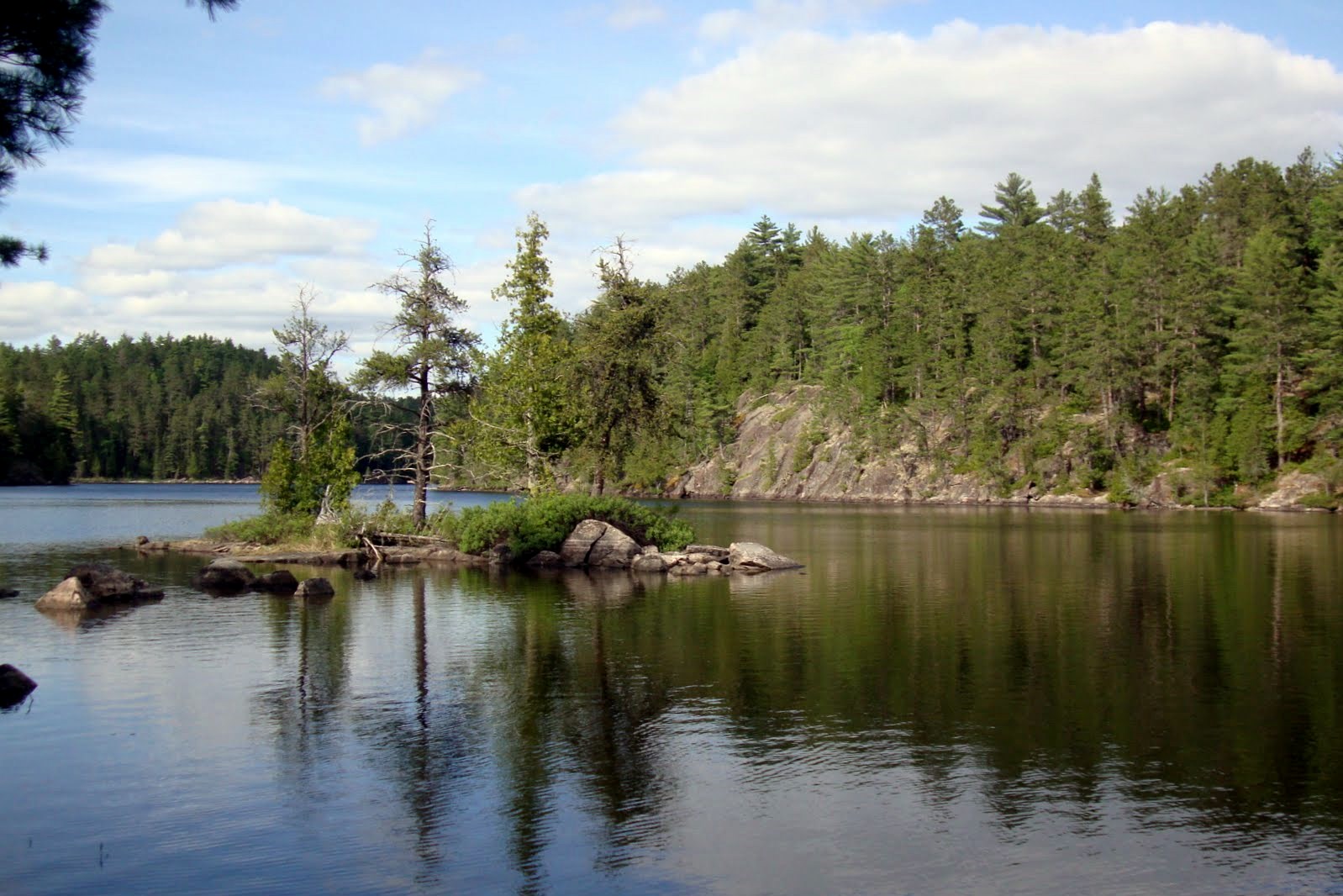
McNiece, which burned in 2006 after a lightening strike, looked like a former war zone. It was surprising to me to find out when we got back to the world and the Internet that it had not burned more recently, like 20009-10! Again, I was disappointed by the view where I had expected to see magnificent pines and healthy understory. We paddled a gentle curve along the southern part of the lake and with the sky now mostly clouded over, it was a dismal scene. We didn’t look hard, but did not see any of the three or so campsites that others have reported on. It didn’t matter though because we wouldn’t be camping here, or wanting to.
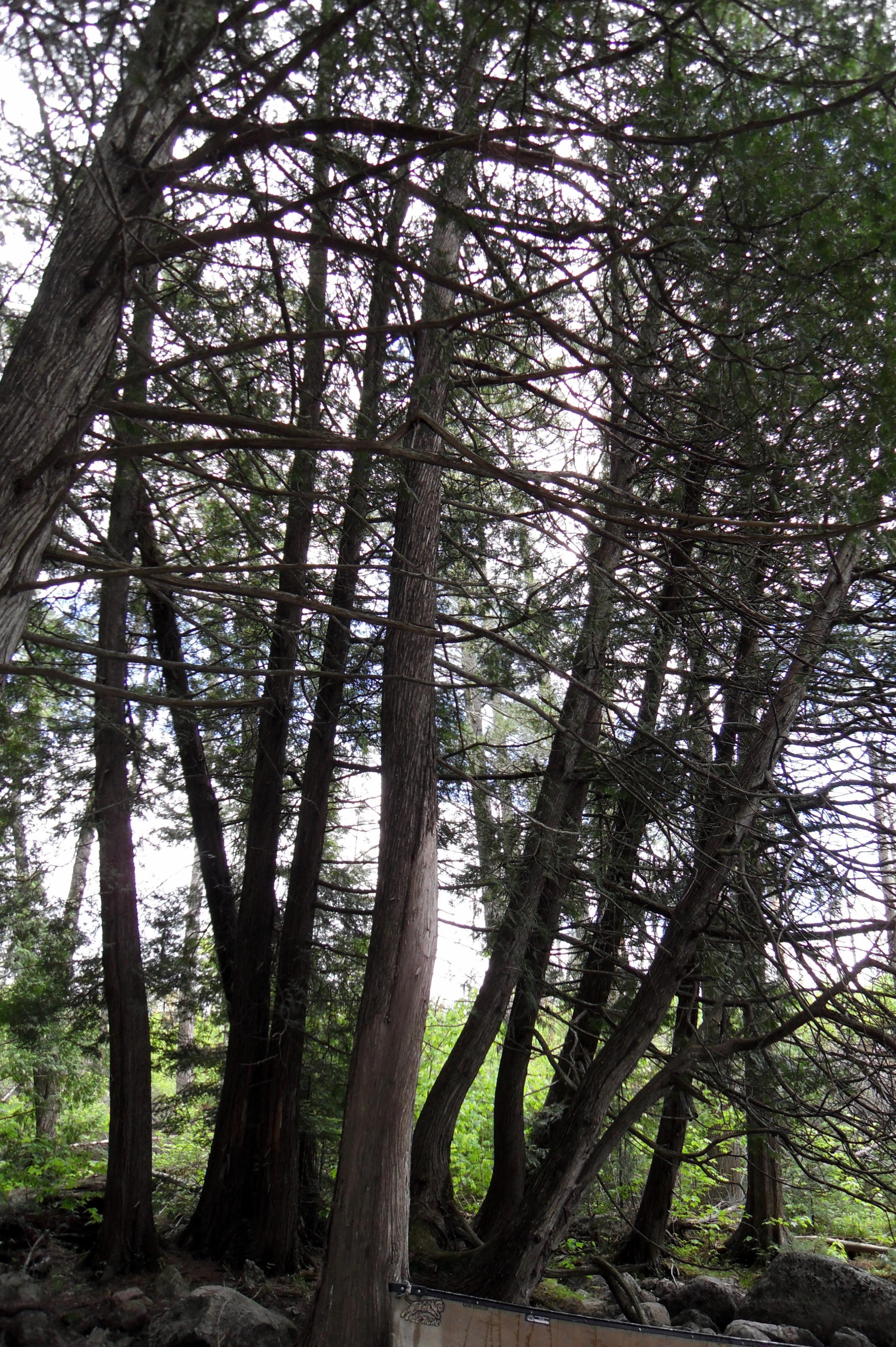
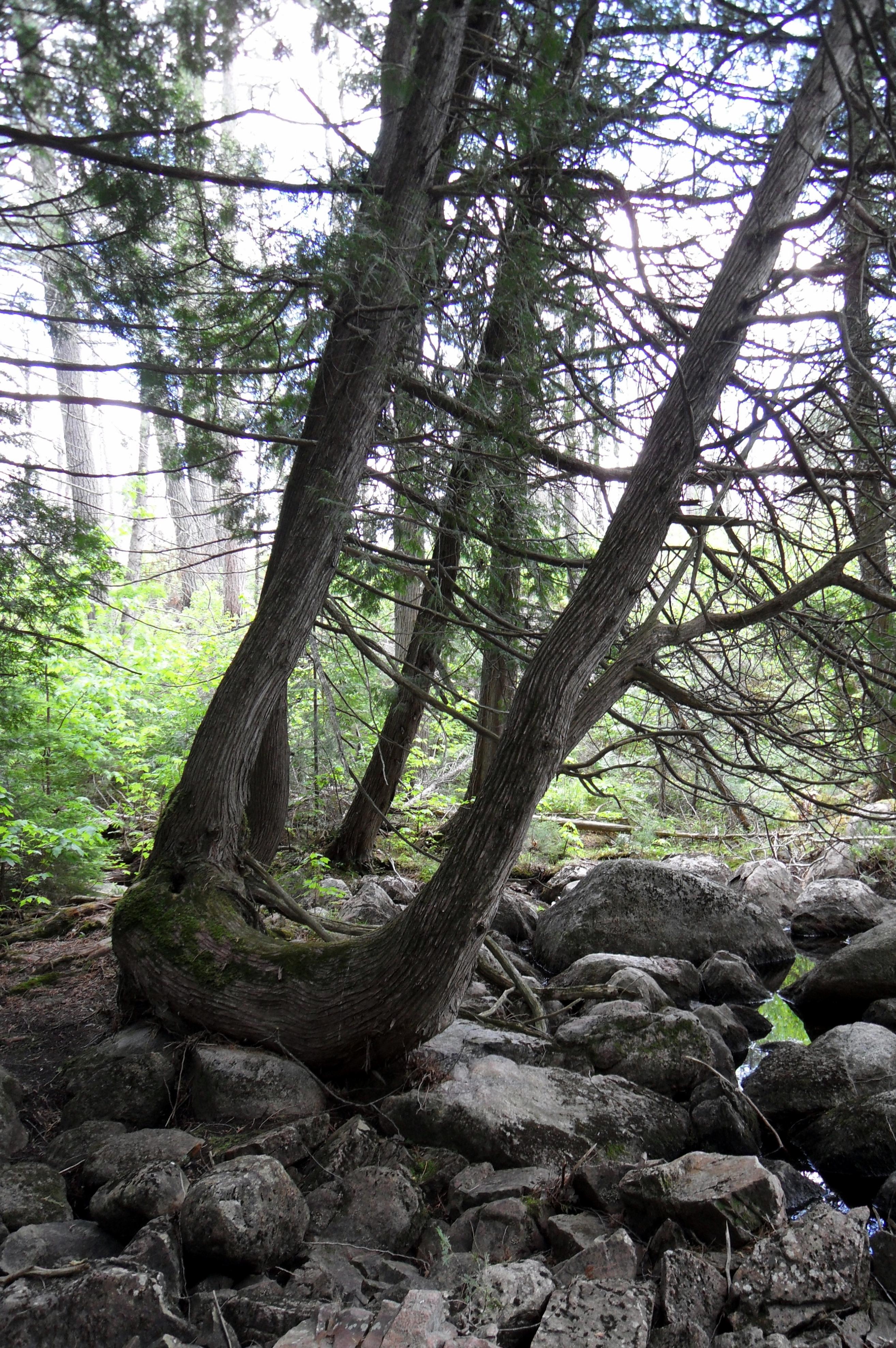
When we reached the take-out for the portage to Shan Walshe we tried to get some pictures of the huge cedars that were not burned, but the lighting was pretty poor so they aren’t too great. I think it was the portage from Walshe to Yum Yum where we saw a bunch of fresh portage crew work practically in the water and took some pictures of that. Once at Yum Yum, we needed to make a decision. We had in mind from pre-trip planning to possibly camp on Grey, which was still a lake and two portages away, and which had only one viable site as far as we knew. We reconsidered, and agreed it made more sense to paddle down Yum Yum and look for a campsite.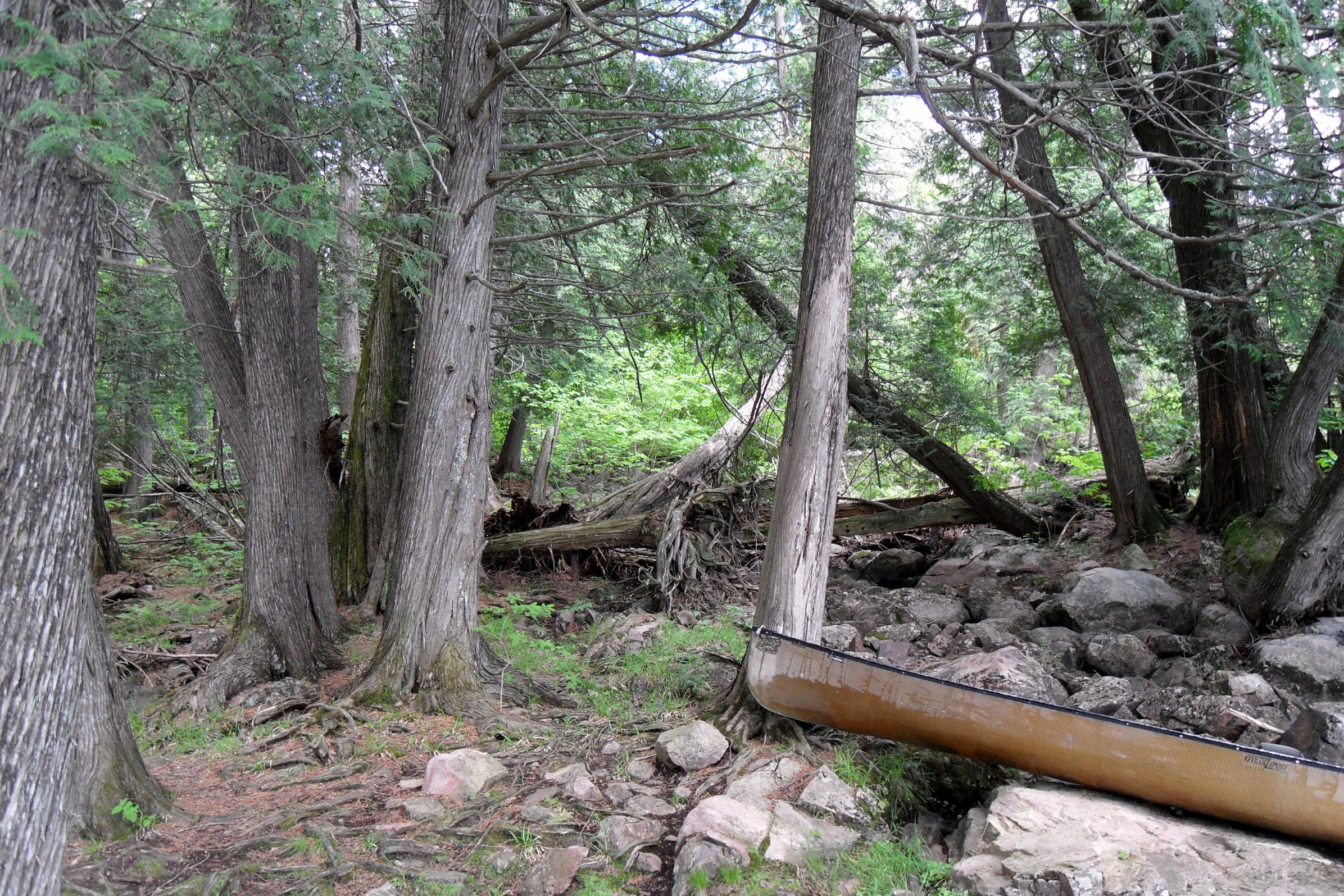
Good call! The “4-star” on the east side point about halfway down the lake was open. It was about 2:30 p.m. when we pulled the canoe out of the water, checked it out and began to set up camp. Around 3:30, Joe was fishing from shore on the east side of our point just as I had come down to ask him what he thought about early supper, when two canoes with six people came paddling up the (dead end) cove from the east. We waved, and I went up the hill to the fireplace and got my camera to take some pictures as they paddled by.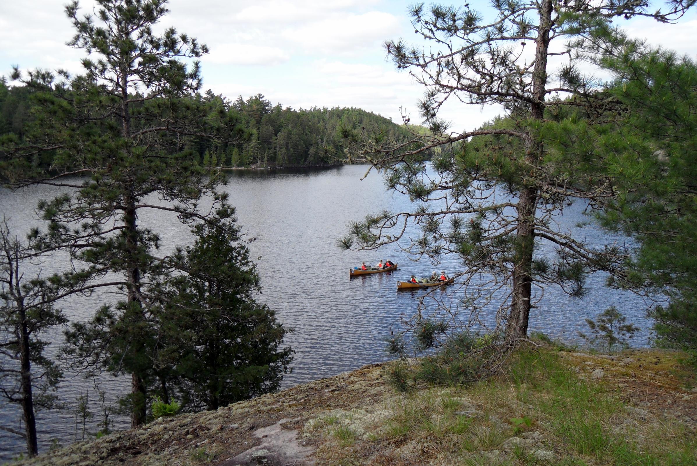
I also got my map out, because I didn’t remember there being a portage where the canoe had come from. There is, of course, but because I had planned from early on to go through Armin – not Yum Yum -- to Grey, I hadn’t noticed. (I wonder if we would have paddled back up Yum Yum and gone through Armin if they hadn’t come through that afternoon?)
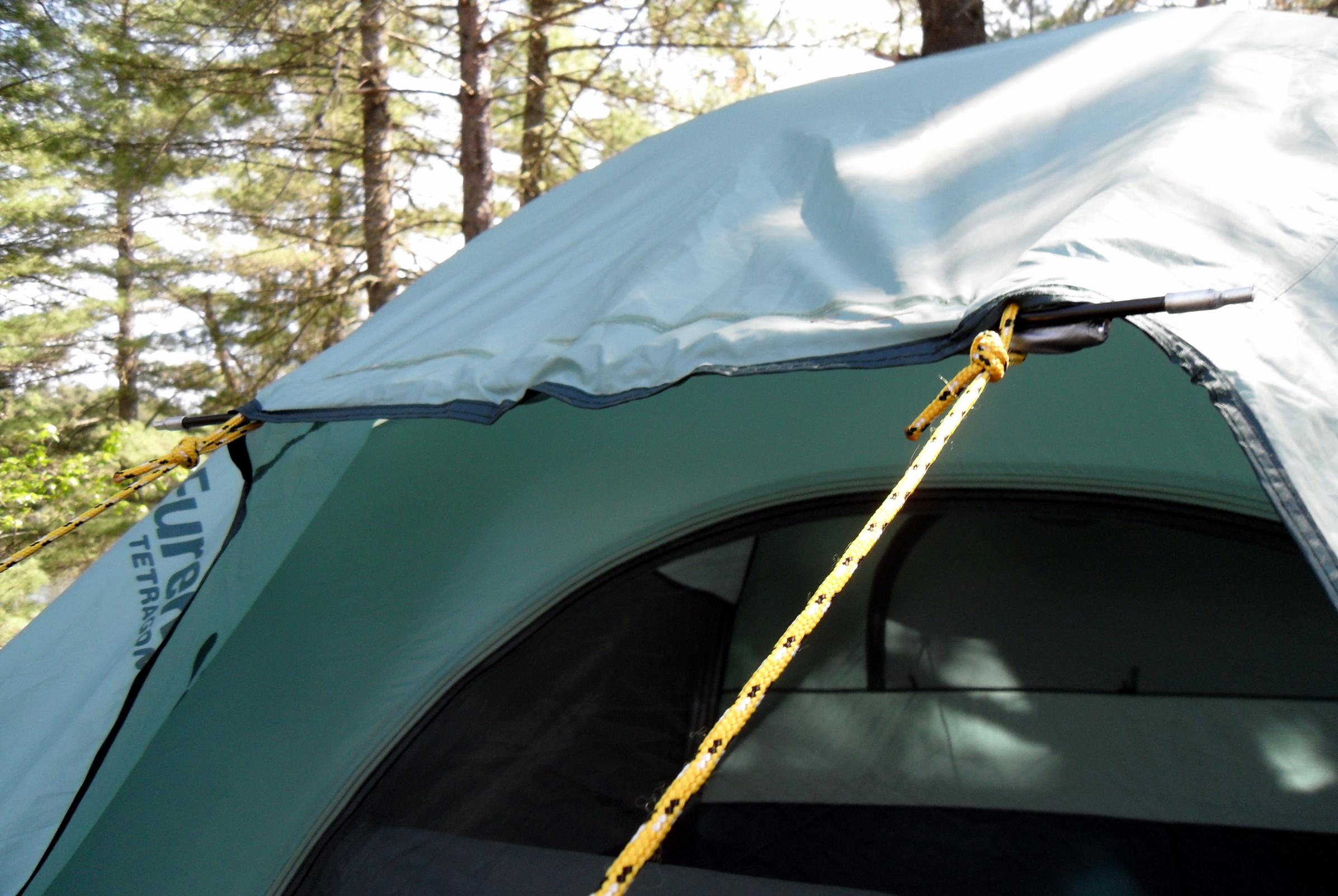
This was another great spot – super views, all kinds of room, great canoe access, fishing or bathing from shore – a bit of a hike up to the very exposed fireplace, but very nice. We put the tent so it faced up the lake and got a nice breeze, hung our clothesline and got some stuff dried or aired out, and had a “bath!” I took the time here to get some pictures of my jury-rigged solution to the broken awning poles on my Eureka Tetragon 7.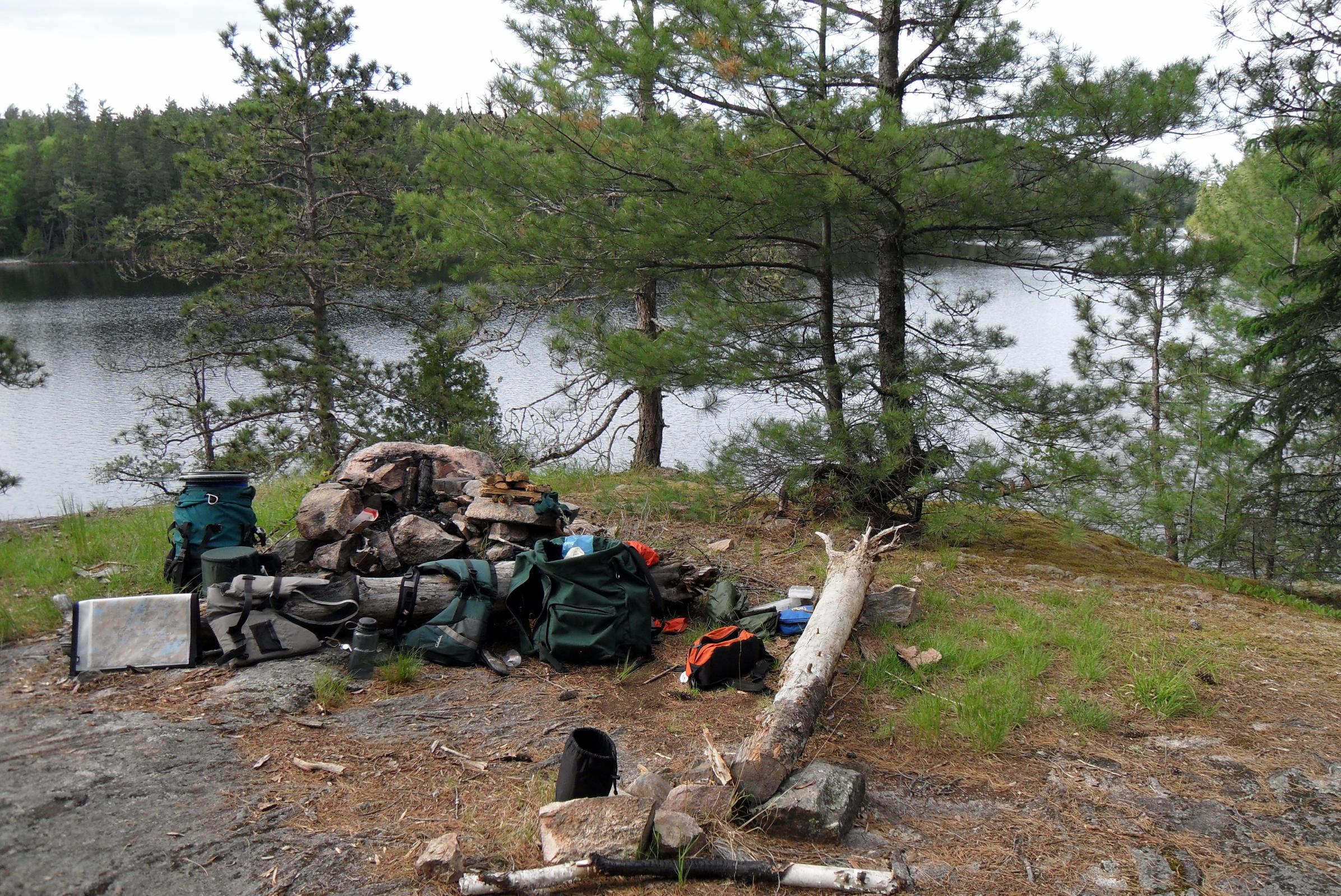
Supper was “Thanksgiving dinner” made with stovetop stuffing, foil-packed chicken and Craisins. I added a little poultry seasoning to the mix to give it a taste a little more like Mom’s. There were no leftovers. I did the dishes in a little mossy clearing behind the main camp area that I told Joe I thought used to be a big tent pad. He pointed out that it was probably created when the two big pines fell and that my “tent pad” was where the root wads used to be. He was probably right. I don’t remember much about the rest of the evening, except that we had a little fire at dusk, as usual and that our cigars and liquor were holding out okay.[
Sark Lake to Yum Yum Lake, via Keefer, Kahshahpiwi, McNiece, & Shan Walshe. (About 10.5 miles) 5 portages of 320m., 8 rods, 1120m., short & 20 rods. (Note: portages in rods from McKenzie map.)
Note: The ballpoint pen I’d used to write notes broke and I tried to use the skinny tube of ink as a pen, but it became a pain in the @ss, so from here on I am reporting from “recall,” not notes.
The weather looked promising as we got started, heading for the 320m. portage to Keefer. This portage was nothing remarkable and we were soon headed south on Keefer. We negotiated the upper segment and after entering the main body we kept to the left (east) side, avoiding the big western bay. We enjoyed Keefer’s rocky shores and the views of bigger water and more distant horizons than we’d paddled for many days.
At the southern end of Keefer, we located the portage landing and decided to take a break on a nice grassy spot. We scarfed down some trail mix and water, took some pictures of either side of the portage and the neat little flow between the lakes. Moving on, we were kind of surprised at how the very upper end of Kahshahpiwi resembles a small lake of its own. The “narrows” is so thin that until we neared it we couldn’t tell where it was. After passing through this pinch point and paddling a bit we were on big, beautiful “Kahsh.” What a great name and great lake.
It was now mostly sunny with puffy white clouds scudding across the sky and the lake surface had a little chop to it as we approached the large burned area. We took some pictures and I remarked how devastated it looked and wondered how long it would take for sizable trees to grow and “improve” the views. As someone who visits the north woods so infrequently, it’s hard for me to get really “comfortable” with a fire-ravaged landscape, even though I know it’s completely natural.
Before long – and to my surprise, because it seemed we were paddling so leisurely – we reached a spot where I kind of did a “double take” looking at the map and then at the real world. We seemingly had reached the opening we needed to turn into to hit the McNiece portage. I told Joe we should paddle over to a rocky point where he could take a look at the map too. So we did, and we were “here” already, and it was only a little after 11 a.m. We decided to have our lunch, and then paddle down to where we should find the portage. By the way, this “campsite” does not appear to be usable for a tent (or hammock.)
We ate our summer sausage and cheese and washed it down then got going toward the portage. We paddled about 15 minutes down the east shore and found it a little more tucked away than we would have thought from the map. (We knew it was well south of where McKenzie maps show it.) So we found it, now what? I wish we’d had a camera out as we eased the Le Tigre up against the sloping rock “shore” that is over about 8 feet of water. And I wish you could have seen the broad slick of algae-rich water running out of a little pool down this rock slope.
Anyway, we figured out that if I could hold the canoe jammed against the rock and Joe could get out without either falling in or upsetting the canoe, we’d be all right. He did and we were. Then he held the canoe while I got out, almost losing my footing and sliding in, and we were okay. I’m not going to dwell on the actual 1100-meter portage, because others have described it well. Suffice it to say, this was the most interesting portage of the trip and maybe of all trips. It had everything. It was challenging. We were in awe of the way the trail went up and down and hugged the edge of a marsh and the foot of a cliff. I can think of several portages that I have done that about did me in, but this is not one of them. I felt good afterwards and was glad we had decided to come this way.
At the McNiece end, on our first trip over, we spotted three canoes with 9 persons a couple hundred yards away and headed our way. (The first people seen for 2 ½ days.) We decided to hustle back to the other side and get the rest of our gear, expecting to meet them on the return trip. We didn’t. When we got back to McNiece, they were all on the rocks waiting for us. We stopped and talked for a bit and found out they were Northern Tier Scouts on their third day, heading north. We told them they shouldn’t have waited for us, but they said it was just as well because a few of the boys fished off the landing and found a “honey hole.” We forgot to ask them what they caught. We wished each other a good trip and off we went.
McNiece, which burned in 2006 after a lightening strike, looked like a former war zone. It was surprising to me to find out when we got back to the world and the Internet that it had not burned more recently, like 20009-10! Again, I was disappointed by the view where I had expected to see magnificent pines and healthy understory. We paddled a gentle curve along the southern part of the lake and with the sky now mostly clouded over, it was a dismal scene. We didn’t look hard, but did not see any of the three or so campsites that others have reported on. It didn’t matter though because we wouldn’t be camping here, or wanting to.
When we reached the take-out for the portage to Shan Walshe we tried to get some pictures of the huge cedars that were not burned, but the lighting was pretty poor so they aren’t too great. I think it was the portage from Walshe to Yum Yum where we saw a bunch of fresh portage crew work practically in the water and took some pictures of that. Once at Yum Yum, we needed to make a decision. We had in mind from pre-trip planning to possibly camp on Grey, which was still a lake and two portages away, and which had only one viable site as far as we knew. We reconsidered, and agreed it made more sense to paddle down Yum Yum and look for a campsite.
Good call! The “4-star” on the east side point about halfway down the lake was open. It was about 2:30 p.m. when we pulled the canoe out of the water, checked it out and began to set up camp. Around 3:30, Joe was fishing from shore on the east side of our point just as I had come down to ask him what he thought about early supper, when two canoes with six people came paddling up the (dead end) cove from the east. We waved, and I went up the hill to the fireplace and got my camera to take some pictures as they paddled by.
I also got my map out, because I didn’t remember there being a portage where the canoe had come from. There is, of course, but because I had planned from early on to go through Armin – not Yum Yum -- to Grey, I hadn’t noticed. (I wonder if we would have paddled back up Yum Yum and gone through Armin if they hadn’t come through that afternoon?)
This was another great spot – super views, all kinds of room, great canoe access, fishing or bathing from shore – a bit of a hike up to the very exposed fireplace, but very nice. We put the tent so it faced up the lake and got a nice breeze, hung our clothesline and got some stuff dried or aired out, and had a “bath!” I took the time here to get some pictures of my jury-rigged solution to the broken awning poles on my Eureka Tetragon 7.
Supper was “Thanksgiving dinner” made with stovetop stuffing, foil-packed chicken and Craisins. I added a little poultry seasoning to the mix to give it a taste a little more like Mom’s. There were no leftovers. I did the dishes in a little mossy clearing behind the main camp area that I told Joe I thought used to be a big tent pad. He pointed out that it was probably created when the two big pines fell and that my “tent pad” was where the root wads used to be. He was probably right. I don’t remember much about the rest of the evening, except that we had a little fire at dusk, as usual and that our cigars and liquor were holding out okay.[
 Donate - BWCA.com