|
 Boundary Waters Quetico ForumGear ForumPrintable BWCA and Quetico Canoe Maps
|
 Forum Sponsor
Author
Text
")

05/06/2019 11:59AM
Free PDF downloads of printable canoe maps for the entire Boundary Waters and Quetico, rendered using Caltopo.
canoemaps.com
canoemaps.com
")

05/06/2019 12:55PM
Been home printing maps for decades, I'd suggest a waterproof synthetic inkjet paper for printing at home. Waterproof Paper over laminating. Have used Nat Geo Adventure Paper in the past now settled on IGuage 8mil. Very waterproof and run free can be written on with common pencil or pen, almost rip proof. I used printed maps as shower mats for a week to check the durability, passed with flying colors that neither smudged, faded, or ran.
I use high quality print settings with high resolution paper style, print on both sides of the paper. Test print on common paper and common settings to check formats and layouts.
Laminated prior to finding waterproof print media, the IGuage I now use is much more versatile and long lasting, while less expensive.
butthead
"never underestimate the power of stupid people in large groups" George Carlin

05/06/2019 08:06PM
Kelso: "Free PDF downloads of printable canoe maps for the entire Boundary Waters and Quetico, rendered using Caltopo.
canoemaps.com "
Supercool. That's really good stuff!
"I don't care what you believe. I care what you can prove." -Philosopher & Mathematician JJJ
05/07/2019 08:25AM
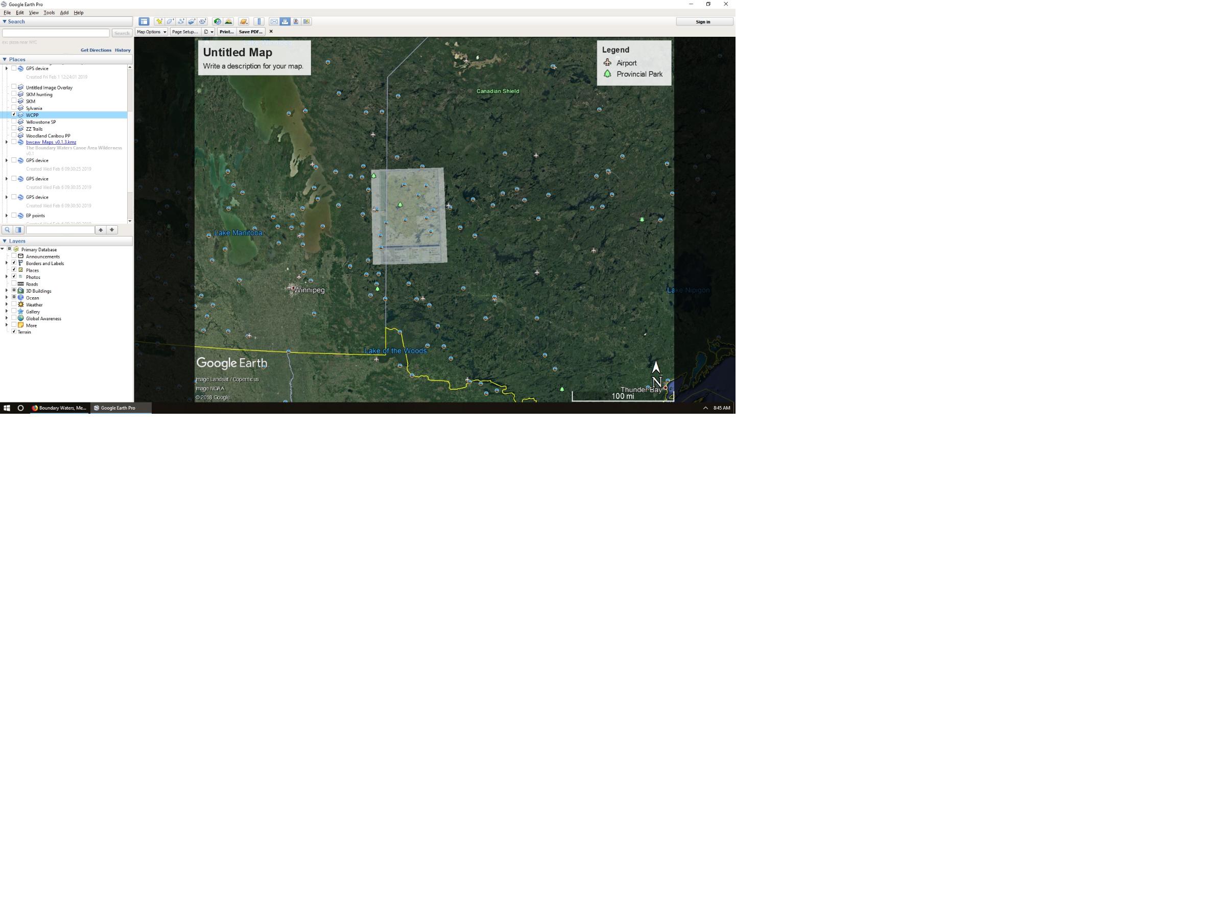
Look in the GPS Forum, Google Earth overlays
You can orient a paper map as an image overlay in Google Earth, save and print it from a variety of mapping programs, I like Garmin Basecamp.


butthead
You can orient a paper map as an image overlay in Google Earth, save and print it from a variety of mapping programs, I like Garmin Basecamp.

butthead
"never underestimate the power of stupid people in large groups" George Carlin
05/07/2019 08:28AM
Thanks for the kind words and suggestions. I've already put more time into this project than I originally intended, but I will begin a list of planned future updates.
- Fire perimeter and PMA labeling: I agree that the fire perimeters and PMAs are often poorly labeled. I will think about practical ways to address this.
- Lakes south of Fall Lake: I will start compiling a list of potential additions in the Quetico-Superior surrounding area. Any others?
- Google earth overlays: Google maps and imagery have copyright protections limiting their distribution. I have opted not to use any Google mapping products in these maps. My intent here is to create printable paper map PDFs. I don't have plans to create Garmin or other GPS overlay files, although I'm willing to host such data created by others.
- Portages: Presently only portages longer than ~100r are labeled with their length. Eventually I want to get all the portage lengths labeled. There's a known bug in the Caltopo software itself causing these labels to be suppressed in the PDFs.
- Points of interest: Points of interest such as pictographs are not currently shown. I do want to add those eventually.
- Verification: None of the maps have been verified by on-the-ground scouting. If someone visits an area I would be interested to hear reports of map accuracy.
- Additional parks and regions: At this time I do not plan to render canoe maps of additional parks and regions, but if someone else does the leg work I will host the files for download. Jaywalker, if you are interested in doing something for Woodland Caribou, please email me at peter@canoemaps.com.
05/07/2019 12:48PM
Kelso:
- Fire perimeter and PMA labeling: I agree that the fire perimeters and PMAs are often poorly labeled. I will think about practical ways to address this."
One free and practical way is by adding the relevant data layers in a map generated with QGIS .
Here's a quick and dirty example of what can be done with QGIS (or any other capable GIS app). I went a bit overboard on the frequency of labelling the fire perimeter, for the benefit of my trip companions:

05/07/2019 01:01PM
Gravelroad: Thanks for the tip about QGIS. You're right, I can do the same in Caltopo, by converting perimeter polygons to tracks. This forces the PDF output to show the labels along the perimeter, instead of at the midpoint of the polygon. However, this means that I must re-render all of the relevant PDFs, a very time-consuming task. I may choose to add labels with a PDF editor or leave them as-is.
05/13/2019 03:05PM
Update: I created a 94x48 inch wall map from the dataset, which is now available for download at canoemaps.com . This wall map covers the entire BWCA and Quetico and includes some map data corrections as well as the addition of all known pictograph sites within the BWCA/Quetico.
If anyone gets this wall map printed, let me know how it turns out.
If anyone gets this wall map printed, let me know how it turns out.
03/25/2020 07:06PM
Kelso: If anyone gets this wall map printed, let me know how it turns out."
Hey, just wanted to express many thanks for making this map. I've read through hundreds of these forums and decided it was time to make an account so I could reply.
With plenty of free time recently, I was able to create and finish the 94'' x 48'' wall map. Thank you for all the work it must have taken to create these files. It made the actual making of the map so much easier!


04/06/2020 07:06PM
Just got an addition to my printing gear, aimed at larger photo prints at home but very adaptable to this topic. A wide 13x19 inch page A3 capable inkjet printer.

 first printing from it a 13x19 and a 8.5x11 printed on a Canon Pixma iX6820, $150 range, inkjet printer.
Waiting on Photo paper but a 500 sheet HR pack cost me $20. I can make some maps now! These were quick samples from BaseCamp but will work on some from Kelso (Thanks!).
butthead

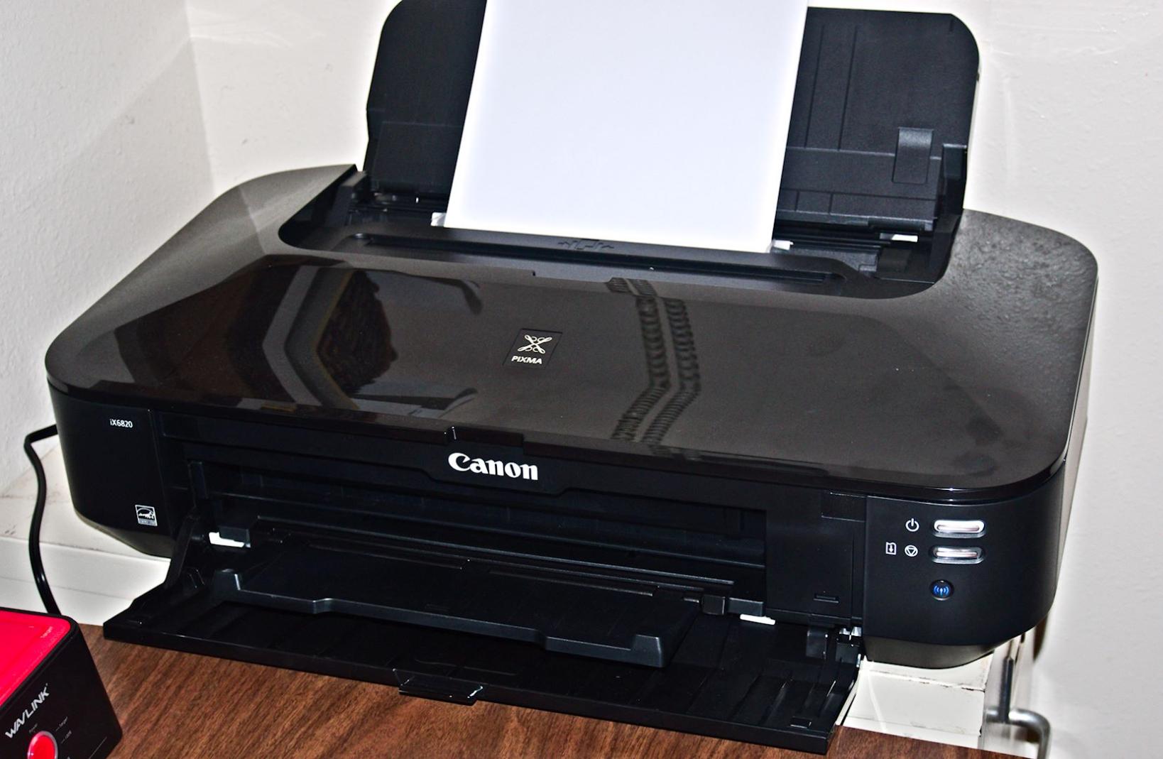 first printing from it a 13x19 and a 8.5x11 printed on a Canon Pixma iX6820, $150 range, inkjet printer.
Waiting on Photo paper but a 500 sheet HR pack cost me $20. I can make some maps now! These were quick samples from BaseCamp but will work on some from Kelso (Thanks!).
butthead
"never underestimate the power of stupid people in large groups" George Carlin

Subscribe to Thread
Become a member of the bwca.com community to subscribe to thread and get email updates when new posts are added. Sign up Here
 Search BWCA.com
 Donate