|

Author
Text
")


10/14/2019 06:32PM
June/2019 trip:
A good map is made from experiences/North Spirit by Paulette Jiles.
The world of living is creating the map for yourself/Braiding Sweet grass/Robin Kimmerer.
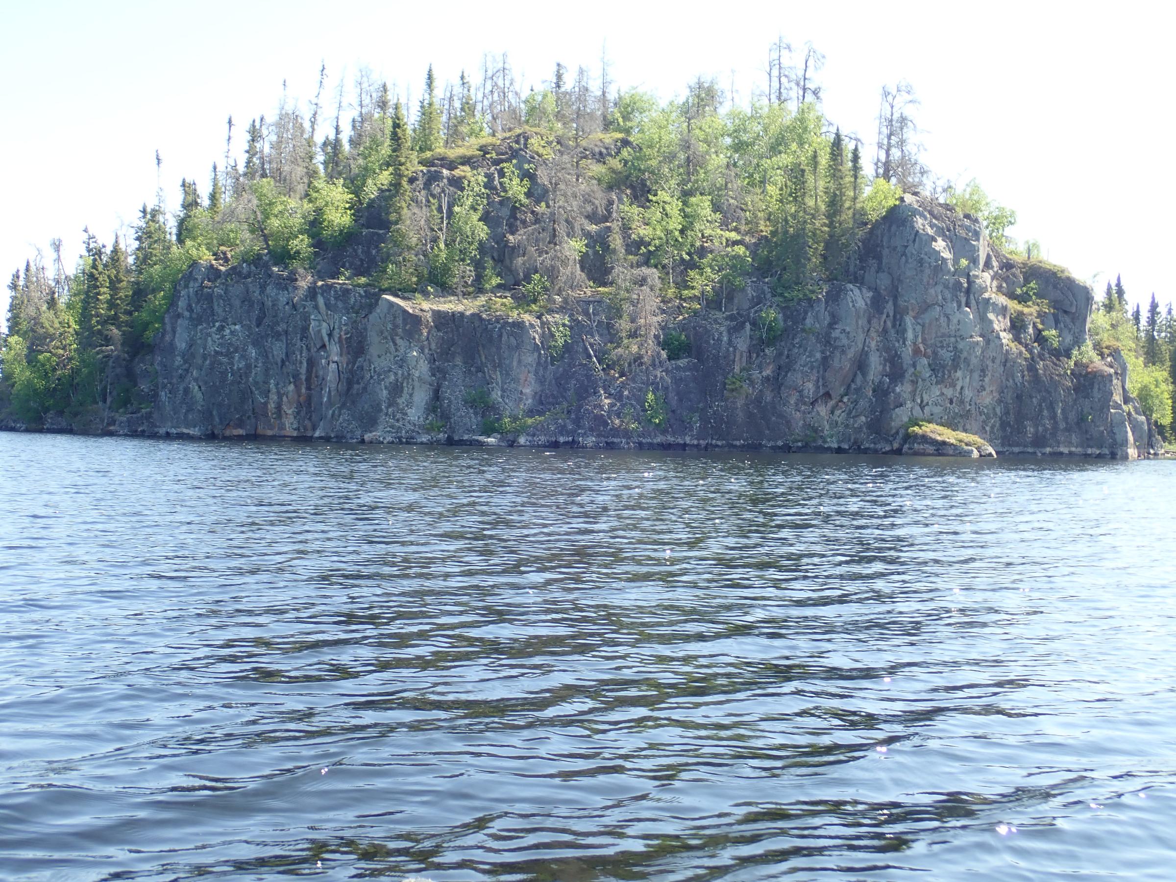
The eagle nest was gone. Somewhere on a back bay of South Aegean the way point of navigation north disappeared. We had seen it twice last paddling season…enjoyed the occupants’ flight show, learned the mixed up muttled island maize from its location. But, mid-June, 2019 our route north towards Aegean slowed. Already we had found the bald rock top ridge, the talus pile of granite at the shoreline that marked a channel in South Aegean. Already, we acknowledged the back bays of an unnamed lake north of Talon, climbed a hill flagged by tape, and portaged into the Oiseau River. So, quietly we stopped at the top of South Aegean and searched islands, looking for a flat rock above water, closing our eyes and imaging 3 canoes, 1992, a noon time fire, and tea brewing in the pot. Frenchmen rock it became from the travelers we met that year. Impressionable and somewhat new to the Woodland, it marked our minds…so, we knew north of that rock, beyond several like islands, a portage trail hid in the burns of the 2016 fire.
Our trip started in Leano, scurried around the frequent portages into Kilburn. We camped where Kilburn turns west. We plodded the next day into Dragon: shuffling pack location in the canoe, moving food and med kits to fit comfortably in our menagerie of packs: Duluth, Frost River, Granite Gear. Already we had tossed out our winter consumption of Pepsi, chocolate cookies, buttered sandwiches, mashed potatoes on the portage into Dragon. Here, we stopped. Found the high cliff camp half way down the lake, bathed sweat into the lake, shuffled more stuff between packs and swallowed next weeks’ sweet treats. Here, as we waxed poetic about forest fires, sunsets, and tomorrow’s rendezvous with Talon, we sought our first glance of the maps. This was familiar country, and simple reminders, notes on the topos, and hot chocolate stains covering contour lines would give us the locations of the trails west of Dragon.
But…no maps: none in the food pack, none where we stuff the tent, no maps on top of the tool kit…
We sought out the maymaygwayshi at night fall, and knew the maps would return the next morning.
Yet…no maps, so our route towards Talon took the path of least resistance…south to Boomerang, then west. We decided to skip the six portages west of Talon: short trails, seldom used, full of markings from beaver, bear, maybe a moose; short trails that brought lakes with glacial erratics on the shorelines, flat rock campsites, and burnt trees rocking noisily in the wind. South, then west was the route:
So we land at a sand beach by the beaver meadows, hunt for old blazes that mark the trail, find moose, beaver tracks on the beach, heave sticks for our lab Birch to retrieve. Then into the woods, skirting the meadows, climbing around windfalls, skipping across pot holes once filled with roots. We drag the canoe the last meters of the trail, find some water and paddled. We’ve done this before, in high water, forded the beaver dams, cut corners on the meanders, and quickly noted Boomerang. But today, we pull the canoe the last kilometers, fling wood ticks off our clothes, portage in the meadow around rocks outcrops. Birch growls, bounds through the meadow at talking heads. Two travelers heading up stream, stop and stare…at the dog, the tick covered travelers, and the awkward meanders beyond them. We break out conversation, tell tales of the Woodland, find we have a common friend, and peek at their maps. The northwest corner of Talon is studied before we say thanks for their kindness, marvel at their grace in their solo boats, their packs, and the long trip they’ve had. We toss in our four packs and the one Labrador into the canoe and pole downstream to Boomerang and head west to Talon.
Talon forms a mirage of cool waters, trout, long fetches to view distant shores, and island campsites.
Often we are gluttons for the perfect WCCP campsites: So we argue over a small, burnt island site where we hid once during a September storm. Too small? Just right? Too buggy? A loon on nest cancels any further discussion and we head the kilometer to the well-used site. We’ve been here before: watched clouds peek over the hills to the north, felt thunder off the rocks, enjoyed northern lights here, ate trout around the fire above the lake. Here, we rest for a day here. Carol has pushed off knee replacement until ice up: now, she travels with braces, reflectively she walks the portages, nursing the torn meniscus, bone spurs, and arthritis along drops, and over windfalls. Two days of traveling, a day off, will be the mantra of the trip: a long ways gone are the days of paddling across Red Lake, into the Gammon and Bloodvein River and finally Lake Winnipeg in ten days…now we mark trips with quiet contemplation: watching dragon fly flights, checking for hex hatches, note regrowth in fire regions, acknowledging like the landscape we have changed.
Thanks to our friends below Dragon Lake, we head north; finding all the portages into South Aegean.
The climb over the hill into South Aegean is slow…the steps up and then downs ache knees, the flowering blueberry plants talk to us about an August trip, and we search hard for the exact part where one views both the take out lake and the lake to the west. We linger on top, watch clouds grow into rain showers, swat bugs, and thank the people that keep this place wild…
On South Aegean we huddle on a rock ledge close to where the Oiseau chatters into the lake…fish the back bays, leave tobacco at the pictographs, and marvel at the divide between watersheds. 150 meters, a gradual slope separates the Oiseau and Haggart Rivers. At times, we’ve noted high water in one drainage and low water in the other. At times wild irises decorate the take outs. Usually, wolf scat marks the trail. We shuffle down the trail, paddle east into Aegean.
In 1990, Aegean’s mid-section was burnt, this forest flourishes now. Then the east/north sections held old growth. Now between pine beetle trees dying and fire this forest is a regrowth of jack pine shoots, young birch, and aspen. We stop at the boat cache, clean up the litter from ice out fisherman, swim Birch, stretch out on the long lake sloping rock, and watch: the wind dance around the islands, meeting from the west and the north, forming a flow of water that eventually bounces on Aegean’s eastern shore… Silence catches us and we listen: raven wings, a loon gurgles, wind gusts playing songs in the jack pines. A kilometer beyond us, waves foam into white caps. Eventually, excited to chase the wind, we leave.
We explore north: find a long, shallow bay of Aegean…smell out campsites, look at weed beds, count growth rate of jack pines, sample water, inhale Woodland summer. In the shade of unburnt islands we hide from the sun. At twilight we camp, facing south, watch the solstice moon build in the sky, count stars, guess at constellations. The calm lake, loon calls, and the skyline drifting into new stories of stars keep us awake. At dawn, sleep finds us. Well into daylight we drift south; walk the sandy point where float planes now land, search out caribou scat along an eastern shoreline of older jack pines, watch a rendez- vous loons.
A day later, we leave tobacco at the rock faced island….and paddle through the maze of islands towards Paull. No maps, so: at the bay where one no longer sees the rock face, we turn left, then turn right, then right again through narrow channels, in a widening of the lake we go straight where we should obviously paddle, then we turn left: it’s at the spot where the beaver cut the young jack pine….ignore the bay to the old portage trail, find a long bay with a right turn and………yes, somehow the portage towards Paull Lake shows up:
450 meters of walking through an old growth torn down by winds. Blueberry plants, flat rock trails, breezes from the south, breezes from Aegean….we drink the last of our Aegean water…reach the far side and filter some new water. Regrowth abounds in the forest…here ferns reach waist height, here roses garden the portages into Paull, here sunlight beckons blueberries to grow. We linger at the entrance to Paull: upset a red tail hawk into diving, crying, wailing at our canoe, get followed by loons uncomfortable with our canoe. We hang out by the camp in the north bay…dry our shoes along the
rock ledge, challenge ants for spaces to sit/read/clean up.
Our trip is slow... as we nurse back to Leano. The six portages from Paull to Upper Kilburn are good. A fun route, a rhythm of paddle: unload, portage, load, paddle…at Confusion Lake, the halfway point, the wind takes our sweat, spins our canoe back north. We stumble on the last portages above Upper Kilburn…a tradition for us.
Upper Kilburn is getting used. Campsites have worn with use. Like other paddlers we’ve come here for trout, for the unburnt shores, the cliffs. Like others, our boots tamp the soil, our tents flatten the columbine and blueberries. Like others we return, grateful to be here, and almost callous to our actions. Like others, we try to minimize our presence…the future will grade the results.
Last days…we love both routes out of Upper Kilburn/North Brule. We take the portage over the paddle into the wind across Middle Kilburn/Six Loon. Once, the portage east was 1000 meters, then 900 meters on the map, and now, in our minds, much less. With wind falls cleared, few mud puddles to avoid, Kevlar over Royalex canoes, and the lighter end of the trip packs it’s shortened again. We’re slowed by a grouse with a “broken wing,” and the need to swat black flies. We carry the packs and canoe in poses, leaving time for reflection on large aspen, silence inside the boreal forest, and day dreaming about cross country skiing along this trail.
Leano Lake and we complete the big circle: Paddlers shared their maps with us between Dragon and Boomerang. As we enter Leano, we meet travelers headed out: somehow, their water filer doesn’t work….we swap…good for bad, each pledging to return the filter to the outfitter. Hopefully ours worked for them in the following weeks.
In all we traveled from June 11 to June 24…in a small loop from Leano to Kilburn west to Dragon. South to Boomerang, west to Talon, northwest to South Aegean and Aegean, then south and east to Paull, Confusion, Upper Kilburn, Kilburn and Leano. Our maps, left at Leano at the start of the trip are kindly returned to Red Lake…today, they rest on a shelf in our house. We’ve added a few comments on them: new camps, outlines of burns, wolf wanderings, blueberry patches, “x’s” for fishing successes, and encounters with caribou. As ice up happens to our home waters, we’ll stare at them, tells stories about their geography as Orion, the Winter Maker, shines down on us… and hopefully take them along on the next trips.
As always we are appreciative of the work of the WCCP staff who keep the trails open, remind us of the wildness of the area, and listen to our stories.
Tom Heinrich
Carol Heinrich


A good map is made from experiences/North Spirit by Paulette Jiles.
The world of living is creating the map for yourself/Braiding Sweet grass/Robin Kimmerer.
The eagle nest was gone. Somewhere on a back bay of South Aegean the way point of navigation north disappeared. We had seen it twice last paddling season…enjoyed the occupants’ flight show, learned the mixed up muttled island maize from its location. But, mid-June, 2019 our route north towards Aegean slowed. Already we had found the bald rock top ridge, the talus pile of granite at the shoreline that marked a channel in South Aegean. Already, we acknowledged the back bays of an unnamed lake north of Talon, climbed a hill flagged by tape, and portaged into the Oiseau River. So, quietly we stopped at the top of South Aegean and searched islands, looking for a flat rock above water, closing our eyes and imaging 3 canoes, 1992, a noon time fire, and tea brewing in the pot. Frenchmen rock it became from the travelers we met that year. Impressionable and somewhat new to the Woodland, it marked our minds…so, we knew north of that rock, beyond several like islands, a portage trail hid in the burns of the 2016 fire.
Our trip started in Leano, scurried around the frequent portages into Kilburn. We camped where Kilburn turns west. We plodded the next day into Dragon: shuffling pack location in the canoe, moving food and med kits to fit comfortably in our menagerie of packs: Duluth, Frost River, Granite Gear. Already we had tossed out our winter consumption of Pepsi, chocolate cookies, buttered sandwiches, mashed potatoes on the portage into Dragon. Here, we stopped. Found the high cliff camp half way down the lake, bathed sweat into the lake, shuffled more stuff between packs and swallowed next weeks’ sweet treats. Here, as we waxed poetic about forest fires, sunsets, and tomorrow’s rendezvous with Talon, we sought our first glance of the maps. This was familiar country, and simple reminders, notes on the topos, and hot chocolate stains covering contour lines would give us the locations of the trails west of Dragon.
But…no maps: none in the food pack, none where we stuff the tent, no maps on top of the tool kit…
We sought out the maymaygwayshi at night fall, and knew the maps would return the next morning.
Yet…no maps, so our route towards Talon took the path of least resistance…south to Boomerang, then west. We decided to skip the six portages west of Talon: short trails, seldom used, full of markings from beaver, bear, maybe a moose; short trails that brought lakes with glacial erratics on the shorelines, flat rock campsites, and burnt trees rocking noisily in the wind. South, then west was the route:
So we land at a sand beach by the beaver meadows, hunt for old blazes that mark the trail, find moose, beaver tracks on the beach, heave sticks for our lab Birch to retrieve. Then into the woods, skirting the meadows, climbing around windfalls, skipping across pot holes once filled with roots. We drag the canoe the last meters of the trail, find some water and paddled. We’ve done this before, in high water, forded the beaver dams, cut corners on the meanders, and quickly noted Boomerang. But today, we pull the canoe the last kilometers, fling wood ticks off our clothes, portage in the meadow around rocks outcrops. Birch growls, bounds through the meadow at talking heads. Two travelers heading up stream, stop and stare…at the dog, the tick covered travelers, and the awkward meanders beyond them. We break out conversation, tell tales of the Woodland, find we have a common friend, and peek at their maps. The northwest corner of Talon is studied before we say thanks for their kindness, marvel at their grace in their solo boats, their packs, and the long trip they’ve had. We toss in our four packs and the one Labrador into the canoe and pole downstream to Boomerang and head west to Talon.
Talon forms a mirage of cool waters, trout, long fetches to view distant shores, and island campsites.
Often we are gluttons for the perfect WCCP campsites: So we argue over a small, burnt island site where we hid once during a September storm. Too small? Just right? Too buggy? A loon on nest cancels any further discussion and we head the kilometer to the well-used site. We’ve been here before: watched clouds peek over the hills to the north, felt thunder off the rocks, enjoyed northern lights here, ate trout around the fire above the lake. Here, we rest for a day here. Carol has pushed off knee replacement until ice up: now, she travels with braces, reflectively she walks the portages, nursing the torn meniscus, bone spurs, and arthritis along drops, and over windfalls. Two days of traveling, a day off, will be the mantra of the trip: a long ways gone are the days of paddling across Red Lake, into the Gammon and Bloodvein River and finally Lake Winnipeg in ten days…now we mark trips with quiet contemplation: watching dragon fly flights, checking for hex hatches, note regrowth in fire regions, acknowledging like the landscape we have changed.
Thanks to our friends below Dragon Lake, we head north; finding all the portages into South Aegean.
The climb over the hill into South Aegean is slow…the steps up and then downs ache knees, the flowering blueberry plants talk to us about an August trip, and we search hard for the exact part where one views both the take out lake and the lake to the west. We linger on top, watch clouds grow into rain showers, swat bugs, and thank the people that keep this place wild…
On South Aegean we huddle on a rock ledge close to where the Oiseau chatters into the lake…fish the back bays, leave tobacco at the pictographs, and marvel at the divide between watersheds. 150 meters, a gradual slope separates the Oiseau and Haggart Rivers. At times, we’ve noted high water in one drainage and low water in the other. At times wild irises decorate the take outs. Usually, wolf scat marks the trail. We shuffle down the trail, paddle east into Aegean.
In 1990, Aegean’s mid-section was burnt, this forest flourishes now. Then the east/north sections held old growth. Now between pine beetle trees dying and fire this forest is a regrowth of jack pine shoots, young birch, and aspen. We stop at the boat cache, clean up the litter from ice out fisherman, swim Birch, stretch out on the long lake sloping rock, and watch: the wind dance around the islands, meeting from the west and the north, forming a flow of water that eventually bounces on Aegean’s eastern shore… Silence catches us and we listen: raven wings, a loon gurgles, wind gusts playing songs in the jack pines. A kilometer beyond us, waves foam into white caps. Eventually, excited to chase the wind, we leave.
We explore north: find a long, shallow bay of Aegean…smell out campsites, look at weed beds, count growth rate of jack pines, sample water, inhale Woodland summer. In the shade of unburnt islands we hide from the sun. At twilight we camp, facing south, watch the solstice moon build in the sky, count stars, guess at constellations. The calm lake, loon calls, and the skyline drifting into new stories of stars keep us awake. At dawn, sleep finds us. Well into daylight we drift south; walk the sandy point where float planes now land, search out caribou scat along an eastern shoreline of older jack pines, watch a rendez- vous loons.
A day later, we leave tobacco at the rock faced island….and paddle through the maze of islands towards Paull. No maps, so: at the bay where one no longer sees the rock face, we turn left, then turn right, then right again through narrow channels, in a widening of the lake we go straight where we should obviously paddle, then we turn left: it’s at the spot where the beaver cut the young jack pine….ignore the bay to the old portage trail, find a long bay with a right turn and………yes, somehow the portage towards Paull Lake shows up:
450 meters of walking through an old growth torn down by winds. Blueberry plants, flat rock trails, breezes from the south, breezes from Aegean….we drink the last of our Aegean water…reach the far side and filter some new water. Regrowth abounds in the forest…here ferns reach waist height, here roses garden the portages into Paull, here sunlight beckons blueberries to grow. We linger at the entrance to Paull: upset a red tail hawk into diving, crying, wailing at our canoe, get followed by loons uncomfortable with our canoe. We hang out by the camp in the north bay…dry our shoes along the
rock ledge, challenge ants for spaces to sit/read/clean up.
Our trip is slow... as we nurse back to Leano. The six portages from Paull to Upper Kilburn are good. A fun route, a rhythm of paddle: unload, portage, load, paddle…at Confusion Lake, the halfway point, the wind takes our sweat, spins our canoe back north. We stumble on the last portages above Upper Kilburn…a tradition for us.
Upper Kilburn is getting used. Campsites have worn with use. Like other paddlers we’ve come here for trout, for the unburnt shores, the cliffs. Like others, our boots tamp the soil, our tents flatten the columbine and blueberries. Like others we return, grateful to be here, and almost callous to our actions. Like others, we try to minimize our presence…the future will grade the results.
Last days…we love both routes out of Upper Kilburn/North Brule. We take the portage over the paddle into the wind across Middle Kilburn/Six Loon. Once, the portage east was 1000 meters, then 900 meters on the map, and now, in our minds, much less. With wind falls cleared, few mud puddles to avoid, Kevlar over Royalex canoes, and the lighter end of the trip packs it’s shortened again. We’re slowed by a grouse with a “broken wing,” and the need to swat black flies. We carry the packs and canoe in poses, leaving time for reflection on large aspen, silence inside the boreal forest, and day dreaming about cross country skiing along this trail.
Leano Lake and we complete the big circle: Paddlers shared their maps with us between Dragon and Boomerang. As we enter Leano, we meet travelers headed out: somehow, their water filer doesn’t work….we swap…good for bad, each pledging to return the filter to the outfitter. Hopefully ours worked for them in the following weeks.
In all we traveled from June 11 to June 24…in a small loop from Leano to Kilburn west to Dragon. South to Boomerang, west to Talon, northwest to South Aegean and Aegean, then south and east to Paull, Confusion, Upper Kilburn, Kilburn and Leano. Our maps, left at Leano at the start of the trip are kindly returned to Red Lake…today, they rest on a shelf in our house. We’ve added a few comments on them: new camps, outlines of burns, wolf wanderings, blueberry patches, “x’s” for fishing successes, and encounters with caribou. As ice up happens to our home waters, we’ll stare at them, tells stories about their geography as Orion, the Winter Maker, shines down on us… and hopefully take them along on the next trips.
As always we are appreciative of the work of the WCCP staff who keep the trails open, remind us of the wildness of the area, and listen to our stories.
Tom Heinrich
Carol Heinrich


")

Subscribe to Thread
Become a member of the bwca.com community to subscribe to thread and get email updates when new posts are added. Sign up Here
Community Links
 Search BWCA.com
 Donate
 Featured Sponsor
