|
 Boundary Waters Quetico ForumGroup Forum: GPS Garmin 66i and BirdsEye
|
Author
Text
")

03/05/2020 08:44AM
I got an email from Garmin yesterday telling me that Birdseye had new and improved imagery.
So far, I had not downloaded any Birdseye imagery so I figured that it was about time. So I downloaded a couple of sections.
Unimpressed!
Maybe I am addicted to Google Earth images...or maybe I am doing something wrong :-(
Comments from anyone who uses BirdsEye??
So far, I had not downloaded any Birdseye imagery so I figured that it was about time. So I downloaded a couple of sections.
Unimpressed!
Maybe I am addicted to Google Earth images...or maybe I am doing something wrong :-(
Comments from anyone who uses BirdsEye??

")


03/06/2020 09:43AM
I think the BirdsEye topos are a separate subscription from the photos? I haven't messed with the photos since I got a eTrex30 that included a limited subscription. It's nice having my GPS look nearly identical as the maps I carry (Mackenzie).
When a man is part of his canoe, he is part of all that canoes have ever known. - Sigurd F. Olson, "The Singing Wilderness"
03/06/2020 01:15PM
NO it includes Imagry and Topo
You select the download from a list that contains, Canadian NRC's, UCGS Topo's and many more with Birdseye Satelite Imagery at the top of the list. All in one download subscription.

If you check the "list only products available to current view" the list is this,

I only have the Birdseye Topo subscription now 6 months into the current sub.
butthead
PS: Update to YES it is another subscription, my error! bh
"never underestimate the power of stupid people in large groups" George Carlin
03/09/2020 08:46AM
i don't think that's true, they're all separate subscriptions and all cost $30/yr individually. the "select" rasters for different countries are also additional $30/yr a piece.
try downloading satellite images from your options below and it'll tell you that you can download limited previews that actually won't be synced to your device.
incidentally, i have birdeye satellite imagery included for 1 year with my 66s, and yesterday i noticed that it seems like garmin is pretty much giving it away for a lifetime, my expiration date went from 2/1/2021 to 2/1/2038...
with regards to the topos, @butthead, i tried them but it looks like at least for BW areas they're older looking maps and they don't have trails mapped on them like modern USGS topo maps would, specifically i just compared the area around eagle mountain which has a trail to the mountain and north/west of there on the new maps but nothing on the garmin maps.
03/09/2020 01:10PM

Sure looks like satellite image of the Fall Chain, with Canadian NRS map background! And I only have a single subscription that was updated last July. Must have missed the second photo of maps available with my subscription I posted earlier.
Far as how up to date they are USGS stopped updating paper maps in 2006 and now uses a GIS database system. The camps, trails, routes, and tracks, are .gpx file and added to Basecamp. I have collected my share of these and have posted them for member use in this forum. Not a difficult process to add them to a map.
Have you knowledge of more up to date maps commonly available for downloading?? If you find some post a reference for our benefit please.
Something else you may be interested in is the ability to overlay a map in Google Earth save the overlay as a .kmz file and import that map into Basecamp and it will be transferable to a GPS at least my old 62st.

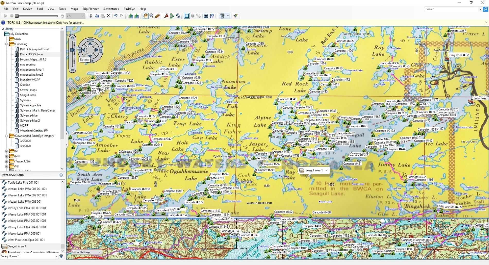
That is a scanned Fisher map uploaded to Google Earth, geo-referenced in Google Earth to match up as best as possible, the imported to Basecamp as a .kmz.
The file handling in the Garmin program works as well and as versatile as the Delorme Topo program I used for years. And for me the subcription Birdseye forms the base for a lot of customized mapping. If only Garmin offered NOAA harbor maps like the Delorme subscription did, the maps of the border routes were highly detailed high contrast B&W and very useful.
butthead
PS: I'm a non-formal type so @butthead is not needed, simply butthead. bh
"never underestimate the power of stupid people in large groups" George Carlin

03/09/2020 04:05PM
That shows the subscription is not registered, without that and the GPS connected it will not download anything. Why it's now un-regestered I have no idea. The website will list subcriptions (at least it did) if you sign up online.
butthead
PS: Next post clarifies my mistake! bh
butthead
PS: Next post clarifies my mistake! bh
"never underestimate the power of stupid people in large groups" George Carlin
03/09/2020 04:20PM
This has gotten me interested so I went to Garmins website and logged in, had to reset my password as it did not recognize the old one written down.
My humble apologies, I do have 2 subscriptions listed but the last time I bought I only wanted the TOPO any way as I did not use the imaging much at all. Maybe they just left it open when I renewed the USGS Canada TOPO subscription. I have used the sat images in 2 years when I first tried them. Notes from 2 years ago pointed out the lack of detail displayed on my 62st so I quit using them. For what it's worth Garmin did not recognize my password and I had it in the 2 year old notes (it has been that long since last logging in). But accepted the old as a new password. May have been a crap in crap out deal. USGS Topo Quads and Canadian NRC Topo is one subcription, the sat imagry is another and both show in my Garmin purchased account.
Aside from that, creating .kmz overlays are what I spend time with now. It takes some orientation and delicate map stretching in Google Earth but the results are very rewarding. I have a large set of overlay topo maps for my favorite local forest trails.
butthead
"never underestimate the power of stupid people in large groups" George Carlin
03/09/2020 05:05PM
Thanks for the update Butthead!
For me, what I have is fine. I really do not use my GPS in the BWCA other than for capturing my trip, and now, with the SAT feature, sending my coords back home to whomever cares to monitor my travels! I am a map and compass guy while on the water!
For me, what I have is fine. I really do not use my GPS in the BWCA other than for capturing my trip, and now, with the SAT feature, sending my coords back home to whomever cares to monitor my travels! I am a map and compass guy while on the water!
03/09/2020 07:22PM
that makes much more sense that they're two separate subscriptions :)
btw, i was saving my reply for later tonight because i thought i was gonna have proverbial cake tonight because i figured out something that others didn't:
- i downloaded pretty much all of bwca in the 2019 USGS 24k .kmz format (straight from their website) and ran all of the grids through kmzfactory... and whaaaa, i'm only able to get 3 quads onto my gps before getting the dreaded "too many custom images" message from basecamp. now my issue is that instead of keeping default compression at 80% i put everything at 100% and it converted a 5MB file into a 15... so i think i have to re-convert a bunch of stuff.
anyways, it seems like there is no perfect solution, i really like the aspect of the TOPO subscription, but if it was equivalent to the 2019 files that could be pulled from USGS it would be incredible, but alas it's not. so yes, unfortunately i'm also left with making my own overlays. i still thinking pulling 24K quads in already a .kmz format is the cleanest, since you don't have to align your own stuff in google earth.
the second best thing to the above i found is simply using caltopo.com with their forestry overlay. now there, at least with a free account, the kmz that's generated is pretty small in area, i suppose you could stack a bunch of them for a larger area, but they do look nice.
anyways, with all of the above I'm really conflicted between keeping the 66 and using something like gaia subscription. garmin definitely has the hardware and i even like basecamp for managing tracks, points, etc., but to say that it severely lacks the mapping aspects of GAIA, caltopo or anything else out there would be an understatement.
03/09/2020 08:36PM
Just went through transferring all my data and programs to a new desktop. When I started to rebuild Basecamp from back-up files the subscription came up as a single license. When I finally got to check into the old Garmin online account I discovered 2 licenses from May 10th 2019 still active, so yes my bad info. One sub is for both USGS and Canadian Topos which I use by far the most, have not messed with the sat imaging for over a year but the downloads showed and worked. The USGS topos are fine for me as I transferred all my waypoints, tracks, routes and a pile of .kmz files that get used with my handheld GPS's. I do not use it for navigating, staying with printed maps and compass. I do print my own custom maps for use. I tend to use the GPS for keeping tracks of adventures and map them at home later, especially useful for hunting! My on the water trips so far have no repeats but look forward to revisiting some old routes.
An old dog learning new tricks, and a long history of working with Delorme Topo series and now Basecamp. Still learning! Some of the newer online mapping have a lot of features, interesting stuff and a lot to learn. Have to admit also aligning complex maps in Google Earth is a huge pain so mostly stick with graphically simpler stuff. Also as mentioned Garmin GPS has it's limits. There are a few ways to work around some, but that takes some trial and error time, patience, which I have less of as I get older.
butthead
"never underestimate the power of stupid people in large groups" George Carlin
03/11/2020 08:49AM
you really should look into using caltopo (even the free account) and downloading 24K quads from usgs.
both of these sources automatically create a .kmz file for you that you just drop onto your GPS and can also import into Basecamp, no need to manually align stuff in google earth and that whole middle step.
if you're still feeling masochistic, both of these sources will also give you a very high quality jpeg/pdf of the area, usgs exports the pdf as something like 90mb per area, which you can then hand align in google earth per the process that you already follow.
i found that 2016+ usgs maps and the maps from caltopo with the 2013-2016 forestry overlay contain all of the trails in BWCA and around the superior trail that i need, something that's drastically missing from the garmin birdseye topo.
i'm primarily speaking from the "planning" phase, if you already downloaded .gpx tracks for all your hikes form somewhere then i suppose garmin birdtopo would be sufficient, but if you're starting from nothing it's pointless to me to look at an empty topo map because everything looks like bushwhacking adventure.
03/11/2020 12:06PM
Familiar and use Caltopo. But where I spend most time is in the WI Kettle Morains and National Forest and I find the Birdseye USGS as good possibly better when displayed on my GPS units.


Both are base 7.5 maps, the Garmin is more legible on the GPS. Not knocking the use of Caltopo but the base USGS 7.5 are the same GIS database product. It's the additions that can be added are different.
I do very little planning for BWCA/Quetico. Just pick an EP and go. I spend much more time in large forest tracts WI MI MN so "already downloaded .gpx tracks for all your hikes form somewhere then i suppose garmin birdtopo would be sufficient" describes me. Been at it since the 1980's with my first GPS handheld (no map-ping just waypoints and tracks) so I got into early digital maps to print at home.
Oh, I did find the NOAA Harbor Charts on an old hard drive. Something to play around with!
butthead
"never underestimate the power of stupid people in large groups" George Carlin
Subscribe to Thread
Become a member of the bwca.com community to subscribe to thread and get email updates when new posts are added. Sign up Here
Community Links
 Search BWCA.com
 Donate
 Featured Sponsor
