|
 Boundary Waters Quetico ForumTrip Planning ForumHorse River Levels
|
 Forum Sponsor

Author
Text
")
03/16/2022 01:47PM
Did anyone take the Horse River from Horse Lake towards Basswood Falls late last fall? It was pretty low when we went through in early June, and I can only imagine that it got worse over the dry summer months.
I would imagine that it would take a significant amount of melting snowpack and spring rainfall to bring water levels back up by the end of May?
I would imagine that it would take a significant amount of melting snowpack and spring rainfall to bring water levels back up by the end of May?
Reply
Reply with Quote
Print
Top
Bottom
Previous
Next


03/17/2022 05:50PM
It was a major slog in mid-September. Lower Basswood Falls to the first portage took us about two hours (and we were running relatively light by then). We never got out but had to pole through mud rather than floating much of it. Lots of longer than usual carries after that in rock gardens that normally have more floating. It basically took a day from Basswood to Horse. Admittedly, we are not the fastest on portages. It will be better now but how much is hard to say. Maybe some early visitors can let us all know.
"The danger of civilization, of course, is that you will piss your life away on nonsense." Jim Harrison

03/18/2022 01:53PM
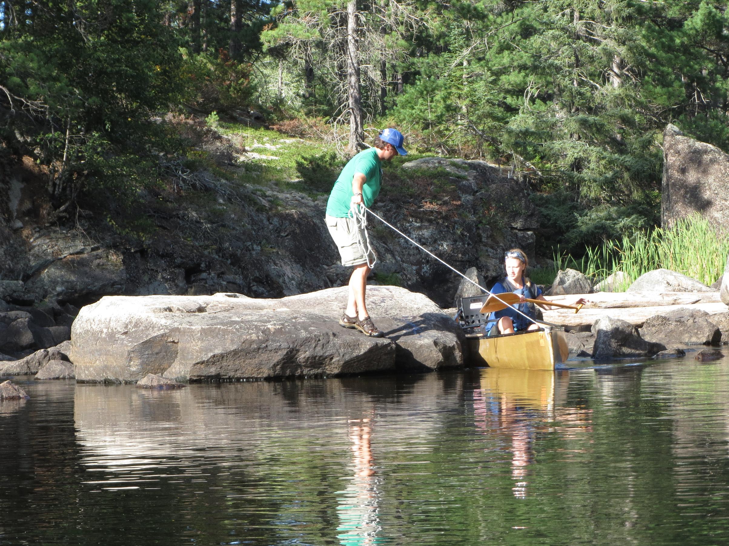
Even during times of "normal" water levels, there are four liftovers or places you'll want to use painters to guide your precious kevlar canoe, even with a lighter load while day tripping. When heading north out of Horse Lake, three of these are before the first marked portage (which is actually on the right/SE side), and one more after it. Downstream and further north, it's quite a bit deeper and a bit easier going.
This was in mid-August 2012:

This was in mid-August 2012:
"You can observe a lot just by watching." -- Yogi Berra
03/19/2022 07:11AM
cyclones30: "You're not going to have any idea until people are taking trips in May or whenever it opens up again. "
There was a decent amount of snowfall this winter in the Ely area so, I'd guess that should bring levels up probably into May. After that, cyclones30 nails it.
Reply
Reply with Quote
Print
Top
Bottom
Previous
Next

Subscribe to Thread
Become a member of the bwca.com community to subscribe to thread and get email updates when new posts are added. Sign up Here
 Search BWCA.com
 Donate