|
 Boundary Waters Quetico ForumListening Point - General Discussion Mapping software
|
 Forum Sponsor

Author
Text
")

06/06/2023 01:09PM
Does anyone use mapping software to document their trips? I would like to be able to see all of the past trips I have done on one map so I can plan for areas I have not visited. Bonus if I could click on individual past routes and upload notes/pictures. Similar to the trip reports section of this site, but with mapping included. I use a SPOT beacon, but don't find the included mapping to be what I am looking for. Any suggestions?
Thank you!
-jmchev
Thank you!
-jmchev

06/06/2023 04:32PM
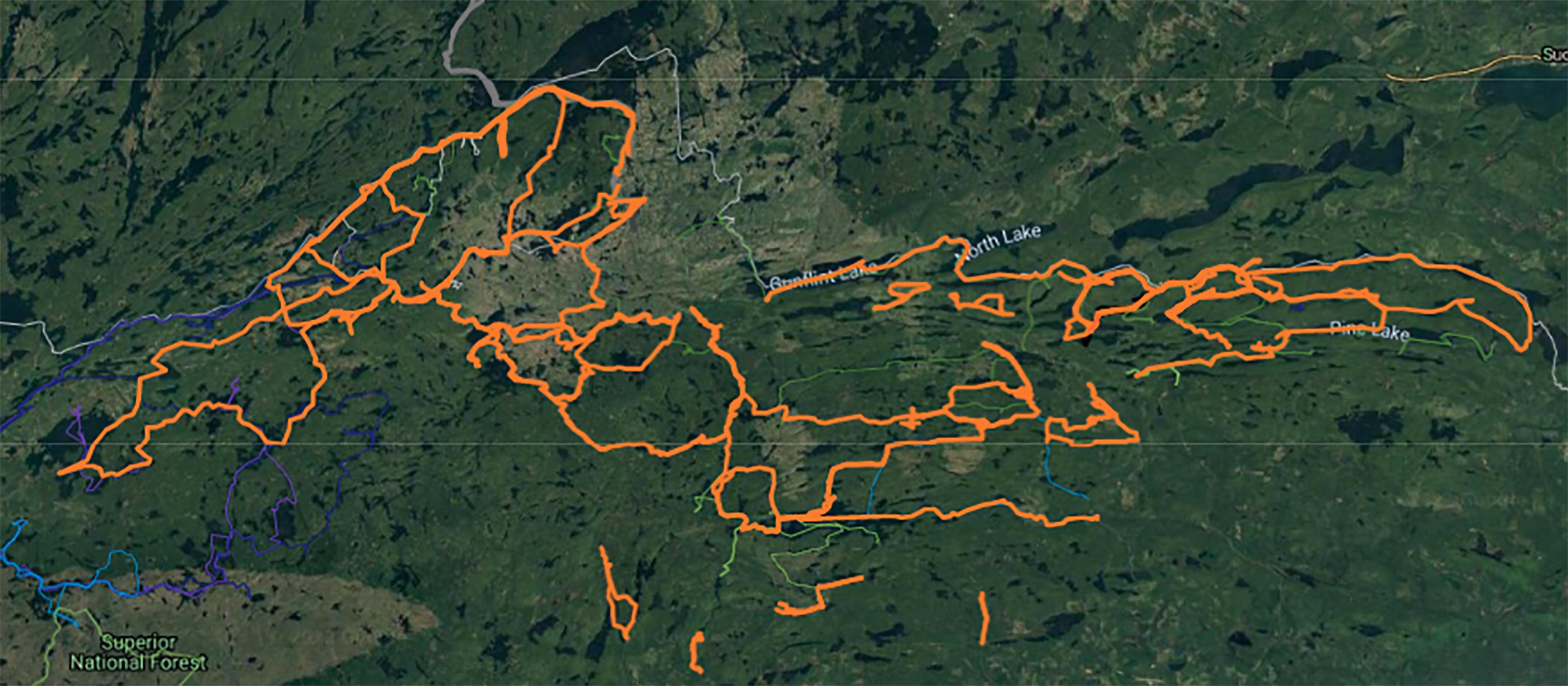
It's far from perfect, but I keep mine in google my maps. I color code it then by year and make a segment for each travel day so I can track number of travel days to a season. It responds reasonably well to file uploads so I have placed the bwca boundary on it as well as campsites and entry points. 
06/06/2023 07:39PM
I do this with Google Earth Pro (the desktop app, not the web app). Easier than learning how to use GIS software like ArcGIS or QGIS. It will let you upload tracks, add notes to said track, upload waypoints and pictures, add additional map layers, and even more.
Bonus is that you can also add portage and campsite locations. It's my all-in-one tool for trip planning.
Bonus is that you can also add portage and campsite locations. It's my all-in-one tool for trip planning.


Subscribe to Thread
Become a member of the bwca.com community to subscribe to thread and get email updates when new posts are added. Sign up Here
Community Links
 Search BWCA.com
 Donate
 Featured Sponsor
