BWCA February ”fun” Boundary Waters Winter Camping and Activities
Chat Rooms (0 Chatting)  |  Search  |   Login/Join
* BWCA is supported by its audience. When you purchase through links on our site, we may earn an affiliate commission.
Boundary Waters Quetico Forum
   Winter Camping and Activities
      February ”fun”     

Author

Text

gravelroad
distinguished member(1420)distinguished memberdistinguished memberdistinguished memberdistinguished member
  
02/11/2026 06:58AM  
I’ve been on the Kek in mid-February when the ambient air temperature went to 50° F and we had a bear in camp. Today’s forecast discussion from the NWS also highlights the need to be prepared for damn near anything in February:

” The primary story for the next several days will be the
significant warming trend. We expect high temperatures to
consistently reach the 30s and 40s, which is well above the mid-
February average for northeast Minnesota and northwest
Wisconsin. In fact, some locations in east-central Minnesota or
northwest Wisconsin could approach 50 degrees. While this will
feel like a welcome break from winter, it introduces a daily
freeze-thaw cycle. With daytime highs above freezing and
overnight lows dropping back into the teens and 20s, any melting
snow will refreeze on untreated surfaces like sidewalks,
driveways, and decks. This will create slick spots each morning
even if the main roads remain mostly dry.

”Looking toward the weekend, a dry shortwave will cross the area
Saturday and Sunday. While this will bring an increase in cloud
cover, no precipitation is expected to reach the ground.

”The weather pattern is slated to become much more active by
Monday and Tuesday of next week. An upper level low moving
across the Rockies will likely spin up a Colorado low pressure
system. This system will tap into Gulf moisture, which is
something we have not seen with the recent train of drier
clippers. While there is still uncertainty regarding the exact
track, this has the potential to be a sizable and impactful storm
system for the region towards the late week. With the current
model data, a surge of warm air ahead of the low may lead
precipitation to start as rain before transitioning to a wintry
mix and eventually heavy snow as the system moves east.”
 
      Print Top Bottom Previous Next
gravelroad
distinguished member(1420)distinguished memberdistinguished memberdistinguished memberdistinguished member
  
02/17/2026 06:16AM  
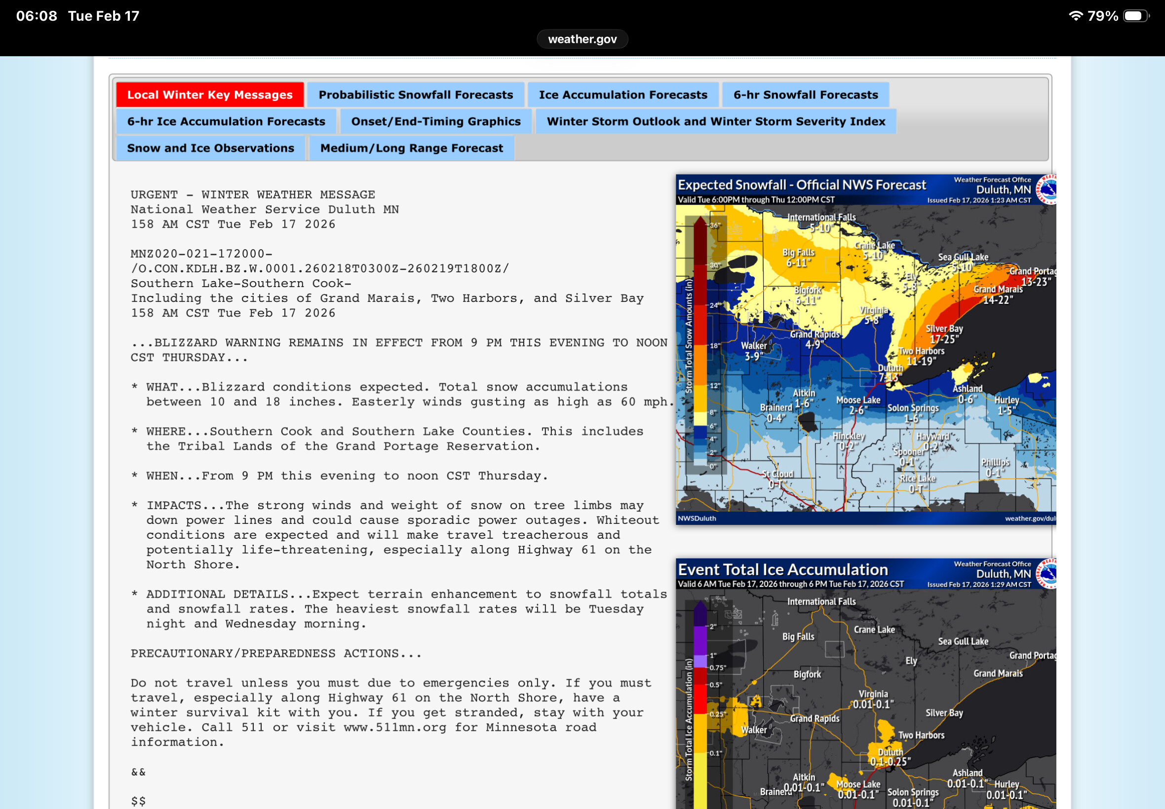
We’re having some kind of fun now.


NWS Duluth Winter Weather Forecasts
 
      Print Top Bottom Previous Next