|
 Boundary Waters Quetico ForumGroup Forum: GPS BirdsEye Topo Maps
|
 Forum Sponsor

Author
Text
")


08/16/2016 01:04PM
Just activated a BirdsEye subscription on BaseCamp. Nice set of maps for North America.


I set the maps to BWCA Q camps and portages for these 2 screenshots.

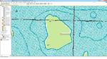
Schweady's post on USGS Topo online got me looking, thanks for the kick in the butt!
Printed out a sample, works pretty well. I need to fiddle a pit with paper and settings.
Gotta do something on a hot Aug. day!
butthead


I set the maps to BWCA Q camps and portages for these 2 screenshots.

Schweady's post on USGS Topo online got me looking, thanks for the kick in the butt!
Printed out a sample, works pretty well. I need to fiddle a pit with paper and settings.

Gotta do something on a hot Aug. day!
butthead
"never underestimate the power of stupid people in large groups" George Carlin
08/22/2016 09:57AM


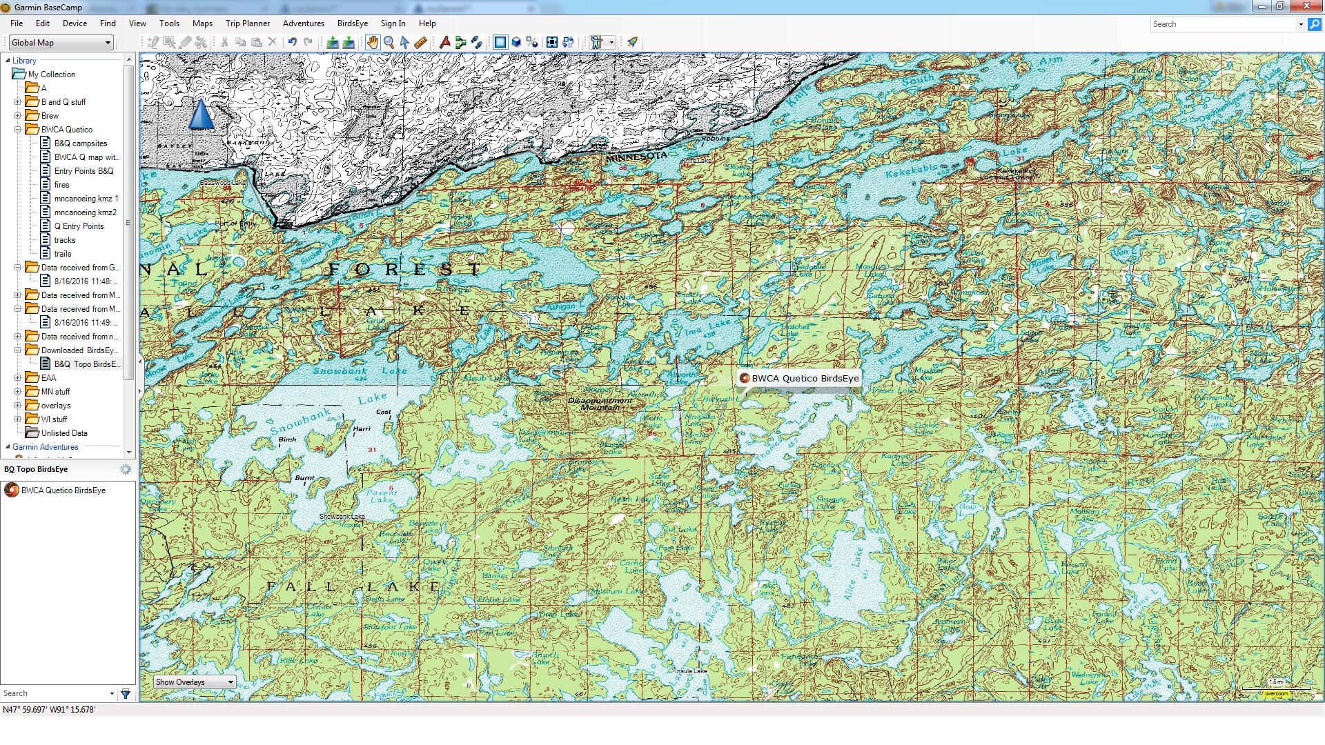
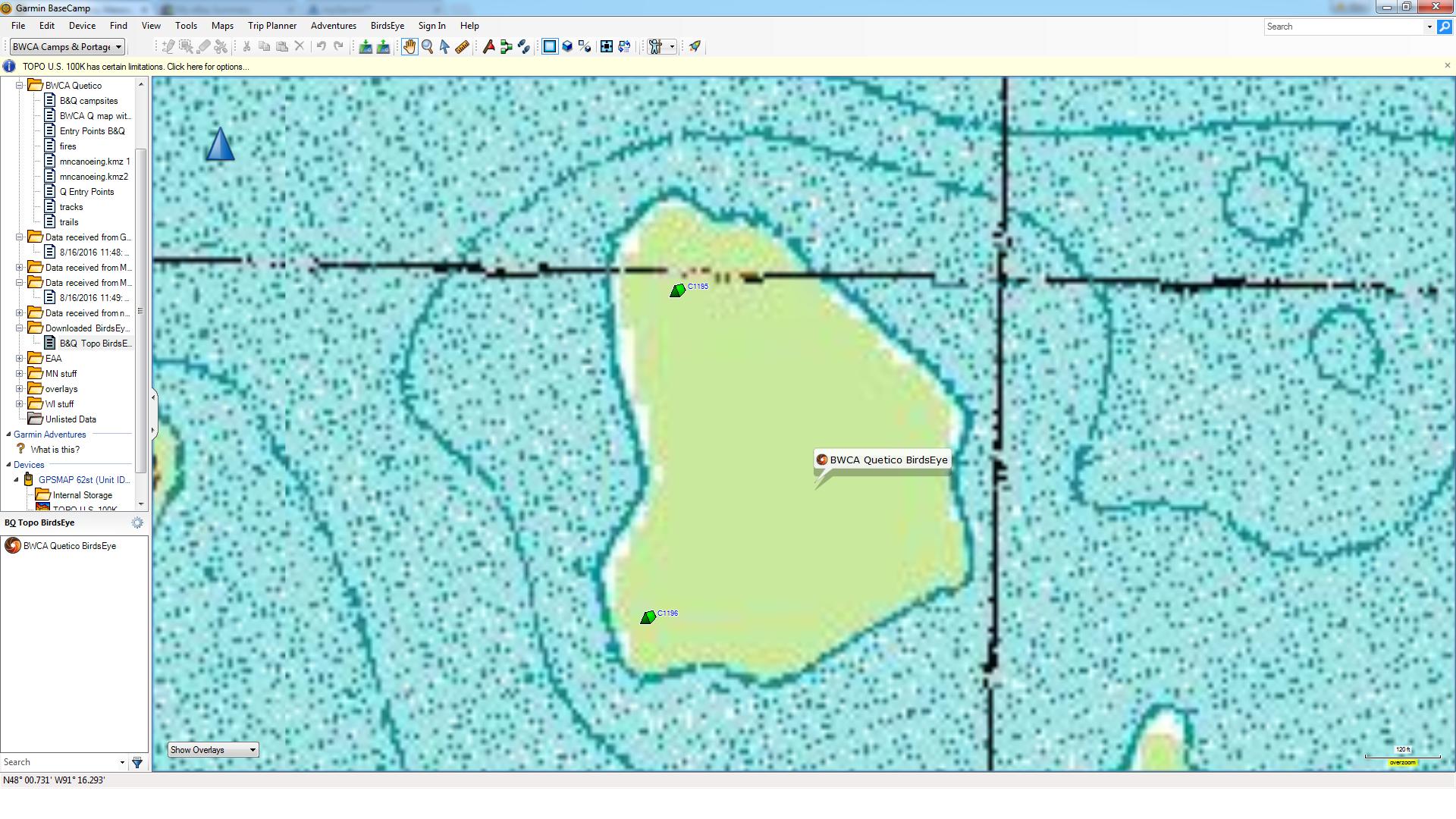
 USGS Quads map printout, screenshot from BaseCamp, screenshgot from GPS.

 Canadian NRC topo.
Working on making overlays with campsites and portages beyond the file from GPS File Depot (specifically adding Quetico camps).
$27 investment for all the Canadian NRC topo and USGS 25K Quads you can download in a year. Not a bad deal!
butthead
"never underestimate the power of stupid people in large groups" George Carlin
")
02/24/2017 02:29PM
How do these maps compare with McKenzie printed maps in terms of accuracy? The McKenzies seem really reliable in terms of portage locations, and pretty good about current sites, exact trail locations, etc. Are these as good?
And do the downloaded maps have a point when they stop working if you don't pay for another year's subscription?
If these are dumb questions, forgive me; I've only ever used printed maps up to now.
And do the downloaded maps have a point when they stop working if you don't pay for another year's subscription?
If these are dumb questions, forgive me; I've only ever used printed maps up to now.
02/24/2017 04:58PM
Have not used Fisher or McKenzie maps in years. If you want a close comparison I have posted many screenshots in high detail .png format, if you want send me a self stamped/addressed envelope, a specific area desired, I'll send a printed copy.
The subscription is for all you can download over a year. Size of downloads are limited in data size but reasonably large. An example is the whole BWCA downloaded in 5 sections in the course of 1 afternoon. The Canadian NRC sheet for WCPP is just 1 download.
I really like the fact my paper maps match the GPS display, after 65 years I can be easily confused!
butthead
PS: I'll be at AppleValley WingNite with some if ya stop in. bh
"never underestimate the power of stupid people in large groups" George Carlin

08/24/2022 01:48PM
I know this is an old thread but it seemed the most appropriate.
I fired up my eTrex 30x the other day to get it ready for my September trip, and when I went to renew my lapsed Birdseye Topo subscription to my surprise it's now valid until 2030. Apparently Garmin discontinued selling it in the last year or two and are trying to push people towards connected devices for live topographical maps instead.
I guess development for BaseCamp ceased in 2020, so take care of those legacy devices!
When a man is part of his canoe, he is part of all that canoes have ever known. - Sigurd F. Olson, "The Singing Wilderness"
08/25/2022 10:31AM
mirth: "I know this is an old thread but it seemed the most appropriate.
I fired up my eTrex 30x the other day to get it ready for my September trip, and when I went to renew my lapsed Birdseye Topo subscription to my surprise it's now valid until 2030. Apparently Garmin discontinued selling it in the last year or two and are trying to push people towards connected devices for live topographical maps instead.
I guess development for BaseCamp ceased in 2020, so take care of those legacy devices!"
I just purchased a Montana 700i and Birds Eye is included. I also cannot seem to get BaseCamp to communicate with my device, perhaps it has been replaced on newer units?
08/29/2022 11:23AM
The newer devices may be only compatible with explore.garmin.com, I do not know. My eTrex is 6ish years old.
I just recently activated an Inreach Mini & it only works with the above website & a helper application on my PC or the Earthmate app on my phone. I do get birdseye satellite & usgs quads in the app, can select layers to display, etc, but it has to download & display on the phone.
The mini is just for helping the wives back home have the warm fuzzies, all my navigation is done with maps or the eTrex.
When a man is part of his canoe, he is part of all that canoes have ever known. - Sigurd F. Olson, "The Singing Wilderness"

Subscribe to Thread
Become a member of the bwca.com community to subscribe to thread and get email updates when new posts are added. Sign up Here
Community Links
 Search BWCA.com
 Donate
 Featured Sponsor
