|
 Boundary Waters Quetico ForumTrip Planning ForumGranite River
|
 Forum Sponsor

Author
Text
")

09/05/2016 02:59PM
I just posted my Granite River trip experience. I love BWCA trips and was told this was a great 3-4 day trip. We really struggled and ended up turning back. Still trying to figure out where we went wrong or if low water conditions just made it tough. I'd love to hear from anyone else who was on the river over the holiday or has canoed the Granite River in early September. Thanks for the help!
Reply
Reply with Quote
Print
Top
Bottom
Previous
Next

09/06/2016 08:02AM
This is very concerning to me because that's the route we were planning to take on Friday. Any feedback is appreciated.
"Keep close to Nature's heart, yourself; and break clear away, once in a while, and climb a mountain or spend a week in the woods. Wash your spirit clean." ~ John Muir
09/06/2016 09:09AM
I once asked a retired outfitter what his favorite route was in the Boundary Waters and without hesitating he told me the Granite River was the way to go. Last year we camped on the north end of the Granite River, coming down from Saganaga Falls and camping near the end of Maraboeuf. It was a great experience - and Jackfish (or anyone else), I can tell you where the walleye are on Maraboeuf if you want to know, just e-mail me.
To the OP - What's surprising to me is that you were with such an experienced paddler - that must be a testament to how difficult the conditions were. My guess is that low water conditions must have been the problem, combined with pretty overgrown portages. Last year some of the portages were pretty bad but still doable.
I'd say focus on careful map reading. Relative perspective can get you out of a lot of navigational difficulties. All I mean by relative perspective is "ok, we're headed east, there's that point there, and that point there, and the portage is going to be between those two points kinda on the left side." This seems to be a pretty well traveled route so I can't imagine the portages would be that hard to find.
Wishing the best for you and hoping you can enjoy more trips. I canoe with my grandpa also and treasure every trip I have made with him.
aka HermitThrush "Such sights as this are reserved for those who will suffer to behold them." -Eric Sevareid

09/06/2016 09:12AM
we just had 3 parties return from that route over the weekend (gunflint lake to sag landing) and none mentioned thinking the water was low. they had all been on this route so they knew what to look for. the portages are not marked in any way on either the MN or Canadian side so it is very important to follow your map. getting some information from an outfitter is usually helpful for the map and things to look for so you know it's the real portage. there is one spot where there is NO portage but there are two little areas of ripples.
yes, when the water is low it can take awhile to find the portage or the way to eventually get to the portage.
yes, when the water is low it can take awhile to find the portage or the way to eventually get to the portage.
09/06/2016 10:12AM
Thanks Sheryl. I was hoping you'd have some current information to share. It doesn't get any more current than that. Kyle and I will stop in to say hello on Tuesday.
"Keep close to Nature's heart, yourself; and break clear away, once in a while, and climb a mountain or spend a week in the woods. Wash your spirit clean." ~ John Muir
09/06/2016 06:37PM
It's a puzzle. Grandpa has been leading trips to the BWCA and Quetico almost every year for over 50 years. He started when his son was just a toddler. It was a bummer to turn around but from others descriptions it sounds like we definitely took a wrong turn. I'd love to figure it out with a map, our pictures and someone who knows the route. I'm sure I will try for a redo next year. He made the right call since the 3 gals have little map reading skills. If he wasn't confident then you have to go back the way you came. It was still a good bonding experience in a beautiful place.
09/06/2016 09:07PM
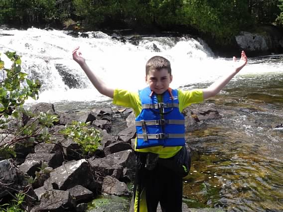
We portaged by little rock falls. Then paddled on over 2 small rapids/ripples. Then we came to a large rapids blocked by trees with a large drop. We backed up a bit looking for a portage. We found a portage covered by a downed pine tree. We thought this was pine portage. See pics below


Then we stayed at a campsite. It had a rapids next to it into another lake. We thought it was Larch lake. Now that we have talked to other people it seems like the gorge we saw was too big to be the entrance to Larch


So if we weren't on clove, where were we? Help solve the mystery...


Then we stayed at a campsite. It had a rapids next to it into another lake. We thought it was Larch lake. Now that we have talked to other people it seems like the gorge we saw was too big to be the entrance to Larch


So if we weren't on clove, where were we? Help solve the mystery...


09/06/2016 09:32PM
I don't disagree. In hindsight my dad (grandpa 81) just came back from backpacking and fly fishing in Yellowstone. I think this trip came up too fast. Had we done more research up front, I'm sure the outcome would be different. Next year :) Now we just want to know where we were.
09/07/2016 07:38AM
did you take the 105rd portage to Clove lake or did you try going around that portage (to the right)?
the other thing would be perhaps you totally missed getting back into the bay where the swamp portage starts and ended up going around to the right of that portage?
i don't recognize a few of your photos and have been on the river when the water has been very low.
the other thing would be perhaps you totally missed getting back into the bay where the swamp portage starts and ended up going around to the right of that portage?
i don't recognize a few of your photos and have been on the river when the water has been very low.
09/07/2016 09:20AM
Sounds like you guys were on the camp #1950 between the Blueberry and Pine Portages. The dead ends and rapids you describe fit this area pretty well.
I do think the Blueberry and Pine Portages can be a bit tricky to find. They are not right along the main flow of the river, but in side channels. You probably saw unofficial portages along the way right near the rapids that created some confusion.
All the real portages on the Granite River are well defined and wide open. Several groups went through the river last week with no issues. Sorry you guys had trouble finding the way. It happens to all of us when the map and what it looks like in reality don't jive.

This bing map shows the areas of dead end rapids and such from above.
Bing Map
There is a light and it never goes out. Morrissey
09/07/2016 07:49PM
I did this route with my family from Gunflint to Clove. Trying to find that portage into Clove was bit tricky after using the 3 Canadian side portages to that point. The portage was in a little cove on the western shore and located where, if I remember correctly, a second "campsite" was supposed to be. There was only a remnant of a previous campsite and no latrine or fire ring to speak of. We found the trail from Granite and portaged into Clove. A group of 5 20-somethings that we met on Clove were wet, muddy and happy to be out there for 21 days --- they told us the portage just north of Clove going up the river was a "boggy mess". I don't know if any of this information helps you locate where you went wrong but I thought it indicated that Granite River was a challenging route (but fun!).
"It is hard to fail, but it is worse never to have tried to succeed.”
09/07/2016 09:35PM
I recalled a youtube video of some young guys that got lost on the Granite route. Watch the first part of this video and see if it explains some things or you recognize some spots. I'll bet what they did is what you did.
Confused video
Confused video
"What could happen?"
09/07/2016 10:14PM
Thank you for all the help. Yes! we were at campsite 1950 and the confused video is exactly what happened to us. There is definite closure now that we know what happened and we aren't the only ones it happened to. Happy camping and looking forward to a redo next year! You are an awesome community!
09/07/2016 11:57PM
I'd really like to paddle this route someday, so I have been following this thread with interest (particularly after reading Mirth's outstanding trip report and a report earlier this summer from Ada of Tuscarora Outfitters on their website). So is it correct that the OP's group struck out on what they thought was the Pine Portage, but they did so about a half mile too soon? Mirth's report said that the paddle from Blueberry Portage to Pine Portage was an easy float, but was the water that much lower just a few weeks later when the OP passed through? Was there sufficient water downstream to paddle to the actual Pine Portage? I hate to belabor what the OP and his outstanding Grandpa look upon with regret, but this info would be very helpful. BTW, Cliff Jacobson suggests skipping the Pine Portage in high water and take two shorter "Guides Portages" to Clove, in order to see an excellent falls and swimming hole just upstream of Clove. Anyone else concur? Thanks in advance!
09/08/2016 01:40AM
The Granite River trip is definitely worth the effort. The portage into Clove is hard to find and somewhat difficult to follow as it is over a large stretch of rock that does not show a "trail". Once into Clove, navigating the rest of the way to Sag is pretty easy.
As an alternative, you can come in through Larch Creek and take the short portage into Clove. Not as scenic but much easier. Given your father's age, Larch Creek might be the better option.
Granite River offers good fishing, varied scenery, and some fairly easy rapids if you are inclined to take them. As you saw on the Youtube video, downloading a gps map set of the area and periodically checking your position on a cell phone would make the initial navigation much easier.
09/08/2016 06:16AM
Our trip should not discourage anyone. We should have had more than one person with map skills and downloaded the gps coordinates. If you've read the book Lost in the Wild (awesome) you can see how easy it is to make a map conform to where you think you are. At one point my dad (gramps) said the lake just doesn't look as big as on the map. He was right. We will go back and do it right. we learned a lesson with no one getting hurt and we have a good story. Even lost, it was beautiful. See we were all still smiling!


09/08/2016 01:07PM
You're welcome, Mirth! I really enjoyed your report.
And I've certainly experienced the map not matching what I am seeing, and vice versa. That happened the last two years on winter camping trips on Little Gabbro, which for some reason bedevils me in the flat light of winter. (I think it bedevils Mackenzie map makers too, who have placed the winter route to Gabbro in a location far, far from the actual winter route.)
And I've certainly experienced the map not matching what I am seeing, and vice versa. That happened the last two years on winter camping trips on Little Gabbro, which for some reason bedevils me in the flat light of winter. (I think it bedevils Mackenzie map makers too, who have placed the winter route to Gabbro in a location far, far from the actual winter route.)
09/11/2016 07:50AM
Don't feel bad I have been on the Granite River 2X and the 2nd time I had the same problem. But I knew I wasn't going the right way as I had been there before so I back tracked but I never did find the official portage so I bush wacked to get back on track.
The 1st time was 2 days after the big blow down. It's one of my favorite routes.
The 1st time was 2 days after the big blow down. It's one of my favorite routes.
You're going to HELL and you're going to drag me with ya!! -Gunsmoke
09/13/2016 10:04AM
My son and I just returned from a 4-day, 3-night trip on the Granite River. We had "zero" problems navigating the route with our McKenzie maps. I would never tell someone that they shouldn't bring a GPS if that gives them peace of mind, but we didn't have one and the map we had was perfect.
The only change to the map that I would suggest to McKenzie is the tip that Mocha (Sheryl) gave us about the portage location at Sag Falls. The portage is on the WEST side of the river, not the east side as the map shows.
I'll get a trip report posted as soon as I can get to it.
The only change to the map that I would suggest to McKenzie is the tip that Mocha (Sheryl) gave us about the portage location at Sag Falls. The portage is on the WEST side of the river, not the east side as the map shows.
I'll get a trip report posted as soon as I can get to it.
"Keep close to Nature's heart, yourself; and break clear away, once in a while, and climb a mountain or spend a week in the woods. Wash your spirit clean." ~ John Muir
09/13/2016 05:26PM
quote Jackfish:
The only change to the map that I would suggest to McKenzie is the tip that Mocha (Sheryl) gave us about the portage location at Sag Falls. The portage is on the WEST side of the river, not the east side as the map shows. "
Yes, and the first part of the portage involves heading up a rock face which I assume would be really treacherous in wet weather.
aka HermitThrush "Such sights as this are reserved for those who will suffer to behold them." -Eric Sevareid
09/19/2016 06:51PM
Sounds like mystery solved - so I'll just add this: we did Granite River down from Sag in August, and I will say that we became disoriented a bit, because we ended up basically lining the canoe and "portaging" in the water, over rocks, etc. on a stretch, due to low water .... it wasn't navigable in a loaded canoe, yet wasn't a bona fide portage. I initially thought I'd missed seeing a portage or some such, but I think it was just the conditions.
09/20/2016 02:47PM
quote chessie: "Sounds like mystery solved - so I'll just add this: we did Granite River down from Sag in August, and I will say that we became disoriented a bit, because we ended up basically lining the canoe and "portaging" in the water, over rocks, etc. on a stretch, due to low water .... it wasn't navigable in a loaded canoe, yet wasn't a bona fide portage. I initially thought I'd missed seeing a portage or some such, but I think it was just the conditions.
"
Just went through there last week in the same direction and yes, there are 2 boulder-filled rapids before getting to the 25 rod "granite river portage" marked on both the Voyageur and McKenzie maps. They are difficult to paddle against the current but could be run going down. And yes, it messed with me too combined with the lack of accurate detail on the McKenzie map for this area.
09/20/2016 07:06PM
quote BeaV: "...and yes, there are 2 boulder-filled rapids before getting to the 25 rod "granite river portage" marked on both the Voyageur and McKenzie maps. They are difficult to paddle against the current but could be run going down. "
We ran 'em. Barely touched a rock. Kind of fun, actually. Very little risk.
"Keep close to Nature's heart, yourself; and break clear away, once in a while, and climb a mountain or spend a week in the woods. Wash your spirit clean." ~ John Muir
09/26/2016 04:32PM
I don't know how there'd be a portage on that side of the falls. Its all thick undergrowth from what I could see. No obvious landings on either side of the falls on the East side. The US (West) side was pretty easy.
When a man is part of his canoe, he is part of all that canoes have ever known. - Sigurd F. Olson, "The Singing Wilderness"
09/27/2016 09:45AM
Falls on the East Side at Sag Falls is news to me as well. I've done the West / US side and all of our customers were told that as well. Seems common knowledge that portage is mismarked on McKenzie maps.....
The portage before Sag falls at Horsetail rapids is on the East / Canadian side.
The portage before Sag falls at Horsetail rapids is on the East / Canadian side.
There is a light and it never goes out. Morrissey
09/27/2016 10:33AM
quote Kiporby: "Falls on the East Side at Sag Falls is news to me as well. I've done the West / US side and all of our customers were told that as well. Seems common knowledge that portage is mismarked on McKenzie maps.....
The portage before Sag falls at Horsetail rapids is on the East / Canadian side."
+1, this is my experience too
aka HermitThrush "Such sights as this are reserved for those who will suffer to behold them." -Eric Sevareid
09/27/2016 11:16AM
quote SaganagaJoe: "quote Kiporby: "Falls on the East Side at Sag Falls is news to me as well. I've done the West / US side and all of our customers were told that as well. Seems common knowledge that portage is mismarked on McKenzie maps.....
The portage before Sag falls at Horsetail rapids is on the East / Canadian side."
+1, this is my experience too"
"all of our customers"... look at you! you're now an outfitter.
anyway, there IS a portage on the canadian side, it's steeper and more difficult to find. i believe Spartan2 posted a photo of it in an earlier thread, there is a sign of some sort in her photo. not sure the canadians maintain their portages? maybe they rely on the tourists traveling those routes to move stuff.
06/30/2018 08:54PM
I was just rereading this thread and reliving my crazy experience. I did want to add that I went back one year later (last summer) with my dad and other family members. We called it the Granite River Redemption trip. There were some muddy portages, but we made it! I am now planning another trip for August with my now 83 year old Dad!
06/30/2018 09:17PM
Thanks for bringing this thread back to life. Our first trip, (me and then 9 year old son) was the Granite River, Gunflint to Sag Falls.
I remember we did have a little trouble finding a couple of the portages, and got turned around once or twice, but all in all didn't have too much trouble navigating. We did have wind problems, but all in all had a great trip.
A few photos from 2015, Little Rock Falls, Campsite on the Pine River, and campsite on the North end of Clove


06/30/2018 09:37PM
ahhh ... memories! i've been on the river a number of times, going both directions. the scenery is different each way, moreso than on a lake, for some reason. maybe it's just me.
not a huge fan of the moving water but i can see why folks like that route.
not a huge fan of the moving water but i can see why folks like that route.
04/03/2022 10:12PM
Bmuck1: "SaganagaJoe...you still active on here?"
Joe is still around, just not posting as often nowadays. Hopefully he'll see your inquiry. You can also email him.
"Keep close to Nature's heart, yourself; and break clear away, once in a while, and climb a mountain or spend a week in the woods. Wash your spirit clean." ~ John Muir
04/05/2022 02:02PM
I've done the Granite River in one way, shape, or form, at least a dozen times. It was the first trip I ever took to the BWCA. It was the route that I did my first solo. It was the first route my wife and I did together. It has been my go-to route when introducing new people to the BWCA. I think it is the best route for first timers. It has a little bit of everything: rivers, rapids, lakes, little water, big water, the Canadian border, and history. It's not too long and it's not too short.
Mike
Mike
I did indeed rock down to Electric Avenue, but I did not take it higher. I regret that.
Reply
Reply with Quote
Print
Top
Bottom
Previous
Next

Subscribe to Thread
Become a member of the bwca.com community to subscribe to thread and get email updates when new posts are added. Sign up Here
 Search BWCA.com
 Donate