| Author |
Message Text |
|
Selfsuffi
|
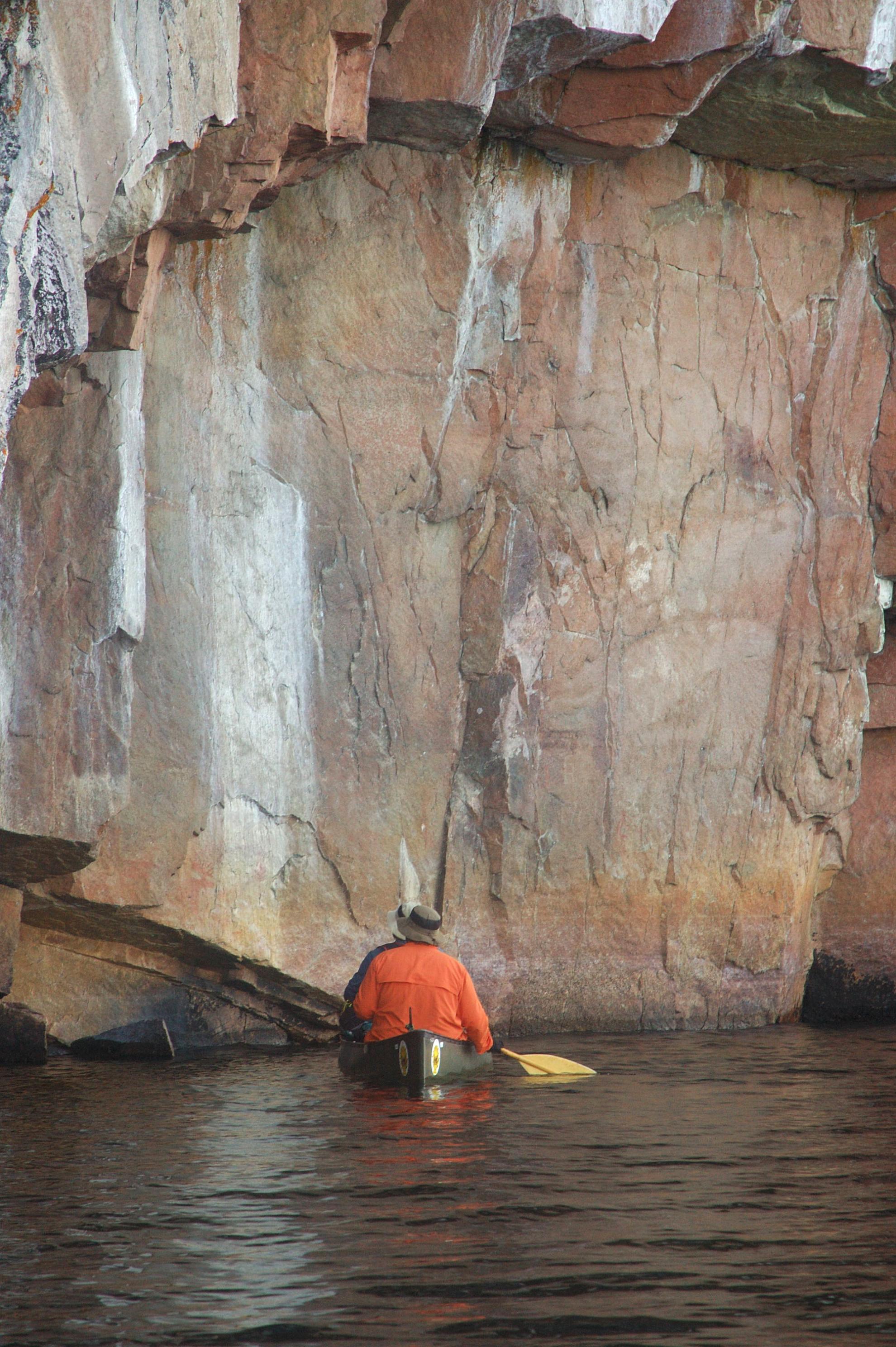
I have a friend that went on his only BWCA trip back in 2006. He didn't plan it or organize it in any way. His recollection is that they went into Moose Lake on a loop trip and half way through they stopped at these pictographs.
Does anyone know what lake this might be? He is asking me to see if we can figure out for his son where they went. His son would like to plan a trip back there if they can figure out where they went. The man who planned and organized this back in 2006 has passed away. Any help is appreciated. Thank you!
Rich


|
|
sedges
|
I believe these are the Lac la Croix pictos on Irving Island. This is on the Canadian side of the lake and part of Quetico PP.
|
|
AmarilloJim
|
Looks like LLC.
|
|
nctry
|
Lac La Croix... makes me think it was Moose River North he went in on.
|
|
Selfsuffi
|
Thank you all. I knew the knowledge on this board would solve it quickly. It makes lots of sense because he mentioned when he touched the wall to keep the canoe off the rock, his friend told him he was touching Canada.
The Moose lake he described didn't match the one I know, but the pictures looked like western BWCA to me. I will pass along the information. Thanks again!!
|