|
07/13/2020 01:59PM |
I took one of these midlands on my trip out of Little Indian Sioux North, EP14. I turned it on maybe 3 times. All I heard was weather for the Brainerd area.
Does the Brainerd area apply to the Ely side of the bwca?
|
07/13/2020 12:20PM |
Enhanced risk
Thunderstorm outlook. Red is high, scroll through time selections upper left
If I were in W. regions of BW I would have weather radio on the ready for later today.
|
07/13/2020 03:39PM |
|
07/13/2020 05:30PM |
|
07/13/2020 11:16PM |


|
07/13/2020 08:02PM |
Jaywalker: "FYI - there is another thread where the topic of coverage areas for weather radios is currently being discussed. I’m trying to figure it out too. Weather radio coverage areas "
Thanks for the link
|
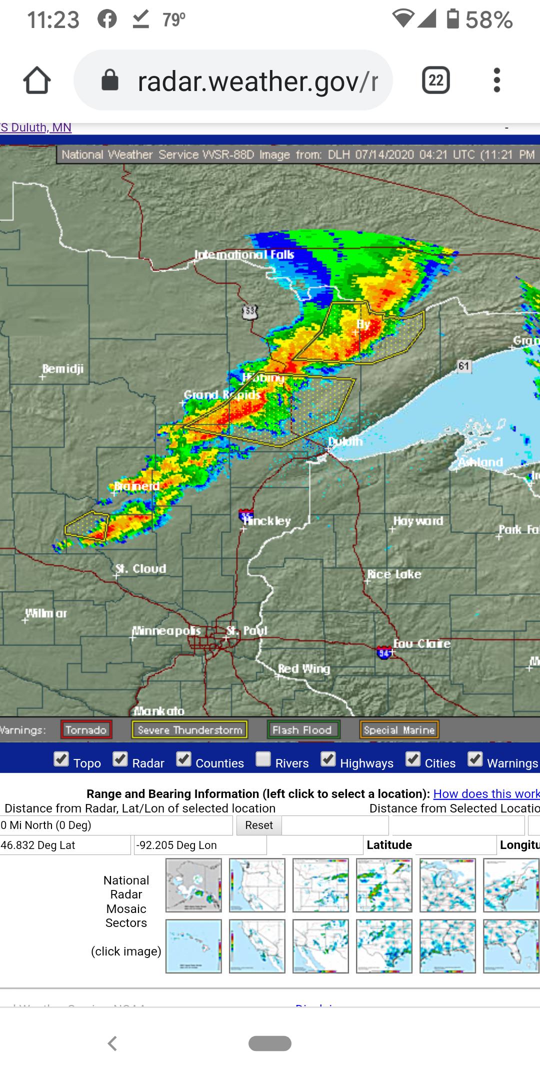
07/13/2020 11:20PM |
Severe Weather Statement
National Weather Service Duluth MN
1118 PM CDT Mon Jul 13 2020
MNC075-137-140430-
/O.CON.KDLH.SV.W.0070.000000T0000Z-200714T0430Z/
St. Louis MN-Lake MN-
1118 PM CDT Mon Jul 13 2020
...A SEVERE THUNDERSTORM WARNING REMAINS IN EFFECT UNTIL 1130 PM CDT
FOR EAST CENTRAL ST. LOUIS AND NORTHWESTERN LAKE COUNTIES...
At 1118 PM CDT, severe thunderstorms were located along a line
extending from Boundary Waters Canoe Area Wilderness, to near Fall
Lake, to near Birch Lake, to 9 miles southwest of White Iron Lake, to
near Babbitt, moving east at 45 mph.
HAZARD...60 mph wind gusts and nickel size hail.
SOURCE...Radar indicated.
IMPACT...Expect damage to roofs, siding, and trees.
Locations impacted include...
Ely, Babbitt, Winton, Basswood Lake, Fall Lake, Birch Lake, White
Iron Lake, Snowbank Lake, southern Boundary Waters Canoe Area
Wilderness, Forest Center, Ensign Lake, Kekekabic Lake, Bald Eagle
Lake, Gabbro Lake, Alice Lake, Ojibway Lake, Farm Lake, Bear Island
Lake, Disappointment Lake, and Greenstone Lake.
PRECAUTIONARY/PREPAREDNESS ACTIONS...
For your protection move to an interior room on the lowest floor of a
building