|
06/20/2025 10:58AM |
:)
|
06/16/2025 11:57PM |
Flash Flood Warning
Flash Flood Warning
MNC061-137-170615-
/O.EXT.KDLH.FF.W.0001.000000T0000Z-250617T0615Z/
/00000.0.ER.000000T0000Z.000000T0000Z.000000T0000Z.OO/
BULLETIN - EAS ACTIVATION REQUESTED
Flash Flood Warning
National Weather Service Duluth MN
941 PM CDT Mon Jun 16 2025
The National Weather Service in Duluth has extended the
* Flash Flood Warning for...
Southeastern Itasca County in north central Minnesota...
Central St. Louis County in northeastern Minnesota...
* Until 115 AM CDT Tuesday.
* At 941 PM CDT Monday, the public reported thunderstorms producing
heavy rain across the warned area. Between 2.5 and 4.5 inches of
rain have fallen. Additional rainfall amounts up to 1 inch are
possible in the eastern Iron Range area. Flash flooding is already
occurring.
HAZARD...Flash flooding caused by thunderstorms.
SOURCE...Public report of water quickly coming into the
basement of a house along 10th Street South in the
city of Virginia.
IMPACT...Flash flooding of small creeks and streams, urban
areas, highways, streets and underpasses as well as
other poor drainage and low-lying areas.
* Some locations that will experience flash flooding include...
Hibbing, Grand Rapids, Lake Vermilion, Virginia, Chisholm,
Eveleth, Mountain Iron, Cohasset, Hoyt Lakes, Coleraine, Gilbert,
Aurora, Babbitt, Keewatin, Buhl, Nashwauk, Biwabik, Cherry,
Embarrass and Tower.
While most rain has ended as of 9:30 PM CT along and west of US
Highway 53 this evening, additional flows into area drainages and
possibly into roadways remains expected over the next few hours.
Rain ends in the eastern Iron Range over the next two hours.
PRECAUTIONARY/PREPAREDNESS ACTIONS...
Be especially cautious at night when it is harder to recognize the
dangers of flooding.
Be aware of your surroundings and do not drive on flooded roads.
&&
LAT...LON 4703 9374 4703 9377 4747 9376 4768 9306
4792 9223 4778 9197 4749 9202 4734 9223
4717 9307
FLASH FLOOD...OBSERVED
$$
NLy
Flash Flood Statement
National Weather Service Duluth MN
816 PM CDT Mon Jun 16 2025
MNC075-137-170615-
/O.CON.KDLH.FF.W.0002.000000T0000Z-250617T0615Z/
/00000.0.ER.000000T0000Z.000000T0000Z.000000T0000Z.OO/
Lake MN-St. Louis MN-
816 PM CDT Mon Jun 16 2025
...FLASH FLOOD WARNING REMAINS IN EFFECT UNTIL 115 AM CDT TUESDAY
FOR NORTHERN LAKE AND NORTHERN ST. LOUIS COUNTIES...
At 816 PM CDT Monday, Doppler radar and automated rain gauges
indicated thunderstorms producing heavy rain across the warned area.
Between 1.5 and 3 inches of rain have fallen. The expected rainfall
rate is 1 to 2 inches in 1 hour. Additional rainfall amounts of 1 to
2 inches are possible in the warned area. Flash flooding is expected
to begin shortly.
HAZARD...Flash flooding caused by thunderstorms.
SOURCE...Radar and automated gauges.
IMPACT...Flash flooding of small creeks and streams, unpaved
roadways, trails, highways, streets as well as other
poor drainage and low-lying areas.
Some locations that will experience flash flooding include...
Ely, Lake Vermilion, Babbitt, Cook, Winton, Crane Lake, Burntside
Lake, White Iron Lake, Robinson, Fall Lake, Birch Lake, Bear Head
Lake State Park, Boundary Waters Canoe Area Wilderness Near Trout
Lake, Basswood Lake, Snowbank Lake, Boundary Waters Canoe Area
Wilderness, Forest Center, Buyck and Voyageurs National Park.
PRECAUTIONARY/PREPAREDNESS ACTIONS...
Be especially cautious at night when it is harder to recognize the
dangers of flooding.
Be aware of your surroundings and do not drive on flooded roads.
&&
LAT...LON 4834 9246 4822 9237 4825 9227 4832 9231
4835 9226 4836 9206 4823 9196 4820 9172
4811 9171 4811 9156 4804 9157 4808 9127
4819 9104 4790 9104 4749 9204 4778 9198
4790 9224 4774 9281
FLASH FLOOD...RADAR AND GAUGE INDICATED
EXPECTED RAINFALL RATE...1-2 INCHES IN 1 HOUR
$$
NLy
|
06/17/2025 08:33AM |
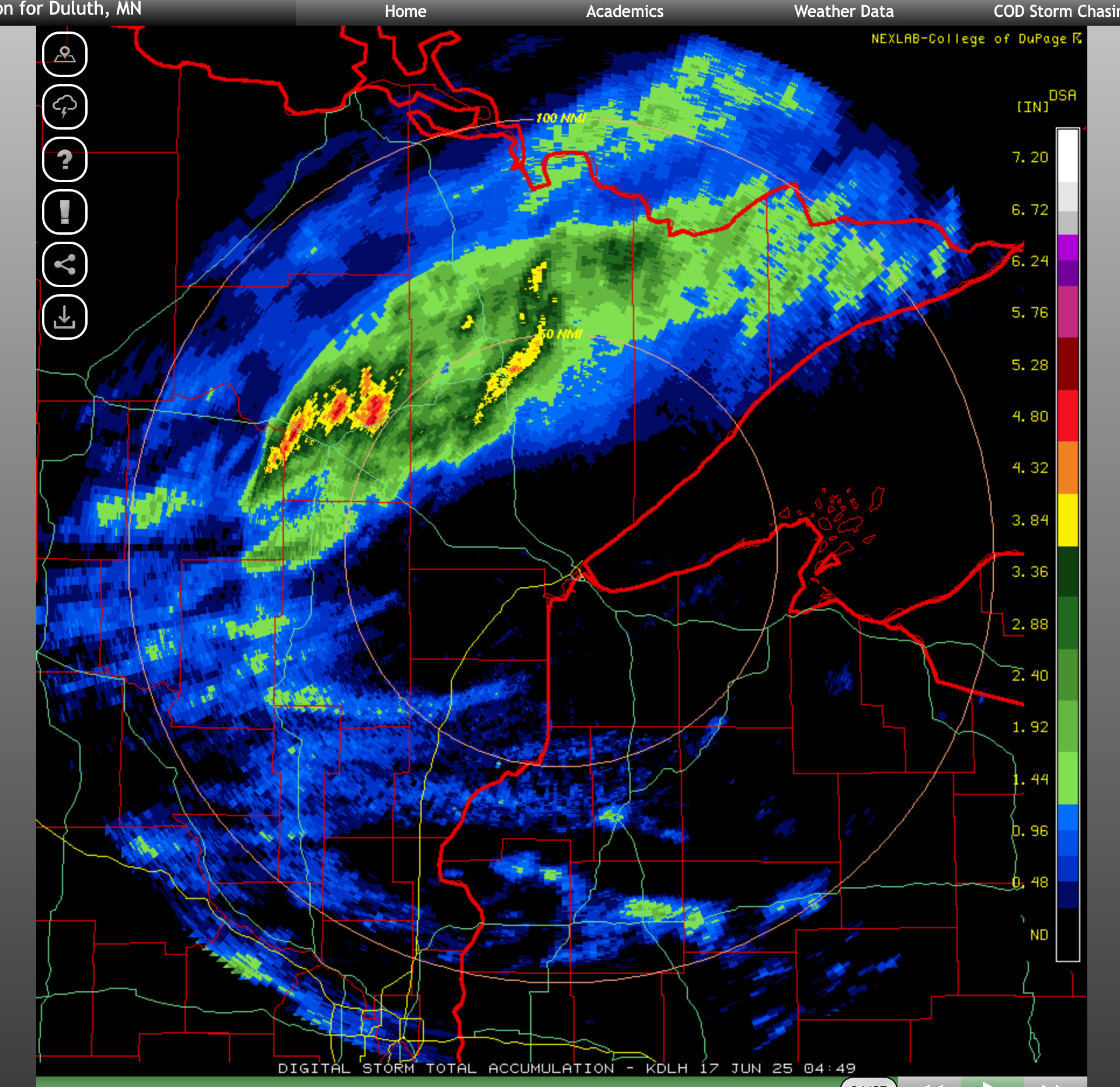
 Screen-grab around 9:30pm last night (CT)
|
06/18/2025 05:06PM |
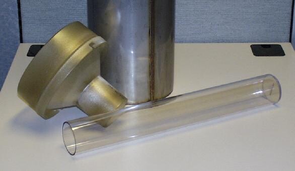
Rain Guage Tipping Bucket
|
06/18/2025 05:15PM |
They are quite accurate in light/moderate rainfall but really lose accuracy in heavy rain compared to manual rain gauges because in the "tipping" procedure they lose precip by it spilling out-- usually 10 to 15% lower than a manual gauge in heavy rain.
pinetree- correct -- the ones used by most Coop Obervers are 4" or 8" in diameter -- 8" being "official" but a little bulky/ heavy and costly for 1000's of coop observers.
|
06/18/2025 11:00AM |
The BWCA got more than the airport... or the airport has a leak ;)
|
06/17/2025 08:39AM |
Only .05 inches in Ely and .12 in Duluth.
|
06/17/2025 12:05PM |
LindenTree: "Good deal, just wish it was more wide spread.
Only .05 inches in Ely and .12 in Duluth."
If someone reported .05" in Ely they should check their rain gauge for leaks. Both the radar and actual rainfall reports had 2-3"+ for the Ely area.
|
06/17/2025 10:11AM |
LindenTree: "Good deal, just wish it was more wide spread.
Only .05 inches in Ely and .12 in Duluth."
Looks like -to me Ely got over 3 inches or close to it-?
These rains this summer have such discreet lines where it has been falling.
My favorite checker-observers-just zoom in
rain gauges
|
06/17/2025 12:20PM |
NEIowapaddler: "LindenTree: "Good deal, just wish it was more wide spread.
Only .05 inches in Ely and .12 in Duluth."
If someone reported .05" in Ely they should check their rain gauge for leaks. Both the radar and actual rainfall reports had 2-3"+ for the Ely area. "
You Tuesday morning quarter backing from Iowa? White Wolf is my Iowa weather guy.
It was WDIO Duluth.
Ely airport reported .11 inches.
.11 inches at airport.
|
06/18/2025 05:50PM |
|
06/18/2025 04:26PM |
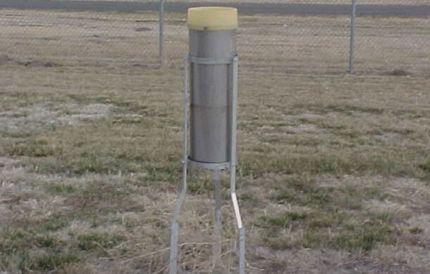
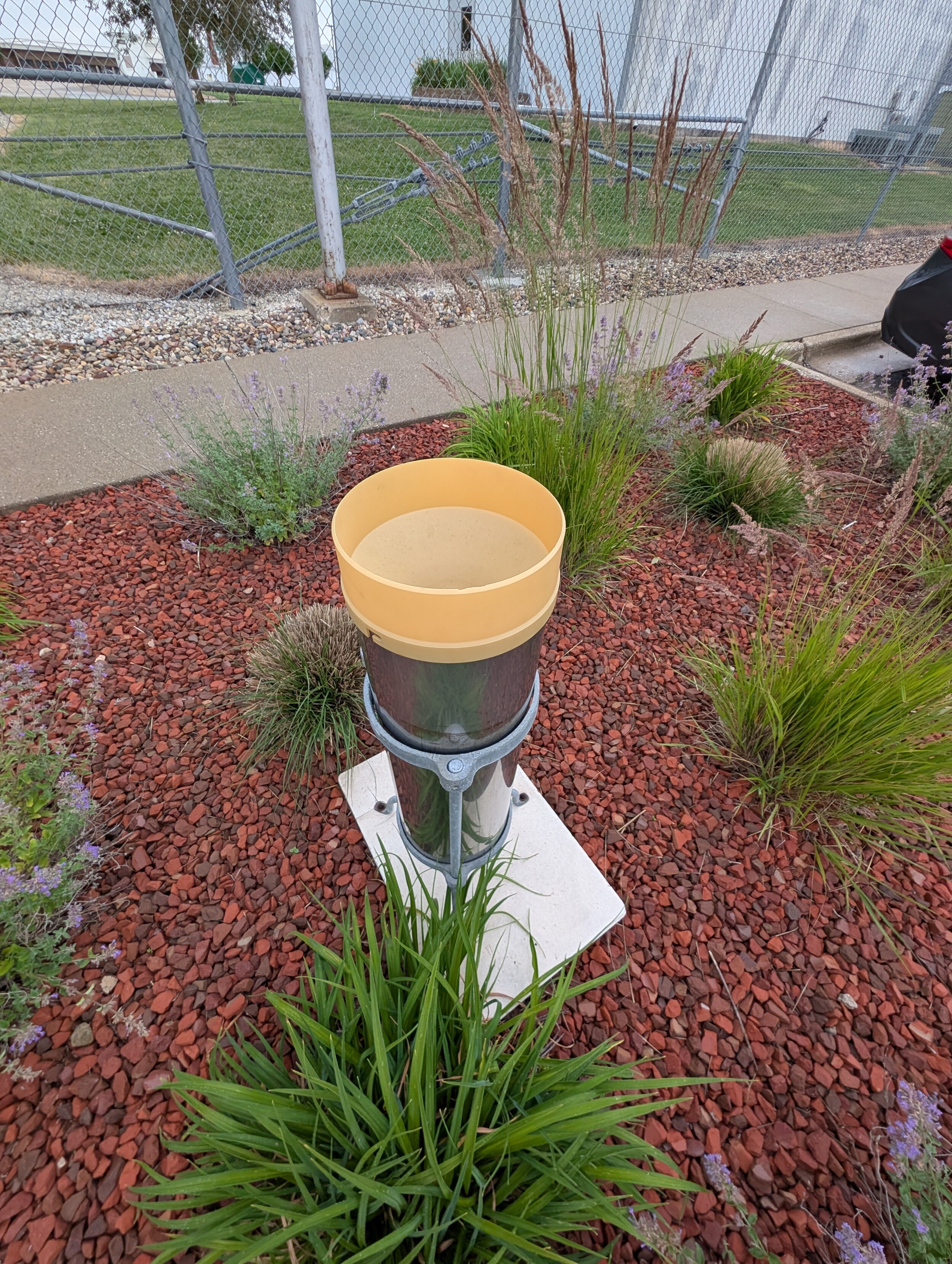
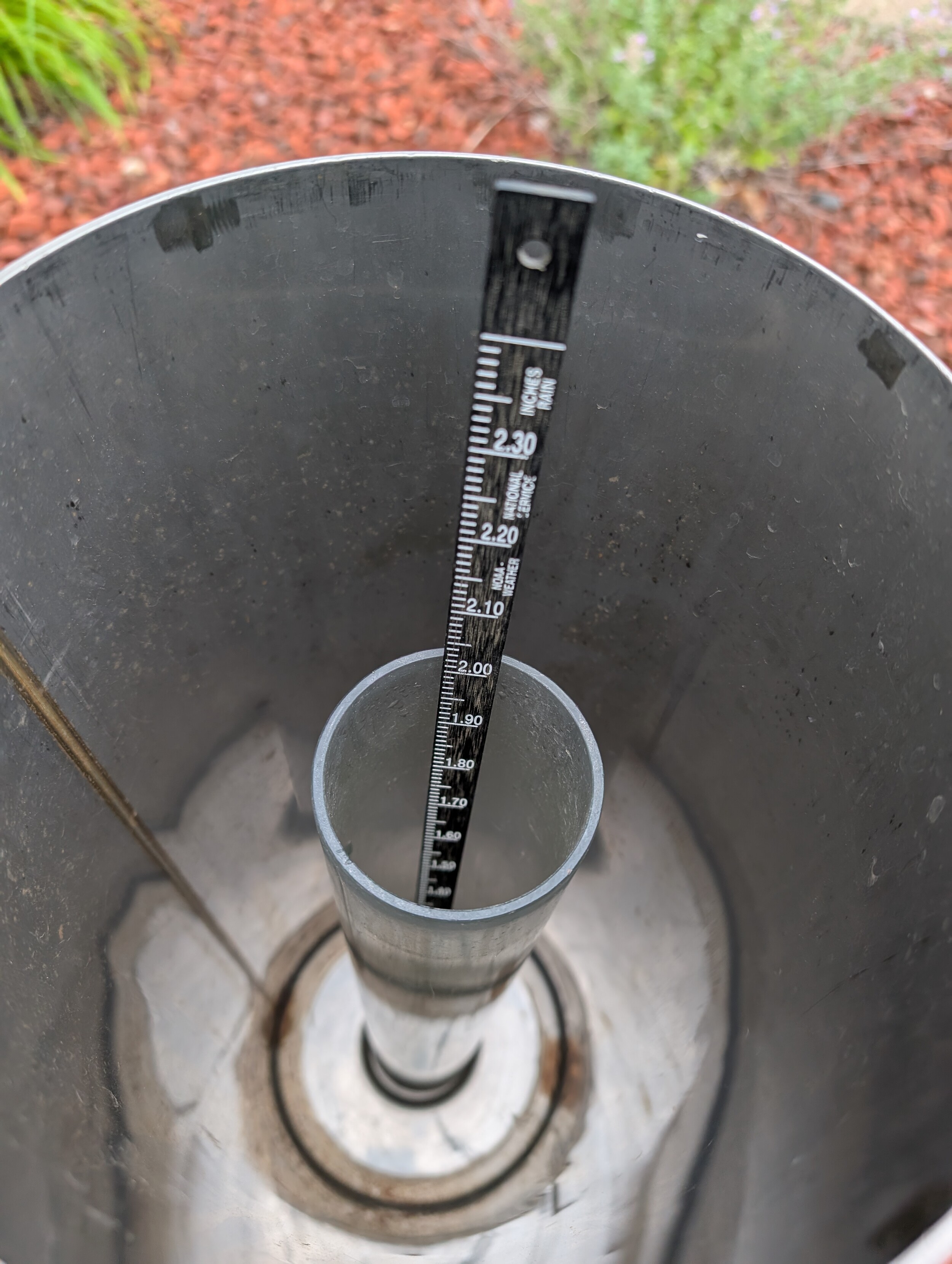
I know most official ones have a big round opening.
|
06/18/2025 05:29PM |
WhiteWolf: "Anything automated is likely going to be a tipping bucket as mentioned by linden.
They are quite accurate in light/moderate rainfall but really lose accuracy in heavy rain compared to manual rain gauges because in the "tipping" procedure they lose precip by it spilling out-- usually 10 to 15% lower than a manual gauge in heavy rain.
pinetree- correct -- the ones used by most Coop Obervers are 4" or 8" in diameter -- 8" being "official" but a little bulky/ heavy and costly for 1000's of coop observers.
Yeh also sometimes I think to hard,I imagine the rainfall hitting the edges of the container and maybe square ones for the same opening surface area size sq. inches opening get less or more because of surface or inner glass side area varies. Especially in a windy situation. My explanation probably confusing.
I remember in 2012 we had one month like 30 inches of rain-maybe a state record.
But often it seems the airport one totals fell behind many local rain gauges. We had numerous 4-5 inch rains. We had floods everywhere. I have no idea what they had for a gauge.
I know the local forestry office had the round opening one, but they dumped it manually back than.