|
02/05/2022 03:04PM |
The image is from here: Ontario Forest Fires
|
02/03/2022 02:48PM |
|
01/24/2022 07:49PM |
schweady: "Superior National Forest Facebook page has the maps. I saved all of the pdf files. Maybe I can get them up here sometime.
Fourtown site #1099 was burned pretty badly in a backburn operation.
"
Here you go. As has been said, not a lot of these burn areas will affect paddling routes as much as some of the major fires of the past. We remember them as affecting a much larger area of closure than the size of the actual burn footprint.
----
I collected information on 38 named wildfires in 2021. (SNF identified 65 fires reported on the Forest in 2021, 29 of which were caused by humans.) I found maps showing fire perimeters — or at least locations — for 19 of them.
Bezhik Fire - west of Big Moose Lake
Perimeter map - May 20, 2021

Hassel, Picketts, Astray, Delta Lake Fires
Locations map - July 16, 2021

Bear Creek, Phantom Creek, Sundial South, Bunggee, Fourtown Lake, Vivid Lake, Ima, Delta Lake, Slowfoot, Agamok, Beth Fires
Locations map - August 3, 2021

Whelp Creek Fire
Perimeter map - August 20, 2021

John Ek Fire
Perimeter map - September 1, 2021

Greenwood Fire (outside of BWCAW)
Perimeter map - September 12, 2021

|
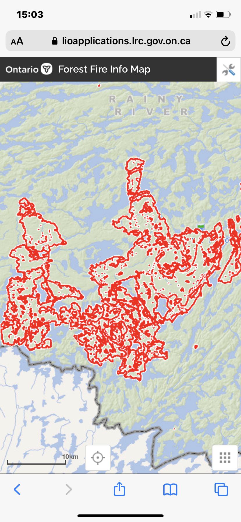
01/24/2022 09:07PM |
I guess if I have a point to this post it’s that a simple map may not do justice to the reality of the situation or tell you what to expect. And things will change quickly in the wilderness. Mother Nature is amazing. A simple map can be somewhat misleading. Below is a map of the Quetico fires in 2021 that I sort of like. It does a decent job of showing and describing the relative impact on various areas that were subject to fires this past summer in Quetico. I don’t think anything like this was put together for the BWCA. Nor do I believe the BWCA had the burn area in 2021 equivalent to that of Quetico, as far as I know.

|
01/21/2022 06:45PM |
|
01/23/2022 09:47PM |
Fourtown site #1099 was burned pretty badly in a backburn operation.
|
01/21/2022 12:02PM |
The 2021 John Ek fire reached the SE shore of Elton Lake, but the other lakes affected by that fire are not on normal travel routes.
|
01/21/2022 11:15AM |
|
01/21/2022 01:26PM |
Overall I’d say that nothing in the BWCA was affected negatively from a campsites burned and trees being down last year by the fires.
Parts of Quetico are affectedand will require planning around fire burned areas.
Ryan