|
02/11/2012 12:41PM |
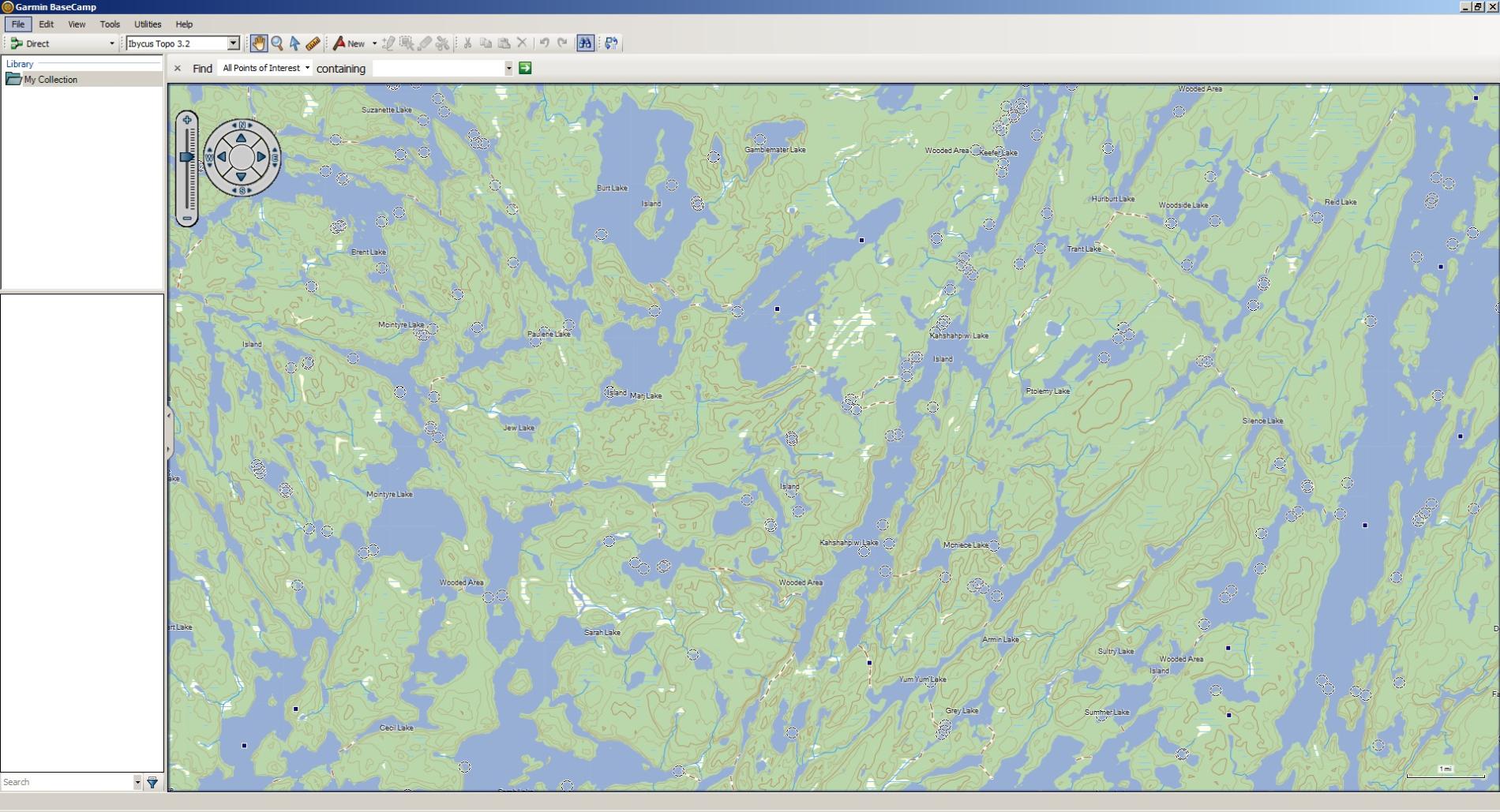 Ibycus Canada Topo, shareware displayed on Garmin Basecamp.
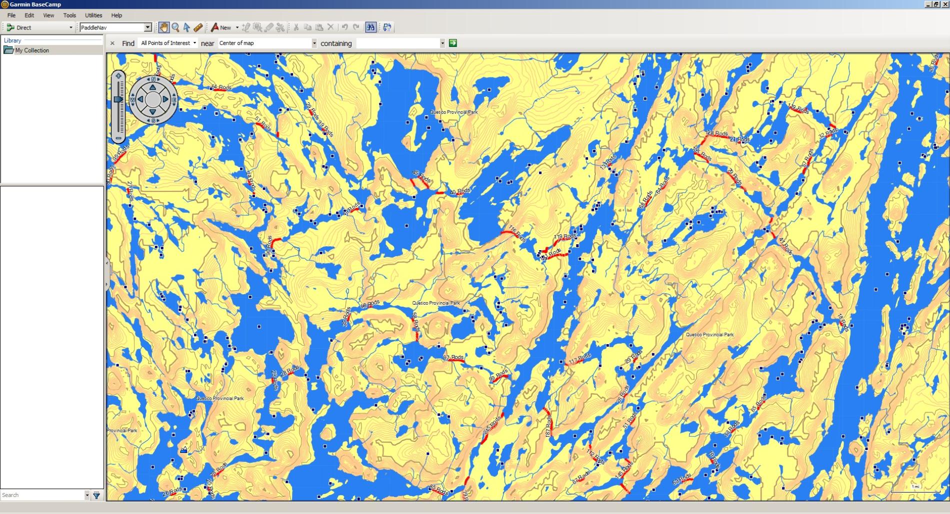 Red Pine Mapping, displayed on Basecamp. Both of Kahshahpiwi Lake Quetico, both could be used on the Garmin Dakota.
butthead
|
02/11/2012 02:39PM |
OP:
whatever GPS you get, it should be compatible with Garmin files, whether directly or through the mapping software
I also have a DeLorme, but my mapping software can take Garmin files, then I can create files for the DeLorme from it
|
02/11/2012 04:05PM |
|
02/10/2012 05:24PM |
There are an awful lot of options out there and I've read some of the posts on here. Some of the recommended GPS units are pretty sweet but are alos pretty expensive for my budget. I'll end up buying one of those units if I find that it's what I really need.
My primary use will be for camping only. It's about the only time I would use it. I need to load maps onto it. I found this unit at Gander Mountain that has a $100 rebate. Plus a friend of mine works there so I'll be able to get this unit for around $150.
Garmin Dakota 20
I do like the touch screen and it says that it works well in bright light. Both of these options I like. Can anyone comment on this unit. I'm a total newbie to modern GPS units so I don't know what I don't know. Thanks.
Tom
|
11/13/2012 08:02AM |
I bought a years subscription to their map service, after trying different data I settled on the USGS data, the sat and other stuff just didn't seem necessary for my use. Which is canoeing and hiking.
The other thing is that the software will take in Garmin data, which you can then export to your DeLorme GPS
|
11/13/2012 05:07PM |
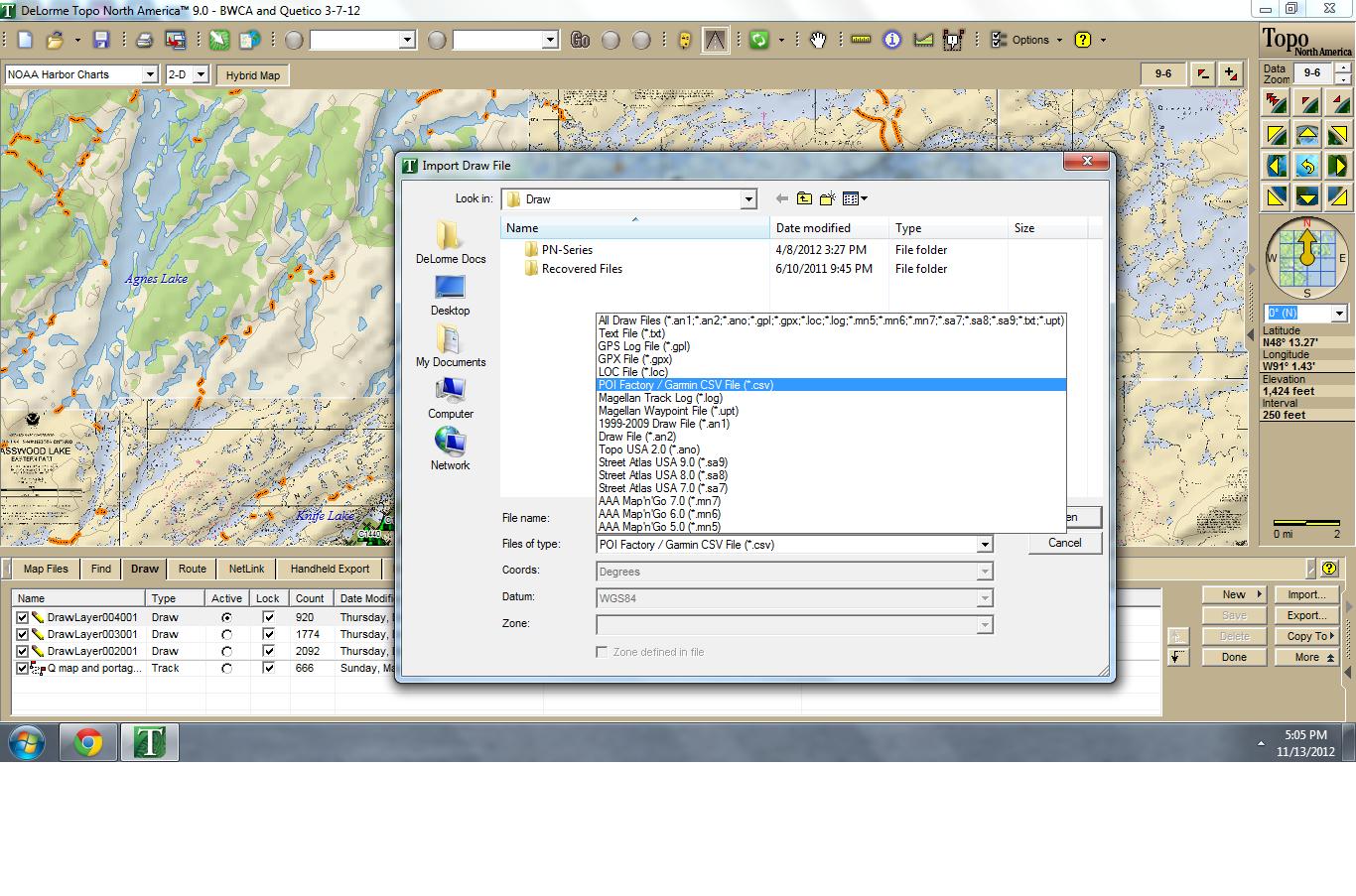 In the draw section, you can import these types of files.
butthead
|
11/14/2012 08:50AM |
|
02/13/2012 07:18PM |
Tom
|
02/14/2012 11:43AM |
BWCA campsite, portage .gpx data available free from Arch Harris.
Lake depth maps for 9,500 lakes on the Garmin Upper Midwest Fishing Guide, $89.99 microchip at Reeds.
Garmin's BaseCamp, a free download.
|
02/14/2012 01:42PM |
Fantastic links. Thanks! When I get the unit I will visit your links more carefully.
Tom
|
02/11/2012 04:36PM |
quote ZaraSp00k: "Butthead: what do those symbols on your maps indicate? the small black squares, circles etc.,
OP:
whatever GPS you get, it should be compatible with Garmin files, whether directly or through the mapping software
I also have a DeLorme, but my mapping software can take Garmin files, then I can create files for the DeLorme from it
"
The symbols are unidentified terrain objects, camps? rocks? I'll check personally on the water in May!
I prefer the maps and programming from Delorme, a year long subscription gets all the USGS, Sat, and aerial imaging you can use. Add portage and campsite overlays and It makes a good mapping system.
I just like to experiment a lot! And the Garmin units/mapping programs are very good also, and improving fast.
butthead
|
02/14/2012 07:23PM |
|
11/12/2012 02:58PM |
I am thinking of dumping the PN-60 and buying a Garmin unless I can figure this out. How do you like your Delorme?
|
11/12/2012 04:56PM |
I use a Delorme PN60, and Topo North America 9.
Don't not know what you mean by "high-contrast maps", but do use printed maps I make with the Topo 9 program, almost exclusively.
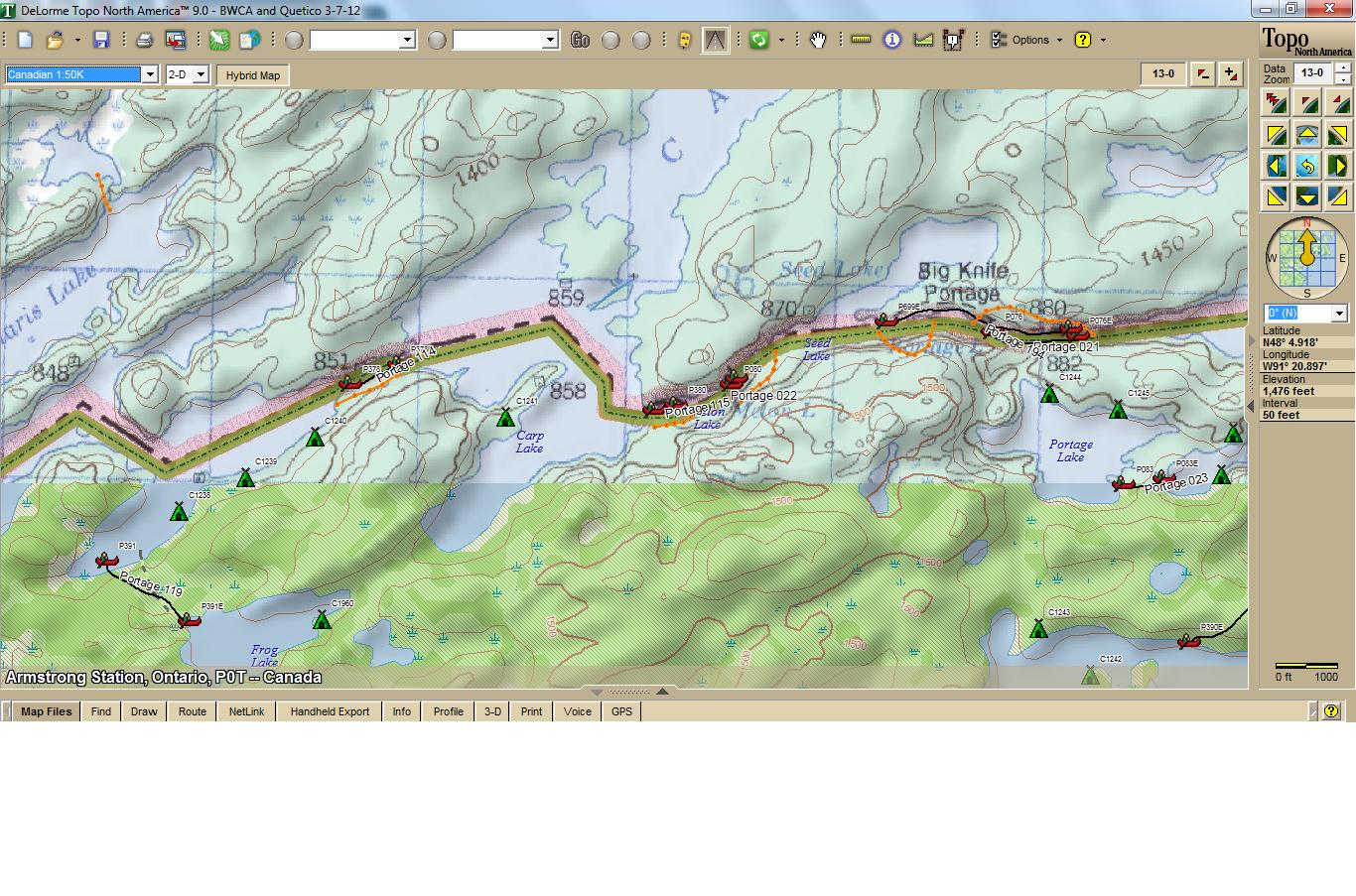
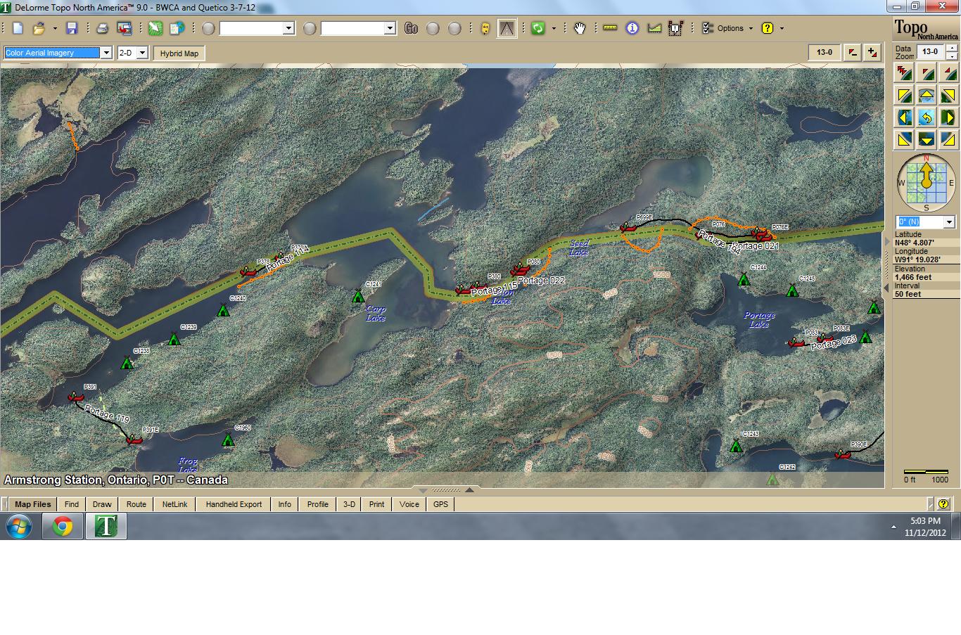

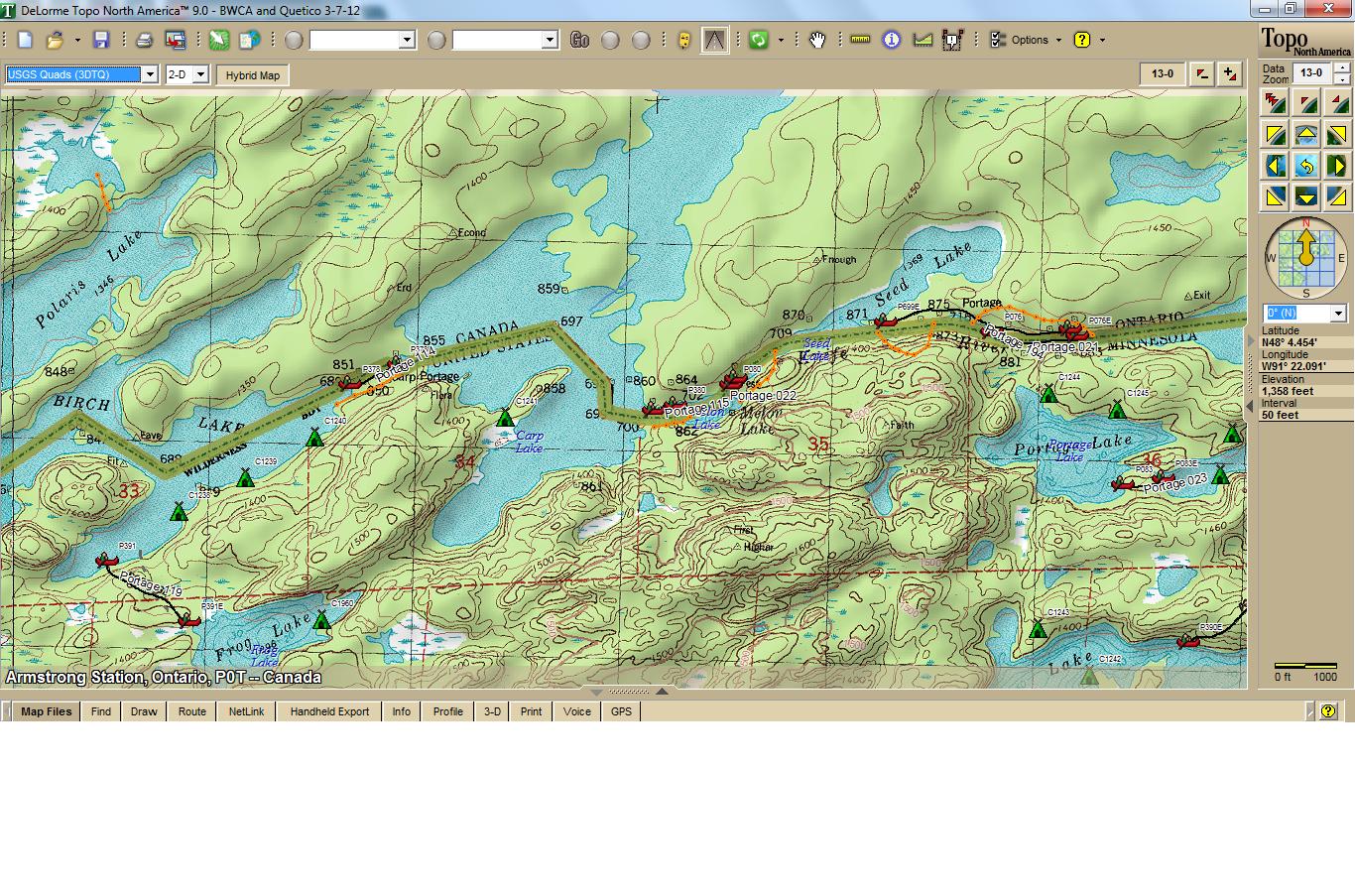
 These maps and more can be loaded onto the PN60 at the same time for display in the field.
You can also make a lot of adjustments in the printer setup and properties, to change the appearance of the maps you print.
Your PN60 and mapping software that came with it will certainly do the job for you, with a bit of effort on your part.
If you chose "dumping the PN60 and buying a Garmin", let me know, I'd like another for my own use.
butthead