Quetico August 2008
by Ho Ho
Day 8 (August 22, 2008): Campsite - Crooked Lake (Gardner Bay) - Portage - Crooked Lake (main body) - Campsite - close to 8 miles altogether (plus an afternoon paddle in Moose Bay): 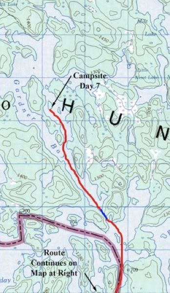

A few drops of rain started falling just as we were getting up at our Gardner Bay campsite on the second-to-last morning of our trip. We draped the rainfly loosely over the tent and put up the tarp - 
Some nice rocks rose up right behind the tent/tarp area. The moss and pine needles look like yummy pink frosting in this picture - 
With or without pink frosting, it was a grey morning - 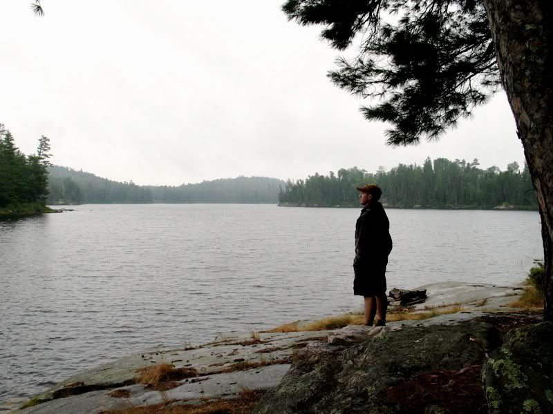
Fortunately, I like grey mornings. We didn't have far to go today and we would cross only one easy portage, so we lazed around camp a long time. There's a flat rock where we stopped for lunch in 2004 on the west side of the island the campsite is on. That's when we discovered this site. When the sun tried to break through the clouds in the mid-morning, we went over there and lounged for a bit - 
There was a bunch of deadfall covering the faint path between that rock and the main campsite, so on our way back to camp we cleared it aside. Then we finished packing up and hit the water about 11:00.
The south wind never stopped blowing overnight, but our campsite was largely sheltered from it by the big island that divides Gardner Bay. Now, as we paddled toward the south end of that island, we could see combers moving up the main part of the bay. We stopped to put on our PFDs and strap down the packs. Then we headed out, angling toward the somewhat sheltered southwest shore of the bay. It was a workout - and an indication of what awaited us out on the main part of Crooked.
At the south end of the bay was the lone portage of the day, from Crooked Lake to Crooked Lake. The landing on the Gardner Bay side is a sandy beach that was protected from the south wind - 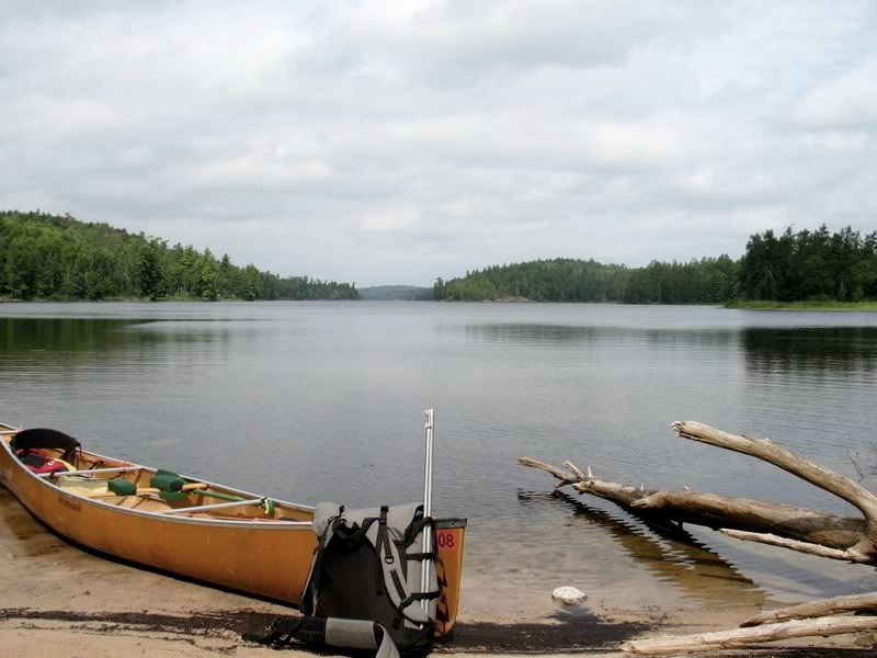
The portage goes up and over an easy sandy rise (a moraine?) dividing the two sections of Crooked Lake. At this point the sun was making another weak attempt to come out, the air was thick, and it was downright sultry as we portaged through the forest where the wind didn't penetrate.
At the far end of the portage, though, the wind was back with a vengeance and cooled things way down - 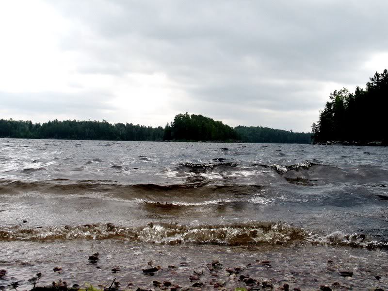
We paddled into the wind funneling up the north-south channel of Crooked Lake on our way to Moose Bay, where we planned to camp. I had never been to this part of Crooked, and it really is spectacular. The irregular shoreline and islands provided some havens from the wind where we could pause and take in the scene. So we charted our southbound course looking for islands and points to hide behind along the way. The very white sky made for poor photography as we passed through this beautiful area, so we have to rely on our memories of how wonderful it was to be there in the flesh. Here's one shot - 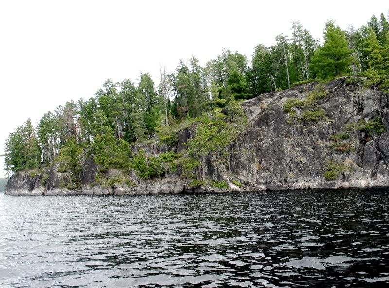
On top of the headwind, this part of Crooked Lake has a very noticeable current in some of the shallower narrows, which we were working against. We would be paddling along, and all of the sudden there would be a lot less resistance against the power blade of the paddle - and so a lot less power. With the wind funneling through the cliffs, there were a few spots when we were paddling into the upstream current where our forward velocity went into a serious nosedive. But we kept moving - and in the right direction, too.
After one of those narrows, we came into Wednesday Bay. We crossed over to the southeast shore and paddled along it for about a mile out of the wind. We’d been expecting to see people after we crossed the portage and started paddling along the border. But we hadn't seen a sign of anyone anywhere, even at a number of well-located campsites on the American side. The only people we had seen since we were drinking coffee on Baird Lake four mornings ago was the father-son duo we briefly encountered portaging into McIntyre Lake. Had the rest of the human race just vanished while we were out on our trip?
Our first sign that other people might still exist came in the form of a lone tent at a campsite just east of Wednesday Bay. We were now approaching Table Rock, and I hoped the site there might be empty so we could stop at that historic spot for lunch. No such luck. There were Actual Real Live People there. Two of them were out fishing in an apparently anchored canoe. It was kind of surreal seeing them stationary there as the wind whipped all around.
We exchanged a friendly greeting, rounded the point, and were suddenly back in the wind ourselves. We decided to keep going to Moose Bay before stopping for lunch. In another narrows further south, we passed three guys in solo canoes playing in the wind and current. They looked like experts and made us feel like rank amateurs as we made our way south.
Not too long after that we came to the mouth of Moose Bay. This seemed like the best place to camp on the Canadian side of Crooked for our Mudro exit the next day. There are a couple Quetico campsites closer to Lower Basswood Falls, but we thought the likelihood of them being open was too uncertain to keep going. Moose Bay also looked like it would be a little more secluded from the (comparatively) heavily used American side.
We checked out the first campsite, just at the mouth of the bay. We liked it and decided to call it home for the night. It was only 2:00 in the afternoon, so even with the wind, it took us about three hours to paddle and portage the eight or so miles from last night's campsite to this one. Though it was a short day of paddling, we were glad we did not have to go a lot farther into the wind today. David was right when he advocated going past Ted Lake and on to Gardner Bay yesterday.
Our new campsite lay on the north side of the point that forms a narrows into Moose Bay. It's not a big point, but it has a large, level, flat area where you could put a large group. The view from that area looks north through more narrows into the main part of Moose Bay - 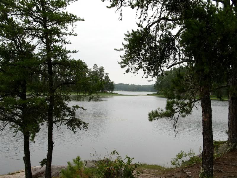
To the west lies a narrow channel connecting the bay to the main part of Crooked Lake - 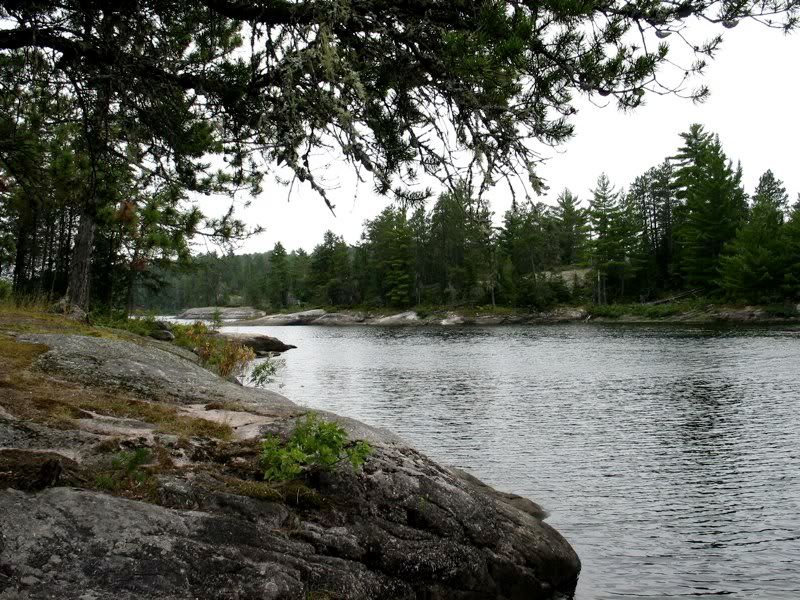
A couple paths lead the short distance from the tent area through some trees to the south side of the point, with a view down the main part of the lake. With binoculars we could see an occupied BW campsite a little more than a mile away, and the Crooked Lake pictograph cliffs in the distance beyond. The United States is on the right and Canada on the left - 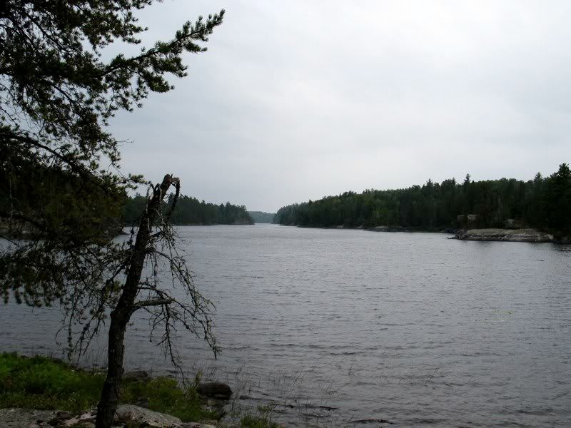
We had lunch, went for a swim, and set up camp. It felt like a storm was in the air, so we put the tarp up and the rainfly on the tent. Then we went for a little paddle to explore the main part of Moose Bay. We followed the marshy shore along the west side of the bay toward the entry to the Tuck River, which I wanted to explore. But a light rain started falling as we were heading in that direction. After prepping our campsite for rain, we neglected to bring our raincoats along for our paddle. By the time we reached the mouth of the Tuck River, it was raining for real. So we turned around and headed directly into the wind and rain back to our campsite. By the time we got back we were pretty wet. We dug out some dry clothes and hung our wet ones under the tarp, where the wind dried them out fast.
Later, in the early evening as we were cooking dinner, we were startled when a dog barked nearby to the south. We went to the south-facing side of our point to investigate and saw two guys with a dog unloading their canoe on the island just on the U.S. side of the border at the mouth of the bay. Our map showed no BW campsite on that island. It seemed like they were going to bivouac up on a cliff there. I'm not sure they even set up a tent - which was pretty gutsy, because thunder was starting to boom just over the western horizon. The dog yapped off and on the rest of the evening. It sounded as close as the next-door neighbor's dog in the city. By wilderness standards, they were even closer than next-door (even if across the international boundary). This was the only night of our trip we could see or hear other campers.
By the time we were finished with dinner, the storm was upon us, with crashing thunder, strong winds, and pouring rain. We enjoyed it from under the tarp - 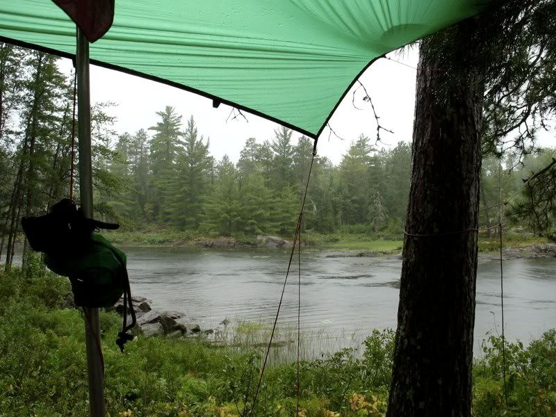
Eventually the storm passed. And then the clouds started breaking up in the west just as the sun was going down, creating perfect conditions for a colorful sunset - 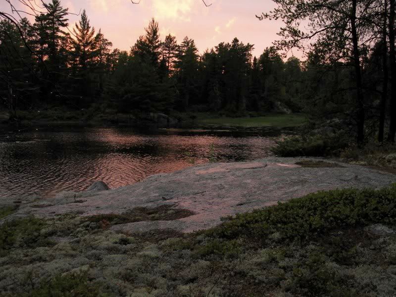
Electric sky - 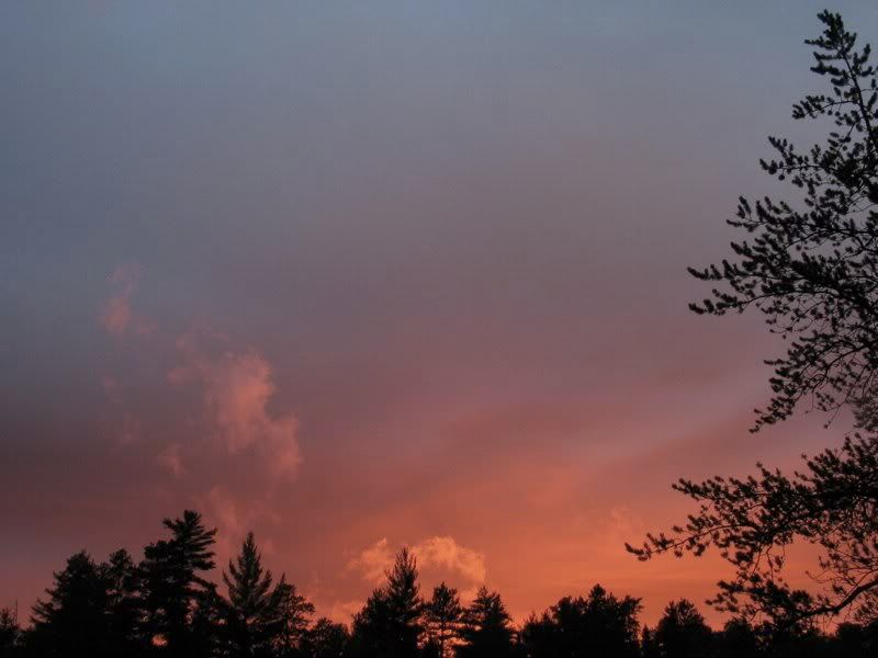
The rain-soaked rocks and lichens reflected the red glow - 
The colors deepened and lingered as it grew darker - 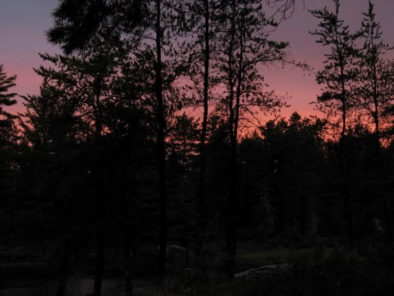
After the sun set, we poured ourselves the last of our Maker's Mark and kicked back on the rocks overlooking the border stretching to our south. A Common Nighthawk and some kind of bat swooped low over the water in front of us, scooping up the insects forced down by the storm. I've never seen a Nighthawk so close to the ground. As we finished our whiskey, all grew quiet (except for an occasional yap from the nearby island) - 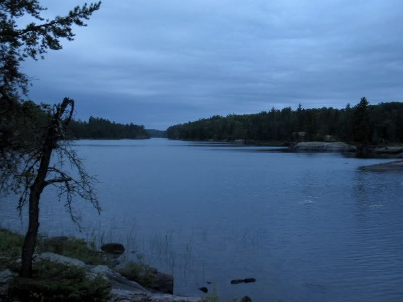
The sky was clearing as we headed to the tent. We removed the fly and slept one last night with a view of the stars in the Canadian border wilderness.
 Donate - BWCA.com