Quetico 2011
by Ho Ho
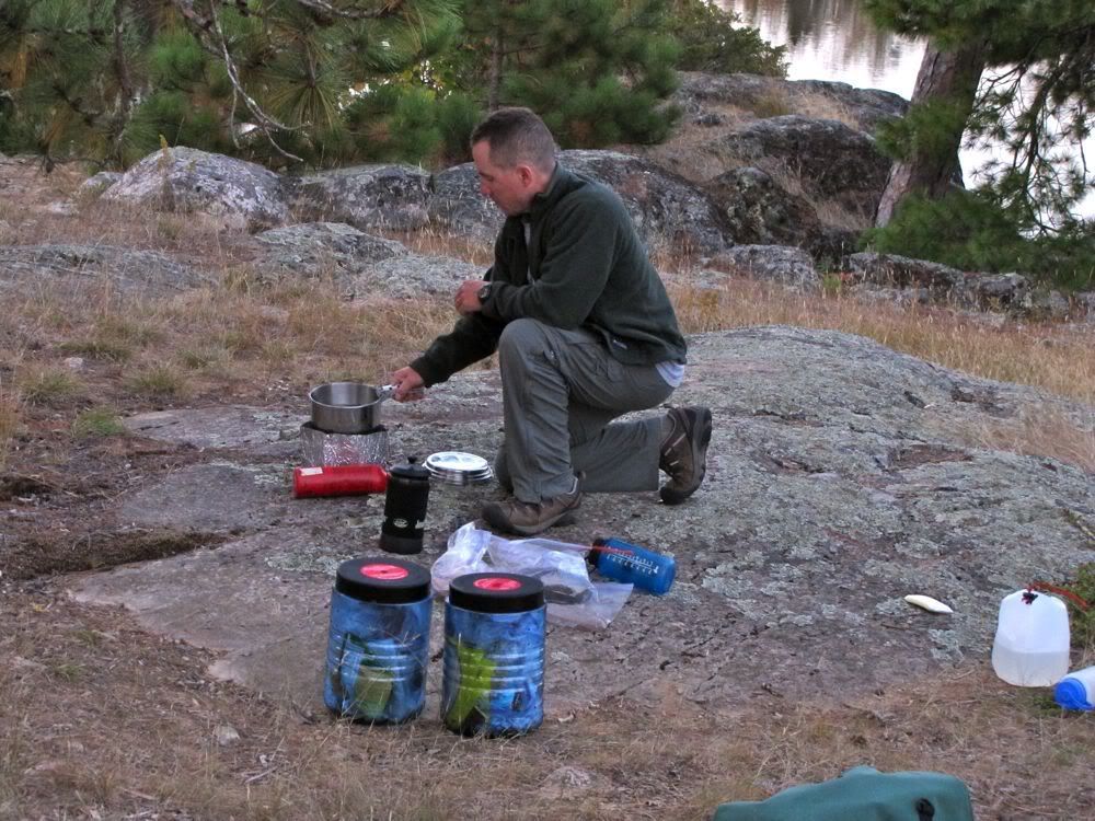
I woke up around 5:30 at our Saganagons cliffside campsite, with the setting moon glowing through the trees on the west side of our island. After about 15 minutes lying in the tent, I got up and started coffee. It was still dark and I needed a flashlight to light the stove. The falls were rumbling faintly in the distance to the northwest. And southbound geese were honking high overhead. I wondered if the geese knew something we did not, and a change in the weather from summery to autumnal was coming our way.
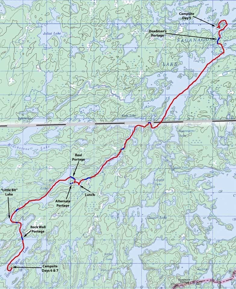
About an hour after I got up, a pre-sunrise pastel sky framed the view from our cliff -
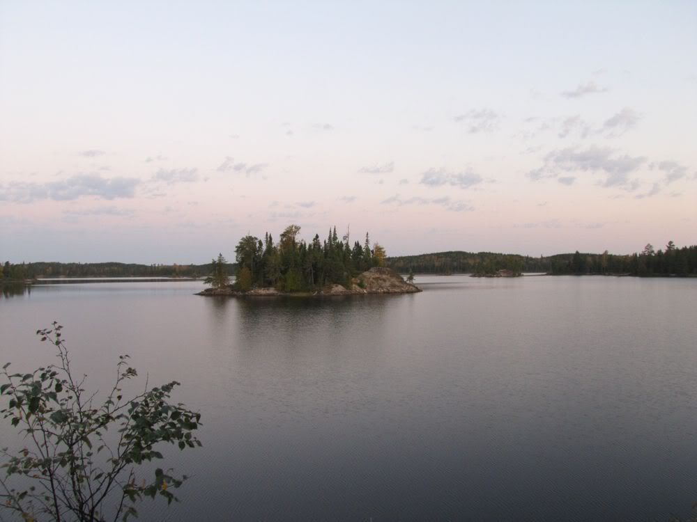
The birches and water posed for an abstract composition -
Our neighbors across the way got up as I was making the second pot of coffee -
The morning warmed quickly. But we had shade at our site, and a cooling breeze was blowing from the northwest. The haze of dawn cleared into a cloudless blue sky as we packed up to go -
We left our camp about 9:45 and headed for Deadman's Portage, which connects the north and south arms of Saganagons Lake and thereby obviates the need for miles of extra paddling around Boundary Point to the east. Our various maps were all in agreement that the most direct route to Deadman's was to circle to the south side of our little campsite island and then head due south into the portage bay. But when we circled the island we came up against a narrow strip of land where there should be open water. All the islands in this area make map reading a bit confusing, so I figured we were in the wrong place, and ended up circling around the big island to our east before finally finding my way into the portage bay.
David decided this was a good time to mock my navigation skills, which I didn't think was all that fair from someone who likes to paddle mindlessly in the bow while I do the navigating and steering. So I was pretty pleased a few months after we were home when I was looking at Google Earth and saw that there is an isthmus connecting the mainland to the bigger "island" that was east of our campsite. That isthmus is not shown on the maps -
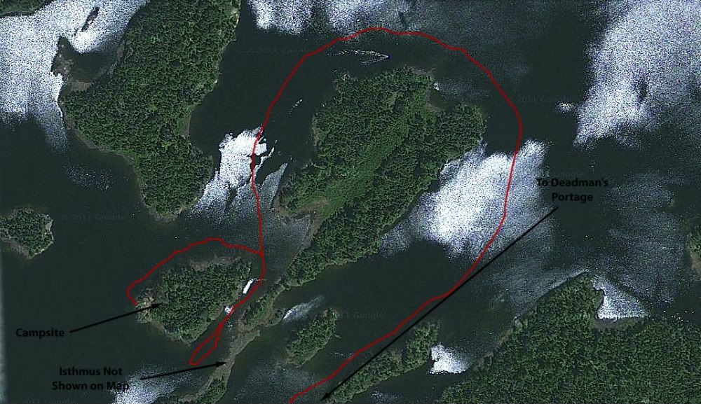
Probably you can just paddle over this narrow strip of land in higher water. And no doubt we could have easily dragged or lifted the canoe over it on this trip. The problem was that the map did not match the land, which confuses the navigator. And really, thinking back on it, David is the one who should have identified the problem, seeing as how he photographed this little isthmus from several angles the evening before (see, e.g., the fourth to last photo on Day 5). So as a canoeist, as a navigator, and especially as a lawyer, I feel retroactively vindicated.
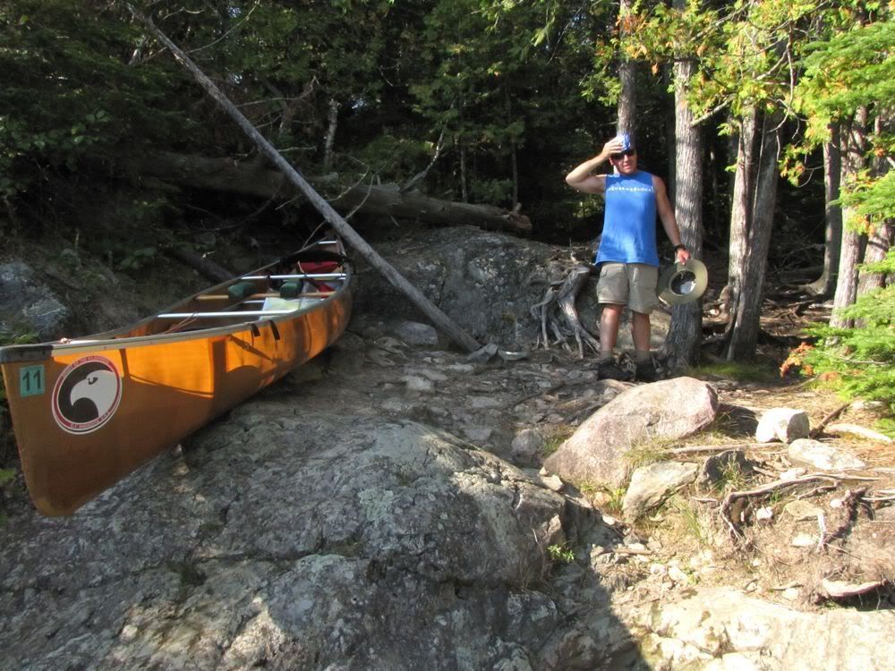
With that minor mishap behind us, we soon arrived at the north terminus of Deadman's Portage. I'm not sure why it's called Deadman's. I do know that I almost killed myself here in 2003, when I slipped on a smooth granite booby trap while carrying a heavy pack. So I watched my step as I carried the canoe across today.
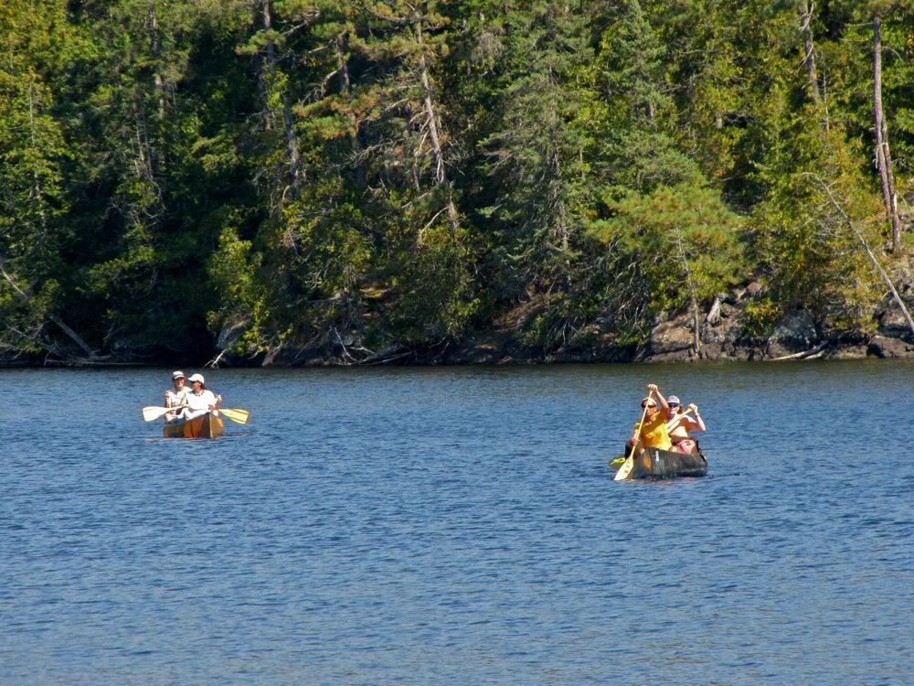
Having made the first carry injury-free, we returned to the start of the portage to get our other two packs. There we were greeted by the sight of our neighbors from last night paddling toward us -
We exchanged pleasantries with the women when they landed, then we headed off with our packs for another safe crossing to the other end of Deadman's. As we were loading up the canoe, the women also came across with their first load of gear. One of them stayed behind, and I noticed she was wearing a cap from an Ely-area camp. I asked about that, and we soon discovered that we were neighbors and had acquaintances in common. She and David had even talked on the phone one time. And the other three women were from Elyland too. They were heading in our direction (though fortunately not planning to vie for the island site on Other Man Lake, where we hoped to stay tonight), so we would probably see more of them later in the day.
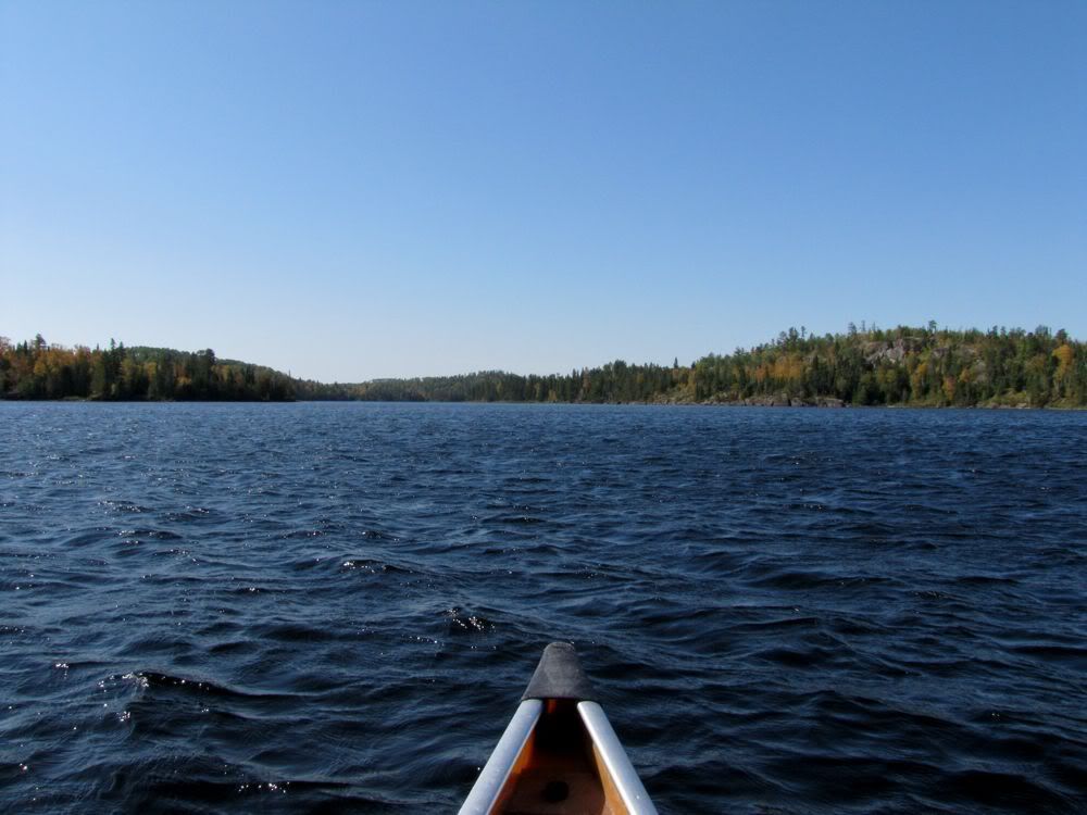
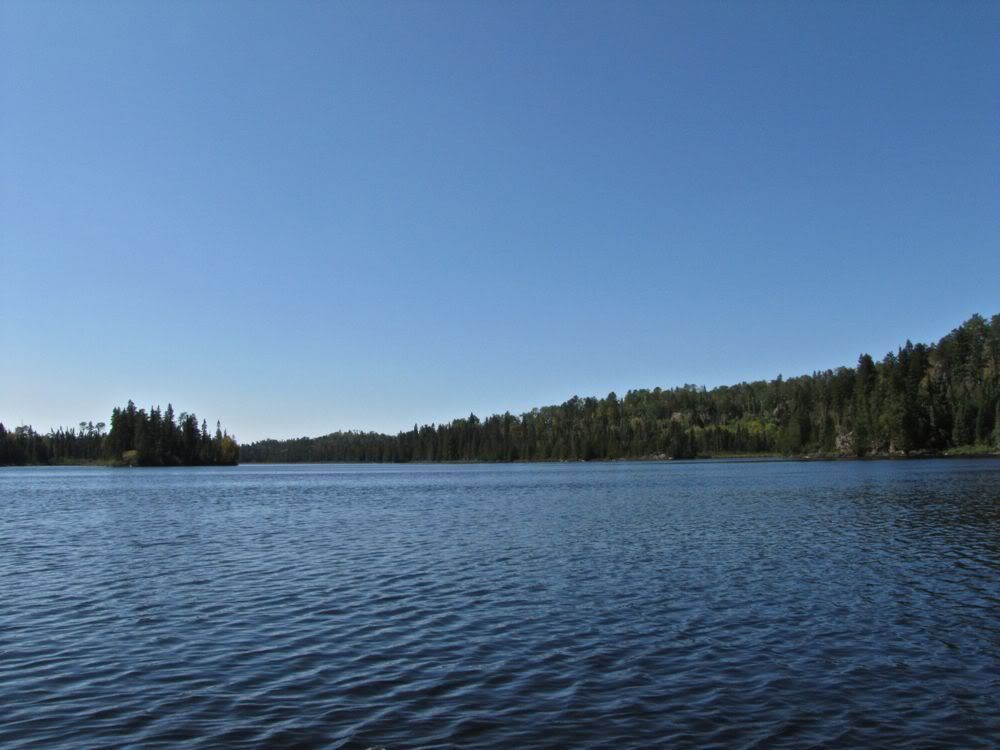
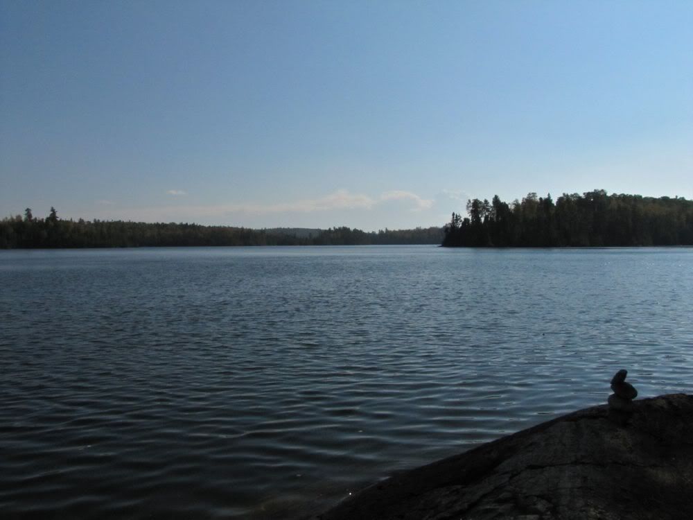
With that we headed out and down Saganagons Lake, passing one occupied campsite on the way. A sturdy northwest wind was blowing from the right side of our bow, and the yellows of fall were noticeably brighter than they had been so far. It all added up to a sparkling scene as we coursed down the big lake -
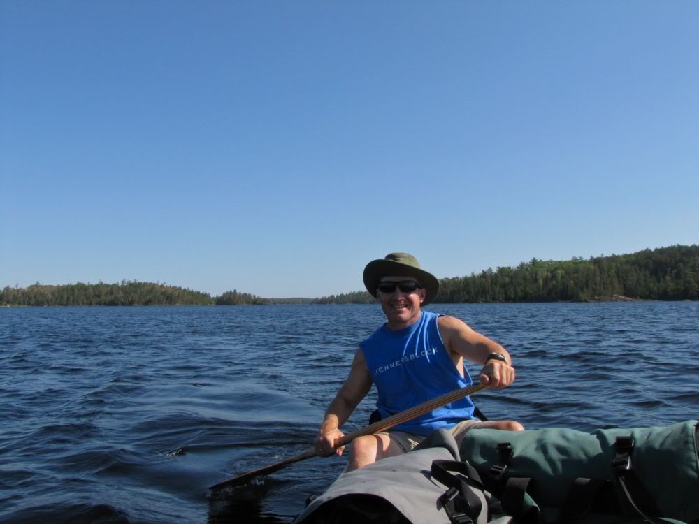
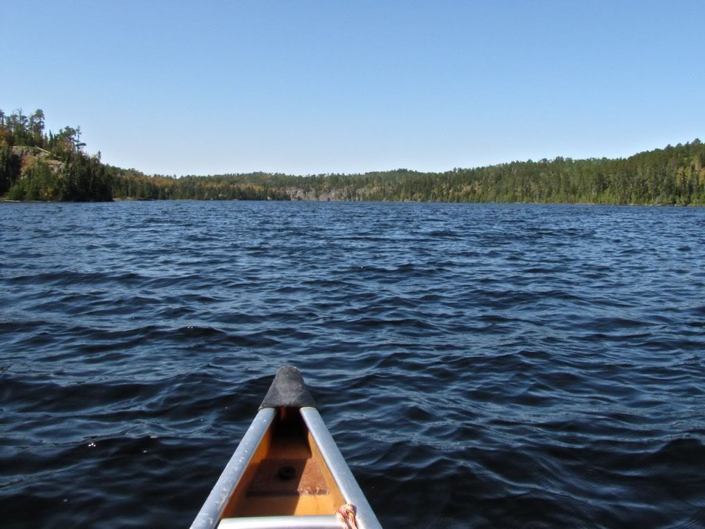
Your correspondent in the stern -
The south end of Saganagons divides into several long bays. We were aiming for the middle one, leading to the portage to Slate Lake and eventually to the Man Chain. Although we had traveled the Man Chain and Saganagons only two years before in 2009, our detour to Blackstone Lake on that trip meant that we had bypassed several lakes - Slate, Fran, and Unnamed - that we would go through today. We had gone through those lakes in the other direction in 2003, but I had little memory of them, so they were like new territory on this trip.
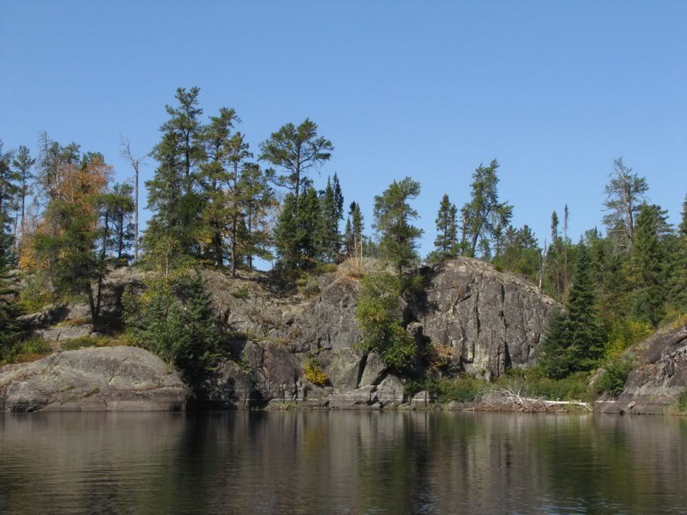
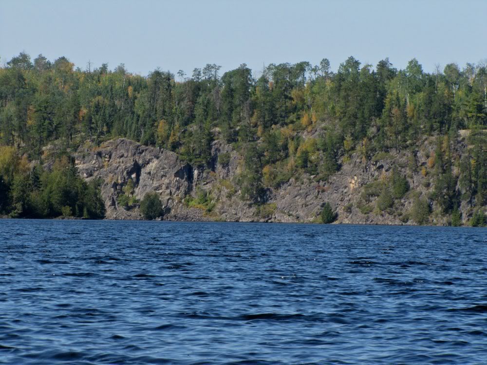
The bay leading to the Slate portage dead-ends into cliffs, with a secret channel on the right leading to the portage -
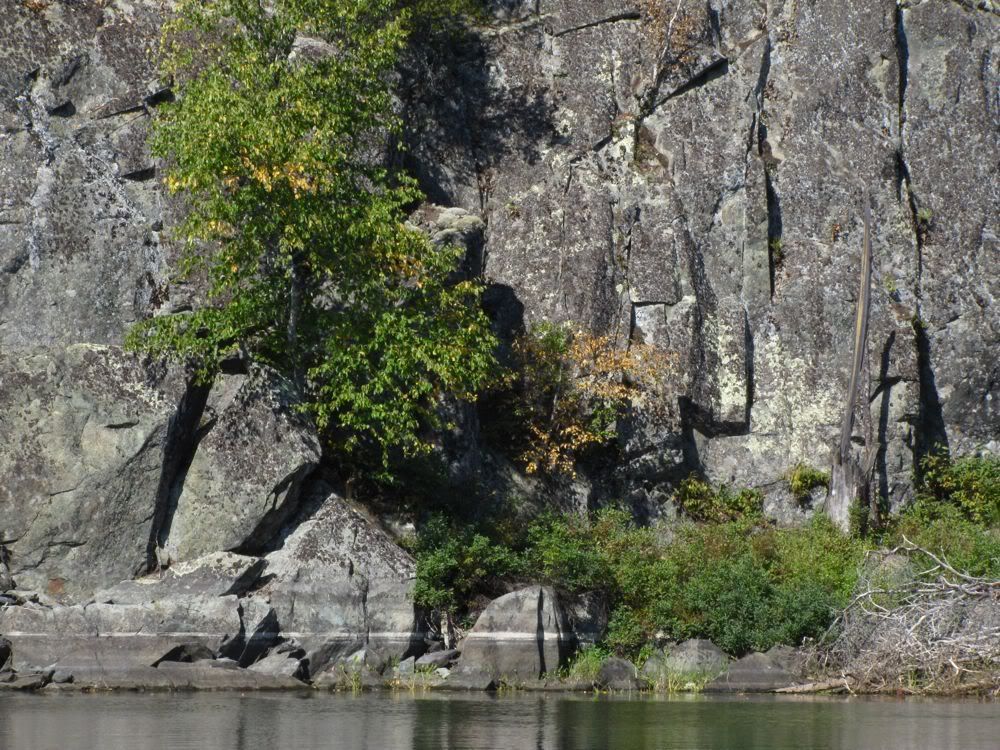
Cliff close-up -
We followed the secret channel and soon arrived at the portage, which is really just a lift up and over a rock dike between Saganagons and Slate. Looking back at Saganagons from the liftover -
We paused to eat some energy bars, and our neighbors caught up with us again. At this and the next few portages, we got to know the whole group - Brenda, Sue, Mary and Peggy. And so what had been a slight negative for us - having a group camped nearby last night - became a big positive - getting to meet a great group of women, who were our neighbors in Ely to boot.
Sue was navigating. She said I was making it easy for her, because they just had to follow us. "At least until I lead you astray," I joked. Mary wanted to go to Blackstone. But the others were looking for a somewhat easier day. No doubt about it, they were strong paddlers and portagers. But they'd been going hard for several days, and three of the four were looking for a little break. Blackstone is beautiful, we told them, but it's not an easy lake to get to. With only two nights left on their trip, we wouldn't do it.
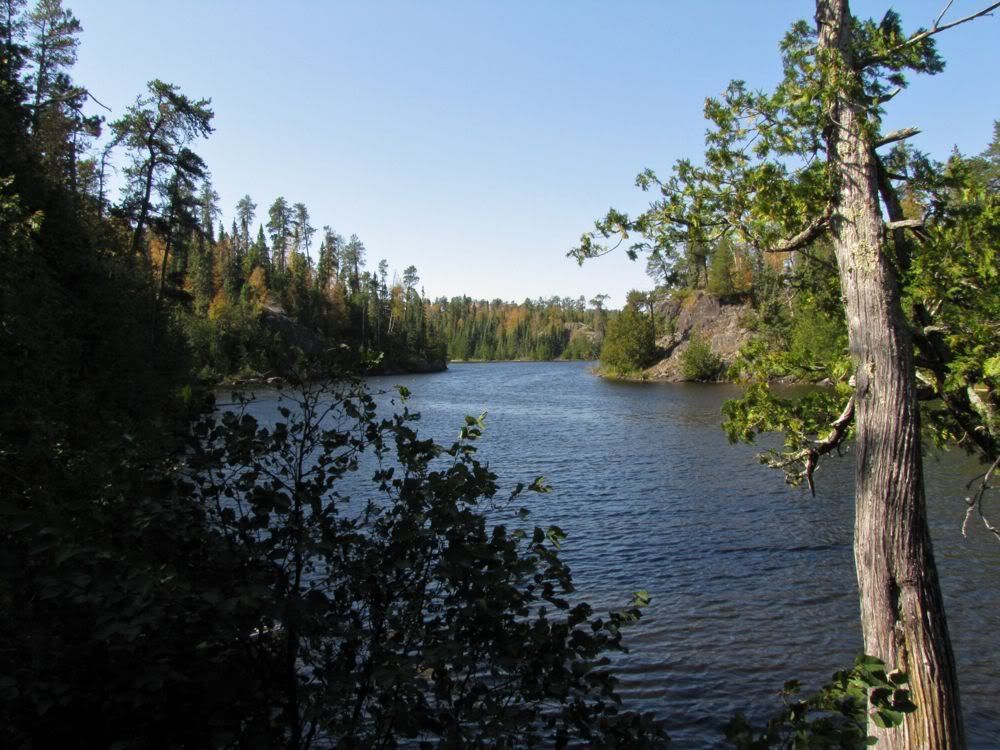
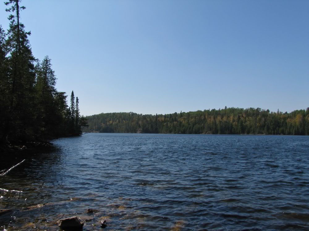
We pushed off ahead of them onto Slate Lake. A few strokes of the paddle brought us around a bend into the main part of the lake, with its steep shoreline in the distance -
Zooming in on the far end -
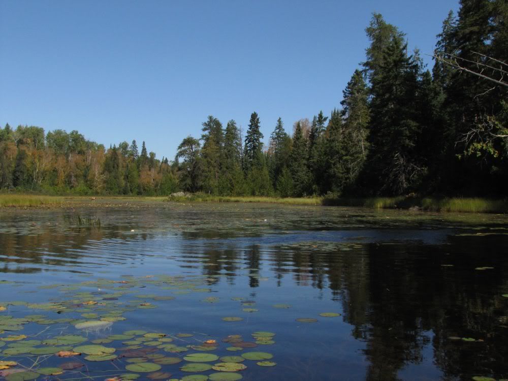
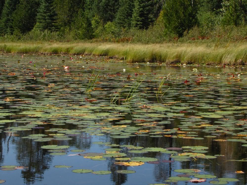
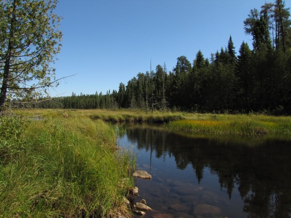
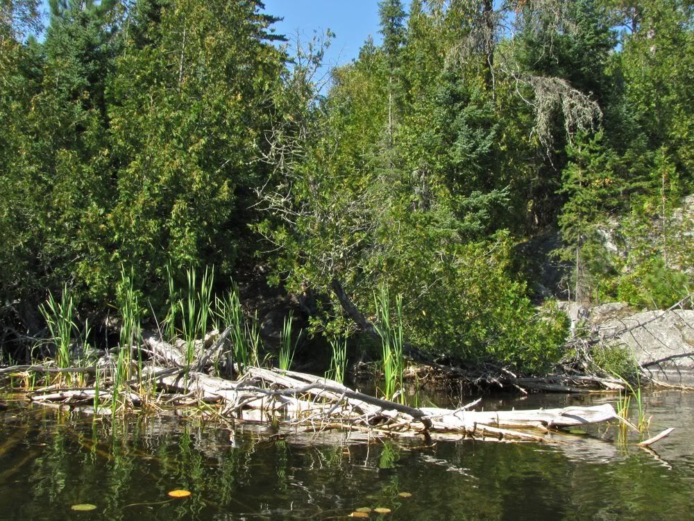
We weren't heading down to that end of the lake today, however, though I'd like to sometime. Instead we aimed south into a marshy arm of Slate that soon became a marshy creek connecting Slate to Fran Lake -
As this channel got progressively narrower, we got hung up on a hummock of muck that was very hard to escape from. We tried to get some leverage with our paddles. But they just sank three feet into the loon shit all around us. Somehow we managed to extricate ourselves and continued up the creek -
The women were right behind us when we got to the 5-rod liftover on the creek to Fran. Apparently they had decided to forgo Blackstone this trip. Since we didn't want to block the portage, we kept moving and were soon paddling up Fran Lake -
From Fran another marshy creek leads to the portage to Unnamed Lake. This time we did not get stuck. Looking back from the portage landing -
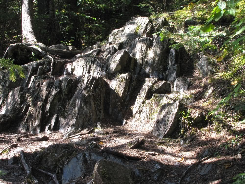
This portage was pretty memorable. Which was a little surprising, since I had no memory of it from our last trip through in 2003. It goes up quite a bit via jagged rock outcrops of the kind that are fun to climb with a canoe on your shoulders -
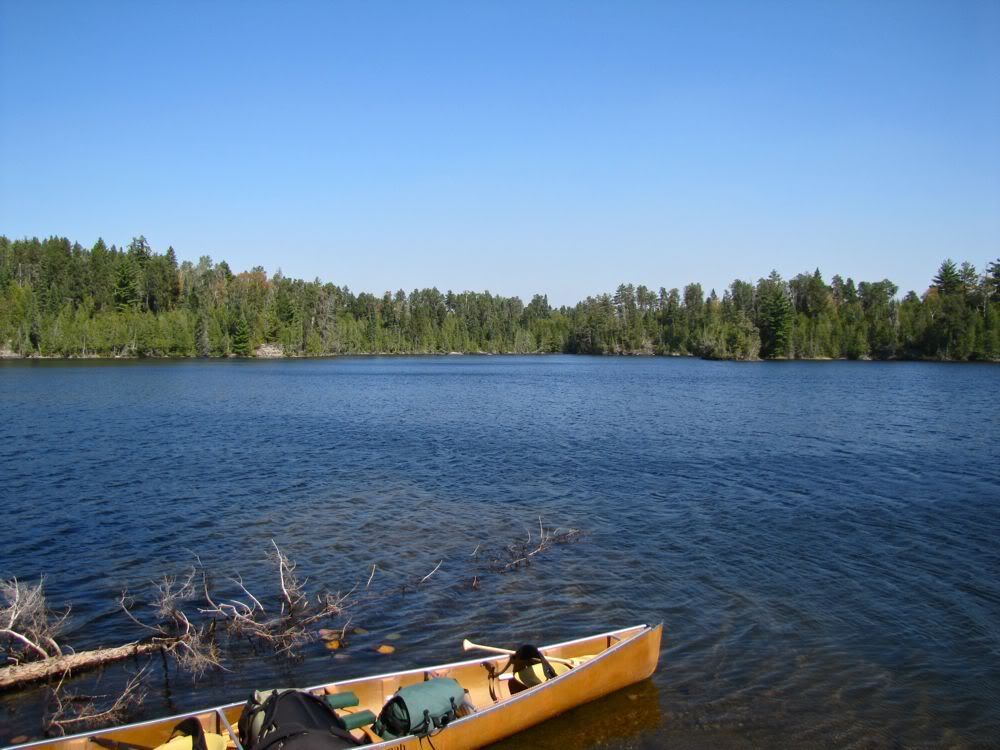
When we had finished this portage, it was around 1:30 and time for lunch. I had marked my map with a potential campsite on the south side of Unnamed. Though I doubted we would find an actual campsite there, these "legacy" sites are often pretty good for a lunch stop. We paddled over and found a nice area to spread out on a little point. This picture looks out from our lunch spot over Unnamed, with the portage from Fran in the center on the opposite shore -
The foursome that was following us didn't show up for a while, so we assumed they had stopped on Fran for lunch. We joked that since they were using us as their navigators, when they finally did come across the portage, they would head straight for us, thinking we were at the next portage into Bell. Sure enough, as we were finishing up lunch, the ladies arrived from Fran, loaded up, and made a bee line right in our direction -
Once they were close enough to communicate, we waved them down and signaled that the Bell portage was actually off to the left. Everyone laughed, and off they went toward the portage. We shoved off from our lunch spot a few minutes behind them.
During lunch David and I had talked about how the next portage figured in the book "Lost in the Wild," which recounts the true-life stories of two different young men who got seriously lost in Quetico and the Boundary Waters. One of the guys was a guide for the boy scout base on Moose Lake who fell and got a concussion searching for the portage we were headed for now. When the boy scout regained his very muddled consciousness, he wandered off into the woods, and . . . well, you'll have to read the book for the rest. The upshot is the book suggests this portage is hard to find - and that some bad stuff goes down if you mess up when looking for it. So I had taken a close look at the official park map and determined that the portage begins at the west end of Unnamed, where a creek flows in from Bell.
We were therefore surprised when we paddled part way there and found the gear of the women's contingent at a landing for a path that was not by the creek. A moment later, one of the women (Peggy, if I recall) came back down the trail and we talked about the situation. She had read "Lost in the Wild" too. And she said that even though this trail was pretty clear, it wasn't as clear as you would expect, and it was a lot longer then the few rods the real portage should be. So she didn't like the situation at all, and was going to wait for her compatriots to return before completing this carry with a heavy pack or canoe.
Based on that report, we thought we should look further to see if the real portage was in fact down by the creek. If we didn't come back and Peggy's group had problems with this path, they could follow us.
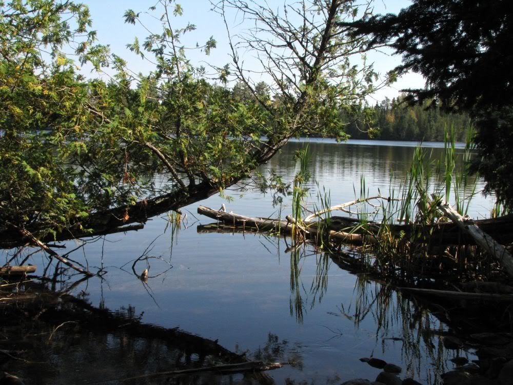
After a minute's paddle we came to the creek. But a trail was nowhere to be seen. Still we thought the real portage must be here. And then we saw it - a dark tunnel, secreted behind deadfall in the water and an arcing cedar jutting out from shore -
We maneuvered around the obstacles and got out on land. This is the view back out toward the lake -
Still cognizant of "Lost in the Wild," I thought we should quickly scout the trail before carrying our gear across. Sure enough, it was just a few rods on a well-trodden path parallel to the creek before we arrived at Bell Lake -
The landing at the Bell Lake end is easy to spot, which explained why we had no trouble finding this portage going the other way in 2003. We carried our gear across and started our paddle westward on sinuous Bell. Soon enough we came upon our friends enjoying a swim off a beautiful cliffy campsite. They made it through just fine, though on a much more difficult path.
Three more portages separated us from our own planned campsite on Other Man Lake. We were now back to truly familiar territory, having come through here in the opposite direction just two years ago in 2009 before veering off Bell to Blackstone Lake. We made fast time down Bell, despite a squirrelly wind that could not decide exactly where it was coming from, other than that it would be no help to us.
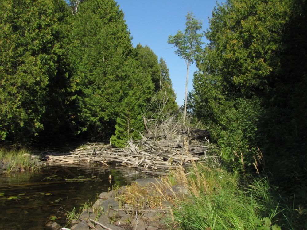
The portage out of Bell, like many in the Man Chain, is a pleasant carry through a creek-side cedar glen. At its far end, we came to the lake I now call "Little Bit." The portage emerges at Little Bit next to a logjam of weathered dead cedars piled up at the outlet creek -
We had camped on Little Bit back in 2003, at a small site that I do not particularly recommend. At that time we thought the lake where our campsite was located was part of bigger Bit Lake, which sprawls out to the west, and which we could see from our camp through picturesque narrows. Then when we came through again in 2009, we decided to paddle through the narrows to explore the main part of Bit. That's when we discovered the "narrows" was really land with a creek flowing between two separate lakes. The real Bit Lake was on the other side, and the little lake where we had camped in 2003 was unnamed. At first I dubbed it "the Lake Formerly Known as Bit." Now I've settled on "Little Bit" as an apt name.
The real Bit Lake looked pretty dramatic from the "narrows" in 2009. And even though the main canoe route goes through Little Bit, Bit Lake itself is not on any route. It's nearby yet remote, and thus very inviting. But in 2009 we decided not to carry our canoe along the short deadfall-strewn creek and to save Bit Lake for another trip. Now we were hoping to explore it during a layover day tomorrow. But first we had to get to our planned layover camp on Other Man Lake.
So we quickly arced across Little Bit to the next portage, a short steep climb into another little Unnamed Lake. This Unnamed seems to be a haven for ducks - we always see some winging overhead when we're there, as we did passing through today. David and I were both surprised, though, at how shallow Unnamed got as we approached the last portage of the day to Other Man. We paddled a good distance with the mucky bottom just an inch or so under our hull. Was the water a lot lower than usual, or had we just failed to notice how shallow this section is before?
With the muck lurking right beneath us, I was happy when we made it to the portage - 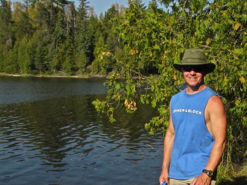
I call (or used to call) this portage the "Rock Wall Portage." From Unnamed Lake it goes straight up a loose rocky gravelly slope to a huge high slab of granite - the rock wall. You traverse that wall a bit, then descend to a path of bottomless muskeg. After somehow crossing the muskeg still alive, you come to a few rods of normal portage path, which shortly delivers you to Other Man Lake.
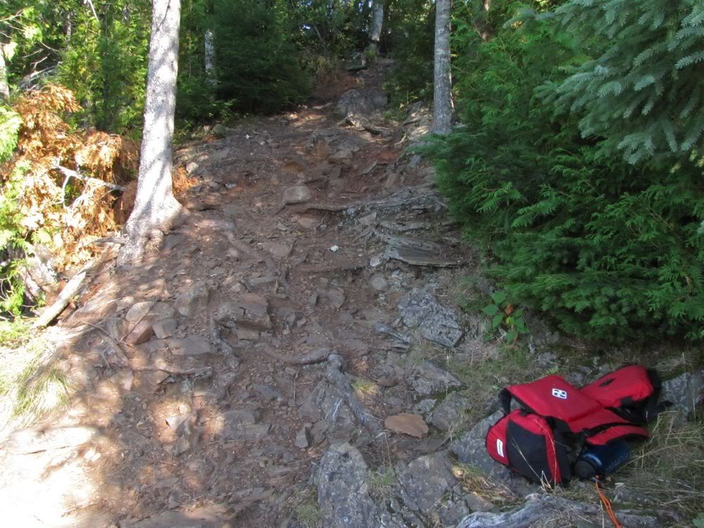
At least that's how it used to go. Now you still start out going up a loose rocky gravelly slope from Unnamed -
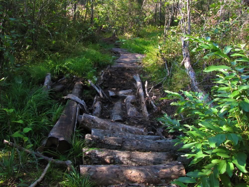
But before your reach the top, they've cut a new path around - not over - the rock wall. And that new path around the rock wall deposits you at a lovely corduroy path through the muskeg. It might as well be paved -
I marveled in horror at these "improvements" as I carried the canoe across. The old portage was, of course, completely absurd. But its bark was worse than its bite, and I had grown to like it. I mean what's next, putting conveyor belts in to carry you across the portage?
I got so distracted with my curmudgeonly thoughts against this atrocity that I slipped on some of that fancy new corduroy and crumpled into a heap with the canoe on top of me, twisting my ankle as I went down. Point proved! That never happened to me on the old portage. Picking myself out of the mud, I determined that my ankle would probably be okay if I retied my boots extra tight for compression, and we continued on our way.
But the outrages were not over yet. At the Other Man end of the portage, the vandals had completed the desecration by cutting down some cedars they apparently thought were in the way. Now, don't get me wrong, some of those cedars were in the way. Problem is, they cut down the cedars that were not blocking the path, while leaving those that were. O the enormity! It was all I could do to mop my brow when I finally got to the end -
But at long last we had arrived at Other Man Lake. As we looked out over the lake, it dawned on us that the "clouds" in the distance must be the plume from Pagami Creek -
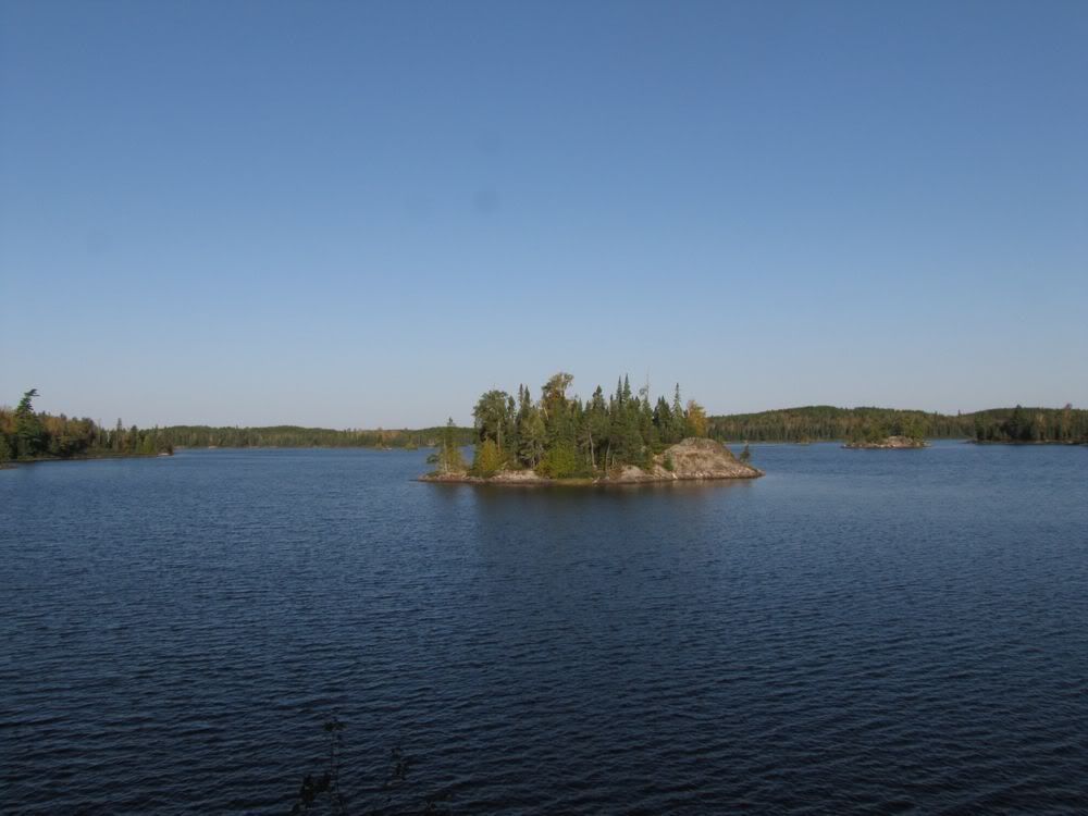
Our plan was to stay two nights on Other Man - assuming the great campsite on the big island where we had stayed in 2009 was open. Since it's a popular campsite among those who come this way, we crossed our fingers and hoped for the best.
We were in luck. Arriving about 4:45, we found our site free. Other Man Lake would be all ours.
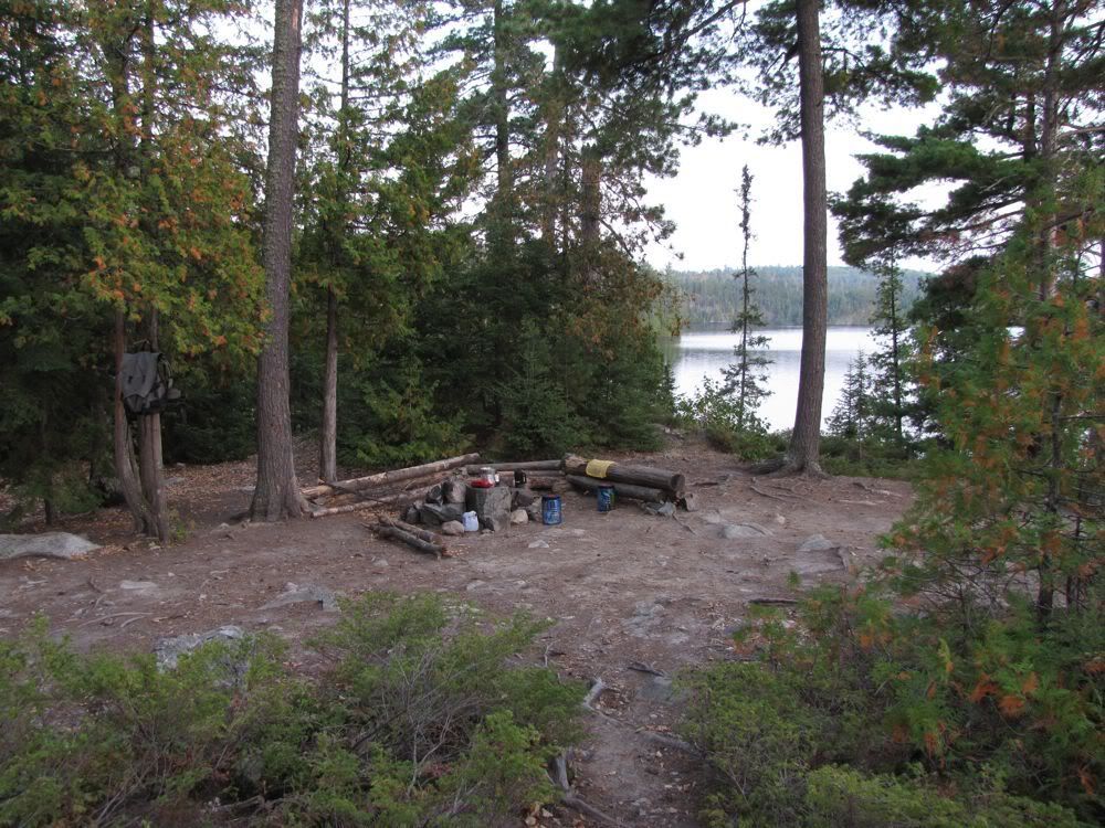
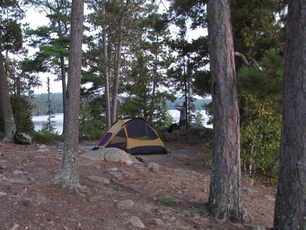
We went for a swim and then set up camp. The campsite is a little trampled, but it's big enough and far enough from any entry point that it's not as beaten down as last night's site on Saganagons and has lots of trees and other vegetation.
The kitchen zone -
The tent area -
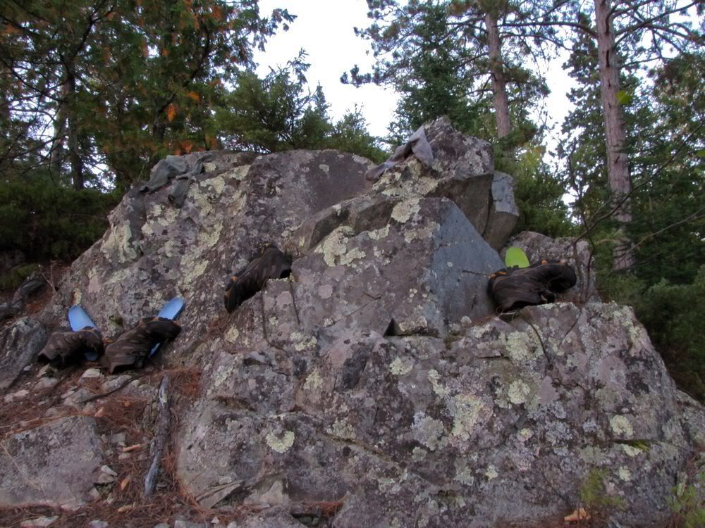
The rock for airing out socks and boots -
After dinner we sat with a little Maker's Mark up on the site's high cliff overlooking the lake. There was a passel of loons making a ruckus, an adult and a juvenile bald eagle soaring about, and a kingfisher rattling as it traveled along the shore - the same avian welcome crew that greeted us here in 2009.
We crawled into the tent early after our long day, then read until almost 10:00 before turning out the lights.
The wind had died down in the evening. But at 3:30 it kicked up again, and blew smoke in too. Half asleep, I wondered what tomorrow would bring.
 Donate - BWCA.com