Piwi Goes to Piwi
by Ho Ho
It was another warm morning when we got up at our Kahshahpiwi site. But at least it didn't seem warmer than the day before. Maybe the warming trend was abating. Some clouds had moved in overnight, and we enjoyed our morning coffee in shorts and tshirts -

We planned to spend two nights at this campsite and take a day trip up to Sark Lake during the day today. We had camped on Sark in 2003, when the lake gave me a strong sense of déjà vu, harking back to my teenage Quetico trips. Ever since, I had felt pulled back to Sark. We passed through it again a couple years ago on our Cutty Creek trip, but that time we wanted to take advantage of a south tailwind to put some miles behind us, so we paddled through Sark without any sightseeing. The plan today was to spend a little quality time there.
We secured our campsite and hit the water heading north on Kahshahpiwi around 10:00. As when we went through this area a few years ago on our Cutty Creek trip, today we had a strong tailwind from the south. But unlike the earlier trip, when we were not going to backtrack, today we were conscious of the fact that if the south wind kept blowing, we would be fighting it on the way back to our campsite in the afternoon.
We paused briefly at the short portage into Kiefer Lake next to tumbling Kahshahpiwi Creek. No late summer trip report would be complete without an aster photo, so we paused to take one here -

The south wind helped push us north on Kiefer. According to the GPS, we paddled 3.2 miles in about 42 minutes, which is a pretty decent speed for us. Kiefer is an interesting looking lake, with some cool cliffs at the north end. But rainclouds seemed to gathering as we passed through, so we didn't pause or take any pictures.
It was almost noon by the time we crossed the 65-rod portage and arrived at Sark. As we paddled into the lake, we caught sight of a tandem and a solo canoe disappearing behind one of the many islands in Sark's main basin. We thought it must be the father-and-sons group we met yesterday. They had mentioned they were heading in this direction and planning a layover, so it seemed likely they were camped here, and we thought we might see them when we paddled around later on.
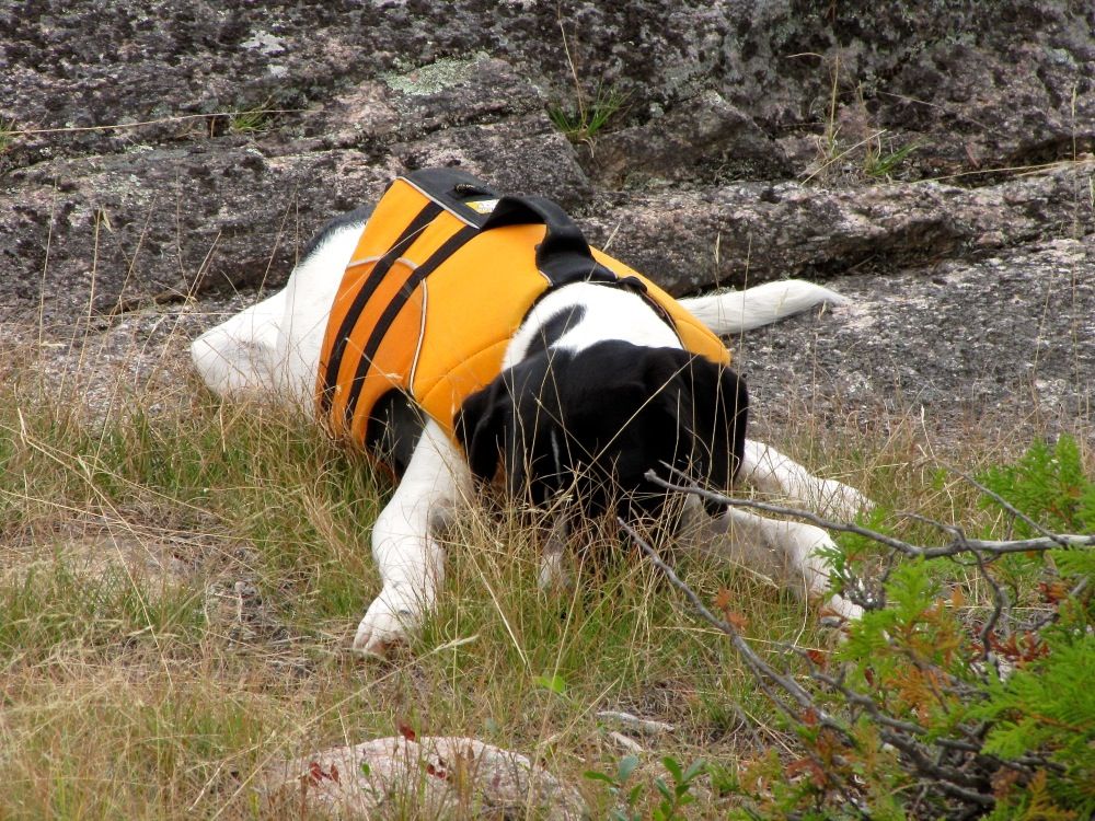
But now it was looking like it might storm. So we pulled up at a campsite on a rocky point out of the wind on the south side of the lake to eat lunch and wait out the weather. Piwi waited patiently while we ate our lunch (she had wolfed her own lunch down in 30 seconds) -
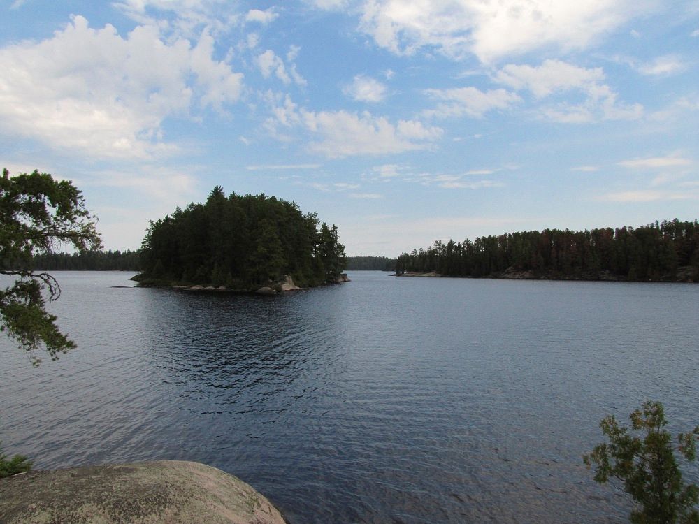
We lazed at our lunch site for a half hour while the front blew over without any real rain. Across the channel was an island where we camped in 2003. Since then a fire had burned much of the understory and some of the pine crowns on the island, making the site less inviting, but perhaps more interesting, to camp at now. In the picture below, the campsite is at the tip of the righthand island, and some of the burnt pine crowns are visible if you look closely -
After lunch we went a for a quick spin around a few of the islands in the lake before heading back to our campsite. I would have liked to have explored some back bays and things like that, but the unsettled weather and continuing south wind made it less inviting to linger before getting home. This seems like a common occurrence on day trips for me - I always feel a little anxiety when far from all our gear back at camp.
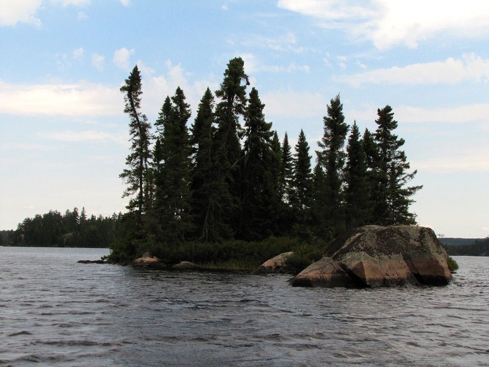
One of the many islets that dot Sark -
As we looped through the islands we thought we would see our friends from yesterday again. But they were nowhere around. It was almost like we had seen phantoms when we paddled into the lake. It remained an unsolved mystery as we portaged back into Kiefer and faced the south wind heading back to camp. The paddle back wasn't as bad as we feared, but (according to the GPS) it did take 10 minutes longer - and definitely more energy - to paddle south on Kiefer compared to our northbound trip in the morning.
When we portaged into Kahshahpiwi we took some time looking in its northern bay for a submerged dock we had heard about. We couldn't find a thing. Anyone know anything about this?
We got back to camp around 3:30 and went for a much-needed swim. We had traveled more than 15 miles on our little daytrip, and we were pretty worn out.
After lazing around a bit, we decided to explore our island. Piwi needed the exercise, as she had mostly been sitting in the canoe all day, with just a few one-way trips across the short portages. We bushwhacked through the woods to an open area at the south tip of the island -

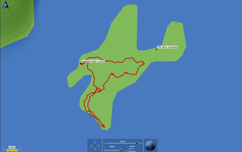
Then we tried to make our way to the other campsite across the island from ours. Just as we were getting to the isthmus leading to the site, we realized it was occupied. We were astonished there were campers so close by and we hadn't known it. Of course this is when Piwi decided to run ahead of us toward the other campsite. We managed to coax Piwi back without invading the camp, then crossed over the center ridge of the island back to our site.
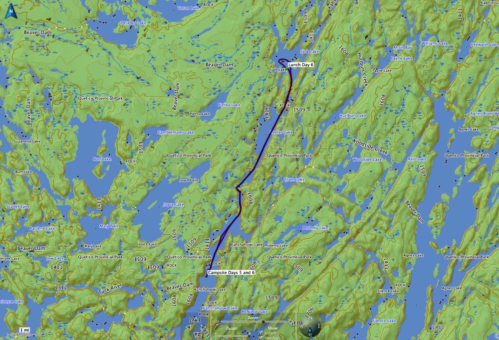
The GPS tracked our peregrinations -
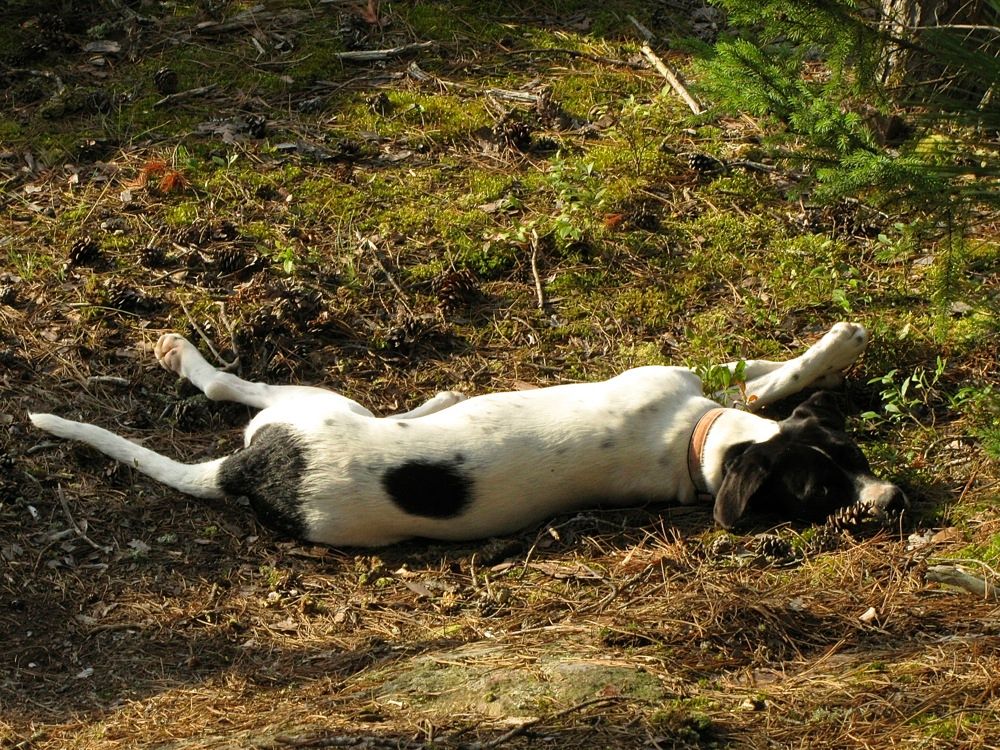
Back at camp we lazed around some more and went for another dip to cool off. The day had gotten pretty warm, probably around 80, and it was definitely hot when the sun peeked from behind the scattered clouds. Piwi took it easy for a while -
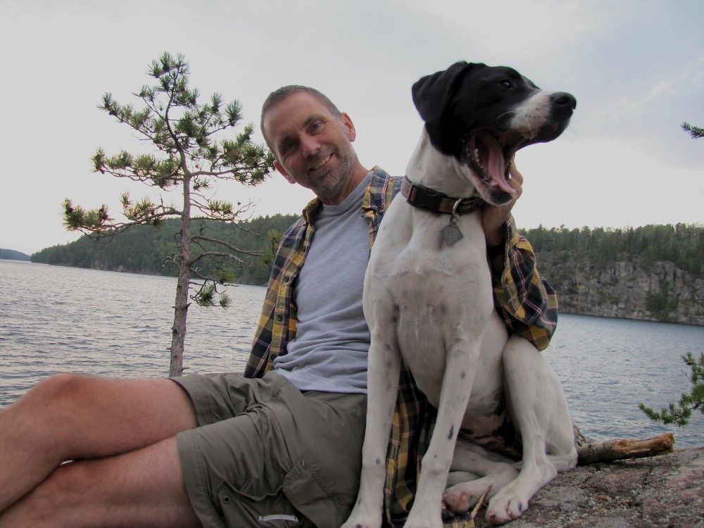
After dinner we spent some quality time on our favorite rock outcrop sipping Maker's Mark and hanging with the puppy. Piwi and David -
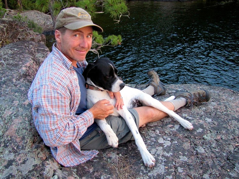
Ho Ho with Piwi pretending to be a lap dog again -
Then we were off to the tent for another good night's sleep in the wilderness.
Total distances traveled Day 6: 15.2 miles, plus 0.4 miles bushwhack hike on island.
 Donate - BWCA.com