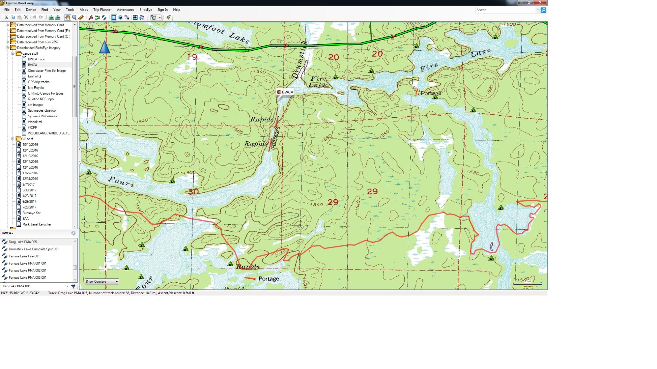
We are considering swinging north out of Lake 4 using what is labeled as Drumstick Creek to Fire Lake for a short stay this year. Looking at Drumstick from Google Maps aerial view makes it look like there's not enough water to paddle it. Anybody been up that creek?
Paddle that way about 15-18 years ago did the route twice and can't really remember a whole lot about it and that is also before the fires that hit that area. If you check the map section above it shows two portage's along that Creek a 24 and a 27 Rod Portage.
Went thru 2005, steep ravine 20+ foot high both sides. Easy portages. Google Earth shows no fire damage. The red line bottom 1/4 on map shows extent of Pagami Fire.
butthead
"never underestimate the power of stupid people in large groups" George Carlin
Thanks Tony, Butthead, and Armored. Did check the map. No fire damage there. Just worried that the creek appears so shallow and, in one spot, blocked by downed trees. Just wanted to make sure there was something to paddle on between those portages.
Help keep support this community and website with the many resources it provides and maintains.
Learn more
We use cookies to enhance your experience, for analytics, and to support 3rd party content and advertising providers. If you continue using this website, you agree to our privacy and legal agreement.
Ok