|
 Boundary Waters Quetico ForumQuetico ForumSturgeon Lake from Nym Entry
|
 Forum Sponsor

Author
Text
04/08/2014 09:42AM
Our crew of 3 is going in May 22nd through Nym Lake Entry point to Sturgeon Lake, 7 days, 6 nights. I am looking for advice on the loop to take in and out of Sturgeon. I see a western route through Jean, a straight route through Walter, and an Eastern Route through Pickerel Narrows. Which route would you recommend on the way in and the way out? We plan for 2 days 1 night on the way in, and the same on the way back. So, If you have a campsite recommendation for those overnight's as well that would be appreciated.
Reply
Reply with Quote
Print
Top
Bottom
Previous
Next
")


04/08/2014 11:51AM
Anyway you approach Sturgeon Lake is great in my opinion. It seems I've done several loop trips that have covered all of the three potential routes you're considering in-order to travel to and from Sturgeon Lake.
You could easily make it to Sturgeon Lake in two days and one night by going south through Batchewaung Lake, Batchewaung Bay, then hooking through the west end of Pickereal Lake. Proceed through Mariah Lake and then camp on Jesse Lake.
Then on Day #2 you could head south through Elizabeth, Walter, and Lonely Lake, and arrive on Sturgeon Lake the afternoon of Day #2. That would probably be the most efficient way to get to Sturgeon Lake. Then again, it depends what section of Sturgeon your aiming for.
You could return by traveling northeast through Sturgeon Lake and then up through Dore' Lake. After crossing Pine Portage, you'd travel towards Emerald Island and then turn 180-degrees, heading west back to Batchewaung and Nym Lakes.
Both in and out of Sturgeon Lake should be easily do-able in two days and one night traveling the aforementioned route. Obviously this can also be reversed. I'm assuming you're taking a few layover days, which would allow for day trips over to Chatterton Falls if the urge strikes you.
Otherwise, heading west out of Jesse Lake across "Cedar Portage" towards Oriana Lake, onto the east end of Quetico Lake, and eventually south through Conk, Jean, Burntside, Rouge and down to the southwest end of Sturgeon Lake is also a great route.
To return, you could travel the reverse of day #1, which I described at the beginning of this reply. That is, head north through Lonely, Walter, Elizabeth, Jesse....
If you traveled west out of Jesse Lake on Day #2, you'd travel across "Cedar Portage", which is either 133 rods or 140 rods, depending on what map you're referencing. The portages from that point on through Quetico Lake, Conk, Jean, Burntside, and Rouge, are short and easy, but "Cedar Portage" is really not a big deal either.
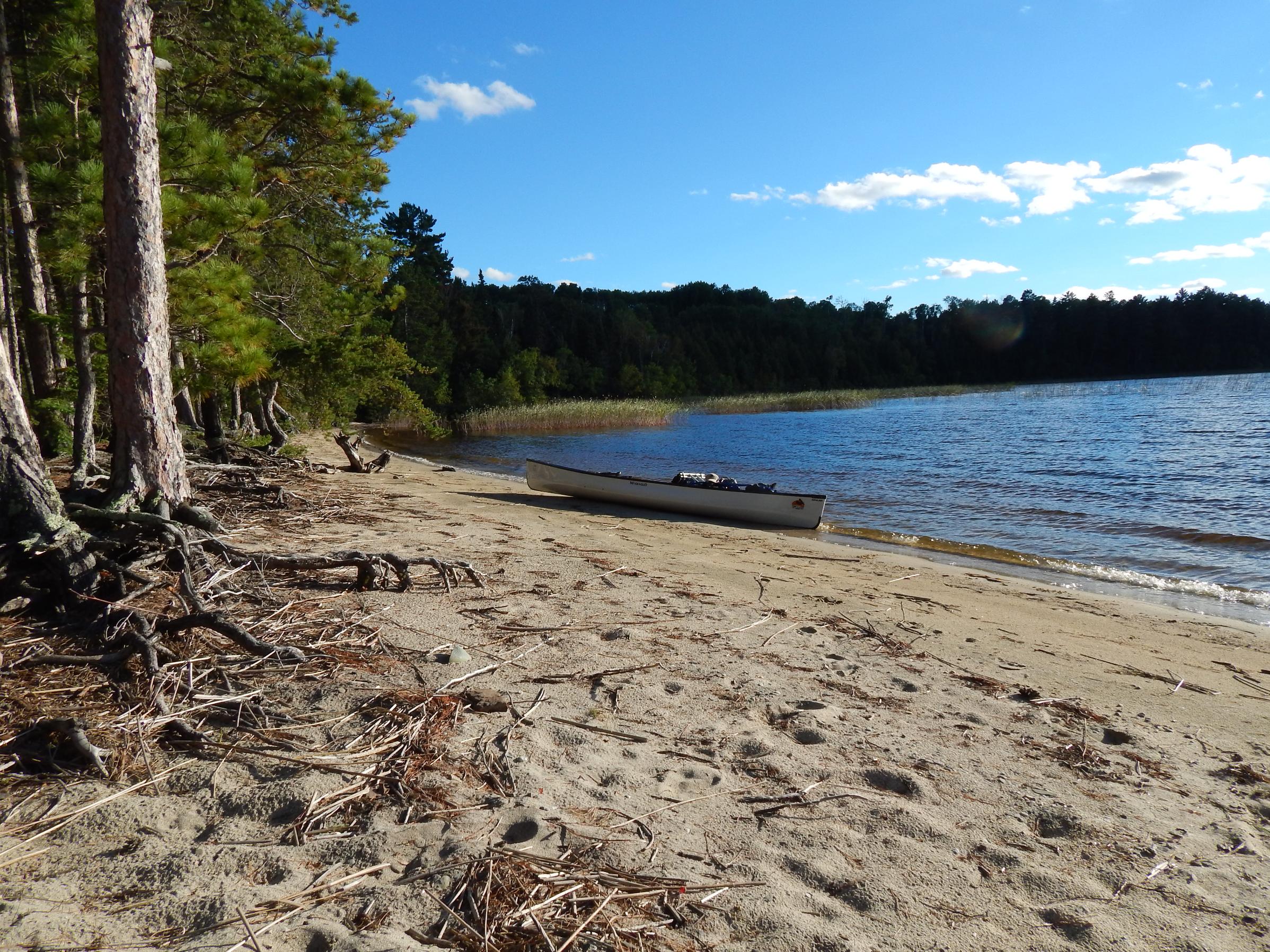
Jesse has several nice campsites to chose from. About mid-way the main body of Sturgeon Lake is a nice, large campsite with sandy beaches on the east shore. It's a popular destination, but it's Quetico in late May so you may have it all to yourself. (pictured below)
If you're ambitious and don't mind paddling long sections of Sturgeon Lake, you could skip the descent through Elizabeth, Walter and Lonely Lake and go through Jesse, Orianna, Quetico, Conk, Jean, Burntside, and Rouge to Sturgeon. Then, return through Sturgeon Lake to Dore' Lake, and eventually travel back to Batchewaung and Nym. That way, you would have covered most of Sturgeon Lake by trips end.
Hans Solo


Water reflects not only clouds and trees and cliffs, but all the infinite variations of mind and spirit we bring to it. – Sigurd Olson
04/08/2014 03:40PM
Good coverage by Hans . . . if going your "straight" way through Jesse, I'd try for site "PN" night one, then on to Sturgeon site "R9" (north of Scripture Island) on night 2. Of the 3 ways you've looked at going and coming, the one through upper Sturgeon/Dore/etc. is "less interesting" IMO, except for the creeky Deux Rivieres area. I would opt for in and out via the other 2 ways. Many good campsites in eastern end Quetico and on Jean Lake. Warning: Starting at Nym you should try TO get going early -- like at dawn -- winds on Nym and Batch can be brutal. (Speaking from personal experience.) Use your map and compass BEFORE leaving Nym put-in, heading for the Batch portage -- heading is S-SW/at about 210 degrees. (Photos: Batch, Jesse, Sturgeon, Jean) --Goose 


Soloing is sweet, but a good partner is "priceless."
04/08/2014 07:26PM
Also be aware that the Sturgeon Narrows flows west. Last year the current was not a big deal but it was noticeable just putzing around the east end of the narrows. Paddling the entire length going east will add a bit of extra work.
04/10/2014 08:00PM
quote OldGreyGoose: "Of the 3 ways you've looked at going and coming, the one through upper Sturgeon/Dore/etc. is "less interesting" IMO, except for the creeky Deux Rivieres area.
I would opt for in and out via the other 2 ways. Many good campsites in eastern end Quetico and on Jean Lake. Warning: Starting at Nym you should try TO get going early -- like at dawn -- winds on Nym and Batch can be brutal.
(Speaking from personal experience.) Use your map and compass BEFORE leaving Nym put-in, heading for the Batch portage -- heading is S-SW/at about 210 degrees."
I agree with Goose about the route through Sturgeon/Dore/etc. being less interesting. I don't know what it is, but the scenery from Sturgeon Narrows, up past Blueberry Island and on to Deux Rivieres is rather mundane. From Dore' Lake through Pine Portage Bay and back to Batchewaung Bay via Pickerel Lake is somewhat more interesting.
There's some historical relics related to the Dawson Trail visible around Pine Portage, for what it's worth. And although there are pictographs on Dore' Lake, they're probably the poorest display in all of Canoe-Country and barely discernible.
Travel along Deux Rivieres can be rather slow going as well. The water is generally shallow and you'll be passing through waves of reeds. (1st picture on left below) Additionally, you'll encounter several beaver dams before reaching Twin Lakes.
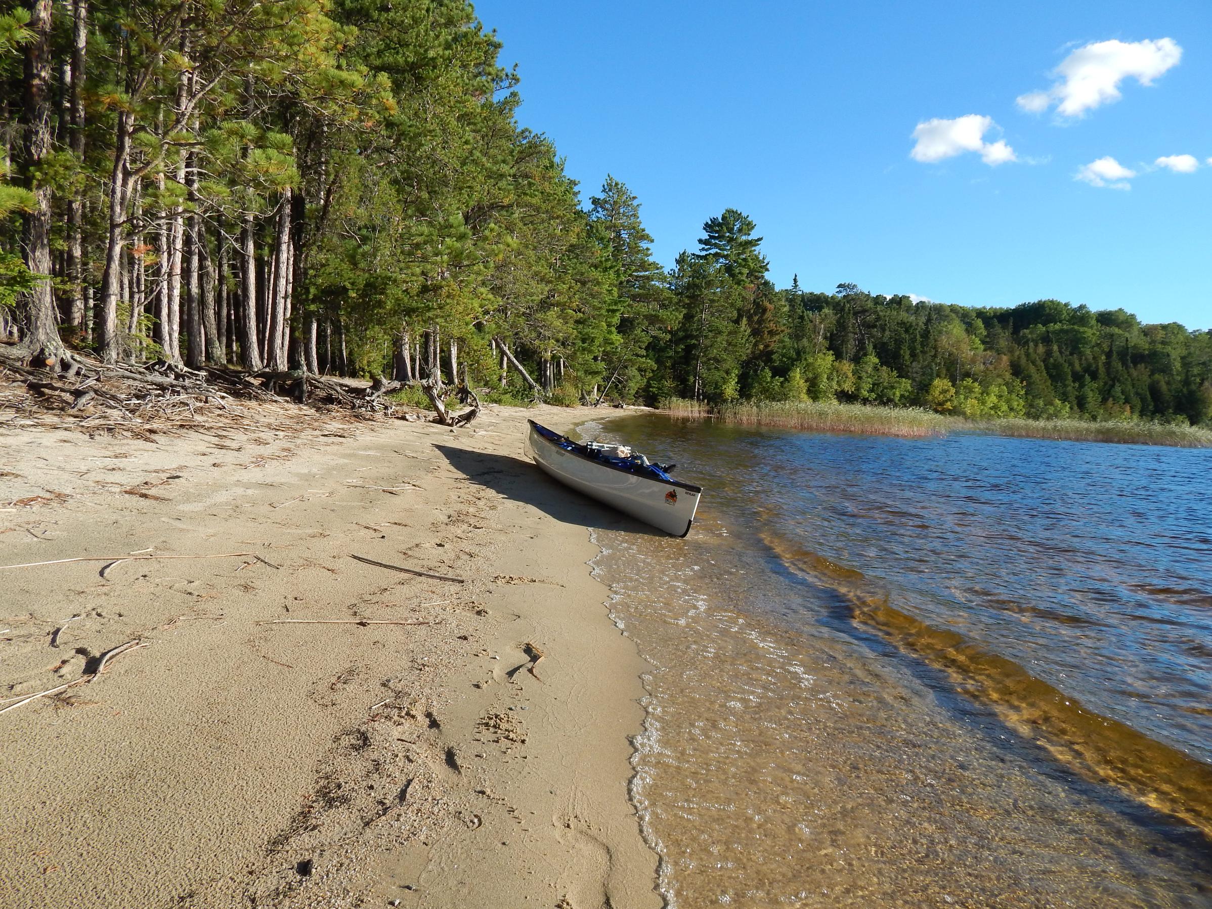
If you do travel through Quetico, Conk, Jean, Burntside and Rouge Lake on your way to Sturgeon, there''s a great island campsite located in the north central portion of Burntside Lake. (pictured below)
Finally, as Goose mentioned, the wind and waves Nym and Batchewaung Lake can get nasty, but Sturgeon Lake can be a challenge when the wind and waves are kicking up also.
I've never been wind bound on Sturgeon Lake, but the potential is there. That said, I've had some thrilling travels when paddling large open sections of Sturgeon Lake.
Good Luck and enjoy whatever route you decide to travel.
Hans Solo


Water reflects not only clouds and trees and cliffs, but all the infinite variations of mind and spirit we bring to it. – Sigurd Olson
Reply
Reply with Quote
Print
Top
Bottom
Previous
Next
Subscribe to Thread
Become a member of the bwca.com community to subscribe to thread and get email updates when new posts are added. Sign up Here
 Search BWCA.com
 Donate