Quetico 2010
by Ho Ho
When we woke on the fourth day of our trip, the wind was still raging down Sarah Lake. The skies had cleared last night, but it sure seemed cold and blowy out there. So, for the third day in a row, we lingered in the tent, this time until after 7:00. When we finally got up, it was a wonderful morning at our leeward campsite -

We had bacon and pancakes for breakfast. As we were breaking camp, I heard a loud squawk overhead, which I thought I recognized as the call of sandhill cranes. I looked up. There were three cranes flying high above us, roughly east to west. That's the first time we've seen cranes in canoe country. They were gone in a flash, but great to see.
We got on the water about 10:00. The wind never stopped blowing overnight, and had picked up more force since dawn. As soon a we launched the canoe and passed through the narrows that guarded our campsite, we were paddling directly into that powerful headwind and big white caps.
The first stretch of open water took us alongside a big island. Then we paused behind a point before the next narrows, where there's another popular campsite. Resting in the shelter of the point -

Passing through those narrows, we crossed more open water, then ducked into the little western bay where the portages to McIntyre are found. As always, I had the Fisher map open in my map case attached to the thwart right in front of me. It showed a single portage directly ahead, on the west side of the bay. And sure enough, there appeared to be a landing there as we looked across the bay. But as we aimed that way, we saw another apparent landing to the south, marked by an ancient blaze.
We decided to keep going to the western landing that is shown on Fisher. We got there and scouted and determined that it was indeed the portage. Only later, when looking at the official park map, did we realize there are actually two portages between Sarah and McIntyre in here, and we had seen the landings for both of them. This is the view over the western bay of Sarah from the landing of the portage we used -

It's not clear why there are two portages for this short crossing. Perhaps the other one somehow avoids this very steep hill -

No need to avoid it, though. It's a fun hike up. Definitely gets the heart pumping -

Once on top, I zipped along the pleasant, level trail, leading the way with the canoe, until I came to this -

On my first trip across, there was no sign that anyone else had made their way through or around the downed tree. The ancient pine had probably toppled in the gale of the last couple days, and we were the first to pass through since then. To get past it, I rammed the canoe through the branches, and found a way to clamber over myself. Then I tossed the canoe back on my shoulders and continued on to McIntyre.
On our trip back between loads, we cleared as many of the downed tree branches as we could without the saw, to make it at least a little easier for the next portagers to pass through -

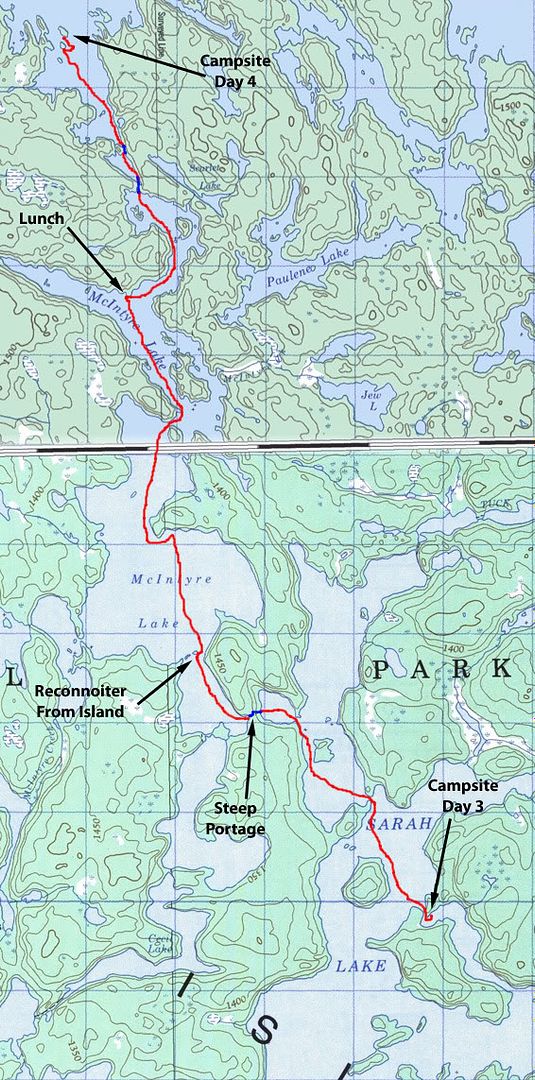
After carrying the rest of our gear across, we got ready to paddle up McIntyre Lake. The first stretch in the south bay of McIntyre was pretty whipped up. But the hardest part was ahead. The southern bay and the rest of the lake are separated by a long natural "breakwater" of rocks that rise just above the waterline between the western shore and a small island. After paddling up the south bay, we stopped behind that small island to reconnoiter the route ahead and snack on some power bars. Looking north from the island -

In conditions like this, I prefer to stay close to shore, just in case of a mishap. Not that I expected one, but it pays to think through the what-ifs. In this case, though, the direction and force of the wind and the shape of the lake did not really leave any alternative other than paddling straight across the open water of the round, central basin of McIntyre to our north.
It was less than a mile from the island to the other side of the basin, but a lot of work to get there. Some monster gusts nearly immobilized us. Yet we kept moving forward. We were very glad to be in our seaworthy Champlain on this stretch, and indeed throughout this trip. About 20 minutes after leaving the island, we arrived in the lee of the big point that forms the north side of the round open basin -

It was almost warm in this sheltered sunny spot, but very chilly in the wind. We were paddling with multiple layers, PFDs, and watch caps on.
After a few minutes resting in the sun and out of the wind behind the point, we resumed our paddle into the teeth of the wind, though now closer to shore. We were aiming to have lunch at a campsite at the north end of McIntyre, where we had camped on our Cutty Creek-Death March trip in 2008.
When we got to the campsite, the wind was whipping down from the northwest arm of the lake right through the pleasant open piney area around the fire pit. So we carried our lunch pack over the low ridge to the east side of the little point to get out of the wind while we ate. This is the view looking back south from our lunch spot -
We talked about our plans while eating. We both thought we should give up any thought of making it to Poohbah Lake this trip. The weather to date had slowed us down too much. And I didn't like the thought of being on big, open Poohbah with winds like this. Thinking ahead to next year, we both had the idea of making a trans-Quetico trip from north to south, going through Poohbah and over the Memory Lane portages along the way.
After eating, I returned the lunch pack to the canoe. You can see in the picture below that I'm dressed warm, even wearing my PFD on land (as well as on the water) for extra insulation -

From our lunch spot we paddled the last stretch of McIntyre, battling the head wind to the twin portages that go to Brent via a little unnamed lake. The first of the two portages out of McIntyre is very short and very steep down to the unnamed lake. Even this small body of water was windy on its exposed south side. But it was a quick paddle across it to the second portage into Brent. This picture looks back at the unnamed lake from the sheltered landing of the second portage -

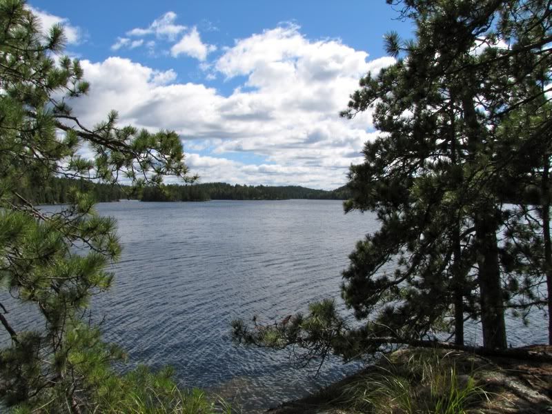
After we crossed this short but slightly rugged portage, we were surprised to see what looked like a small armada coming toward us on windblown Brent Lake -
First there was a group of six guys in three tandem canoes. Then, after they landed, another canoe with a male-female duo waited off shore. We had not seen anyone since Isabella Lake a couple days ago. So it was funny to run into everyone all at once now.
The group of six guys said they had been pinned down by the weather on Elk Lake for a couple days, so they'd made a break for it today. Somehow they knew the forecast for tomorrow, which was for sunny skies and - shock of shocks - calm winds. We also talked briefly to the male-female duo, who were really wrapped up in warm clothes. They were out for a couple weeks, coming from the north side of the park, and said they'd seen people every day.
Out on Brent, the headwind continued, though not as bad as on Sarah and McIntyre. Even though it was just around 3:00, we decided to check out the campsites at this end of the lake and stop if there was a nice one. We weren't in any hurry now that we had definitely ruled out a detour to Poohbah. And we were pretty pooped out from fighting the headwind.
Our campsite search took us first to a little island that someone had marked as a 5-star site on the PCD. I got out and scouted around. There was indeed a small ancient fire ring. But it looked like it had not been used in many years. And there were no tent pads or any other signs of past encampment. Since the Fisher map showed a campsite on the somewhat larger island right next door, maybe the person who made the entry on the PCD had mixed up the two islands. So we paddled across the channel between the islands to check out the Fisher site. It was top-notch, and we decided to stay.
Our first order of business was a swim. The main camping area was exposed to the north wind. Fortunately, there was a nice rock ledge just around the corner that was out of the wind and facing the sun. But even swimming off of this semi-tropical rock, the water was starting to feel pretty chilly for early September.
This is the view from the swimming rock later on, after I had suited back up in my warmer clothes. The little island just above my head is where the alleged 5-star campsite was mismarked on the PCD -

Our actual 5-star site had a huge flat open area among the pines, where an army could set up tents. It was well-used (and had a resident squirrel that was obviously accustomed to snagging food from campers), but not abused. The only problem now was that the wind was blowing through. So we put up the tarp as a windbreak -

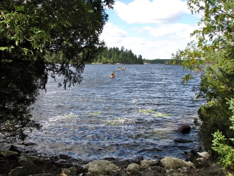
Once camp was set up, we explored the length and breadth of the island. This fungus was kind of cool -
The view to the north -

After our tour and some more loafing, I made rice and bean burritos for dinner. This was a meal that we added to our repertoire on our Crab-Cummings trip with Mike and Josiah in July. First I cooked up some basmati rice (with a little butter and a bay leaf), added some canned refried beans (transferred to a Lexan container for the trip), and then heated the mixture through. This bean and rice mixture was then piled on flour tortillas with finally sliced cheddar cheese and medium-hot salsa (also transported in a Lexan container). Two stuffed burritos a man. They were really tasty and really filling. And even though everything but the rice was already fully "constituted" and had to be carried at full weight, I don't think this meal was much heavier than the two freeze-dried dinners we would otherwise eat. Upgrading our dinner menu is definitely a trip-refinement objective these days. The burritos are a good start.
After dinner, the wind finally quieted. We set ourselves down on some rocks by the shore with our Maker's Mark and a few cookies, enjoying the glow of the setting sun in the northwest sky -

Another shot -

I'm always mesmerized by the way the light plays on the little ripples of twilit lakes. The interplay of light and ripples has to be in motion to give the full effect, but a freeze shot makes a nice abstract -

When the sun was down, the cookies eaten, and, alas, the nightly allotment of Maker's Mark consumed, we got in the tent to read for a while. This was the first night of the trip when we did not have the fly on our tent. We turned the headlamps off at about 9:00, and fell into another deep sleep under the glow of a thousand stars flickering through the pines.
 Donate - BWCA.com