|
||||
 Boundary Waters Quetico Forum Trip Planning Forum Kawishiwi lake ep 37 question in traveling to Polly Reply Boundary Waters Quetico Forum Trip Planning Forum Kawishiwi lake ep 37 question in traveling to Polly Reply
|
| Previous Messages: | |
| Author | Message Text |
| boonie |
07/19/2020 10:30AM If you do, be sure to report back. I've looked at it on satellite view and considering the portages were always where they are before the fire, and I think I can see why . . . it would be interesting. It looks like a lot of places that would have to be portaged around, without any portages there. The most I've heard in about 8 years is one guy said they went about 200 yards and decided to turn around. It looks OK for a while out of Kawaschong; I don't remember which direction they started from. |
| printing |
07/19/2020 08:32AMJackpineJim: "At the end of May I poked around a bit on the Kawashachong end of the river looking for remnants of the old Tomahawk Timber Company bridge sites. Didn't go to far but it looked like it might be a fun slog if that was your mission. I can say that the sun really gets hot in the burned area and there is no shade to be found. I'd try in late April or late September but not in the heat of the summer. Thanks for sharing your experience, I think I will have to try it one year for the challenge. |
| cyclones30 |
07/18/2020 10:53PM Interesting, we did that route a few years ago. I figured that "beaver dam" just upstream from Kawashachong was just that....a dam. Makes sense if it was already a shallow spot from previous history |
| JackpineJim |
07/18/2020 08:18PM At the end of May I poked around a bit on the Kawashachong end of the river looking for remnants of the old Tomahawk Timber Company bridge sites. Didn't go to far but it looked like it might be a fun slog if that was your mission. I can say that the sun really gets hot in the burned area and there is no shade to be found. I'd try in late April or late September but not in the heat of the summer.  Bridge site just down-stream from Square Lake Bridge site just down-stream from Square Lake Bridge site just up-stream from Kawashachong Lake (note size of burned 70 year old Jackpine growing in road bed) Bridge site just up-stream from Kawashachong Lake (note size of burned 70 year old Jackpine growing in road bed)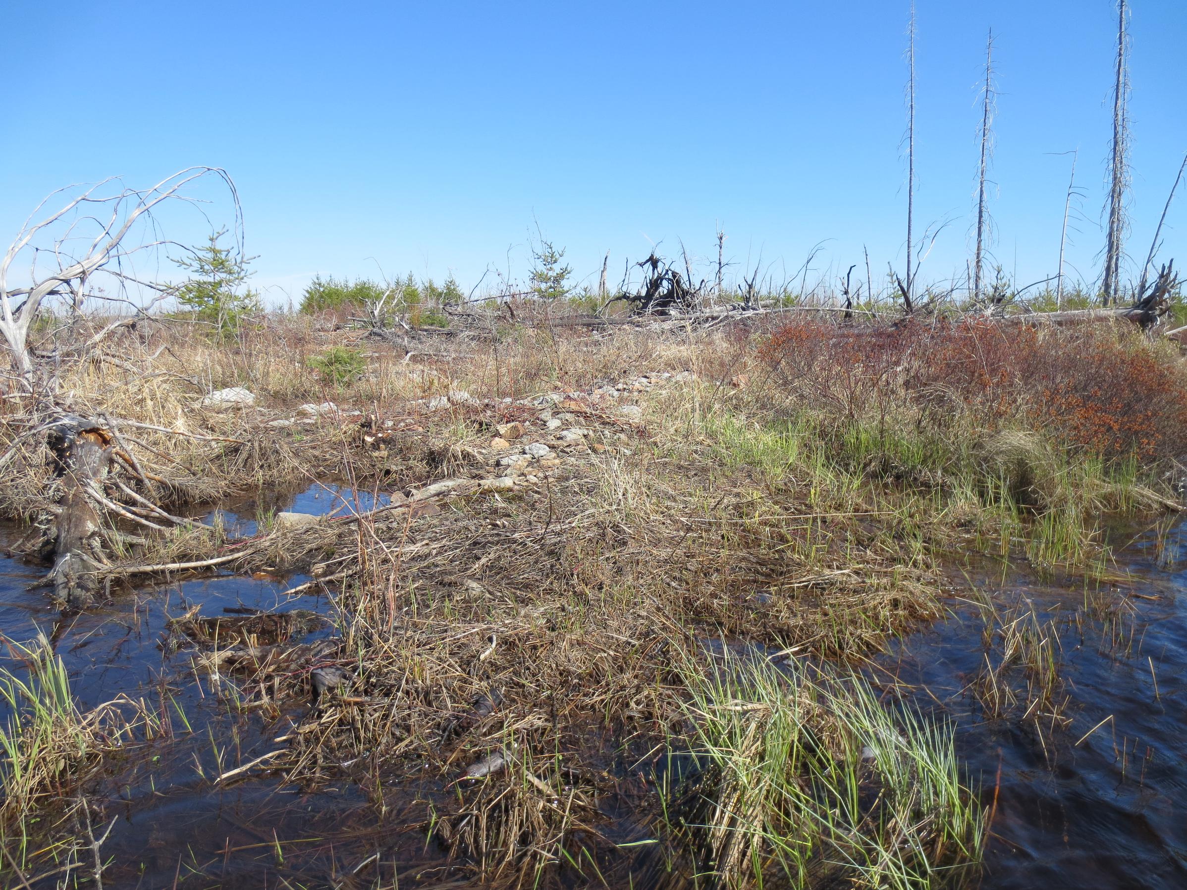 Rock rubble leading up to bridge/culvert across Kawishiwi River just down-stream from Kawashachong Lake. Rock rubble leading up to bridge/culvert across Kawishiwi River just down-stream from Kawashachong Lake.
|
| Michwall2 |
07/18/2020 03:41PM There have been a couple previous thread on this subject. Especially the Kawasachong to Polly route. Most have said they would never attempt again. I don't remember seeing anything since the Pagami Creek Fire. The entire area you have outlined has burned. I would guess the fire has left the river bed choked with dead falls. A quick virtual trip via a satellite map showed several choke points that are crisscrossed with deadfalls. While I know that there is not a time when there would not be some of that encountered, I think this would be a very difficult trek at this point in time. |
| Northwoodsman |
07/18/2020 12:03PM The portages look like the easiest route by far. As you know, they aren't bad at all. |
| MikeinMpls |
07/18/2020 11:37AM I asked this question in May, and was directed to Google Maps or Google Earth...I don't recall. Anyway, the river was choked with fallen trees from the fire. The portages are the way to go. Mike |
| cyclones30 |
07/18/2020 11:31AM That's a good way to never have newbies come again. |
| boonie |
07/18/2020 10:46AM What they said. Not too long ago the question came up again, certainly not for the first time. You can look at it on google maps satellite view. If you're looking for an easier way, that's not it. |
| printing |
07/18/2020 10:43AM The main reason I was asking is because I have done those portages before and was looking to change up the route to Polly. But you all might be right, it might be to many pull overs and blow downs to be worth it this time around. Especially after checking some satellite imagery from 2013. (would be nice to find more recent images) Maybe I will make an attempt when I am not bringing newbies. Thanks though! And if you have done it I would love to hear your experience! |
| cowdoc |
07/18/2020 10:30AM take the portages |
| ducks |
07/18/2020 10:04AM I 2nd what Tipsy said. |
| TipsyPaddler |
07/18/2020 09:14AM I have not personally paddled up either of those routes but the question gets asked somewhat often on the forum. Consensus answer tends to be “portages are there for a good reason” meaning they are the quickest, easiest route between lakes. Those small rivers are probably full of down trees and beaver dams that will require numerous pullovers, walk arounds, etc. Those portages are pretty easy. The long one has rocky drop into Polly at the very end you need to be a little careful on the descent but the rest of it is flat and easy going despite the length. If you are looking for a bushwhacking test of endurance try those routes. If you want to get from EP37 to Polly quickly with the least amount of effort stick to the portages. |
| printing |
07/18/2020 09:04AM Has any one bypassed the portage from Kawasachong to Polly? I’m contemplating take the red or blue highlighted routes in the screen shot below.  Any and all advice is appreciated! |
 Search BWCA.com
 Donate