BWCA Water levels Boundary Waters Listening Point - General Discussion
Chat Rooms (0 Chatting)  |  Search  |   Login/Join
* BWCA is supported by its audience. When you purchase through links on our site, we may earn an affiliate commission.

Author

Text

06/19/2022 06:22AM  
Water levels are perplexing to me up there currently.

I have been up there 8 days in past 2 weeks from Moose Lake area and then was just up at Crooked Lake area. Overall, I wasn't seeing a lot of high water indicators but then at La La Croix the water still seems very high.

Does anyone have info on this topic and why some lakes still seem way higher yet others aren't? Or are others seeing this on other lakes as well?

Pics - from Lac La Croix (Tiger Bay)
1. Water lines on tree
2. Pictographs with water level reference (does anyone have a similar pic to show water level?)
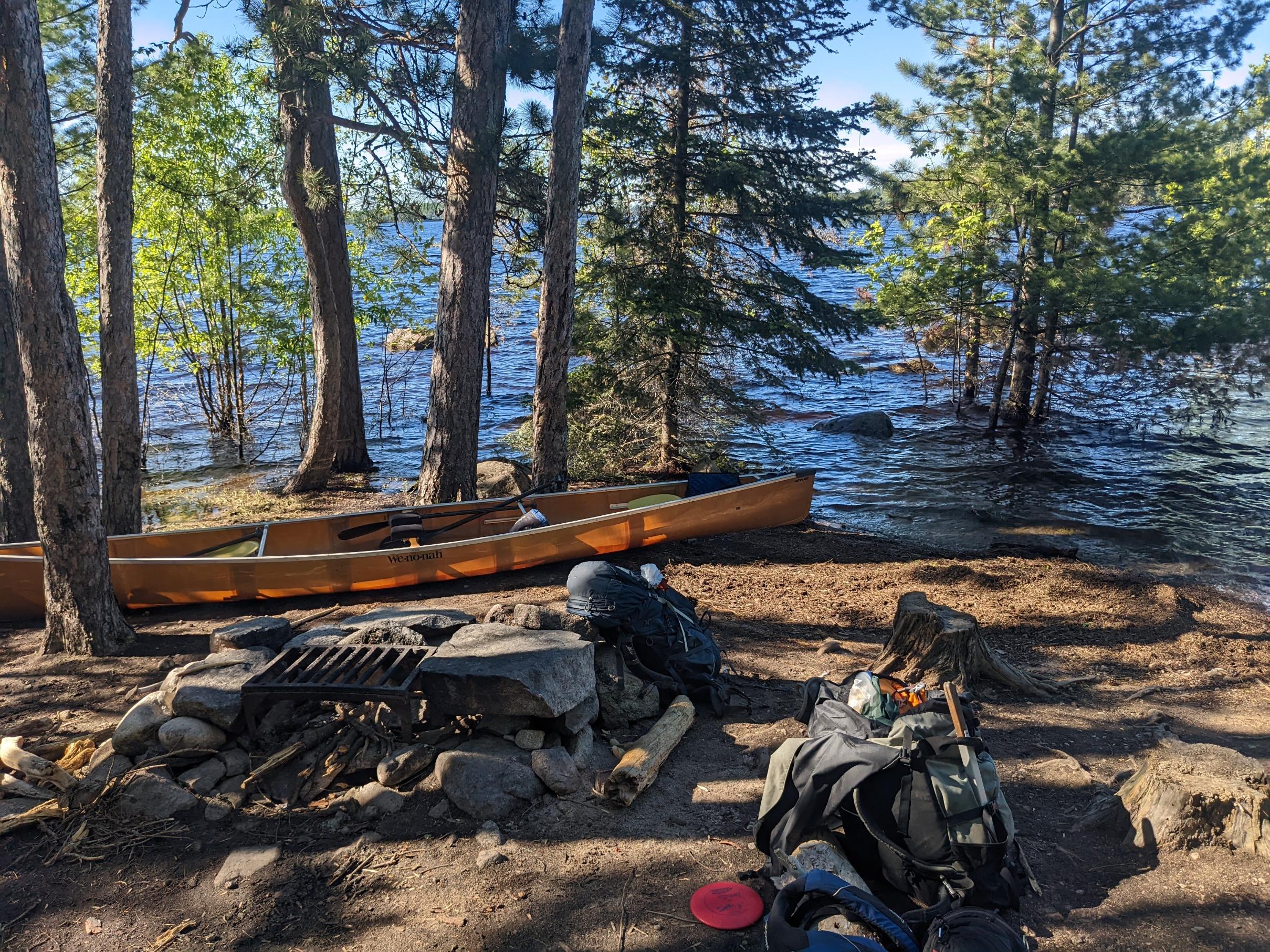
3. Campsite that the water is still way up from normal
4. Campsite spot
5. 2017 photo of same pictographs spot


2017
 
      Print Top Bottom Previous Next
06/19/2022 10:14AM  
Simple really; water flows downhill. Lakes at the top of the hill drop quicker, the lower on the river system you are the greater the drainage area, the higher the rise and the longer it takes for the increase to ebb. Moose Lake is near the top of the watershed, LacLaCroix is near the bottom (for the BWCA)- LaCroix gathers water from every bit of the BWCA that doesn't flow into Lake Superior (that would be most of it) and nearly all of the Quetico as well.
 
Heyfritty
distinguished member (181)distinguished memberdistinguished memberdistinguished member
  
06/20/2022 01:47PM  
I was on the numbered lakes from the 7th through the 18th. The water dropped about 10” during that time. It dropped about 6” in the early days and seemed to start stabilizing by the end. I could see that the water had been about 3’ higher before I got there.

For the first time, I got a sense of the volume that the Kawishiwi watershed carries. Here’s a photo of the falls(off the Fernberg), the night before I entered. I only wish I could have seen it a few weeks earlier!

 
tumblehome
distinguished member(2906)distinguished memberdistinguished memberdistinguished memberdistinguished member
  
06/20/2022 04:28PM  
I made some hydrological observations while in the Q where I observed similar issues where some lakes were absurdly high while others not so much.

I found that some lakes can drain water more rapidly than others. One lake in particular had an obscene amount of water pouring into it (Chatterton Lake) but was unable to drain it just as fast so it was like an overflowing bath tub. The next lake down (Russell) while still high, had the ability to drain it’s influx much more rapidly and thus was not as high. Both lakes were receiving the same amount of water

The lakes I saw this on were a long chain of lakes separated by waterfalls. It was all quite fascinating actually.

Tom
 
      Print Top Bottom Previous Next