|
 Boundary Waters Quetico ForumQuetico ForumNorth Bay to Isabella
|
 Forum Sponsor

Author
Text
03/31/2012 06:32PM
I'm dreaming of an upcoming Quetico trip in June. I have the maps piled up around me and I was wondering about one area of the trip. I'll be traveling from North Bay (Basswood Lake) north and then west over to Isabella Lake. Does anybody know if that creek connecting the unnamed lake to the southeast bay of Isabella is navigable? Or, is it wiser to take the 2 separate marked portages shown on the Fisher maps to get to Isabella? Also, how are the camping sites on Isabella? Thanks!
Reply
Reply with Quote
Print
Top
Bottom
Previous
Next
")

03/31/2012 07:41PM
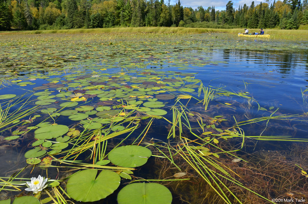
Isabella Creek was navigable last September but if the dry weather continues it 's going to be a challenge getting to the river from North Bay--there are a couple of beaver dams at the start of the river that leave little water and lots of evil smelling mud downstream, and precious little landing or solid footing to get out and portage around. After you get into the river there are 2-3 beaver dam liftovers but the river is very pretty.

Heading in, early Sept. 2012

Heading out, early June, 2010

Heading in, early Sept. 2012

Heading out, early June, 2010
03/31/2012 08:36PM
Thanks for the information....and the pictures!! Looks beautiful! It will be interesting to see what the water levels are like in June this year. Pretty amazing how many of the northern Minnesota lakes are.....wondering about Quetico. Thanks!
")

04/01/2012 10:16PM
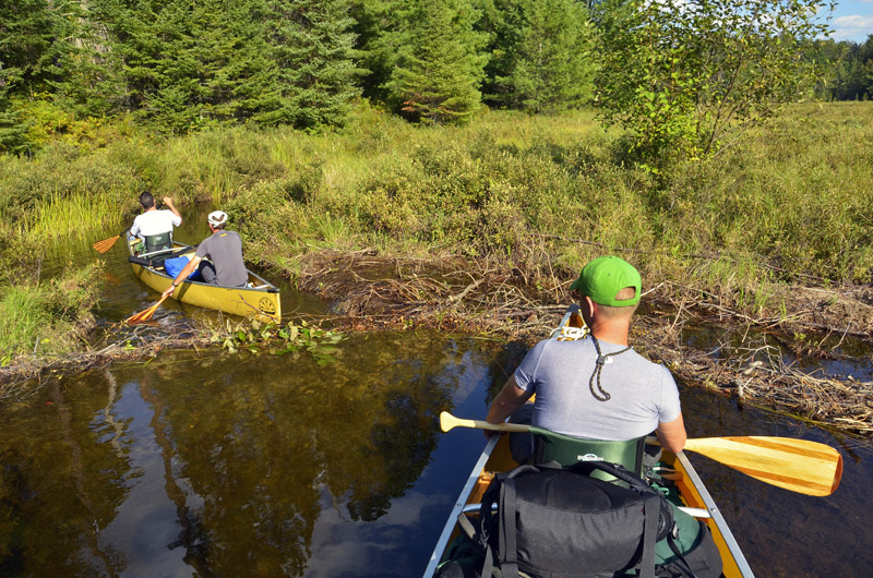
I think whether you take Isabella Creek or the portages, the trIckiest part of this route is finding the little creek out of North Bay that goes up to the unnamed lake/pond. It's hidden behind reeds, keep searching an you will find the channel. In low water you may run into muck just north of there, but persevere, very soon you will come to a beaver dam and after you pull up and over it, the water is deep enough to paddle. There is another small rapids with beaver dam a little further upstream, after that you are on the unnamed lake/pond.
From there I would say take Isabella Creek to Isabella Lake. It looks marshy but generally has a good sandy bottom, so even in low water it should be no problem to hop out and line your canoe. The campsite in the narrows of Isabella Lake is vey pretty.
From there I would say take Isabella Creek to Isabella Lake. It looks marshy but generally has a good sandy bottom, so even in low water it should be no problem to hop out and line your canoe. The campsite in the narrows of Isabella Lake is vey pretty.
04/02/2012 12:46PM
I was on my iPhone when I posted last night and could not see Springer's pictures very well. That first one is the spot I was also talking about where you might have trouble in low water.
It's raining here on the Echo Trail today, and it looks like they're getting more rain up in Quetico. Rain rain rain!
It's raining here on the Echo Trail today, and it looks like they're getting more rain up in Quetico. Rain rain rain!
04/02/2012 01:29PM
Here are a few more shots from September 5, 2011--my guess is the water levels will be about the same this June.
Headed for the river mouth

Stupid beavers--one more unnamed pond, then the river

The rocky ~50 rod portage from the river to Isabella Lake follows a pretty stream.

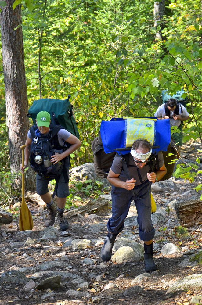
Headed out, 9/9/2012, the killer hill out of Side Lake.

Beaver dam on the river, 9/9/2012.

At the mouth of the Isabella River. 9/9/2012.

Headed for the river mouth
Stupid beavers--one more unnamed pond, then the river

The rocky ~50 rod portage from the river to Isabella Lake follows a pretty stream.

Headed out, 9/9/2012, the killer hill out of Side Lake.
Beaver dam on the river, 9/9/2012.
At the mouth of the Isabella River. 9/9/2012.


04/02/2012 01:30PM
Our group of Boy Scouts went through Isabella Creek in 2003. Other than the occasional beaver dam drag-over, it was navigable all the way to the short portage into Isabella itself.
 This is representative of what most of the creek was like (at least when we were there).
We're headed through there in July this year. I'll be interested to read your report to see how navigable it is this year.
 This is representative of what most of the creek was like (at least when we were there).
We're headed through there in July this year. I'll be interested to read your report to see how navigable it is this year.
"Keep close to Nature's heart, yourself; and break clear away, once in a while, and climb a mountain or spend a week in the woods. Wash your spirit clean." ~ John Muir
04/03/2012 03:11PM
quote Springer2: "Sorry the captions don't line up with the photos--haven't figured that aspect of posting on this board out yet."
Springer, it may not be you. It may be the settings on your computer. They're almost perfect on my end.
"Keep close to Nature's heart, yourself; and break clear away, once in a while, and climb a mountain or spend a week in the woods. Wash your spirit clean." ~ John Muir
04/05/2012 09:06AM
You shouldn't have any problems getting to Isabella in June. I went that route solo last July. There were several pullovers as I paddled up the creek between the unnamed and Isabella. As a solo it was quite more tiring than I expected. There are two campsites I know of on Isabella. The first is on the left (southern) shoreline at the narrow pinch midlake. I didn't camp on this elevated site due to the great numbers of horseflies/deerflies all over. The other site is further down Isabella across from the portage. I pressed on and camped at a mediocre site on an unnamed lake on the way to Side.
Do what you can, with what you have, where you are -- Teddy Roosevelt
08/25/2019 05:22PM
When I went through in mid-July beavers had constructed a dam farther down the creek than in any year previous. This raised the water levels for relatively easy paddling (with a couple of more dams to pull over) all the way to the portage. There is a 150 yard shallow section before the lower dam ending in a swift. It is hard bottomed and easy to walk.
Nobody exists on purpose, nobody belongs anywhere, everybody’s going to die.
08/26/2019 02:04PM
Banksiana: "When I went through in mid-July beavers had constructed a dam farther down the creek than in any year previous. This raised the water levels for relatively easy paddling (with a couple of more dams to pull over) all the way to the portage. There is a 150 yard shallow section before the lower dam ending in a swift. It is hard bottomed and easy to walk."
Is there a name for that creek? I don't see one on the map. I'd like to put the actual name, if any, on my map so I can refer to it. A person in my group was calling it the Isabella River and that's what prompted me to to look at it again, even after notes you had given me, etc.
"Isabella Creek" is what it was called up in this thread.
08/26/2019 09:56PM
We have also always used Isabella Creek. May have some shallow spots, certainly will have beaver dam pull overs, but this is Quetico fun. The only real portage is at the west end into Isabella Lake itself. Not long.
Only one decent campsite on Isabella is at the narrows half way along, so allow ample time to move onward to other lakes.
Only one decent campsite on Isabella is at the narrows half way along, so allow ample time to move onward to other lakes.
"I shall return" General Douglas McArthur
08/27/2019 10:23AM
Eyedocron: "We have also always used Isabella Creek. May have some shallow spots, certainly will have beaver dam pull overs, but this is Quetico fun. The only real portage is at the west end into Isabella Lake itself. Not long.
Only one decent campsite on Isabella is at the narrows half way along, so allow ample time to move onward to other lakes."
Is that campsite named XP?
08/27/2019 02:53PM
Still my favorite stretch - North Bay to Isabella. My don us instructed to put my ashes there.
I didnt think the site further north west across from pirtage to mon nsme was bad - plus not to high vluff jumping. YMMV. Narrows is best. Often see moose watering in morning.
I didnt think the site further north west across from pirtage to mon nsme was bad - plus not to high vluff jumping. YMMV. Narrows is best. Often see moose watering in morning.
08/28/2019 08:35AM
Eyedocron: "XP it is. If full, go to the west end of Isabella and take two portages north. A decent campsite is on the SW shore just before the downhill portage."
Thanks. That's along our intended path anyway so that works. I don't see a name for the two lakes (large ponds?) but they are between Isabella and Side, right? Campsite VT if I have it right.
08/28/2019 08:36AM
Eyedocron: "XP it is. If full, go to the west end of Isabella and take two portages north. A decent campsite is on the SW shore just before the downhill portage."
A nice site but a tight squeeze for a group of six. I would rate it as 4 folks or less.
Nobody exists on purpose, nobody belongs anywhere, everybody’s going to die.
08/28/2019 08:39AM
Banksiana: "Eyedocron: "XP it is. If full, go to the west end of Isabella and take two portages north. A decent campsite is on the SW shore just before the downhill portage."
A nice site but a tight squeeze for a group of six. I would rate it as 4 folks or less."
And hammockers to boot. Would need the right mix of trees.
Reply
Reply with Quote
Print
Top
Bottom
Previous
Next

Subscribe to Thread
Become a member of the bwca.com community to subscribe to thread and get email updates when new posts are added. Sign up Here
Community Links
 Search BWCA.com
 Donate
 Featured Sponsor
