2008 Quetico Fly-In to Clay Lake
by OldGreyGoose
Day 1, Sunday, June 22: We had an early breakfast at the Outdoorsman Restaurant, an “interesting” eatery with local color. We got our gear together, poured Rock Star into our two 1-quart bottles and stashed some store-bought bottled water for the day ahead. The CC van took us to the base, which had a couple of buildings for the pilots and guests (with TV), and a parking lot serving those coming and going from Quetico and “outposts.” Our gear was weighed and before long, two deHavilland Beavers came in with outgoing parties. The second plane was ours.
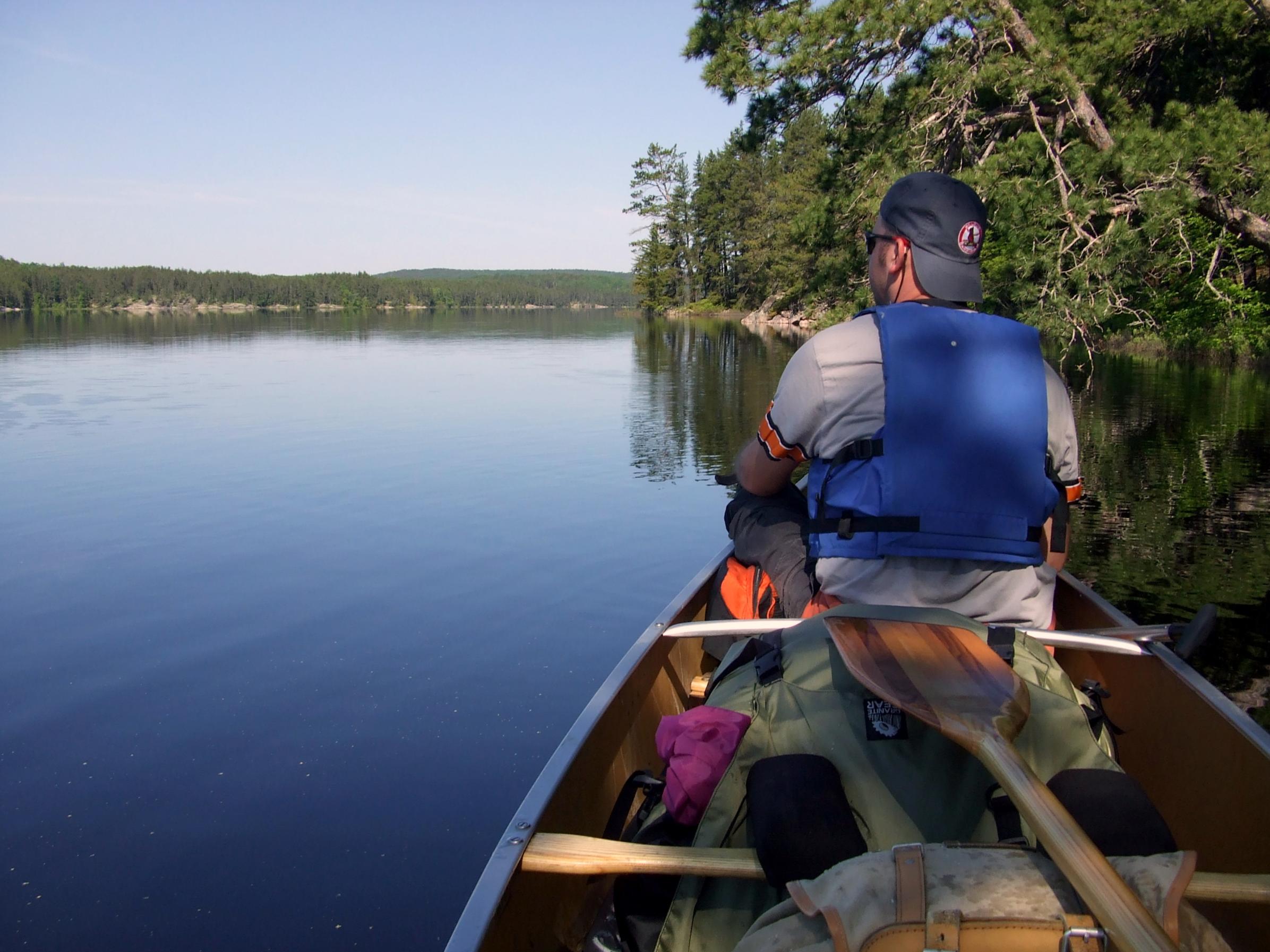
After our gear was loaded and the canoe was secured, we took off. Flying over the forests and lakes was awesome! We saw four canoes on one lake and later recognized the end of Pickerel Lake and the “Pines” from last year’s trip. Our pilot circled and landed in the middle of Clay Lake, turned off the engine, and climbed out. While he untied the canoe and got it in the water, we grabbed our gear from the plane. After we loaded up and paddled away, the plane took off and the sudden quiet and solitude after the noisy flight was almost a shock. A short paddle brought us to the outflow of Greenwood Creek. My watch said 10:30 am and we wondered how long it would take to reach Kawa Bay and a campsite.
At first the creek was somewhat straight and we made good progress, but as it began to bend sharply left and right our 18’ Souris River seemed two foot too long! The creek water level was very high, with water far back into the brush, and at times there was a visible current. It was hard to judge the need to paddle, or coast, or steer, and we often banged the canoe ends into brush as we made sharp turns. After about an hour and a half the creek entered the Wawiag River, and the going was 100 percent better, at least at first.
We made better time since the river was more open and not choked in by brush. The scenery was also much better and we frequently scared up ducks. Then we came to a logjam! A large tree still connected to the ground on one bank and lying completely across the stream blocked our path. The swift current took us to the far left where the water was easily 10’ feet deep and we got “parked” parallel to the tree and several feet from shore and the root wad.
Joe, in the bow, was furthest from solid ground, so I carefully got out onto the tree and then he scrambled from the bow back to where he could get out onto the root wad while I held the canoe. I horsed the packs out and passed them to him then pulled the empty canoe toward me and somehow levered it up and over to the downstream side where we could reload and get back in. (All this probably took about 20 minutes and was a lot harder than it sounds.)
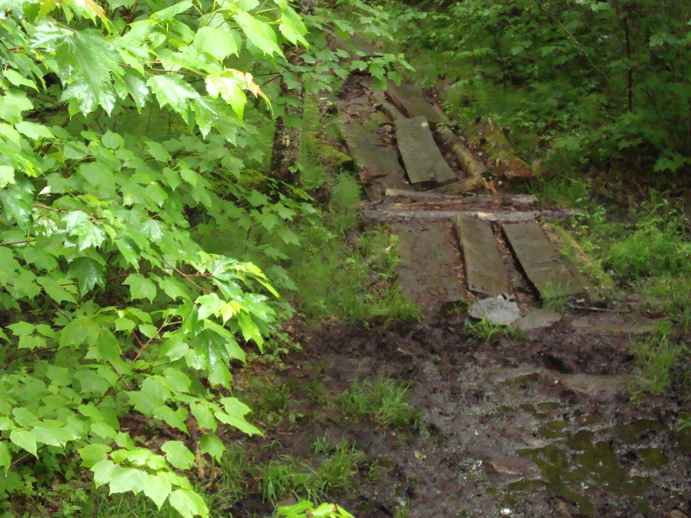
Next up was a rapids we knew about (and which Joe heard) and we got over to the far left in plenty of time. We could see standing whitecaps at the lower end from the portage take-out. The short portage was really easy but the mosquitoes were brutal! (There was a definite campsite at the upper end, but we would say it was a “last resort” only. At the bottom end where a short beat-up old canoe was lying, was a campsite that looked unusable.) Paddling on downstream, we came to several “almost” logjams that we could barely squeeze through. Then came the worst, made of countless logs spanning the river’s width a maybe 75 yards long! We could see on the left bank that others (and moose) had “portaged” around this one. We carried the packs around, then two-man carried the canoe, since there was a fallen tree about crotch-high across the path.
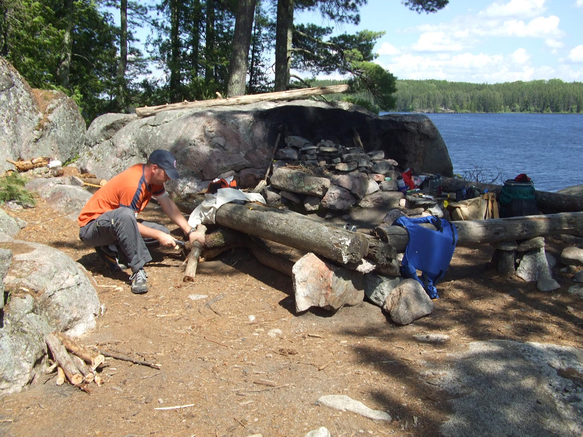
About when we were starting to wonder when this would end, it did, and we entered Kawa Bay (Kawnipi Lake) a little before 4:30 pm. (This meant it had taken just under 6 hours, which we knew was a respectable time.) We discussed going out into the bay a ways before stopping, and decided to camp at the mouth. This site had a sloped tent pad, an OK fireplace, and a good tree for hanging the food pack. There was little firewood around, but Joe made a fire, we ate supper and spent a restful evening. Two people in a canoe fished the river “mouth” later, but otherwise we were completely isolated on Day 1.
Later, by the dying fire, we recounted the day’s highlights, especially the logjams, a beaver sighting, and the many waterfowl. I went to bed while Joe sat up as the coals turned to ashes. I woke up about 11:30 pm and thought I saw the glow of the campfire through the tent wall. Joe was asleep. I thought maybe the fire had rekindled, but then I realized someone was shining a flashlight or headlamp around! Joe woke up and we lay there, finally deciding that someone had just come off of the Wawiag River and was looking for a campsite! The lights went away and about a half hour later, we awoke again and apparently they had come back and Joe heard one of them say, “Oh, there’s someone camped here.” (Another great Quetico memory!)
Day 2, Monday, June 23: It rained during the night and it was foggy at sunup. By 8 am the sky fog was gone, the sky was clear, and there was no wind as we cruised up Kawa Bay, noticing some of the old fire-scarred landscape that had greened back up but was still rather unsightly. The scenery improved greatly as we neared and then came out on the main body of Kawnipi. We hit the (alleged) pictograph site before 10 am but after looking around a little, gave up, and after eating a “floating snack” we decided to head north and then check out McKenzie Bay.
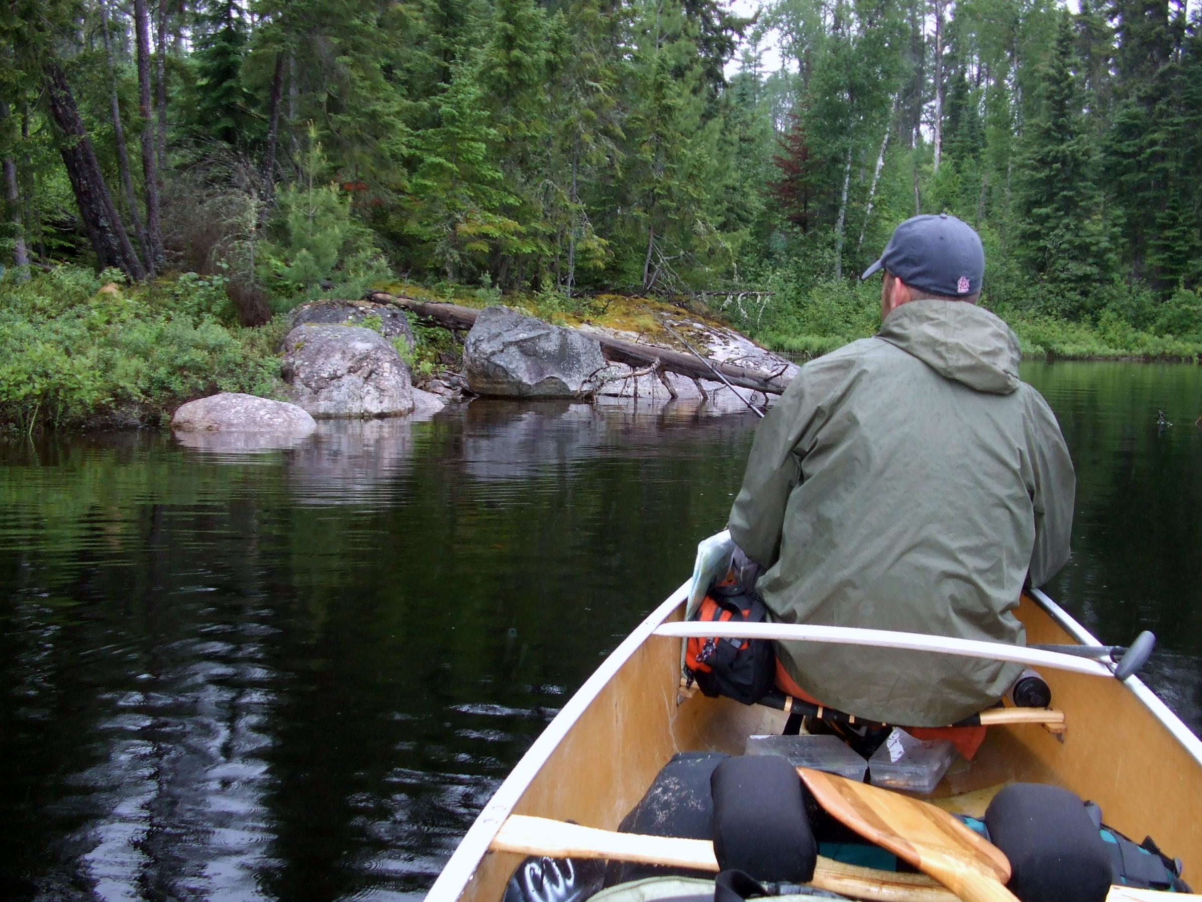
We had seen no others until we entered McKenzie Bay where a party was camped at a point on the right side where the bay begins to widen. We paddled into the widening and headed to the south point of the largest island where I had marked a campsite rated online by “Azalea” (PCD site “1RA”) on my map. It did not take long to decide to claim this site, even though it was only about 11:00 am. The view here was gorgeous and the multi-level site itself had tall white and red pines, trails, and numerous rocks to sit on or fish from or wash up on. Nearby were shorelines and reefs that looked fishy and a pair of eagles were sailing around! We set up the tent and tarp, got the cooking gear arranged at the “main” fireplace, and had lunch.
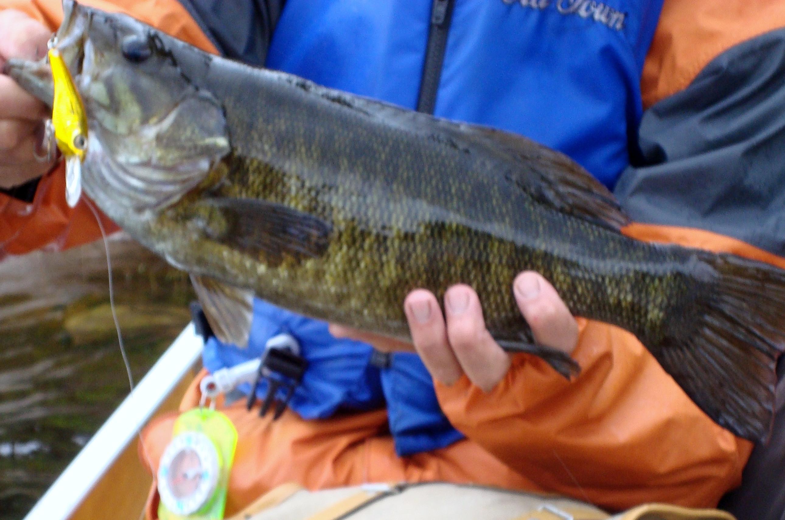
Later, we paddled around “our” island and to nearby shores and reefs, pitching lures to see what we could find. The fishing was excellent, with Joe having the most success. We caught pike all around our island, and smallmouth and walleyes nearby. A couple of the smallmouth were 4-4 ½ pounds, and several walleyes went 1 ½ - 2 pounds. Back at camp, before turning in, we had no trouble deciding to hang out and fish here another day and night!
Day 3, Tuesday, June 24, 2008: It rained again during the night and was cloudy when we woke up and we stayed in the tent a little longer than usual, then we had breakfast under the tarp. A little later there was another rain shower. It cleared later, but then got very windy, at one point tearing a tie out of one corner of our tarp and causing us to relocate the tent a short distance. (One of the plusses for this site was the number of tent options; one of the few minuses was exposure of the main areas to sun and wind.) We loafed around during the rainy morning and the worst wind, Joe caught some smallmouth from shore and we did not get out in the canoe until late, and we tried the main shore east from camp. Nothing much was biting there so we paddled back closer to camp where the bite was better.
This day turned out to be almost a washout, since the weather did not allow us to explore and fish further up the bay like I had planned. We had no complaints though, and if I had to recommend one spot on Kawnipi Lake to others, this would definitely be it. We hit the tent knowing that tomorrow was moving day and wishing it were not.
Day 4, Wednesday, June 25: We got going quickly with gray threatening skies and paddled into the main Kawnipi water and started north, thinking of making it to somewhere in the “Poets Chain.” We heard thunder rumbling in the west and continued paddling until we became worried about lightning and then went ashore at the bay north of McKenzie Bay. The rain hit us like a waterfall! I squatted down to keep a low profile and ate a granola bar while the torrent of water seriously tested my new Columbia rain jacket. My top stayed dry but my bottom was soaked.
When the pour became a drizzle and the thunder had moved on east, we bailed out the canoe and got started again under less dangerous-looking skies. It gradually cleared up as we paddled, but I felt “cheated” that Kawnipi’s beauty was hidden behind such a gloomy morning. We paddled past Rose and Kasie Islands, through the narrows, and stopped at poor, low-lying, buggy campsite in the north end for lunch. High water was almost inundating this site. After eating, we entered the last narrow area, where water from Kawnipi joins water from Kahshahpiwi Creek and it all pours out into the Poets.
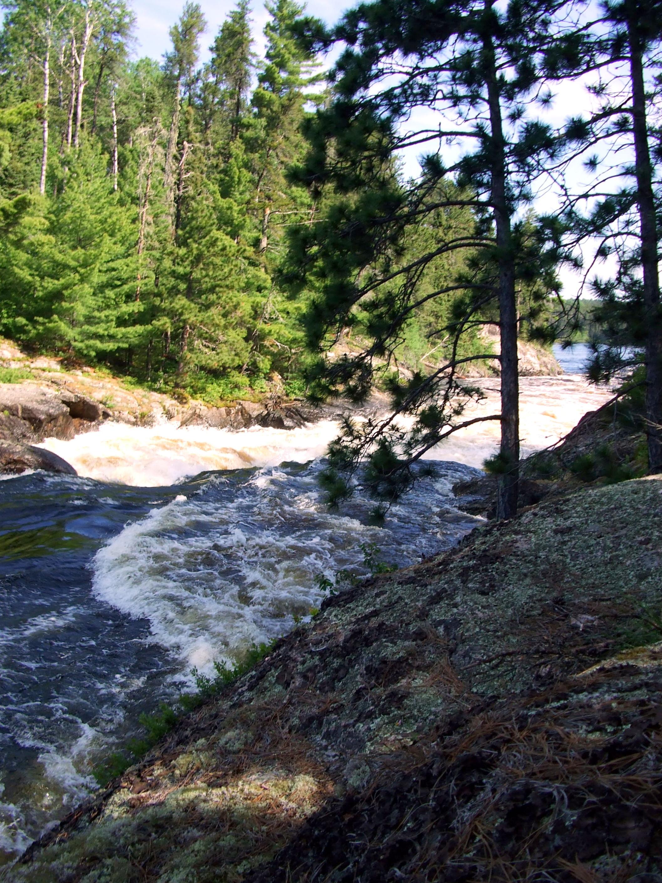
We paddled (and portaged -- our first since Day 1) the twisting waters into Shelley Lake, which to me had a dreary, bomb-out look. We decided maybe Keats Lake would be a good stopping point. A party going the other way – the first folks we’d talked to since the fly-in – said a group of Scouts was ahead of us, but we never saw them. Perhaps they took the Have A Smoke Portage into Keats, while we were taking the Snake Falls route that has two short portages around two falls.
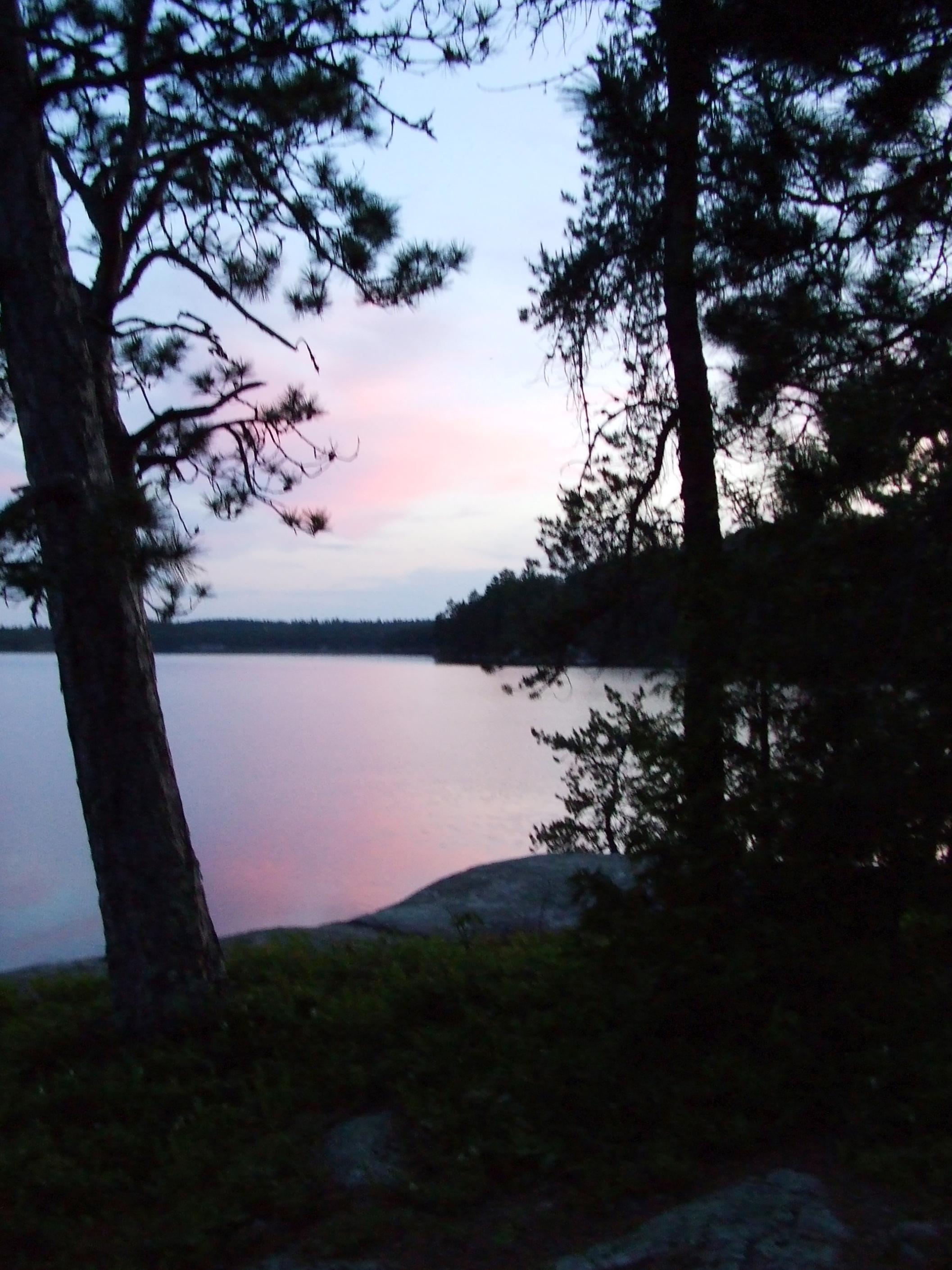
The first site west, on a small island, with a good view back to the lower falls was open, so we took it rather than going further, thinking the Scouts may have taken the next one. It looked as if someone had strewn rocks all around it, and we wondered it that was supposed to discourage folks from staying there.(?) Except for that, and the small size, it was a nice site. (PCD site “1CE”) This great day ended clear and cool, and we relaxed and enjoyed this really sweet location!
Day 5, Thursday, June 26: Day broke clear and we got underway and I wanted to slow down and let Joe try fishing as we moved toward Russell Lake. We tried at several places we either had marked on the map or that looked good as we headed west on Keats. No luck. Keats was deserted and we gradually made our way to the portage around Split Rock Falls. After portaging and photographing the falls – a very pretty spot on a beautiful day – I got Joe positioned in the flow just below and to the left of the falls. Here he hooked a nice (30”?) walleye that got off when the line broke. He tied on another lure and repeatedly cast into the choppy flow but could not connect again.
Joe fished around some reefs in southern Chatterton and then we headed up to Chatterton Falls. The water here (again) was very high and at the top of the falls we could not “see” the portage take-out. Thinking it was on the right, I said that maybe it was under water. (If I had checked my other map, I might have realized it’s on the left and starts right at a campsite.) Anyway, we turned around and paddled back to the “alternate” 400-meter portage that’s not by the falls. (So, we’ll have to revisit the Poets some time and get a closer look at Chatterton Falls.)
This portage into Russell Lake was easy and downhill, but it was getting hot and we were hungry, and I was not too happy at this time. We stopped at another almost flooded campsite not far from the falls for lunch, and then headed back north. We had seen no one else, and by early afternoon we were wondering out loud where all the people were! We cruised up between the two big islands and came out into upper Russell expecting to see canoes at any time, but there were none. Map-watching and talking about finding a campsite, I said we’d head for the dot marked near Russell rapids and Sturgeon Narrows and see if it was open. It was!
This site had great canoe access although most of site is high above water. It was breezy, bug-free with several tent pitching options, many, many rocks and ledges for sitting, fishing, or washing. Several trails, including one to an out-of-the-way diving rock radiate from the central area, which has a nice fireplace, and log seating with nearby long, 4' high rock ledge. Site is shaded by old tall pines and is definitely a sweet spot! (PCD site “12A”) We claimed it and set up, washed up, rested, explored, and ended the day with campfire popcorn. Awesome!
Day 6, Friday, June 27: We hated to leave Russell and the terrific site, especially since we had seen no one there and in fact had seen no one since Wednesday on Shelley, but we had to move on. Leaving, we had some fun in the fast water rushing out to Sturgeon narrows! Paddling north through upper Sturgeon we passed Blueberry Island, then the northern larger island and found the opening to Deux Riviere. We thought we saw a tent on the island before the DR/Pickerel River junction, and if so it was the first campsite we recalled since Wednesday on Kawnipi! Where was everyone? This morning was very gray and it looked like it might rain soon.
We paused on the water for a PowerBar and some Russell Lake Kool-aid. As we sat there I thought how we could take a right turn here and go down the river to Olifaunt Lake and the “B-chain lakes.” I really enjoyed that area last year. But we had the Deux Riviere ahead, and Jeremy had promised we’d see a moose, and so we quietly entered the twisting, marshy “river.” Then, at about the midway point, we saw canoes coming toward us! Of all the places to meet other paddlers, it had to be here. When we drew closer, a little boy in one of the canoes said to Joe in the bow, “Guess what we just saw?” Sure enough, they had seen “our” moose. Looking back now though, I’m really glad he saw one. That boy will want to come back again.
There was plenty of water in Deux Riviere, and it was about here that we began to notice the mosquitoes for the first time since Day 1. It started to rain very lightly as we paddled through Twin Lakes – one of those nice little lakes you hate to be just passing through – and I steered us in the wrong direction before finding the 730-meter portage to Dore Lake, which someone online (QuietJourney) claims “doubles as a swamp.” Like a good swamp, it had a million mosquitoes, and we got chewed up. Luckily, this was the longest portage we had on the trip and we had only one more today if we camped on Pickerel Lake.
From the (submerged) beach landing on Dore, we paddled across the lake and forgot to look for the sunken barge left behind from the lumbering days. We talked as we paddled about looking for a site to camp, but decided to just head for the portage to Pine Portage Bay of Pickerel Lake. This portage is a walk in the park compared to most others I have seen in Quetico. We paddled out into the bay, happy to know our portaging was over for the trip (except for the one up to the parking lot at Stanton Bay) and sad that our next campsite would be our last. We checked out the site on the NW end of the island about halfway across the lower part of the bay and decided we should take it. (PCD site “1AP”) This was a decent site but not great.
After hauling our gear ashore, we set up the tarp and tent. Not long after we arrived here we saw a group of scouts in aluminum canoes paddle past. I wondered if they were the ones we heard about the other day and if we took their intended camp. After we were settled in it began to drizzle and we had to cook and eat our frying pan chicken quesadillas last supper on the ground under the tarp. Afterwards the drizzle let up and except for some nuisance mosquitoes we spent a nice last evening and Joe caught some nice smallmouth – one big one – from the shore.
Day 7, Saturday, June 28: When we woke up there were dozens of mosquitoes on the tent screens. The morning was cool and not yet rainy, but rain was sure to come. There was no need to hurry off, but with the ugly-looking sky and the thought of navigating in challenging weather conditions, we packed up and got going after a quick cold breakfast. After I tried to steer us into a dead-end cove and then re-oriented, we paddled through the narrows toward Wetasi Island. We fought a little headwind – the first of the trip – heading toward the main Pickerel Lake body. We paddled steadily around the southern part of Emerald Island then turned and went point-to-point north toward the tip of Long Island, map-watching and counting coves and islands to my map. Once we neared Long Island and identified Lookout Island on my map, we turned NE and soon hit the Stanton Bay mouth.
We stopped here and got out on a semi-level rock ledge and had a good snack. The paddle to here was not bad and might have been more difficult later on. After our snack we paddled leisurely up the channel toward the bay and knowing we had plenty of time now, I paddled Joe around while he fished. He got into a couple of decent-sized smallmouth right away and then one that was probably five pounds – the fish of the trip – near a little rock bluff on the right side of the narrows. Another canoe paddled by while he fought this fish, which was pretty cool. It got more breezy and was starting to drizzle, so we paddled into the bay itself. We fished around all the way to the flowage coming in from the west until I got tired of paddling and we called it quits and headed for the take-out.
A man and woman were bringing the last of their gear over and when we pulled up they said that a CC van was in the parking lot. We talked to them a little – they asked about the conditions out on Pickerel – and I was thinking I hated to be leaving, but would not have wanted to be starting out right then. Joe and I carried one load of gear up the 450-meter trail/wood work to the parking lot. It was uphill and very slippery. Our driver was napping and we woke him up. He said he’d dropped off another party much earlier but was told to stay and wait for us. He offered to help us with the second load, but it didn’t seem like the way I wanted to end a trip, so we said “no thanks.”
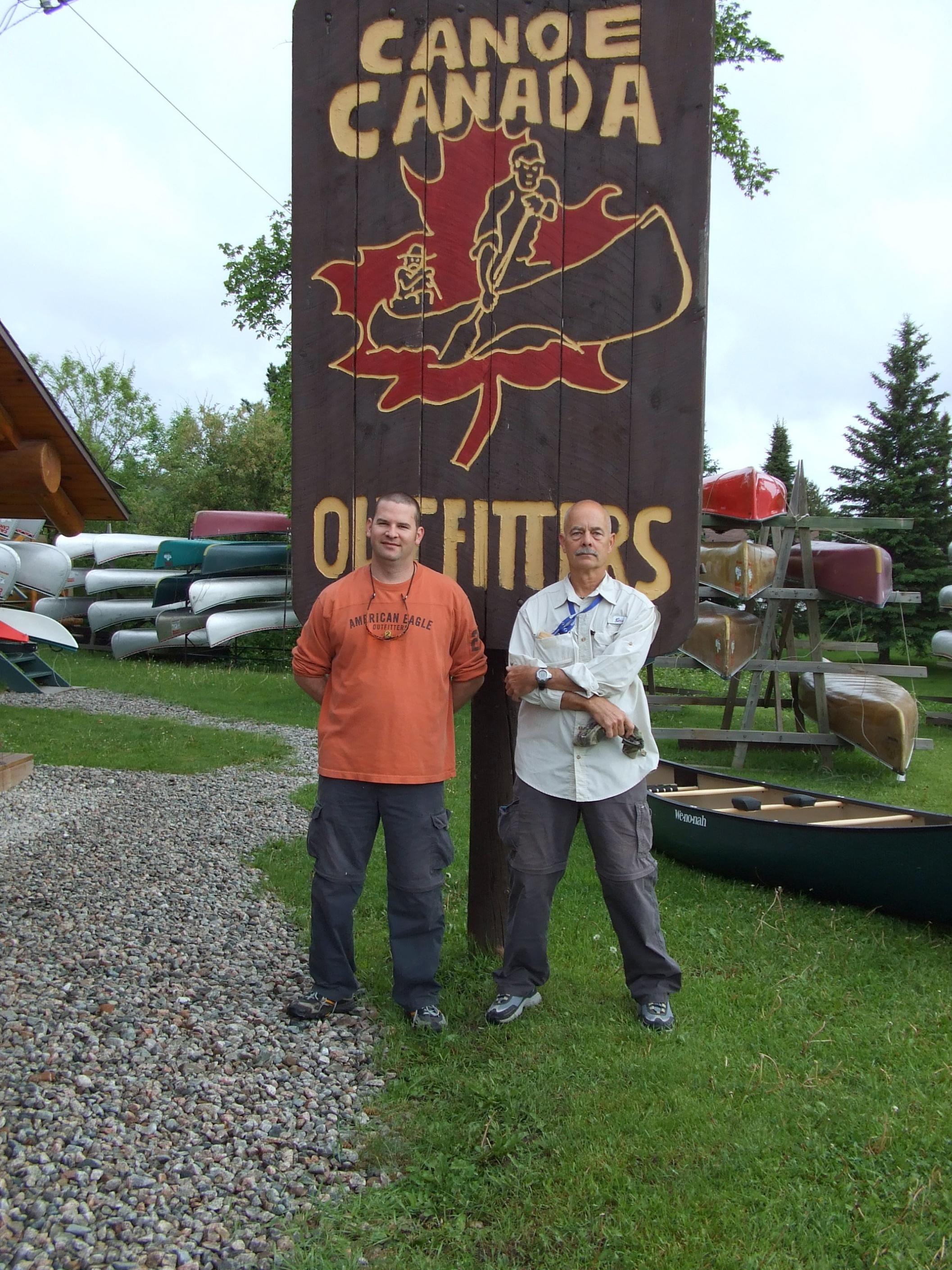
With the gear all carried over and stowed and the canoe tied down we headed back to Atikokan, Joe and I each drinking an ice cold Molson Canadian! (Actually, I think I had two.) Back at CC everyone asked us how our trip was, and I think all we could say was “awesome.” Then after settling up our account and buying some souvenirs, we drove over to the Outdoorsman Restaurant for bacon cheeseburgers and fries (“No gravy on the fries, thanks!”). After we ate I asked the man who I thought was the owner or manager for one of their wall calendars for a souvenir. There were none left, so he took down that one and gave it to me. It hung on my office wall until well after the New Year!
Afterthoughts: The fly-in and reaching an isolated setting on the first morning was a fantastic way to start the trip. The Wawiag River was quite a wilderness experience itself. Kawnipi Lake is huge and it would take weeks to explore its many bays. The Poets Chain is real jewel and a popular route, yet when we went through it was virtually empty. The fishing was the best I’d seen in Quetico. Joe caught some big smallmouth and lost a trophy walleye. The Deux Reviere-Twin-Dore area was very wet and buggy for us, but at times you cannot even paddle this route, and the rest of the trip was bug-free. We saw another part of Pickerel Lake – big water – in entirely different conditions from 2007. We brought back some memories, pictures and stories that I hope will tide us over until next year. Finally, if I did it again the only change I’d make would be to add a few days!
Trip pictures can be viewed at Picasa Web Albums: http://picasaweb.google.com/molonlabe44/2008QueticoFlyInTrip# and http://picasaweb.google.com/molonlabe44/2008JuneJoeSQueticoPics#


 Donate - BWCA.com