Quetico September 2009
by Ho Ho


We got up about 6:15 at our Jasper Lake campsite. It was warm, yet dew was still heavy on the ground. I'd guess the dew point was around 60, which is humid for canoe country, especially in mid-September.
While drinking coffee, we made use of the east-facing seat we built the night before at the overlook -

After breakfast, breaking camp, and a refreshing morning dip, we got on the water about 9:40. It was just a few minutes' paddle to the portage to Ottertrack Lake. Looking back at Jasper -

The Jasper-Ottertrack portage skirts two small ponds. The first has some big ash trees at one end. I really notice the ash trees nowadays, knowing that they may not be around much longer -

Thistles - I never know whether they are a native variety -

The second pond along the portage is shown on the Fisher map as being paddleable, but it was mostly choked with cattails as we went by -

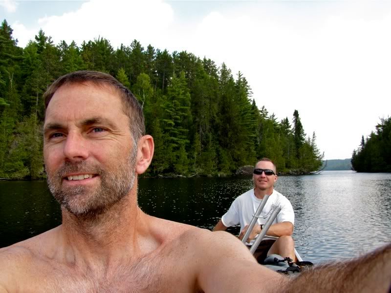
Once on Ottertrack, we paddled down the north arm of the lake toward the border. As we rounded the bend into the long stretch of Ottertrack that forms the international boundary, we looked back the way we had come -

There was a strong headwind blowing up the main body of Ottertrack. This part of the lake is marked by impressive cliffs, especially on the Canadian shore. At one point we saw something that looked like a plaque on one of the cliffs and wondered what it was, but the wind deterred us from turning back to check it out. Somewhat further on there was a lull in the wind and we took a picture -

As we continued westbound, two canoes came around a bend toward us. Aside from the duo who had been camped near us on Saganagons, these were the first people we had seen since Bell Lake several days ago. We exchanged greetings as they sped by with the wind to their backs, and then we had the lake to ourselves again. We pulled up on the American shore for a pit stop and found a boundary marker. We realized then that the plaque we saw on the cliffs further back was probably also a boundary marker, adapted to its cliffy site. Here's the one where we pulled over -

Because of the steep shoreline, there are few campsites in this part of Ottertrack, but there was one that looked promising on the Canadian side near these cliffs -

Continuing on, we came to the narrows leading into the far western bay of Ottertrack -

Looking back after paddling through the narrows -
This back bay has a BWCA campsite hidden away in it. The site was occupied as we went by. It looked like a great destination for a BW trip. We stopped for lunch at a very primitive Quetico campsite in the same bay. Filtering water at our lunch stop -

After lunch we paddled the short distance to the portage to Plough Lake. This carry was a decent workout. It starts more or less going up the middle of a creek. Or at least there was water running down the middle of the rocky portage tread. After a bit it levels out for a while into a nice path through the pines -

That doesn't last, and there are lots of wet, rocky or boggy sections. The big old cedar "corduroy" in here was picturesque, but treacherously slick -

The portage path crossing a small creek -

A little mushroom hamlet -

Arriving at Plough Lake -

Plough is a scenic, very narrow, very green lake with some more good cliffs -

We stopped to hike up the very steep portage to Littlerock Lake. I had read there is a campsite on Littlerock close to the portage, but we didn't see any sign of it scouting around by foot from the portage, so we returned to the canoe waiting for us on Plough. This picture looks back up Plough Lake from where we tied off for our little exploration -

The only campsite we saw on Plough looked like an "emergency-only" bivouac spot, so we made our way to Emerald Lake for the night. The Plough-Emerald portage is another path through a cedar glen near gurgling water. I was impressed this (slick) cedar boardwalk, it's entire width from a single tree -

There is also a multicolored rock along this portage that reminded me of the one at Dorothy Molter's from the pictures I've seen. We weren't far from the Isle of Pines. In fact, we talked about paddling that way tomorrow to check out Dorothy's rock in person for comparison's sake. These rocks hint at the huge geological forces that made the mineral-rich greenstone formations -

Funky fungus -

Giant birch in decay -

We made it to Emerald Lake with our second load of gear at about 4:30. Now it was time to find a campsite. I'd marked a possible site on the large point west of the portage, so we paddled in that direction. The point's rugged shoreline is dramatic, but just as we were thinking it seemed like a promising place to camp, we heard voices from people who were already there. Drat, foiled again!
Never mind, there were some other possible campsites a little more than a mile down the lake, and we steered thataway now. After paddling across, we checked out a site on a shallow point along the lake's south shore. It was okay, but we decided to check another candidate on a nearby island before picking our spot for the night. This second site was also decent, but neither one struck us as fantastic at first glance, so we spent a few minutes debating where to set up camp before deciding to stay on the island where we were.
We got there about 5:15, making this day both our earliest start and our latest arrival on this trip. A quick dip at the site's excellent swimming spot revived us to set up camp and make dinner. Here's our campsite after dinner and the ritual hanging of the food bag -

Now it was time to sit out on the west-facing rocks of our island home with a little Maker's Mark. We thought this site might be buggy, but nary a mosquito bothered to buzz us as night fell. A bank of clouds was visible over the western horizon -

Distant lightning flashed high in the clouds, seemingly far, far to our west. As the last light of day faded, we wondered if we could see lighting all the way from the Red River prairie lands -

Then the Milky Way came out in all its blazing glory, and we lay back on the still-warm rocky slopes by Emerald Lake gazing up at the heavens. Finally about 9:15 we pulled ourselves into the tent. We read for about an hour while a loon somewhere across the lake howled and howled like it was being tortured. Eventually we conked out for a well-earned night's rest, undisturbed by the storm far off in the distance.
 Donate - BWCA.com