southern Utah wander and big, wonderful lands
by buz
Goodbye foreign and most tourists. For the next few days, until we get to the next national park, Capitol Reef, we saw few tourists, and no foreigners. Way different experiences coming up.
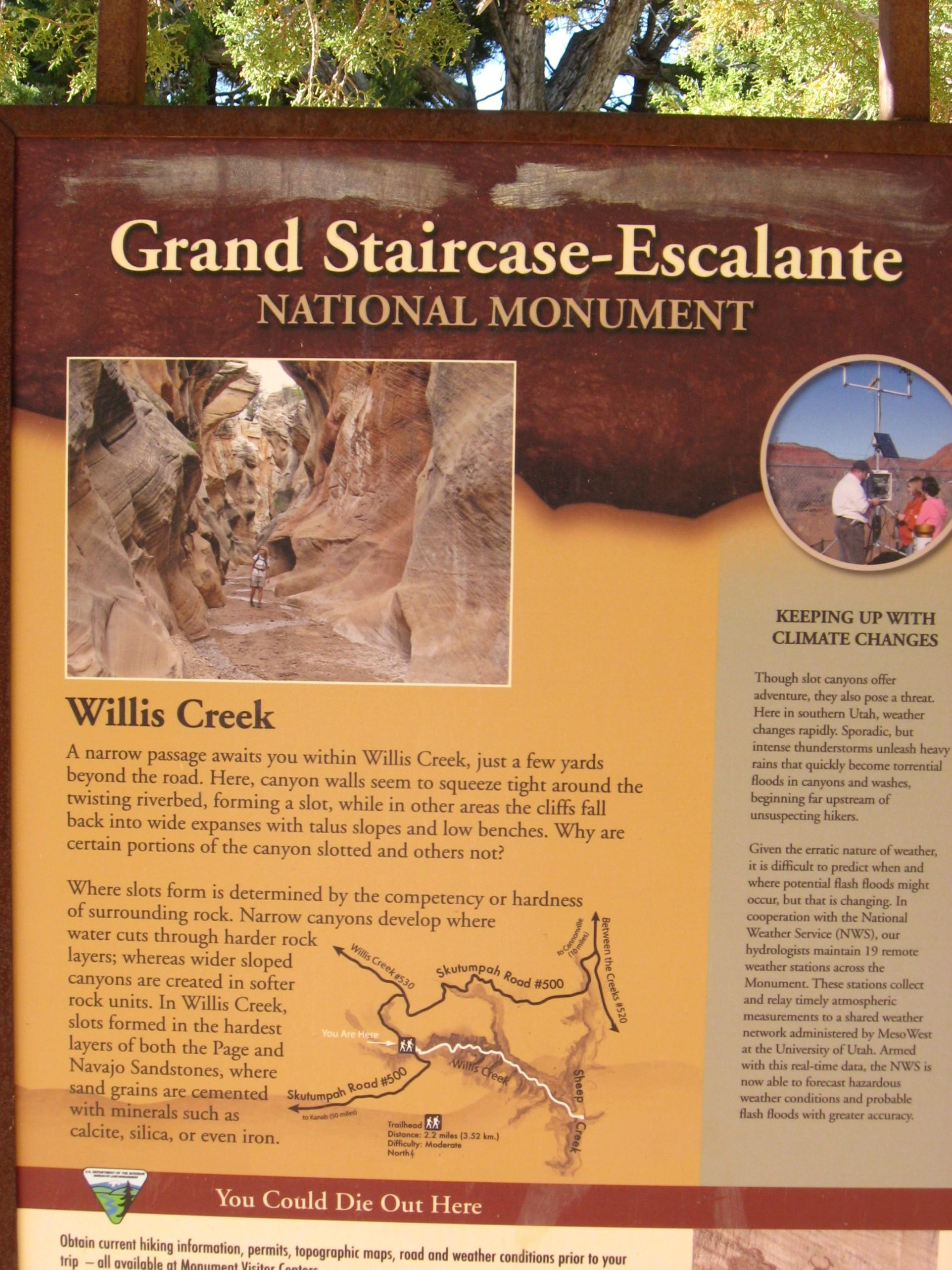
Tropic to Escalante, about 40 miles on route 12. Entered GSENM, Grand Staircase Escalante National Monument, a gigantic area with very few paved roads, and one of the most remote places in the lower 48. GSENM has visitor centers along the way, we stopped in the first on Cannonville, only about 5 miles from Tropic. Today's adventure was Kodachrome Basin State Park, Grosvenor natural arch, Cottonwood Canyon walk, back to Cannonville then out different unpaved road to Willis Creek slot canyon.
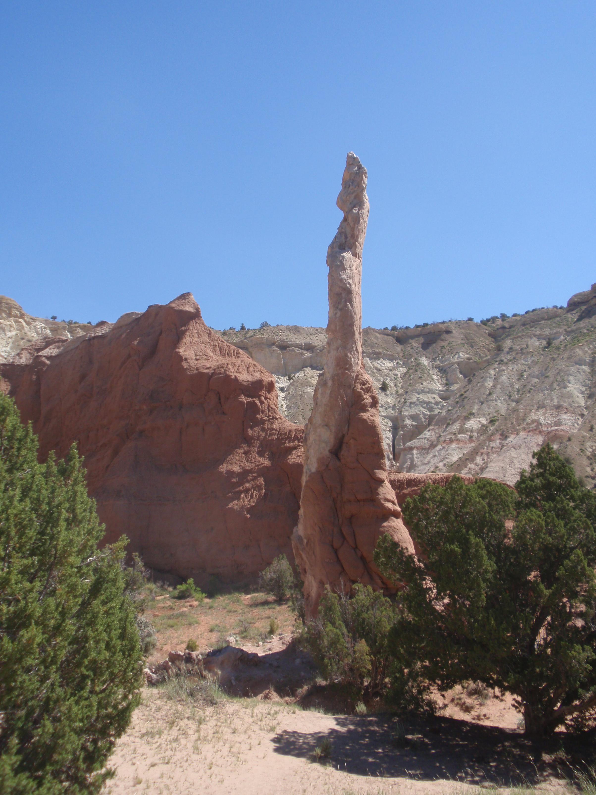
Kodachrome Basin, first up, a Utah state park about 10 paved miles down Cottonwood canyon road. Unique geography as usual, different from anywhere else in the world. The claim to fame here are stone stand pipes, which were somehow formed and turned into harder stone than the surrounding stone, which then eroded, leaving the stand pipes. If your mind is in the gutter, looks like big male appendages sticking out of the ground at various places, lol. Also, on trail we took, some unique formations with what looks like melted rock on top of hard rock, very unique to the eye. Nice state park, campground very recently fully redone, about 20 sites. Walked about 2.5 miles over trail with Bryce Canyon and great views in the background

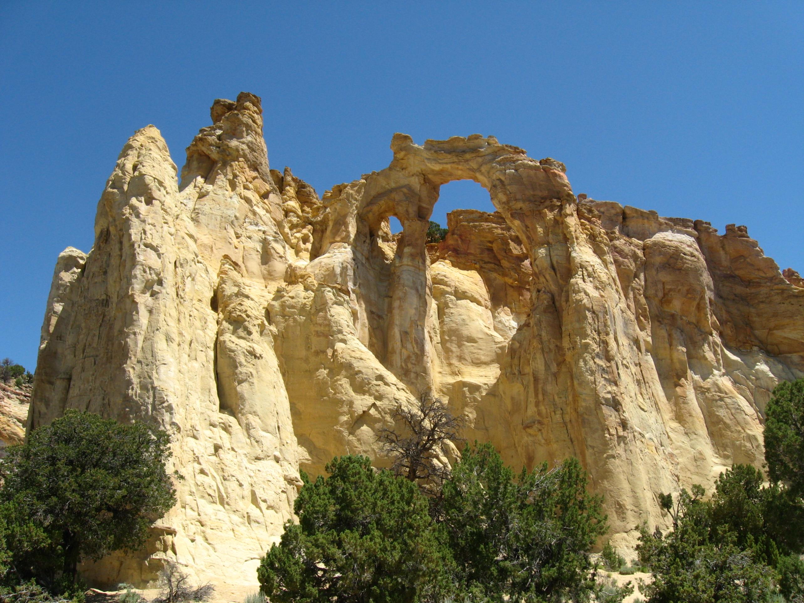
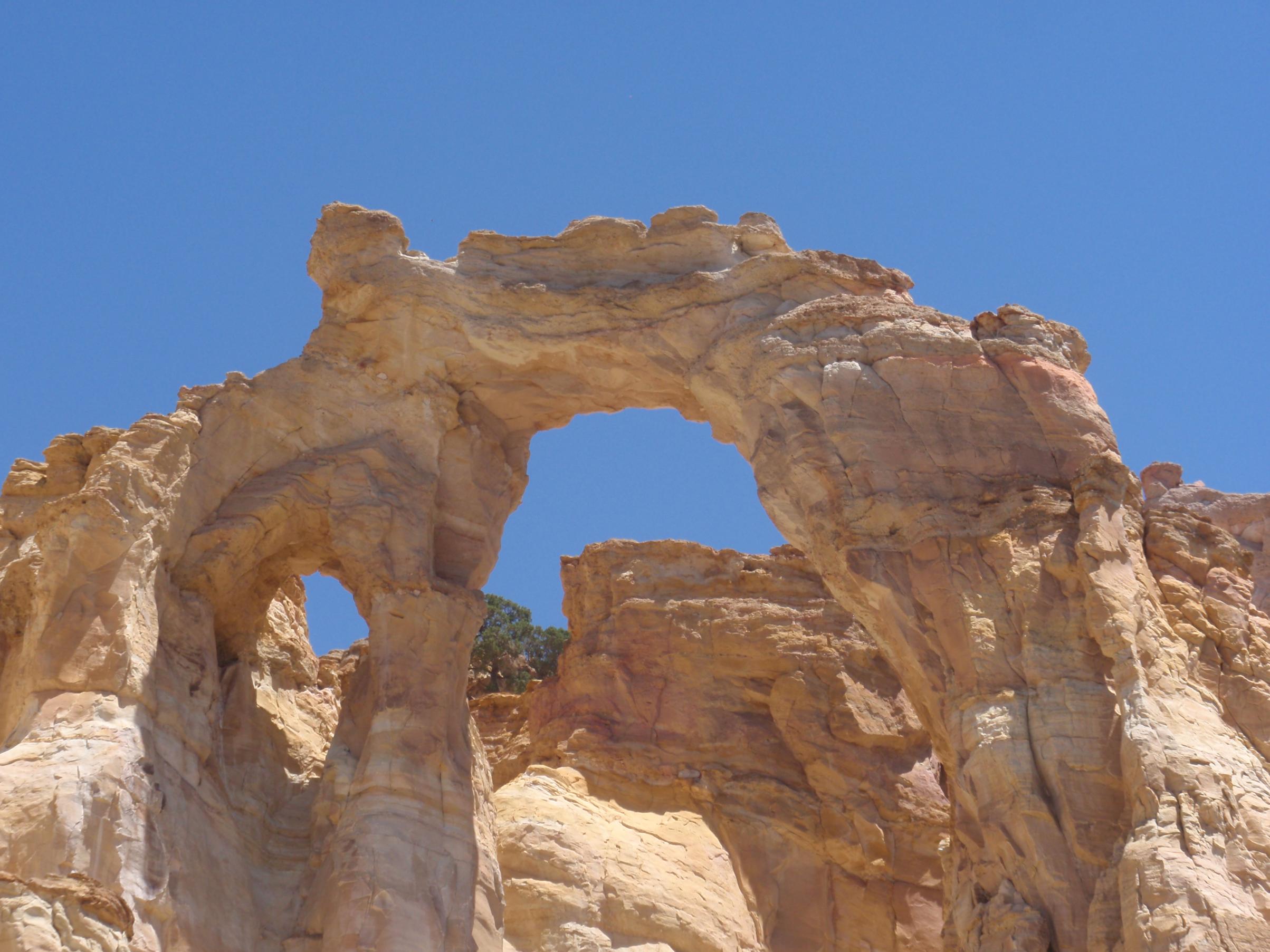
Onto to Grosvenor Arch. Onto Cottonwood Canyon road, about 8 miles, unpaved, washboardy, very rough sections, can drive up to about 40 mph down to about 1 mph, depending on road condition. Was all dry, but in clay sections very rutted. Average speed, not more than 20 mph, and we had an Explorer. We saw minivans at some trailheads, and I am not sure how they did these GSENM roads, other than very slowly.

Arch was drive up off main "road", short walk, very beautiful.
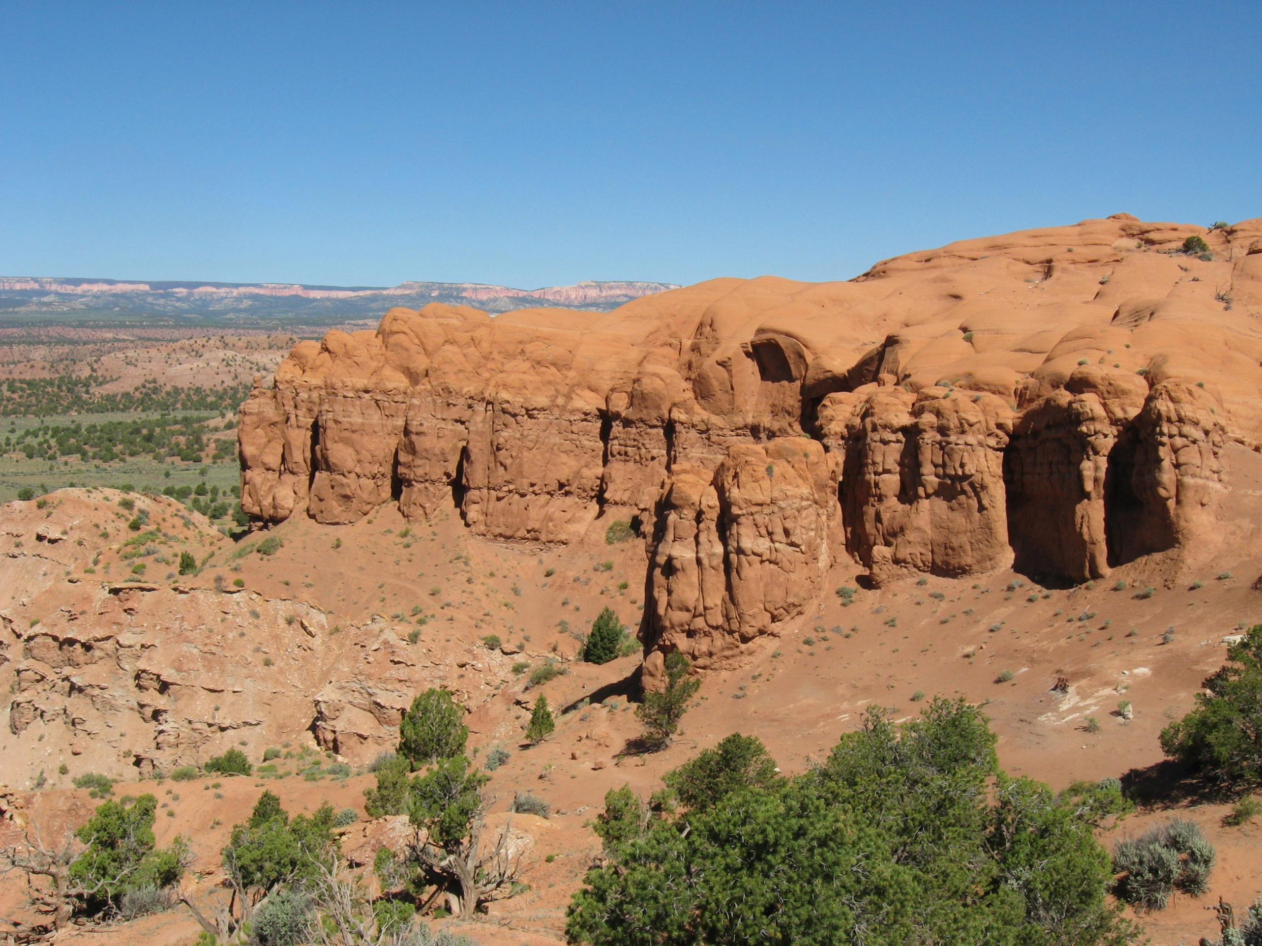
Down road about 3+ very rough miles to Cottonwood Narrows, a semi narrow canyon cut thru the Navaho sandstone. Ate lunch at car on road, at "trailhead", never saw another car or person for next 3+ hours.


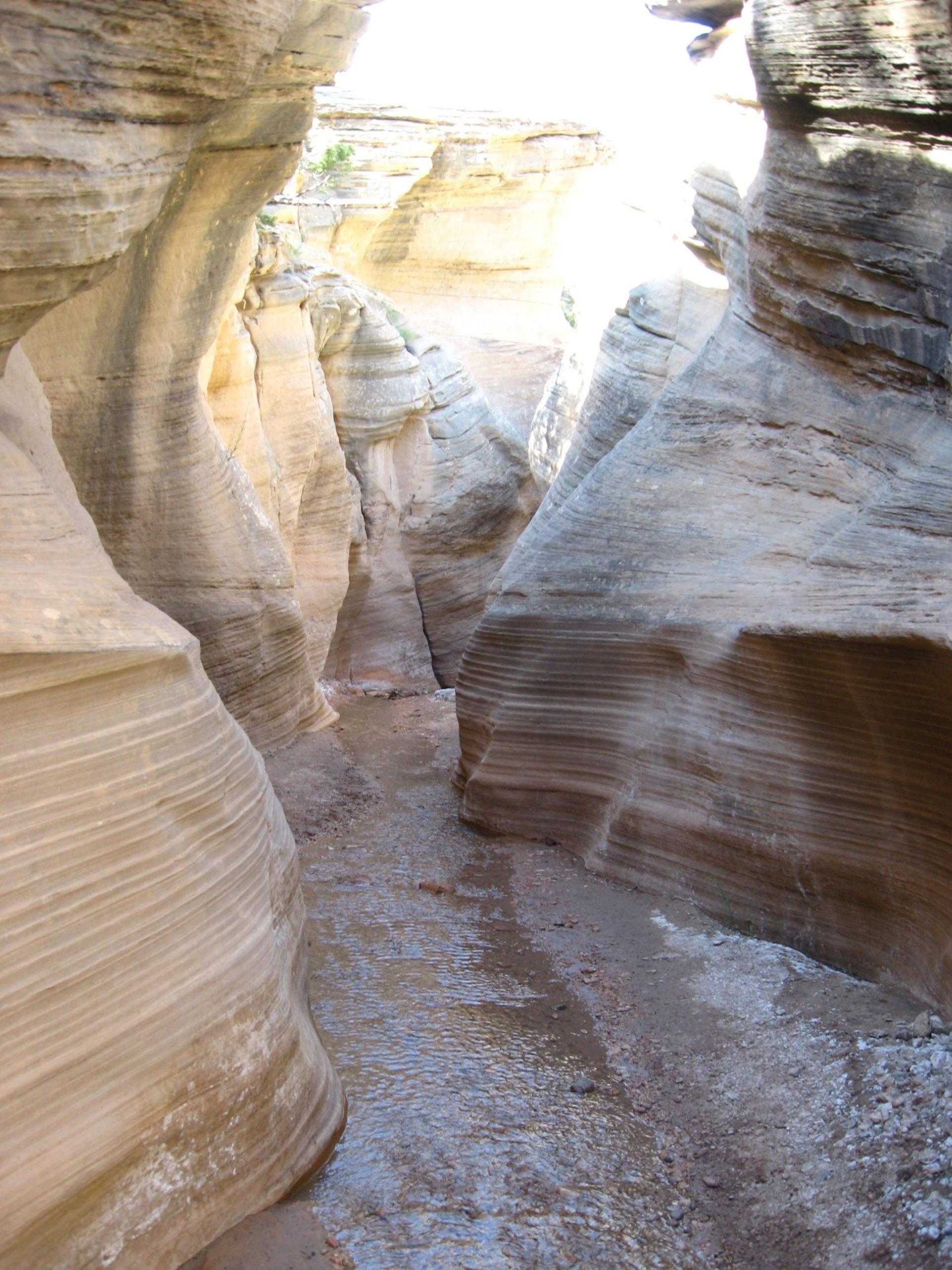
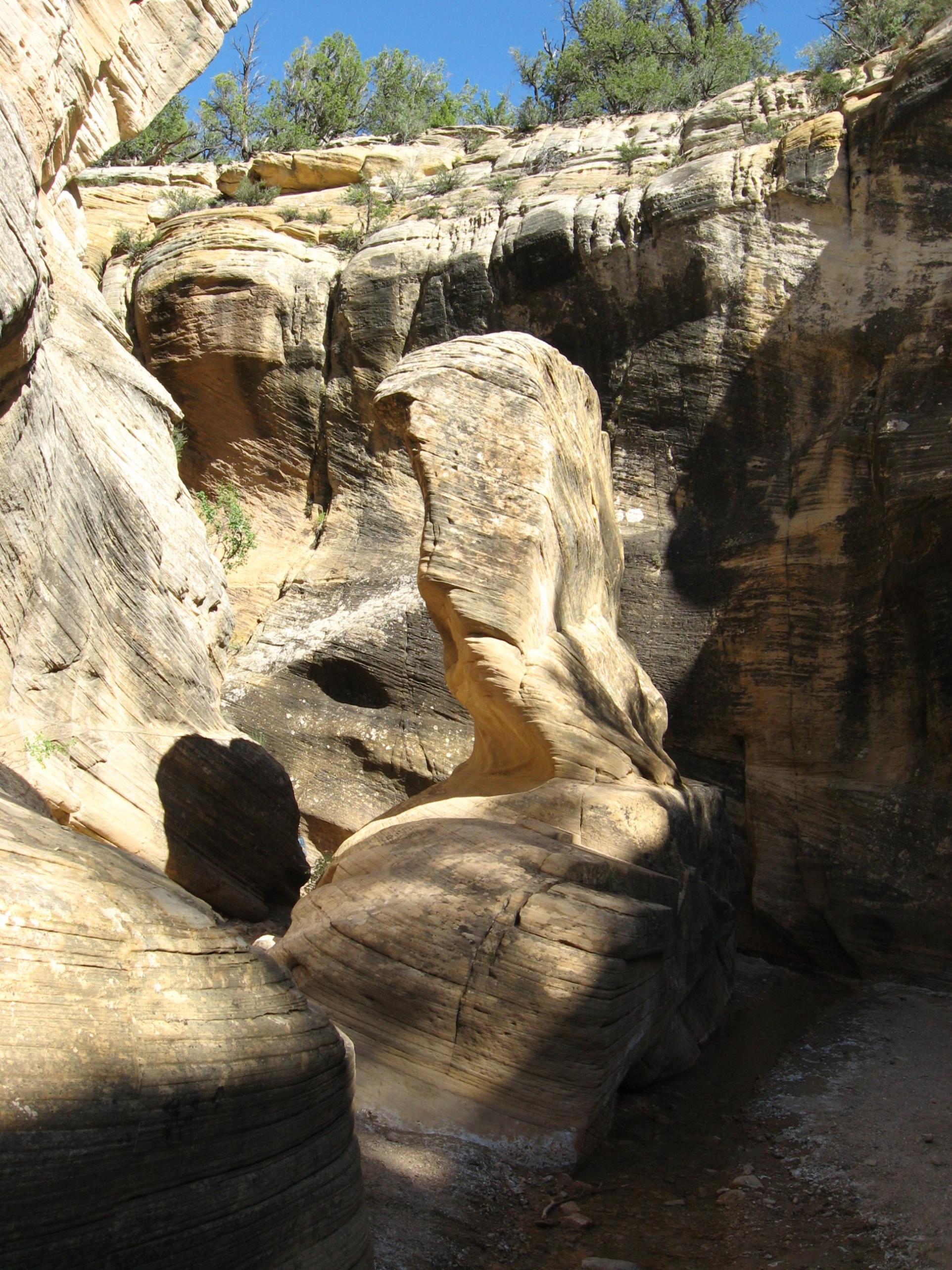
Scour holes in all of these canyons were incredible, showing the force the water rages thru them at times.

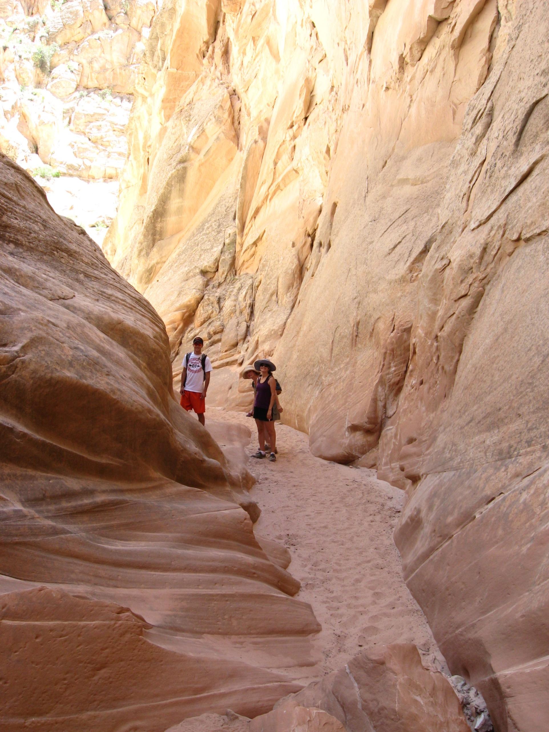
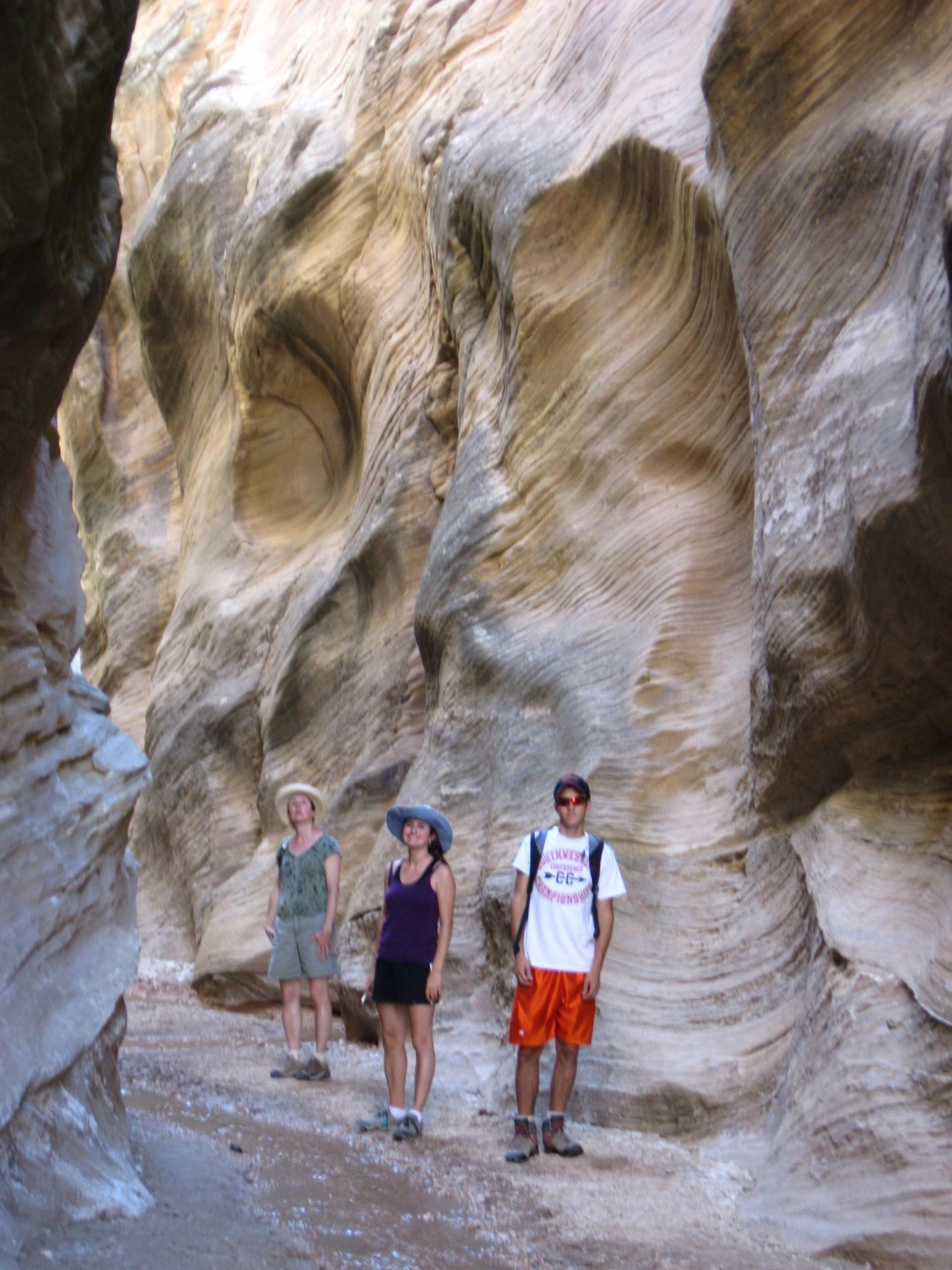
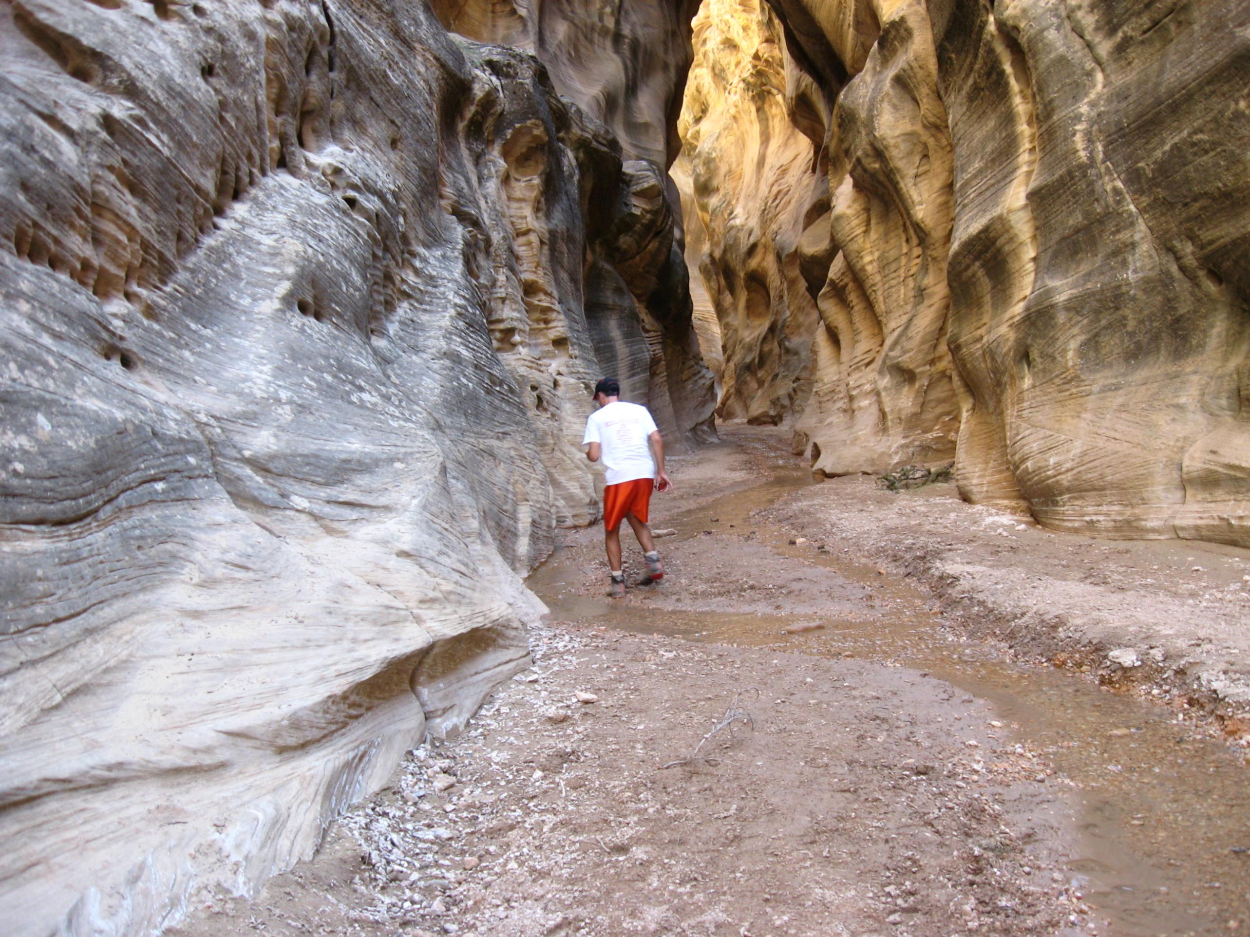
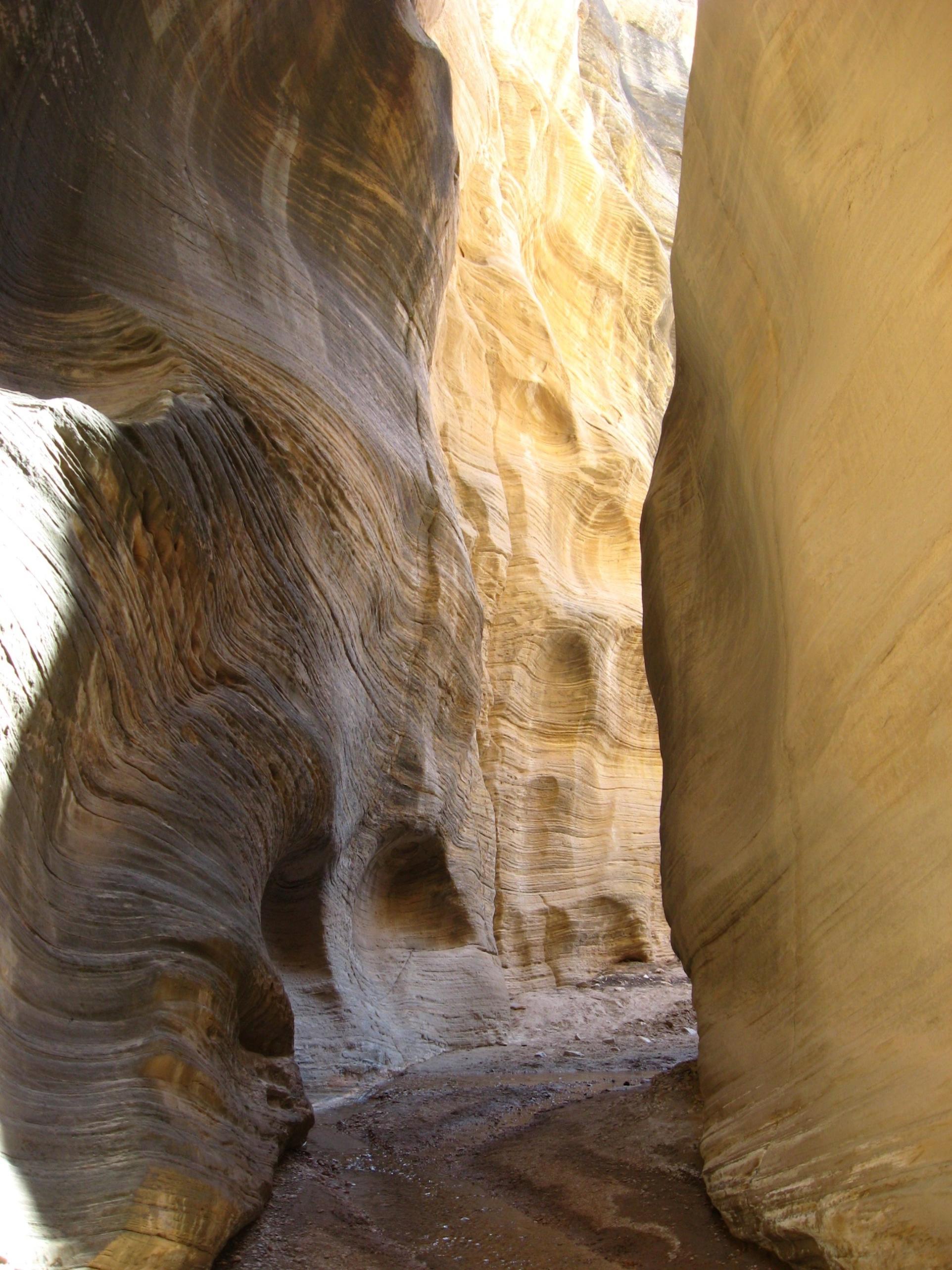
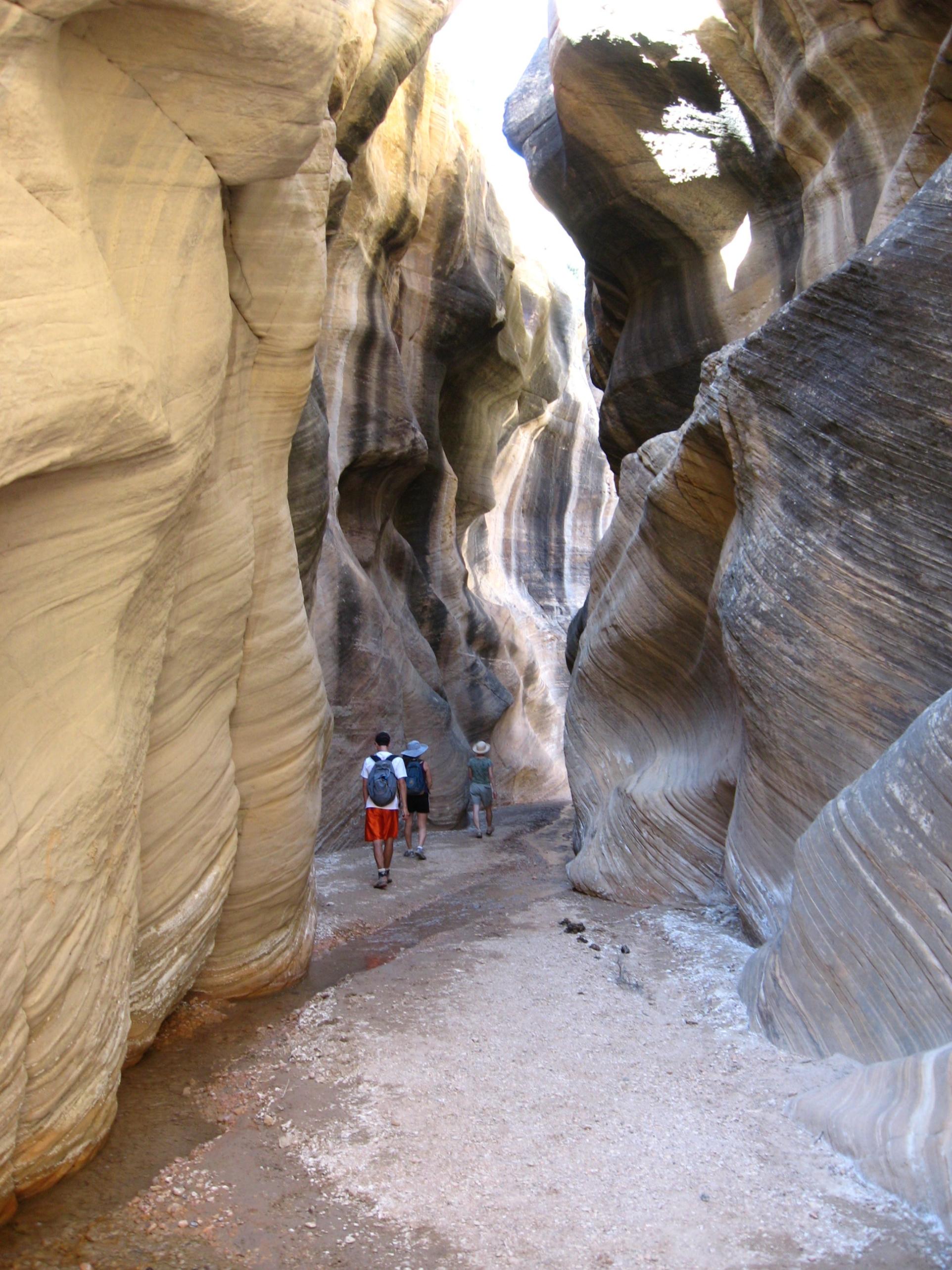
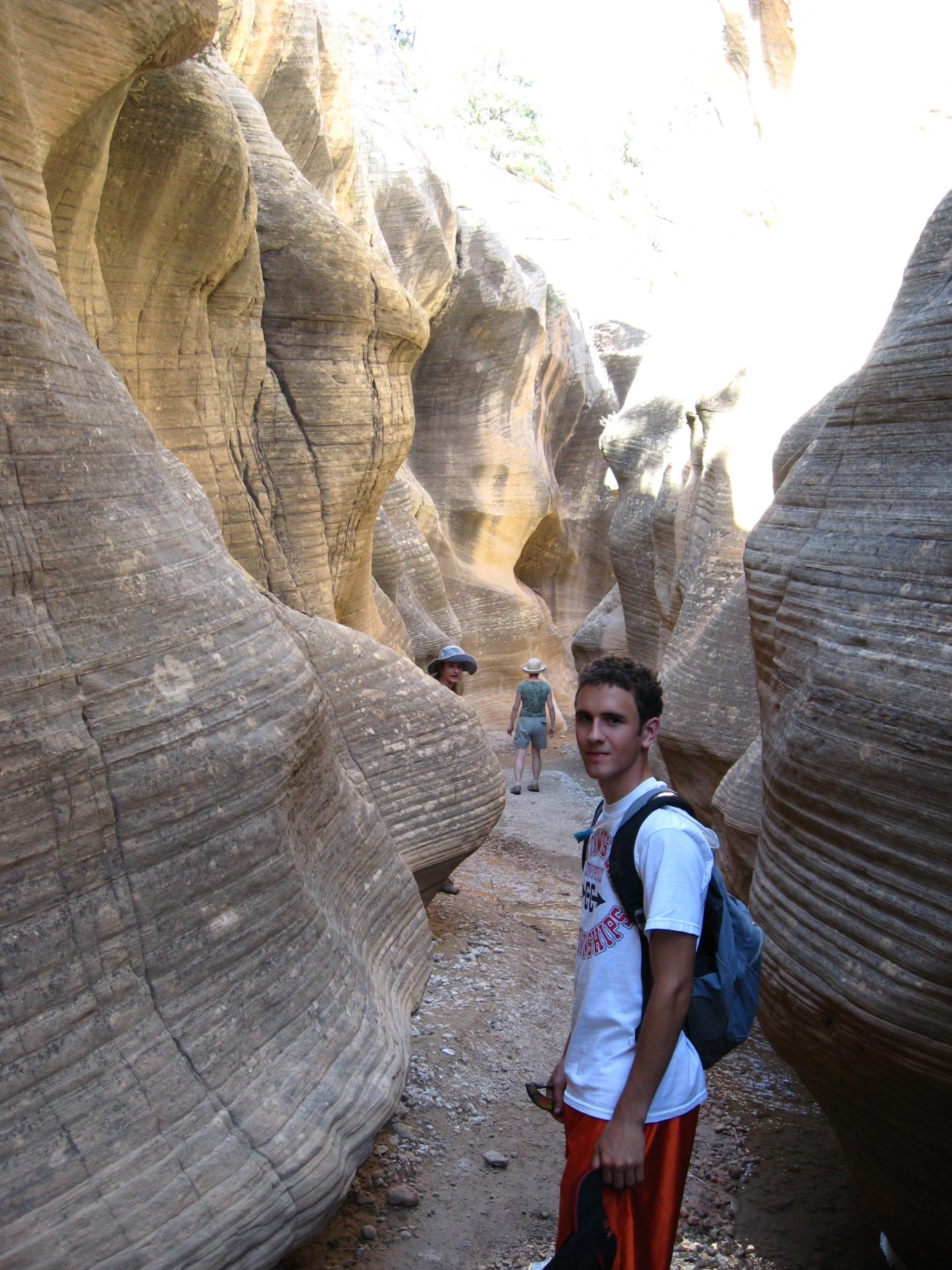
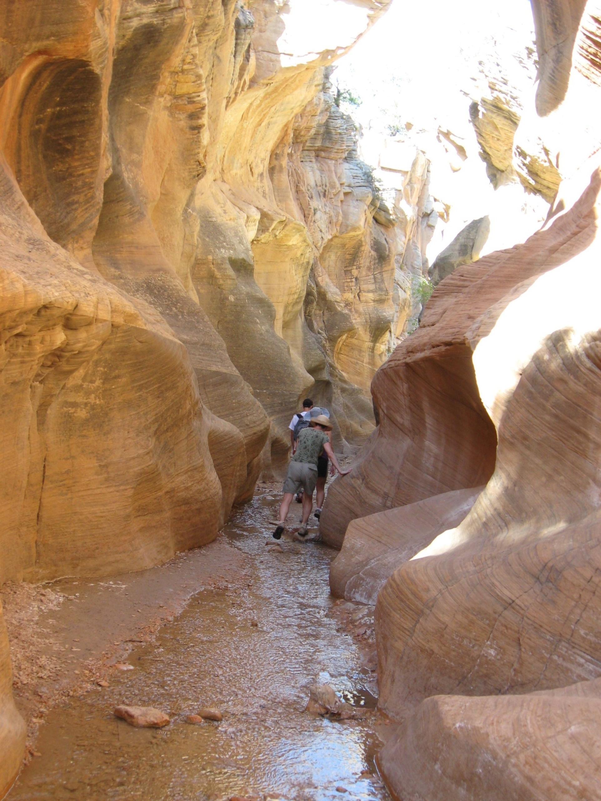
Back up road to civilization. Get gas, decide to go to Willis Creek, a slot canyon up different "road" called the Skutumah Road. Only 6 miles, "OK lets' go." Down paved road, start on Sk road. Holy **** batman. Explorer pretty challenged the first mile by ruts and potholes. Rest of of road only reallllllllllly bad. Took 1/2 hour for 6 miles. This better be good, or else dad is in trouble for bouncing family's heads off interior roof of Explorer for 1/2 hour. The tensioners on our seat belts worked real well on this adventure. They were tested multiple times. Well thank goodness, just like in BW, sweat equity (in this case my hands on the wheel of the Explorer) = very cool stuff. The hike was 4 miles round trip in a semi slot canyon, which slotted up, then opened up repeatedly. Unbelievably beautiful. Again only car at trailhead, saw no one for 3 more hours.

Rock "Island" carved by water in middle of canyon. How long this this take to make?
Couple more, think you get the point, was outstanding hike

Back to car, signed register out to show that we made it back, noticed this sign. Glad we were prepared, and it didn't rain, lol. Look at bottom, noted above all the precautions. People do die, but we didn't come close, like to think it was because we understood what the issues were and planned appropriately, like any wilderness adventure.
Down crazy road, back on pavement, drove to Escalante, about 45 miles, ate at Escalatte Cafe, man, killer pizza and local brewed organic IPA, was excellent end to fabulous day.
 Donate - BWCA.com