Quetico June 2010 (Badwater Lake) Trip Report
by OldGreyGoose
The low water put-in at Quetico Lake is no worse than before and we soon make our way north through West Bay toward the narrow sand spit portage to Quetico Lake proper. On the way up through this area, I let Joe have the map in the bow and he navigated us checking points and bays and getting a feel for how much different things look from water level than from a bird’s eye view that the map shows. When we got to the sandy beach at the short portage we carried all the gear across and then had some lunch and planned the paddle from there.
We decided to go across to the southwest corner of Eden Island, see if the campsite marked there was occupied and check it out. Finding this huge, very heavily used (and abused) site open we decided to take it and set up camp. Someone (we supposed adolescent boys) had made signs with first names, “toilet,” and other witticisms using rocks around the site. We soon ridded ourselves of this “graffiti” by moving them, turning them over, or covering them up. After pitching the tent and tarp we spent the rest of the warm, windy day resting up and planning for the remainder of the trip.


Day 6, Sunday June 27 We got up rather late. (I don’t really know what time that was.) We were in no hurry and had a hot breakfast of “oatmeal plus” which is an envelope of instant oatmeal with a generous heap of plain oatmeal and a bunch of raisins/nuts/whatever you have and powdered milk to which we add boiling water. Joe had his usual hot tea and I had instant coffee – Via or Taster’s Choice.
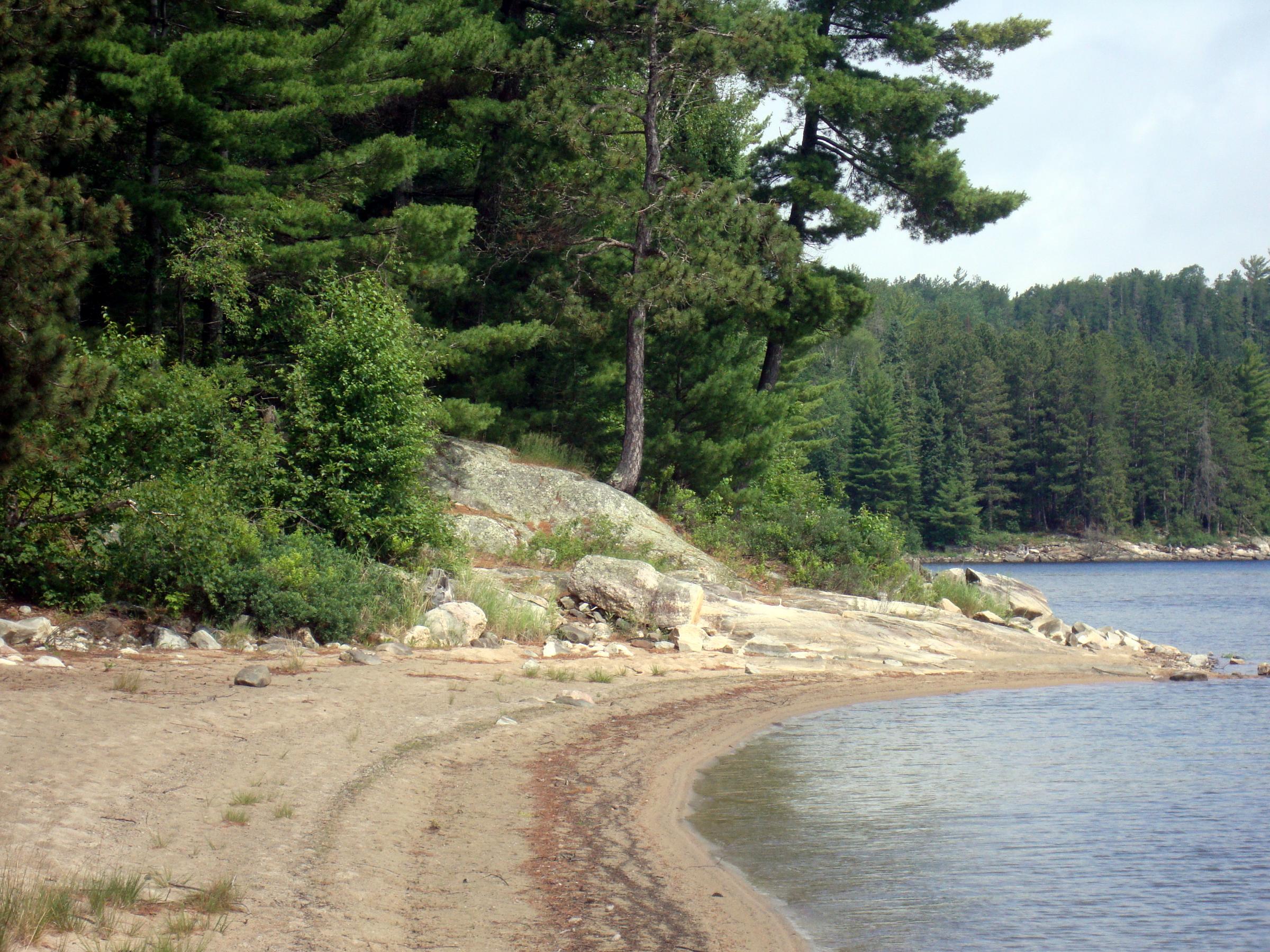
We decided to paddle around huge Eden Island, going counterclockwise from our campsite. Not wanting to leave our food barrel in camp (I had hidden it on the ground last night) and wanting some extra ballast I took it with us. This would later prove to be a “good call” as Joe said. We also took some fishing tackle, but fishing was not the main plan. It was calm and cool with partly cloudy skies as we started off and when we got to the sandy beach at the southeast corner of the island, we stopped for a look around. If you check the PCD, this site (3P) is NOT rated. On my old Fisher map, I had written “sandy beach” and a question mark. Well, it definitely has that, and a BIG one, AND a lot more, but more on that later.
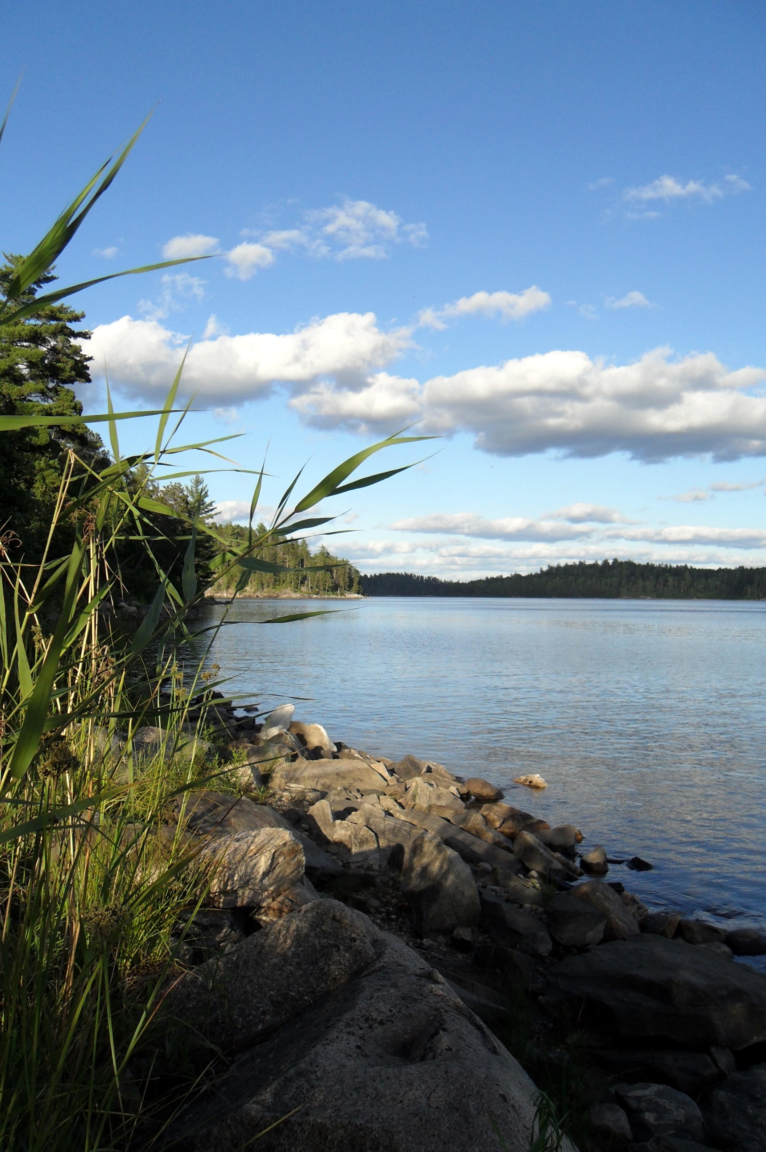
After looking around, noticing the many human and deer tracks on the beach and having some water and snacks, we looked at the map and headed northeast in a roughly straight line with Joe getting some more navigating practice as we paddled steadily up the east side of the island. We made pretty good time, checking our progress by spotting a couple of campsites that could be identified on our map(s). The weather became mostly sunny and the wind picked up as the temperature rose. We had reached the narrowing on the northeast end of the island and I told Joe we should head for the pictograph locations that were up ahead. As we neared the more open water of this area, we could see that a West wind was starting to kick things up pretty good along the north shore where we were headed.
We paddled to the east end of the granite cliffs and then turned directly into the wind and went along close to shore looking for the displays. I know there are supposed to be an otter and a caribou and something else but we could only find something that appeared to be a Cross. As we passed the last cliff and approached the narrow slot that leads to Cirrus Lake, we could really feel the wind and sensed that it could only get worse heading this way. We paddled hard and got to the narrow pinch point where the wind was funneling through from the western side of the island and pulled the canoe in behind a rock slab point and got out to have a look.
We climbed up several yards above water level and over the rock where we could see a mile or so to the west. It was solid whitecaps as far as we could see. I wanted to get up higher so we climbed the fairly open hillside to an old campsite. It was clear that it would be a difficult and probably dangerous paddle to continue west. (Note: This campsite is not on any map that I have and is not in the PCD. Its location is south-southwest from site 3W across the water and high up on the hill overlooking a cove. It did not appear to have been used for a long, long, time – maybe years.)
Joe and I went back down to the canoe and opened up some snacks and drank some water. We both agreed it was no use going further and that we should return the way we came and hope the east side of the island was in the lee of the wind and we could make it back to camp that way. We joked about having the food with us and being able to survive for quite a while without making it back to camp. (In my mind I was pretty sure we’d be alright going back as far as the sandy beach site, but I wondered to myself what the final 1½ miles or so heading west from there would be like.)
We headed back east, and then turned south around the big beak-like end of the island where we found it very breezy from the southwest and with some whitecaps, but nothing dangerous. By not heading directly southwest like you normally would and turning a little west and keeping closer to shore we were able to paddle hard and steady towards our waiting “haven.” As we got closer, we were more protected by the island and the final ½ mile or so was pretty easy steady paddling, which by this time was much appreciated. We made it back to the sandy beach about 12:30 pm.
It was blowing a gale from the west through the main channel of Quetico Lake and we had probably 1½ miles to go. What follows could be called “how we spent an afternoon, stranded on a sandy beach.” We lunched, walked the beach, lay in the sun, laid in the shade, talked, fished (Joe did), and generally worked on our patience and ability to accept fate. I thoroughly rinsed myself in the lake about twenty feet from shore where the water was very clear and about crotch deep. (Firm sand bottom with no leeches!) Later we snacked again and inspected the campsite adjacent to the beach.
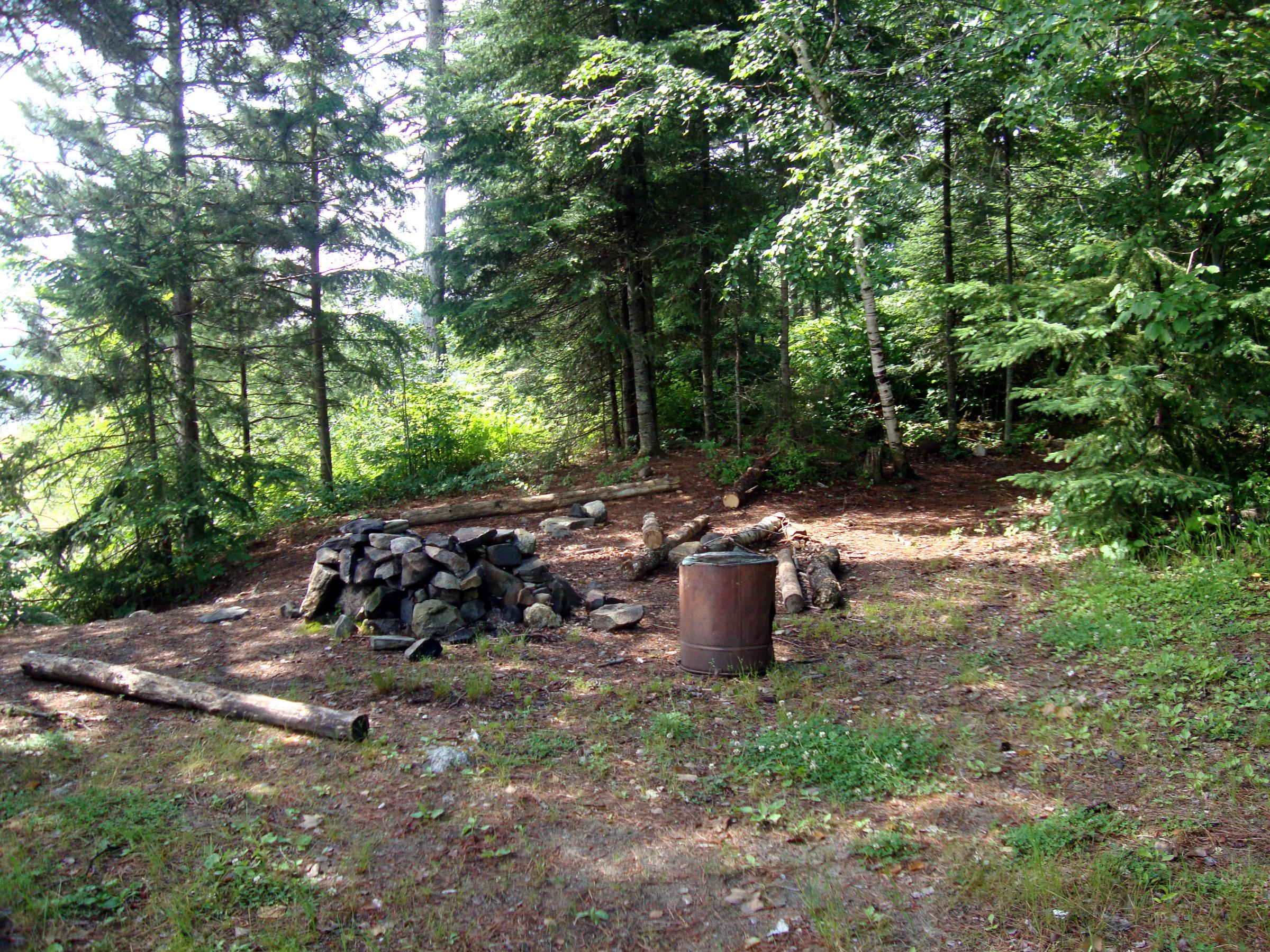
The actual campsite sits north of the beach, is 6-8 feet up above the beach and hidden from view from the water. It is a fairly small, level site with a nice fireplace but “disrupted” log seating. The sight shows little signs of use, although the adjacent beach shows much use and actually has its own fire pit. We saw no great tent pads, but there were at least two “ok” ones. Two relics – a rusty barrel and an old bucket – were lying in the camp area. Underneath the barrel was an empty glass (liquor?) bottle.
Off and on during our stay on the beach one or both of us would walk up to the point and look west. Each time we saw the same old thing, endless whitecaps and relentless rolling waves. Several times as the afternoon wore on it seemed to calm somewhat off shore from the beach, but the beach faces east and that was the lee side. Finally, after about a dozen times of thinking it was calming and being resigned to it only being a ruse, it did start to calm. At 5:30 pm we knew we could paddle into the now calmer waves and were fairly certain that it was not going to kick up again. We set off and paddled easily back to camp arriving about 6:30 pm.
Safe and sound at camp, we secured the canoe and settled in at the fireplace for a couple shots of “Jack” in celebration. (Later, making supper, I had this rather complicated recipe that I kind of screwed up – I guess I should have waited until after supper for my Jack.) Needless to say, this is not how we had intended to spend the day, but on the positive side, the five hours spent on the beach were some of the best of the trip. On the negative side, it was kind of a throwaway day in terms of accomplishing anything, seeing much new territory, or catching fish. We went to bed tired – probably mostly mentally tired – and I slept like a rock for the first time on the trip!!!


Day 7, Monday June 28 Today it was very windy and we were stuck at camp all day . . . The wind blew from the N/NW all day and sometimes it was actually cold on the windy side of our point and hot on the lee side. We passed the time talking, exploring the shore and doing odds and ends around camp. We found a couple of tufts of deer hair attached to hide – probably going with a piece of rib we’d found earlier – Joe guessed that wolves got the deer on the winter ice. At one point during the day we watched an algae-eating striped minnow that reminded me of ones I’d seen in our Missouri Ozark streams.
On the wind side of the point we had whitecaps and rolling surf crashing the shore all day. We estimated the wind speed at 35 mph, at its peak. I wondered all day when we’d be able to leave here and we listened to the NOAA weather radio off and on. (Later, back at in Atikokan we heard that winds in International Falls had reached 55 mph and Jeremy said it had been one of the windiest days in the last couple years.) At one point, I had on two tee shirts, my long-sleeved shirt, long pants and my full rain suit to stave off the wind chill.
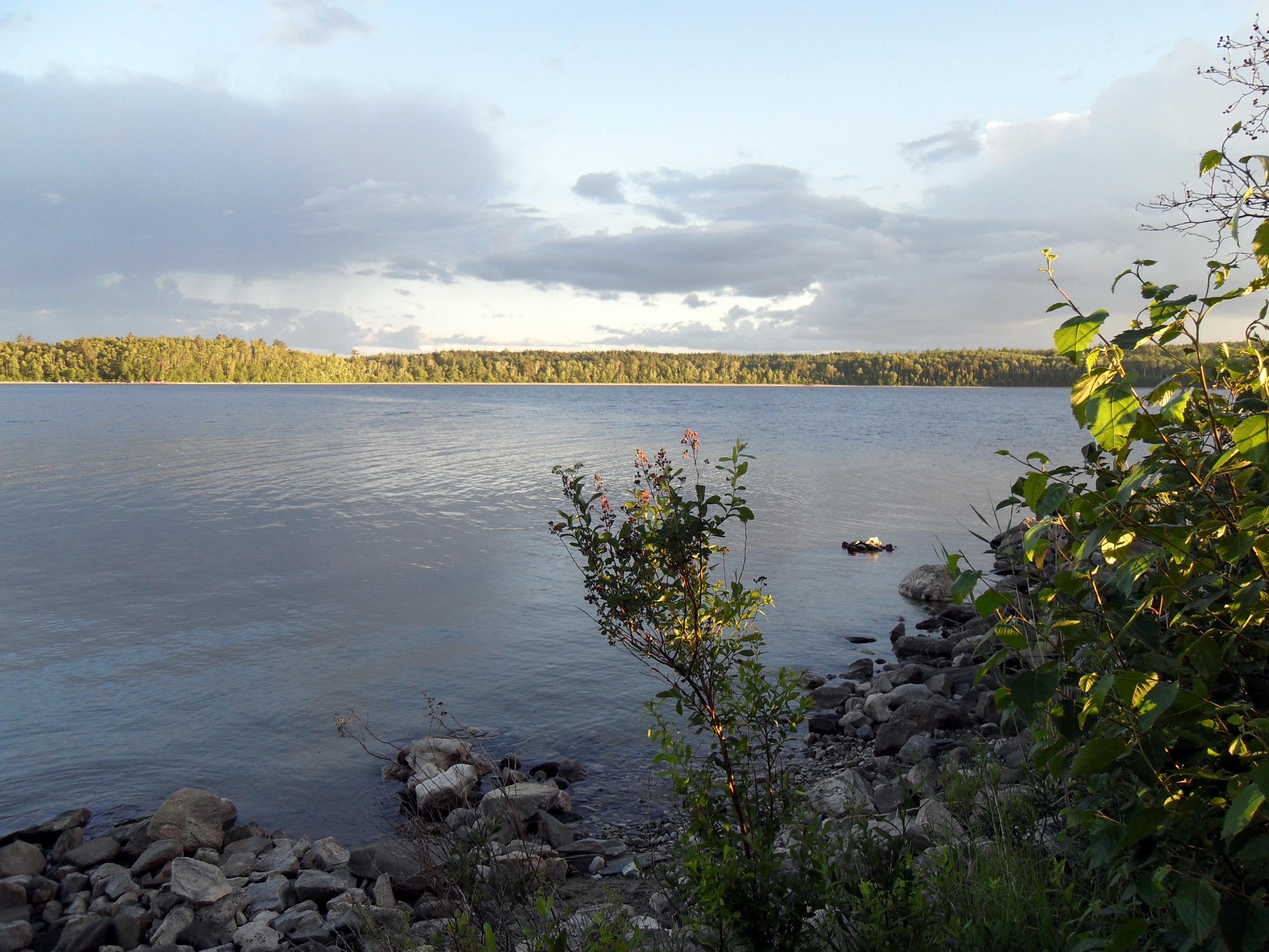
Late in the day we paddled out on the lee side to get some fresh water as it had become very calm on that side. I had been taking photos off and on all day around camp and as the sun began to get low, got some nice photos from the lee shore. NOAA radio, whose signal seemed to vary depending on where we stood with the radio, predicted a low of 35 degrees for International Falls and 40 for Quetico. The wind seemed much less at dark as we had our last cigars and got ready for the tent, but it came back strong sometime during the night and it also rained a little overnight.


Day 8, Tuesday June 29 I was awake at daylight and the wind was rustling the tent front and back and I thought “Oh no, not another day of this.” At about 5am I got out of the tent and my watch thermometer left outside read 46 degrees. I walked to the windward shore and looked things over and went back to the tent and told Joe things looked good for traveling but that it probably would be windy before long and we should get going and “bug out.”
The sky was clear and the morning air was fresh and clean. We rustled up two cups of coffee/tea and had granola and Rice Krispie bars for a quick breakfast. Joe packed up the stuff inside the tent while I packed up the fireplace stuff and fly, then we took the tent down and we were ready to load the canoe and head off.
Since it was still pretty calm on the shore with the sandy beach across from camp and since we’d seen two parties spend some time over there during the last couple days (possibly waiting to see if we vacated our site?) we decided on a quick look at where they had camped. We found one decent campsite at the far east end of the sandy beach with an actual tent pad and fireplace back in the woods. (This would be the preferred site over the “makeshift” one at the portage across the peninsula.) It was a little breezy paddling over to the arm leading to the portage to Beaverhouse, but once in the arm itself it was practically calm.
Arriving at the portage we negotiated the low water obstacles and carried our gear over and took a few pictures. We paddled out into the main body of Beaverhouse where it was beautiful and almost calm. I think we both were wishing we could have spent a couple days and fished for smallmouth here, but it was not meant to be. When we reached the cove where the portage to Cirrus is located we stopped to look around since I was planning a solo trip using the Cirrus Lake entry in September. As we approached the shore we noticed a deer back in the weedy creek – our fourth whitetail siting on this trip.
We beached the canoe and I walked up the hill toward Cirrus until I reached the point where it levels off, just to see what it was like. (I was surprised that the trail was so narrow and seemed like a portage deeper into the park than it was.) After I climbed back down we paddled up the creek mouth to the take-out and carried the canoe and gear to the parking lot where we loaded up the van and headed out in search of our traditional after-trip meal of bacon cheeseburgers and fries.


Thanks again to "OldHoosier" for pre-trip information about the Badwater-Bee-Omeme-Pelee area!
 Donate - BWCA.com