Quetico - 17 Day Solo (Part 1 of 2)
by PineKnot
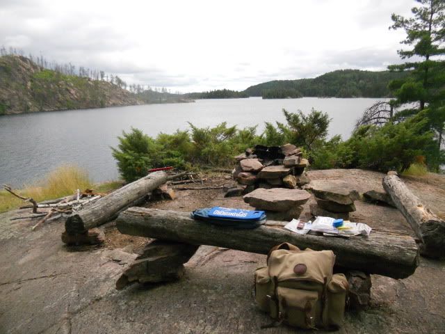
The wind is still blowing moderately from the north, but this south-facing site is mostly calm even though it’s high above the water. I explore the several walking paths and find outstanding views of north Kahshahpiwi. It was a good thing I gathered some wood on the paddle up here, because there is no firewood near this site. It starts to sprinkle, so I quickly put up the tarp and relax for an hour or so with a cigar and a drink. By late-afternoon, the sprinkles subside so I erect the tent and begin cutting and splitting enough wood to bake the trout. As the fire starts to burn, I lay the fillets on foil, rub in my special Cajun spice mix, and top it with some butter.
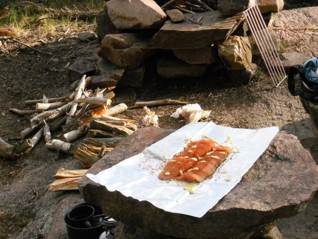
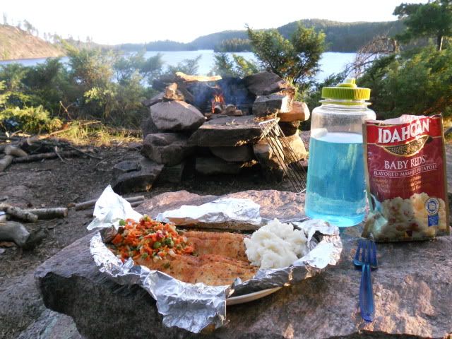
Once the coal bed is ready, the foil-wrapped fillets go on the grill and I cook up some baby red smashers and mixed veggies. Nothing quite beats the first lake trout dinner on a Quetico solo!
I get everything cleaned and secured for the night. With enough sunlight still remaining, I find a path that leads down the granite bluff and near the water’s edge facing south. There’s some really nice sitting areas down here. I watch hundreds upon hundreds of water bugs congregate into two distinct groups in the eddy of the granite bluff. The two groups never converge into one and remain separated by about 10 feet. I watch them and each seems to pulsate, alternating from a tight dark mass only to explode out, looking like a watery version of the Milky Way. As the wind calms and the sky darkens, I climb back up to the campsite and into the tent. I don’t know what tomorrow holds. Physically, I’m feeling really good. I begin to think about laying over a day, heading west over to Marj like I had planned, or pushing north and making a run to Camel, with the outrageous thought of bushwhacking into Hoare, bad knee and all. That's when I realize I left my McKenzie maps of the Camel route back in the car. All I have is my trusty Chrismar map and my memory. I’ve never tripped in Quetico before with just the Chrismar, but it should be doable. And I think I can remember where most of the campsites are and the details of the bushwhack into Hoare and the Death March. These thoughts continue to bang around in my head as I warm up in my sleeping bag. Just before falling asleep, I decide I’ll move in the morning. I have plenty of days left and am in no real hurry. If the wind is down, I'll head north.
Day 4. Kahshahpiwi to Baird via Heronshaw and Metacryst
Total Miles - 14.8; 7 Portages (1660 yards)
View 2011 Day 4 in a larger map
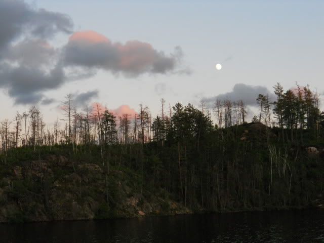
During the wee hours of the morning, I wake up to the sound of "ploosh" as if some big rock had been thrown off the nearby cliff into the deep water. "What is making that sound?" It went on for about 20 minutes, with a “ploosh” every few minutes or so. It wasn't the distinct slap of a beaver tail, and it was too low pitched to be a small fish. Maybe some big lakers feeding on the surface in the middle of the night in mid-July? Maybe some playful otters competing in a cliff-diving contest? Ploosh. 9.5! Ploosh. 9.7! Ploosh. Yes! That’s a 10! I fall back asleep and wake up at first light to a cool, calm, partly cloudy sky. The moon is still visible as sunlight begins to shed detail on an eastern shoreline still showing the scars from a massive fire that ripped through it a few years ago.
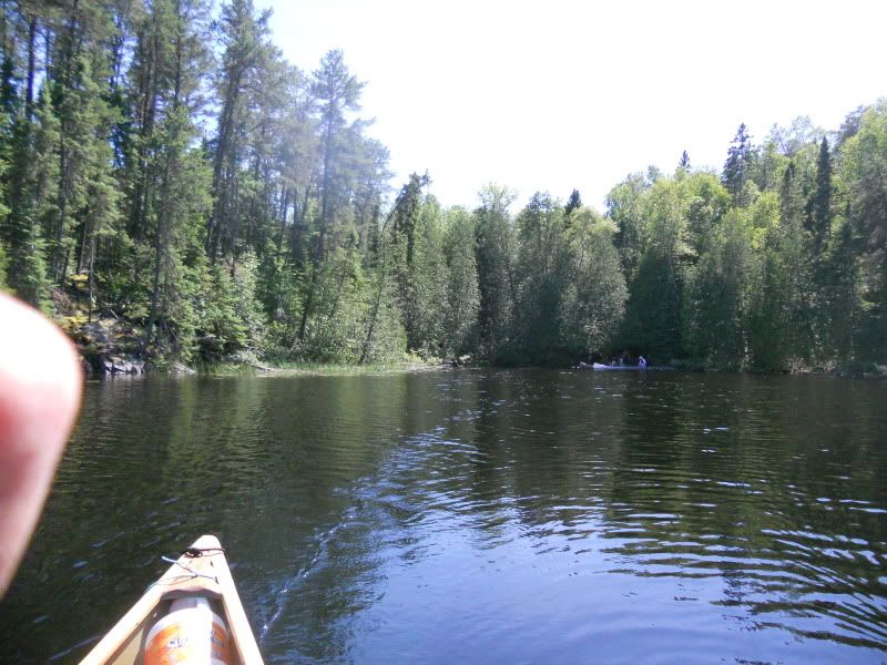
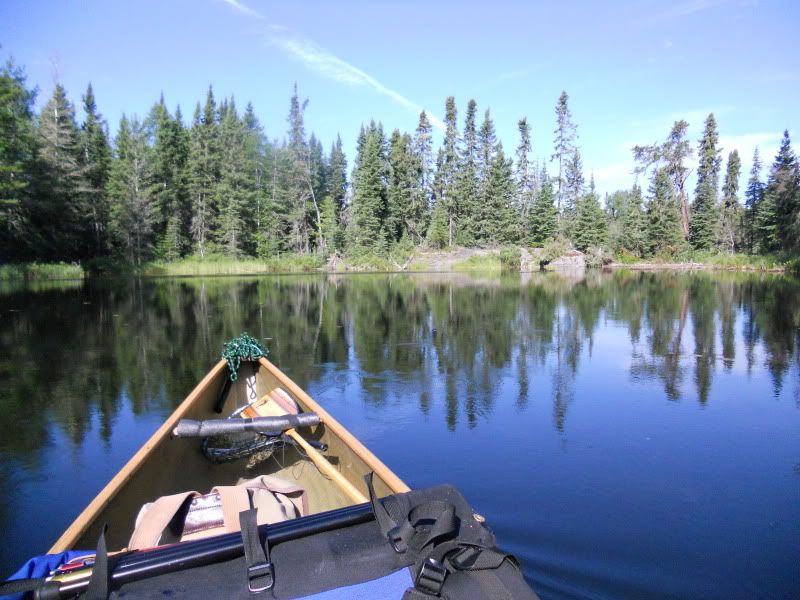
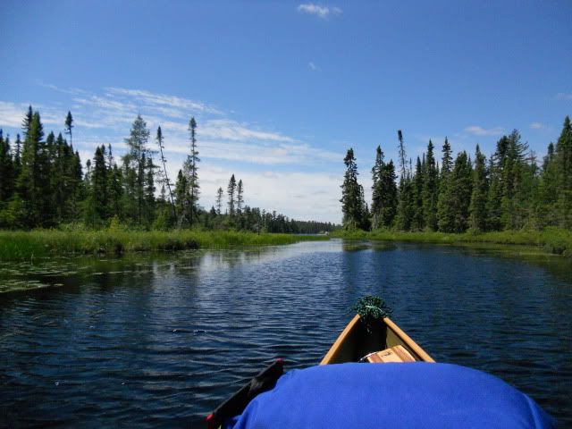
It’s a bit after 8:00 as I finish my coffee and cereal. The wind can’t seem to make up its mind. It seems to come from the south, then the north, then the west. I see some high cirrus rolling in from the western horizon. Time to pack up and head north. I quickly reach the narrows heading to the northernmost area of Kahshahpiwi.
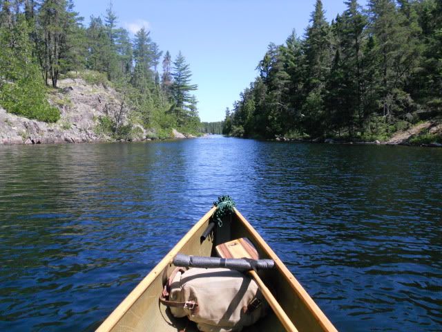
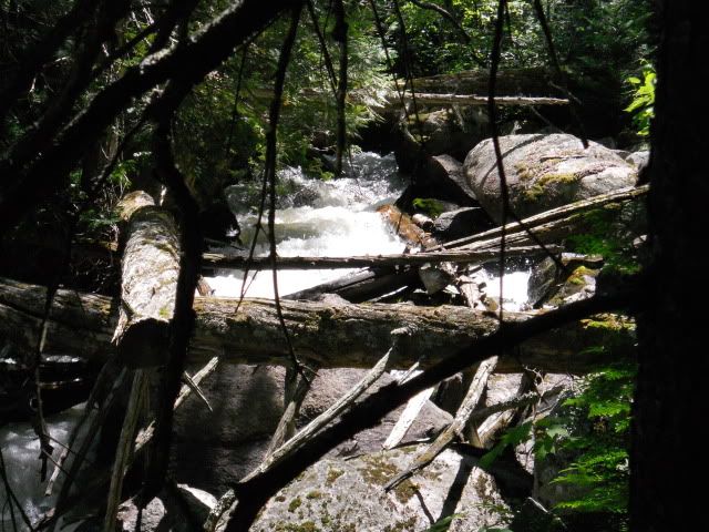
The short portage into Keefer follows a scenic little set of rapids. I look back at the outflow into Keefer,
This place definitely looks fishy so I cast my spinnerbait at the base of the outflow several times. Nothing. I grab the deep husky jerk and begin trolling north towards the main body of Keefer. Still nothing. The eastern shoreline is quite steep and picturesque with numerous steep rock faces studded with trees sprouting from hidden cracks and crevices in the rock. As I near the main expanse of Keefer, it starts. A little wisp at first. Then another. Getting stronger. Now it’s pretty steady. You’ve got to be kidding me! I put away the rods, grab the yak paddle and begin a slow, methodical paddle, into a modest northerly breeze. I think to myself, “Hey, it’s only about 12 more miles to Baird”. And the wind isn’t that strong. Yet. I’m beginning to not like the Quetico gods.
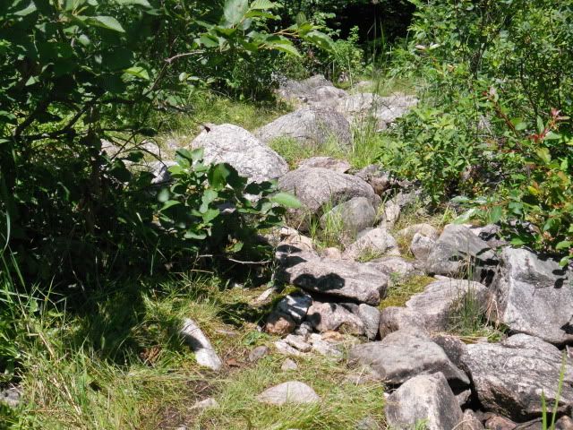
I reach the 320 yard portage into Sark in about an hour. Not bad. Roughly 3 mph soloing into a modest breeze. The take-out requires a bit of boulder hopping before getting to the main path, which is rocky and rooty, but well worn.
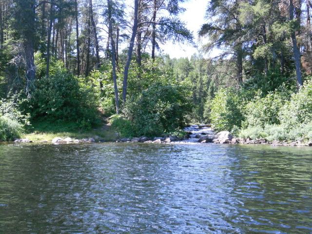
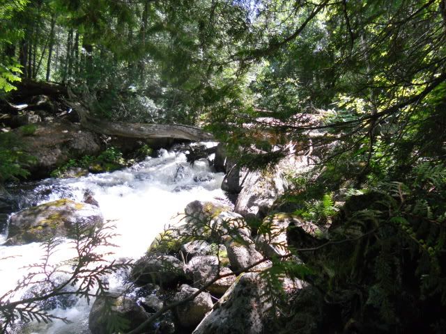
The portage parallels a scenic creek that has some quite noisy rapids as the rushing water crashes towards Sark.
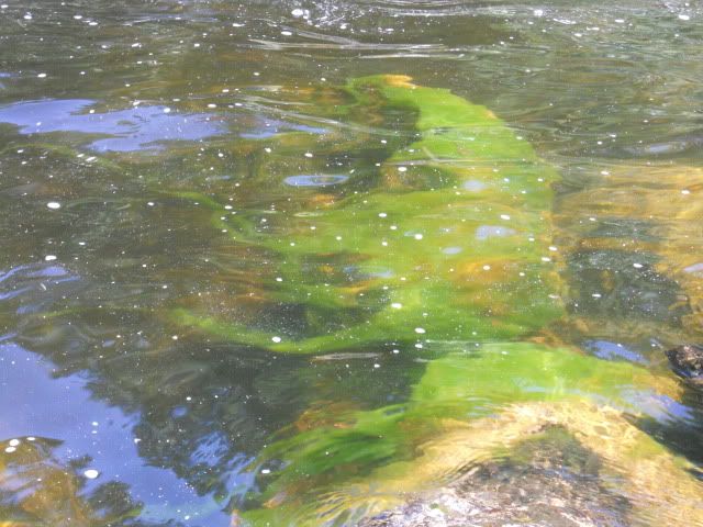
Just before paddling away from the put-in, I see algae flowing just under the surface of the moving water and the grand northerly view of Sark..
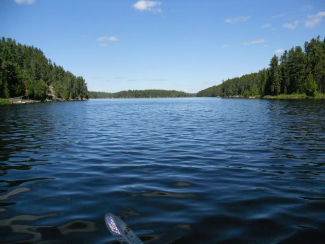
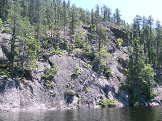
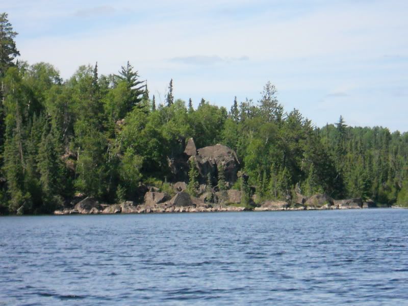
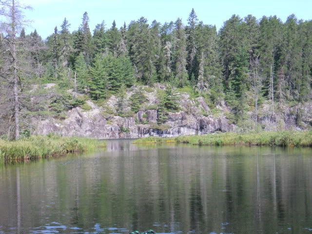
As I munch on some trail mix and wash it down with some water, I notice that Sark, like Keefer, is a long, narrow lake lined on the east and west by rugged cliffs and numerous exposed rocky bluffs. I wonder is any of these rock facings have a nickname like Warrior Hill on LLC?
A mile or so to the north I see the paddle of a canoe, then another canoe, and then another. They appear to be heading north as well. I dig in to see if I can catch them before the portage into Cairn. As I near the northern end Sark, I see the 3 canoes have stopped near the end of the lake. They appear to be discussing where to go next. I hook to the right and glide past them. As I near the Cairn portage, I run aground on a shallow rock. DOH! I step out of the canoe, slide it off the rock and wade over to the take-out. The party behind has paddled up and now wait patiently as I ground my heavier packs on shore away from the takeout. Then I hoist up the canoe and head down the 470 yard mostly downhill and well-worn trail. When I get ready to resume my paddle up Cairn, I visit with this group of a couple adults and several teens. They are from Texas and are being guided by a young lady from one of the local outfitters. They’re planning to camp on Cairn and then head over to Kawnipi before heading back to Prairie Portage via Agnes. The boys ask about catching fish, so I give them some tips on trolling the shoreline drop-offs of Kawnipi and tell them they’ll most likely catch some nice fish. One of the boys tells me he’s never caught a smallmouth bass and wonders what it’s like. I smile and tell him to get ready for the fight of his life as his eyes widen with anticipation. I push off and pull a snack out of my pack as I glide away. Then I turn around and take a picture of the Texas crew putting in on Cairn.
Luckily, as I paddle up Cairn, the wind begins to calm. Cairn is a strikingly beautiful lake dotted with rocky cliffs and islands, large and small. On the western shore I spot a really strange looking rock formation. Now, you tell me. Looks like a giant elephant or perhaps a stegosaurus, doesn’t it?
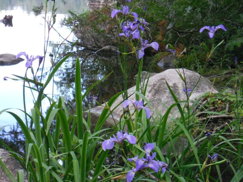
The portages into Heronshaw and Metacryst are short and easy. The portage from Metacryst into the unnamed on the way to Baird is not quite so simple. “Holy crap, this is a rocky portage!” There is also a large blowdown about 2/3 up the trail that was laying horizontally across the trail about head high. As I near the obstacle with the canoe, I’m prepared for it because I know it’s coming up fast. BONK!! I nail the trunk dead on with the bow. I take a couple steps backward, hunch down and squeeze the bow under the tree on the far left side of the path. As I get all the way under and through, I stand up thinking, “Ahh, this is so cool!” A few more steps and BAM! I run the bow right into a big old white pine, dead center, that stops me cold. “Oh, crap!” Thank God I don’t move very fast with the canoe or I would have smashed it. Anyway, I continue on and carefully boulder hop my way to end of the portage and into the unnamed south of Baird. It sure is hard to enjoy a scenic portage while trying to keep from breaking an ankle or kneecap on so many slippery boulders and rocks. Near the end of the portage, a large almost 1.5 foot diameter white pine had fallen across the trail, but thankfully, the portage crews had sawed through it to clear the trail. As I lay the canoe in the water, I noticed a swarm of blooming wild blue iris.
The portage from the unnamed to Baird isn’t too long, maybe 150 yards. It goes slightly uphill on a decent path until the forest literally engulfs the path. For the next 30 yards or so, I’m relegated to watching my feet so I can keep on the trail, along the way hopping over a couple hidden jack pines that had fallen down across the path.
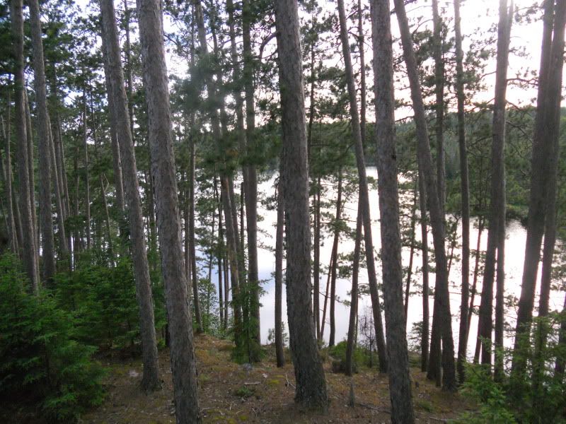
The short portage ends with a crazy steep drop into Baird. We’re talking at least 45 degrees, probably more. If it were wet, I’d be on my butt sliding down the dropoff trying not to destroy the canoe. I finally get on Baird and thank the good Lord. “No more dang portages!” I yell out to nobody. The island campsite is a couple hundred yards straight ahead and I sure hope nobody else is on this supposedly haunted lake. It’s open! And quite nice! It has a large flat ledgerock landing with a great view to the east. You head up to the first tier where the firepit is located with some large relatively flat granite slabs that sit about 20 feet above the water and provide spectacular views to the west. A little further up the hill is a nice tent pad. And then at the top of the rise, which is on northern side of the island, you get some great views. The island is comprised almost entirely of young and middle-aged red pine.
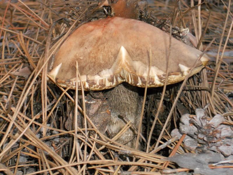
The ground all over the island is littered with several inches of dry, crunchy, pine duff. Various fungi punch their way through the duff.
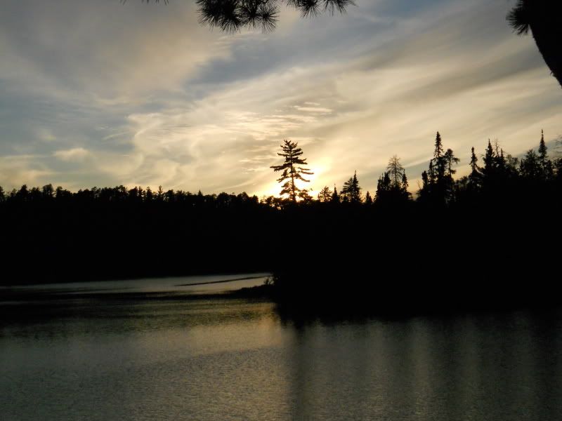
The sun is still above the trees, so I take a quick dip in the water swim to wash off the grime of the portages, rinse out the boots and socks, grab my chair and sit down to relax on the flat granite slab near the firepit. I decide a triple decker PBJ with a Gatorade and a cigar would really be good about now. And it was! As the sun begins to settle below the treeline, I set up the tent, secure all the gear under my poncho, and return to my chair to gaze at the sunset. In the calmness, the loons begin their wild calls that echo all over the lake. Easily the best evening of my trip so far.
Day 5. Baird to Camel via Cutty Creek
Total Miles – 9.1; 4 Portages (275 yards)
View 2011 Day 5 in a larger map
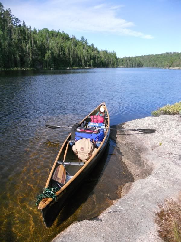
It’s about 6:00 as I roll out of the tent very sore. I didn’t sleep well, probably because Baird is haunted. “Gonna be a Motrin morning”, I say to myself. After a quick breakfast and some coffee, I pack up the gear and prepare to push off for the Cutty Creek and Camel Lake. I feel a light westerly breeze as high clouds begin to fill the far southern and western skylines. In no real hurry, I decide to take a few pictures before pushing off. Here’s a shot of my canoe setup looking westward across Baird towards Cutty Creek.
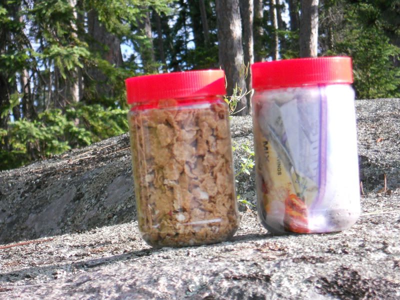
One of things I’ve packed over the last several trips are 18oz JIF peanut butter jars. I usually put cereal or crackers in them, and when they become empty, they’re ideal for packing out the garbage.
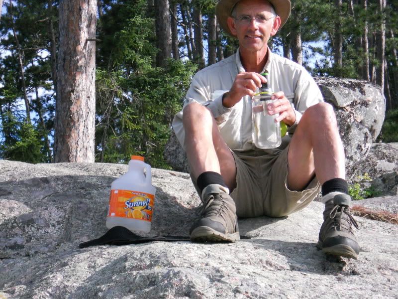
I used a Steripen purifier for the first time ever instead of my usual Katadyn filter. It works great, purifying about 6 liters of water per day (about 75 seconds per liter). Just make sure you’ve got the clear nalgene bottles so when it’s on you can see the UV light from the Steripen. Here’s me prior to departing for Cutty Creek purifying a couple of liters of water that would last until I reach Camel Lake.
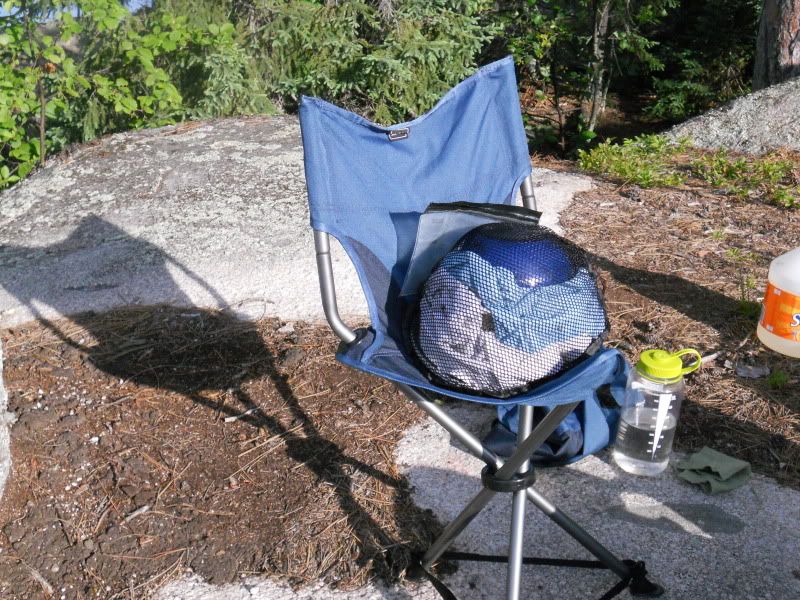
A few folks asked about my kitchen pack set up. 2 Aluminum plates, an 8-in GSI non-stick aluminum skillet, a 2-quart Snow Peak titanium pot, 2-quart MRS Blacklite non-stick pot, a Primus stove with an 8 oz can of butane/propane fuel, and a GSI plastic bowl. All nest together with lightweight towels in a small mesh bag, shown here on my 3-legged camp chair from REI.
I shove off and turn west. Even though it has a haunting reputation, Baird is quite scenic. The portage at the west end of Baird is located to the left of a small creek clogged with various sized pieces of timber.
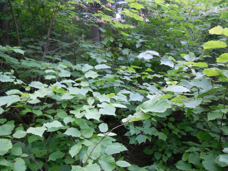
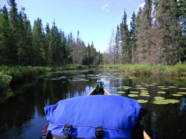
The portage trail was well used and mostly downhill, but several blowdowns made for a few acrobatic moments. The tranquil Cutty Creek is one of the most pleasant morning paddles I’ve had in Quetico, except for the horseflies. I literally HATE horseflies! But the creek itself has a variety of flora: pine-covered sides that rise up into the hills, marsh grasses, lily pads and the like. No moose today, though.
The creek meanders back and forth and finally begins to open as you near the cliffs that signal the entrance to Cub. From here, you turn left and follow the northern shoreline. Of course, I bet myself $100 that I’d be paddling into the wind, and of course, I won that bet. The wind was blowing right into my face. Again.
The next portage from Cub is one of the rare mismarks on the Chrismar map. You can actually paddle right back into the creek and there’s a short, maybe 25 yard portage on the right. After a short paddle, scenic Eag comes into view. Paddling northward through a narrows and turning to the west, the next short carry is also on the right of the creek. The creek is loaded with lily pads, marsh grasses, and, of course, horseflies. I count 14 buzzing around my canoe as I reenter the creek. Needless to say, I become quite adept at holding my flyswatter while paddling and I murder at least 20 of them before reaching the final portage of the day. This one is also on the right on a well-used sometimes rocky trail. I meet a nice couple here who are on Day 16 of a 21-day loop out of Nym. They’ve been on Cutty Creek several times before and I remark how lovely the area is. They provide some detailed info on the Delahey Death March which tracks closely with my memory of posts by other paddlers. We part ways and I put the canoe into the narrow creek channel that winds it way back and forth. Fortunately, water levels were high enough that navigating through the narrow passages was no problem.
Finally, the creek begins to widen and straighten as Camel Lake comes into view.
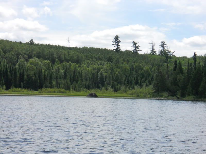
As I make my way across Camel, the wind has shifted and is now from the south. I notice numerous tall scorched pine trunks that resemble long black spikes as they poke out from the deep green forest understory of the southern and western shorelines. I stop for lunch at a rarely-used little campsite on the western shoreline just above the narrow chute that leads to the southernmost waters of Camel. I leisurely eat an energy bar, trail mix, M&Ms and Gatorade. I decide to paddle through the chute and hug the western shoreline down to the creek area that would mark the way into Hoare Lake. As I paddle along, I notice how the forest has changed from the pictures I’ve seen from the early 70s. Back then, fires had consumed much of the forest, leaving it quite open. Today, it is thick with undergrowth. Here’s a good picture of the western shoreline from the lake.
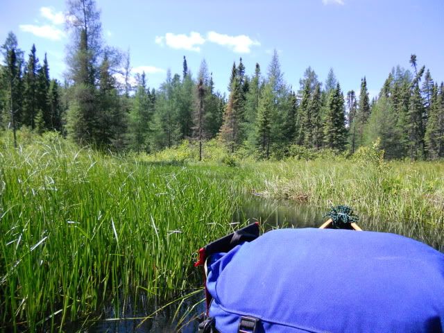
The creek entrance leading to Hoare Lake at the center of the photo is actually a large marsh area guarded by shoulder high grasses. You can see a big cedar leaning precariously over the water on the right. I stop here first, tie off the canoe, and try to make my way through the forest for about 40 yards. Wow. Really thick. Virtually impassable with a canoe. Next I paddle past the cedar for about 40 yards, run the canoe into the tall grass on the northern edge of the marsh, and step out onto the shoulder high grass. As I take steps through the tall grass, I’m able to stay mostly dry. Every now and then, the tufts give way and I sink below the ankles. I follow a couple of game trails on the northern edge of the marsh and after about 75 yards I come to the 10-foot wide creek where water trickles through the rocks and boulders into the marsh. From here, I boulder hop another 100 yards or so up the creek, then move into the forest on the right and bob and weave my way through, over, and under the forest vegetation that follows the creekbed. After about 50 yards, I arrive at another open marsh area of tall grasses. The going is not easy and would be much harder with packs and canoes. I backtrack to the canoe and check the time. 45 minutes. Wow. I estimate that it would take me at least 7
 Donate - BWCA.com