One less item on the Bucket List - Wabakimi 2011
by jcavenagh
We awoke around 6:30 or so and took our time making hot tea and oatmeal for breakfast. As we broke camp and headed down the Caribou River it seemed that we were getting some overcast. It was nice and warm, and we had a little wind, but nothing to be concerned about. We had several portages today. I have never canoed in a place with portages so close to the rapids. I was also worried that we would not be able to find the portages. 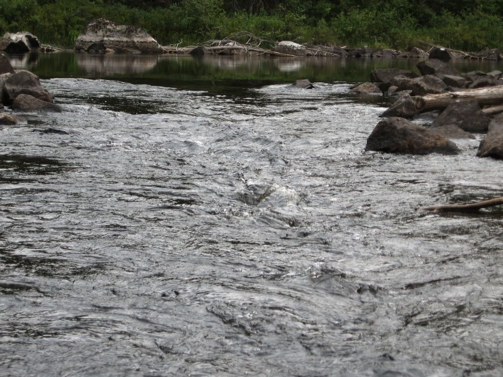
I had read in my research that the trailheads were very small and well hidden. I was afraid we might have some trouble being pulled down the rapids before we beach the boats and portage around.
Sarge and Dave had a little trouble finding one portage. 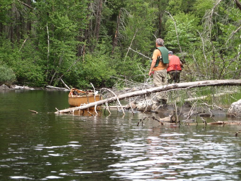
Well, we were OK. The portages were very close to the rapids, but we moved slowly and we found each portage with little difficulty. At the third portage of the day, we had to line the boats through a little channel just before the portage. This was a first for me. I had never lined a canoe as all my previous trips were in lakes. This trip we were doing a lot of drop and pool paddling. It was great fun and my new OTB boots handled it extremely well. As we were entering the water at the end of the third portage, the Sargeant Major crawled over the packs to reach the bow. As he put his weight on the yoke of Dave’s MNII it broke and also cracked the wood gunwale. Oh, man, we seemed to be in some real trouble. We stayed calm, though, and at the next portage we unloaded the boat and carried up to the campsite at the middle of the portage. Pat used some paracord to lash it all back together. 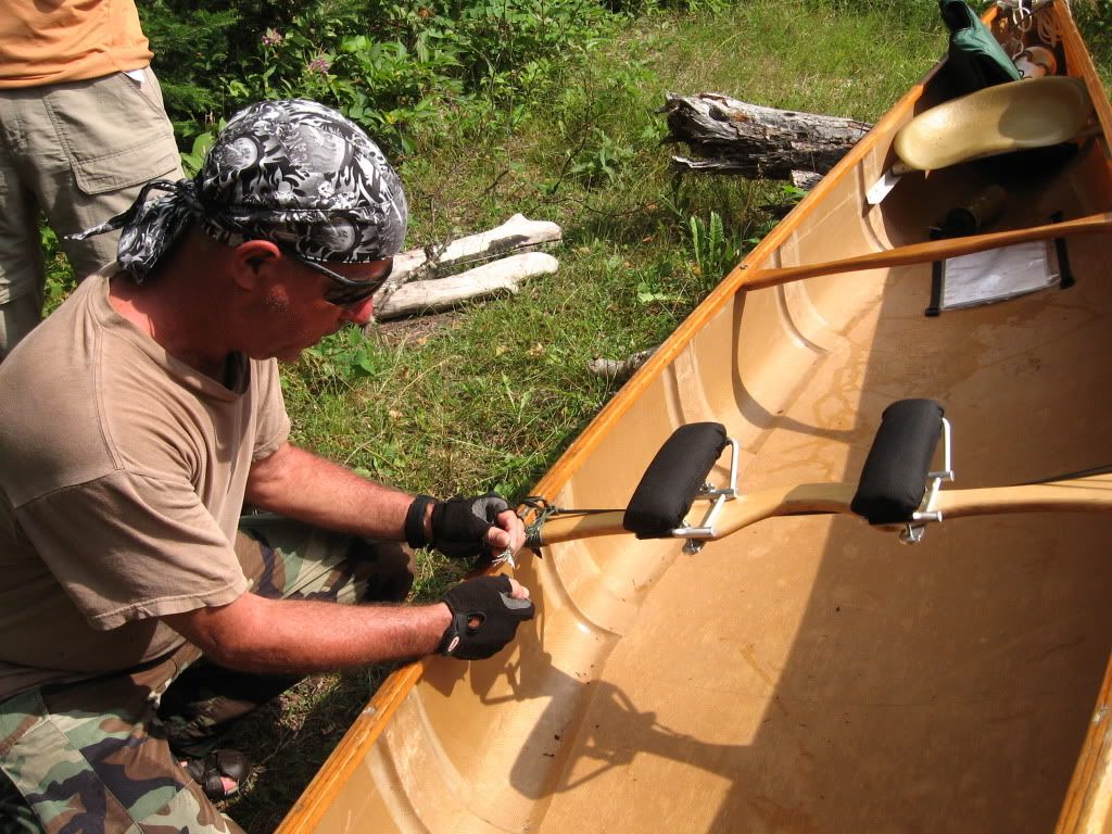
He had some “help” from his two supervisors, Sweeps and Dave. 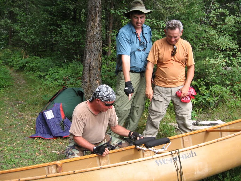
They gave it a little test and it seemed good to go. Fortunately, we did not have any portages for a few days, so we would be able to really test the lashing and fix any serious issues before we needed to carry the boat any significant distance. We had a long lunch on the nice sandy beach at the east end of Funger Lake. 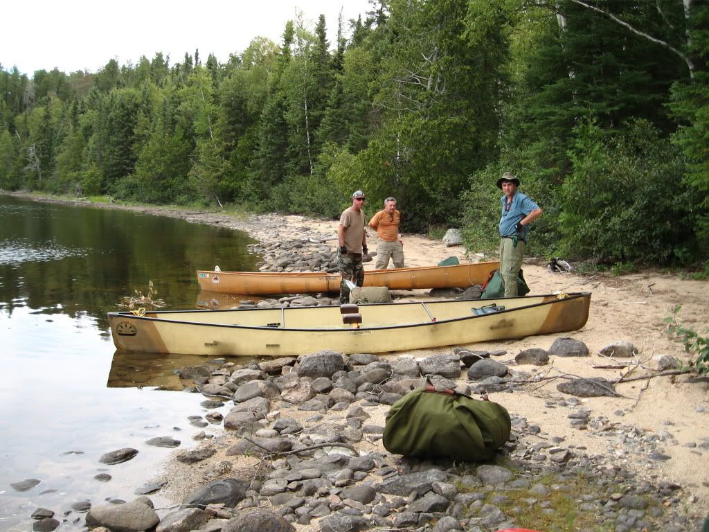
Well, westward ho! into Funger and let's see what nature has in store for us! 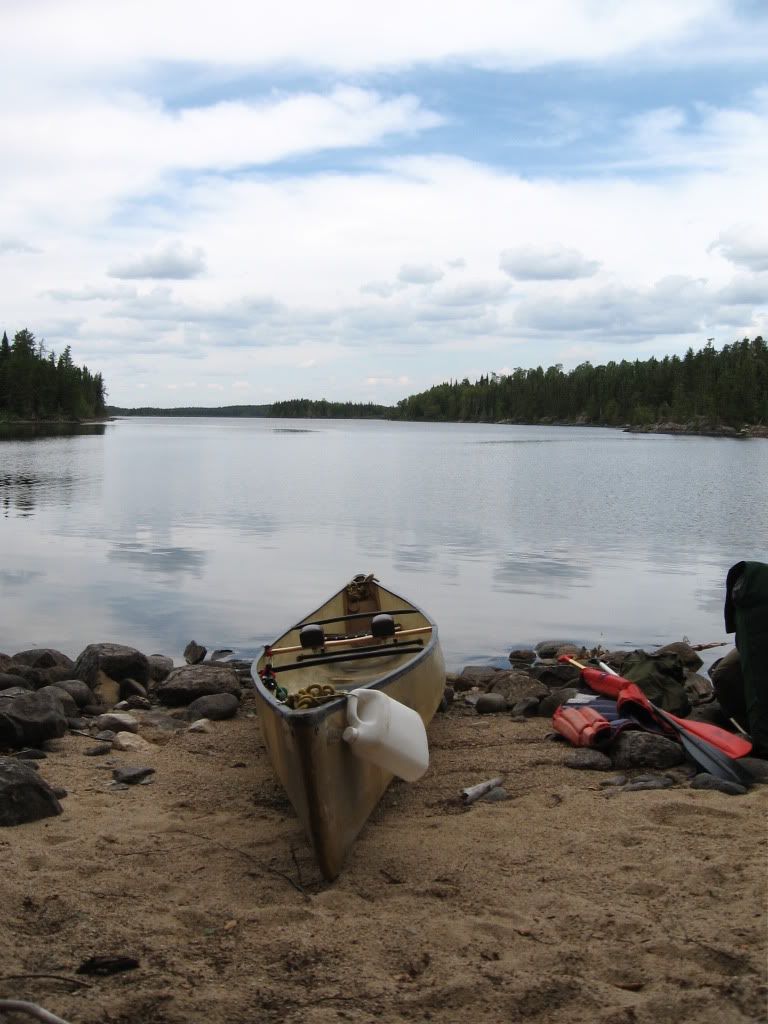
We were not sure how big the fire might be, the sky wasn’t black or anything like that. We could smell the fire now, but it was not really very strong. We wondered if maybe it was going out or had blown on to another area. So we pushed on west through the center of Funger Lake. As we reached the narrows known as the “Honey Hole” on our maps, the fire was burning low and broad all along the northern shore. 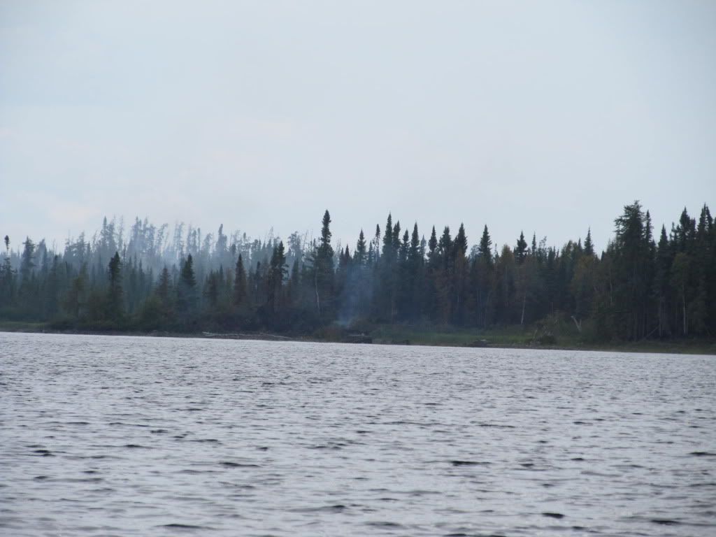
Our eyes were now feeling the smoke. The wind seemed to be from the north or northeast, but there were no flames visible. I caught a couple 15-18” Northerns, but released them because we had been told that walleye were plentiful. Why eat Northern when we would soon be feasting on walleye?? Right?? By the time we entered Caribou Bay we were pretty tired. We decided to stop at the first campsite we found. We were about 3km past the Honey Hole and saw a site as marked on the map. Helicopters had been crisscrossing the park the whole time we had been there. Burt told us they were fighting the fires up in the north end of the park and were shuttling crews in and out by chopper. As we were heading toward the camp site, a helicopter which had been flying pretty high turned around and swooped down toward us. It circled pretty low over us and then flew back up and went north again. We were confused about that, but thought he was just making sure he knew how many were in our party.
We tried the campsite at 50* 33’ 25.0”N 89* 16’ 59.9”W. This was a pretty bad site. It had a very difficult landing with high rocks to throw the packs up and then we had to drag the canoes up about 5-6 feet. It had one poor tent pad and was on a windy, rocky point. We moved the fire pit out onto the exposed rock point to try and make another tent site. (We could not find any good hammock spots and so would need to use tents.) Just as we finished moving the fire pit we realized why the chopper pilot had come down and circled us. He was trying to warn us that a forest fire was blowing toward us from about 1-2 km away. We thought we had paddled past the fire, but on a second look we realized this just wasn't the place. It was pretty late and we were tired, but we packed everything and moved on. We were headed to a campsite that showed as 8km further west. As we were paddling, I noticed a campsite on the south shore that did not appear on the Wildwaters map. I took out the Wabakimi Project maps and saw that several other campsites showed up. One in particular looked promising. It was on a peninsula about 1km long just where Caribou Bay turned from southwest to northeast and looked to be about 5km further on. We found it and it was a great site and it was just about exactly halfway through Caribou Bay. We set camp, and had spaghetti and sauce for dinner. Irish whiskey would cap this day off quite nicely. Beautiful views to the south and west as the sun set late. Again, no skeeters until we went to bed. 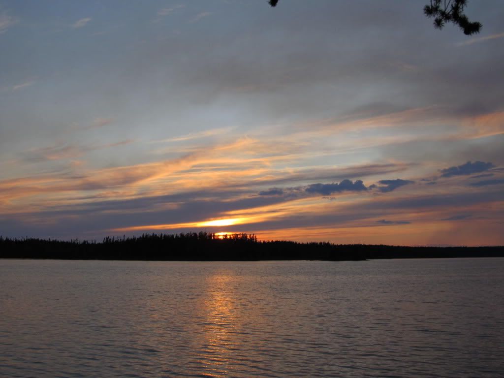
Once the sun had set we could see how much smoke there really was. 
 Donate - BWCA.com