Drowning River
by user0317
Trip Type:
Paddling Canoe
Entry Date:
09/21/2018
Entry & Exit Point:
Other
Number of Days:
8
Group Size:
1
Discuss Trip:
View Discussion Thread (15 messages)
Day 8 of 8
Friday, September 28, 2018
Travelled 2 miles from P12 to P14, near Waba Creek junction There are basically 3 ways out to the logging roads from the Drowning river, which more or less end their stretch northwards at Supawn Lake. One can do a short bushwhack from P12 to a clearing, but according to John the road near there is a bit rough. P14 has a trail opened up off the portage to a solid logging road, which is the route I would be taking out. Otherwise, one can paddle a short ways up Waba creek and hit a different logging road from there. If one proceeds any further down the Drowning from P14, the only way out is to paddle 130 miles to the junction of the Drowning and the larger Kenogami and arrange for pickup via floatplane. I would love to do this stretch of river someday, and can find pretty much no documentation on it. In all likelihood one would have to cut all their own portages from here on down.
At about noon I took the short paddle from P12 to P13. It was hard to make out 200m portage for P13, but the forest is open enough that you can pretty much make your own route and just stay close to the river. It is unusual to find forest this open up here. With P13 out of the way I went through a couple of small rapids, and soon found myself at the series of falls surrounding the island at P14.
  There was orange flagging tape near the portage sign and I found the trail splitting off the portage towards the logging road. A few hundred meters later I was in a clearcut, about 10 years into regeneration. It was surreal to see a road back here, even as rough as it was.
  I hauled everything that I wouldn’t need to camp overnight to the road, and despite the short day found myself overwhelmingly tired. I thought about just sitting on the trail and taking a nap against my bear barrel, but figured I better hang my hammock and make something to eat (pho noodles and coffee). After eating I worked my way around the island to check out all the waterfalls, and went to bed.
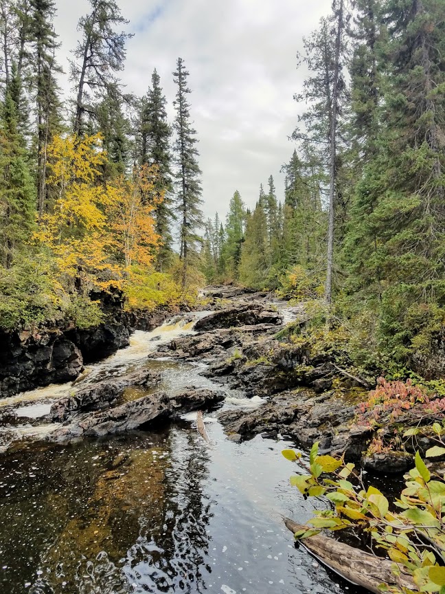
Saturday, September 29th. I woke up about 7am on Saturday, and just had a couple of snack bars for breakfast, not wanting to dirty any dishes. I slowly packed up camp and hauled my stuff out to the road. About 5 minutes after I finished, John showed up. We tied the canoe to his truck, loaded my gear, and began the 2 hour drive down to his camp. Once at Twin Lakes Lodge, I loaded up my truck, and John graciously let me use the shower room at his camp. It felt great to wash the smoke and dirt away, and stand underneath the warm water.
Epilogue:
Overall this turned out to be a great route, and one of many gems in the Nakina area I am sure. This really is an under-utilized region for paddling. Most of my challenges centered around the weather and to a lesser-degree, water levels. I wouldn’t say that the Drowning was a difficult river. With 2-4” more of water, paddling would have been a breeze. With 2” less it would have been a nightmare.
I suspect that fishing would be excellent for walleye in the rapids earlier in the summer, and overall I can’t complain about the fishing I had in the fall. Generally you don’t have to work too hard to pick up a meal of fish in the remote areas of Ontario. If I were paddling in the Nakina area, I would highly recommend arranging a shuttle with John at Twin Lakes Lodge. There are several remote routes that one can exit through the network of logging roads, but its best to let a knowledgeable local navigate those roads and keep your vehicle safe for you while you are gone. Additionally, you can pick up a lot of advice on routes in the area and fishing during the long shuttle ride back to your car!
Travelled 2 miles from P12 to P14, near Waba Creek junction
At about noon I took the short paddle from P12 to P13.
Saturday, September 29th. I woke up about 7am on Saturday, and just had a couple of snack bars for breakfast, not wanting to dirty any dishes. I slowly packed up camp and hauled my stuff out to the road. About 5 minutes after I finished, John showed up. We tied the canoe to his truck, loaded my gear, and began the 2 hour drive down to his camp. Once at Twin Lakes Lodge, I loaded up my truck, and John graciously let me use the shower room at his camp. It felt great to wash the smoke and dirt away, and stand underneath the warm water.
Epilogue:
Overall this turned out to be a great route, and one of many gems in the Nakina area I am sure. This really is an under-utilized region for paddling. Most of my challenges centered around the weather and to a lesser-degree, water levels. I wouldn’t say that the Drowning was a difficult river. With 2-4” more of water, paddling would have been a breeze. With 2” less it would have been a nightmare.
I suspect that fishing would be excellent for walleye in the rapids earlier in the summer, and overall I can’t complain about the fishing I had in the fall. Generally you don’t have to work too hard to pick up a meal of fish in the remote areas of Ontario.
 Donate - BWCA.com