85 Challenging Miles Solo (EP 36 Entry to EP 37 Exit)
by cabinsolutions
Trip Type:
Paddling Canoe
Entry Date:
06/18/2026
Entry Point:
Hog Creek (EP 36)
Exit Point:
Kawishiwi Lake (EP 37)
Number of Days:
4
Group Size:
1
Trip Introduction:
This trip has been on my radar for two years. I planned to go last season, but I was unable to go due to family obligations. So, this year a permit came available last minute, and I dusted off my plan and away I went! The main purpose of this trip was to test my ability to check-off miles and determine how much training I would need prior to taking on the Border Route Challenge. The route stretched my navigation skills, mental toughness, and physical abilities as a solo. Shout out to Straighthairedcurly and Jaywalker for your detailed trip reports that assisted in my planning....many thanks!
Discuss Trip:
View Discussion Thread (1 messages)
Day 1 of 4
Thursday, June 18, 2026 17.8 Miles: Hog Creek to Isabella River Camp 1928. 9.5 hours
0630: Put-in Hog Creek. 1600: Arrive Camp 1928.
Key Points: NW headwind 10-15. Overgrown Perent River Portages, Wind on Isabella, Crowded Isabella.
I started out with the slow winding Hog Creek paddle to Perent Lake. This section is quite beautiful and took about 1.3 hours to complete. There are a couple beaver liftovers following the short initial portage. Navigation was pretty straightforward except for trying to keep your bearings during all the turns. Water levels were low but navigable.
0750: Arrived Perent lake and oriented on the islands and open water. Similar to others commenting on this lake, it is a bit deceiving after you spent time winding on the creek. I recommend pausing here to orient your map and identify your line across. In my attempt to quarter into the NW headwind, I paddled too far west and ended up in the wrong bay. A quick pause, and I noted I needed to point straight north and clear the next major point before turning west towards the Perent River portage. If you are paddling from Hog Creek to this portage, consider following the eastern shore for awhile if the winds allow. You'll be able to guide off the campsites a little easier before turning west.
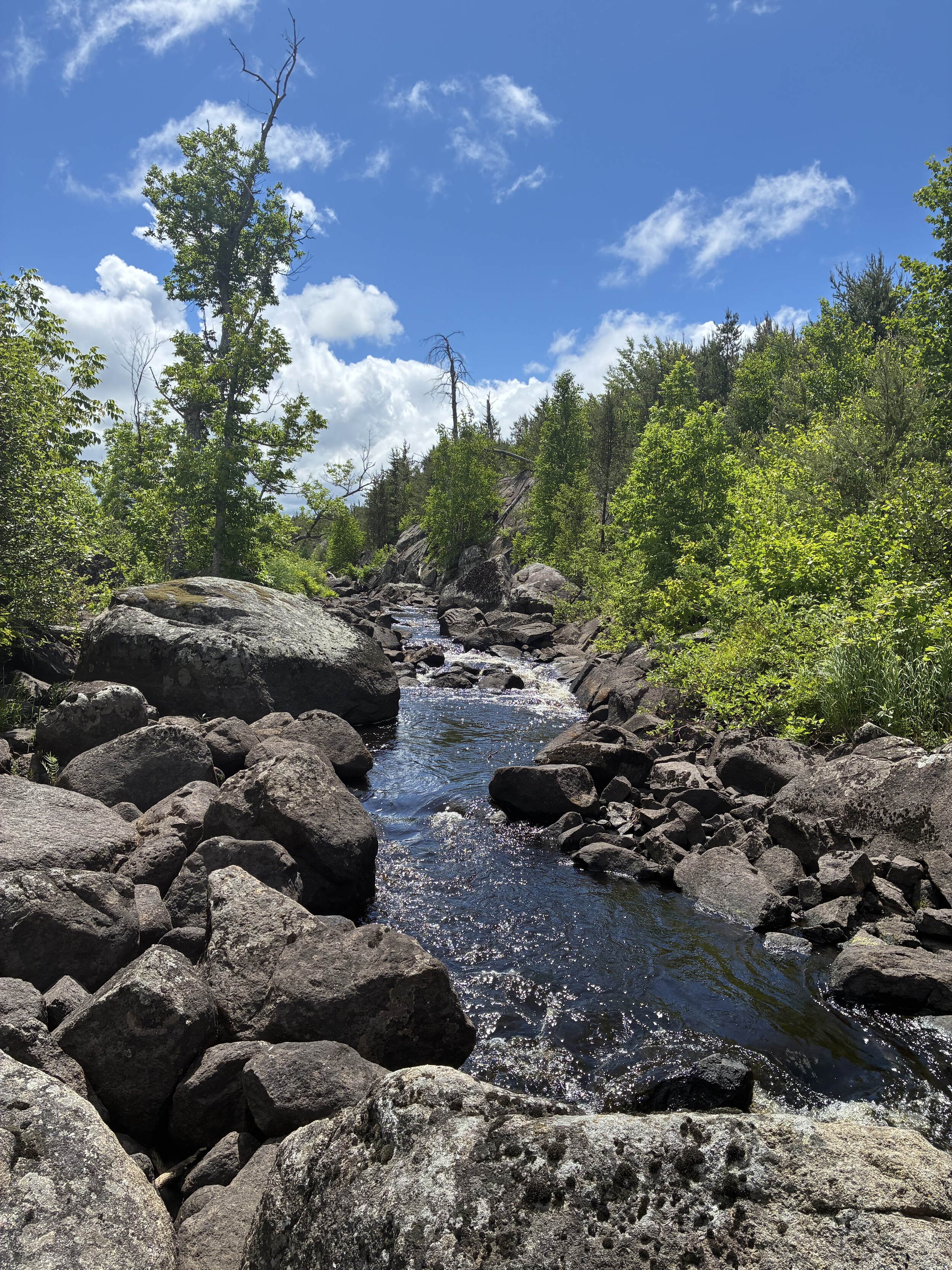
Arrived Perent River about 0850. Paused for hydration and a snack while studying the map for the upcoming 13 portages. As a general comment, these portages are all difficult to spot with the dense foliage. Once you are on them, you will find yourself bushwhacking while trying to follow the goat trail underneath. As I single portaged, I was careful to watch my footing and if the canoe bumped into something, I negotiated that obstacle. This approach was for safety. It is very easy to turn an ankle and take a fall along these portages. They are rocky. The first six portages are fairly straightforward. Refer to the commentary offered on this site and you'll be able to understand the specifics. The seventh portage from east (224) is after you navigate a shallow rock garden. You'll think that it should be coming up and there's no way you need to navigate the rocks, but you do. You'll find it on the north side following the rock garden. If water levels get any lower, I assume this will become more difficult later in the season. I was unable to find the 8th portage (225). It is suppose to be on the North side. I ended up just paddling this and getting out and pulling the canoe through a few areas of this section. I don't know if you actually need to portage around this rapids. The 9th portage (674) was on the south side right next to the rapid entrance. The map shows this on the north side, but I looked for several minutes here and finally gave up and started looking for other options. Sure enough, it was mis-marked on my Voyaguer map. The remaining portages to Isabella were a little easier to find and were better traveled.
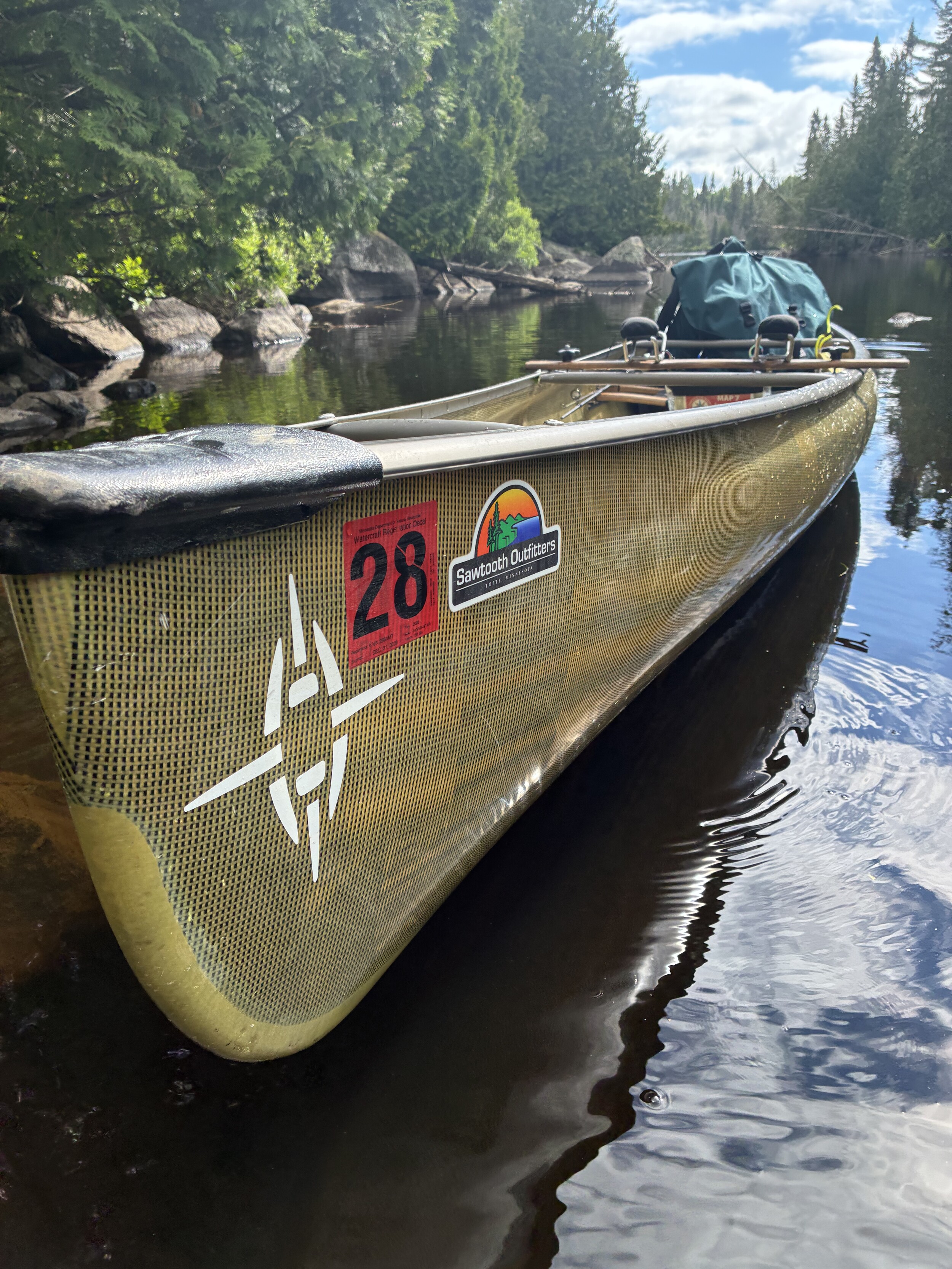
1400 Arrived Isabella Lake. This is where the wind kicked up, I could see the washing machine churning! I decided to re-trim my NW solo canoe to 'weight-forward' and give it a test run. If it was too dangerous, the plan was to bail south to one of the southern campsites or EP 35. After entering the melee, I found the NW solo to be very seaworthy, and I beared down with the double blade paddle and plowed across, sticking to the southern side. The middle section was chaos with unpredictable wave breaks. As, I neared EP 35, the waves became more manageable, and I was able to let up a bit. I arrived at the Isabella River portage thankful to have that stretch behind me. Of note, all campsites on Isabella were occupied. I assume others were windbound and decided to sit it out that day. I portaged through to the Isabella River after checking out the bridge on the Powwow Trail. I had an uneventful paddle west to Campsite 1928 and was thankful to find it available and pulled in around 1600. Recovery drink, evening chow, established camp and hit the rack around 1900.
Random thoughts: The Garmin network went down for about 2 hours during that afternoon. Livetrack and navigation was down. This is just a reminder to not rely on a single tool for navigation and never trust anything with a battery! I didn't realize it was down until my family texted my InReach later telling me they lost the track during that timeframe. ~Hog Creek, Perent Lake, Boga Lake, Isabella Lake, Isabella River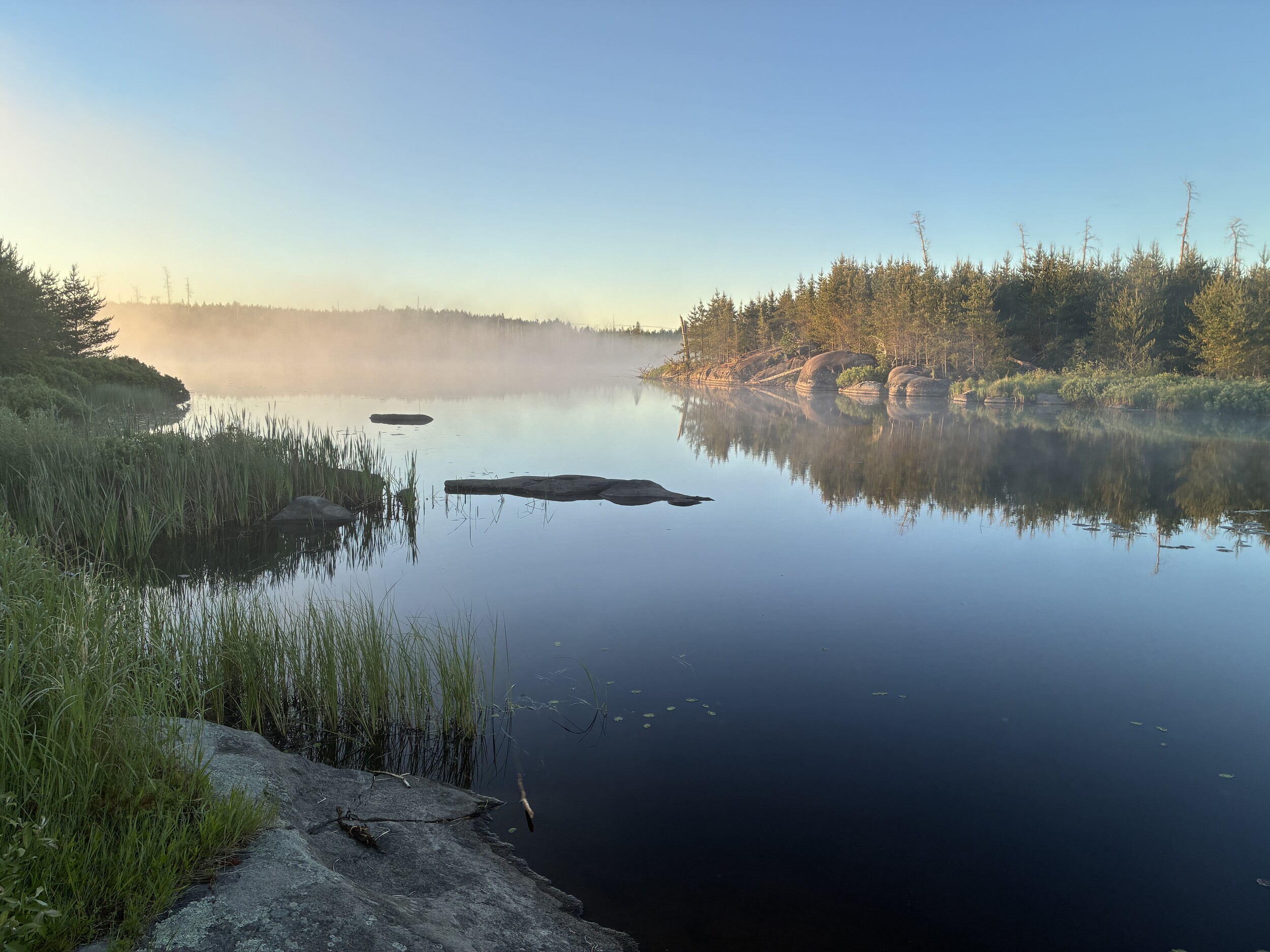
0630: Put-in Hog Creek. 1600: Arrive Camp 1928.
Key Points: NW headwind 10-15. Overgrown Perent River Portages, Wind on Isabella, Crowded Isabella.
I started out with the slow winding Hog Creek paddle to Perent Lake. This section is quite beautiful and took about 1.3 hours to complete. There are a couple beaver liftovers following the short initial portage. Navigation was pretty straightforward except for trying to keep your bearings during all the turns. Water levels were low but navigable.
0750: Arrived Perent lake and oriented on the islands and open water. Similar to others commenting on this lake, it is a bit deceiving after you spent time winding on the creek. I recommend pausing here to orient your map and identify your line across. In my attempt to quarter into the NW headwind, I paddled too far west and ended up in the wrong bay. A quick pause, and I noted I needed to point straight north and clear the next major point before turning west towards the Perent River portage. If you are paddling from Hog Creek to this portage, consider following the eastern shore for awhile if the winds allow. You'll be able to guide off the campsites a little easier before turning west.
Arrived Perent River about 0850. Paused for hydration and a snack while studying the map for the upcoming 13 portages. As a general comment, these portages are all difficult to spot with the dense foliage. Once you are on them, you will find yourself bushwhacking while trying to follow the goat trail underneath. As I single portaged, I was careful to watch my footing and if the canoe bumped into something, I negotiated that obstacle. This approach was for safety. It is very easy to turn an ankle and take a fall along these portages. They are rocky. The first six portages are fairly straightforward. Refer to the commentary offered on this site and you'll be able to understand the specifics. The seventh portage from east (224) is after you navigate a shallow rock garden. You'll think that it should be coming up and there's no way you need to navigate the rocks, but you do. You'll find it on the north side following the rock garden. If water levels get any lower, I assume this will become more difficult later in the season. I was unable to find the 8th portage (225). It is suppose to be on the North side. I ended up just paddling this and getting out and pulling the canoe through a few areas of this section. I don't know if you actually need to portage around this rapids. The 9th portage (674) was on the south side right next to the rapid entrance. The map shows this on the north side, but I looked for several minutes here and finally gave up and started looking for other options. Sure enough, it was mis-marked on my Voyaguer map. The remaining portages to Isabella were a little easier to find and were better traveled.
1400 Arrived Isabella Lake. This is where the wind kicked up, I could see the washing machine churning! I decided to re-trim my NW solo canoe to 'weight-forward' and give it a test run. If it was too dangerous, the plan was to bail south to one of the southern campsites or EP 35. After entering the melee, I found the NW solo to be very seaworthy, and I beared down with the double blade paddle and plowed across, sticking to the southern side. The middle section was chaos with unpredictable wave breaks. As, I neared EP 35, the waves became more manageable, and I was able to let up a bit. I arrived at the Isabella River portage thankful to have that stretch behind me. Of note, all campsites on Isabella were occupied. I assume others were windbound and decided to sit it out that day. I portaged through to the Isabella River after checking out the bridge on the Powwow Trail. I had an uneventful paddle west to Campsite 1928 and was thankful to find it available and pulled in around 1600. Recovery drink, evening chow, established camp and hit the rack around 1900.
Random thoughts: The Garmin network went down for about 2 hours during that afternoon. Livetrack and navigation was down. This is just a reminder to not rely on a single tool for navigation and never trust anything with a battery! I didn't realize it was down until my family texted my InReach later telling me they lost the track during that timeframe. ~Hog Creek, Perent Lake, Boga Lake, Isabella Lake, Isabella River
 Donate - BWCA.com