85 Challenging Miles Solo (EP 36 Entry to EP 37 Exit)
by cabinsolutions
Trip Type:
Paddling Canoe
Entry Date:
06/18/2026
Entry Point:
Hog Creek (EP 36)
Exit Point:
Kawishiwi Lake (EP 37)
Number of Days:
4
Group Size:
1
Discuss Trip:
View Discussion Thread (2 messages)
Day 3 of 4
Saturday, June 20, 2026 23.6 Miles: K. River Camp 1138 to Alice Lake Campsite 1164. 8.5 hours
0630: Departed 1138. 1500: Arrive Alice Lake Camp 1164.
Key Points: Tailwind, Busy Section, Navigation Hiccups, Insula Portages
0500 Reveille followed by power oats and coffee. I broke camp and started paddling NE along the river in calm conditions. After a couple quick portages, I was on Lake One with a tailwind building. I made it quickly across the numbered lakes with little issue. This is where I achieved my top speed of 9.5 mph while going through a narrow channel pushed by a stiff tailwind. Thankful for that wind on day three! Portage 624 heading to Lake 4 eluded me slightly. I guided off the nearby campsite (1505), but failed to enter the correct channel just to the SE. Once in the correct channel, the portage was obvious. I chalk this up to being tired and losing focus for a moment. Once through, I quickly traversed Hudson. The portage from Hudson to Insula was a challenging, rocky, steep up and over. It is only around 95 rods, but be prepared for a steady climb and rocky descent. Watch your footing, especially on the Insula end.
I paused for lunch before entering Insula. This lake has many islands and can confuse you if you aren't paying attention. I chose to bank NW as soon as I was able in order to get on the lee side. I bypassed the first small channel (mistake) because it didn't appear to go anywhere. So, I ended up going too far east before getting back on track. After that, I was able to guide off campsites and islands to get me to "The Rock". Once I hit this section, I could see the northern channel that allows you to skirt through before turning east to Williamson's island. Once again, I overshot a bit playing the wind, so I had to drift back south once I got to the east shore. The channel to the portage is a little disguised. But, if you guide off campsite 1323 and go to the east of that, you'll roll into the correct channel. After turning south into the K. River again, the remainder of the day was uneventful.
1500 I arrived Alice and decided to call it an early day knowing I was within shot of completing my journey the following day. I stopped at Alice Lake site 1164 and enjoyed a swim and some relaxation prior to the final push.
Random thoughts: I found the open-lake navigation to be the most challenging. Things tend to look the same, and when you are solo, you start second-guessing yourself. I used all navigation aides during the trip to include, map, compass, InReach, and the sun. I prefer a hard copy map and compass, but the InReach helped to verify my plan allowing me to paddle an efficient track.~Lake One, Lake Two, Lake Three, Lake Four, Hudson Lake, Alice Lake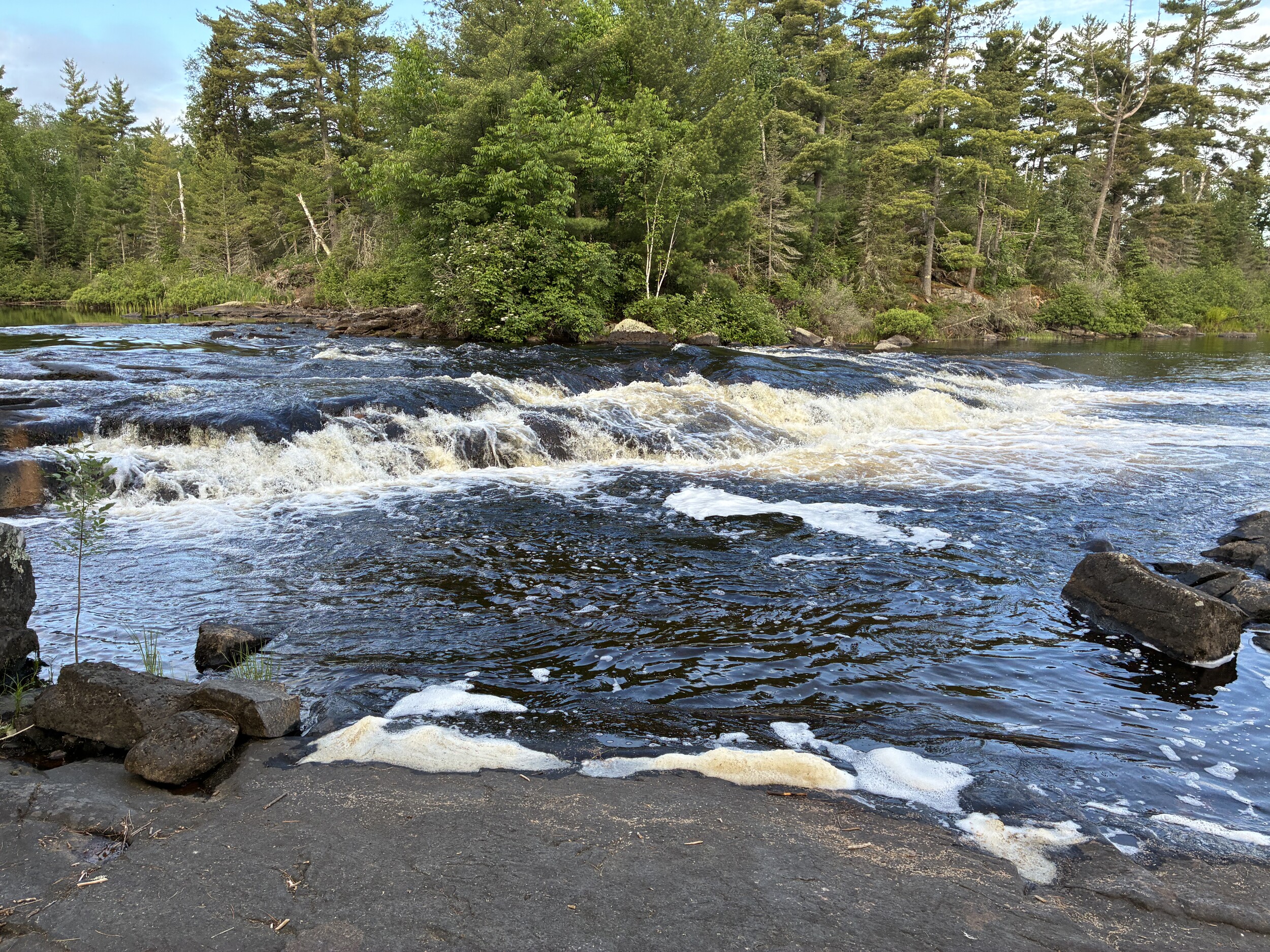
 Donate - BWCA.com