|

Author
Text
")
11/03/2018 07:55PM
I was attempting to get more info on Tomahawk Timber Co. and their Camp 4 & Camp 5 north of Isabella Lake. I got onto this sight and read some of Jackpine Jim's comments on the Maniwaki Lake camp. I had been there back in the late 1960s and also in the early 1970s and would like to find out more. Is Jackpine Jim still out there somewhere?


11/05/2018 12:55AM
Tomahawk Timber Co. had their office in Ely, and was located upstairs of Frank's Variety next to the State Theater.
You may want to contact the Trygg Land Office, as they had maps that show logging camps and several Indian Villages in the entire area. I also think they have a book with the info.
There are still some old loggers that worked in those camps, and I know one that was born in a camp next to Insula Lake.
All the Camps had numbers for names, and the history is very interesting.
https://www.facebook.com/pages/Great-Outdoors-Bait-Tackle/1606420532911075?skip_nax_wizard=true
11/05/2018 10:31AM
Jackpine,
Good to hear from you! As I said earlier, it was ironic how I got on this website. I was hoping to get pictures of Tomahawk Timber's Camp 4 but so far, no luck. But I got onto your response and you seemed so knowledgeable about the area. I'm here to pick your brain of your experiences in that country.
I knew of Camp 4 back in 1967 or thereabouts and as we were on our way from Polly Lake to Hazel lake, I knew we would come across Camp 4 at the end of Polly. I was disappointed to find out that not much was left of the buildings I somehow expected to see. All that was left at that time were the concrete footings of some buildings and some rotted out wooden timbers, I'm sure that the powers-to-be have somehow even eliminated those footings by now to make it appear more like a "wilderness." When we continued to Hazel Lake on Phoebe Creek, we crossed the portage going east out of Hazel back into Phoebe Creek. On that portage was a road the width of the Tomahawk Road back in the days of Forest Center. All graveled, heavily used and wide enough for 2 pulp trucks to pass, the road came from just south of Kawishiwi Lake. Many years later I was back there, coming up from Phoebe Lake to Hazel. I knew the road had been there but you really had to look hard for it, a person not knowing it was there would never know it was there.
I know a guy that lived in not only Forest Center (Camp 3) but also Camp 4 and Camp 5. I knew about Camp 4 but had no idea where Camp 5 was. I asked him about Camp 5 and he said he couldn't recall, he was only 6 or 7 yrs. old at the time. But you claimed Camp 5 was near the southwest end of Maniwaki Lake. I was also in to Maniwaki back in the late 60s. We usually camped on Insula Lake and went through Hope, South Hope to get into Maniwaki. The area was loaded with moose at the time, supposedly the highest moose numbers per mile in the lower 48. As you left South Hope and went south on a creek to a portage that ran east/west (I recall it as around 120 rods) that went to Maniwaki Lake, the portage crossed Maniwaki Creek just before arriving at the lake. My memory of that time tells me that at that crossing there was also a truck bridge at that location for a road that came from the Isabella North Road. The North Road was only about 1/4 mi. (or less) away at this point. Do you have any recollection of that bridge? Where exactly was Camp 5 at this point?
I talked to a logger from Ely that cut that area after Tomahawk left in 1964 and he said he doesn't recall a bridge there. If no bridge then there must've at least been culverts there for that road that ran north up into the Fishdance Lake area. My memory might be all wet on that bridge but was wondering if you knew of one there? It's bothered me ever since I asked this logger about it and he didn't recall it.
Back in the early 70s a friend & I walked up to this point on the Isabella North Road and walked into Maniwaki Creek and I seem to recall that bridge there then also (but memories are fine when they work, but recalling something that far back might be a challenge), came back to the North Road and continued on up past a road the went into Baskatong Lake. I think Camp 5 and Camp 4 were only about 5 miles apart and our goal was to get to Camp 4 but there was a culvert that had been pulled out after Baskatong on the North Road and we turned around and headed back toward Isabella Lake. The North Road that went north past Camp 4 went up into Malberg/Koma Lake area but forked south of Polly Lake and went to the west over toward Townline Lake. It crossed the Townline portage and you could definitely see the road that was starting to grow in.
So, do you recall that bridge at Maniwaki Creek? Is that where Camp 5 was? What is your connection to area that makes you so very knowledgeable?
Hope to hear back from you soon.
11/05/2018 04:45PM
 After the Pagami fire I was amazed how many old roads and rail road grades that could easily be seen from the air. I also heard an old car was found up in the Hope lake area. Before the fire from the air you couldn't see any sign of a road or people. I always knew the roads were there but they were hard to spot. As things are growing back now things are disappearing again. I am sure if you flew above the area in the early spring you could still see signs of the camps and roads you talk about.
 JIM
Raised by wolves!
11/05/2018 08:46PM
Yes there are a lot of old artifacts left from the logging days. At the Palmquist Cutting site on the Wolf Lake Road a few miles before Schlamn Lake, there is a '56 Chevy in the woods.
https://www.facebook.com/pages/Great-Outdoors-Bait-Tackle/1606420532911075?skip_nax_wizard=true
11/06/2018 11:46AM
I was grouse hunting once way back when on what was the Isabella East Road. The road ran east out of Forest Center over toward Perent River and Kawishiwi lake. At that time the road was still driveable but closed to the public. I had passed the trail into Tomahawk Lake when I scared up a bird that flew off the side pf the road. I shot the bird and went over to pick it up, about 30'-40' off the east Road. When I picked bird up I stepped on something that made a holow sound and moved. I kicked a layer of leaves and soil off what was the hood of a red car. A closer look told me that an entire car had probably been bulldozed over and flatteened from the Tomahawk days instead of hauling it out. On another trip I scared up a bird over on the roaf that went toward Quadga Lake. The bird kept flying on short flights and I never did get a shot off but I came right up to a '53 black Buick. It was mostly intact and to this day I still reember looking at one of the tail light lenses, of all things. The tail light lenses back then were glass and about 1/2" thick............
11/06/2018 12:45PM
EL, Jackpine do you live in the Arrowhead region? I remember people living and logging in the Sawbill landing area. I think it was the early 70s when they left Sawbill Landing. Some of the house were moved to Isabella. I know a girl that lives in Isabella and her father lived and worked at Sawbill Landing.
Raised by wolves!
11/06/2018 08:34PM
ellahallely: "EL, Jackpine do you live in the Arrowhead region? I remember people living and logging in the Sawbill landing area. I think it was the early 70s when they left Sawbill Landing. Some of the house were moved to Isabella. I know a girl that lives in Isabella and her father lived and worked at Sawbill Landing."
My Dad grew up in the Tomahawk Timber Company logging camps in in the early 1940s beginning at Camp 1 near Babbitt, MN. He went to grade school in Camp 2 at the juncture of the Tomahawk Road and Highway 1 going East to Isabella Lake. His first job as a logger he lived in Camp 4 Polly Camp then Boga Camp near Boga Lake. He logged the South East of Koma Lake and other relatives logged the East side of Boze Lake. I was born in Winton hospital when we lived in Boga Camp, North of Camp 5 close Maniwaki Lake. I don't remember that area as we moved to Camp 6 near the Stoney River when I was 4 yeas old in 1959. We kids from Camp 6 were bused to grade school in Forest Center and my family were the last to leave Camp 6 in summer of 1965. We moved to northern Wisconsin where I went to high school. I then went away to the University of California, Berkeley and then on to grad school at MIT in Cambridge, MA.
After a few more stops I worked my way back to the Twin Cities where I live now and have had a few chances to poke around the old logging camp sites and roads. There are some photographs and videos of the camps on the
Forest Center Facebook page maintained by Bill Hamlin, the son of Luke and Lee Hamlin. Luke Hamlin was a Logging Superintendent in the camps. One of the videos shows scenes from Camp 4 and there are at least two pics from Camp 5, one with my great aunt Tress' white picket fence.
Story: My Dad ran a trap line in the spring up the North Road after they moved out of the "roadless area" and closed it off. He told me the only building left from Camp 5 was the Blacksmith's shop. It was really cold so he sought shelter in the small building nd made a fire on a piece of sheet metal. He let the fire burn down an while he was out checking his traps the coal dust from the forge caught fire and burned down the small building and all his supplies with it :(
Another story: There is an old car body just north of the Tomahawk Road on road 387 heading toward Bald Eagle Lake. There was a logging camp there called Smithville, after the several members of the Smith family who lived there. Dad told me the car belonged to two brothers that came home from the service and were logging there and both drowned while fishing in Bald Eagle Lake.
Lots of other random stories and legends from the area I find endlessly fascinating.
Wilderness both captivates your soul and sets it free :)
11/07/2018 04:39AM
Fascinating stuff. A while ago people were discussing possible old portage’s from Kawishiwi Lake to Perent. I looked on google maps and used the time function to look at older imagery. I was probably seeing some of those roads on some of the older images. Not sure how much there is for this area, but the USGS has online access to not only satellite imagery but also aerial photos that can be much higher resolution and older todo maps. Poke around at USGS.gov and you might find some more older stuff.
Just a random coincidence, but Jim is 4 years older than me and so we might have been at MIT at the same time when I was an undergrad. I was there from 1977-1981.
Just a random coincidence, but Jim is 4 years older than me and so we might have been at MIT at the same time when I was an undergrad. I was there from 1977-1981.
11/07/2018 02:50PM
Jackpine Thanks for sharing your memories! I know that area better then most, however not like you know it. I was born in 1960 so many of your memories are a little before my time. I started spending time in that area around 1970. You could still snowmobile in the b dub then. The old logging roads were our winter routes. I remember seeing the car you mentioned south of Bald Eagle. The winter route from Ely to Isabella and the Shore went through there. Omaday, Bogberry, and August Lakes area.
Did any of the camps have generators? Where do you get your water in the winter? Did you go the town (Isabella) or any of the resorts like Evergreen lodge or the Knotted Pine?
My Grand Father was superintendent of schools in Ely when you were born in Winton. Winton was a happening town. With schools and a hospital like you mentioned.
If your in the area sometime try to get in touch with me. Maybe I could pick you up in my float plane and we could fly over the old camps. No promises but if there was a time that worked for both of us it would be fun .
JIM P.
Raised by wolves!
11/07/2018 08:22PM
andym: "Fascinating stuff. A while ago people were discussing possible old portage’s from Kawishiwi Lake to Perent. I looked on google maps and used the time function to look at older imagery. I was probably seeing some of those roads on some of the older images. Not sure how much there is for this area, but the USGS has online access to not only satellite imagery but also aerial photos that can be much higher resolution and older todo maps. Poke around at USGS.gov and you might find some more older stuff.
Just a random coincidence, but Jim is 4 years older than me and so we might have been at MIT at the same time when I was an undergrad. I was there from 1977-1981."
Andym, I had a 10 year hiatus of gallivanting before going off to college so was at MIT from '87 - '92. Course 5 Ph.D.
Wilderness both captivates your soul and sets it free :)
11/07/2018 08:26PM
ellahallely: "Jackpine Thanks for sharing your memories! I know that area better then most, however not like you know it. I was born in 1960 so many of your memories are a little before my time. I started spending time in that area around 1970. You could still snowmobile in the b dub then. The old logging roads were our winter routes. I remember seeing the car you mentioned south of Bald Eagle. The winter route from Ely to Isabella and the Shore went through there. Omaday, Bogberry, and August Lakes area.
Did any of the camps have generators? Where do you get your water in the winter? Did you go the town (Isabella) or any of the resorts like Evergreen lodge or the Knotted Pine?
My Grand Father was superintendent of schools in Ely when you were born in Winton. Winton was a happening town. With schools and a hospital like you mentioned.
If your in the area sometime try to get in touch with me. Maybe I could pick you up in my float plane and we could fly over the old camps. No promises but if there was a time that worked for both of us it would be fun .
JIM P."
Jim P, at Camp 6 the water came directly out of the stream running out of the 'Trout Pond'. I vividly remember the pipe sticking in the stream with only a coarse screen on the end. In the summer someone would wrap a piece of t-shirt on it to add some extra 'purification'. In the winter my dad dipped directly from the pond to fill our two milk cans with water. My Dad had a generator in a shack that started up when you flipped the light switch in our shack. I can still remember the put-put sound of it starting up in the morning. Later, Camp 6 had a generator that supplied the many shacks of the camp. I was just there at the end of October and you can easily find the concrete footings or pedestals the generator building was mounted on. Socializing was often done at the Happy Wanderer bar on highway 1.
I'd love to take you up on that offer of the float plane ride next summer. I'll dig up the maps Dad marked up for me.
Wilderness both captivates your soul and sets it free :)
11/08/2018 06:54AM
Harv: "This is a great thread! Love reading about how Ely and the surrounding area was before the BWCA, etc.
Ellahall - can I can the name of your grandfather who was Superintendent of Ely schools?
"
My Grandfathers name was Willard Murphy. My Mother and Aunt where also going to school in Ely at that time.
Raised by wolves!
11/08/2018 07:34AM
JackpineJim: "andym: "
Just a random coincidence, but Jim is 4 years older than me and so we might have been at MIT at the same time when I was an undergrad. I was there from 1977-1981."
Andym, I had a 10 year hiatus of gallivanting before going off to college so was at MIT from '87 - '92. Course 5 Ph.D."
I see. I was course 12 but I had to look up 5 so I’ll make it easy and say geology. By your years I was done with my Ph.D. and working at the USGS in Menlo Park. But those years gallivanting sound good. Its a lot easier to do that before school than afterwards.
I am really enjoying the info you are providing. It’s helping me visualize what the logging days were like better than some of the books we have.
11/08/2018 09:34PM
EL, We've walked some of the same paths for sure. The East Road was one of my favorite bird hunting haunts before the burn. What is your connection to this area? Are you a member of this site that just posted as "EL Guest Paddler"?
By the way, while bird hunting off the Tomahawk road the last week of October I happened to chat with a fellow from Virginia, MN who mentioned walking the North Road, and other old roads in the area. Was that you by chance?
By the way, while bird hunting off the Tomahawk road the last week of October I happened to chat with a fellow from Virginia, MN who mentioned walking the North Road, and other old roads in the area. Was that you by chance?
Wilderness both captivates your soul and sets it free :)
")

11/09/2018 07:38PM
JackpineJim: "EL, We've walked some of the same paths for sure. The East Road was one of my favorite bird hunting haunts before the burn. What is your connection to this area? Are you a member of this site that just posted as "EL Guest Paddler"?
By the way, while bird hunting off the Tomahawk road the last week of October I happened to chat with a fellow from Virginia, MN who mentioned walking the North Road, and other old roads in the area. Was that you by chance?"
Every year we walked the old logging roads on the Pow Wow-Arrow lake and Parent river and north of Ferne lake also. Often we ran onto a individual from Virginia whom once worked with the forest service and he would start a half hour before daylight and hike up the POW Wow trail grouse hunting. He started early to get ahead of other hunters in the 1980's and 90's. That was grouse heaven.
I had a favorite road just before the Island river on thenorth side I walked for grouse. It was like 4 miles long and ended just across the Mitiwan creek at a old logging shack with the wood stove still in it.
11/09/2018 08:49PM
Pinetree: "JackpineJim: "EL, We've walked some of the same paths for sure. The East Road was one of my favorite bird hunting haunts before the burn. What is your connection to this area? Are you a member of this site that just posted as "EL Guest Paddler"?
By the way, while bird hunting off the Tomahawk road the last week of October I happened to chat with a fellow from Virginia, MN who mentioned walking the North Road, and other old roads in the area. Was that you by chance?"
Every year we walked the old logging roads on the Pow Wow-Arrow lake and Parent river and north of Ferne lake also. Often we ran onto a individual from Virginia whom once worked with the forest service and he would start a half hour before daylight and hike up the POW Wow trail grouse hunting. He started early to get ahead of other hunters in the 1980's and 90's. That was grouse heaven.
I had a favorite road just before the Island river on thenorth side I walked for grouse. It was like 4 miles long and ended just across the Mitiwan creek at a old logging shack with the wood stove still in it."
Pinetree, I've never walked that road nor did I know it was there. I can see it on the satellite map so might have to poke around a bit next time I'm in the area. Some of these roads are getting pretty difficult to walk with all the growth.
Wilderness both captivates your soul and sets it free :)
11/09/2018 09:29PM
JackpineJim: "Pinetree: "JackpineJim: "EL, We've walked some of the same paths for sure. The East Road was one of my favorite bird hunting haunts before the burn. What is your connection to this area? Are you a member of this site that just posted as "EL Guest Paddler"?
By the way, while bird hunting off the Tomahawk road the last week of October I happened to chat with a fellow from Virginia, MN who mentioned walking the North Road, and other old roads in the area. Was that you by chance?"
Every year we walked the old logging roads on the Pow Wow-Arrow lake and Parent river and north of Ferne lake also. Often we ran onto a individual from Virginia whom once worked with the forest service and he would start a half hour before daylight and hike up the POW Wow trail grouse hunting. He started early to get ahead of other hunters in the 1980's and 90's. That was grouse heaven.
I had a favorite road just before the Island river on thenorth side I walked for grouse. It was like 4 miles long and ended just across the Mitiwan creek at a old logging shack with the wood stove still in it."
Pinetree, I've never walked that road nor did I know it was there. I can see it on the satellite map so might have to poke around a bit next time I'm in the area. Some of these roads are getting pretty difficult to walk with all the growth.
"
That road just before the river had I believe class 5 gravel on it. It was a major logging road.
The years just before the big fire the forest was taking over the road pretty much and I see now it is burnt over and lot of downfalls. Yes On old aerial photos you should see the open field at the end of the road where the shack was. I also took old roads that came out on the little Isabella river like a 0.5 miles up from the parent river I believe those were satelite(sp) roads from the Island river road.
The Island river road also had a spur that went south toward bog lake but stopped just short. Lot of red pine plantations back there.
I have paddled up the Mitawan creek from Island river and intersected the old road where the bridge crossed the creek but it was removed.
I would love to see photo's from the logging city by Isabella lake. I don't think I ever have seen any?
11/10/2018 08:36AM
Pinetree:"That road just before the river had I believe class 5 gravel on it. It was a major logging road.
The years just before the big fire the forest was taking over the road pretty much and I see now it is burnt over and lot of downfalls. Yes On old aerial photos you should see the open field at the end of the road where the shack was. I also took old roads that came out on the little Isabella river like a 0.5 miles up from the parent river I believe those were satelite(sp) roads from the Island river road.
The Island river road also had a spur that went south toward bog lake but stopped just short. Lot of red pine plantations back there.
I have paddled up the Mitawan creek from Island river and intersected the old road where the bridge crossed the creek but it was removed.
I would love to see photo's from the logging city by Isabella lake. I don't think I ever have seen any?"
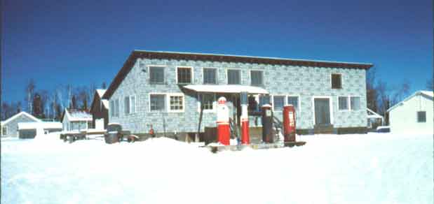
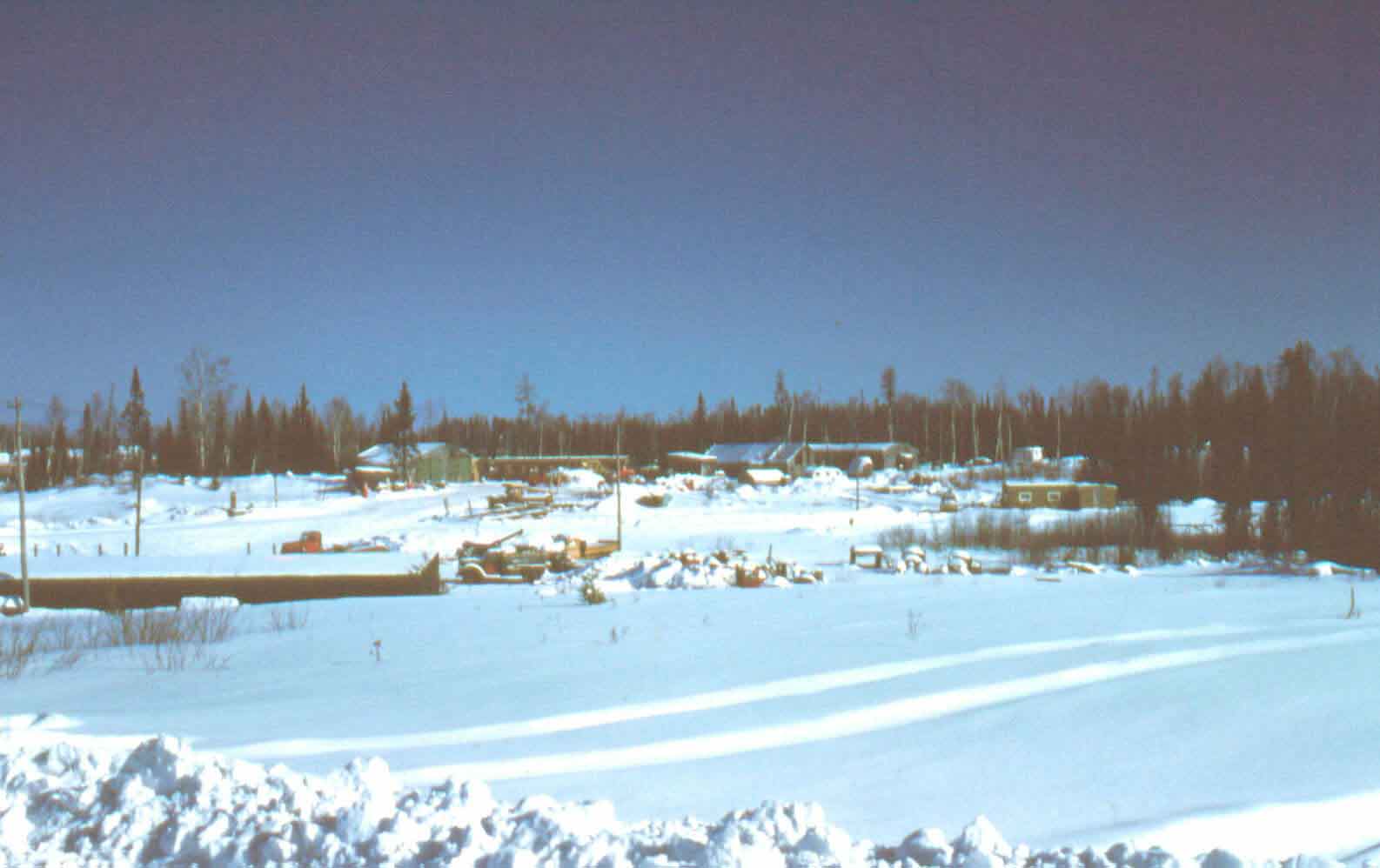
Pinetree, here are a couple photos of Forest Center. The store and Post office building with gas pumps was up on the hill overlooking the wood yard and railroad tracks where the BWCA Entry parking lot is now.
The small brown shacks on mid right in the second photo is where my Uncle Ted and Aunt Tress lived. This is across the road to the south of the BWCA parking lot. Easy to locate and still looks much as it did.
The Village was along the stub road south of wood yard, which was in the clearing at very top of that photo. You can see the old school house (round roof) in the village photo. It is now an open gravel pit. You can find the concrete footings of the new school house, which was built later just to south of old one if you look. You can also find some evidence of the houses along both sides of the road if you kick around in the burned down trees from Pagami fire. Frank and Sylvia Lundberg and the Housey family lived in a couple of the houses on the left side of that road as I recall.

Wilderness both captivates your soul and sets it free :)
11/10/2018 10:07AM
A link about Forest Center.|
The link is from Ely Echo archives page, it is best viewed in full screen. There is also a search function, although not the best search engine. Also try Sawbill landing or Winton, etc ….. if looking for other logging info.
The link is from Ely Echo archives page, it is best viewed in full screen. There is also a search function, although not the best search engine. Also try Sawbill landing or Winton, etc ….. if looking for other logging info.
11/10/2018 11:36AM
Moosepatrol: " A link about Forest Center.|
The link is from Ely Echo archives page, it is best viewed in full screen. There is also a search function, although not the best search engine. Also try Sawbill landing or Winton,
etc ….. if looking for other logging info."
Thanks for posting that Moosepatrol, I went to first grade in that school. One memory is of a big hornets nest someone brought in and it was hanging on display in the window.
Wilderness both captivates your soul and sets it free :)
11/10/2018 02:46PM
Forest Center was in my division during the Pagami Fire.
I found this phone while kicking around in the ashes during the fire, on the south side of the road and BW parking lot.
Ps, if you can get a tour of the Isabella Work Center they have alot of pics and memorabilia of Forest Center. It's in their display case where they used to issue permits

I found this phone while kicking around in the ashes during the fire, on the south side of the road and BW parking lot.
Ps, if you can get a tour of the Isabella Work Center they have alot of pics and memorabilia of Forest Center. It's in their display case where they used to issue permits

May the rivers be crooked and winding, and your portages lonesome, leading to the most amazing view.
11/10/2018 07:59PM
JackpineJim: "Pinetree:"That road just before the river had I believe class 5 gravel on it. It was a major logging road.
The years just before the big fire the forest was taking over the road pretty much and I see now it is burnt over and lot of downfalls. Yes On old aerial photos you should see the open field at the end of the road where the shack was. I also took old roads that came out on the little Isabella river like a 0.5 miles up from the parent river I believe those were satelite(sp) roads from the Island river road.
The Island river road also had a spur that went south toward bog lake but stopped just short. Lot of red pine plantations back there.
I have paddled up the Mitawan creek from Island river and intersected the old road where the bridge crossed the creek but it was removed.
I would love to see photo's from the logging city by Isabella lake. I don't think I ever have seen any?"
Pinetree, here are a couple photos of Forest Center. The store and Post office building with gas pumps was up on the hill overlooking the wood yard and railroad tracks where the BWCA Entry parking lot is now.
The small brown shacks on mid right in the second photo is where my Uncle Ted and Aunt Tress lived. This is across the road to the south of the BWCA parking lot. Easy to locate and still looks much as it did.
The Village was along the stub road south of wood yard, which was in the clearing at very top of that photo. You can see the old school house (round roof) in the village photo. It is now an open gravel pit. You can find the concrete footings of the new school house, which was built later just to south of old one if you look. You can also find some evidence of the houses along both sides of the road if you kick around in the burned down trees from Pagami fire. Frank and Sylvia Lundberg and the Housey family lived in a couple of the houses on the left side of that road as I recall.


"
Thanks,quite a town. Its quite the lumber town,too bad someone didn't do a book on the town. A lot of peoples life was spent there.
11/10/2018 08:02PM
LindenTree3: "Forest Center was in my division during the Pagami Fire.
I found this phone while kicking around in the ashes during the fire, on the south side of the road and BW parking lot.
Ps, if you can get a tour of the Isabella Work Center they have alot of pics and memorabilia of Forest Center. It's in their display case where they used to issue permits
The day of the fire expansion I came out from Island river to the Little Isabella parking lot that day and forest service already had yellow ribbon across the access. Drove down to Island river bridge and Isabella parking lot and you could see all hell was breaking out and Forest service trying to get everyone out. Ashes were flying everywhere. I knew it was time for me to get out of the way so I left.
I remember the day before the big cloud that looked like a atomic bomb went off but it died down some that evening. Hindsight they should of attacked with everything they got instead of waiting one more day and it flared up.
11/10/2018 09:23PM
 This photo of the Pagami was taken from county road 7 at Crooked Lake Resort, by the Trestle Inn. Shortly after this picture was taken the wind switched direction by almost 180 degrees. The closest the fire came to Crooked Lake Resort was 11 miles as the crow flies.
Raised by wolves!
11/10/2018 09:36PM
ellahallely: "This photo of the Pagami was taken from county road 7 at Crooked Lake Resort, by the Trestle Inn. Shortly after this picture was taken the wind switch direction by almost 180 degrees. The closest the fire came to Crooked Lake Resort was 11 miles as the crow flies. "
I probably was one of the closest person on the east side when that formed and I didn't have a camera,as I paddled out with temperature at 10 am in the 80's there was a big bull moose cooling off in little Isabella river with a cow also 20 yards in front of me. No camera. When I got home I bought a new digital compact camera.
11/10/2018 10:40PM
Northwoodsman: "Great thread. I have enjoyed following along. I found the Facebook page a good resource. I found myself spending a couple of hours looking at aerial photos, Google Maps and Google Earth trying to find evidence of the camps and roads. "
Northwoodsman, After reading your post About aerial photos I surfed around and found this site MNDNR Landview You can toggle between different years' IR and visible photos and a USGS map. Easy to spend a couple hours poking around looking at the old roads.
Jim
Wilderness both captivates your soul and sets it free :)
11/10/2018 11:45PM
Jackpine,
I think you hit the mother lode with that website. That's incredible to be able to toggle back & forth between different years and different layers. Thanks for the link. It's funny how when I was back in high school and college I hated history, and now I'm hooked on it. Of course I never has a class on BWCA and surrounding area history, nor I had ever been to the area at that time. But then again I was born in 1964 so when I was in school this era wasn't really "history" yet. That statement just made me feel much older. It had to be an extremely tough and dangerous job but I'd give up my office job in a heartbeat to trade places with them. I think what amazes me the most is that I have paddled and traveled this area and had no idea the former life that it once had. I want to go back and explore and dream.
I think you hit the mother lode with that website. That's incredible to be able to toggle back & forth between different years and different layers. Thanks for the link. It's funny how when I was back in high school and college I hated history, and now I'm hooked on it. Of course I never has a class on BWCA and surrounding area history, nor I had ever been to the area at that time. But then again I was born in 1964 so when I was in school this era wasn't really "history" yet. That statement just made me feel much older. It had to be an extremely tough and dangerous job but I'd give up my office job in a heartbeat to trade places with them. I think what amazes me the most is that I have paddled and traveled this area and had no idea the former life that it once had. I want to go back and explore and dream.
11/11/2018 12:22AM
Northwoodsman: "...had no idea the former life that it once had."
Having lived here all my life with the exception of a couple of short interruptions, the logging and mining history of the region is familiar to me, but I always enjoy hearing first hand stories of those times.
11/11/2018 12:10PM
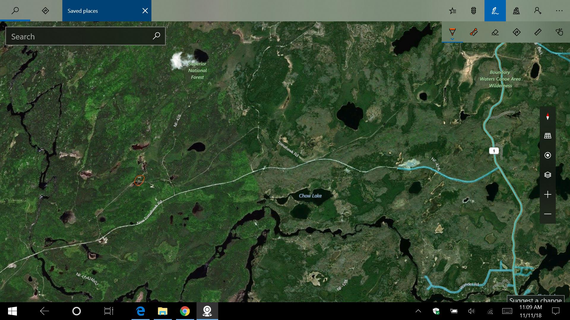
ellahallely: "Jackpine Jim Where was camp 6? I see you said by Stoney River. Was it near the Happy Wanderer? I spent a little time at the Wanderer back when they sold gas and beer. Maybe 30 years ago. The Wanderer is for sale."
Camp 6 was in the red circle on this map image. Just a grown over gravel pit now. Some artifacts if you kick around a bit.
Wilderness both captivates your soul and sets it free :)
11/11/2018 12:18PM
JackpineJim: "ellahallely: "Jackpine Jim Where was camp 6? I see you said by Stoney River. Was it near the Happy Wanderer? I spent a little time at the Wanderer back when they sold gas and beer. Maybe 30 years ago. The Wanderer is for sale.
In the red circle on this map image. Just a grown over gravel pit now. Some artifacts if you kick around a bit.
"
Camp 2 was here (red circle) near Highway 1 Tomahawk Road intersection.

Wilderness both captivates your soul and sets it free :)
11/12/2018 07:40PM
Moosepatrol: " A link about Forest Center.|
The link is from Ely Echo archives page, it is best viewed in full screen. There is also a search function, although not the best search engine. Also try Sawbill landing or Winton, etc ….. if looking for other logging info."
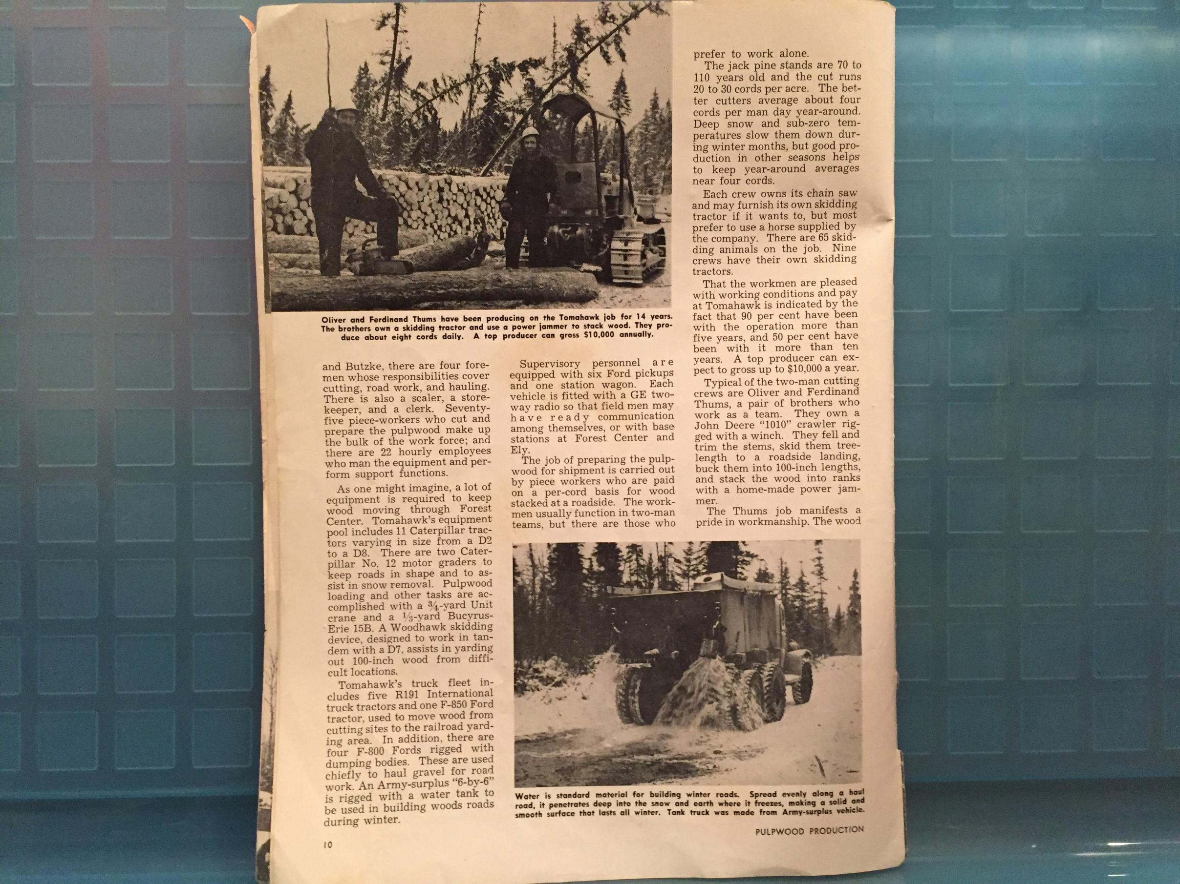
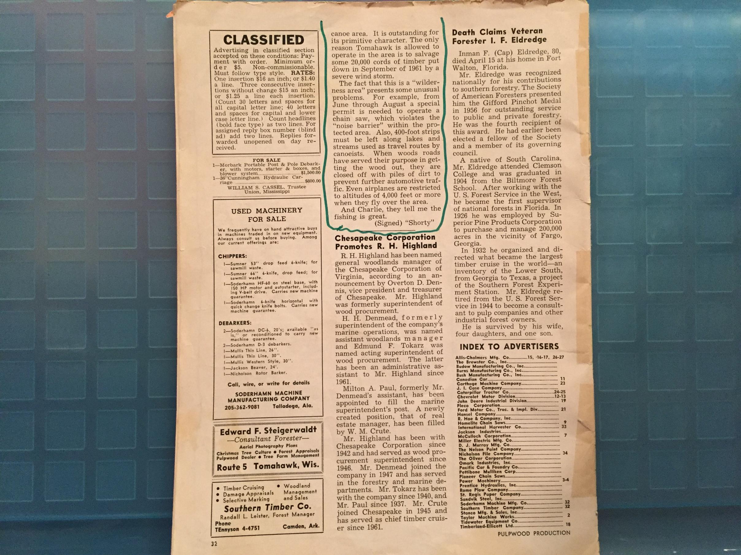
My Mom kept a magazine from 1963 with a couple of good articles about Forest Center.
You'll have to expand the photos to read the articles.


The horse was named Colonel - best horse ever!, I was told.


Wilderness both captivates your soul and sets it free :)
11/13/2018 02:54PM
JackpineJim: "Moosepatrol: " A link about Forest Center.|
The link is from Ely Echo archives page, it is best viewed in full screen. There is also a search function, although not the best search engine. Also try Sawbill landing or Winton, etc ….. if looking for other logging info."
My Mom kept a magazine from 1963 with a couple of good articles about Forest Center.
You'll have to expand the photos to read the articles.


The horse was named Colonel - best horse ever!, I was told.

"
I worked with Oliver Thums (mentioned in the article) in the early 2,000's.
I ran the fire engine out of the USFS Isabella Work Station, Ollie was a SCEP employee.
Senior Citizen Employment Program. I also worked with a few other past people who lived at Forest Center.
I believe the building housing the current Stoney River Cafe in Isabella was moved from Sawbill Landing. A community similar to Forest Center.
May the rivers be crooked and winding, and your portages lonesome, leading to the most amazing view.
11/13/2018 05:38PM
The Great Outdoors: "Tomahawk Timber Co. had their office in Ely, and was located upstairs of Frank's Variety next to the State Theater.
You may want to contact the Trygg Land Office, as they had maps that show logging camps and several Indian Villages in the entire area. I also think they have a book with the info.
There are still some old loggers that worked in those camps, and I know one that was born in a camp next to Insula Lake.
All the Camps had numbers for names, and the history is very interesting."
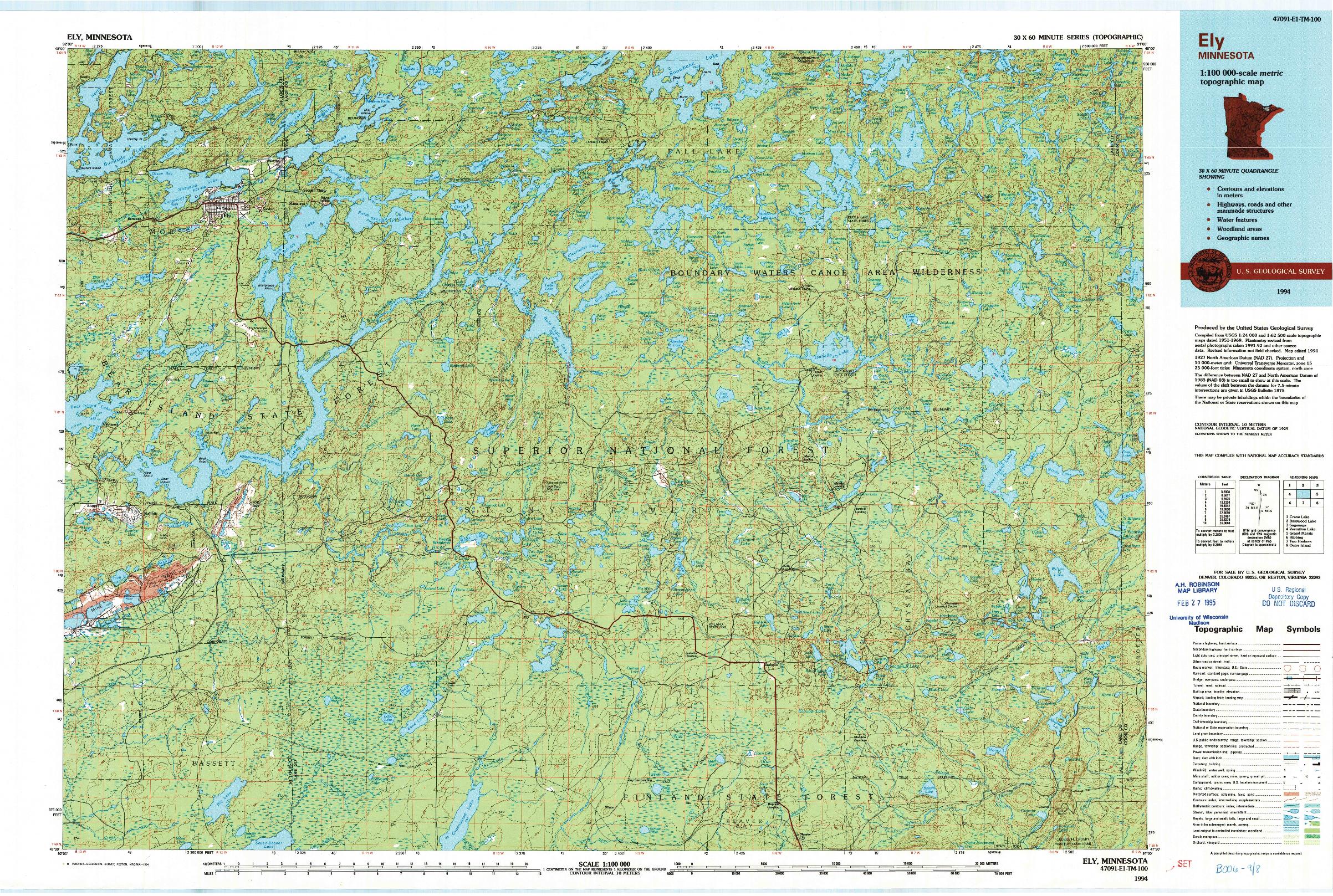
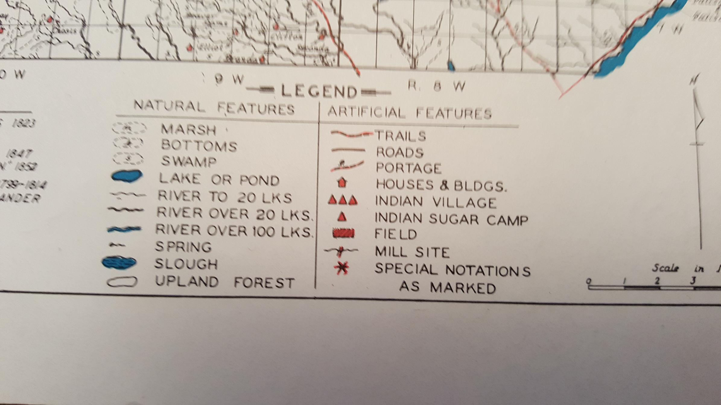
The Trygg maps are great. The ones I have are before logging or even before roads or towns. Maybe they date to around 1850-1880S. They do show Indian Villages and Indian sugar camps. They also show cabins that settlers built. Many of the lakes had different names.
J. William Trygg (Bill Sr.) was born September 17, 1905, at Cook Minnesota. He became a professional forester and worked for the United States Forest Service (USFS) from 1926 until 1954. He was in charge of Civilian Conservation Corps (CCC) camps in the Ely, Minnesota, area and, at the time of his retirement from the USFS, was a district forest ranger. In addition to his expertise in forestry he had experience with Indian claims throughout the Great Lakes region.
After leaving the Forest Service Trygg worked as a land use consultant and as an appraiser of natural resources. Through an intense interest in the history of the area he developed a system he used to make historical appraisals on behalf of various Indian tribes in the Midwest, appraisals for Indian lands already ceded to the United States. With his son he owned the Trygg Land Office, a real estate agency located at Ely. Trygg was elected to the Minnesota House of Representatives in 1966 from District 62 (St. Louis County) and served one term.
Trygg died in Washington, D.C. on April 11, 1971, where he was testifying on Indian land claims. He is buried in the Ely Cemetery.
You can buy the maps online for $8 or read more on the history of the Trygg family at
at this link.
If you like old maps of the area these are a must have.
Raised by wolves!
11/13/2018 09:40PM
Pinetree: "Lot of great info-keep it coming. I heard there was a saloon back at the Forest center also,I bet they did one awesome business with the loggers back there. I wonder what kind of sewer system and water setup they had?"
Pinetree, I don't recall there being a tavern in Forest Center. No centralized sewer and water system either. I do recall the 'new' school had running water and, I presume, a septic system, since it had modern bathrooms. I don't know how many of the other houses our buildings were so equipped, the ones my relatives lived in did not. Camp 6 had a six-seater outhouse and many of the families had their own outhouses. Chamber pots were the rule.
Wilderness both captivates your soul and sets it free :)
11/13/2018 09:58PM
ellahallely: "The Great Outdoors: "Tomahawk Timber Co. had their office in Ely, and was located upstairs of Frank's Variety next to the State Theater.
You may want to contact the Trygg Land Office, as they had maps that show logging camps and several Indian Villages in the entire area. I also think they have a book with the info.
There are still some old loggers that worked in those camps, and I know one that was born in a camp next to Insula Lake.
All the Camps had numbers for names, and the history is very interesting."
The Trygg maps are great. The ones I have are before logging or even before roads or towns. Maybe they date to around 1850-1880S. They do show Indian Villages and Indian sugar camps. They also show cabins that settlers built. Many of the lakes had different names.
J. William Trygg (Bill Sr.) was born September 17, 1905, at Cook Minnesota. He became a professional forester and worked for the United States Forest Service (USFS) from 1926 until 1954. He was in charge of Civilian Conservation Corps (CCC) camps in the Ely, Minnesota, area and, at the time of his retirement from the USFS, was a district forest ranger. In addition to his expertise in forestry he had experience with Indian claims throughout the Great Lakes region.
After leaving the Forest Service Trygg worked as a land use consultant and as an appraiser of natural resources. Through an intense interest in the history of the area he developed a system he used to make historical appraisals on behalf of various Indian tribes in the Midwest, appraisals for Indian lands already ceded to the United States. With his son he owned the Trygg Land Office, a real estate agency located at Ely. Trygg was elected to the Minnesota House of Representatives in 1966 from District 62 (St. Louis County) and served one term.
Trygg died in Washington, D.C. on April 11, 1971, where he was testifying on Indian land claims. He is buried in the Ely Cemetery.
You can buy the maps online for $8 or read more on the history of the Trygg family at
at this link.
If you like old maps of the area these are a must have.
"
It is interesting you mention the maps with the locations of Indian villages. My Dad told me of the logging camp called Indian Village Camp he lived in in 1943, located in the red circle in this map. He didn't know why it was called Indian Village.

Wilderness both captivates your soul and sets it free :)
11/13/2018 10:22PM
JackpineJim: "Pinetree: "Lot of great info-keep it coming. I heard there was a saloon back at the Forest center also,I bet they did one awesome business with the loggers back there. I wonder what kind of sewer system and water setup they had?"
Pinetree, I don't recall there being a tavern in Forest Center. No centralized sewer and water system either. I do recall the 'new' school had running water and, I presume, a septic system, since it had modern bathrooms. I don't know how many of the other houses our buildings were so equipped, the ones my relatives lived in did not. Camp 6 had a six-seater outhouse and many of the families had their own outhouses. Chamber pots were the rule."
I was talking with my brother today,he mentioned he thought there was one tavern,maybe he is wrong? i will have to ask him again. It really wasn't that long ago and thee should be a fair number of survivors still? Maybe not?
Its also amazing how fast this town was built and how fast it disappeared. I never thought of this before but I believe where the town was is now federal land and wonder what ownership status was than.
A six seater-that is something else.
11/14/2018 08:26AM
Jackpine Jim says at camp 6 they got their water from the "trout pond". Sorry Jackpine but in my world that is a swamp. I am surprised no one got beaver fever.
I have been by camp 6 on the old Tomahawk road more then 100 times and never knew it was a logging camp. Been by camp 2 more then 200 times and never even knew it was there Thanks for the info.
JIM P.
I have been by camp 6 on the old Tomahawk road more then 100 times and never knew it was a logging camp. Been by camp 2 more then 200 times and never even knew it was there Thanks for the info.
JIM P.
Raised by wolves!
11/14/2018 08:52PM
Pinetree: "Asked my brother again and he thought he was tld there was a saloon at the Forest center,along with a church and school."
I just talked to my Mom about it and she said there was a small restaurant but no saloon. Folks went to Happy Wanderer or Chub Lake Resort on Highway 1.
Wilderness both captivates your soul and sets it free :)
11/14/2018 08:56PM
ellahallely: "Jackpine Jim says at camp 6 they got their water from the "trout pond". Sorry Jackpine but in my world that is a swamp. I am surprised no one got beaver fever.
I have been by camp 6 on the old Tomahawk road more then 100 times and never knew it was a logging camp. Been by camp 2 more then 200 times and never even knew it was there Thanks for the info.
JIM P."
Yes, The Pond was no more than a small swamp hole but the water was crystal clear. Still,
I would never drink the water untreated or unfiltered today. But, people did drink unpurified water for millennia, and I'd wager a good portion of the world's population do so today.
Wilderness both captivates your soul and sets it free :)
11/15/2018 11:51PM
Tomahawk: " I was attempting to get more info on Tomahawk Timber Co. and their Camp 4 & Camp 5 north of Isabella Lake. I got onto this sight and read some of Jackpine Jim's comments on the Maniwaki Lake camp. I had been there back in the late 1960s and also in the early 1970s and would like to find out more. Is Jackpine Jim still out there somewhere?"
I'm glad you started this thread Tomahawk. It prompted me to dig around for some maps and listen to some recordings of oral history my Dad left me. Here is a map showing many of the roads in the area. I know this map is incomplete because there was a logging camp on the portage trail between Baskatong and Square Lake with a road to it. 'I'm having trouble uploading the map got it
Wilderness both captivates your soul and sets it free :)
11/21/2018 07:58AM
Jackpine Jim,
I hope you're still around and patient. I've tried to respond numerous times to your great posts but have had posting issues - for some reason the site wouldn't accept my posts. If this post works there will be more coming in the next days.
Tomahawk
I hope you're still around and patient. I've tried to respond numerous times to your great posts but have had posting issues - for some reason the site wouldn't accept my posts. If this post works there will be more coming in the next days.
Tomahawk
11/21/2018 04:52PM
Jackpine Jim,
When last we communicated, you asked if that was me that you spoke to on the Tomahawk Road this past season. No, it wasn't but I wish that it was. When you said the guy was from Virginia I asked a former hunting partner who lives there and he said it wasn't him either. So, there's someone else out there a lot like us.
There's a story I've heard for years now about a B-17G Flying Fortress that crash landed south of the Tomahawk Road around 1946 in the area of Inga Creek. I was wondering if your dad mentioned anything about that? I've heard bits & pieces of this story...........
Tomahawk
11/21/2018 06:33PM
Tomahawk: "Jackpine Jim,
When last we communicated, you asked if that was me that you spoke to on the Tomahawk Road this past season. No, it wasn't but I wish that it was. When you said the guy was from Virginia I asked a former hunting partner who lives there and he said it wasn't him either. So, there's someone else out there a lot like us.
There's a story I've heard for years now about a B-17G Flying Fortress that crash landed south of the Tomahawk Road around 1946 in the area of Inga Creek. I was wondering if your dad mentioned anything about that? I've heard bits & pieces of this story...........
Tomahawk"
Like I mentioned earlier,in the late 80's and 90's we Grouse hunted down the Tomahawk road on the Pow Wow trails and every weekend we ran into somebody from Virginia whom worked as a Forester back than and I believe his Dad did also. He was usually there Saturday,but not Sunday. very nice to talk to also.

11/22/2018 11:31AM
I have this same series of maps, very interesting to look at. The most interesting thing of all is the near constant mention of iron deposits. I've been all through that country since back in the 1970s and in some areas you can not trust a compass. The needle keeps turning and won't stop from all the iron in the ground.
11/22/2018 11:35AM
Tomahawk: " Just curious what did you fish for? Northerns? I was surprised there would be anything worth fishing for in there until Juel Foster of Happy Wander told me they fished that for big northerns. Only caught small northerns, he confessed."
Northern pike,one of the arrow lakes was known for big northerns. Myself I just caught little ones,but just fished it after grouse hunting my way in.
11/22/2018 11:46AM
Nothing big huh? Juel told me when they walked in there that was the first and last time he'd do that. He wasn't a big hiker at all and said he was sore for a month after that.
Oh, the birds were thick back in the day on that road. I'd hunt that one and also the one that went into Hudson Lake. Almost as many moose as grouse back in the 70s. I'd average 3-4 moose a trip and as many as 6. A lot of good bulls but one in particular on the Hudson Road. I'd see his tracks, the size of a Clydesdale horse. Enormous. Then he'd have the road all torn up with bigger trees rubbed, girdled and smaller ones torn right out of the ground. He was an ornery cuss when he went into rut. I saw him only once, unbelievable! Just a guess but he had to go about 1200 lbs. and had a rack from at least 5', maybe even more, from antler tip to antler tip. I saw his tracks every year for about 5 yrs. until they were no more. I always wondered, wolves or just old age?
Oh, the birds were thick back in the day on that road. I'd hunt that one and also the one that went into Hudson Lake. Almost as many moose as grouse back in the 70s. I'd average 3-4 moose a trip and as many as 6. A lot of good bulls but one in particular on the Hudson Road. I'd see his tracks, the size of a Clydesdale horse. Enormous. Then he'd have the road all torn up with bigger trees rubbed, girdled and smaller ones torn right out of the ground. He was an ornery cuss when he went into rut. I saw him only once, unbelievable! Just a guess but he had to go about 1200 lbs. and had a rack from at least 5', maybe even more, from antler tip to antler tip. I saw his tracks every year for about 5 yrs. until they were no more. I always wondered, wolves or just old age?
11/22/2018 11:50AM
Tomahawk: "I have this same series of maps, very interesting to look at. The most interesting thing of all is the near constant mention of iron deposits. I've been all through that country since back in the 1970s and in some areas you can not trust a compass. The needle keeps turning and won't stop from all the iron in the ground."
Very true about the compass needle, I could run a 1/4 mile line and be within 5 feet of a survey stake, turn the corner go a couple hundred feet and nothing. I could not get an accurate reading to save my life.
Had to go back and use a Tremble GPS to finish painting the timber sale lines, around Isabella.
Ellahallely that's a cool map.
May the rivers be crooked and winding, and your portages lonesome, leading to the most amazing view.
11/22/2018 12:03PM
Jackpine,
You really have my interest when you mentioned Camp 5. I have been there a number of time via canoe from South Hope to Maniwaki but never realized there was a camp there. Also walked in there off the North Road. I've looked on the satellite map and you say it was on the southwest part of Maniwaki lake. Was it near the road that came in from the North Road, the road that went up into Fishdance Lake or was it more over toward the creek that went along the portage in the direction to South Hope? Can you circle it on a map?
Thanks much, I know a guy who lived there when the camp was there but he was only 5 at the time and wasn't sure where it was.
Many thanks!!
11/22/2018 12:36PM
Tomahawk: " Nothing big huh? Juel told me when they walked in there that was the first and last time he'd do that. He wasn't a big hiker at all and said he was sore for a month after that.
Oh, the birds were thick back in the day on that road. I'd hunt that one and also the one that went into Hudson Lake. Almost as many moose as grouse back in the 70s. I'd average 3-4 moose a trip and as many as 6. A lot of good bulls but one in particular on the Hudson Road. I'd see his tracks, the size of a Clydesdale horse. Enormous. Then he'd have the road all torn up with bigger trees rubbed, girdled and smaller ones torn right out of the ground. He was an ornery cuss when he went into rut. I saw him only once, unbelievable! Just a guess but he had to go about 1200 lbs. and had a rack from at least 5', maybe even more, from antler tip to antler tip. I saw his tracks every year for about 5 yrs. until they were no more. I always wondered, wolves or just old age?"
I loved the Hudson road also,when I found it by than it kind of petered out just past the creek getting grown over. Not sure how much further you could go. Also tried once coming in from Hudson lake up the creek,but can't remember why but we didn't quite get all the way in.
Instead of turning toward the Hudson road you go to you hit the beaver dam and the big meadows that was a favorite moose spot.
Lot of good memories there.
Sometimes we would pack in and camp at the designated camp site on Pose and hunt from there.
11/22/2018 12:43PM
Tomahawk: "Jackpine,
You really have my interest when you mentioned Camp 5. I have been there a number of time via canoe from South Hope to Maniwaki but never realized there was a camp there. Also walked in there off the North Road. I've looked on the satellite map and you say it was on the southwest part of Maniwaki lake. Was it near the road that came in from the North Road, the road that went up into Fishdance Lake or was it more over toward the creek that went along the portage in the direction to South Hope? Can you circle it on a map?
Thanks much, I know a guy who lived there when the camp was there but he was only 5 at the time and wasn't sure where it was.
Many thanks!!"
.
The MN DNR like around 1969 stocked Maniwaki with muskie the shoepack strain. Tried fishing it from canoe coming up from South Hope around 1990 and all we caught was big perch. Much of it was pretty shallow. Did cross the old road north of Maniwaki

11/22/2018 01:49PM

In the photo that I tried to send here is of the large area that was dug up by that huge bull moose I had seen. If you look closely at the deepest area you can see my 2 3/4" 12 ga. shotgun shell to give an idea how deep it was. It was at least 12"-14" deep, maybe deeper and nearly 4' across. I had seen many of these scrapes by moose in other areas before but nothing this large. He must've also peed in it because it was wet toward the center of the dug out and the entire area smelled like a horse barn. The urine smell was incredibly strong, I must've just missed him.
The Hudson Road went in quite aways and ended in a clearcut where they must've had a landing at one time. We followed it that far many times on hunting trips back in the 70s-80s. Gradually it grew over but someone was cutting it to keep it open for many years. But you pretty much had to know the trail well in order to follow it. This was not far from the creek that came in from Hudson Lake. I'm thinking that cutover must've been about 400'-500' from that creek where the reservation boundary was.
11/22/2018 02:03PM
 This photo is of my hunting partner carrying out a nice antler he had found very near to Arrow Lake. For years we had it hidden, tied to a tree and trying to figure a way to carry it out. It was very heavy and finally we strapped it to a pack frame and got it out. It sits in his basement with a painted scene on it to this day.
11/22/2018 03:12PM
Tomahawk: "
In the photo that I tried to send here is of the large area that was dug up by that huge bull moose I had seen. If you look closely at the deepest area you can see my 2 3/4" 12 ga. shotgun shell to give an idea how deep it was. It was at least 12"-14" deep, maybe deeper and nearly 4' across. I had seen many of these scrapes by moose in other areas before but nothing this large. He must've also peed in it because it was wet toward the center of the dug out and the entire area smelled like a horse barn. The urine smell was incredibly strong, I must've just missed him.
The Hudson Road went in quite aways and ended in a clearcut where they must've had a landing at one time. We followed it that far many times on hunting trips back in the 70s-80s. Gradually it grew over but someone was cutting it to keep it open for many years. But you pretty much had to know the trail well in order to follow it. This was not far from the creek that came in from Hudson Lake. I'm thinking that cutover must've been about 400'-500' from that creek where the reservation boundary was."
I think the one cutting the trail to keep it open was the individual(he was one fast walker) that I mentioned from Virgina_area who hunted grouse there and worked as a USFS employee once. He always carried a machete with him and seen where he cut the trails be it toward the Parent river loop or the Pose loop area.
The Hudson loop had just a overgrown area where once they took gravel just before the creek. Good area for grouse.
11/22/2018 08:42PM
Pinetree,
Back in the late 60s, the USFS had big plans for the Maniwaki Lake area. The moose population in that area from Ferne Lake to the south to Maniwaki to the north the was the highest in the lower 48, if I remember correctly it was 15-20 moose per square mile! They were interested in developing campsites in Maniwaki Lake for moose hunters that would hunt via canoe. But for some reason that never materialized.
For those interested in posting on this subject, I can't tell you how much I appreciate sharing my experiences and hearing from yours!!
Jackpine Jim this is all your fault, we have to meet some day!
11/22/2018 09:00PM
I hunted Moose in 1977 and at that time they said Ferne lake had the highest per sq. mile but
I believe it was quite a bit lower than that number. I wonder if that was the winter yard number. I remember I thought it was like 3 moose/sq mile and they mentioned a good area in Canada would be 0.75 moose per sq. mile.
You may be right now I think about it,that would be like the hey day of logging and maybe pulled the moose in from all over to that spot.
11/23/2018 08:47AM
Tomahawk, where do you live now.
That moose rack is as big as I have seen in Minnesota for along time!
Did anybody run into wolves back then? 40s, 50s,60s,70s?I remember the Happy Wanderer have a stuffed one. I had a few beers at the Wanderer in the day.
That moose rack is as big as I have seen in Minnesota for along time!
Did anybody run into wolves back then? 40s, 50s,60s,70s?I remember the Happy Wanderer have a stuffed one. I had a few beers at the Wanderer in the day.
Raised by wolves!
11/23/2018 09:40AM
ellahallely: "Tomahawk, where do you live now.
That moose rack is as big as I have seen in Minnesota for along time!
Did anybody run into wolves back then? 40s, 50s,60s,70s?I remember the Happy Wanderer have a stuffed one. I had a few beers at the Wanderer in the day. "
In the 60's you seen a few,but they were much more wary. Often you seen a track in the snow come up to a human track and they would turn right around. The few survivors than became quite wary.
11/23/2018 09:45AM
Those numbers seemed high to me at the time as well but that's what I was told. It seemed to be a pretty credible source from the DNR if I recall. We saw so much sign back in the 70s-80s plus all the sightings that I sure thought it to be believable. Who knows.
11/23/2018 11:58AM
Currently living in Duluth.
In those near 50 yrs. that I've hunted in that country, my partner & I have seen many wolves. Once after we split up, he went toward Quadga and I toward Insula/Hudson, just after he crossed the small creek coming out of Fallen Arch Lake he jumped 3 wolves that had downed a moose calf. As soon as they saw him, only 15 yds. away, they scattered. One year we'd hear a large pack of them howling when we got to the Quadga Fork off the North Road. Nearly each time we got to that point early in the morning they'd cut loose. Really unnerving. One memorable day I went toward Insula and he went toward Quadga. As I walked on the North Road that pack must've been paralleling me and not far back off the road, either. Every once in awhile one would cut loose with a howl that would nearly make you fill your pants.When I got to the Insula /Hudson Fork on the North Road I turned toward Insula and where the first creek crosses on that road here came 5 or 6 wolves that got on the road about a block ahead of me. I suspected this was the same bunch that was following me. They seemed not to even pay me much attention as they ran up the road, the same direction I was going. I didn't hear anything from them until I got on the Hudson Road. I was back in about 2 miles on that road when a wolf cut loose with a bellow to my left, sounded like he was only a block off the road. Then one answered with a howl just off the road to the right of me. Enough to make you jump out of your boots when you realize that you're between them. Interesting times.
In those near 50 yrs. that I've hunted in that country, my partner & I have seen many wolves. Once after we split up, he went toward Quadga and I toward Insula/Hudson, just after he crossed the small creek coming out of Fallen Arch Lake he jumped 3 wolves that had downed a moose calf. As soon as they saw him, only 15 yds. away, they scattered. One year we'd hear a large pack of them howling when we got to the Quadga Fork off the North Road. Nearly each time we got to that point early in the morning they'd cut loose. Really unnerving. One memorable day I went toward Insula and he went toward Quadga. As I walked on the North Road that pack must've been paralleling me and not far back off the road, either. Every once in awhile one would cut loose with a howl that would nearly make you fill your pants.When I got to the Insula /Hudson Fork on the North Road I turned toward Insula and where the first creek crosses on that road here came 5 or 6 wolves that got on the road about a block ahead of me. I suspected this was the same bunch that was following me. They seemed not to even pay me much attention as they ran up the road, the same direction I was going. I didn't hear anything from them until I got on the Hudson Road. I was back in about 2 miles on that road when a wolf cut loose with a bellow to my left, sounded like he was only a block off the road. Then one answered with a howl just off the road to the right of me. Enough to make you jump out of your boots when you realize that you're between them. Interesting times.
11/24/2018 07:36AM
Ellahallely, when you mentioned about that moose rack picture I had sent brings up another memory. I would often run into another hunter who lived in Forest Lake but had grown up in Forest Center and would drive up an old school bus. You'd see it parked at Forest Center, usually across from where the rail spurs came in, and knew he was around. Anyway, I had run into him up on the East Road one day and told him about this moose antler that my partner had hauled out. The guy then told me about one he had found. He was on the road just before Perent River, a very recent road put in by Leusteck Logging around 1971 when they were picking up contracts that hadn't been cut by Tomahawk after the '64 Wilderness Act was passed. He said he found an enormous one, so big he didn't know how to carry it out. It was way back in on this newer road and he said he went in off the road, and crawled atop a small ledge to hide it until he could figure out a way to get it out. He didn't want anyone else to find it. When I told him about the pack frame idea he thought that was a great idea and he might try that. I often wondered if he ever got it out or if it still sits atop that ledge. The way I remember him describing it to me, he said the antler was about 6"- 8" longer than his entire shotgun!
11/24/2018 09:22AM
ellahallely: "Tomahawk, where do you live now.
That moose rack is as big as I have seen in Minnesota for along time!
Did anybody run into wolves back then? 40s, 50s,60s,70s?I remember the Happy Wanderer have a stuffed one. I had a few beers at the Wanderer in the day. "
Dad carted this rack out from a bull he found frozen in the ice near Arrow Lake when he was running his trap line in 1962 or '63. He would use a bicycle to get his traps and gear
up the old roads. He tied the rack to his bicycle and pushed it down the road all the way to where his car was parked on the North Road by Forest Center. The road was already bermed off by then. He told me on some mornings when the ground was frozen solid and the snow was mostly gone he could ride the bike and made great time all the way to Bugo Lake. Often, in the afternoons, the ground would be too soft to ride the bike with his pack of traps.
Wilderness both captivates your soul and sets it free :)
11/24/2018 10:14AM
JackpineJim: "ellahallely: "Tomahawk, where do you live now.
That moose rack is as big as I have seen in Minnesota for along time!
Did anybody run into wolves back then? 40s, 50s,60s,70s?I remember the Happy Wanderer have a stuffed one. I had a few beers at the Wanderer in the day. "
Dad carted this rack out from a bull he found frozen in the ice near Arrow Lake when he was running his trap line in 1962 or '63. He would use a bicycle to get his traps and gear
up the old roads. He tied the rack to his bicycle and pushed it down the road all the way to where his car was parked on the North Road by Forest Center. The road was already bermed off by then. He told me on some mornings when the ground was frozen solid and the snow was mostly gone he could ride the bike and made great time all the way to Bugo Lake. Often, in the afternoons, the ground would be too soft to ride the bike with his pack of traps.
"
Wow quite the story. Anymore trapline stories. What a trapline,never know what you would see or experience. What was his main furs.
The mid to late 60's up to 1969 when the area and all of northern Minnesota there was deer everywhere also. Era of big bucks. By 1970 numbers crashed. The deer populations were very high also until the very harsh winter of 1969 where snow was already deep during deer season.
11/24/2018 10:15AM
Jackpine, Good to hear from you again. That is a great story about your dad, he must've been an incredible fellow! That rack is.............WOW! The picture of that rack brings me back to another memory. My partner and I were on our way back on the North Road after a day of grouse hunting. He had just gotten out of the service after being stationed in Alaska. Less than a mile from Isabella River, this enormous bull came out of a lowland area on the west side of the road. He stopped on the road and gave us the ol' evil eye, turned and ran down the road toward the River. I still remember my friend saying," That's an Alaska sized moose!" I also remember us both standing there "catching flies" with our mouths wide open, dumbfounded at the size of this critter. We lost sight of him as he ran away from us but there was a road not far from the River that ran to the east and just on the north side of Isabella Lake, his tracks went down that road. That was I one of the first moose seasons, around 1973 or so. Not long after we saw where his tracks went down that road did we ran into moose hunters on horseback. We described this moose to them, told them where it went and they concluded that here was no moose this size in n. MN. We never heard a shot but within a week or so there was a picture of this very same guy we talked to with a picture of an unbelievable moose rack in the Duluth-News Tribune. Maybe someone else recalls these same antlers in that picture, I think the man's name may have been McKenzie? It was at least the size of your antlers here, possibly even larger.
11/24/2018 12:05PM
Pinetree: "JackpineJim: "ellahallely: "Tomahawk, where do you live now.
That moose rack is as big as I have seen in Minnesota for along time!
Did anybody run into wolves back then? 40s, 50s,60s,70s?I remember the Happy Wanderer have a stuffed one. I had a few beers at the Wanderer in the day. "
Dad carted this rack out from a bull he found frozen in the ice near Arrow Lake when he was running his trap line in 1962 or '63. He would use a bicycle to get his traps and gear
up the old roads. He tied the rack to his bicycle and pushed it down the road all the way to where his car was parked on the North Road by Forest Center. The road was already bermed off by then. He told me on some mornings when the ground was frozen solid and the snow was mostly gone he could ride the bike and made great time all the way to Bugo Lake. Often, in the afternoons, the ground would be too soft to ride the bike with his pack of traps.
Wow quite the story. Anymore trapline stories. What a trapline,never know what you would see or experience. What was his main furs.
The mid to late 60's up to 1969 when the area and all of northern Minnesota there was deer everywhere also. Era of big bucks. By 1970 numbers crashed. The deer populations were very high also until the very harsh winter of 1969 where snow was already deep during deer season. "
Dad mostly trapped beaver and a few otter and mink and got an occasional red fox. This pic is a year after the moose antler picture and one of the beaver pelts is of a jet black beaver he caught in Arrow Lake. The only black furred beaver he ever caught. He got a few more dollars for that one.

Wilderness both captivates your soul and sets it free :)
11/24/2018 12:33PM
Dad mostly trapped beaver and a few otter and mink and got an occasional red fox. This pic is a year after the moose antler picture and one of the beaver pelts is of a jet black beaver he caught in Arrow Lake. The only black furred beaver he ever caught. He got a few more dollars for that one.
"are your brothers still alive? If so, where did they wind up going? Love the history of this thread!
<><
11/24/2018 02:08PM
ellahallely: "

Trygg map of area. I have others of NE Minnesota I can upload if anyone wants to see them."
I'd love to see your other maps. I was just listening to some audio recordings I my dad left me where he mentioned an old Forest Service trail on the East side of the Arrow lakes that connected with the Hudson Road. He trapped along that. Also, I found a mention of a 1953 map of the area that might be informative.
Wilderness both captivates your soul and sets it free :)
11/24/2018 04:22PM
Cretbo: "
Dad mostly trapped beaver and a few otter and mink and got an occasional red fox. This pic is a year after the moose antler picture and one of the beaver pelts is of a jet black beaver he caught in Arrow Lake. The only black furred beaver he ever caught. He got a few more dollars for that one.
"
are your brothers still alive? If so, where did they wind up going? Love the history of this thread!"
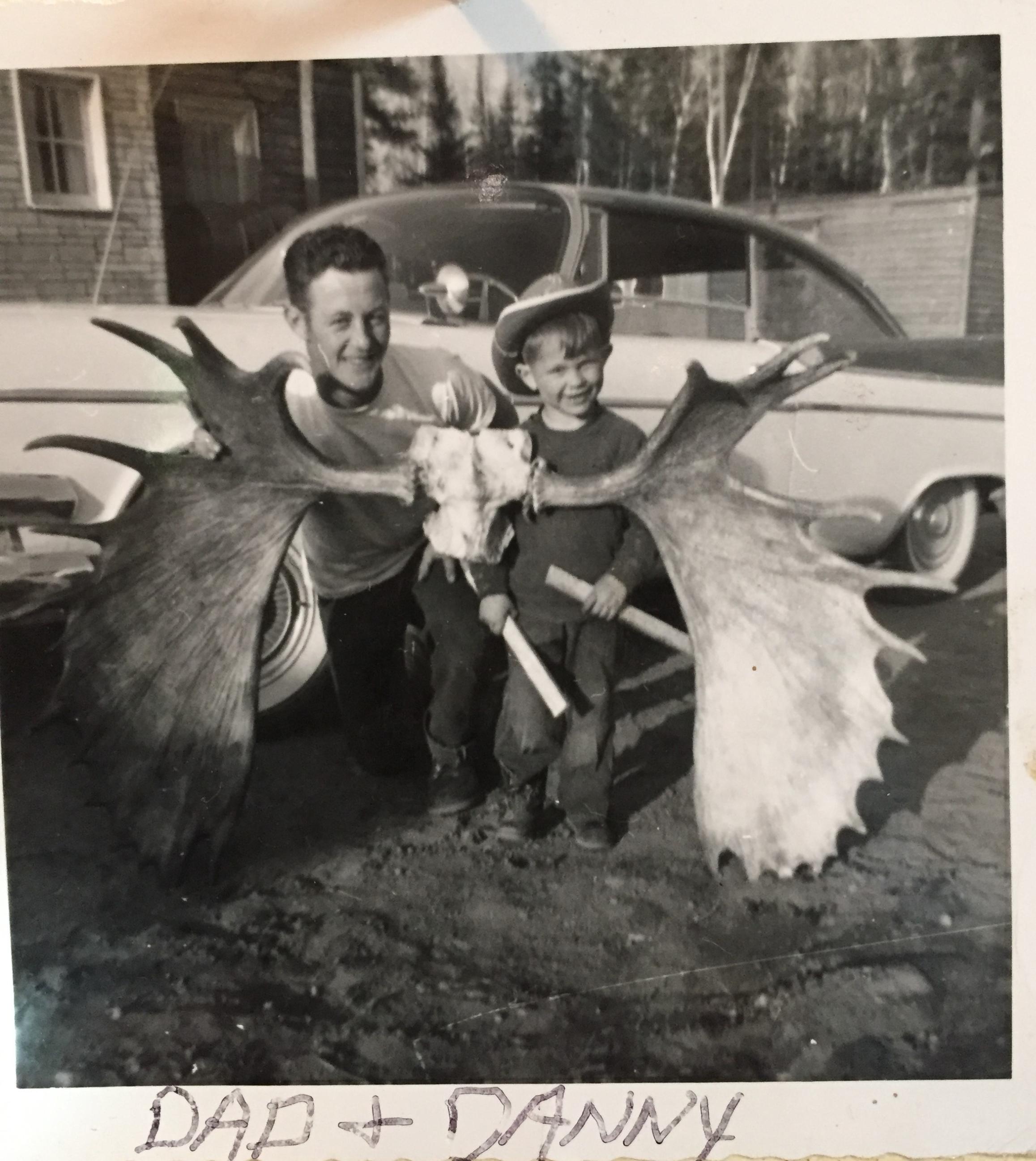
Both still kicking :) One lives near Madison and the one with the cowboy boots and hat in the moose antler pic is a physician in Oneida county, WI.
Wilderness both captivates your soul and sets it free :)
11/24/2018 11:40PM
Tomahawk: "Jackpine,
You really have my interest when you mentioned Camp 5. I have been there a number of time via canoe from South Hope to Maniwaki but never realized there was a camp there. Also walked in there off the North Road. I've looked on the satellite map and you say it was on the southwest part of Maniwaki lake. Was it near the road that came in from the North Road, the road that went up into Fishdance Lake or was it more over toward the creek that went along the portage in the direction to South Hope? Can you circle it on a map?
Thanks much, I know a guy who lived there when the camp was there but he was only 5 at the time and wasn't sure where it was.
Many thanks!!"
Tomahawk, I'm operating from memory of discussions with my Dad on where Camp 5 was located. I recall him saying it was near the creek to Maniwaki. I was thinking it was near where the road branched off to the north crossing Hope Creek but I found these two different maps (too big to upload, apparently) from 1960 that appear to show two buildings (squares) near Maniwaki Creek on the East end of Maniwaki Lake. They are in the white area just east of the 1612' Benchmark triangle in the road. There was a branch in the road just NE of the two squares ( buildings?) with one heading North toward Fishdance and the other continuing on to Camp 4 (Poly Camp). I'll ask my mother this weekend and see if she can recall the exact location of Camp 5.
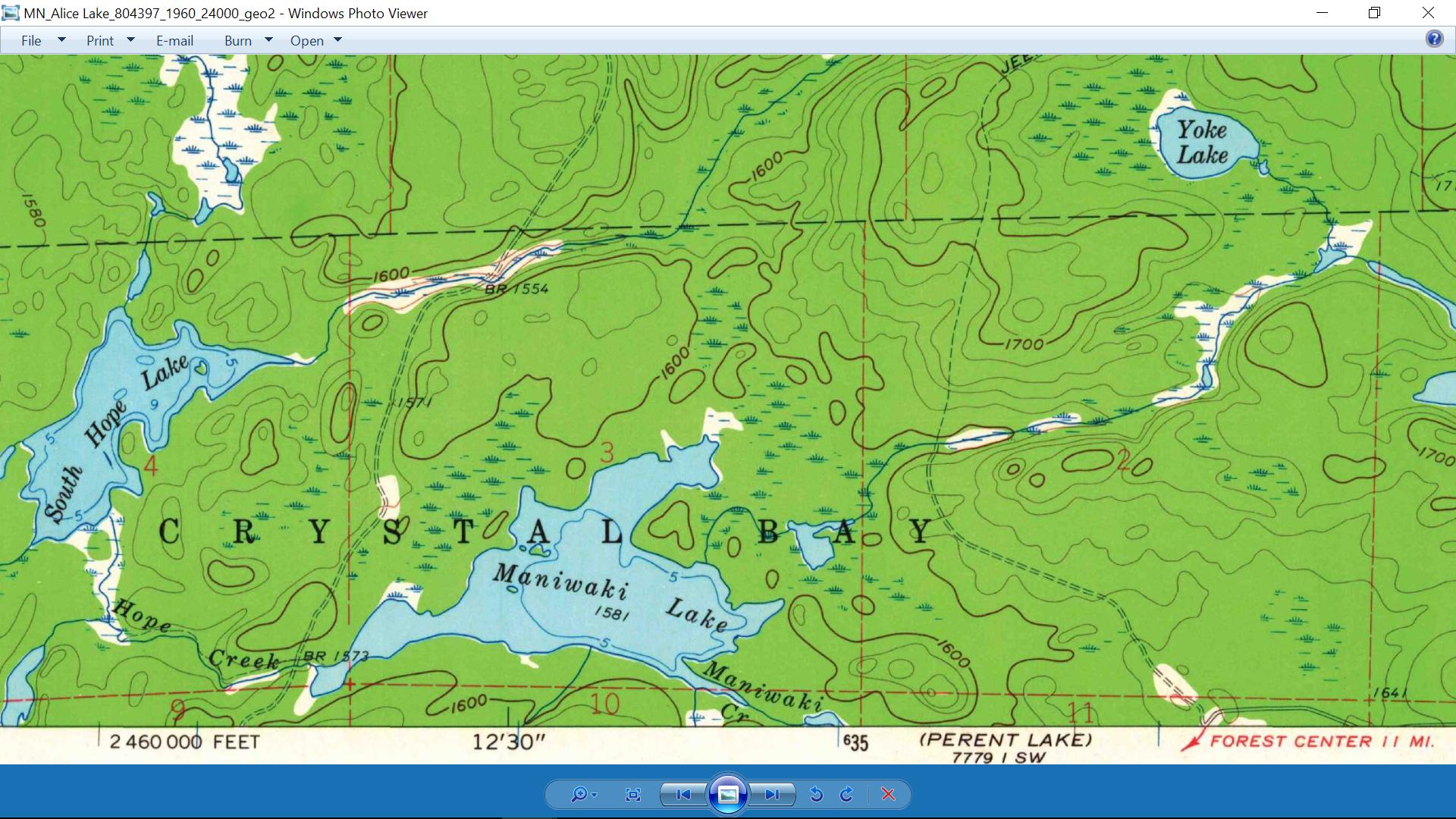
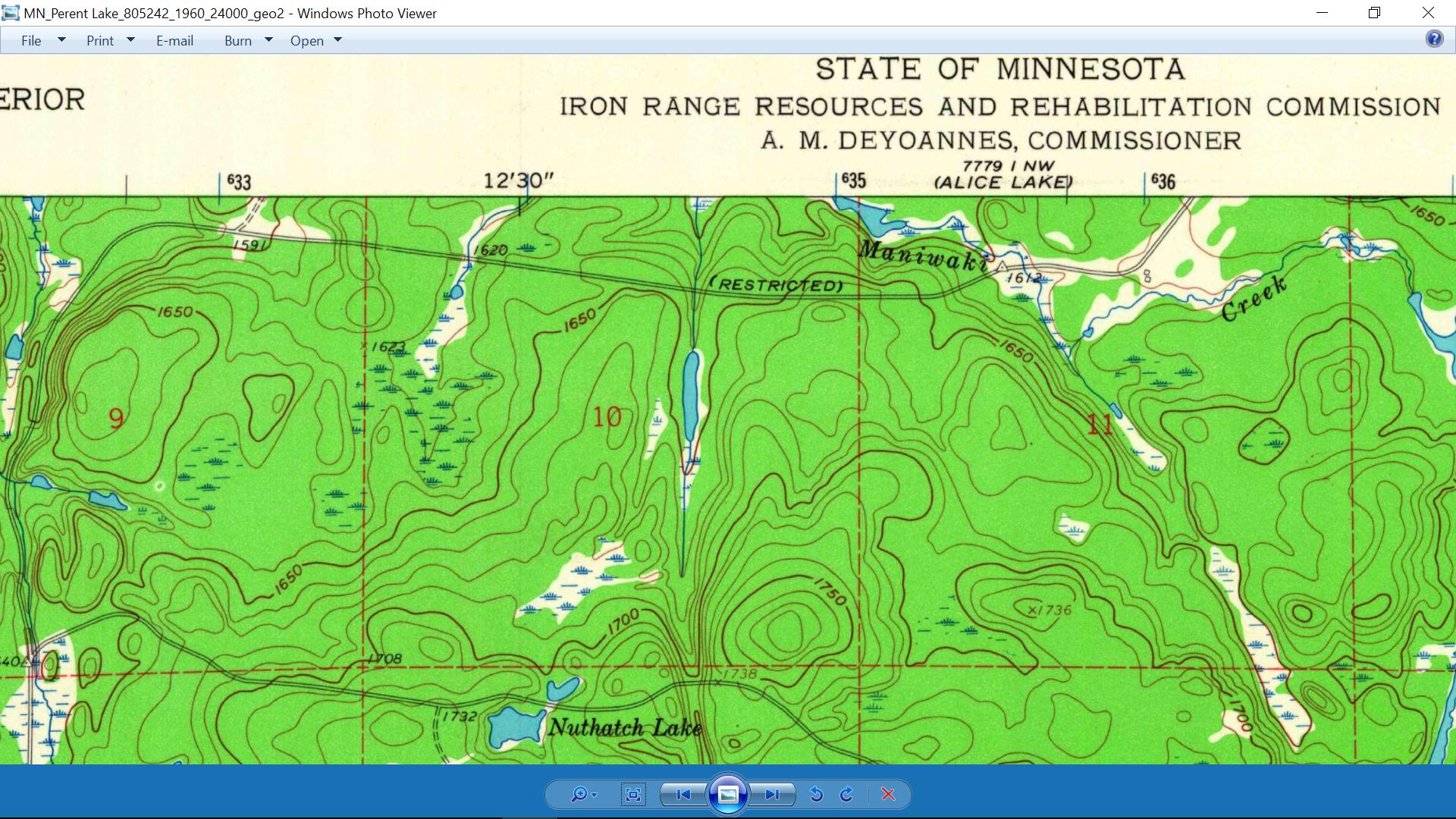
Wilderness both captivates your soul and sets it free :)
11/25/2018 09:34AM
Much appreciated if you could find out more from Mom on Camp 5. I was just talking to a guy yesterday that spent a lot of time with Tomahawk Timber, lived in a shacker house near Kawasachong Lake. Lived and worked by himself, I could've listened to him all afternoon. I'm going to try to arrange to talk with him again, must be well into his late 80s but his memory is still pretty sharp.
You mentioned Bugo Lake. Anyone ever fish that? I heard once they tried to dump walleyes in there. Your dad's trap line, all the way from Bugo Lake to Forest Center on a bike? The berm you are talking about is the one that was near the bulk tanks, where the rail spurs came in? That's one incredible trip on a bike!
I've asked you before but you must've forgotten. Did your dad ever say anything about that B-17 bomber that crashed around 1946 near Inga Creek? The guy I talked to yesterday said he was into the crash site about 2 years after it happened.
11/25/2018 10:24AM
Tomahawk: " Much appreciated if you could find out more from Mom on Camp 5. I was just talking to a guy yesterday that spent a lot of time with Tomahawk Timber, lived in a shacker house near Kawasachong Lake. Lived and worked by himself, I could've listened to him all afternoon. I'm going to try to arrange to talk with him again, must be well into his late 80s but his memory is still pretty sharp.
You mentioned Bugo Lake. Anyone ever fish that? I heard once they tried to dump walleyes in there. Your dad's trap line, all the way from Bugo Lake to Forest Center on a bike? The berm you are talking about is the one that was near the bulk tanks, where the rail spurs came in? That's one incredible trip on a bike!
I've asked you before but you must've forgotten. Did your dad ever say anything about that B-17 bomber that crashed around 1946 near Inga Creek? The guy I talked to yesterday said he was into the crash site about 2 years after it happened."
Dad never mentioned fishing Bugo Lake. When we lived there the 'strip' he was cutting was near Koma and Fantail Lakes. Koma was his 'nervana'. He built a raft near where the river runs in from Poly and poled out to fish his honey hole. All of his fishing trips then focused on Koma and Malberg for the rest of his days.
In the '60s, '70s and '80s we would canoe in to Koma to fish and trap minnows in Fantail. Good moose territory - we would often just sit quietly by the shore of Fantail in the mornings waiting for a moose to show himself before checking the minnow trap. You could still see the old road from Bugo in the late 70's near Fantail.
I'd be interested to know the fellow's name. My dad would be 83 years old so he's likely a friend of his and I'd recognize his name.
Dad has a good story about that bomber crash that he told me about many times and left in an audio recording. I'm trying to convert the .wav file to text so I can share in his own words here. I know the general area and I've tried to find the crash site several times but came up empty so far - It's hard walking in those spruce swamps and things grow over in 74 years.
Wilderness both captivates your soul and sets it free :)
11/25/2018 11:12AM

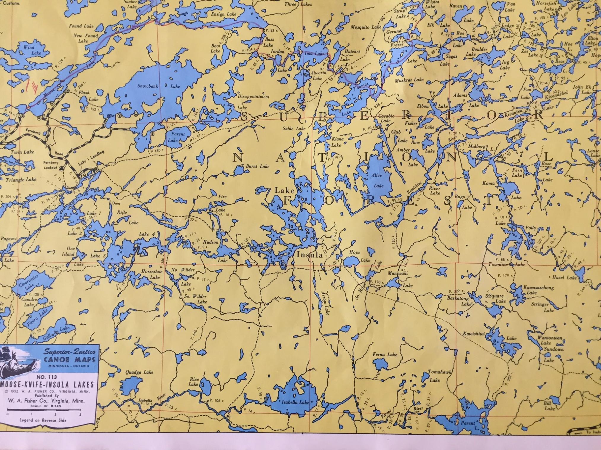 Some old fisher maps I have of the area, dated 1952. With trails or small roads before the roads were made by the people of Forest center.
Hudson road, was that the road(now powwow trail) going north and starting on the west side of Isabella Lake? There was a fire tower off that road called Arrow lookout tower. However it was closer to Pose Lake then the Arrow Lakes.
I am sure people paddle to this area Koma, Hudson, Hope etc...…. go ashore and think they might be in a spot that no man had ever stood. When in fact it was logged 50-80 years ago.
 This is a map I copied from another thread on this site.
JIM P.
Raised by wolves!
11/25/2018 11:31AM
Malberg was a great lake for walleyes, some of the fastest fishing I've ever had including Canadian fishing but the walleyes were fairly small. We'd talk to people fishing Koma for huge northerns, they said, but I never wet a line there when the walleyes were so close by in Malberg.
The guy I talked to yesterday was Don Hoover, great guy, hard worker. He said he drove right into the crash site of that B-17 on a road the government put in there. There wasn't much left when he was there, a couple of wings and small parts was about it. He said the Air Force came in to get the 4 engines and the Norden bomb sight. That bomb sight was super secret and used for precision bombing, something the Russians never had but would've been very interested in. The engines had superchargers on them to give a boost when carrying heavy bomb loads, our allies the Brits wanted to know more about that but as far as I know we never let them in on it. I still laugh about that.
The guy I talked to yesterday was Don Hoover, great guy, hard worker. He said he drove right into the crash site of that B-17 on a road the government put in there. There wasn't much left when he was there, a couple of wings and small parts was about it. He said the Air Force came in to get the 4 engines and the Norden bomb sight. That bomb sight was super secret and used for precision bombing, something the Russians never had but would've been very interested in. The engines had superchargers on them to give a boost when carrying heavy bomb loads, our allies the Brits wanted to know more about that but as far as I know we never let them in on it. I still laugh about that.
11/25/2018 11:33AM
interesting,was their actually a road from lake one and than on the north side of Hudson lake also?
I just thought the Hudson road was a spur you take to the left,cross the creek going into Hudson on the south side than goes so far and peters out? I seem to be wrong maybe?
I just thought the Hudson road was a spur you take to the left,cross the creek going into Hudson on the south side than goes so far and peters out? I seem to be wrong maybe?
11/25/2018 12:00PM
I painted the boundary lines for a bunch of the Timber sales (Red Pine thinning) around Forest Center, mostly on the West side. Also that thin stringer of Red Pine that was between the parking lot and the end of the Tomahawk Rd.
This timber was second generation Red Pine planted after the logging around Forest Center.
One timber sale I remember was replanted on a lot of ledge rock less than a quarter mile west of the paarking lot. When I went back there last summer I noticed that that particular timber stand was one of the few remenants of Red Pine timber that survived the Pagami Fire around Forest Center.
(It is located just west of the Pow Wow trail entrance kiosk.)
May the rivers be crooked and winding, and your portages lonesome, leading to the most amazing view.
11/25/2018 12:11PM
lindentree: "I painted the boundary lines for a bunch of the Timber sales (Red Pine thinning) around Forest Center, mostly on the West side. Also that thin stringer of Red Pine that was between the parking lot and the end of the Tomahawk Rd.
This timber was second generation Red Pine planted after the logging around Forest Center.
One timber sale I remember was replanted on a lot of ledge rock less than a quarter ile west of the paarking lot. When I went back there last summer I noticed that this timber thinning had one of the few remenants of Red Pine timber that survived the Pagami Fire."
I always liked walking around on that super huge ledge rock.
Yes it is interesting at the forest center the few pine trees that survived and location. Remember going down to the bulletin board at Island river there and it literally melted and burned. One hot fire. Yes still remember being at the forest center that day of the fire and all the ashes in the air. Time to get out of the way and go home.
11/25/2018 12:22PM
ellahallely: "
Some old fisher maps I have of the area, dated 1952. With trails or small roads before the roads were made by the people of Forest center.
Hudson road, was that the road(now powwow trail) going north and starting on the west side of Isabella Lake? There was a fire tower off that road called Arrow lookout tower. However it was closer to Pose Lake then the Arrow Lakes.
I am sure people paddle to this area Koma, Hudson, Hope etc...…. go ashore and think they might be in a spot that no man had ever stood. When in fact it was logged 50-80 years ago.
This is a map I copied from another thread on this site.
JIM P."
Jim P. It looks like the Pow Wow trail diverges from the Hudson Road South of Pose Lake. I think the map you posted shows the actual Hudson road, which my dad told me was still a good road in the 1950's. This map shows some of the Tomahawk Timber Co. spurs that Pinetree mentioned.

Wilderness both captivates your soul and sets it free :)
11/25/2018 12:23PM
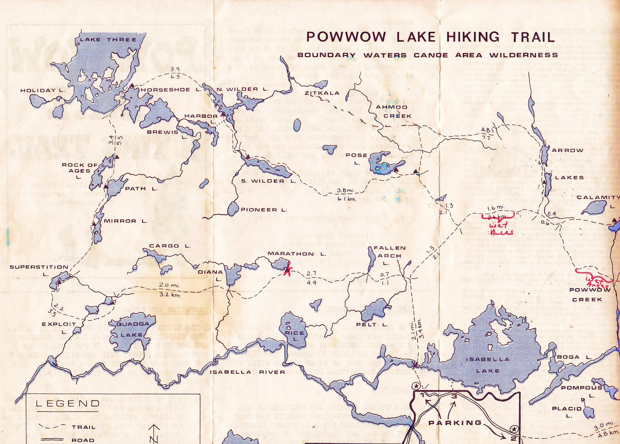
Ellahallely, yes, the way to Hudson started on the west side of Isabella Lake, this was called the Isabella North Road because as it left Forest Center it ran in a northwardly direction. About 3 mi. up there was a road that left off the North Road to the left and went NW. This was the road that went near the Arrow Lookout. You're right again, the tower was much closer to Pose than Arrow Lakes. Go figger how they gave it the name Arrow Lookout, always wondered that myself. Anyway, About a mile off the North Road going NW on this road you came to another fork with a road to the left, going due west, this went to Pose Lake. But staying on a due North heading at this fork would take you to the Ahmoo Creek bridge crossing. This bridge was gone by the time I was there, only some timbers left to cross the river. After crossing Ahmoo, the road went due north for about 1/2 mi., then another fork. To the right (east) the road went below Insula Lake and over toward Arrow Lakes; to the left (west) the road went toward Hudson Lake. Going toward Hudson about another 3/4 mi brought you to another crossing of Ahmoo Creek and a nice, big bridge. After the bridge the road went another 1 1/2 mi. or so and ended in a clearcut where they also had a landing at one time. This was the end of Tomahawk's main haul road, from here there was a network of short winter roads before they ended as well at the very end of Tomahawk's sale boundary. This is where the creek came in from Hudson Lake to the sale area. The trail on the map that you show here is too far to the north, the Hudson Road actually went further to the south, ending in the area of Zitkala Creek. The trail you show is a fire trail and they crisscrossed much of the BW, running from fire tower to fire tower. Hope this helps.
11/25/2018 12:36PM
Tomahawk: " Malberg was a great lake for walleyes, some of the fastest fishing I've ever had including Canadian fishing but the walleyes were fairly small. We'd talk to people fishing Koma for huge northerns, they said, but I never wet a line there when the walleyes were so close by in Malberg.
The guy I talked to yesterday was Don Hoover, great guy, hard worker. He said he drove right into the crash site of that B-17 on a road the government put in there. There wasn't much left when he was there, a couple of wings and small parts was about it. He said the Air Force came in to get the 4 engines and the Norden bomb sight. That bomb sight was super secret and used for precision bombing, something the Russians never had but would've been very interested in. The engines had superchargers on them to give a boost when carrying heavy bomb loads, our allies the Brits wanted to know more about that but as far as I know we never let them in on it. I still laugh about that."
Tomahawk, I don't recall dad mentioning Don Hoover. Next time you talk to him ask him if he remembers these people: Charlie Hommerding, Ted and Tress Lundberg, Ollie Thumes, Charlie McClosky, Lloyd and Marion Taylor, Buck and Liz Lundberg, Luke Hamlin, Henry Knuth, Jim Lundberg, Emil Utecht, Alvin Housey, Max Rudolph, George Klaus, Nick Jasper, Walt Knotts...
Wilderness both captivates your soul and sets it free :)
11/25/2018 12:53PM
The Hudson Road actually went further than this map shows. I have a huge map of the Halfway Ranger District and the actual boundaries of the entire Tomahawk Timber sale in the Forest Center area. The map shows the Hudson Road going to all the way to Zitkala Creek to the NW with a small network of roads going to that creek that comes from Hudson. I'd love to show you guys this map sometime.

11/25/2018 01:04PM
Interesting that you saw how people think they're in a virgin wilderness with all the cutting that went on, some areas were cut 2 and 3 times. People camping at campsites in the area will wander back in the woods and find tree stumps where trees had been cut. Tomahawk cut to a reservation boundary that was about 400'-500' from existing waterways.
At times when I was grouse hunting on the Pow Wow Trail, I'd run across another hunter who had no idea of the history of the area. We'd strike up a conversation and I'd talk about the original roads in the area that made the trail system. More often than not they'd look at me with a blank stare and ask about "Roads? What roads?" "Well, how about the road you're standing on", I might say. Bewildered, I'd have to show them how far the original roadbed went out from the trail that is now covered with brsuh & trees.
At times when I was grouse hunting on the Pow Wow Trail, I'd run across another hunter who had no idea of the history of the area. We'd strike up a conversation and I'd talk about the original roads in the area that made the trail system. More often than not they'd look at me with a blank stare and ask about "Roads? What roads?" "Well, how about the road you're standing on", I might say. Bewildered, I'd have to show them how far the original roadbed went out from the trail that is now covered with brsuh & trees.
11/25/2018 02:04PM
Tomahawk your description above of Hudson is what I thought.
I did the roads north of Ferne lake via Ferne lake by canoe and they stayed open for quite awhile. I could go east and west at a T,but both ways they got grown over in the 90's. Them trails by Ferne were quite wide.
I did the roads north of Ferne lake via Ferne lake by canoe and they stayed open for quite awhile. I could go east and west at a T,but both ways they got grown over in the 90's. Them trails by Ferne were quite wide.
11/25/2018 03:09PM
Tomahawk: "Roads? What roads?" "Well, how about the road you're standing on", I might say. Bewildered, I'd have to show them how far the original roadbed went out from the trail that is now covered with brsuh & trees."
Yep, I was never a fan of hiking the Pow Wow trail west and north of Isabella Lake, because it always felt like I was hiking on an (abandoned) road, which it actually was/is.
May the rivers be crooked and winding, and your portages lonesome, leading to the most amazing view.
11/25/2018 03:46PM
Pinetree, the Insula/Hudson Roads did get overgrown by the 90s, if you weren't familiar with that area it was best to stay out. We never missed a year up there from 1971-2011 until the fire came through. You'd really had to know where the old road went to keep your bearings.
There was a guy around 2001 or so, Jason Rasmussen I believe his name was, that got himself lost for about 7-8 days near Arrow Lakes. I believe it was the beginning of November and he got caught back there in about 14" of wet snow. Totally lost, no idea where he was. Luckily, they found him alive but the rescuers used ATVs to get back in there and recut the trail below Insula and over to Arrow, they were in great shape once again for many years. If you want to read a good book about it, "Lost in the Wild" by Cary Griffith will have your attention.
Those roads around Ferne lake were wide enough to drive a pulp truck down in places! We called it the Ferne Loop, it left the North Road south of Arrow Lakes and came back to it south of Maniwaki Lake. Birds all over back then.
Did you ever fish Ferne?. Great walleye fishing, nice fish in there!
11/25/2018 04:25PM
I will bring these names up to him the next time we meet, not sure when that will be. Don mentioned a few names here, he knew Freddie & Ollie Thumes. I knew Freddie myself, threw down more than 1 beer with him at the Happy Wanderer. He also mentioned Charlie Hommerding, I knew him as well. Charlie lived on the Bandana Lake Road off Hwy. 1 for many years. Speaking of Jim Lundbereg, this is him in the picture of the young kids at school in Forest Center.  Jim is in the 1st row, 4th from left I believe.
 Jim is in the 1st row, 4th from left I believe.
11/25/2018 04:45PM
Tomahawk: " I will bring these names up to him the next time we meet, not sure when that will be. Don mentioned a few names here, he knew Freddie & Ollie Thumes. I knew Freddie myself, threw down more than 1 beer with him at the Happy Wanderer. He also mentioned Charlie Hommerding, I knew him as well. Charlie lived on the Bandana Lake Road off Hwy. 1 for many years. Speaking of Jim Lundbereg, this is him in the picture of the young kids at school in Forest Center.
I knew a lot of those kids. If I'm not mistaken, the first four in the front row, left to right; Jimmy Krings, Jimmy Lundberg, Neil Olson, Johnny Olson, ?, ?, ?
Second row seated/kneeling, left to right; Jim Steigel, ?, ?, Pam Dehnhoff, ?, Suzie Westerland, ?, ?, ?
Third row standing (six girls); ?, ?, Thelma Gardener, Margaret Housey, Christine Thums, ?
Back row standing; Jimmy Evans, Mikey Yeager, ?, ?, ?, Ricky Deitrick, Shirly Thums, ?, Mrs. Sylvia Hansen, Larry Lundberg, ?
Wilderness both captivates your soul and sets it free :)
11/25/2018 05:12PM
Tomahawk: "Pinetree, the Insula/Hudson Roads did get overgrown by the 90s, if you weren't familiar with that area it was best to stay out. We never missed a year up there from 1971-2011 until the fire came through. You'd really had to know where the old road went to keep your bearings.
There was a guy around 2001 or so, Jason Rasmussen I believe his name was, that got himself lost for about 7-8 days near Arrow Lakes. I believe it was the beginning of November and he got caught back there in about 14" of wet snow. Totally lost, no idea where he was. Luckily, they found him alive but the rescuers used ATVs to get back in there and recut the trail below Insula and over to Arrow, they were in great shape once again for many years. If you want to read a good book about it, "Lost in the Wild" by Cary Griffith will have your attention.
Those roads around Ferne lake were wide enough to drive a pulp truck down in places! We called it the Ferne Loop, it left the North Road south of Arrow Lakes and came back to it south of Maniwaki Lake. Birds all over back then.
Did you ever fish Ferne?. Great walleye fishing, nice fish in there!"
I knew that area quite well where he got lost. The trail slowly disappeared after you crossed the the big meadow with the beaver dam. I actually bushwacked to fish arrow than.
Actually when I heard he was lost on the news for some reason I thought it was the east end toward lake two etc.. the way they talked at first?
I though to myself at that time where could a person get lost along the Pow Wow and the first area I thought of was that trail where he did get lost. But I thought what do I know and let it go at that. Luckly he made it out and the many mistakes he made,but had a strong will to live.
I always have my compass and map and know enough about the flowages and land marks. I know we came up there after that incident happened and the snow must of melted after that.
Yes for years we made a August-Labor day weekend trip into that lake. Than it started getting more popular. Tried once since the fire and I think I could of made it but decided to camp on the Parent river.
11/25/2018 05:46PM
We still hunted the Pow Wow up to the year of the fire. The early 90's there was hunters galore the first two miles than they thinned out. As the trails grew up and many of the side branches disappeared you seen few hunters.
We often stayed in a topper-pickup in the gravel pit on the right,or the one with the gravel pit in the pines about 0.5 miles after crossing the Island river going to the center.
Back than it seemed like the bird hatches were huge with 6-10 in a group sometimes. Ruff or spruce. I preferred Ruff but actually got to like Spruce. To me their in between a ruff grouse and a duck taste. I know most people don't like the pine needles eating grouse.
11/26/2018 08:55AM

Jackpine, you've added quite a few names to that photo I found on the Internet. Thanks much! You've identified Don (Bobby) Krings for me. His real name was Don but hey called him Bobby, maybe his dad was also Don? When I was a senior in high school in Ely (1966), Don and his girlfriend, Jeannie Kramm came to Ely from Forest Center. I got to know Don a little, they were both real quiet, very nice people. Lovebirds, they made a great couple and eventually got married, had one daughter at least. I lost track of them after high school and I believe Don went in the service and came out to work fro Reserve Mining Co. in Babbitt, possibly a welder. Sadly to say, both Don & Jeannie have passed away.
11/26/2018 09:07AM
Pinetree, I know exactly where you are, where that grassy area was and the trail nearly disappeared in places. You had to know where the trail went originally to pick it up again further along. Where that beaver dam is and the pond to the right as you were heading toward Arrow, we always called that Lost Lake in honor of Rasmussen that was lost. He was not far from here when he did really foolish things.
The reason you thought he might've been lost on the east part of the Pow Wow might be because that was where he was supposed to be heading. If you read that book, Rasmussen tells of seeing a beaver dam not far from where the Quadga Road leaves the North Road. There is NO beaver dam where he claims, going east on the North Road just after the Quadga Fork, there is one not far down the Quadga Road, however. I believe that's what he did, he went toward Quadga and then for some reason headed back toward the North Road and then continued up toward Insula/Hudson. He does not claim to do this back pedaling in the book, I believe he became unsure of himself this early at that Quadga Fork, now they have since put up arrows going in both directions, these were never there before he got lost. They were trying to stay away from putting up signs in a wilderness area to make it appear more "wild." Now they have also put up a directional sign where the trail goes to Insula off the North Road. Then later on Rasmussen paid little attention to the big grassy area further up (the maintained trail goes west to Pose Lake here) where the un- maintained trail continued north to Insula, eventually over to Arrow. He continued north where he lost, regained and continued to regain and lose the trail.
The reason you thought he might've been lost on the east part of the Pow Wow might be because that was where he was supposed to be heading. If you read that book, Rasmussen tells of seeing a beaver dam not far from where the Quadga Road leaves the North Road. There is NO beaver dam where he claims, going east on the North Road just after the Quadga Fork, there is one not far down the Quadga Road, however. I believe that's what he did, he went toward Quadga and then for some reason headed back toward the North Road and then continued up toward Insula/Hudson. He does not claim to do this back pedaling in the book, I believe he became unsure of himself this early at that Quadga Fork, now they have since put up arrows going in both directions, these were never there before he got lost. They were trying to stay away from putting up signs in a wilderness area to make it appear more "wild." Now they have also put up a directional sign where the trail goes to Insula off the North Road. Then later on Rasmussen paid little attention to the big grassy area further up (the maintained trail goes west to Pose Lake here) where the un- maintained trail continued north to Insula, eventually over to Arrow. He continued north where he lost, regained and continued to regain and lose the trail.
11/26/2018 09:38AM
I thought he might of got lost there because instead of going toward Pose at first the trail is real good going straight ahead. Than you get what I call the beaver pond-meadow. After that the trail slowly disappears and it kind of fools you and pulls you in until you lose it. Than everything looks the same.
I have followed the meadows south from the beaver pond and it stays meadow like quite abit. Talk about moose looking country.
I have followed the meadows south from the beaver pond and it stays meadow like quite abit. Talk about moose looking country.
11/26/2018 09:51AM
Did you say you had gone into Arrow quite often to fish in August and others were coming in there as well?
You are right, the first few miles of the Pow Wow had many hunters but they thinned out fast after that.
I remember a pickup/topper parked in the gravel pits, so that was you. Someone made a nice trail into Arrow, maybe that was you as well.
I have an interesting memory on that road that ran just south of Insula. I was bird hunting and the road then was a 2 track road with grass in the center. So, the road was in very good shape at the time, had to be in the early 80s I'm guessing. I was about halfway between where the Hudson Road forked off and Arrows Lakes. I happened to be in a low spot on the road, walking toward Arrow and the road was about to climb a small hill. All of a sudden I heard distant thumping and an occasional crash. I had no idea what it was until the noise became louder & louder from whatever was running down the road TOWARD me. Because of the hill I didn't know if it was a moose or bear but figured it had to be something big like that. As the critter got closer I could hear hooves thundering as they hit the ground and then over the crest of the hill comes a good-sized cow moose and her calf. They were all white-eyed with eyes bulging and wide open, coming down the slight hill I was just below at a full sprint. They saw me as I had nearly frozen in place trying to figure out what to do next. I do remember stepping off the road to give them all the room they needed. Instead, mom did a 90 degree turn to the left and the calf did the same. They both ran off the road a mere 10' from me, crashing through the brush. Something had put them at a full sprint like that so I got ready with my 12 ga. for whatever was going to happen next. I figured a pack of wolves had been after them but nothing came. I listened carefully after the moose disappeared and nothing. No sound at all. I never heard anything more nor ever saw what ever put them on the run. I do suspect wolves that had gotten my scent and ran off. Or. could've been a bear after them as it was the end of September. Interesting times in that country..............you never knew what you were going to come across next.
11/26/2018 10:19AM
Ferne lake was the one of increasing traffic for a few years. I think the fire stopped most all with downfalls. I don't know now.
Arrow lake might as well say nobody fished hardly. I do know two people use to bushwack from Insula to the Arrow chain and fish every few years. This was decades ago.
Arrow I usually fished a short time and got small northern pike,mostly grouse hunted in. Their is some nice pike in one of the three Arrow lakes.
11/26/2018 10:24AM
I think the trail clearing which was not me is the fellow I believe was from Virginia and he always had a machete and was cutting mainly tag alder of and on while hunting. I also believe it was him who always started walking like the Pow Wow when it was pitch dark for like a half hour to get ahead of other hunters. Every Saturday he would be there.
Also my brother often talked with a gentlemen from Duluth quite often while he was on the Pow Wow. My brother to do the south Arrow route until it grew up than switched to Quadga and back out. It was him and his young boy in the early 1990's on that trail.
Also my brother often talked with a gentlemen from Duluth quite often while he was on the Pow Wow. My brother to do the south Arrow route until it grew up than switched to Quadga and back out. It was him and his young boy in the early 1990's on that trail.
11/26/2018 04:03PM
Pinetree, I'm surprised there was that much traffic into Ferne. The last time I was in there we did real well with the walleyes. Coming out we ran into 4 people coming in on the portage. They were surprised to see someone (us) in Ferne and asked if we had our "Primitive Permit." Huh? They told us we needed one of these special permits in order to be in Ferne Lake, this was on top of the BW permit. They made it sound like only one party could be in there at a time It was news to me, that was the last time I was in there. On that trip the portage was getting increasingly hard to find, I carried the canoe down a moose trail that was better than the portage itself for a short time until I realized it wasn't the portage. The first time I was in there fishing they had a couple of campsites with facilities (fireplace grate, latrines, etc.) That last time I was in there all that was gone, it had become a "Primitive Area" where they do no maintenance. If you didn't want anyone to go into a lake, that's what you'd do I guess. Later I heard that you could no longer even find the portage. After that I did take a short walk on the portage from Perent River and there were all sorts of windfalls across the trail, near impossible to navigate. Too bad, I liked going in there. That was all before the fire.
Not only were the fishing memories good ones but he bird hunting was really great. We'd walk in from the North Road and make the loop that went back to the North Road. There must've been a camp at the top of the lake where the road came in, a big clearing there. That clearing was usually all torn up from moose in rut. For some reason they sure liked that area.
Not only were the fishing memories good ones but he bird hunting was really great. We'd walk in from the North Road and make the loop that went back to the North Road. There must've been a camp at the top of the lake where the road came in, a big clearing there. That clearing was usually all torn up from moose in rut. For some reason they sure liked that area.
11/27/2018 10:47PM
Tomahawk: " Malberg was a great lake for walleyes, some of the fastest fishing I've ever had including Canadian fishing but the walleyes were fairly small. We'd talk to people fishing Koma for huge northerns, they said, but I never wet a line there when the walleyes were so close by in Malberg.
The guy I talked to yesterday was Don Hoover, great guy, hard worker. He said he drove right into the crash site of that B-17 on a road the government put in there. There wasn't much left when he was there, a couple of wings and small parts was about it. He said the Air Force came in to get the 4 engines and the Norden bomb sight. That bomb sight was super secret and used for precision bombing, something the Russians never had but would've been very interested in. The engines had superchargers on them to give a boost when carrying heavy bomb loads, our allies the Brits wanted to know more about that but as far as I know we never let them in on it. I still laugh about that."
This is a transcript of my dad's B-17 bomber story:
"When I was nine years old, we lived in Little Bear Camp by Little Bear Lake, South of the Tomahawk Road. On the day before Thanksgiving [Wednesday, November 22, 1944], just before dark I was outside and a B-17 bomber flew over real low sputtering and missing a bunch of beats like it was running out of gas, and I knew it was going to crash.
The next morning I went cross country about a mile and came to that little creek and followed the creek and I could see where the wings had sliced off or chopped off the trees - popple and jackpine and spruce. It actually lit in a spruce swamp. One of the motors and one of the wheels tumbled right into the creek.
I went through the plane and found a few items. A couple of 50 caliber shells, one with a red nose and one with a black tip. The machine gun was kind of knocked loose so I tugged and twisted and pulled it loose and drug into the woods and hid it in the spruce moss and stuff. Over a period of days, me and little Joey Gutowski would drag it a ways, and then [my cousin] Ruth would help, and we'd drag it a ways and we eventually got it all the way back to Bear Lake Camp.
Well, then Uncle Ted went into Klune's Tavern in Ely and talked about the machine gun. The next Sunday, The Sheriff came into camp - it wasn't even his jurisdiction, it's a different county. He came in with the siren going - that's enough to scare anybody - and [told us] it was illegal to have an automatic weapon. So, he took my machine gun away from me.
In the mean time there was no road in there. So I had a thriving little business there. People would pay me fifty cents to take them in there, they wanted to see it and they'd get souvenirs. Fifty cents was a lot of money in those days. I made a few bucks on that deal.
When I was a teenager the sheriff's daughter took me to see the machine gun - it was mounted on a rock monument in the sheriff's yard.
Years later [about 1960] me and one of my best friends, Hank Knuth, went in there and found where the bomber came down. Somebody had salvaged it and picked all the aluminum scrap and everthing out of it.
And that's my bomber story."
Here is a couple of references I found on the internet:
B-17 crash near Isabella
"The ears of many Jackson countians were held close to the radios last Wednesday afternoon as announcers related the progress of the flight of a Flying Fortress which had gone out of control with ten men aboard and was circling over a two hundred miles area in South Dakota and Minnesota, and did not crash until five hours later. Before the crash, however, the announcer said that ten parachutes had been seen floating down from the runaway Fortress and it was believed that all the crew had landed safely. While people were interested in the progress of the pilotless plane they did not realize that one of the members of that crew was Cpl. James O. Sayre, son of Mr. and Mrs. J.W. Sayre, of Sandyville. On Thursday morning it had been definitely established that all the members of the crew, including Cpl. Sayre, had landed safely at widely separated points in South Dakota. The plane crashed near Isabella, Minnesota late Wednesday afternoon, and the ten members of the crew, had abandoned it near Marion, South Dakota five hours earlier. Minnesota forest rangers saw the plane crash at 4:45 eastern war time. (Friday, Dec 1, 1944)"
Read page 144 of this book (link)
Minnesota Goes to War
Wilderness both captivates your soul and sets it free :)
11/28/2018 09:40AM
Jackpine, you have certainly done your homework! Great story on the B-17. I had heard that the plane was armorless, stripped of all weapons in 1946 and had only the pilot & copilot aboard plus I heard that it was abandoned over the MN-ND border. But with 10 men aboard I am certain it had to have been fully armed, I believe the 17s had 9 gun stations, all.50 cal. Where it went down is the spot I had heard where it went in from a pretty credible source. He said, "Off the east side of Bomber Road, about a mile south of the Tomahawk Road." To this day they still call FR 177 Bomber Road. I'll bet that red tipped.50 cal. round your dad found was a tracer round - when they fired it it left a red trail so they could see where the rounds were going and where they were hitting.
I might have an idea of who that guy was who confiscated the gun. It was rumored that when single guys who worked for Tomahawk passed away a certain guy would show up to collect any valuables they had. Never knew if it was true or not.
By the way, did you know Don (Bobby) Krings, age about 70 now if he were still alive? Possibly Jeannie Kramm was one of the girls in that class photo you hadn't identified. Don (Bobby) you had identified and Jeannie was his main squeeze.
11/28/2018 10:54AM
A little off topic, but this F 16 went down 15 to 20 miles from Isabella by Whyte.
I remember guys I worked with assisted Lake County in the initial SAR before the military cordoned it off.
I know the top of the article states Hennepin cty, but everything else indicates it went down south of isabella.
"F-16A 81-0684 (call sign WOLF 3) of the 179th FS, 148th FG, Minnesota Air National Guard, USAF, was written off on 7 January 1987 when it crashed 47 miles north of its home base in Duluth, Minnesota, while practising night intercepts. The aircraft went down in a remote dense woodland area at Whyte, near Greenwood Lake. The pilot, Major Pete Woodbury, did not eject, and was killed."
F 16 crashes near Whyte
May the rivers be crooked and winding, and your portages lonesome, leading to the most amazing view.
11/28/2018 11:23AM
Tomahawk: "Jackpine, you have certainly done your homework! Great story on the B-17. I had heard that the plane was armorless, stripped of all weapons in 1946 and had only the pilot & copilot aboard plus I heard that it was abandoned over the MN-ND border. But with 10 men aboard I am certain it had to have been fully armed, I believe the 17s had 9 gun stations, all.50 cal. Where it went down is the spot I had heard where it went in from a pretty credible source. He said, "Off the east side of Bomber Road, about a mile south of the Tomahawk Road." To this day they still call FR 177 Bomber Road. I'll bet that red tipped.50 cal. round your dad found was a tracer round - when they fired it it left a red trail so they could see where the rounds were going and where they were hitting.
I might have an idea of who that guy was who confiscated the gun. It was rumored that when single guys who worked for Tomahawk passed away a certain guy would show up to collect any valuables they had. Never knew if it was true or not.
By the way, did you know Don (Bobby) Krings, age about 70 now if he were still alive? Possibly Jeannie Kramm was one of the girls in that class photo you hadn't identified. Don (Bobby) you had identified and Jeannie was his main squeeze. "
The Krings in that photo would be 64 years old.
Wilderness both captivates your soul and sets it free :)
11/28/2018 11:23AM
Tomahawk: "Jackpine, you have certainly done your homework! Great story on the B-17. I had heard that the plane was armorless, stripped of all weapons in 1946 and had only the pilot & copilot aboard plus I heard that it was abandoned over the MN-ND border. But with 10 men aboard I am certain it had to have been fully armed, I believe the 17s had 9 gun stations, all.50 cal. Where it went down is the spot I had heard where it went in from a pretty credible source. He said, "Off the east side of Bomber Road, about a mile south of the Tomahawk Road." To this day they still call FR 177 Bomber Road. I'll bet that red tipped.50 cal. round your dad found was a tracer round - when they fired it it left a red trail so they could see where the rounds were going and where they were hitting.
I might have an idea of who that guy was who confiscated the gun. It was rumored that when single guys who worked for Tomahawk passed away a certain guy would show up to collect any valuables they had. Never knew if it was true or not.
By the way, did you know Don (Bobby) Krings, age about 70 now if he were still alive? Possibly Jeannie Kramm was one of the girls in that class photo you hadn't identified. Don (Bobby) you had identified and Jeannie was his main squeeze. "
It appears, I was mistaken. That is Jimmy Krings in that photo and would be my age, 64 years old. I must have mixed the names up remembering a story my uncle Allen told me about how his friend Bobby Krings saved his life after he was knocked unconscious when he hit his head on a rock while diving into Lake Isabella. My uncle Allen was born on November 7th, 1949, the same year as Don “Bobby” Krings. I will edit the names I associated with that photo.
Wilderness both captivates your soul and sets it free :)
11/28/2018 11:35AM
Jackpine Jim, I'm still laughing about your dad getting 50 cents a head for taking folks in to get their own souvenirs. What an entrepreneur at 9 yrs. old! He must've been a great guy to talk to with all his stories. Wow! I would've been all ears.
11/28/2018 01:03PM
Tomahawk: " Lindentree, I remember that well. Very sad story near Greenwood Lake. I don't recall them finding the plane right away, either. Am I correct on that?"
If I remember correctly it may have been a few days or more before they found the jet.
A story from my co-worker goes like this.
"Lake County sheriff's dept and Search and Rescue came into the USFS Isabella Work Station to coordinate the search. I asked them if they needed a map because we had TOPO maps of the entire area at our station.
Sherrif's dept employee replied (no, we have a map).
He then pulled out a Lake County Plat book."
May the rivers be crooked and winding, and your portages lonesome, leading to the most amazing view.
11/28/2018 01:20PM
07 Jan 1997 [w/o] 81684 81-0684 [USAF] USAF 179 FS F-16A Block 15C ADF Details
The aircraft went down about 50 miles north of its home base in Duluth, Minnesota while practicing night intercepts. The aircraft went down in a remote dense woodland area near Greenwood Lake. The pilot, Maj. Pete Woodbury, did not eject.
The aircraft went down about 50 miles north of its home base in Duluth, Minnesota while practicing night intercepts. The aircraft went down in a remote dense woodland area near Greenwood Lake. The pilot, Maj. Pete Woodbury, did not eject.
11/28/2018 01:57PM
lindentree: "Tomahawk: " Lindentree, I remember that well. Very sad story near Greenwood Lake. I don't recall them finding the plane right away, either. Am I correct on that?"
If I remember correctly it may have been a few days or more before they found the jet.
A story from my co-worker goes like this.
"Lake County sheriff's dept and Search and Rescue came into the USFS Isabella Work Station to coordinate the search. I asked them if they needed a map because we had TOPO maps of the entire area at our station.
Sherrif's dept employee replied (no, we have a map).
He then pulled out a Lake County Plat book."
"
Correct the plane was found 2 or 3 days later. It was spotted by SAR plane.
It is pretty common to see the Air National Guard dog fighting in this area. This is MOA snoopy west(military operations area.. air space) 6000 feet up to 18000 feet.
There is another plane and pilot still missing in the area from 2012 link to story link to story
The forest service also crashed a plane on the shore of Dumbbell Lake in the 50s I think, everyone walked away from that crash. There is a book by Bob Cary called Bush Pilots: Legends of the Old and Bold . It talks about flying out of Ely and a few other crashes. Good book for anyone that enjoys the history of the area.
Shagawa lake in Ely had 350 floats planes on it before the air ban. This is part of the reason for few roads, everyone flew into their cabins and camps.
Raised by wolves!
11/28/2018 04:47PM
Good to hear that you're in Jackpine, that book we'd write would be a best seller. The first chapter would be about your dad and his souvenir business, that'd sell the book right there! I'm still giggling.
Jackpine, you asked me earlier how I got interested in the area. I tried to reply but I had issues with the website, all seems to be working fine now so here it goes. It goes back to our neighborhood when I grew up in Ely. An older guy I got to know was a "catskinner" for the Forest Service. He was a heavy equipment operator for them and he ran an International TD-19 (similar in size to a Caterpillar D8 or D9) dozer. I was always interested in those that ran such equipment, so about 1968 or so I asked him what he was doing currently. He said he and another TD-19 were working up north of Ferne Lake, rock raking. The photo here shows a rock rake, a fork-like attachment that they put on the front of dozers to pick up all the left over branches and tops from recent logging operations and push them into piles or windrows for burning. For any snags or trees left standing they would hook up anchor chain to the rear of the dozers. This anchor chain is the same anchor chain used on Great Lakes ships, real heavy chain with links about a foot long. For a long time there was about a 50' length of this very chain near Camp 2, right along the road, many of you out there probably remember this chain. After they hook this chain up to the back of the dozers, the run parallel with each other and knock down anything left standing.
The older guy that was doing the rock raking told me about all the grouse and moose he'd see everyday. The area was open to hunting on foot but there was a gate across the road that would not allow private vehicles in. Each day they'd have a key for the gate, open it, and drive their panel truck up to their two TD-19s north of Ferne. During the week they'd stay in the last house left at Forest Center that was atop the hill overlooking the pulp yard. I've been told this was the McDonald house. Nice house with a garage and a full basement.
I started hunting the area in 1971 and we saw so many moose and grouse that people wouldn't believe us. It was the heyday for both, we'd see those big coveys of spruce and ruffed that Pinetree talked about. Coveys of 7-8 were fairly common, some as large as 11-12. It would be no time at all before we'd have a limit so then we'd quit hunting and just walk to see how many grouse and moose we'd see. We never counted how many we saw in those early years but later on there was another spike in the grouse population in the 80s and I decided to count one particular day. We ended up seeing 72 one day, mostly ruffs. Those early days in the 70s were even better, we saw even more then. When we first started in '71, the only tracks we'd see were moose & wolf tracks, no boot tracks. An occasional tire track as they were still logging in certain areas plus they'd have wolf trackers in vehicles. A wild time, indeed.

11/28/2018 06:12PM
A person looks back and can now say>Boy we had it good back than. A person in life sometimes doesn't realize how good he had it at times until it passes.
I can just see it now a Autographed book by you two and a book signing with people lined up out the doors and around the corner.
I can just see it now a Autographed book by you two and a book signing with people lined up out the doors and around the corner.
11/28/2018 06:16PM
ellahallely: "
Correct the plane was found 2 or 3 days later. It was spotted by SAR plane.
"
ellahall,
I talked to a retired fuel truck driver from the 148th today, (we know each other from the local watering hole) and asked him about this F-16 accident.
He remembers it and said that the plot had Vertigo, according to my buddy he was upside down and the planes voice computer kept telling him to pull up, so he did and flew it right into the ground, that was probabally why the report said he was doing 4-6 G's when it crashed.
May the rivers be crooked and winding, and your portages lonesome, leading to the most amazing view.
11/28/2018 07:39PM
lindentree: "ellahallely: "
Correct the plane was found 2 or 3 days later. It was spotted by SAR plane.
"
ellahall,
I talked to a retired fuel truck driver from the 148th today, (we know each other from the local watering hole) and asked him about this F-16 accident.
He remembers it and said that the plot had Vertigo, according to my buddy he was upside down and the planes voice computer kept telling him to pull up, so he did and flew it right into the ground, that was probabally why the report said he was doing 4-6 G's when it crashed."
I seem to recall a spate of F-16 crashes blamed on computer malfunction in the fly-by-wire system about that time. I don't know much about those systems but I have my share of computer malfunctions :) I've also had bout of full spin vertigo and would hate to be driving anything, let alone an F-16 at 600 mph, when it came on. I'm sure its thrilling to fly one of those babies but it comes with an element of danger. God bless those called to serve our country.
Wilderness both captivates your soul and sets it free :)
11/28/2018 07:53PM
ellahallely: "lindentree: "Tomahawk: " Lindentree, I remember that well. Very sad story near Greenwood Lake. I don't recall them finding the plane right away, either. Am I correct on that?"
If I remember correctly it may have been a few days or more before they found the jet.
A story from my co-worker goes like this.
"Lake County sheriff's dept and Search and Rescue came into the USFS Isabella Work Station to coordinate the search. I asked them if they needed a map because we had TOPO maps of the entire area at our station.
Sherrif's dept employee replied (no, we have a map).
He then pulled out a Lake County Plat book."
"
Correct the plane was found 2 or 3 days later. It was spotted by SAR plane.
It is pretty common to see the Air National Guard dog fighting in this area. This is MOA snoopy west(military operations area.. air space) 6000 feet up to 18000 feet.
There is another plane and pilot still missing in the area from 2012 link to story link to story
The forest service also crashed a plane on the shore of Dumbbell Lake in the 50s I think, everyone walked away from that crash. There is a book by Bob Cary called Bush Pilots: Legends of the Old and Bold . It talks about flying out of Ely and a few other crashes. Good book for anyone that enjoys the history of the area.
Shagawa lake in Ely had 350 floats planes on it before the air ban. This is part of the reason for few roads, everyone flew into their cabins and camps."
My dad told me about a float plane that crashed in Malberg Lake sometime in the early 1950's due to being overloaded with walleyes they were poaching. I wonder if there's a mention of that in Bob Carey's book?
Wilderness both captivates your soul and sets it free :)
11/28/2018 08:19PM
Tomahawk: "Good to hear that you're in Jackpine, that book we'd write would be a best seller. The first chapter would be about your dad and his souvenir business, that'd sell the book right there! I'm still giggling.
Jackpine, you asked me earlier how I got interested in the area. I tried to reply but I had issues with the website, all seems to be working fine now so here it goes. It goes back to our neighborhood when I grew up in Ely. An older guy I got to know was a "catskinner" for the Forest Service. He was a heavy equipment operator for them and he ran an International TD-19 (similar in size to a Caterpillar D8 or D9) dozer. I was always interested in those that ran such equipment, so about 1968 or so I asked him what he was doing currently. He said he and another TD-19 were working up north of Ferne Lake, rock raking. The photo here shows a rock rake, a fork-like attachment that they put on the front of dozers to pick up all the left over branches and tops from recent logging operations and push them into piles or windrows for burning. For any snags or trees left standing they would hook up anchor chain to the rear of the dozers. This anchor chain is the same anchor chain used on Great Lakes ships, real heavy chain with links about a foot long. For a long time there was about a 50' length of this very chain near Camp 2, right along the road, many of you out there probably remember this chain. After they hook this chain up to the back of the dozers, the run parallel with each other and knock down anything left standing.
The older guy that was doing the rock raking told me about all the grouse and moose he'd see everyday. The area was open to hunting on foot but there was a gate across the road that would not allow private vehicles in. Each day they'd have a key for the gate, open it, and drive their panel truck up to their two TD-19s north of Ferne. During the week they'd stay in the last house left at Forest Center that was atop the hill overlooking the pulp yard. I've been told this was the McDonald house. Nice house with a garage and a full basement.
I started hunting the area in 1971 and we saw so many moose and grouse that people wouldn't believe us. It was the heyday for both, we'd see those big coveys of spruce and ruffed that Pinetree talked about. Coveys of 7-8 were fairly common, some as large as 11-12. It would be no time at all before we'd have a limit so then we'd quit hunting and just walk to see how many grouse and moose we'd see. We never counted how many we saw in those early years but later on there was another spike in the grouse population in the 80s and I decided to count one particular day. We ended up seeing 72 one day, mostly ruffs. Those early days in the 70s were even better, we saw even more then. When we first started in '71, the only tracks we'd see were moose & wolf tracks, no boot tracks. An occasional tire track as they were still logging in certain areas plus they'd have wolf trackers in vehicles. A wild time, indeed.
I wish I would have walked those roads then but when dad had vacation time we'd canoe into Koma and Malberg. We'd always see 10 or more moose on those trips. It was moose heaven.
Wilderness both captivates your soul and sets it free :)
11/29/2018 07:50AM
I've read that book and I don't recall any mention of that incident. After reading the book I happened to mention the book to a retired U.S. Forest Service Beaver pilot. He just smiled and said his take on the book was that Carey was a "journalist" and said some of the incidents may have been embellished for journalism's sake. I have no idea, just telling you what he told me.
11/29/2018 09:07AM
Jackpine, I don't recall seening many moose in either Koma or Malberg as you did, you were fortunate, indeed, We did see some on Louse River, going east from Malberg through Boze Lake into Trail Lake.
Our jackpot moose area was from Insula Lake to Maniwaki. We'd camp in Insula and one day when we were taking the creek to Hope lake we came across a big cow moose right smack dab in the middle of the creek. It was odd to us because other moose we had seen in the rivers would usually move off when they'd see us coming through. But this critter had found good feed and wasn't about to leave until she was ready to do so. She'd put her head underwater for a long time and come up with a mouthful. Staring us down the whole time her head was back up. We were young & dumb at the time and my partner at the stern said we should paddle a bit closer and see she if moves, sounded good so we inched our way toward her and then she inched her way toward us. The guy in the back said let's stay here and hold our ground. Well, I was closest to her in the bow and that didn't sound good at all to me and after I protested mildly we backed up. Then she held her ground as well. The standoff continued for quite a time until we thought if we hit our paddles on the water she'd move. Nope, just gave us that evil glare and continued feeding. She must've seen this move before. This went on for at least 1/2 hr. -45 mn. (seemed like hours at the time) until she had her fill both of whatever she was eating and us. She then just moved off and back into the tree cover.
Maniwaki would be a good place to see moose. Each time we were in there we'd see at least 3, sometimes 6 along the shore. We were in there at the end of August once and saw one of the top 5 biggest bulls I'd ever seen. He was with 2 cows and looked like he was starting his harem already. Enormous antlers on that boy!! He was by far the biggest bull I had seen in there.
11/29/2018 09:12AM
I don't remember a crash on Malberg Lake in the book. Yes Bob Cary was sometimes lets say dramatic. He did run for president a few times on the fishing ballot. I am sure a lot of the lakes had float plane crashes with the number of planes flying around.
There was a popular snowmobile route through there Kawishiwi, Polly, Koma, Malberg, Adams, Boulder, then west into Snowbank, Basswood, Fall and into Ely. Until the 70s ban on snowmobiles.
OT Lindentree how about the Mahnomen/Waubun Thunderbirds football team!!
JIM P.
There was a popular snowmobile route through there Kawishiwi, Polly, Koma, Malberg, Adams, Boulder, then west into Snowbank, Basswood, Fall and into Ely. Until the 70s ban on snowmobiles.
OT Lindentree how about the Mahnomen/Waubun Thunderbirds football team!!
JIM P.
Raised by wolves!
11/29/2018 09:32AM
Very interesting, I do not recall a snowmobile route going from Kawishiwi lake to Malberg. I do remember the border routes from Basswood through Knife, etc., I didn't know there was one from Kawishiwi Lake. Did you ever travel that route, seems like not very good ice with so many creeks to travel on.
11/29/2018 09:46AM
Pinetree,
Those were the days, for certain. When the roads north & east of Isabella Lake were no longer used for logging, they were in excellent shape for walking & grouse hunting. Seeing all the moose was always a huge bonus. My hunting partner and I have talked about this often, we thought it would always be that way with the roads and being in such a remote area we figured the moose and grouse would always be there in big numbers. Like you said, you don't realize what you've had until you lost it. For the last 2 yrs. we've taken a walk on the old North Road, very difficult with all the trees across the road. I give them credit for trying to keep it open but the trees keep falling across the trail. Didn't see a grouse, either. Two years ago we saw 1 set of moose tracks, this year nothing. We only walked up to where the Insula Road left the North Road, the walking was that difficult.
The only way I'd be part of a book is if you were also part of it; then yourself, Jackpine and I could all be part of the book signing :-)
11/29/2018 10:03AM
I traveled that route a handful of times. There were always spots with bad ice, however most creeks froze pretty solid. Low water and deep snow. I will look around I know I have a hand drawn map and itinerary around somewhere. I will post them if I find them.
I also took the border route many times. I knew Benny Ambrose and Dorothy Molter. We would bring them some supplies and fresher food. I think the border route closed around 1985. Being good to Dorothy always assured me and my friends home brew beer, not the "flat" root beer for us.
I also took the border route many times. I knew Benny Ambrose and Dorothy Molter. We would bring them some supplies and fresher food. I think the border route closed around 1985. Being good to Dorothy always assured me and my friends home brew beer, not the "flat" root beer for us.
Raised by wolves!
11/29/2018 10:29AM
Ellahallely, I knew Dorothy well, we'd stay there many times (always tried to get the Point Cabin) when we fished Knife for lake trout. Helped put ice up for her a couple of times. Never knew Benny. Ahhhhh, that Dorothy's cold root beer on a hot day. Will never forget how good it tasted! I think that all ended in 1985.
Another motor route was Isabella Lake through Bald Eagle/Gabbro. Not sure if that was a snowmobile route, however. We'd take outboards in there but I was never in there in the winter. I'd be interesting to see what that map looked like from Kawishiwi Lake north, just wasn't aware of it.
Another motor route was Isabella Lake through Bald Eagle/Gabbro. Not sure if that was a snowmobile route, however. We'd take outboards in there but I was never in there in the winter. I'd be interesting to see what that map looked like from Kawishiwi Lake north, just wasn't aware of it.
11/29/2018 10:45AM
Tomahawk maybe we crossed paths at onetime or another. I also helped Dorothy put up ice one year. There was a group of snowmobilers from Two Harbors that helped her put up ice many times. Was at the memorial for Dorothy at Knife Lake, there were about 500 snowmobiles there.
I have a snowmobile map from around 1970 of the Ely area I will find and post.
I have a snowmobile map from around 1970 of the Ely area I will find and post.
Raised by wolves!
11/29/2018 11:00AM
Ellahallely, I was at that memorial service on Knife as well, a somber day indeed. Reading your emails along with Jackpine Jim and Pinetree, I know we've crossed paths. Maybe even stumbled across Lindentree's path once or twice. It's a small world.
If you can find that map, that'd be neat to see .
If you can find that map, that'd be neat to see .
11/29/2018 11:07AM
Tomohawk or Jackpine did you ever deer hunt there. The mid 60's to at least 1969 that very hard winter I heard there was lot of deer in the area. There had to be some really big brutes with the light hunting pressure.
I bet with the logging town there some of the residents hunted from town in the very early years also?
I mentioned many times but still remember the time coming around a cornerin that area here comes a dark colored wolf-well it flushes a grouse and it lands in a tree above me. The wolf looks at me and walks away after we stared at each other for awhile. For some reason I just couldn't shoot that grouse. Maybe I could of trained the wolf to be a bird dog? Well I do have a imagination.
11/29/2018 11:13AM
Lindentree and I have crossed paths. We went flying over the area last spring. He also lives on the Rez that my father grew up on. Maybe next spring before things start to grow you, Jackpinejim, Pinetree, and myself could find a time to get together. Maybe I could take us flying over the area. The old roads are easy to see before the brush starts to green up.
JIM P.
JIM P.
Raised by wolves!
11/29/2018 11:15AM
Tomahawk: " Ellahallely, I knew Dorothy well, we'd stay there many times (always tried to get the Point Cabin) when we fished Knife for lake trout. Helped put ice up for her a couple of times. Never knew Benny. Ahhhhh, that Dorothy's cold root beer on a hot day. Will never forget how good it tasted! I think that all ended in 1985.
Another motor route was Isabella Lake through Bald Eagle/Gabbro. Not sure if that was a snowmobile route, however. We'd take outboards in there but I was never in there in the winter. I'd be interesting to see what that map looked like from Kawishiwi Lake north, just wasn't aware of it."
My brother new Dorothy well also,she always talked about her secret lake for lake trout?
11/29/2018 12:25PM
ellahallely: "
OT Lindentree how about the Mahnomen/Waubun Thunderbirds football team!!
JIM P."
Yes, I watched the game on TV, Jeremy Londo was the MVP for the T-Birds.
I fought fire with his dad also (jeremy) and two uncles for many years, I have been fairly close to that family ever since. they are from Naytahwaush.
That area sure puts out good football players, Mahnomen was always good but Waubun (a much smaller town) won the state title a couple times if I remember right.
May the rivers be crooked and winding, and your portages lonesome, leading to the most amazing view.
11/29/2018 12:36PM
Dorothy mentioned that secret lake to us as well but never said which one it was. By process of elimination we thought it might be Amoeber, we got some nice lakers out of there. When we mentioned to her that we had been into Amoeber, her secret lake, she just smiled. She had a heck of a poker face from playing cards with her sister Ruth and brother Bud. They fleeced us more than once :-))
But that's another story...................
But that's another story...................
11/29/2018 12:48PM
Pinetree, yes, there were some big, big deer in that area north & east of Isabella Lake. We didn't see many over the years but when we saw one it was a big animal. The Forest Center people hunted there a lot, we'd run into some of their younger relatives or even they themselves and they would hunt deer there in the 70s.  The nice doe in the photo here was one I came across between Quadga and Diana Lakes. Actually, it was very near the Quadga Village (where the houses had been built atop that sandpit to the north of the road and also down the side of the pit). I had flushed a bird off the road and went back to see if I could flush it again. Not far off the edge of the road was this dead doe. You can see where the hind end has been chewed by wolves, I assumed. There were no wolves that I saw and the deer was stiff, had been there awhile. You can see where the entrails are even coming out the back end. The next week when my partner came to the spot I described, there wasn't a thing left, only some hair.
 The nice doe in the photo here was one I came across between Quadga and Diana Lakes. Actually, it was very near the Quadga Village (where the houses had been built atop that sandpit to the north of the road and also down the side of the pit). I had flushed a bird off the road and went back to see if I could flush it again. Not far off the edge of the road was this dead doe. You can see where the hind end has been chewed by wolves, I assumed. There were no wolves that I saw and the deer was stiff, had been there awhile. You can see where the entrails are even coming out the back end. The next week when my partner came to the spot I described, there wasn't a thing left, only some hair.
11/29/2018 01:00PM
Pinetree, nope, never hunted deer there. We always had better places with more deer. If you hunted around Forest Center you were after big deer, I guess I never was.
You have a real sense of humor, training wolves to be a bird dog. I'll bet if anyone could, you could. Imagination or not! Good story about the wolf and the bird. You made me think of another story. My partner and I would try to hunt during the middle of the week, the weekends were becoming very crowded. One day during the middle of the week he went toward Arrow and I went up the East Road. It was one of those beautiful October mornings, clear sky and frost on the ground. I was walking in that mile from Forest Center toward where it was bermed up, just after legal shooting hours. It was still fairly dark and the stars were still out. When I got to that big boulder that was part of the berm I decided it was still a bit dark to see way back into the woods. So, I sat on another boulder there and poured myself some hot tea from my thermos. Not a breath of wind and quiet as could ever be. As I raised my cup to take a drink, all of a sudden a wolf bellowed out to the north of the road. Sounded like it was right in front of me but I'm guessing it was back in about a couple of blocks. Damn near scared the you know what out of me but luckily I had taken care of that in the Isabella Lake toilet at the parking lot. But my tea was all over me. Damn! Then another wolf cut loose with a long drawn out howl to the south of me. So loud on a quiet morning that I thought the critter could've been in my lap. The hairs on the back of my neck were like porcupine quills, I was between I had no idea how many! Luckily I never saw them and later I talked to a wolf guy who seemed to know something about them. He said what happened was I probably had gotten between 2 packs, I was in their buffer zone where they don't enter. It's an area that's a neutral zone to keep packs separated otherwise they'll kill each other. He also said that they've been finding that deer will live in these neutral zones knowing that they're safe. He figured the wolves were letting the other wolves in the opposing pack know they were there as well as letting me know they were there. As far as I was concerned, knowing that they were there gave me little comfort.
You have a real sense of humor, training wolves to be a bird dog. I'll bet if anyone could, you could. Imagination or not! Good story about the wolf and the bird. You made me think of another story. My partner and I would try to hunt during the middle of the week, the weekends were becoming very crowded. One day during the middle of the week he went toward Arrow and I went up the East Road. It was one of those beautiful October mornings, clear sky and frost on the ground. I was walking in that mile from Forest Center toward where it was bermed up, just after legal shooting hours. It was still fairly dark and the stars were still out. When I got to that big boulder that was part of the berm I decided it was still a bit dark to see way back into the woods. So, I sat on another boulder there and poured myself some hot tea from my thermos. Not a breath of wind and quiet as could ever be. As I raised my cup to take a drink, all of a sudden a wolf bellowed out to the north of the road. Sounded like it was right in front of me but I'm guessing it was back in about a couple of blocks. Damn near scared the you know what out of me but luckily I had taken care of that in the Isabella Lake toilet at the parking lot. But my tea was all over me. Damn! Then another wolf cut loose with a long drawn out howl to the south of me. So loud on a quiet morning that I thought the critter could've been in my lap. The hairs on the back of my neck were like porcupine quills, I was between I had no idea how many! Luckily I never saw them and later I talked to a wolf guy who seemed to know something about them. He said what happened was I probably had gotten between 2 packs, I was in their buffer zone where they don't enter. It's an area that's a neutral zone to keep packs separated otherwise they'll kill each other. He also said that they've been finding that deer will live in these neutral zones knowing that they're safe. He figured the wolves were letting the other wolves in the opposing pack know they were there as well as letting me know they were there. As far as I was concerned, knowing that they were there gave me little comfort.
11/29/2018 08:14PM
Tomahawk: "Very interesting, I do not recall a snowmobile route going from Kawishiwi lake to Malberg. I do remember the border routes from Basswood through Knife, etc., I didn't know there was one from Kawishiwi Lake. Did you ever travel that route, seems like not very good ice with so many creeks to travel on."

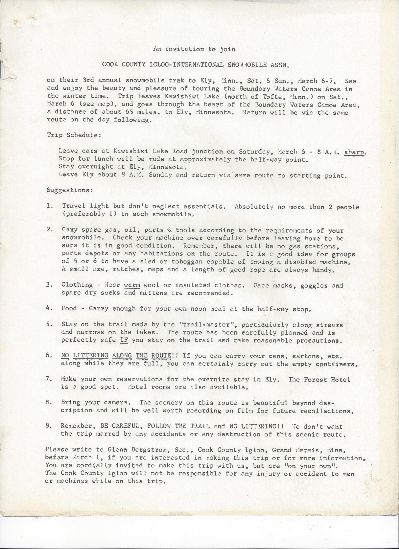
Hand drawn map with itinerary. 1976
Raised by wolves!
11/29/2018 08:25PM
ellahallely: "Tomahawk: "Very interesting, I do not recall a snowmobile route going from Kawishiwi lake to Malberg. I do remember the border routes from Basswood through Knife, etc., I didn't know there was one from Kawishiwi Lake. Did you ever travel that route, seems like not very good ice with so many creeks to travel on."

Hand drawn map with itinerary. 1976
"
I'll bet that was a blast. Did you make that trip?
Wilderness both captivates your soul and sets it free :)
11/30/2018 08:55AM
Ellahallely, what an interesting map! I had no idea that route went beyond Thomas/Fraser, I've been that far to fish lake trout. That was one long trip, how long in hours if you recall? You must've carried extra gas with you, not may places to refuel in there. Did you come back the same way?
11/30/2018 08:59AM
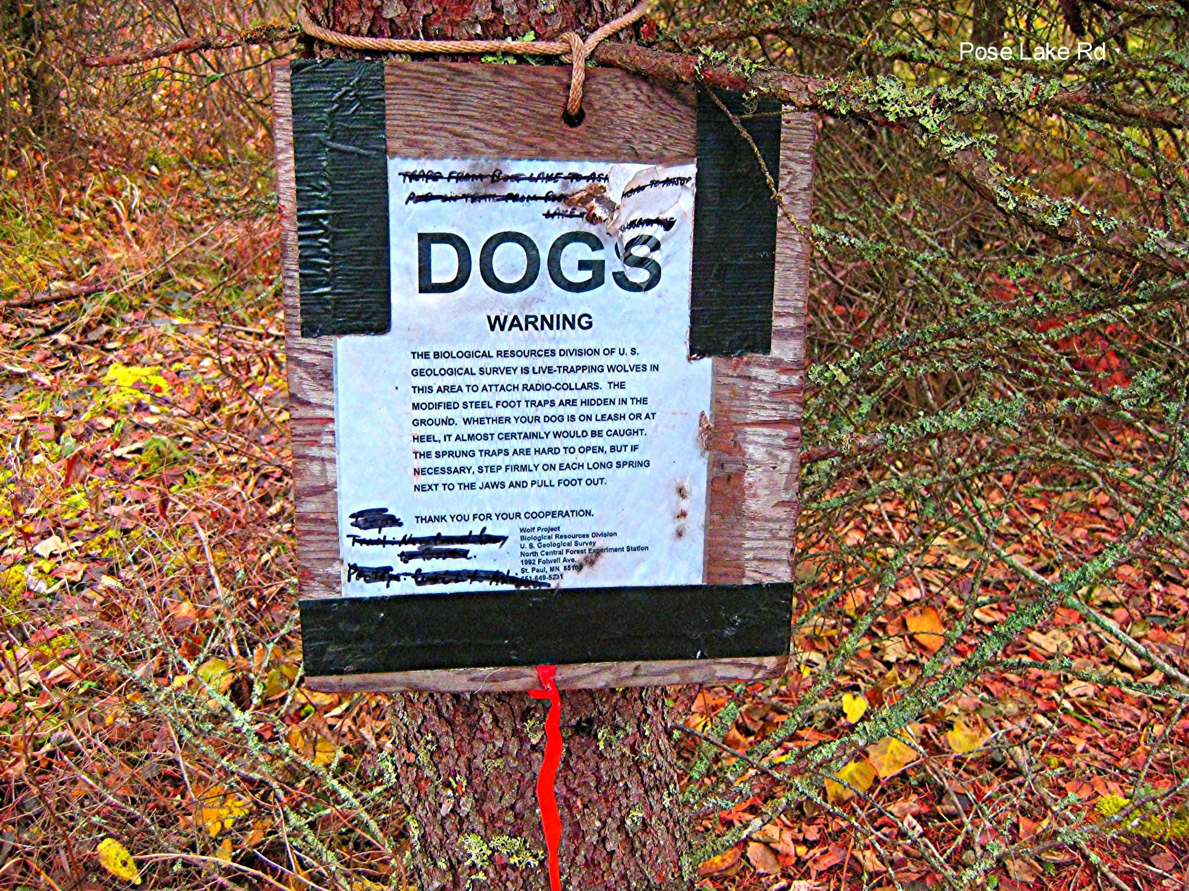


Pinetree, I remember those signs well that the wolf trappers had put up. I ran into them many times, mostly up in the Pose Lake toward Arrow Lakes area. These were federal trappers, a head trapper with an assistant and very nice people, interesting to talk to. The first time I met them there was a young guy and a young woman, she was very attractive. They hadn't trapped any wolves at that time and said they were staying at Pose Lake, I've sent a picture of that campsite here. I suppose that's all burnt now, it was a real nice site. Not far from that picture of the sign I sent I came across where they had a trap. I don't know what they baited their traps with but it stunk so bad I almost lost my breakfast. But I suppose to a hungry wolf it'd smell pretty good. I saw the same lead trapper the next year in the same area but he had a different assistant. This time the assistant was another guy and after I talked with them awhile I told the new guy that he wasn't as good looking as the assistant the head trapper had last year. He had a puzzled look on his face, I filled him in on the previous assistant and the looked at the head trapper who was blushing by this time. Then with a big grin on his face he told me, "He never told me anything about her." The new guy did tell me that they not only had not trapped any wolves but some clever critter, they fingered either a weasel or a pine marten, had been cleaning out their traps without springing them.Then to add insult to injury the culprit would relieve itself on the trap without springing it! This not only happened on one trap but quite a number that they had out. We all laughed hard about that. The trappers were out again the following year but I never had a chance to visit with them. However, after a day's hunt we met some other hunters in the parking lot that we ran into often. They had run into the trappers and they still had not trapped a wolf in 3 years. One of the hunters said he looked at the head trapper and told him kiddingly, "You're just not very good at this are you?" The young trapper just smiled, what could he say.
Also sending a picture of a wolf track we came across on the old Northwest Road near Little Isabella River. That's a 2 3/4" 12 ga. shell next to it. It was lone wolf, walking all by itself for a long ways.
11/30/2018 05:32PM
ellahallely: "Tomahawk: "Very interesting, I do not recall a snowmobile route going from Kawishiwi lake to Malberg. I do remember the border routes from Basswood through Knife, etc., I didn't know there was one from Kawishiwi Lake. Did you ever travel that route, seems like not very good ice with so many creeks to travel on."
Hand drawn map with itinerary. 1976
"
If the trail had been used and cleared it took most of the day, with several breaks. We always tried to be off the trail before dark. We carried extra gas but most didn't need it. One trip we came back the same way. 2 others trips we did a loop riding the Tomahawk rd. We wouldn't do the loop in one day, we would spend the night at one of the resorts.
One year we tried it early in the year. The trail (portages) hadn't been cleared we worked all day and turned back. That was from the Ely side.
Raised by wolves!
11/30/2018 05:50PM
Tomahawk: "Ellahallely, I was at that memorial service on Knife as well, a somber day indeed. Reading your emails along with Jackpine Jim and Pinetree, I know we've crossed paths. Maybe even stumbled across Lindentree's path once or twice. It's a small world.
If you can find that map, that'd be neat to see ."


Front and back. Map is dated 1976. Not sure how to rotate with this format?
Raised by wolves!
11/30/2018 06:22PM
Curious,
Do any of you remember a story of two brothers who died in a small cabin off the Tomahawk road ?
Ken Dehnoff's (sp) wife May, both from Isabella told me that two of her brothers died in a cabin off the the Tomahawk road. She said they died of carbon Monxide poisining. I'm guessing it would be in the late 1950's or 1960's.
If I remember correctly the cabin was just off the North side of the Tomahawk road, right across from the Northwest road, seems like I can remember the old clearing for that cabin.
I can't remember May Dehnoff's maiden name and couldn't find a newspaper article on it. Her brothers probabally would have been in their 20's.
May the rivers be crooked and winding, and your portages lonesome, leading to the most amazing view.
12/01/2018 11:38AM
Tomahawk: "Never heard about that, what a tragedy that must've been. I remember Juel Foster, owner of the Happy Wanderer, lived in that very same area by Mitawan Creek. I think he said he was single at the time."
I'll probably go back to Isabella this winter and spend a nite at the Knotted Pine.
May Dehnoff's brother (Adee) lives on Mitowan Lake I'll ask him about it. May died last year but her husband Kenny is still around. I can ask him, we always got along well.
Happy Wanderer, I had a few beers there in 2002 ish. I bought the logs for a log home I built from Juel Foster, I paid him cash and I'll never forget his response.
"Thats the first time anyone ever paid me before I even delivered the logs"
Shortly after he delivered the logs, seems like they cost around 600 bucks.
The log home is built just south of the old Moose Ridge bar, and Stoney River cafe at 9351 St hwy 1, Isabella.
That's where I lived. Here is a poor pic of the place, I sold it in 2003 when I moved back to Detroit Lakes.

May the rivers be crooked and winding, and your portages lonesome, leading to the most amazing view.
12/01/2018 12:37PM
Beautiful Home! Nice work. Who put it up for you?
Juel was a hard worker, kindest person you'd ever hope to meet. A good friend of mine drives pulp truck and when he just bought his first truck many years ago Juel was still selling fuel at the Wanderer out of the pumps out front. My friend asked Juel if he could pay him later at the end of the month, times were tough for him at the moment and Juel told him, "Pay me whenever to get on your two feet. No hurry." Had many a beer with Juel at the Wanderer myself, he was a real saint.
Juel was a hard worker, kindest person you'd ever hope to meet. A good friend of mine drives pulp truck and when he just bought his first truck many years ago Juel was still selling fuel at the Wanderer out of the pumps out front. My friend asked Juel if he could pay him later at the end of the month, times were tough for him at the moment and Juel told him, "Pay me whenever to get on your two feet. No hurry." Had many a beer with Juel at the Wanderer myself, he was a real saint.
12/01/2018 01:12PM
Tomahawk: " Beautiful Home! Nice work. Who put it up for you?
Juel was a hard worker, kindest person you'd ever hope to meet. A good friend of mine drives pulp truck and when he just bought his first truck many years ago Juel was still selling fuel at the Wanderer out of the pumps out front. My friend asked Juel if he could pay him later at the end of the month, times were tough for him at the moment and Juel told him, "Pay me whenever to get on your two feet. No hurry." Had many a beer with Juel at the Wanderer myself, he was a real saint."
I built it myself, that is the 3rd of 4 I have built.
All Butt and Pass method, I mostly saw them flat 3 sided, I owned a Bell circular sawmill when I built this one and sawed the logs myslef.
That sawmill was one of the funnest things I ever owned, kinda dangerous however.
Bought it from Mark Johnson in the Matiwan Lake area, his dad was Barry,
May the rivers be crooked and winding, and your portages lonesome, leading to the most amazing view.
12/01/2018 02:25PM
LindenTree: "Tomahawk: " Beautiful Home! Nice work. Who put it up for you?
Juel was a hard worker, kindest person you'd ever hope to meet. A good friend of mine drives pulp truck and when he just bought his first truck many years ago Juel was still selling fuel at the Wanderer out of the pumps out front. My friend asked Juel if he could pay him later at the end of the month, times were tough for him at the moment and Juel told him, "Pay me whenever to get on your two feet. No hurry." Had many a beer with Juel at the Wanderer myself, he was a real saint."
I built it myself, that is the 3rd of 4 I have built.
All Butt and Pass method, I mostly saw them flat 3 sided, I owned a Bell circular sawmill when I built this one and sawed the logs myslef.
That sawmill was one of the funnest things I ever owned, kinda dangerous however.
Bought it from Mark Johnson in the Matiwan Lake area, his dad was Barry, "
Quite a talent.
12/01/2018 02:27PM
ellahallely: "ellahallely: "Tomahawk: "Very interesting, I do not recall a snowmobile route going from Kawishiwi lake to Malberg. I do remember the border routes from Basswood through Knife, etc., I didn't know there was one from Kawishiwi Lake. Did you ever travel that route, seems like not very good ice with so many creeks to travel on."
Hand drawn map with itinerary. 1976
"
If the trail had been used and cleared it took most of the day, with several breaks. We always tried to be off the trail before dark. We carried extra gas but most didn't need it. One trip we came back the same way. 2 others trips we did a loop riding the Tomahawk rd. We wouldn't do the loop in one day, we would spend the night at one of the resorts.
One year we tried it early in the year. The trail (portages) hadn't been cleared we worked all day and turned back. That was from the Ely side.
"
Done that entire route also. But not at once.
Did from Kawishiwi lake-Fraser-Sagus by canoe in the 80's in one day with a 85 pound aluminum canoe. That was one good workout. I would think there would be a lot of slush on that route. Did see 5 moose.
Snowbank-Thomas-Fraser area in the winter by skis.
12/01/2018 04:17PM
LindenTree: "Curious,
Do any of you remember a story of two brothers who died in a small cabin off the Tomahawk road ?
Ken Dehnoff's (sp) wife May, both from Isabella told me that two of her brothers died in a cabin off the the Tomahawk road. She said they died of carbon Monxide poisining. I'm guessing it would be in the late 1950's or 1960's.
If I remember correctly the cabin was just off the North side of the Tomahawk road, right across from the Northwest road, seems like I can remember the old clearing for that cabin.
I can't remember May Dehnoff's maiden name and couldn't find a newspaper article on it. Her brothers probabally would have been in their 20's."
LindenTree, My dad told me about that, or a similar tragic event. He told me it occured at Smithville Camp, right on the Tomahawk Road, between Jackpine Mountain and Little Isabella River in the late 1940’s. After reading your post I researched and found out Mae Dehnhoff’s brothers names were Dwight and Raymond Singleton.
From the recording Dad left me: “While we were at Smithville (Dad didn’t say, but I infer around 1945 or 1946), a couple of young guys that had been in the service came up for a job. They weren’t there very long, got their first check, I guess, and went up to Chub Lake tavern and had quite a bit to drink and came home [to their shack] and built a fire in an Airtight stove and it got away from ‘em and they burned up.”
Wilderness both captivates your soul and sets it free :)
12/01/2018 05:23PM
JackpineJim: "LindenTree: "Curious,
Do any of you remember a story of two brothers who died in a small cabin off the Tomahawk road ?
Ken Dehnoff's (sp) wife May, both from Isabella told me that two of her brothers died in a cabin off the the Tomahawk road. She said they died of carbon Monxide poisining. I'm guessing it would be in the late 1950's or 1960's.
If I remember correctly the cabin was just off the North side of the Tomahawk road, right across from the Northwest road, seems like I can remember the old clearing for that cabin.
I can't remember May Dehnoff's maiden name and couldn't find a newspaper article on it. Her brothers probabally would have been in their 20's."
LindenTree, My dad told me about that, or a similar tragic event. He told me it occured at Smithville Camp, right on the Tomahawk Road, between Jackpine Mountain and Little Isabella River in the late 1940’s. After reading your post I researched and found out Mae Dehnhoff’s brothers names were Dwight and Raymond Singleton.
From the recording Dad left me: “While we were at Smithville (Dad didn’t say, but I infer around 1945 or 1946), a couple of young guys that had been in the service came up for a job. They weren’t there very long, got their first check, I guess, and went up to Chub Lake tavern and had quite a bit to drink and came home [to their shack] and built a fire in an Airtight stove and it got away from ‘em and they burned up.”
"
Another blurb from Dad:
“They called it ‘Smithville’ because there were three families named Smith living there; there was Ted, Tiwi and Willard Smith. Willard had all them kids in the second grade. I’m pretty sure there were four of them.”
Wilderness both captivates your soul and sets it free :)
12/01/2018 06:56PM
JackpineJim: "LindenTree: "Curious,
Do any of you remember a story of two brothers who died in a small cabin off the Tomahawk road ?
Ken Dehnoff's (sp) wife May, both from Isabella told me that two of her brothers died in a cabin off the the Tomahawk road. She said they died of carbon Monxide poisining. I'm guessing it would be in the late 1950's or 1960's.
If I remember correctly the cabin was just off the North side of the Tomahawk road, right across from the Northwest road, seems like I can remember the old clearing for that cabin.
I can't remember May Dehnoff's maiden name and couldn't find a newspaper article on it. Her brothers probabally would have been in their 20's."
LindenTree, My dad told me about that, or a similar tragic event. He told me it occured at Smithville Camp, right on the Tomahawk Road, between Jackpine Mountain and Little Isabella River in the late 1940’s. After reading your post I researched and found out Mae Dehnhoff’s brothers names were Dwight and Raymond Singleton.
From the recording Dad left me: “While we were at Smithville (Dad didn’t say, but I infer around 1945 or 1946), a couple of young guys that had been in the service came up for a job. They weren’t there very long, got their first check, I guess, and went up to Chub Lake tavern and had quite a bit to drink and came home [to their shack] and built a fire in an Airtight stove and it got away from ‘em and they burned up.”
"
Could have been them, I vaguely rmember something like they were in the military but didn't post it because I couldn't remember for sure. That would make Mae 20+ years younger, than her brothers, but they had a big family so its possible.
Mae died of Colon Cancer, she gave my wife and I an Afgan quilt she sewed as a wedding gift.
Funny, I looked up Mae Dehnoff's obit just now. Her brother I always called Adie is actually Kent/Anni, I mostly talked to him in the Knotted Pine so maybe it was the bar noise.
I can't hear all that well.
Chup Lake Tavern, thats the old resort just north of Hwy 1 isn't it.
You know the one right across from the Outhouse that has the door open with a mannequin sitting over the thunderbox hole :-)
May the rivers be crooked and winding, and your portages lonesome, leading to the most amazing view.
12/01/2018 07:18PM
Tomahawk: "You spoke of deep snow along that route, slush must've been a real issue. Sounds like that would've been a great trip, regardless!"
Slush could be a problem, especially early in the year. As with all the winter routes we would take we would always stay close to the packed trail. If you were amongst the first groups through travel could be slow. Later winter and early spring were the times to travel. Long days and hard snow. The swampy areas with tall grass were always the worst. Very loose deep snow and very good at insulating.
Jule Foster's place was always a stop for gas and repairs. He would let us use his shop. Well and then there were the beers and conversation. The winter trails led to the Wanderer from all directions.
Raised by wolves!
12/02/2018 10:38AM
Jackpine Jim, Your mention here of Jackpine Mountain brings up a question for you or anyone else out there who might know. Back in the 70s I could drive my pickup or snowmobile to the top of Jackpine Mountain to the site of the Jackpine Lookout, the lookout was long gone as was the cabin but a real nice log thunderbox was still there. It would be a true honor for anyone who used that. The view back then was unbelievable! A couple of years ago we walked up there on an ATV trail while bird hunting, the road had all but grown in and once you got to the old tower sight it was all pretty much overgrown. But right at the concrete pads for the tower were 2 crosses. All of a sudden we became very quiet, we knew we were at a place of reverence. One cross said: Dick,8-18-37 to 8-25-13 and the other said: Pete, 1957 - 2003. I suspected that Dick had at one time manned the tower by his age but the younger Pete I had no idea. A friend confirmed my thought about Dick but he said Pete was a real tragic story. Seemed that younger guys from Wisconsin would come up each year to deer hunt there. One year Pete was accidentally shot by another hunter in the party. Anyone know anything more? 


Also included is a photo of that classic boom box atop the Mountain in the 70s.

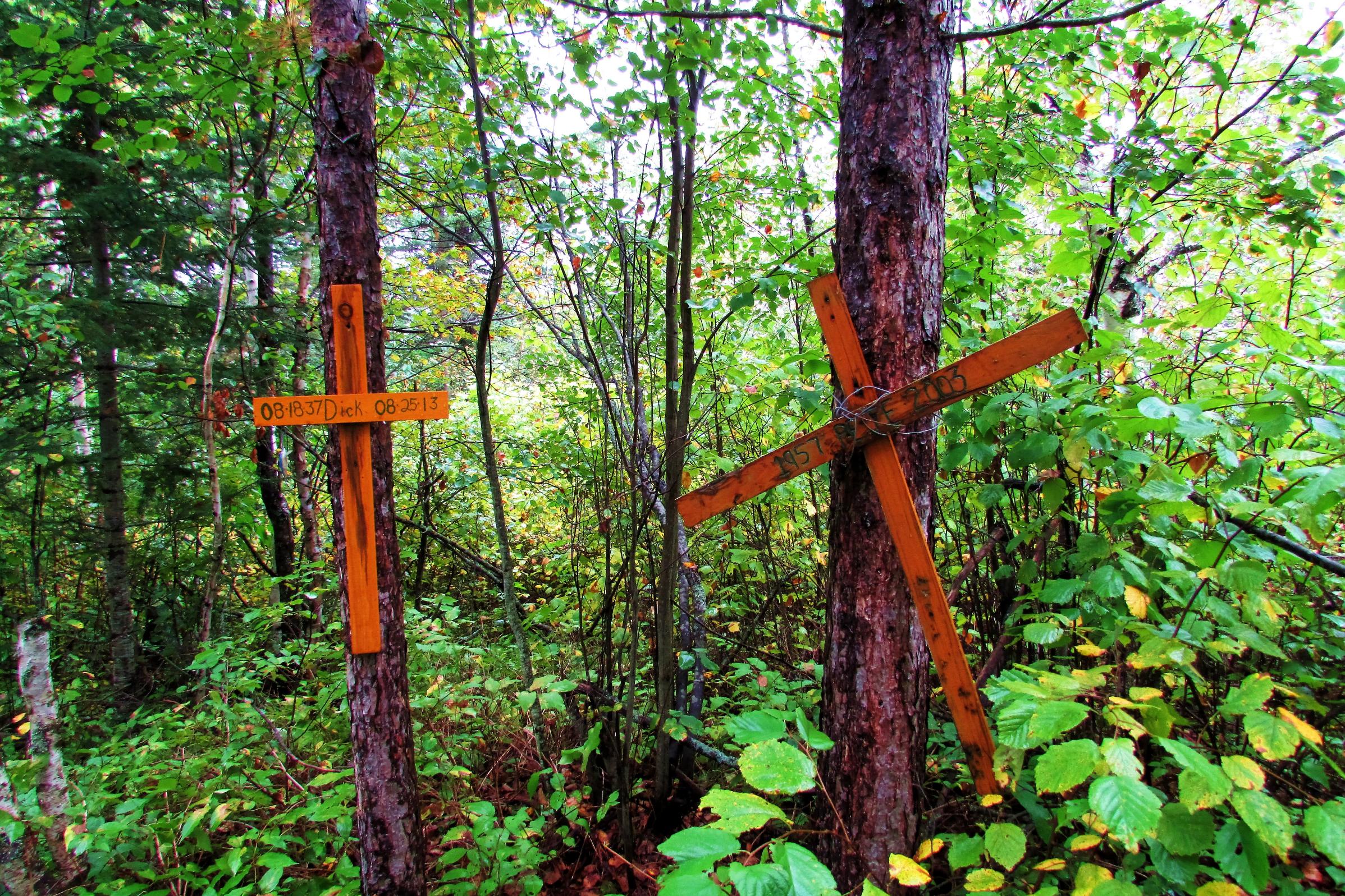

Also included is a photo of that classic boom box atop the Mountain in the 70s.

12/02/2018 12:35PM
Like the view with the sleds. Must be early 70s, an elan, Nordic, and I sure don't remember seen all that many Yamahas in the area. The last time I was at Jackpine Mt. there was one cross. The trees had grown so much there was no view, so I haven't been up since. I remember the first time riding Tomahawk rd. on snowmobile. It was like a super highway. I could seen what looked like forever. Now with the trees all grown not so much. But I was just a kid then. Good memories. With the improvements of snowmobiles in the late 60;s it sure changed winter for the people of Ely.
When doing a loop and going back the border route we would always stay with Vince (RIP) at Windigo.
When doing a loop and going back the border route we would always stay with Vince (RIP) at Windigo.

Raised by wolves!


12/02/2018 01:29PM
Yes We stayed with Jerry (RIP) at Evergreen on Mitawan Lake. We always stopped there for a beer and food when passing through. I didn't start going to the Knotted Pine until after Jerrys demise and the closing of Evergreen around 1983???. Since then I have been in the Pine many hundreds of times.I think the guys name that ran the Knotted Pines name was Jack then. I don't remember the Pine or Evergreen selling gas then. We would get gas in Isabella from the sisters that ran the gas station-bar. We would also stay at Crooked Lake resort, next to later built Trestle Inn. My friends (RIP) Lee and his son Kurt found the old RR trestle while snowmobiling in the woods. Took it apart and dragged it out to its site today and built the Trestle Inn. I had snowmobiled in that area since I was a little kid. I still have a snowmobile but do hardly any riding. The joy of riding today is just not what it was. It was an expedition every trip we went on. The groomed trails do nothing for me.
JIM P.
JIM P.
Raised by wolves!
12/02/2018 03:37PM
Yep, Ellahallely, there 's an Elan there but I think the other Ski-Doo was an Olympic, I might be wrong. But the Yamis are all '73s, Jim W. was selling them at Mike Motors in the 70s. Oh, those were the days! When there was hardly any snow elsewhere we'd go to the Tomahawk Road. We'd either park at the start of the Quarry Road (road off Hwy. 1, opposite Harris Lake Road) that runs to August Lake or we'd park by Camp 2. We'd go back on those road systems and ride all day, come back around dark.
12/02/2018 05:16PM
Tomahawk: "Yep, Ellahallely, there 's an Elan there but I think the other Ski-Doo was an Olympic, I might be wrong. But the Yamis are all '73s, Jim W. was selling them at Mike Motors in the 70s. Oh, those were the days! When there was hardly any snow elsewhere we'd go to the Tomahawk Road. We'd either park at the start of the Quarry Road (road off Hwy. 1, opposite Harris Lake Road) that runs to August Lake or we'd park by Camp 2. We'd go back on those road systems and ride all day, come back around dark."
The old sleds especially pre-1970,you go for a ride with 3 friends,usually one would break down and you had to haul it back,belts always breaking and spark pugs getting fouled out.
12/02/2018 08:09PM
Sorry, kind of off topic. I collect vintage sleds. My dad grew up in Crosby, so a I found his old Scorpion 71 stinger III, have a 78 Scorpion whip, 79 Tkx Scorpion, and 77 Yamaha exciter. My buddies and I do a lot of vintage rides. It's a blast!
Ellahalley, what were the most dependable sleds for you back then?
Ellahalley, what were the most dependable sleds for you back then?
12/02/2018 10:40PM
Tomahawk: "Jackpine Jim, Your mention here of Jackpine Mountain brings up a question for you or anyone else out there who might know. Back in the 70s I could drive my pickup or snowmobile to the top of Jackpine Mountain to the site of the Jackpine Lookout, the lookout was long gone as was the cabin but a real nice log thunderbox was still there. It would be a true honor for anyone who used that. The view back then was unbelievable! A couple of years ago we walked up there on an ATV trail while bird hunting, the road had all but grown in and once you got to the old tower sight it was all pretty much overgrown. But right at the concrete pads for the tower were 2 crosses. All of a sudden we became very quiet, we knew we were at a place of reverence. One cross said: Dick,8-18-37 to 8-25-13 and the other said: Pete, 1957 - 2003. I suspected that Dick had at one time manned the tower by his age but the younger Pete I had no idea. A friend confirmed my thought about Dick but he said Pete was a real tragic story. Seemed that younger guys from Wisconsin would come up each year to deer hunt there. One year Pete was accidentally shot by another hunter in the party. Anyone know anything more?
Also included is a photo of that classic boom box atop the Mountain in the 70s.
Tomahawk, when last I was on Jackpine Mountain in 2015 I took note of the crosses and had a. moment of silence for Pete and Dick and wondered what their stories were. Dad always went hunting up there during Pete's lifetime and stayed with Jule and Marylou Foster but never mentioned any hunting accidents of any kind. I know Jule was from Jump River, Wisconsin and there were other hunters from Wisconsin in the area.
Wilderness both captivates your soul and sets it free :)
12/03/2018 07:55AM
Ellahallely, did you ever know of a guy by the name of Wayne Slayden? I think that's the name, he has owned Evergreen Resort when we would stop there. Whomever the owner was, he was an over the road truck driver. When we'd stop there I don't think we ever met him, his mother would be running the bar there.
12/03/2018 09:08AM
Tomahawk I remember him, I thought his name was Sletten, but I also called an olympic a Nordic. The last time I was in there he was there and the place was a mess. I think he hung himself shortly after my last visit. Then the resort was sold off. Jerry the previous owner along with Lee Schumacher owner of Crooked Lake Resort then built a trail between the 2 resorts and groomed it. Today it is known as the Tomahawk trail.
Raised by wolves!
12/03/2018 09:32AM
Zwater: "Sorry, kind of off topic. I collect vintage sleds. My dad grew up in Crosby, so a I found his old Scorpion 71 stinger III, have a 78 Scorpion whip, 79 Tkx Scorpion, and 77 Yamaha exciter. My buddies and I do a lot of vintage rides. It's a blast!
Ellahalley, what were the most dependable sleds for you back then?
"
Back then newer was always better. My little brother on the 1964 Cat me on the 71 Cat. We also had 68 Ski Doo twin cylinder. Hence the yellow suit I was wearing. I also owned Mercury and Polaris.
Many a bush mechanic took a good sled and made it into an unreliable machine. I might comment on mining however I would never say one snowmobile was better then the other. Those were fighting words!!

Dorothy Molter always said Polaris was the best.

Raised by wolves!
12/03/2018 11:02AM
Ellahallely, I'll go with Sletten, that sounds better and you seem to have known him better than I. When we were there you could tell the place was in disrepair, going downhill at light speed. I felt sorry for mom who was running the place while he was gone, she seemed to be out of her element. That's terrible that he hung himself, never heard that.
Those old snowmobiles were something else. Travelling in 3s worked well and you had to make sure someone had a tow strap. Every once in awhile someone would get towed back. I had that '73 Yamaha SL 338, one plug was constantly fouling so they recommended to put a Champ L-78 in one side and L-81 (must've been on the fan side) in the other cylinder. That seemed to work but I remember changing plugs way too often, I froze my fingers way too often as well in -20 weather. To this day my hands are real sensitive to cold or heat. Damn Yamaha! Then I got a another one, also a '73 but was a 338 GP - I was a slow learner. Much better carburetion and it would really fly. Never had to change a broken belt on those but we had a guy with a Ski-Doo that would go with us, his machine would eat up belts like it was a dessert. Later I got into a Polaris Apollo, not a bad machine but it would break rear coil springs on those rough portages into Knife Lake. Later I had a Polaris Sport and was very happy with that.
Back in the day there was a constant back forth in a kidding way about who had the best machine. You'd give a guy a hard time when he had a break down and that was OK until you had a breakdown. We'd seem to take turns. Then it wasn't so funny when it was your turn, I leaned to keep my wise remarks to myself mainly because I didn't particularly like the taste of crow.
Quite a project to get that trial system started. Didn't know Lee Schumacher at all and Kurt died the year we started to go to Crooked Lake Resort. We've gone to Crooked each year since, first week of June for walleyes and rainbows. We'll be there again this June, stop by and we'll have a beer or 2 at the Trestle Inn..................
12/03/2018 04:37PM
Tomahawk: "Ellahallely, does Vince Jr. run Windigo now?"
I think Windigo got sold recently. No Vince Jr didn't run it. As far as I know Char Vince's widow ran it. Went in there one time after the fire and it was not the same to me. Link about the fire for those who don't remeber it.
Tomahawk it was kind of the same thing with Crooked Lake Resort after Kurt Died I went back a few times but it was not the same.
Tomahawk let me know before you go up this summer, if I am in the area I could take you up in my float plane. As far as a beer at the Trestle well if I am flying then no. I will tell you this if you tell Sue owner of the Trestle you know me she might do something to your food. Long story but to sum it up I got caught up in the local drama!!!! I still consider Patty at the resort a dear friend. I spent hundreds of nights at Crooked Lake we ran a large group of snowmobilers from all over out of there for more then 30 years.
Raised by wolves!
12/03/2018 06:46PM
Tomahawk: "Jackpine, how did you get to the top? ATV? We walked up, birdhunting. It was early in the season and a humid day. Tough walk, took around 50 mn. one way, pretty steep grades in places."
Tomahawk, my buddie and I walked up. It was a bit of a hike and we were breathing heavy when we got to the top. We joked the crosses were from people that walked up and had heart attacks and died up there.
Wilderness both captivates your soul and sets it free :)
12/04/2018 07:57AM
Jackpine, What a great line, I wish I would've thought of that one after climbing Jackpine Mountain. Those crosses were from people climbing to the top of the Mountain....................I'll be giggling about that all day now. We felt about the same way when we got to the top.
12/04/2018 08:24AM
Ellahallely, I can just imagine how things changed after Kurt's death, I would've liked to have known him. But Patty, Craig, Nate & Kasey are doing their best to keep the wolves away from the door. Never ending list of things to do when you own a resort but they appear to be holding their own, that new sauna building is a real plus and we use that each night we're there. Those resorts are an endless list of breakdowns, things to fix, things to replace and it never seems to end. I remember working at one for a summer when I was in high school and just wondered how people could do this year after year.
As far as flying with you. that's be great. But if you were flying I'd never expect you to have any alcohol, if you did I'd never go with you. I just thought if you were in the neighborhood of Crooked Lake maybe you could stop by. We'll be in Cabin 4 from June 3-4. Cabin 4 will be the one with the beer.
As far as flying with you. that's be great. But if you were flying I'd never expect you to have any alcohol, if you did I'd never go with you. I just thought if you were in the neighborhood of Crooked Lake maybe you could stop by. We'll be in Cabin 4 from June 3-4. Cabin 4 will be the one with the beer.
12/04/2018 10:36AM
Tomahawk: "Ellahallely, I can just imagine how things changed after Kurt's death, I would've liked to have known him. But Patty, Craig, Nate & Kasey are doing their best to keep the wolves away from the door. Never ending list of things to do when you own a resort but they appear to be holding their own, that new sauna building is a real plus and we use that each night we're there. Those resorts are an endless list of breakdowns, things to fix, things to replace and it never seems to end. I remember working at one for a summer when I was in high school and just wondered how people could do this year after year.
As far as flying with you. that's be great. But if you were flying I'd never expect you to have any alcohol, if you did I'd never go with you. I just thought if you were in the neighborhood of Crooked Lake maybe you could stop by. We'll be in Cabin 4 from June 3-4. Cabin 4 will be the one with the beer."
Being a past pilot and coming from a family of pilots I will add that ellahallely appears to be an above average aviator. I flew with him last summer, plus he has a beautiful plane.
May the rivers be crooked and winding, and your portages lonesome, leading to the most amazing view.
12/04/2018 10:49AM
Grouse hunting the POW WOW trails-Once I shot two grouse about 2 blocks into my hunt. Instead of carrying them for another 3-4 miles or more I hid them and will pick them up on the way back. Hoping to get 3 more to fill my limit. Well got lucky and got 3 more. On the way back stopped to pick up my grouse-Well all I had left was a pile of feathers- a Pine Marten cleaned me out. Well I guess it was his home turf.
Seen them chasing rabbits and red squirrels while in that area also.
Seen them chasing rabbits and red squirrels while in that area also.
12/04/2018 12:01PM
Good story Pinetree, reminds me of a couple of others. One time I was up on the East Road, I'd dropped my pack off where Tomahawk Creek crossed the road, just below Albino Lake. They had culverts here at one time then were replaced by a foot bridge that deteriorated later on. I'd walk up another hour, going past where the trail went into Tomahawk Lake and come back to my pack at about lunch time. That I did and I was sitting by the creek with my lunch, here comes a snowshoe hare at a full sprint with ears laid back along its head, eyes wide open and bulging. It was clearly in a run for its life and about 20' behind it was a pine marten, also in full sprint. The bug-eyed hare saw me and ran by me like I wasn't even there, 4' away from my boots. With the marten on its tail, off they went, never heard or saw them again.
Your 2 birds in the bush reminds me of another story, sort of. During the good bird years in the early 70s, I was going north on the Insula/Hudson Road and was just south of the Hudson Fork. I had 3 birds already and saw another on the road. I prefer to shoot them on the wing but looked over the surrounding area and I knew it'd be too thick to get a shot off. So, as I put the bead on his head and just as I squeezed the trigger another walks out from the side of the road about 10' away and they both fall over, flapping away. Wow, I got 2 with 1 shot and never even saw the second until the last second and on top of that I had my limit. Hold the phone, as I went to pick the birds up there was a 3rd one flapping. I never saw the 3rd one at all but now I was 1 over the limit. An honest mistake but not sure a warden would believe me. Not sure what to do about that, I knew my partner was up on the Quadga Road and we were going to meet up at the end of the day where the Quadga Road left the North Road. Hopefully he didn't have his limit, if he did then we'd have to decide what to do with my extra bird. Toss it? I sure didn't want to do that. Well, when we met up, luckily he had only had 2 birds so now he had 3 with mine. When I shot, about 5 other birds also flew up and away, there were around 8 in that covey.
Your 2 birds in the bush reminds me of another story, sort of. During the good bird years in the early 70s, I was going north on the Insula/Hudson Road and was just south of the Hudson Fork. I had 3 birds already and saw another on the road. I prefer to shoot them on the wing but looked over the surrounding area and I knew it'd be too thick to get a shot off. So, as I put the bead on his head and just as I squeezed the trigger another walks out from the side of the road about 10' away and they both fall over, flapping away. Wow, I got 2 with 1 shot and never even saw the second until the last second and on top of that I had my limit. Hold the phone, as I went to pick the birds up there was a 3rd one flapping. I never saw the 3rd one at all but now I was 1 over the limit. An honest mistake but not sure a warden would believe me. Not sure what to do about that, I knew my partner was up on the Quadga Road and we were going to meet up at the end of the day where the Quadga Road left the North Road. Hopefully he didn't have his limit, if he did then we'd have to decide what to do with my extra bird. Toss it? I sure didn't want to do that. Well, when we met up, luckily he had only had 2 birds so now he had 3 with mine. When I shot, about 5 other birds also flew up and away, there were around 8 in that covey.
12/04/2018 01:13PM
Tomahawk: "
Ellahallely, yes, the way to Hudson started on the west side of Isabella Lake, this was called the Isabella North Road because as it left Forest Center it ran in a northwardly direction. About 3 mi. up there was a road that left off the North Road to the left and went NW. This was the road that went near the Arrow Lookout. You're right again, the tower was much closer to Pose than Arrow Lakes. Go figger how they gave it the name Arrow Lookout, always wondered that myself. Anyway, About a mile off the North Road going NW on this road you came to another fork with a road to the left, going due west, this went to Pose Lake. But staying on a due North heading at this fork would take you to the Ahmoo Creek bridge crossing. This bridge was gone by the time I was there, only some timbers left to cross the river. After crossing Ahmoo, the road went due north for about 1/2 mi., then another fork. To the right (east) the road went below Insula Lake and over toward Arrow Lakes; to the left (west) the road went toward Hudson Lake. Going toward Hudson about another 3/4 mi brought you to another crossing of Ahmoo Creek and a nice, big bridge. After the bridge the road went another 1 1/2 mi. or so and ended in a clearcut where they also had a landing at one time. This was the end of Tomahawk's main haul road, from here there was a network of short winter roads before they ended as well at the very end of Tomahawk's sale boundary. This is where the creek came in from Hudson Lake to the sale area. The trail on the map that you show here is too far to the north, the Hudson Road actually went further to the south, ending in the area of Zitkala Creek. The trail you show is a fire trail and they crisscrossed much of the BW, running from fire tower to fire tower. Hope this helps."
Tomahawk, Do you have a similar map for the East loop of the Pow Wow Trail?
Wilderness both captivates your soul and sets it free :)
12/04/2018 01:29PM
 Jackpine, ask and you shall receive. Actually, this map is just the right hand side of the map I sent earlier, it was too big to scan in all at the same time. If you look at the map, where the East Road goes past Tomahawk Lake going NE, it takes an abrupt turn to the N/NW just below Chickadee Lake. At this point is where the Pow Wow Trail system was only a trail going up to Chickadee, Fungus & Whittler Lakes, the East Road went due east, down a steep hill, crossed Chickadee Creek and went up a steep hill on the other side of the Creek. I walked up toward Fungus lake only briefly, it didn't look too birdy. Staying on the East Road was much birdier. From Chickadee Creek it was only about another 2 miles to the main road that went north to Kawishiwi Lake, but maybe only another 1/2 mi. from the Creek got you into the middle of a huge clearcut up on a huge vista. The clearcut was on such a very high point of land and you could see both Perent Lake to the south and Kawishiwi Lake to the north. This was an incredible view to see all this, on top of it all to the north, in a swamp very close to Kawishiwi Lake, was an enormous bull moose. The size was just incredible, probably one for the record books with a rack that was equally incredible! A memory I will never forget! This was the furthest we ever walked, always planned to come back and walk all the way to the Kawishiwi Road but never did. Incidentally, when the East Road crossed the road going Kawishiwi Lake, the East Road kept on going north up to Polly Lake & Camp 4. In the winter you could make the loop back to the North Road and Forest Center, I've been told.
12/04/2018 02:08PM
You know we now have a lot of Fischer around Brainerd- Longville. Do you see many up there.
Remember hunting around Ely in 1975. There must of been a ton of snowshoe rabbits on the trail in those early years. I really don't mind eating them,some people don't like them.
Remember hunting around Ely in 1975. There must of been a ton of snowshoe rabbits on the trail in those early years. I really don't mind eating them,some people don't like them.
12/04/2018 06:19PM
Tomahawk: Those two 'PowWow Lake Hiking Trail' maps are terrific. Do you know what year they were printed? Perhaps if the southern portions of both maps were made visible, the legend would have that info...
This entire thread is a fascinating read.
This entire thread is a fascinating read.
"You can observe a lot just by watching." -- Yogi Berra
12/05/2018 07:46AM
Tomahawk Crooked Lake Resort is a special place. All most all of these down to earth family resorts are gone. I was happy that Patty kept the resort open. It would have been so easy to sell to people looking to build giant cabins, like the ones up at Wilson Lake. My friends and I helped out at the resort after Kurt died. Craig seems like a nice guy and helps keep things going. When I first started staying at the resort they had a radio phone and generator they would start when electricity was needed.
Raised by wolves!
12/05/2018 08:02AM
JackpineJim: "Tomahawk: "Jackpine,
You really have my interest when you mentioned Camp 5. I have been there a number of time via canoe from South Hope to Maniwaki but never realized there was a camp there. Also walked in there off the North Road. I've looked on the satellite map and you say it was on the southwest part of Maniwaki lake. Was it near the road that came in from the North Road, the road that went up into Fishdance Lake or was it more over toward the creek that went along the portage in the direction to South Hope? Can you circle it on a map?
Thanks much, I know a guy who lived there when the camp was there but he was only 5 at the time and wasn't sure where it was.
Many thanks!!"
Tomahawk, I'm operating from memory of discussions with my Dad on where Camp 5 was located. I recall him saying it was near the creek to Maniwaki. I was thinking it was near where the road branched off to the north crossing Hope Creek but I found these two different maps (too big to upload, apparently) from 1960 that appear to show two buildings (squares) near Maniwaki Creek on the East end of Maniwaki Lake. They are in the white area just east of the 1612' Benchmark triangle in the road. There was a branch in the road just NE of the two squares ( buildings?) with one heading North toward Fishdance and the other continuing on to Camp 4 (Poly Camp). I'll ask my mother this weekend and see if she can recall the exact location of Camp 5.

"
Tomahawk, I visited my Mom and uncle Donny last weekend about the location of Camp 5. Mom couldn't locate it on the map, only remembered it was about 4 miles from Pow Wow Lake, where Marion Taylor used to fish from shore right "down in the brush right next to the road", and Aunt Tress' cook shack ant the store were right on the main road. My uncle Donny only remembered the site was a "big field" when he camped there with my dad while trapping when he was 14 years old in 1962. Then Mom pulled out a map my dad had drawn in the road just south of Maniwaki Lake and put a mark for Camp 5 on the Northeast side of Maniwaki Creek, very near where the map in this post shows the two squares. So, I'm positive those two squares mark the location of Camp 5.
Wilderness both captivates your soul and sets it free :)
12/05/2018 09:11AM
Ellahallely, After we had stayed there at Crooked Lake Resort for a couple of years and got to know Patty, I asked her if she intended to hold on to the Resort. She said she's an Aldinger (her maiden name) and....." we're from here. I'm not going to sell nor am I going anywhere but here." An answer I was happy to hear. I met her cousin Ron Aldinger this past June. He's also been helping out and is really interesting to talk to. He was from Sawbill Landing and cut pulp along with his dad. A lot of history in him as I picked his brain. People like him are so interesting to listen to.
12/05/2018 09:12AM
Tomahawk: " Jackpine, you mentioned fishing right from shore. Was that Pow Wow Lake that Marion Taylor fished? What was he fishing for? I know the North Road ran right alongside Pow Wow Lake."
Yes, POW Wow Lake. Mom never said what she fished for.
Wilderness both captivates your soul and sets it free :)
12/05/2018 09:19AM
Schweady, the maps were made in October 1986. 

 I sent all 3 images of the Pow Wow Trail system map, I think I have it all here for you now if not, let me know. Glad to help out.
It was odd how we found out about the map. My hunting partner and I had seen the road system getting overgrown, little by little. Funny, but we thought it was always going to be the way it was when we first started hunting there in 1971. You learn a lot about Mother Nature filling voids such as entire road systems. Pinetree said it best here earlier when he said you don't realize what you had until you lost it. Anyway, we were out on the Insula Road one day and were on our way toward Arrow Lakes where the road usually ended, or became so over gorwn we didn't care to go any further. We got to one of those overgrown points and the trail was wide. it had been cut. The same for the road that we had walked in on, we noticed that was wider as well and windfalls had been cut. We were elated that the road system was not going away anytime soon. We wanted to find out more so we went to the nearest Ranger Station, that was the Isabella Ranger Station which is no more. There we not only found a map but they had plans for restoring a lot of the old road system, making loops out of them. Their purpose was to make loops so you wouldn't have to go the same way out as the way you came in, at the same time running into less people that way. They put in campsites with facilities and replaced the former truck bridges with walking bridges. The one they put in across Perent River on the East Road was a real feat of engineering! They really had a nice plan and it held for about 5 yrs. or so. Then they ran out of funds and the program ended. Typical federal government, spend all that money to build a nice trail system then just let it go away and the higher ups in the regional office seemed to have cared less. The local grunts that put the system in wanted it to continue but no one upstairs was listening to them. What a shame! But the Kek Trail Club and Martin Kubik (bless his soul) came to the rescue and kept the North Loop of the trail system open. The East loop was pretty much written off because of all the beaver activity flooding the trail out, a good call. Martin is still trying to keep the North Loop open after the fire. Incidentally, if you look at the map where it says "wet areas" in red marker, those areas had about 3"-4" of water in them at the time in the deepest spots, now they're beaver ponds or small lakes.
It was probably somewhere in the 90s when I last walked the part of the East Loop around Ferne lake. I'd always look forward to that trip, we'd see so many grouse and moose. But the last time was the last time, there was so much beaver activity the trails were mostly covered in water and disappearing fast.


 I sent all 3 images of the Pow Wow Trail system map, I think I have it all here for you now if not, let me know. Glad to help out.
 It was odd how we found out about the map. My hunting partner and I had seen the road system getting overgrown, little by little. Funny, but we thought it was always going to be the way it was when we first started hunting there in 1971. You learn a lot about Mother Nature filling voids such as entire road systems. Pinetree said it best here earlier when he said you don't realize what you had until you lost it. Anyway, we were out on the Insula Road one day and were on our way toward Arrow Lakes where the road usually ended, or became so over gorwn we didn't care to go any further. We got to one of those overgrown points and the trail was wide. it had been cut. The same for the road that we had walked in on, we noticed that was wider as well and windfalls had been cut. We were elated that the road system was not going away anytime soon. We wanted to find out more so we went to the nearest Ranger Station, that was the Isabella Ranger Station which is no more. There we not only found a map but they had plans for restoring a lot of the old road system, making loops out of them. Their purpose was to make loops so you wouldn't have to go the same way out as the way you came in, at the same time running into less people that way. They put in campsites with facilities and replaced the former truck bridges with walking bridges. The one they put in across Perent River on the East Road was a real feat of engineering! They really had a nice plan and it held for about 5 yrs. or so. Then they ran out of funds and the program ended. Typical federal government, spend all that money to build a nice trail system then just let it go away and the higher ups in the regional office seemed to have cared less. The local grunts that put the system in wanted it to continue but no one upstairs was listening to them. What a shame! But the Kek Trail Club and Martin Kubik (bless his soul) came to the rescue and kept the North Loop of the trail system open. The East loop was pretty much written off because of all the beaver activity flooding the trail out, a good call. Martin is still trying to keep the North Loop open after the fire. Incidentally, if you look at the map where it says "wet areas" in red marker, those areas had about 3"-4" of water in them at the time in the deepest spots, now they're beaver ponds or small lakes.
It was probably somewhere in the 90s when I last walked the part of the East Loop around Ferne lake. I'd always look forward to that trip, we'd see so many grouse and moose. But the last time was the last time, there was so much beaver activity the trails were mostly covered in water and disappearing fast.
12/05/2018 11:22AM
When the forest service was started they made money from mining and timber sales. Now with people opposed to both things have changed. Limited logging has also increased forest fires. For awhile they were losing money on timber sales, hard to believe but true. Now they are a money eating machine with most of there money going to fighting fires. I would guess mostly in California. The forest service budget increases by 100 million each year. Starting in 2020, the Forest Service will be able to access over $2 billion a year outside of its regular fire suppression budget. Trump signed this in. Maybe it is time we increase user fees and make it more self supporting. I don't feel right having people paying subsidies for my vacation. Many of the people paying these taxes can't even afford to go on vacation.
Raised by wolves!
12/05/2018 01:32PM
JackpineJim: "Tomahawk: " Malberg was a great lake for walleyes, some of the fastest fishing I've ever had including Canadian fishing but the walleyes were fairly small. We'd talk to people fishing Koma for huge northerns, they said, but I never wet a line there when the walleyes were so close by in Malberg.
The guy I talked to yesterday was Don Hoover, great guy, hard worker. He said he drove right into the crash site of that B-17 on a road the government put in there. There wasn't much left when he was there, a couple of wings and small parts was about it. He said the Air Force came in to get the 4 engines and the Norden bomb sight. That bomb sight was super secret and used for precision bombing, something the Russians never had but would've been very interested in. The engines had superchargers on them to give a boost when carrying heavy bomb loads, our allies the Brits wanted to know more about that but as far as I know we never let them in on it. I still laugh about that."
This is a transcript of my dad's B-17 bomber story:
"When I was nine years old, we lived in Little Bear Camp by Little Bear Lake, South of the Tomahawk Road. On the day before Thanksgiving [Wednesday, November 22, 1944], just before dark I was outside and a B-17 bomber flew over real low sputtering and missing a bunch of beats like it was running out of gas, and I knew it was going to crash.
The next morning I went cross country about a mile and came to that little creek and followed the creek and I could see where the wings had sliced off or chopped off the trees - popple and jackpine and spruce. It actually lit in a spruce swamp. One of the motors and one of the wheels tumbled right into the creek.
I went through the plane and found a few items. A couple of 50 caliber shells, one with a red nose and one with a black tip. The machine gun was kind of knocked loose so I tugged and twisted and pulled it loose and drug into the woods and hid it in the spruce moss and stuff. Over a period of days, me and little Joey Gutowski would drag it a ways, and then [my cousin] Ruth would help, and we'd drag it a ways and we eventually got it all the way back to Bear Lake Camp.
Well, then Uncle Ted went into Klune's Tavern in Ely and talked about the machine gun. The next Sunday, The Sheriff came into camp - it wasn't even his jurisdiction, it's a different county. He came in with the siren going - that's enough to scare anybody - and [told us] it was illegal to have an automatic weapon. So, he took my machine gun away from me.
In the mean time there was no road in there. So I had a thriving little business there. People would pay me fifty cents to take them in there, they wanted to see it and they'd get souvenirs. Fifty cents was a lot of money in those days. I made a few bucks on that deal.
When I was a teenager the sheriff's daughter took me to see the machine gun - it was mounted on a rock monument in the sheriff's yard.
Years later [about 1960] me and one of my best friends, Hank Knuth, went in there and found where the bomber came down. Somebody had salvaged it and picked all the aluminum scrap and everthing out of it.
And that's my bomber story."
Here is a couple of references I found on the internet:
B-17 crash near Isabella
"The ears of many Jackson countians were held close to the radios last Wednesday afternoon as announcers related the progress of the flight of a Flying Fortress which had gone out of control with ten men aboard and was circling over a two hundred miles area in South Dakota and Minnesota, and did not crash until five hours later. Before the crash, however, the announcer said that ten parachutes had been seen floating down from the runaway Fortress and it was believed that all the crew had landed safely. While people were interested in the progress of the pilotless plane they did not realize that one of the members of that crew was Cpl. James O. Sayre, son of Mr. and Mrs. J.W. Sayre, of Sandyville. On Thursday morning it had been definitely established that all the members of the crew, including Cpl. Sayre, had landed safely at widely separated points in South Dakota. The plane crashed near Isabella, Minnesota late Wednesday afternoon, and the ten members of the crew, had abandoned it near Marion, South Dakota five hours earlier. Minnesota forest rangers saw the plane crash at 4:45 eastern war time. (Friday, Dec 1, 1944)"
Read page 144 of this book (link)
Minnesota Goes to War "
I thought it might be interesting to add some background info on the characters in this story (I’ll add more links as I find them):
Hank Knuth
Wilderness both captivates your soul and sets it free :)
12/05/2018 03:34PM
Tomahawk: "Schweady, the maps were made in October 1986.
"
Thanks. Not to be a stickler, but the map would be complete with a 4th image: the SE corner... the area south of Perent River/Perent Lake. (even tho there's probably no additional trail there) :-)
"You can observe a lot just by watching." -- Yogi Berra
12/05/2018 03:57PM
An interesting side note here was the logging done back in the 1960s. It was said, from some pretty reliable sources, that the Halfway Ranger District, which included all of the sales that Tomahawk Timber Co. was cutting, floated the entire Superior National Forest with their timber sales. That was how much timber they were cutting each year back then before people became squeamish about using a renewable resource.
12/06/2018 08:31AM
 Schweady, I'm sending that last portion of the map here so you can have a complete map. It doesn't have any part pf the Pow Wow Trail system on it that I didn't already send but it does include part of Perent River, Perent Lake, etc. that you asked for so now you're complete. My apologies for the condition of the map but it was put through a lot of use over the years when we were on the trail.
12/06/2018 09:53AM
Jackpine Jim,
I keep thinking about the story with your dad, the bike and the moose rack from Arrow Lakes. You mentioned that you thought it was around '62 that the road was bermed up. Which berm were you talking about, beyond and north of Ferne Lake on the North Road?It couldn't of been berened before Isabella River in '62 where it was bermed later because they were still driving up there when they rock raked north of Ferne Lake in 1968. I was just curious how far your dad had to drag all that he had to haul on his bike. An incredible feat, for sure!
I keep thinking about the story with your dad, the bike and the moose rack from Arrow Lakes. You mentioned that you thought it was around '62 that the road was bermed up. Which berm were you talking about, beyond and north of Ferne Lake on the North Road?It couldn't of been berened before Isabella River in '62 where it was bermed later because they were still driving up there when they rock raked north of Ferne Lake in 1968. I was just curious how far your dad had to drag all that he had to haul on his bike. An incredible feat, for sure!
12/06/2018 09:59AM
When I was looking at my Pow Wow Trail map when I sent the images to Schweady, I remembered a time up on the East Road. The trail crossed Tomahawk Creek 3 different times, I'm thinking it was at the first crossing where they had pulled out the culverts for truck traffic and later put in a foot bridge. I was walking in one morning, was on the bridge and looked downstream to my right. It was always a nice spot for moose and I saw a good bull on the east side, nothing huge but very adequate, about 1/4 mi. away. It appeared as though he saw my silhouette against the sky while I was on the bridge because he kept staring in my direction, their eyesight is not the best. I didn't think much of it and was about to leave my pack here as I always did, and go another hour up the trail before coming back for my lunch. But the area was all gravel and had been all torn up by what appeared to be a huge bull moose. Small brush, trees were uprooted and 4" jackpine were girdled from his rubs. I marveled at the size of the tracks, back then we saw many moose tracks but these stood out for their size. Another Clydsdale. After leaving my pack tied in a tree, I walked up another mile or 2 beyond where the trail went into Tomahawk Lake, turned around and came back to my pack. I left my 12 ga. shotgun next to my pack and went down to the creek about 30' away to clean a couple of grouse I had gotten.You ever get the feeling that some critter is watching you one those very windless days? Well, I did here but went on with my bird cleaning. Until I heard the muffled noise of a small twig snapping. I looked in that direction and here was the beast himself, the track-maker. Enormous wouldn't say it all. He had walked in so silently from I'm not sure where but he was here now. The maker of those big tracks I noticed on the way in a couple of hours earlier was here now! He had his hind quarters closest to me and his head was looking over his hind quarters at me. The antler spread was monstrous! He was in rut and at that time they can be very unpredictable, the poor eyesight doesn't help. I wasn't sure if he was thinking I might be that other moose I had seen earlier not far from here, bulls are very territorial when in rut. Or he thought I was me and he didn't particularly care for that, either. I stood up anyway to show him I wasn't another competing bull and then realized that my shotgun was back up with my pack. Not that a shotgun would do much good against him if he decided I was competition but it might've given me more comfort, I felt a bit naked without it. I always carry a .40 cal. hand gun also so I felt somewhat better about that. We stared at each other for a long tome before he turned and moved toward me about 5' closer. I hollered and he stopped and we stared some more. At this point he was about 40'-50' away and he lowered his head, I hollered again. I really didn't like how this was developing and pulled the.40 from my holster. I waved it in the air (like he was going to recognize what that was, dumb me) but he just stared. These staring contests were getting old fast. At this point I didn't want him want closer so my plan was to fire a round in the air to the right of both of us, just to scare him away. I had no intention of shooting at him. As soon as he heard the click of the safety going off his head went up and he ran off. WHEW!! Evidently the metallic click saved the day for both of us. He was easily in that top 5 list of the largest bull moose I have ever seen.

12/06/2018 12:08PM
aholmgren: "Great thread indeed. Thanks to all who contributed. I collect vintage maps and wanted to post this 1957 USGS map of Forest Center which shows some of the areas and roads mentioned, though I am not sure how well they will show detail"
Curious anyone, is the current bridge over the Island River the auto bridge or RR bridge that served Forest Center back in the day?
I always figured the bridge now was the old RR bridge.
May the rivers be crooked and winding, and your portages lonesome, leading to the most amazing view.
12/06/2018 01:53PM
Indeed a great thread! I was born in 1960 and started traveling in the area around 1970 with friends and family. It is nice to hear from and about the people that were in the area before my time. I remember snowmobiling on the pow wow trail. The many roads brought us to the area for ease of travel in the winter. Liked the area so much I started to spend more time in the Isabella area then Ely. Most of my family moved out of Ely by 1970.
I remember the gates. I remember one by Sawbill landing on the old RR grade(now fs rd 379) going up to Forest Center until about 1987? Many of the other ones had been removed and the roads blocked with rocks or berms. About that time is when I started to see many wolf and they were starting to become very bold.
Anyone remember the town of Sawbill Landing? I am not old enough to remember Forest Center but I remember Sawbill Landing.
Raised by wolves!
12/06/2018 02:09PM
Ellahallely,I remember Sawbill Landing fairly well, although I was only there once in 1968. We had coffee & a great carmel roll in a neat little cafe they had there. There were some nice homes there, as well as trailer homes, a very well-kept little vicinity. I also remember pulp trucks parked in yards along with skidders, dozers and whatever else you needed for the industry. There were also neat white picket fences around some yards that had lawns. It was not a junky place at all, very neat.
In the early 60s a family by the name of Dabill came to Ely from Sawbill along with the Kainz families. Kainzs' opened a sawmill in Ely and if I recall correctly, Mr. Dabill ran it for them. The Dabill's had a son that was a natural athlete. He had tremendous spring in his legs and unbelievable jumping ability. He was on the basketball team and one of the best rebounders around until he broke his leg going up so high for a rebound and coming down wrong. He healed by track season and was an excellent high jumper, not many were able to beat him in that event.
In the early 60s a family by the name of Dabill came to Ely from Sawbill along with the Kainz families. Kainzs' opened a sawmill in Ely and if I recall correctly, Mr. Dabill ran it for them. The Dabill's had a son that was a natural athlete. He had tremendous spring in his legs and unbelievable jumping ability. He was on the basketball team and one of the best rebounders around until he broke his leg going up so high for a rebound and coming down wrong. He healed by track season and was an excellent high jumper, not many were able to beat him in that event.
12/06/2018 02:40PM
Ellahallely, You mentioned how bold some wolves are getting and I've shared some of my encounters with them, here's a couple more. On a grouse hunting trip one beautiful bluebird, sunny day in October many years ago, I was walking on the Quadga Road on the Pow Wow and on my way to Superstition Lake. Perfectly calm in the early morning about 9 am, I was approaching Marathon Lake about couple of hours from the parking lot. A wolf cut loose ahead of me with a howl that made me jump near out of my boots, and he was close. I had to check, yup, I still had my boots on. Then a bit later another howl from what sounded like a different wolf and at the same time a 3rd one chimed in, so now I realized was I was dealing with a pack not far ahead of me. That's when you realize how alone you are. I had been noticing very fresh scrape marks on the trail since leaving the Isabella North Road, all over and often, where they had probably peed and left their scent. This bunch must've been out drinkin' all night because it seemed they were peein' non-stop. Not meant to gross anyone out but I've sent an image of one of the scat piles (with the green 12 ga. 2 3/4" shell for effect) left by what must've been the Alpha male. A near record if not a new record as far as I was concerned. This guy could've plugged a toilet had he been using one. At first I thought they were moving toward me but they kept their distance and it was clear we were both moving in the same direction, west. Every half hour to 45 mn. they'd cut loose to let me know they were still there and fully aware of me. After awhile I even got used to the howls, at least I knew they were still going away from me and not coming toward me. This went on all the way to Superstition where I turned around and was on my way back, they kept going to the west. See ya! I did not flush either a ruffed or spruce grouse anywhere near the trail on the way up,
the wolves had taken care of that with their mere presence but with the wolves gone on the way back I even picked up 2 ruffs.
I've also sent a picture of another scat pile near a red 12 ga. shell by another large wolf, this one on the old Northwest Road between the Little Isabella River and the Edwards Lake Road. Another toilet plugger.


12/06/2018 04:18PM
Tomahawk: "Schweady, I'm sending that last portion of the map here so you can have a complete map. It doesn't have any part pf the Pow Wow Trail system on it that I didn't already send but it does include part of Perent River, Perent Lake, etc. that you asked for so now you're complete. My apologies for the condition of the map but it was put through a lot of use over the years when we were on the trail."
So here we have the 4 map tiles, pieced together... I do love old maps.
The used condition gives it character, for sure. In fact, parts that bled through made for some interesting reading once the image was mirrored. Mostly, the usual camping suggestions, but enough of it indicated a bit of area history such that scans of that reverse side would be of interest, I'm sure.
Some of the resolution was lost in my merge process, but in your original image posted above, the date in script at the lower right looks sort of like '10/80.' October 1980? Also, there's a very faint pencilling above the '80' that looks like '85.' ??

"You can observe a lot just by watching." -- Yogi Berra
12/06/2018 06:44PM
aholmgren: "Great thread indeed. Thanks to all who contributed. I collect vintage maps and wanted to post this 1957 USGS map of Forest Center which shows some of the areas and roads mentioned, though I am not sure how well they will show detail
Great Map, thanks for posting. I particularly like the indication of where
the building/shacks were. Are those building markers on the East side of Arrow lake It's kind of hard to make out. Do you have any more of 1957 maps?
Wilderness both captivates your soul and sets it free :)
12/06/2018 07:00PM
Tomahawk: "Ellahallely, You mentioned how bold some wolves are getting and I've shared some of my encounters with them, here's a couple more. On a grouse hunting trip one beautiful bluebird, sunny day in October many years ago, I was walking on the Quadga Road on the Pow Wow and on my way to Superstition Lake. Perfectly calm in the early morning about 9 am, I was approaching Marathon Lake about couple of hours from the parking lot. A wolf cut loose ahead of me with a howl that made me jump near out of my boots, and he was close. I had to check, yup, I still had my boots on. Then a bit later another howl from what sounded like a different wolf and at the same time a 3rd one chimed in, so now I realized was I was dealing with a pack not far ahead of me. That's when you realize how alone you are. I had been noticing very fresh scrape marks on the trail since leaving the Isabella North Road, all over and often, where they had probably peed and left their scent. This bunch must've been out drinkin' all night because it seemed they were peein' non-stop. Not meant to gross anyone out but I've sent an image of one of the scat piles (with the green 12 ga. 2 3/4" shell for effect) left by what must've been the Alpha male. A near record if not a new record as far as I was concerned. This guy could've plugged a toilet had he been using one. At first I thought they were moving toward me but they kept their distance and it was clear we were both moving in the same direction, west. Every half hour to 45 mn. they'd cut loose to let me know they were still there and fully aware of me. After awhile I even got used to the howls, at least I knew they were still going away from me and not coming toward me. This went on all the way to Superstition where I turned around and was on my way back, they kept going to the west. See ya! I did not flush either a ruffed or spruce grouse anywhere near the trail on the way up,
the wolves had taken care of that with their mere presence but with the wolves gone on the way back I even picked up 2 ruffs.
I've also sent a picture of another scat pile near a red 12 ga. shell by another large wolf, this one on the old Northwest Road between the Little Isabella River and the Edwards Lake Road. Another toilet plugger.
One of the highlights of the year for me was taking my Dad up road hunting for birds on the old Tomahawk Timber Company roads. We'd stay with Jule and Marylou Foster (rest all their souls) - Dad and Jule were great friends from way back in the day. Jule told us a story about a logging truck that broke down late in the day back in on one of the roads off the Tomahawk Road. The driver, I don't recall his name, grabbed his picaroon from behind the seat and started walking out. The picaroon provided a moderate sense of security. After some distance a wolf came out on the road and started following him. He'd stop and turn around and the wolf would stop and stare at him. he'd walk some more and the wolf would follow, all the while getting closer, showing no aggression. He'd stop and the wolf would stop. After a time the wolf was very close, only feet away. The guy spun quickly and hit the wolf on the side of the head with the picaroon and killed it.
That makes a guy think. Must have been something wrong with that wolf.
Wilderness both captivates your soul and sets it free :)
12/06/2018 07:24PM
Tomahawk: "Ellahallely,I remember Sawbill Landing fairly well, although I was only there once in 1968. We had coffee & a great carmel roll in a neat little cafe they had there. There were some nice homes there, as well as trailer homes, a very well-kept little vicinity. "
I was in charge of a controlled burn at least one time at Sawbill Landing, probabally two times, can't remember.
Sawbill Landing would be grown over with Aspen/Popple if it was not for these prescribed burns. The USFS burns this area (Sawbill Landing regurlarly) and many other small areas to create wildlife openings.
The (edges/transition) between two different timber types and species, supports some of the most diverse plant and animal life, not just in northern MN, but world wide.
I also understory burned the Red Pines between the road and Sawbill Landing, once or twice. I wrote burn plans for Kelly Landing and a few of the areas along that road, can't remember how many I actually burned myself.
May the rivers be crooked and winding, and your portages lonesome, leading to the most amazing view.
12/06/2018 07:37PM
aholmgren: "Great thread indeed. Thanks to all who contributed. I collect vintage maps and wanted to post this 1957 USGS map of Forest Center which shows some of the areas and roads mentioned, though I am not sure how well they will show detail
A little more than a mile south of Bog Lake there is a cluster of more than a dozen buildings. Anyone know what this was?
Raised by wolves!
12/06/2018 07:59PM
ellahallely: "aholmgren: "Great thread indeed. Thanks to all who contributed. I collect vintage maps and wanted to post this 1957 USGS map of Forest Center which shows some of the areas and roads mentioned, though I am not sure how well they will show detail
A little more than a mile south of Bog Lake there is a cluster of more than a dozen buildings. Anyone know what this was?"
Years ago I do remember that being a fairly open field like area at one time. I think I remember one of those huge logging chains laying there. Gone now.
I did bush wack from the road-trail north of bog lake that crosses the Mitiwan and went to a field with a logger shack and stove intact 20 years ago. I than bush wacked to John lake than to the road with the buildings shown on the map. Glad I had my compass. I could follow a road heading south for a ways than it disappeared. Did see a old setup for wolf trapping with wired attached to a tree than running toward a rock.
6 years ago from Little Isabella river just before entering the Island river I parked my canoe on the east side and could walk a old road for quite a ways and a red pine plantation was there also.
12/07/2018 08:35AM
LindenTree: "I wrote burn plans for Kelly Landing and a few of the areas along that road, can't remember how many I actually burned myself."
I was thinking about Kelly Landing myself just last night. Does anyone know if there was anything there at some time, or was it just a place name for the railroad?
12/07/2018 08:39AM
ellahallely: "aholmgren: "Great thread indeed. Thanks to all who contributed. I collect vintage maps and wanted to post this 1957 USGS map of Forest Center which shows some of the areas and roads mentioned, though I am not sure how well they will show detail
A little more than a mile south of Bog Lake there is a cluster of more than a dozen buildings. Anyone know what this was?"
Jim P, My dad told me; "The Northwest Paper Company, where Jule worked, had a timber sale and camps on that [North] side of the road."
I don't know if those buildings were theirs. He told me they had a camp very near August Lake as well, and I recall a camp on the Northwest side of the foot bridge across the Snake River that was a Northwest Paper Company camp.
Wilderness both captivates your soul and sets it free :)
12/07/2018 08:57AM
Jackpine, I know you have many more memories of Jule and Mary Lou than I do but I do think of them often. Jule had a real good sense of humor that at times would have Mary staring daggers at him. We just laughed, then she'd laugh. I heard than after Jule died Mary sort of lost her interest in living. Rest in peace, both of you.
That story you told about the wolf was clearly out of character for a wild animal, that picaroon came in handy.
I have still another hair-raising wolf encounter, the scariest of them all. My partner & I were hunting on the 949 Road off the Bomber Road (177) a few years ago. At one time it was a truck road, now just a well used 2 track ATV trail. We were very near the Little Isabella River crossing where a beaver dam now sits. As we came around a corner in the road into a straight stretch, here come 8-9 wolves at a full sprint right toward us. We never knew they were there and it appeared they didn't know we were there because as soon as we made eye contact they stopped dead in their tracks but, only 50' away. Both of our shotguns (my 12 and his 28) came up instinctively, not to shoot but in a defensive position. I had no intention of shooting, only if it came to that and they made the wrong move. This happened at light speed, I never got an exact head count when my partner asked, "What do we do now?" I remember saying to him, "I don't know, let them make the next move" with my heart about to jump out of my throat. As I recall the incident later, the younger wolves were up front, as you went toward the back of the pack they got larger with the much larger Alpha male acting as the caboose. Within seconds after they froze on the road they began to disperse, some going off the trail to the right, some to the left. The last one on the trail was the Alpha, after the smaller ones made their exit the Alpha stood there glaring at us for another second or so then ran up the trail ahead of us and disappeared. I don't know if he had given them a signal of some sort to leave the trail but it was nothing that we heard. As scary as this was, it got scarier. When the wolves left the trail, they disappeared in the leaf cover and NEVER made a sound. We had no idea where they had gone, or if they did intend to withdraw from the stand off or had more sinister plans. We remained frozen on the trail, listening for any sound or trying to catch a glimpse of them back off the trail. We finally put our guns pointing outward and went back to back, turning very slowly so we could cover any approach they might make on us. But nothing, they disappeared and we never saw them again. Thinking back on it now, I have to believe the reason for the full sprint was that they had caught the scent of something, it's just funny they never had our scent.
Some of you may recall an incident that happened a week prior to this encounter. A man & his son were hunting with their dog just north of Isabella. The dog came running back to the truck at a full spring with 2-3 wolves on his trail while another 2-3 wolves watched within sight. The prey and the predators made 1 lap around the truck, then the dog jumped in the truck through an open window. If I recall, the wolves stood there and watched, I think a gunshot by the hunters to scare them didn't even work. If I remember correctly, they just left on their own. I think the wolves we ran into could've been the same pack, we were not that far away.
12/07/2018 09:00AM
Thanks. Its fun to find those relatively open areas in the middle of the woods. Now I see there were also places called Wheeler and Martin Landing. Wheeler Landing still looks open from the satellite view, but Martin Landing seems to have vanished.
12/07/2018 10:36AM
Schweady, I know what you mean, I'm an old map freak myself. As a matter of fact, I have one of the entire Tomahawk Timber Co. Sale area, made back in the 50s is my guess. I can look at old maps like this one for hours on end..............
I've made a copy of the back of that Pow Wow map as well as another copy of the front of it. I've got both the front & back down to 2 pieces each, so maybe that'll work better for you. Not sure how well the back will read for you but it's better than nothing I guess.
I really enjoy conversing with all you out there, sharing my stories and listening to yours. My wife has heard all these stories over & over again and when she hears me about to retell them she'll wrinkle up her nose and find something else to do. Evidently, it's more interesting to clean the toilet bowl than listening to my stories again. Women. So, it's nice to have someone interested and listening out there..........................


12/07/2018 11:41AM
Yes, I have many (dozens/hundreds-multiple collections) of these vintage USGS maps as well as Fisher and US Army Corps maps of BWCA and arrowhead. The years on them vary from Fishers from late 1930s and 40's and USGS and Fisher from 50-60s and into the 70s. I will have to look for specific years to see if any others from 1957 but yes I have many USGS maps of similar scale from 1950-70s. They are not cataloged/organized too well but i'd be happy to look for /post /sell any specific maps or years anyone is looking for. I'll have a closer look at the building structures? on the east side of arrow lake.
12/07/2018 08:15PM
Tomahawk: "Schweady, I believe you may be correct. The date on the map may very well be 10/80. I thought it looked more like 10/86, it's still hard to tell."
Okay, now everyone can print their own map -- front and back on legal size paper -- and travel the Pow Wow in just the same way that Tomahawk did back in the 1980s... :-)

I wonder whether the USFS publication number SU-03-7-81-IS-R on this text side possibly indicates a 1981 publication date (03-7-81 ?? or 7-81 ??) with the map drawing on the reverse dated 10/80 by the cartographer... (I spent a good bit of time googling USFS publication numbering systems, to no avail.)
"You can observe a lot just by watching." -- Yogi Berra
12/08/2018 09:12AM
Jackpine Jim, I hit the send button by mistake on that other email, so here goes. You were right on the money with your location of Camp 5. I found it marked on my huge map (made in 1957) of the entire Tomahawk Timber Co. Sale Area  If you look at the image with Maniwaki Lake at the very bottom center, go right (east) from there and just beyond Maniwaki Creek you'll see a dark line at the very bottom of the image here. That dark line is the Isabella North Road and just below the North Road you'll find another road with broken lines meaning either a secondary road or a winter road. The main haul roads are all shown in heavy black lines, the secondary/winter roads are in broken double lines. Anyway, look on that secondary road just below the North Road and you'll small black boxes that represent buildings, this must've been where your dad spent the night in the blacksmith's shop? If you look even harder you'll see a black box with a peaked roof on it and nearby that you'll find C.P. V (Camp 5). I walked right through this area in 1971 and had no idea a camp was here back in the days. The red dots are campsites and if you strain your eyes you may see portages marked with yellow.The heavy dark line with black dots is the No Cut Boundary.There is also a heavy dark line signifying the Halfway Ranger District Boundary and a heavy broken line showing the Tomahawk Sale Boundary.
From another portion of that large map I'm sending an image of the Polly lake Camp, Camp 4. That camp is marked as Camp IV and has 2 short double vertical lines below a peaked roof, that can be found near the very bottom of that most eastern bay on Polly Lake and at the end of a portage leading to Phoebe Creek. I was there a few times in the late 60s and only some concrete footings were left of the buildings plus a couple of rotting timbers.

 If you look at the image with Maniwaki Lake at the very bottom center, go right (east) from there and just beyond Maniwaki Creek you'll see a dark line at the very bottom of the image here. That dark line is the Isabella North Road and just below the North Road you'll find another road with broken lines meaning either a secondary road or a winter road. The main haul roads are all shown in heavy black lines, the secondary/winter roads are in broken double lines. Anyway, look on that secondary road just below the North Road and you'll small black boxes that represent buildings, this must've been where your dad spent the night in the blacksmith's shop? If you look even harder you'll see a black box with a peaked roof on it and nearby that you'll find C.P. V (Camp 5). I walked right through this area in 1971 and had no idea a camp was here back in the days. The red dots are campsites and if you strain your eyes you may see portages marked with yellow.The heavy dark line with black dots is the No Cut Boundary.There is also a heavy dark line signifying the Halfway Ranger District Boundary and a heavy broken line showing the Tomahawk Sale Boundary.
 From another portion of that large map I'm sending an image of the Polly lake Camp, Camp 4. That camp is marked as Camp IV and has 2 short double vertical lines below a peaked roof, that can be found near the very bottom of that most eastern bay on Polly Lake and at the end of a portage leading to Phoebe Creek. I was there a few times in the late 60s and only some concrete footings were left of the buildings plus a couple of rotting timbers.

12/08/2018 11:03AM
Tomahawk: "Jackpine Jim, I hit the send button by mistake on that other email, so here goes. You were right on the money with your location of Camp 5. I found it marked on my huge map (made in 1957) of the entire Tomahawk Timber Co. Sale Area
From another portion of that large map I'm sending an image of the Polly lake Camp, Camp 4. That camp is marked as Camp IV and has 2 short double vertical lines below a peaked roof, that can be found near the very bottom of that most eastern bay on Polly Lake and at the end of a portage leading to Phoebe Creek. I was there a few times in the late 60s and only some concrete footings were left of the buildings plus a couple of rotting timbers.
Wow! The exact locations of all these camps have been in the back of my mind since I was a child. Mom told me last weekend that when she and dad go married she they lived in an outpost camp North of Camp 4 "Polly Camp" and then moved to an outpost camp they called "Bogo Camp" just S.E. of Bugo Lake, just before I was born in 1955.
Interesting story: They had a 1950 Dodge pickup "woods truck" he bought from Uncle Ted at the time, I guess it was a beater, and when mom went into labor the decided to drive into the Winton hospital. The didn't trust the truck for such an important journey so the first drove down to Camp 5 to borrow Uncle Ted and Aunt Tress' car. Unfortunately, their car wouldn't start so the drove the "woods truck" all the way to Winton where Dr. Snyker (I originally posted Dr Grawhak but Tomahawk corrected me and I confirmed with my mom it was Dr. Snyker) delivered yours truly.
This is the Dodge pickup

Liz, Aunt Tress and Uncle Ted
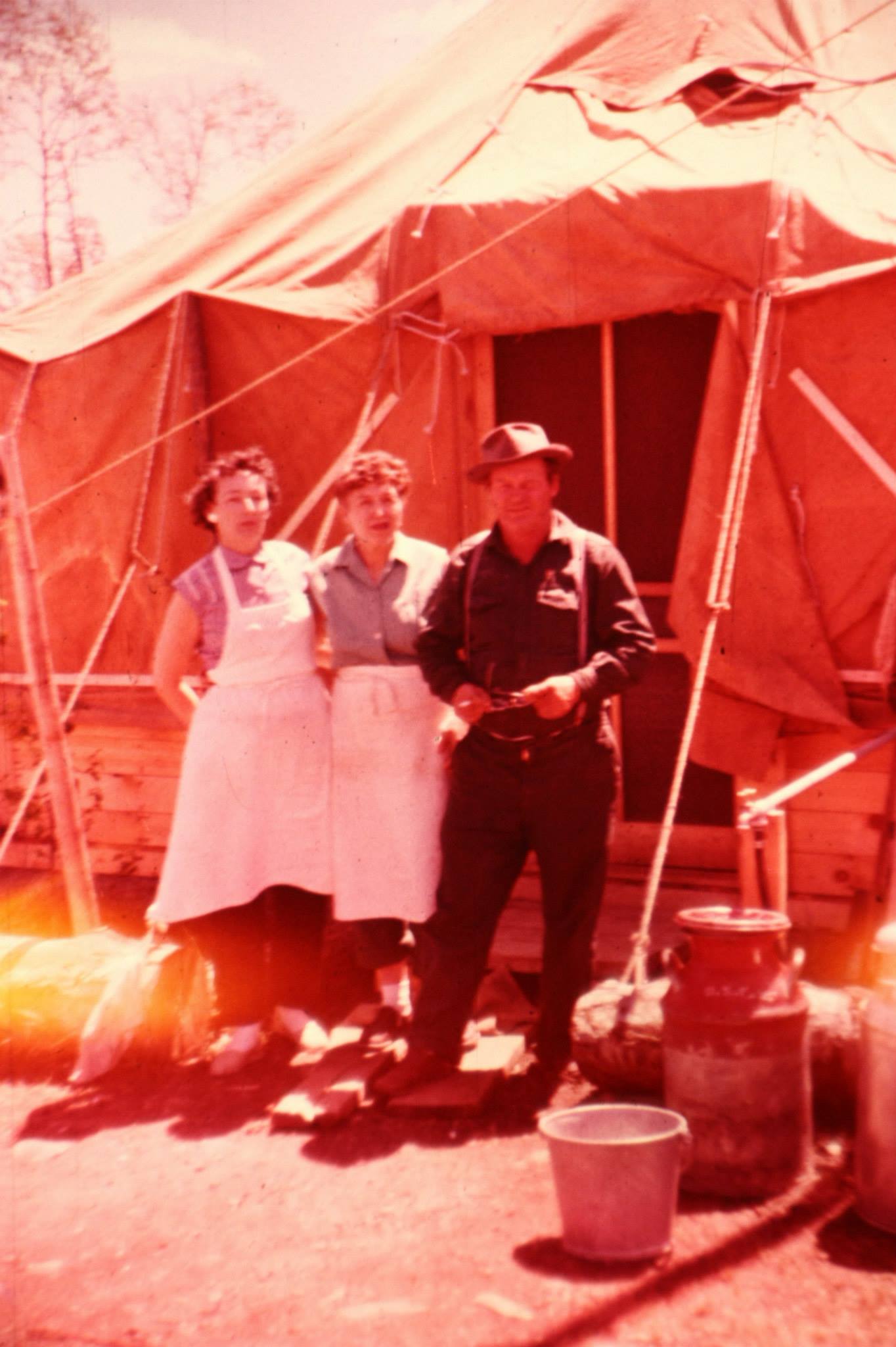
I'm pretty sure this is Camp 5.

Wilderness both captivates your soul and sets it free :)
12/08/2018 11:47AM
Jackpine, what an interesting story! Your folks were tough people, they don't make'em like that anymore. I'll bet your doctor wasn't Doc Grahek, he was at the Shipman Hospital then later the Ely Bloomenson Hospital in Ely. I'll bet your doc was Doc Snyker if you were born in the Winton Hospital. Doc Snyker was also my doc but I was born in 1947 in Ely at home, they were just building the hospital in Winton at that time. So, I've got whiskers on you and you can see what happens when you wait your turn like you did, you had a hospital to be born in, not like me. :-))
I've never heard of the Bogo Camp, but that doesn't mean anything. I have heard of the Boga Lake Camp on the wide part of Perent River, 1 portage off Isabella Lake or the Boze Lake Camp just east of Malberg Lake. But either of those is nowhere near Bugo Lake. Just a thought, do you suppose there were any bugs around Bugo Lake? :-)) That was our question when we first noticed Bugo Lake on our maps.
Where was the North Road bermed up when your dad hauled those antlers out of Arrow Lakes with the bike?
12/08/2018 01:08PM
Tomahawk: "Jackpine, what an interesting story! Your folks were tough people, they don't make'em like that anymore. I'll bet your doctor wasn't Doc Grahek, he was at the Shipman Hospital then later the Ely Bloomenson Hospital in Ely. I'll bet your doc was Doc Snyker if you were born in the Winton Hospital. Doc Snyker was also my doc but I was born in 1947 in Ely at home, they were just building the hospital in Winton at that time. So, I've got whiskers on you and you can see what happens when you wait your turn like you did, you had a hospital to be born in, not like me. :-))
I've never heard of the Bogo Camp, but that doesn't mean anything. I have heard of the Boga Lake Camp on the wide part of Perent River, 1 portage off Isabella Lake or the Boze Lake Camp just east of Malberg Lake. But either of those is nowhere near Bugo Lake. Just a thought, do you suppose there were any bugs around Bugo Lake? :-)) That was our question when we first noticed Bugo Lake on our maps.
Where was the North Road bermed up when your dad hauled those antlers out of Arrow Lakes with the bike?"
Tomahawk, I bet you are right about Doc Snyker. The names Snyker and Grawhak were in my mind and I went with Grahek. My memory isn't what it used to be. I re-listened to my dad's recordings and all he said about the North road being blocked off so he had to park "at the bridge where Isabella spills out toward Bald Eagle.". He did mention "they were up in there planting trees"... ant there was an old camp where Charlie Homerding, Nick Jasper and Walt Knotts and four or five other people were living, so we bummed a ride out of there." So clearly the road wasn't bermed off at that time (1960?). Clearly he couldn't drive in there so I wonder if there was a gate or what. Dad marked Bugo Camp on the map for me, and in 1967 I went with a crew to BWCA and camped right on thr Koma-Malberg rapids. We canoed up to Boze Lake, and my dad's cousin, Bob Lundberg, was with us. He lived in the Boze Lake camp. On the Southeast end of Boze there was a beaver house in a small bay. Bob told us he used to hike over there and fish bluegills while standing on that beaver house. Also on that trip we had minnow traps set on Fantail Lake. Dad showed me the old road where he piled his pulpwood 12 years before. It was about two miles from there to the Bugo Camp (Dad always called it Bogo Camp).
Wilderness both captivates your soul and sets it free :)
12/08/2018 01:53PM
Was everything pulp? Was anything or what was milled for building. I was told in the early years cedar was not cut, it was "junk wood". That is why so many old cedars are standing. Maybe not some much in this area but more to the north.
Funny to think what is now a pma was a work area for the local residents. A play ground for the local kids. And so easy to get to by car or truck.
Funny to think what is now a pma was a work area for the local residents. A play ground for the local kids. And so easy to get to by car or truck.
Raised by wolves!
12/08/2018 03:35PM
I believe just about all of what Tomahawk Timber cut was pulp wood that was railed back to Nekoosa-Edwards paper mills in Wisconsin, if I am incorrect in saying that, someone please straighten me out on that. I know they did take some pine for home building, they had a sawmill at Forest Center where they cut dimensional lumber for home building and home expansion, As families grew they had to make homes larger. It was my understanding that the company put the sawmill in there just for that purpose, from all that I've heard Tomahawk Timber was a good outfit to work for - very high retention rate for employees.
The sawmill was over by the bulk tanks, where the main rail line came in and crossed the North Road. I recall hearing the sawmill was powered by a captured German diesel submarine engine. Anyone else hear that?
The sawmill was over by the bulk tanks, where the main rail line came in and crossed the North Road. I recall hearing the sawmill was powered by a captured German diesel submarine engine. Anyone else hear that?
12/08/2018 03:35PM
ellahallely: "Was everything pulp? Was anything or what was milled for building. I was told in the early years cedar was not cut, it was "junk wood". That is why so many old cedars are standing. Maybe not some much in this area but more to the north.
Funny to think what is now a pma was a work area for the local residents. A play ground for the local kids. And so easy to get to by car or truck."
Jim P. There was a saw mill at Forest Center, so some of the logs were milled. It was located at the West end of the wood yard. I believe the vast majority of wood that was cut was jack pine and spruce pulpwood.
Forest Center Saw Mill

Forest Center Wood Yard (where the BWCA and Pow Wow Trail parking lot is now.

Wilderness both captivates your soul and sets it free :)
12/08/2018 03:54PM
Tomahawk: "Jackpine, you have so many good family memories of that area. You mention Fantail Lake, where was that? And do you recall where on Boze Lake the camp was?"
Tomahawk, I don't have any info on the location of Boze Lake Camp. Fantail Lake is just west of Koma Lake. It's the little pear-shaped oval in the upper left corner of the old map you posted. We used to bushwhack over there from Koma to trap minnows. There are two big White Spruce on the hill about 3/4 of the way that you can see from Koma that we used as landmarks. We'd go to them then angle NW to where the creek runs out towards Koma and put the minnow trap in there. The old road ran right next to the white spruce trees then crossed the creek and headed north. Great place to spot a moose back in the day. You can make out part of the road in this satellite image.

Wilderness both captivates your soul and sets it free :)
12/08/2018 03:54PM
Jackpine, that road must've been bermed sometime after 1967-68. It was even drivable around 71-72 because Leustek's were back on the Quadga Road, logging. There were also wolf trackers driving in their with antennas on their vehicles, I talked to them a few times. So, it would've had to been after 1972 when the road was bermed. The 2 catskinning crews with those 2 International TD-19 dozers were rock raking up there then north of Ferne Lake around 67-68. They had a gate very near where the rail line came in from Island River that they'd have to unlock each day before they went through then lock again after they went through and then drove their panel truck up to Ferne. I remember that panel truck! When they came back they'd take the road that went to the boat landing and stop at the end of the pulp yards, park that panel truck where the rail lines ended and then take out one of those big metal milk cans that they always carried with them. Right where the current portage to Isabella Lake drops down from the former pulp yards, there is a spring to the left as you go down to the lake. Each day the catskinners would fill up that milk can with water for the evening and next day. The spring is still there but needs to be dug out as a lot of leaves have settled in there.
12/08/2018 04:17PM
Good picture of the sawmill. I have a tale to tell that relates to the sawmill. I tried posting this earlier but was having trouble doing that so I'll try again. I know it didn't show up on my computer so if it showed up on yours and you've seen this, just ignore it.
There is a connection to Forest Center and the S/S Edmund Fitzgerald that many are maybe not aware of. Kenny Armogast ran Tomahawk's office at Forest Center and would be in contact with Ray Buroglio in Tomahawk's office in Ely on nearly a daily basis. Ray was a good friend of mine, now passed away, and told me he was talking on the phone with Kenny one day when the phone went dead.
Ray called someone else at Forest Center and told them to go and check on Kenny, Ray thought something bad may have happened to him. They found Kenny dead of a massive heart attack, Kenny left a wife and 2 small children, Mike & Janice. A sad tale? hang on, we're not done yet. Kenny's wife got on at the sawmill but Ray told me it was no life for a young wife and young kids. So, she moved her family back to Iron River, WI where she was from. Mike Armogast grew up and sailed on the Great Lakes, becoming one of the fastest rising officers for Oglebay Norton Company's Columbia Transportation Division. Mike was a 3rd mate on the Edmund Fitzgerald went it went down with all 29 men on November 10, 1975.
12/08/2018 07:29PM
Here is my wolf story from Isabella.
My USFS co-worker played Ring around the Rosey with a big Bull Moose one day.
The next day we went looking for this big Moose at 8:30 am.
We didn't see the Moose in the swamp, but instead saw a really big TImber Wolf. He was sunning himself in the June sun and had no idea we were around.
I said to my co-worker, lets see how close we can get to him. We belly crawled through the swamp grass, covering about 200 feet in 30 + minutes.
We are now about 200 feet give or take away. The wolf knew something was up because he would get up from his sunning bed every once in a while, sniffing at calm morning air,only to lay back in his bed.
Finially we inched closer and my buddy made too much noise, the wolf rose up and scampered off.
That is only one of the two times I have ever observed a wolf close up, when they did not know I was around.
The other time I was trapping Leeches on the White Earth Rez.
A similiar calm, sunny, summer morining I went to check my traps at about 0:600.
I approached the small lake where my traps were and stopped short, to see a lone wolf across this pond barely 250 feet away.
This wolf was walking in the pond about 6 feet from shore turning over rocks.
I watched this for over 5 minutes, it would turn over rocks and move along, guessing he was looking for crayfish, but I really have no idea. Finially I said to myself, I gotta check my traps.
I walked through the Alder into the opening by my canoe. The wolf heard me and scampered off.
May the rivers be crooked and winding, and your portages lonesome, leading to the most amazing view.
12/08/2018 11:08PM
Tomahawk: "Jackpine Jim, You were right on the mark with your location of Camp 5. I have this huge mape with all the road cut by Tomahawk and foung the location of Camp 5. "
Tomahawk, Could you post that entire map? I'd love to see it.
Wilderness both captivates your soul and sets it free :)
12/08/2018 11:11PM
The Great Outdoors: "Tomahawk Timber Co. had their office in Ely, and was located upstairs of Frank's Variety next to the State Theater.
You may want to contact the Trygg Land Office, as they had maps that show logging camps and several Indian Villages in the entire area. I also think they have a book with the info.
There are still some old loggers that worked in those camps, and I know one that was born in a camp next to Insula Lake.
All the Camps had numbers for names, and the history is very interesting."
TGO, Could you share the name of the person born in the camp by Insula? He must be about my age and I might know him.
Jim
Wilderness both captivates your soul and sets it free :)
12/09/2018 08:57AM
Pinetree, there were small portable sawmills and the Kainz family operated a mill for awhile in Ely. That mill was operating even after the '64 Wilderness Act was passed which allowed logging in the portal zone of the BW. Then the '78 Wilderness Law eliminated all logging in the BW and that ended the life of that mill. Early on, before the days of Tomahawk Timber, there were some big mills operating by Swallow-Hopkins in Winton. Knox may have operated one there as well.
12/09/2018 09:02AM
Many posts talk about bushwhacking in to remote areas and that brings to mind following my dad on through some pretty thick bush - and this was long before GPS for sure. He never used a compass that I recall but I distinctly remember him breaking branches of the hazel brush and tag alders. He'd always break them off about chest high and bend them in the direction we were walking. He never said anything about it, but now I realize it was like leaving bread crumbs to find his way back out of those places. I'm curious, do any of you do that?
Wilderness both captivates your soul and sets it free :)
12/09/2018 09:02AM
Many posts talk about bushwhacking in to remote areas and that brings to mind followi g my dad on through some pretty thick bush - and this was long before GPS for sure. He never used a compass that I recall but I distinctly remember him breaking branches of the hazel brush and tag alders. He'd always break them off about chest high and bend them in the direction we were walking. He never said anything about it, but now I realize it was like leaving bread crumbs to find his way back out of those places. I'm curious, do any of you do that?
Wilderness both captivates your soul and sets it free :)
12/09/2018 09:06AM
Interesting encounters, Lindentree. Again, some of these stories remind me of others as well. One day my partner and I were up on the Isabella East Road on a 1972 grouse hunt. The road was in excellent shape then, mostly all gravel that was even being graded at the time. Leustek Logging was cutting up just passed Chickadee Creek on the south side of the road. We were about 1/2 mi. past the 3rd crossing of Tomahawk Creek and came over the top of a pretty good hill, There in the road ahead of us was a huge timber wolf. Where he was standing broadside to us it was a 2 track road with grass coming up the center. He had his back legs in one track and front legs in the other track. To give you a better size of the critter, his legs were straight up and down, completely vertical. So, his legs were about the distance between 2 track tracks, the rest of the body was longer than that. It was near the size of a deer! He had to go way over 120 lbs., he knew we were coming, we never knew he was there until we came over the top of that hill and he was unafraid as we locked stares for what seemed like forever. He wasn't budging so we decided to each fire a warning shot to get him to make a move, We did and he ran off.
About 2 years ago we were coming down the Tomahawk Road in my pickup and got to the end where the Tomahawk met Hwy. 1. There was a hand pump there at one time and recently there have been pulp truck trailers parked there. Standing right in that parking area was a good-sized lone wolf that just stood there as we drove by. We backed up and he never moved then just walked away after a staring contest that must've bored him.
About 2 years ago we were coming down the Tomahawk Road in my pickup and got to the end where the Tomahawk met Hwy. 1. There was a hand pump there at one time and recently there have been pulp truck trailers parked there. Standing right in that parking area was a good-sized lone wolf that just stood there as we drove by. We backed up and he never moved then just walked away after a staring contest that must've bored him.
12/09/2018 12:59PM
Tomahawk: "Pinetree, there were small portable sawmills and the Kainz family operated a mill for awhile in Ely. That mill was operating even after the '64 Wilderness Act was passed which allowed logging in the portal zone of the BW. Then the '78 Wilderness Law eliminated all logging in the BW and that ended the life of that mill. Early on, before the days of Tomahawk Timber, there were some big mills operating by Swallow-Hopkins in Winton. Knox may have operated one there as well."
Thanks,there just had to be with the big white pine era?
12/10/2018 08:40AM
Pinetree, you're right, that was an excellent road, still is at times. The FR 381 Road, it's still known as the Northwest (NW) Road after Northwest Paper Co. had many sales in that area north of the Tomahawk Road, ran north off the Tomahawk at Split Rock Hill. After you cross Snake Creek on the Tomahawk at the bottom of Split Rock Hill, going east toward Forest Center and just before the NW Road at the top of Split Rock Hill is a huge, out of place boulder to the right (south side of the Tomahawk) that has a split in it, that's how the hill got its name. As you go north on the NW Road, it forks about 2 mi. in, going left goes over toward Snake Creek. That is now a portage about another mile down at the berm, getting into Snake Creek, Isabella River and eventually Bald Eagle Lake. That at one time was a road put in by Verne Johnson Logging of Ely and at one time went as far north as Gabbro Lake and connected to the Spruce Road (FR 181). That was an excellent bird road in its day, all overgrown now but still usable in places if you knew the old road. I remember fishing on Bald Eagle during the summer of 1968 when you could hear the chain saws going in that area.
Going back to the NW Road and turning left at the fork takes you all the way back to the Tomahawk Road at Mitawan Creek after crossing both the Little Isabella River and Inga Creek where bridges have long since been taken out, the NW Road skirts the southern edge of the BW in a couple of places. Where the NW Road meets up with the Tomahawk again at Mitawan Crossing and goes south to Isabella it becomes FR 373. Where 373 now meets FR 173 (173 goes toward Sawbill Landing) was the end of the NW Road back in the day. All pretty good grouse hunting areas.
Going back to the NW Road and turning left at the fork takes you all the way back to the Tomahawk Road at Mitawan Creek after crossing both the Little Isabella River and Inga Creek where bridges have long since been taken out, the NW Road skirts the southern edge of the BW in a couple of places. Where the NW Road meets up with the Tomahawk again at Mitawan Crossing and goes south to Isabella it becomes FR 373. Where 373 now meets FR 173 (173 goes toward Sawbill Landing) was the end of the NW Road back in the day. All pretty good grouse hunting areas.
12/10/2018 08:42PM
Pinetree: "Keep the photos and stories of the Forest center up. I wonder when the Tomohawk trail was created itself?"
Tomahawk, This is from Inspector13"s post in 2011 " Scroll down to the years 1945 and 1948 in the link provided. wilbers site" Wilbers
"1948:
Railroad tracks are laid to Lake Isabella and construction begins on Forest Center, a logging town carved out of the southern edge of the roadless area, in preparation for logging by the Tomahawk Kraft Timber Co. A large turnaround and sawmill are built by the lake, and eventually more than 50 homes – as well as a church, restaurant, school, store, and recreation hall – are built, along with five smaller camps in the area. Logging by Tomahawk ends in 1964, when loggers reach a buffer zone created by the Shipstead-Nolan Act. By 1965 the town is gone, though the alteration in the southern boundary of the present Boundary Waters Canoe Area Wilderness remains. "
I know the Tomahawk Road existed in some form on West of the Island River in 1945 because my dad told me they "In 1945, I think, we moved from Little Bear Lake Camp to the Smithville Camp up on the highway, or the main road which we called the highway."
Wilderness both captivates your soul and sets it free :)
12/11/2018 10:59AM
It's most interesting that this article makes mention of the Shipstead-Nolan Act ending it all for Tomahawk Timber. I recall reading the it was the '64 Wilderness Act that pretty much ended it all for Tomahawk. Although the '64 Act allowed logging in the Portal Zones (away from the Interior Zones where the canoe routes were), it was not enough to keep Tomahawk interested. I might be wrong here, but I thought the Shipstead-Nolan Act only provided for a either a 400' or 500' buffer around all lakes and waterways and Tomahawk had done that all along whenever they came to a lake or waterway.
I also recall reading that Tomahawk had planned to be in the area much longer than it was. Afterall, they thought Forest Center was a company town that had much more of a future than the mere 20 yrs. or so that it was around. It was the U. S. Congress that ended it all so soon.
I also recall reading that Tomahawk had planned to be in the area much longer than it was. Afterall, they thought Forest Center was a company town that had much more of a future than the mere 20 yrs. or so that it was around. It was the U. S. Congress that ended it all so soon.
12/11/2018 11:19AM
Back in 1971 the first Moose season in Minnesota two brothers from Ely got a permit. They were also loggers and logging within the BWCA-Pow Wow area.
They went to moose orientation and were told they couldn't use their vechile to pursue a moose within the BWCA or haul it out. They had a permit for logging only.
Well the brothers shot a moose along the Pow Wow trail and hauled it out in a vechile.
A violation the Game wardens and USFS told them ahead of time repeatly don't do it.
Well they lost their moose by confiscation and also fines.
12/11/2018 12:19PM
Pinetree, We just happened to be grouse hunting on the North Road one day during that moose hunt. We had run into a Forest Service employee that I knew, said he was watching at the gate to make sure no one hauled a moose out illegally. Many years later on I had talked to one of the guys involved and the understanding that he gave me was the judge threw the case out. The judge, according to what he told me, said the boundaries where the moose was shot were not defined well enough and was a judgement call by the employee pressing the charges. The guy also said this happened up on the East Road, somewhere around Kawishiwi/Perent Lake.
12/11/2018 01:00PM
Tomahawk: " It's most interesting that this article makes mention of the Shipstead-Nolan Act ending it all for Tomahawk Timber. I recall reading the it was the '64 Wilderness Act that pretty much ended it all for Tomahawk. Although the '64 Act allowed logging in the Portal Zones (away from the Interior Zones where the canoe routes were), it was not enough to keep Tomahawk interested. I might be wrong here, but I thought the Shipstead-Nolan Act only provided for a either a 400' or 500' buffer around all lakes and waterways and Tomahawk had done that all along whenever they came to a lake or waterway.
I also recall reading that Tomahawk had planned to be in the area much longer than it was. Afterall, they thought Forest Center was a company town that had much more of a future than the mere 20 yrs. or so that it was around. It was the U. S. Congress that ended it all so soon."
I think what they are saying is that the Shipstead-Nolan Act, which was passed in 1930, fifteen years before the Tomahawk Timber sale, created a buffer zone that would not allow for further logging. By 1964 the Tomahawk Timber Co reached that boundary of protected virgin timber, so the Forest Service could not set up any additional timber sales.
The wording is kind of misleading though, because if all that was needed was pulp and 2nd growth was OK, that wording shouldn't have been used in that paragraph.
12/11/2018 01:52PM
Tomahawk: "Didn't the Shipstead-Nolan create the buffer zone around waterways?"
Yes. A 400ft buffer around all waterways. I can’t find any other prohibitions when it comes to logging, so now I am really confused why the Wilber’s website says that. It is usually accurate. This map, provided by jwartman, shows No Cut Zones were established for 1965 and 1975.
12/11/2018 02:15PM
Tomahawk: "Pinetree, We just happened to be grouse hunting on the North Road one day during that moose hunt. We had run into a Forest Service employee that I knew, said he was watching at the gate to make sure no one hauled a moose out illegally. Many years later on I had talked to one of the guys involved and the understanding that he gave me was the judge threw the case out. The judge, according to what he told me, said the boundaries where the moose was shot were not defined well enough and was a judgement call by the employee pressing the charges. The guy also said this happened up on the East Road, somewhere around Kawishiwi/Perent Lake."
It could of been,but they must of lost the moose. That is coming from reliable DNR employees who were there at that time.. The location I understood was just in the BWCA. Wasn't quite sure which road,assumed the Pow Wow
12/11/2018 02:30PM
inspector13: "I was south of Cunningham lake in 1976 seen the truck driver hauling logs,said that was the last load going out of there.
With further reading, it looks like a succession of 1964 Wilderness Act, the Selke Committee, Judge Miles Lord, and the 1978 Wilderness Act, ended logging in the BWCA.
"
12/11/2018 02:30PM
inspector13: "I was south of Cummings lake in 1976 seen the truck driver hauling logs,said that was the last load going out of there.
With further reading, it looks like a succession of 1964 Wilderness Act, the Selke Committee, Judge Miles Lord, and the 1978 Wilderness Act, ended logging in the BWCA.
"
12/11/2018 03:08PM
Inspector 13, I'm not sure exactly when but somewhere after the '64 Wilderness Act and the '78 Wilderness Act there was allowable logging in the BW. Portal Zones in the BW were established where logging was permitted, these were away from the canoe routes. The Interior Zones were also established that included no cutting in the BW at all. The 400' Reservation Boundary was enforced wherever logging came near a body of water of any kind (lake, river, creek, etc.).
12/11/2018 03:18PM
Tomahawk: "Pinetree, interesting, where is Cunningham Lake and I wonder where this guy was hauling from?"
Big whoops on my part.
I meant Cummings lake. You went in on the west side of Burntside on the Wolf lake road to the end.
There was and is a huge chunk of Mn State land-forest designation there. Much of the logging took place there. Phantom lake and up towards Cummings lake-also a road branch south of Western lake.That was real good grouse hunting also. About all Ruffs. They logged up to maybe 0.5 miles from Cummings lake.
That day in 1976 was later in November because deer season was later I believe that year because of fire season-severe drought? They even closed fishing season that fall(made no sense but they did)
Anyway didn't get a deer. But was walking thru a cutting and all of a sudden I heard this clicking or noise of something hitting brush and making noise. All of a sudden three monster bull moose walked out all had that like a double shovel or antlers sticking out by the base. Very very wide racks. Like a old Alaskan moose and these antlers were just as big. Most spectacular wildlife view I ever seen in Minnesota.
Than the Trails-roads were real good and fair number of deer around.
For some years after would setup at Phantom and camp and grouse hunt.
12/11/2018 04:01PM
Tomahawk: "Inspector 13, I'm not sure exactly when but somewhere after the '64 Wilderness Act and the '78 Wilderness Act there was allowable logging in the BW. Portal Zones in the BW were established where logging was permitted, these were away from the canoe routes. The Interior Zones were also established that included no cutting in the BW at all. The 400' Reservation Boundary was enforced wherever logging came near a body of water of any kind (lake, river, creek, etc.)."
According to this when the 1978 Act was signed by Jimmy Carter “the Secretary of Agriculture must terminate all timber sale contracts in the BWCA within one year of its passage. The logging in virgin forests was to terminate immediately. The one-year termination period allows contracts to expire and for the logging companies to take corrective steps to clean up and restore tracts of timber which were harvested heavily. The U.S. government paid compensation for any timber contracts terminated or modified by this Act.”
But yes it looks like logging was gradually ended between 1964 and 1978.
I remember pro logging signs out on the Gunflint Trail in 1983, so I’m not sure if the logging companies were still in there or that they wanted to modify the 1978 Act.
12/11/2018 04:13PM
The last logging in the BWCA took place after a timber sale in 1978-79 160 acres of virgin pine from a St. Louis County timber sale sold, than one year allowed for cleanup. This wasup by Big Moose lake a late addition to the BWCA.
There was a total of 93 years of logging in what is now called the BWCA-that was the end.
There was a total of 93 years of logging in what is now called the BWCA-that was the end.

12/11/2018 08:29PM
JackpineJim: "Pinetree: ""
I love the maps you guys are posting."
Curious, why wasn't there more Rail Road logging previous to the Tomahawk sale in the area that is now the BW?
Where I have my cabin by Itasca State Park, the old logging rail lines can still be seen easily when walking through the woods, I have an old RR- spike from the early 1900's.
One rail line splits my property and is now a DNR Forest road.
Roads around Forest Center,
I remember one time when I was fighting the Pagami Fire, I was SE of Isabella Lake but before Comfort Lake. I was crawling through the brush with a couple of Smoke Jumpers.
We were flagging fireline for the hand crews to come up behind us. Suddenly I came aross an old road heavily over grown but, was as clear as the nose on my face. (I have a big nose). This road may have been able to hold small trucks.
We didn't use this road as a fireline, but cut our fireline right across it as we followed the fires path.
Your map doesn't go that far over to the East to show the road I came across.
But back to my OP.
How come more rail road logging was not done in the BW area north of Forest Center or other areas previous to the 1930's in the Superior NF?
May the rivers be crooked and winding, and your portages lonesome, leading to the most amazing view.

12/11/2018 09:20PM
Linden you talk about old railroad grades by in your area. South of Longville they have a road called the old grade. There was the main rail line but branches or side tracks quite common for logging. Big logging railroad lumber yards existed around there.
Some of it might be logistics where you can run a line and how far. Bemidji-Cass lake-Remer were big logging areas and had lines.
Some of it might be logistics where you can run a line and how far. Bemidji-Cass lake-Remer were big logging areas and had lines.
12/12/2018 08:58AM
LindenTree: "How come more rail road logging was not done in the BW area north of Forest Center or other areas previous to the 1930's in the Superior NF?"
These are all just educated guesses, but it takes money to lay those lines. First off, the topography of the land is different. It seems it was hard enough just to put in winding roads where vertical grade didn’t matter as much. Maybe the concentration of the most valuable tree types was less there too.
Secondly the distance to major milling and lumber markets are greater. The southern halves of St. Louis, Lake, and Cook counties are riddled with old rail lines which are closer to Duluth and Cloquet. One major lumber consortium I know about, headed by Duluth banker Albert Ordean, was more interested in the White Pine lands closer to Lake Superior. He owned my land at one time.
Thirdly, railroad builders and investors in Northeast MN were more interested in hauling out iron ore than logs. Many of the rail lines you mention further to the west were Edward Backus’s interests, the guy that wanted to dam up the Boundary Waters.
Here is some interesting reading.
12/12/2018 09:06AM
Inspector 13 & Lindentree, I think you have listed a lot of good reasons why the rail line ended at Forest Center. I remember reading that it was tough enough putting the line that far and going further north there was even more swampland/lowland and marshes to cross. Laying corduroy first then the rail line was something the Duluth, Missabe & Iron Range Railway was not interested in doing. Especially if the wood could be trucked out over winter roads once they froze and brought to the rail head at Forest Center. That was a no-brainer as far as the D.M.&I.R. was concerned. Had that been iron ore in there it would've been a different story, I have to believe. Iron ore is the cash cow and pulpwood, not so much.
12/12/2018 09:23AM
Pinetree, Cummings Lake I know of well. I've got a funny story here. We were in there a couple of times in June after the insistence of one of our 6 man crew to go after the bass fishing in there. He had been in there with another party years before and had tremendous bass fishing so we went for no other reason than to shut him up. When we got in there the bass fishing was terrific, each cast had one on, threw them all back. One day he suggests we go to Buck Lake, about a 1 1/2 mi. portage to the west. He claimed that to be one of the #1 lakes in MN for huge northerns. Me, being more interested in walleyes and not northerns, agreed to go in there as did the rest of our crew, more less to shut him up once again. When we got in there we caught nothing BUT walleyes, most were 1 1/2 - 2 lbs. Beautiful walleyes! We never let him forget about that one, it was brought up often around the campfire on many June trips after. I still giggle over that one.
That first trip was in 1973, we went back at the insistence of the same guy around 1976 or so. We asked him if he wanted to go back into Buck Lake, which we heard was the #1 lake for big northerns in MN. No comment from him, he just smiled. They were logging not far off Cummings Lake then, all night long. Maybe that cutting operation was part of that last load that you talked about. It was interesting that they had the skidders going back & forth all night, almost like they were in a hurry to get that contract done. That was know as the Palmquist Cutting area.
That first trip was in 1973, we went back at the insistence of the same guy around 1976 or so. We asked him if he wanted to go back into Buck Lake, which we heard was the #1 lake for big northerns in MN. No comment from him, he just smiled. They were logging not far off Cummings Lake then, all night long. Maybe that cutting operation was part of that last load that you talked about. It was interesting that they had the skidders going back & forth all night, almost like they were in a hurry to get that contract done. That was know as the Palmquist Cutting area.
12/12/2018 09:30AM
Some of the lines in like Cass county were across sandy areas and yes swamps but not much for hills or rock ledges etc. where very little if any prep needed to be done.
There is some fascinating film on the huge mill and stacked logs that stretched forever and all that burnt in a big fire.
There is some fascinating film on the huge mill and stacked logs that stretched forever and all that burnt in a big fire.
12/12/2018 09:45AM
Pinetree, according to what the guy told me that shot the moose, it was not off the Pow Wow Trail. He claimed it was over between Perent and Kawishiwi Lakes, the Pow Wow didn't come close to that (at least 2-3 mi. away). Besides, the Pow Wow Trail system was not created until the early 80s and it's further most eastern part ended just before Chickadee Creek where the trail went north to Chickadee, Fungus & Whittler Lakes before going NW back to the Isabella North Road.
I wish I could remember more of what the guy told me about the moose, such as being able to keep the moose or not, he was pretty chatty at the time. But you're probably right, he had to cough it up.
I wish I could remember more of what the guy told me about the moose, such as being able to keep the moose or not, he was pretty chatty at the time. But you're probably right, he had to cough it up.
12/12/2018 09:53AM
Pinetree: "
Linden a little more east here."
Looking at it closer I bet I was on one of those roads heading east out of Forest Center just before or Northeast of Comfort Lake. I didn't look at the road bed very close because we had to keep moving so I don't know if it was a main road, but I kinda doubt it.
Funny story.
I was setting up to scout that fireline with the two Smoke Jumpers and another firefighter. As we were getting ready I took off my bulky fire gear back pack and put on a belt with my fire shelter and a day pack on. We had about 7 miles to bushwack toward Comfort Lake. The jumpers looked at me funny and asked me why I was ditching my pack. I replied.
I'm getting ready to bushwack, and bushwack we did. Many times we had to crawl on the ground to make it through the Alder or regeneration Balsam Fir. We flagged line to Comfort Lake and caught a ride back to our starting point. I think I had over 14 miles of fire hose lays on my setion of line. WIth Mark III water pumps every couple of miles or less.
May the rivers be crooked and winding, and your portages lonesome, leading to the most amazing view.
12/12/2018 09:58AM
The roads were there but not called Pow Wow as you know. That is a good question when did they start calling it the Pow Wow trail?
When I first mentioned it the exact location in the BWCA was I was quite unsure of. My info is from DNR staff located in Ely at the time who said they were stopped in the BWCA and lost the Moose and told what me else happen but not sure on lost of vechile etc. or fine?
The location was where these brothers were logging and they did log some north of the Forest center but yes probably logged to the east like you said also.
12/12/2018 10:08AM
LindenTree: "Pinetree: "
Linden a little more east here."
Looking at it closer I bet I was on one of those roads heading east out of Forest Center just before or Northeast of Comfort Lake. I didn't look at the road bed very close because we had to keep moving so I don't know if it was a main road, but I kinda doubt it.
Funny story.
I was setting up to scout that fireline with the two Smoke Jumpers and another firefighter. As we were getting ready I took off my bulky fire gear back pack and put on a belt with my fire shelter and a day pack on. We had about 7 miles to bushwack toward Comfort Lake. The jumpers looked at me funny and asked me why I was ditching my pack. I replied.
I'm getting ready to bushwack, and bushwack we did. Many times we had to crawl on the ground to make it through the Alder or regeneration Balsam Fir. We flagged line to Comfort Lake and caught a ride back to our starting point. I think I had over 14 miles of fire hose lays on my setion of line. WIth Mark III water pumps every couple of miles or less."
Sounds like a calorie burner workout.
12/12/2018 10:19AM
The location of the moose in question that the shooter gave me was close to the Isabella East Road at it's far eastern end. Yes, you are right, it was in the BW and there a lot of roads off the East Road in that area.
When we were bird hunting and first noticed the old roads had been cut from overgrowing, we went to the Isabella Ranger Station which was still there at the time. Later on that was absorbed by the Kawishiwi and Tofte Districts. At the Isabella Station the guy in charge of the cutting told us that the cutting we had seen was now the Pow Wow Trail System and gave us each a map.The date on the map was around 1980 or so, it's hard to read the year. So, the Pow Wow didn't come into reality until the early 80s would be my guess.
When we were bird hunting and first noticed the old roads had been cut from overgrowing, we went to the Isabella Ranger Station which was still there at the time. Later on that was absorbed by the Kawishiwi and Tofte Districts. At the Isabella Station the guy in charge of the cutting told us that the cutting we had seen was now the Pow Wow Trail System and gave us each a map.The date on the map was around 1980 or so, it's hard to read the year. So, the Pow Wow didn't come into reality until the early 80s would be my guess.
12/12/2018 10:34AM
Tomahawk: " The location of the moose in question that the shooter gave me was close to the Isabella East Road at it's far eastern end. Yes, you are right, it was in the BW and there a lot of roads off the East Road in that area.
When we were bird hunting and first noticed the old roads had been cut from overgrowing, we went to the Isabella Ranger Station which was still there at the time. Later on that was absorbed by the Kawishiwi and Tofte Districts. At the Isabella Station the guy in charge of the cutting told us that the cutting we had seen was now the Pow Wow Trail System and gave us each a map.The date on the map was around 1980 or so, it's hard to read the year. So, the Pow Wow didn't come into reality until the early 80s would be my guess. "
I didn't start there until the 80's. Didn't they move the trailhead out to the Isabella lake parking lot and blocked the road going to the BWCA edge the year of or after that guy got lost along the Pow Wow. I believe they did it so they would more easily know when someone is back in there.
I remember early 90's that trail going up to the berm and the POW WOW we would get there and there would be 3-4 trucks with campers people sleeping in them and getting ready to go hunting in some of the good years. You usually lost everybody by the fork going to Diane or the other way to Pose.
12/12/2018 04:53PM
Pinetree, I don't believe that trail head was moved because the guy was lost up there. When they moved it, they had the trail head open as well as that road where guys would drive up to the berm and they'd park their campers. A very reliable source at the time (retired FS employee), said they dug up that road that went into the berm because there were more & more complaints, mostly coming from hikers that would start at the parking lot that had no idea of the history of the area. They had no idea the Pow Wow Trail System was originally part of a road system put in by Tomahawk Timber, so when they walked on the trail from the parking lot down the old railroad beds (this should've been some sort of clue to them) and came to the road with parked campers they were not only mystified but irked. They thought they were headed off into a wilderness somewhere and end up coming to a road with campers parked on it. More and more complaints led to that road to be torn up. I would be out bird hunting and run into hikers that were perplexed by that very thing. More often than not would I have to set them straight on all of that. Some were downright mad. So, I really don't think that trail head was changed because of the lost hiker, that's the first time I've heard that.
12/13/2018 10:17AM
You know the log cabin on the edge of Two Harbors that is used for a tourist information building. Its just north of town on the Lake side of US 61.
One of the foresters from Tofte/Isabella told me that this building used to be a forest Ranger Guard cabin on Cloquet Lake, that was moved there. Anyone else have information regarding that? The cabin sure has the CCC look to it.
Cloquet Lake is 5+ miles South of the town of Isabella, and West of Murphy City.
May the rivers be crooked and winding, and your portages lonesome, leading to the most amazing view.
12/13/2018 07:06PM
Thanks Inspector, I knew I could count on you, especially since it is in your wheel house.
I remember seeing footings on Cloquet Lake, just don't remember there being a fire tower in that area.
I remember seeing footings on Cloquet Lake, just don't remember there being a fire tower in that area.
May the rivers be crooked and winding, and your portages lonesome, leading to the most amazing view.
12/14/2018 09:02AM
I don’t remember seeing one there when I first visited in the early 1990’s. I didn’t hang around though since a lot of activity was going on. Maybe what I was seeing was the start of the gravel pit between Cloquet and Katherine Lakes? The place I looked at in 2003 was about 3/4 of a mile south of the Cloquet Lake public access.
12/14/2018 09:52AM
inspector13: "
I don’t remember seeing one there when I first visited in the early 1990’s. I didn’t hang around though since a lot of activity was going on. Maybe what I was seeing was the start of the gravel pit between Cloquet and Katherine Lakes? The place I looked at in 2003 was about 3/4 of a mile south of the Cloquet Lake public access.
"
It wasn't the place where the survivalists were waiting for the world to end when Y2K
hit was it. You ever see that place/compound?
It was a little sketchy, to use a word thats floating around :-)
May the rivers be crooked and winding, and your portages lonesome, leading to the most amazing view.
12/14/2018 11:03AM
Jackpine jim, What time of the year was that when your mom had to go in the hospital? Must've been winter if they couldn't get Uncle Ted's car to start. She didn't drive all that way by herself did she?
In all those years since 1971 that I've been bird hunting north of Isabella Lake, I've certainly come across some critters and some interesting finds. One of the finds were Dray Bunks. There were quite a number of them in a grassy area about halfway between where the road turned west toward Quadga Lake off the North Road and Quadga Lake itself. They were laying in that open, grassy area on the north side of the road, also found part of an old shovel there as well. I guessed there must've been some sort of settlement there at one time but that's just a guess. There were horses there at one time for sure, a lot of oat grass around. Supposedly from what I had heard from a guy who worked in the area for Tomahawk Timber, these heavy metal brackets would be placed at the ends of the dray (sled) to build up the sides of the dray so vertical posts could be added when dragging out logs. Possibly a few of you out there have also seen these in that very field.


And then I came across a most interesting find of all, a Set Vice. I found this back off the road that went north to Insula/Hudson Lakes. It was just north of where the trail went west toward Pose Lake (in that grassy field). Going north of this field at least 200 yards or so I happened to look off the road to the west. And there, about 100' off the Insula/Hudson Road, was something that appeared to be a grouse sitting on a tree stump. From that distance I couldn't tell what it was, I was now thinking it wasn't a grouse at all so I walked in toward it, waiting with my shotgun at the ready for a flying shot as the bird flew off the stump, just in case it decided to turn into a grouse:-)) Been there, done that! As I got closer I could see it wasn't a bird at all, the closer I got the more puzzled I became. When I got right up to it I was even more puzzled, really scratching my head now. At first I thought it was some form of early chainsaw art. But the same guy that told me about the Dray Bunks said this was a Set Vice after showing him a picture of it. To me it looked like this upside down pyramid was one of those steel splitting wedges that had been left in this tree stump, long forgotten. When I tried to pick the "splitting wedge" out of the stump I realized that it was also wood and all part of the stump. This was really spooky now after realizing it wasn't a steel splitting wedge at all. The whole structure was a single piece, all one carving! Now I was really confused as to what this was, but whatever it was it had been there for a LONG,LONG time! The guy told me that this was from the days of the 3' long buck saws, there was a cut in the top of this "pyramid" where the back of the saw would slide into. With the saw teeth now facing upward, the teeth could be set giving the sawyer a better cut into a tree. I had found not an early wood sculpture but a device to set saw teeth, no chainsaw art but something well before chainsaws were used around here. From the best info I could find, this area had been cut in the late 40s-early 50s, I discovered the Set Vice in 2008. Anyone else ever come across this very device in this spot or one like it? I'm hoping that either Jackpine Jim or Pinetree have stumbled across this as well, I don't want to be the only one. Anyone else seen this? I also understood they had these in a number of locations. In all the times I had come by this very spot I had never seen it. In my early days of 1971 when I first had come by here, the trees were all small and low to the ground with their branches and nearby brush was all hiding the Set Vice. As the trees grew taller, the lower branches must've died off and the brushy areas next to the tree also died off from lack of sunlight as the trees grew taller. The day I saw it the sun was just shining on it right so could finally see it. There was no evidence of any buildings around the Set Vice, the adjacent jackpine & spruce were at least 15" across so it had been a long time if any buildings had been here. I'm guessing there were buildings here at one time as there was also a lot of oat grass around from the horses.


12/14/2018 11:52AM
I never heard about that, so I doubt it. The real estate agent in Silver Bay told me a little about the cabin’s short history. He said the owners hauled everything in there via Heffelfinger Road by horse team in the winter. It was heated with a stove like Hobbydog’s, but it was much more ornate.
I don’t think it was survivalists I saw in the 90’s either, unless they were putting in an underground bunker. (Cats, dump trucks, etc.)
Speaking of sketchy people. It seems the Rainbow People have rendezvous' deep in the woods every 5-10 years or so. There was one in the Grand Marais area this past summer. I read a drug addict not associated with them, but welcomed by them, attacked someone.
12/14/2018 12:14PM
Inspector,
A group of survivalists 3-4 families if I rremember right set up a ramshackle compound of poorly built, cabins out of demensional lumber in the late 90's.
They thought the world was going to shut down because the computers were not going to be able to switch the year Y2K. When Y2K didn't happen they moved away and left their buildings to rot.
I can't remember exactely where it was, somewhere off the 102 road on the East side around Kathrine and Cloquet Lakes. I never got to Cloquet Lake much because it was too far in if we got a fire call, and it was technically in LaCroix Ranger District, not Tofte.
May the rivers be crooked and winding, and your portages lonesome, leading to the most amazing view.
12/14/2018 12:56PM
Were they squatting? There is a lot of private land around there. According to the 2014 Plat book, a lot of the land between Cloquet and Katherine Lake is owned by "The People’s Bank of WI". That is also were what now looks like a gravel pit is located. Maybe they defaulted? If you look at recent satellite images you can see quite a few nice places around there. It is kind of amazing, being that far from a paved road.
12/14/2018 01:58PM
inspector13: "
Were they squatting? There is a lot of private land around there. According to the 2014 Plat book, a lot of the land between Cloquet and Katherine Lake is owned by "The People’s Bank of WI". That is also were what now looks like a gravel pit is located. Maybe they defaulted? If you look at recent satellite images you can see quite a few nice places around there. It is kind of amazing, being that far from a paved road.
"
Pretty sure they owned the land, could be the bank's now.
Another resident around Kathrine Lake area had a roomate.
They spent a winter up by International Falls 2004 ish. Guess he got cabin fever and killed his roomate, leaving him in an abandoned car that was in the woods.
Authorities found the frozen body a couple months later.
May the rivers be crooked and winding, and your portages lonesome, leading to the most amazing view.
12/14/2018 02:33PM
I’m glad I picked my current place then! Neighbors not too crazy, and I can get there in the winter. Weird thing. One sister knows the guy that bought the property south of me. Another sister knows the guy a few miles north on the shores of the Langley River. A co-worker has an uncle on Kane Lake. And there's only 35 other people at this company.
Sorry Tomahawk. Cool find!
12/15/2018 02:50PM
Tomahawk: "Jackpine jim, What time of the year was that when your mom had to go in the hospital? Must've been winter if they couldn't get Uncle Ted's car to start. She didn't drive all that way by herself did she?
In all those years since 1971 that I've been bird hunting north of Isabella Lake, I've certainly come across some critters and some interesting finds. One of the finds were Dray Bunks. There were quite a number of them in a grassy area about halfway between where the road turned west toward Quadga Lake off the North Road and Quadga Lake itself. They were laying in that open, grassy area on the north side of the road, also found part of an old shovel there as well. I guessed there must've been some sort of settlement there at one time but that's just a guess. There were horses there at one time for sure, a lot of oat grass around. Supposedly from what I had heard from a guy who worked in the area for Tomahawk Timber, these heavy metal brackets would be placed at the ends of the dray (sled) to build up the sides of the dray so vertical posts could be added when dragging out logs. Possibly a few of you out there have also seen these in that very field.
And then I came across a most interesting find of all, a Set Vice. I found this back off the road that went north to Insula/Hudson Lakes. It was just north of where the trail went west toward Pose Lake (in that grassy field). Going north of this field at least 200 yards or so I happened to look off the road to the west. And there, about 100' off the Insula/Hudson Road, was something that appeared to be a grouse sitting on a tree stump. From that distance I couldn't tell what it was, I was now thinking it wasn't a grouse at all so I walked in toward it, waiting with my shotgun at the ready for a flying shot as the bird flew off the stump, just in case it decided to turn into a grouse:-)) Been there, done that! As I got closer I could see it wasn't a bird at all, the closer I got the more puzzled I became. When I got right up to it I was even more puzzled, really scratching my head now. At first I thought it was some form of early chainsaw art. But the same guy that told me about the Dray Bunks said this was a Set Vice after showing him a picture of it. To me it looked like this upside down pyramid was one of those steel splitting wedges that had been left in this tree stump, long forgotten. When I tried to pick the "splitting wedge" out of the stump I realized that it was also wood and all part of the stump. This was really spooky now after realizing it wasn't a steel splitting wedge at all. The whole structure was a single piece, all one carving! Now I was really confused as to what this was, but whatever it was it had been there for a LONG,LONG time! The guy told me that this was from the days of the 3' long buck saws, there was a cut in the top of this "pyramid" where the back of the saw would slide into. With the saw teeth now facing upward, the teeth could be set giving the sawyer a better cut into a tree. I had found not an early wood sculpture but a device to set saw teeth, no chainsaw art but something well before chainsaws were used around here. From the best info I could find, this area had been cut in the late 40s-early 50s, I discovered the Set Vice in 2008. Anyone else ever come across this very device in this spot or one like it? I'm hoping that either Jackpine Jim or Pinetree have stumbled across this as well, I don't want to be the only one. Anyone else seen this? I also understood they had these in a number of locations. In all the times I had come by this very spot I had never seen it. In my early days of 1971 when I first had come by here, the trees were all small and low to the ground with their branches and nearby brush was all hiding the Set Vice. As the trees grew taller, the lower branches must've died off and the brushy areas next to the tree also died off from lack of sunlight as the trees grew taller. The day I saw it the sun was just shining on it right so could finally see it. There was no evidence of any buildings around the Set Vice, the adjacent jackpine & spruce were at least 15" across so it had been a long time if any buildings had been here. I'm guessing there were buildings here at one time as there was also a lot of oat grass around from the horses.
Tomahawk,
It was the first of August when uncle Ted's car wouldn't start, so couldn't blame it on the cold. Mom didn't drive alone to the hospital. I've never run across the Set Vice that I recall. I wonder why the upside down pyramid shape was necessary. Dad told me he used a crosscut saw when he first started logging with his cousin, but never mentioned such a device. I've seen many a dray in action, but wouldn't recognize a dray bunk if I saw one until you posted this picture - Thanks for that. As for the oat grass, that gives away the location of the old horse barns. I've shot quite a few birds near the oat grass over the years. Jim
Wilderness both captivates your soul and sets it free :)
12/16/2018 08:54AM
Jackpine, my thoughts exactly, why the upside down pyramid shape? I'm guessing there was a reason for it though. I'm sure it wasn't done to be "cute" or "creative," there just wasn't the time for that sort of thing. Everything was done for a purpose.
The spot where I mentioned that there were quite a number of these Dray Bunks laying around in that grassy field was a very good area to find birds, just like you said, Jackpine. The particular spot that I mentioned on the north side of the road, on the opposite side of the road, the south side, had an excavation pit that was dug when they built the road. It usually held water and also seemed to hold birds more often than not. About a hundred yards on each side of that field & water hole was a good spot to find birds through the years. Some of you out there that traveled that road to Quadga Lake may also recall that lone Dray Bunk in that wide part of the road (they'd usually be spruce grouse around there, sometimes big coveys), leaning up against that tree a few blocks west of Diana Lake. I'm guessing it was somebody's souvenir and had tried to carry it out. Those Bunks were HEAVY! There was a good reason it didn't go much further from that spot for some time but then it did disappear after what I recall as being about 2-3 yrs.
Jackpine, I was hoping that you had somehow stumbled across that Set Vice that I had found. I'd like to have someone else beside my partner & I to appreciate something as historical as that. I'm still hoping Pinetree may have seen it, or anyone else out there reading this. I fear now after Pagami that it might be ashes.
12/16/2018 09:16AM
Spartan 1, did your dad's Set Vice have the pyramid shape to it? Just curious, there had to have been a reason the that shape in the one that I found. Did your dad call it a Set Vice? Where did you live, were you also out in the Forest Center area? Good to hear from someone else who knew about Set Vices!
12/16/2018 09:23AM
Spartan 1, You correctly spelled Set Vise, the guy that gave me the info on all this spelled it Set Vice, I should've caught that. The same guy told me about Drey Bunks which I caught and correctly spelled Dray Bunks. Anyway, thanks for the correction!
12/16/2018 01:58PM
Tomahawk: "Spartan 1, did your dad's Set Vice have the pyramid shape to it? Just curious, there had to have been a reason the that shape in the one that I found. Did your dad call it a Set Vice? Where did you live, were you also out in the Forest Center area? Good to hear from someone else who knew about Set Vices!"
It was just a 12 to 14 inch post with a slot, no pyramid shape. Maybe the flat area was used to hold files and tools.
We were located in the Thumb of Michigan and we didn't have a name for the post.
12/16/2018 03:56PM
Here is a story my Dad told about trapping up north of Lake Isabella that you might enjoy.
Trapping in the Roadless Area;
“In the spring of the year the company got in the habit of having you work three days a week. Or sometimes - one spring was bad - they had you... 7 1/2 cord a week is all you could cut. It made it pretty tough living then. Then I started trapping a little areas around Camp 6 here and there [1959 and 1960]. I got a few fox, I got another mink or two, but as long as you could work, a guy worked, you know, you didn't take much time for trapping. But, little by little I gathered up some traps. I think I had 25 traps at one time. I got 15 traps from Reno Hennenen, he used to trap, he said, years before. Anyway, I got a few beavers down by Camp 6. "
First year trapping in the Restricted Area (1961): "And then [in 1961] me and old George Klaus, he wanted to go trapping. He'd made a two wheeled cart out of a home made axel, a couple bicycle wheels he bought, had a box built on it on it, and a piece of metal pipe bent into a u-shape for a handle. We put our traps in the box, and some groceries, a couple of sleeping bags, a piece of plastic for a tent, and we walked from Forest Center, up by the old the bridge there on the North Road, all the way up in to Calamity Camp. Well, we set a few traps that same day, built our selves up a tent. Too dumb to check the weather forecast when we went. Woke up about daylight when something plopped down on top of me. Here that son of a bitch had snowed about 7 inches during the night. So, the tent collapsed on us. Too much wet snow weight.
So we walked out. I'd break trail for a ways and the George would break trail for a ways. There was an old little camp site [of shacks], that's where Charlie Hommerding and Nick Jasper and Walt Knotts and four or five other people were living. We bummed a ride with Nick Jasper and got back to where we had parked the car. We gave him enough money to buy a case of beer. We had a hell of a time getting turned around. And went back to Camp 6 and we didn't go back for a week. When we went back that time we snitched a ride about 2/3 of the way in. The Forestry was getting ready to plant trees. We walked the rest of the way in and checked what traps we had set before, then we set a bunch of traps that day. We had three that we caught - it didn't hurt them to lay there for a week in the freezing water they'd drowned you know.
Anyway, we stayed up there and trapped for two weeks then. I think we got 42 beaver, no otter that time. So then I was enthused."
Second year trapping in the Restricted Area (1962): "The next spring [1962] I went in alone. George said it was too much for him. Ah, shit he was 60 years old. He did it more for the fun of it because I don't think he was hurting for money. Then I bicycled. I'd start right from the bridge where Isabella spills off and heads toward Bald Eagle. After getting in good bicycling shape I could get in there to Camp 5 in an hour and a half. It's about 12 miles or so. I biked all the way into Camp 5 and camped there. One time I biked all the way to Camp 4 [Poly Camp] and set traps on the Phoebe river. I only did that trip twice, once to set the traps and once to check them and take them out. It was just too far to go."
Third year trapping in the Restricted Area (1963): "Well, when I went alone I'd bicycle, but one time the next year [1963] me and [younger brother] Donny and Bob Reese hoofed'er in to Camp 5 pushing the cart George Klaus made. I think Donny was 13 or 14 years old at the time.
When the company pulled out of Camp 5 they left a horse shoeing rack - a blacksmith shop is what it was. That was a long walk up there pushing that cart, and we were tired when we got there. We built a lean-to with a piece of plastic up against the blacksmith shop. It got cold that night and it snowed, so we went inside the blacksmith shop in the morning to get out of the wind and warm up. There was a couple of pieces of sheet metal in there on the floor so I scraped up a little pile of coal chunks and coal dust up on one of the pieces of sheet metal and started a little fire and it got nice and comfortable warm pretty quick.
Well, then we went out and set some traps and, coming back about 2:00 in the afternoon, and holey shit, I could see smoke. When we got there, the blacksmith shop was burned down, our tent and sleeping bags were burned up, half of my traps were burned and the temper was out of them and they wouldn't spring any more. Our groceries were gone. So there we were, no groceries, no tent, no sleeping bags, so we hoofed'er back out of there. It was really an ideal place to camp if we wouldn't have been so dumb to start that fire there.
Well, that was it for Bob Reese, he quit and wouldn't go back. Donny went up a couple of more times with me to check my traps.
When I went back a couple days after we burned to check my traps - we'd set about six or eight - that's where I found that dead moose frozen in the ice out on that beaver pond where the timber wolves had killed him. I chopped his horns off right through the eyes in the skull and behind the ears. It made one nice rack of horns. I got a jet black beaver on south Hope Lake."
Fourth year trapping in the Restricted Area (1964): "So the next year I went back in alone to where I first trapped that country, to Calamity Camp, and trapped those ponds north of Calamity up towards Promise, where we lived for a while in a small camp, then over to the West side of Arrow Lake by Tornado Lake and along a creek [Ahmoo Creek] heading towards Hudson Lake. That must have been my fourth year of doing it. There was an old Forestry trail that went from Arrow Lake, you had to make kind of a big detour around a big beaver pond [North of Arrow] and walk the beaver dam and got on that trail on the back [West] side of Arrow Lake. [Dad marked the beaver dam on a map at the north end of the northern-most of the three Arrow Lakes.] Near there is where I got my first otter on a small pond South of Tornado Lake.
Well, then I got smart and bought some maps, got a couple from Ed Nelson, and lo and behold, I discovered that the Hudson Road was a hell of a lot closer to where I was trapping and going in and out on the Hudson road was easier. There were some beaver dams right there and it was pretty nice trapping and from there I'd walk up and around to the East side of Arrow Lake and make that little route and camp at Calamity Camp site and then come back out that same way. Anyway, I could really sail out of there in a hurry [on the Hudson Road] - well, not in a hurry, it took a couple hours when you've got a big load of rough skinned pelts and traps.
But that last trip up there was a good one - I think I got 7 beaver that last trip. So that last trip out was quite a load. I think I had about 20 traps and seven pelts. Frank [Dad's brother] was living at Forest Center and logging up there and he said he'd meet me at the junction of the North Road and the road to Quadga, where he working at the time, and he'd pull me out. I'd ride the bicycle and hold on to the side of his car and he'd go slow. So, I met him there and I hung on to the back fender some how and he pulled me back to my car.
Then I gave up on going way the hell up there. Well, if you trapped one area too much there's not enough to reproduce, the season is short and the weather can be miserable, and if it would freeze at night the beaver wouldn't even come out.”
Here are some relevant images. Those are the moose antlers in the story. One of the pelts Dad is holding in that picture is the “jet black” one he caught. That map covers most of the territory Dad trapped.
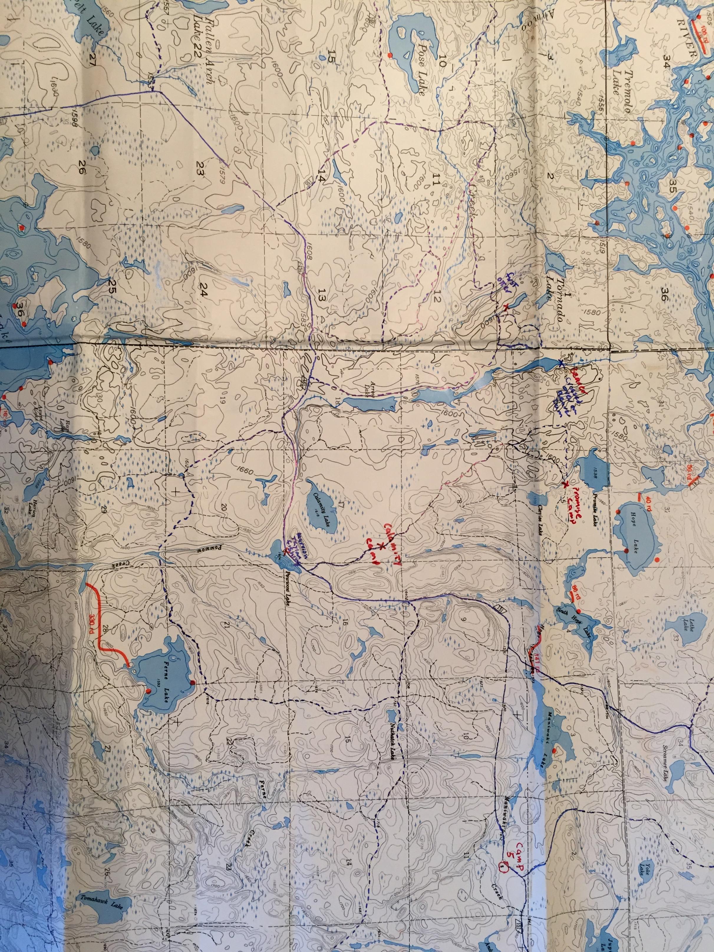

Wilderness both captivates your soul and sets it free :)
12/17/2018 03:25PM
Jackpine, that is an incredible accounting of your dad's trapping, what a tough life. I walked by Calamity Lake so many times, never knew there was a camp nearby. I believe the Houseys and the Mosers may have lived there at one time. Thanks for sharing all that, it would've been an honor to meet him and talk with him. What a guy! The map you included added a lot to the stories. Nice job!
12/17/2018 05:05PM
Moser’s lived there for sure. I think the Housey’s too. We an Moser’s moved to Camp 6 and Housey’s moved to Forest Center. I know Floyd Housey so will have to ask him next time I see him.
Wilderness both captivates your soul and sets it free :)

12/18/2018 09:40AM
Jackpine, I sent that other email too early, my mistake. I was going to add another map but hit the wrong button. You might know how that goes:-(( 
 I've sent a couple of maps here, there's some overlap involved but this might give you a better idea of some of your dad's travels on his trapline. You can see where one of the secondary haul roads came off the the main haul road, the Isabella North Road, just to the north of Pow Wow Lake and to the east of Calamity Lake. It was a good haul road for what looks like a couple of miles (I've only walked it once and never walked that far on it so not sure how it was further up) or so before it goes to a winter road. I'm guessing your dad would've walked this winter road for awhile before going west to pick up that old fire trail that crossed the beaver dam just north of the 3rd and northernmost of the Arrow Lakes, where he got the moose antlers. My map here shows this is the end of that winter road but then go due west from Arrow and you can see a very good road coming from the west, just south of Tornado Lake. This was an EXCELLENT haul road in 1971 and eventually went to just south of Hudson Lake. I'd be willing to bet your next retirement check that this is the way your dad would've gone to Hudson. On the other map you can follow this road west as it travels just below Insula Lake, comes to the fork just north of the Ahmoo Bridge crossing where continuing to go W/NW would take to to just south of Zitkala and Hudson Lakes. I've walked this road eastwardly to it's end just below Tornado Lake, good solid road that ended into a winter road & boggy area. About 1/4 mi. before it's end the Pow Wow Trail left this old road bed going east and went overt to the west side of Arrow, then going south until it met the North Road. Looks like the north end or Arrow and the end of this road below Tornado is less than a mile, there must've been a trail connecting the two that your dad used.

 I've sent a couple of maps here, there's some overlap involved but this might give you a better idea of some of your dad's travels on his trapline. You can see where one of the secondary haul roads came off the the main haul road, the Isabella North Road, just to the north of Pow Wow Lake and to the east of Calamity Lake. It was a good haul road for what looks like a couple of miles (I've only walked it once and never walked that far on it so not sure how it was further up) or so before it goes to a winter road. I'm guessing your dad would've walked this winter road for awhile before going west to pick up that old fire trail that crossed the beaver dam just north of the 3rd and northernmost of the Arrow Lakes, where he got the moose antlers. My map here shows this is the end of that winter road but then go due west from Arrow and you can see a very good road coming from the west, just south of Tornado Lake. This was an EXCELLENT haul road in 1971 and eventually went to just south of Hudson Lake. I'd be willing to bet your next retirement check that this is the way your dad would've gone to Hudson. On the other map you can follow this road west as it travels just below Insula Lake, comes to the fork just north of the Ahmoo Bridge crossing where continuing to go W/NW would take to to just south of Zitkala and Hudson Lakes. I've walked this road eastwardly to it's end just below Tornado Lake, good solid road that ended into a winter road & boggy area. About 1/4 mi. before it's end the Pow Wow Trail left this old road bed going east and went overt to the west side of Arrow, then going south until it met the North Road. Looks like the north end or Arrow and the end of this road below Tornado is less than a mile, there must've been a trail connecting the two that your dad used.
12/18/2018 10:39AM
Tomahawk: src="https://photos.bwca.com/thumbnails/TOMAHAWK-181218-074252.JPG" align="left" >
What are the red lines with circles and numbers in them.
Kinda looks like aerial fire patrol check points to me, but they would be really close together.
May the rivers be crooked and winding, and your portages lonesome, leading to the most amazing view.
12/18/2018 11:05AM
Lindentree, when I first saw this map that's exactly what I thought, those red lines & circles were some sort of check in points for aerial fire patrols. But I've flown with them on fire patrols as part of a smoke chaser crew and I never saw them calling in at all these points. Unless they'd only call in from a point if they saw smoke at that particular numbered point? Or might it have something to do with call ins from the fire towers? Your guess is as good as mine.
12/18/2018 08:01PM
Tomahawk: " I've hoisted a few beers with Al Moser, Floyd Housey and Juel Foster at the Wanderer. I think it was Floyd who said he skidded the last loa of wood out of Calamity Lake."
Thanks for posting these maps Tomahawk. I can contemplate them for hours. They bring a lot of things back to life. I haven't seen Al Moser since we left Camp 6 in 1965. I used to sit and listen to Dad and Jule shoot the breeze about the old times. Very entertaining. I never had much opportunity to talk to Floyd much but sure enjoyed when I did. There sure were some great people living that life.
Wilderness both captivates your soul and sets it free :)
12/19/2018 08:45AM
Happy to hear you like the maps, I knew you would. I'm like you, I could drool over maps for hours, they're fascinating. I'm like a millennial with an iPad when I start looking at a map. That map you sent about your dad's trapping had me mesmerized for hours, topped off with a puddle of drool on it. I would've been all ears to a conversation between your dad and Juel Foster, I'd never tire of that. Floyd was another one I enjoyed a beer or 2 with, what a great sense of humor. I ran into his brother Alex once way up on the East Road at Tomahawk Creek, many, many years ago. We were both chasing birds around. I've got a funny Floyd story I'll tell you about at another time..........
But speaking of Juel Foster and the Happy Wanderer, I have a good story to share with you. I was with 3 other guys up on Malberg Lake, back in 1968. The canoe I was in was near the where the portage came in from the North Kawishiwi River. Across the portage and into Malberg came a couple of guys that loaded their canoe and paddled up to us. After a short, "How's fishin' ?," we gave then the walleye report. They were headed to Koma Lake after the big northerns, they said. I remember their names only as "Punchy" & Chuck. They both had connections to Forest Center, Punchy was in Forest Center at one time, then living in the Twin Cities and Chuck lived at Happy Wanderer but also lived at Forest Center back in the day. I'll bet you might know them, especially Chuck. I think his last name may have been either Moser or Yeager. Anyway, these 2 tell us that there was supposed to be 7 in their party, all but the 2 of them cancelled out. But they had 7 bottles of booze that they brought along in those plastic bottles because of the new bottle/can ban that went into effect about that time. We were going leave in a couple of days and they told us to paddle up to Koma for a nightly cocktail or 2. They then paddled on and we were out of booze, we began to plan. When we got back to our campsite that night we told the other 2 guys in our party about the invite. One of the guys said,"How about we go into Koma tomorrow and set up a tnet their for the night?" He had read my mind, I thought we might not be in much shape after the cocktail party to paddle back to our camp on Malberg. So, it was agreed to and we headed for Koma the nxt day. Punchy & Chuck were out there all day, trlling for those elusivre northerns. They came by our camp and reminded us, "You know, we hear there's a cocktail party tonight." We said yes, we had heard the same thing. "When you finish with supper, bring your 7 little little friends over here," we told them. They thought that was a great idea so later on they appeared at our Koma camp. I still remember, it was raining off & on most of the day, it was late August and the rain was a cold one. We had real nice fire going and then the bottles came out. Punchy was the shorter of the 2 of them and the chatty one. Chuck was the taller of the 2 and was a quiet one, but when Chuck spoke you didn't want out miss it because it was something that would make you laugh so hard that your stomach hurt. Oh, they were funny, we laughed long and hard. Standing around that roaring fire in rain gear, passing the bottle from one to another. Sometimes the bottle would go around only 3 times before was dry. When one went dry, Punchy would reach into the magic duffle bag that he carried them in and bring another out. There was whiskey, brandy, Southern Comfort, peppermint schapps that I can remember. All in quart bottles. We darn near drank it all up before Punchy realized there was only 1 bottle left for the 2 of them. So Punchy cut us off and the night ended. Good thing because no one was walking very well. I don't remember how they got in their canoe but they did and got safely back to their campsite which was very close by. I remember hearing vomiting throughout the night but not from me. I may have been the only one who didn't lose it but the hangover was terrible the next day. Maybe I should've stuck my finger down my throat a maybe would've felt better but I looked at the pukers the next morning and they didn't look any better than myself. When we went by Punchy & Chuck's tent on our paddle out the next morning there was not a sign of life.
Now, for the rest of the story as Paul Harvey would say. My bird hunting partner & I would stop at the Wanderer at the end of the day and we did that one day many, many years after the Koma Lake Incident. I was telling Floyd about it and Juel was working behind the bar, all ears to my story and a grin from ear to ear. As the story went on his grin got wider, when I finished Juel looked at me and pointed hi finger while breaking out in full laughter, "So, you are the guys! Chuck told me all about that right after it happened. You're a legend!"
12/20/2018 07:58AM
Tomahawk: " Happy to hear you like the maps, I knew you would. I'm like you, I could drool over maps for hours, they're fascinating. I'm like a millennial with an iPad when I start looking at a map. That map you sent about your dad's trapping had me mesmerized for hours, topped off with a puddle of drool on it. I would've been all ears to a conversation between your dad and Juel Foster, I'd never tire of that. Floyd was another one I enjoyed a beer or 2 with, what a great sense of humor. I ran into his brother Alex once way up on the East Road at Tomahawk Creek, many, many years ago. We were both chasing birds around. I've got a funny Floyd story I'll tell you about at another time..........
But speaking of Juel Foster and the Happy Wanderer, I have a good story to share with you. I was with 3 other guys up on Malberg Lake, back in 1968. The canoe I was in was near the where the portage came in from the North Kawishiwi River. Across the portage and into Malberg came a couple of guys that loaded their canoe and paddled up to us. After a short, "How's fishin' ?," we gave then the walleye report. They were headed to Koma Lake after the big northerns, they said. I remember their names only as "Punchy" & Chuck. They both had connections to Forest Center, Punchy was in Forest Center at one time, then living in the Twin Cities and Chuck lived at Happy Wanderer but also lived at Forest Center back in the day. I'll bet you might know them, especially Chuck. I think his last name may have been either Moser or Yeager. Anyway, these 2 tell us that there was supposed to be 7 in their party, all but the 2 of them cancelled out. But they had 7 bottles of booze that they brought along in those plastic bottles because of the new bottle/can ban that went into effect about that time. We were going leave in a couple of days and they told us to paddle up to Koma for a nightly cocktail or 2. They then paddled on and we were out of booze, we began to plan. When we got back to our campsite that night we told the other 2 guys in our party about the invite. One of the guys said,"How about we go into Koma tomorrow and set up a tnet their for the night?" He had read my mind, I thought we might not be in much shape after the cocktail party to paddle back to our camp on Malberg. So, it was agreed to and we headed for Koma the nxt day. Punchy & Chuck were out there all day, trlling for those elusivre northerns. They came by our camp and reminded us, "You know, we hear there's a cocktail party tonight." We said yes, we had heard the same thing. "When you finish with supper, bring your 7 little little friends over here," we told them. They thought that was a great idea so later on they appeared at our Koma camp. I still remember, it was raining off & on most of the day, it was late August and the rain was a cold one. We had real nice fire going and then the bottles came out. Punchy was the shorter of the 2 of them and the chatty one. Chuck was the taller of the 2 and was a quiet one, but when Chuck spoke you didn't want out miss it because it was something that would make you laugh so hard that your stomach hurt. Oh, they were funny, we laughed long and hard. Standing around that roaring fire in rain gear, passing the bottle from one to another. Sometimes the bottle would go around only 3 times before was dry. When one went dry, Punchy would reach into the magic duffle bag that he carried them in and bring another out. There was whiskey, brandy, Southern Comfort, peppermint schapps that I can remember. All in quart bottles. We darn near drank it all up before Punchy realized there was only 1 bottle left for the 2 of them. So Punchy cut us off and the night ended. Good thing because no one was walking very well. I don't remember how they got in their canoe but they did and got safely back to their campsite which was very close by. I remember hearing vomiting throughout the night but not from me. I may have been the only one who didn't lose it but the hangover was terrible the next day. Maybe I should've stuck my finger down my throat a maybe would've felt better but I looked at the pukers the next morning and they didn't look any better than myself. When we went by Punchy & Chuck's tent on our paddle out the next morning there was not a sign of life.
Now, for the rest of the story as Paul Harvey would say. My bird hunting partner & I would stop at the Wanderer at the end of the day and we did that one day many, many years after the Koma Lake Incident. I was telling Floyd about it and Juel was working behind the bar, all ears to my story and a grin from ear to ear. As the story went on his grin got wider, when I finished Juel looked at me and pointed hi finger while breaking out in full laughter, "So, you are the guys! Chuck told me all about that right after it happened. You're a legend!""
Tomahawk, Great story. That must have been Charlie Yeager. He was a good friend of Dad's and they canoed and fished up on Koma and Malberg together back in the day. I remember dad mentioning someone with the last name of Punches but not in the context of fishing. Charlie, as my mom and dad called him, had a wife named 'Honey', a son we called Mikey, and a younger brother Abby, who also lived in Calamity Camp at one time and accompanied Dad on fishing trips to Koma. I've seen several pictures of Dad and Charlie and others fishing up there. I'll have to see if Mom still has them and ask her if she knows Punchie's real name. One picture was from the late 1950's of them holding a pole with 5 northerns totaling over 100 pounds. The fish were caught along the northwest shore of Koma and beneath the Malberg rapids. There wasn't much catch-and-release sport fishing back then, they brought them all out for food.
Your story about Chuck and Punchie brings back memories of several good stories I'll write up in another post and hopefully Mom still has the photos to augment the tales.
Wilderness both captivates your soul and sets it free :)
12/20/2018 08:54AM
I knew you'd appreciate that Jackpine, possibly Pinetree might also. Others might not find much humor in it with all the political correctness around today but those were different times back then. I also know, Jackpine, that you can picture Juel pointing that finger at me and saying that to me with that big Juel Foster grin on his face.
That's quite a stringer of fish that they caught on Koma/Malberg, wow! I do remember Charlie telling us about the big snakes in Koma, he elaborated by saying, "Whatever dumb-shit things you ever do in your lives, just don't to go swimming in Koma Lake!" This was well before the movie, "Jaws." That was one of those belly laughs that we got out of him that night, I guess you had to have been there. I had to look at Charlie's face to see if he was serious and he had one of the best poker faces I remember ever seeing, so I never knew for sure.
Wasn't that one of neatest places, that spot just below the rapids going into Malberg? There was always a good current there, I remember a big boulder there on shore next to the rapids. Never fished there, we always got fish elsewhere on the lake. Looked like a good spot to fish in the spring.
Speaking of that portage going from Koma to Malberg, we were crossing that one real hot day back in the late 60s. I was carrying the canoe and when I got to the Malberg side I could see 2 other canoes pulled up on shore. Looking from under the canoe, I saw 2 guys fishing from shore in the rapids and too late did I notice 2 young ladies, who were accompanying them, running for cover without a stitch of clothes on. By the time I realized that I had interrupted 2 sunbathers, I saw the bare backside one of the ladies heading for the trees with a swimsuit bottom (it was turquoise in color, I'll never forget that) covering her bottom side. Soon after, I heard muffled screams and giggles coming from the trees, I had missed the whole show. It was over before I knew it! As we set out gear down on the portage, the 2 guys never missed a beat and never missed a cast. Didn't seem to be bothered at all that we had interrupted the 2 nude sunbathers and the guys never seemed to notice they were even nude. Seen 'em once, seen 'em all I guess. We asked about the fishing, exchanged pleasantries and went back for the rest of our gear on the Koma side. By the time we came back to Malberg side with the rest of our gear, the 2 couples were long gone and nearly out of sight. They were paddling down the lake making great time, the ladies in the bows seemed to be paddling the hardest of all but not sure about that. A quick evacuation prompted by the embarrassed ladies, we guessed. About a couple hours after doing some walleye trolling we were looking for a campsite, came around a point and here were the 2 couples on the campsite were were hoping to get. The 2 ladies were in swimsuits this time (one in a 2 piece turquoise bikini, imagine that), sunbathing again and the 2 guys were fishing again from shore. Some things ever change. As we got closer the 2 guys were very talkative like nothing had ever happened but the 2 gals moved into the tent, not talkative at all. Both ladies were real "lookers" and were not only red from the sun but maybe from some embarrassment. To say I had missed the earlier show was an understatement.
Jackpine, I'd be real interested if you can find out more about Punchy, he was a real character. I'd look forward to seeing more pictures you might also come up with.
12/21/2018 10:44AM
Jackpine, sending along a picture of my hunting partner back in 1972. He is on the North Road as it ran next to Pow Wow Lake on one of those beautiful October days. I'm trying to remember who you said would fish here, was it Marion Tyler? This is very close to that very spot that you had marked on that map. 

12/21/2018 11:02AM
Tomohawk and Jackpine do you still go down by Isabella and hunt anymore?
Wonder what kind of shotgun did you carry on your long hikes?
I broke d 12 guage.own and got me a SKB over and under shotgun 12 guage. I loved carrying but sometimes I would just carry a single shot 12.
Wonder what kind of shotgun did you carry on your long hikes?
I broke d 12 guage.own and got me a SKB over and under shotgun 12 guage. I loved carrying but sometimes I would just carry a single shot 12.
12/21/2018 01:59PM
I still do hunt north of Isabella as does my hunting partner of 45 yrs. We hunt mostly south of the Tomahawk now. I started out with a single .12, later moved to a Remington Wingmaster Pump which I use to this day. Heavy gun to carry all day but I have a sling for it.
12/22/2018 08:17AM
Pinetree: "Tomohawk and Jackpine do you still go down by Isabella and hunt anymore?
Wonder what kind of shotgun did you carry on your long hikes?
I broke d 12 guage.own and got me a SKB over and under shotgun 12 guage. I loved carrying but sometimes I would just carry a single shot 12."
I only hunted North of Isabella twice since the fire. The first time after the fire I didn't see or hear any animal, not even a crow. I still hunt the unburned area around Isabella. On long walks I use a 20 gauge Remington 870 I bought when I was 12 years old. On shorter walks, or road hunting I use my dad's 20 gauge double barrel.
Wilderness both captivates your soul and sets it free :)
12/22/2018 08:41AM
Tomahawk: "Jackpine, sending along a picture of my hunting partner back in 1972. He is on the North Road as it ran next to Pow Wow Lake on one of those beautiful October days. I'm trying to remember who you said would fish here, was it Marion Tyler? This is very close to that very spot that you had marked on that map.
Tomahawk, Thanks for posting the photo. It brings back memories. It was Marion Taylor that always fished there. She lived in Calamity Camp, nearby where you took that picture, with the husband Charles 'Lloyd' Taylor. She was Hank Knuth mother. Hank and his wife, Kathy, also lived in Calamity Camp.
Wilderness both captivates your soul and sets it free :)
12/22/2018 09:07AM
Pinetree, when you asked about hunting around Isabella, I thought you meant the town of. Now maybe I'm thinking you meant Isabella lake. Although we spend much of our time south of the Tomahawk Road now, we made a couple of trips on the Pow Wow Trail. It was pretty miserable 2 years ago, our first attempt at doing this. There were so many trees down that we had to step over, crawl over and walk around that we didn't get as far as we intended. We were hoping to get to Pose Lake but turned around about 20 mn. down the old Insula/ Hudson Road after leaving the North Road. This year we tried again and got only up to the where the old Insula/Hudson Road left the North Road. Never saw a grouse on either trip, including songbirds. One day was without wind and there wasn't even a sound. Spooky. I don't really know how you'd hunt for grouse there now or even see one if it wasn't sitting right on the trail or running across. Big trees downed from the fire criss-cross each other, piled sometimes 5' high. Then there's the typical young jackpine coming up so common after a fire, so thick it gives the hairs on a dog's back a run for their money. The jacks are sprouting up 4"- 6" from each other in places, no exaggeration. We had heard of moose in the burn area now, 2 yrs. ago we saw 1 set of old tracks, this year not a track.
This fire is on the Forest Service for allowing it to even happen to the degree that it did and even worse they're showing no interest in helping to recut these trails. Unbelievable.
This fire is on the Forest Service for allowing it to even happen to the degree that it did and even worse they're showing no interest in helping to recut these trails. Unbelievable.
12/22/2018 09:29AM
Thanks for setting me straight on Marion Taylor's correct name. That image of Pow Wow Lake also shows what nice shape the roads were in at the time, the small jacks are just stating to make their presence known. Sending another image taken in 1973, also on the North Road. This one was on that long straight stretch going east just after leaving the spot where the Insula/Hudson Road left the North Road. Wolf trackers with antennas on their trucks were still driving the road at that time, but much later on and even before the fire that part of the road became choked with alder and criss-crossed with windfalls, now it's near impassable and there's no evidence of a road even being there. Mother Nature hates a void.  One of my partners here is walkng west, about a block from where the Insula/Hudson Road leaves the North Road.
 One of my partners here is walkng west, about a block from where the Insula/Hudson Road leaves the North Road.
12/22/2018 09:30AM
Yes I meant around Isabella lake. I to have started hunting other trails between Tomahawk and other areas in the Superior National Forest. Was hoping to go this week,but it didn't happen.
Yeh like I mentioned before,maybe we always thought it would be that good there, and we didn't know how good we had it. Especially You Tomahawk and Jackpine you walked the area long before I.
Yeh like I mentioned before,maybe we always thought it would be that good there, and we didn't know how good we had it. Especially You Tomahawk and Jackpine you walked the area long before I.
12/22/2018 11:04AM
Pinetree, you said it best when you said we never knew what we had until we didn't have it anymore. My hunting partner & I have mumbled those very words amongst ourselves over the years as we watched the roads grow over, you're the one who came out and said it publicly. It was good to hear that from someone else! You're the one who should write a book:=)) When you look how wide that North Road was in 1973, we mistakenly thought it would always be like that. Mother Nature hates a void.
01/01/2019 10:15AM
Hope all out there had a nice Christmas and best wishes to all for a great 2019! It was really nice to hear all your comments and let me relive some of mine. Some of those were forgotten until some of you rekindled those memories with stories of your own.
I was looking through some old photos of those days of yesteryear and came across a real jewel. Most moose hunters had good, well-thought out plans but others didn't have a clue. The picture was taken by one of my bird hunting partners of our limit of grouse in a wheel barrow. The picture needs a beginning, so here we go. Back in the 70s there were 3 of us that would hunt together at times. On this particular day, one guy went up toward Insula/Hudson and myself and another guy went up toward Maniwaki Lake. When we got to the spot atop the hill where the Insula/Hudson Road left the North Road, there was a tent set up. It was about 9 am and 2 older-aged moose hunters were standing around a camp fire. They told us that further up the North Road were 2 younger guys from their party, pushing a wheel barrow with a flat bottom duck boat atop it! No kiddin' I could never make this up. The older guys were madder than hell at what these 2 younger guys were going to get them involved in should they get a moose back that far. Where they were camped it was already about 3 1/2 mi. back in. The young guys had a plan, they'd push this wheelbarrow/duckboat up to the first beaver pond and paddle across the pond with them and the wheelbarrow in the boat. Getting to the other side they'd just start pushing the wheel barrow with the boat atop it once again until they got to the next pond. We walked around at least 3-4 beaver ponds and never saw them. There was a large pond (long straight stretch, of corduroy) just to south where a road branched off the North Road and went east toward Nuthatch and Ferne Lakes, and we found the duck boat on one end and the wheelbarrow on the other. Evidently they had enough of this foolishness at this point. We had gone up to Maniwaki and never saw them, on the way back we put our limit of grouse in the wheelbarrow just for a picture. I told my partner, we need a picture of this, we can't pass this up. On our way back the 2 older guys were gone somewhere, maybe had enough of all this and packed up their gear and went home for all we knew. On top of it all the wheelbarrow was illegal in the BW, that area was not authorized for wheeled transportation. We told the old guys this earlier that morning and they just shrugged their shoulders. I never heard what happened here, whether or not they got a moose, I hope not. It might've killed the older guys.
A couple of weeks later, we ran into a guy in the Isabella Lake parking lot and told him the story of the wheeled-duckboat. He never heard anything about it even though stories like that spread like wildfire, hard to keep something like that quiet. He had, however, heard of moose hunters up north of Ferne Lake that shot a huge bull that same weekend that the wheeled-duckboat was in service. That party had canoed in from Perent River and shot he bull just north of Ferne, not far off the old road that came from the North Road. It was an excellent place to see moose activity back then. But then they had to get the bull into the canoe that was at least 3 blocks away, canoe across Ferne to about a 1 mile portage, paddle down Perent River and across Boga Lake, take the 30-some rod portage into Isabella Lake, cross the Isabella Lake and then portage up to the truck in the parking lot. If I recall correctly, they thought they had walked 22 miles on the portages getting the moose out.
In all those years since the first moose season in 1971, we saw some real characters dressed up as moose hunters. Once, I had gone up to Superstition Lake and was on my way back just west of Quadga Lake. I came across an older guy hunting for moose about 8 mi. from the truck! I asked what he was going to do if he shot one this far back and he told me "We've got a lot of young guys we can call up back in the Twin Cities." How'd YOU like to be on the other end of THAT call?
Another year we had gotten to the berm at Isabella North Road just after legal shooting hours. It was still pretty dark and we weren't going to shoot anything yet but started walking anyway. Here coming down the North Road were headlights from an ATV pulling a boat trailer. The road then was in very good shape and an ATV/boat trailer were completely possible to use, only illegal. No motorized or wheeled vehicles allowed. The guys were very surprised to see us, I think they figured we might be wardens. We told them we weren't but there was a warden that sniffed around this area much of the time and he'd love to find them in their current state of affairs. They had shot a moose up near Marathon Lake (5 mi. in) and had been hauling it in all night. We told them about the legal issue which they seemed to not know anything about.
I recall another incident, also at Marathon Lake in which a young hunter had shot 2 bulls by mistake. He supposedly shot 1 and thought he'd missed as a second one very near the first had gotten up and he also shot that one. Supposedly as the father related the story to us, both bulls had been bedded down very near each other. The father was on the way out to find a warden. If I also recall how the story ended, the wardens were convinced it was a mistake but the party had to dress both animals out and carry them out the 5 mi. They lost the moose but I don't recall any fines or confiscations being issued.
I was looking through some old photos of those days of yesteryear and came across a real jewel. Most moose hunters had good, well-thought out plans but others didn't have a clue.
 The picture was taken by one of my bird hunting partners of our limit of grouse in a wheel barrow. The picture needs a beginning, so here we go. Back in the 70s there were 3 of us that would hunt together at times. On this particular day, one guy went up toward Insula/Hudson and myself and another guy went up toward Maniwaki Lake. When we got to the spot atop the hill where the Insula/Hudson Road left the North Road, there was a tent set up. It was about 9 am and 2 older-aged moose hunters were standing around a camp fire. They told us that further up the North Road were 2 younger guys from their party, pushing a wheel barrow with a flat bottom duck boat atop it! No kiddin' I could never make this up. The older guys were madder than hell at what these 2 younger guys were going to get them involved in should they get a moose back that far. Where they were camped it was already about 3 1/2 mi. back in. The young guys had a plan, they'd push this wheelbarrow/duckboat up to the first beaver pond and paddle across the pond with them and the wheelbarrow in the boat. Getting to the other side they'd just start pushing the wheel barrow with the boat atop it once again until they got to the next pond. We walked around at least 3-4 beaver ponds and never saw them. There was a large pond (long straight stretch, of corduroy) just to south where a road branched off the North Road and went east toward Nuthatch and Ferne Lakes, and we found the duck boat on one end and the wheelbarrow on the other. Evidently they had enough of this foolishness at this point. We had gone up to Maniwaki and never saw them, on the way back we put our limit of grouse in the wheelbarrow just for a picture. I told my partner, we need a picture of this, we can't pass this up. On our way back the 2 older guys were gone somewhere, maybe had enough of all this and packed up their gear and went home for all we knew. On top of it all the wheelbarrow was illegal in the BW, that area was not authorized for wheeled transportation. We told the old guys this earlier that morning and they just shrugged their shoulders. I never heard what happened here, whether or not they got a moose, I hope not. It might've killed the older guys.
A couple of weeks later, we ran into a guy in the Isabella Lake parking lot and told him the story of the wheeled-duckboat. He never heard anything about it even though stories like that spread like wildfire, hard to keep something like that quiet. He had, however, heard of moose hunters up north of Ferne Lake that shot a huge bull that same weekend that the wheeled-duckboat was in service. That party had canoed in from Perent River and shot he bull just north of Ferne, not far off the old road that came from the North Road. It was an excellent place to see moose activity back then. But then they had to get the bull into the canoe that was at least 3 blocks away, canoe across Ferne to about a 1 mile portage, paddle down Perent River and across Boga Lake, take the 30-some rod portage into Isabella Lake, cross the Isabella Lake and then portage up to the truck in the parking lot. If I recall correctly, they thought they had walked 22 miles on the portages getting the moose out.
In all those years since the first moose season in 1971, we saw some real characters dressed up as moose hunters. Once, I had gone up to Superstition Lake and was on my way back just west of Quadga Lake. I came across an older guy hunting for moose about 8 mi. from the truck! I asked what he was going to do if he shot one this far back and he told me "We've got a lot of young guys we can call up back in the Twin Cities." How'd YOU like to be on the other end of THAT call?
Another year we had gotten to the berm at Isabella North Road just after legal shooting hours. It was still pretty dark and we weren't going to shoot anything yet but started walking anyway. Here coming down the North Road were headlights from an ATV pulling a boat trailer. The road then was in very good shape and an ATV/boat trailer were completely possible to use, only illegal. No motorized or wheeled vehicles allowed. The guys were very surprised to see us, I think they figured we might be wardens. We told them we weren't but there was a warden that sniffed around this area much of the time and he'd love to find them in their current state of affairs. They had shot a moose up near Marathon Lake (5 mi. in) and had been hauling it in all night. We told them about the legal issue which they seemed to not know anything about.
I recall another incident, also at Marathon Lake in which a young hunter had shot 2 bulls by mistake. He supposedly shot 1 and thought he'd missed as a second one very near the first had gotten up and he also shot that one. Supposedly as the father related the story to us, both bulls had been bedded down very near each other. The father was on the way out to find a warden. If I also recall how the story ended, the wardens were convinced it was a mistake but the party had to dress both animals out and carry them out the 5 mi. They lost the moose but I don't recall any fines or confiscations being issued.
01/01/2019 11:54AM
Tomahawk: " He supposedly shot 1 and thought he'd missed as a second one very near the first had gotten up and he also shot that one. Supposedly as the father related the story to us, both bulls had been bedded down very near each other. "
My buddy did the exact same thing in Alaska. He shot two big bull moose.
He shot one, it went into the woods, he thought he missed it, another moose appeared, my buddy thought it was the same moose, so he shot at it. Knocking it down he went to get it, when he found the first moose dead not far away.
Lucky for him he was with another guy who also had a bull tag so they were able to keep them.
Both European mounts grace the side of his current log home in Delta Jct.
May the rivers be crooked and winding, and your portages lonesome, leading to the most amazing view.
01/01/2019 12:44PM
Oh boy, looks like it can happen easy enough. At least nothing went to waste.
As soon as I closed off with my earlier email about moose hunters I thought of another incident, the mind works in mysterious ways. I had been out grouse hunting by myself up on the Insula/Hudson Road and was on my way back on one of those beautiful October days. There weren't many birds around that day as I recall but it was one of those windless, sunny days when you wouldn't have wanted to be anywhere else on the planet. I was on the North Road and very close to the spot where the Quadga Road went off to the west. I could hear voices coming from the fork and all of a sudden and out of nowhere comes a shotgun blast, BOOM and shot coming through the trees above me and all around. I hit the dirt and before I could holler another round came, BOOM with shot whizzing right by me. I hollered out,"Hey!! don't shoot!!" Then I heard a quiet, "Sorry!" as I walked toward them. It was a father and son, the dad told me the son was shooting at a squirrel that he wanted the tail from. Regardless, they were shooting right up the trail toward me where the trail bent to the right. Seems that they had just come from a moose indoctrination class in which part of their party went elsewhere to look for the best moose sign for the upcoming moose season, 1 week away. Both dad & son looked like they stepped out of a Cabela's catalog with brand spanking new clothes. I must've looked pretty rumpled alongside them. They said they were from Bloomington and were very sorry about what nearly happened, shooting me. I just shook my head, close call.
As soon as I closed off with my earlier email about moose hunters I thought of another incident, the mind works in mysterious ways. I had been out grouse hunting by myself up on the Insula/Hudson Road and was on my way back on one of those beautiful October days. There weren't many birds around that day as I recall but it was one of those windless, sunny days when you wouldn't have wanted to be anywhere else on the planet. I was on the North Road and very close to the spot where the Quadga Road went off to the west. I could hear voices coming from the fork and all of a sudden and out of nowhere comes a shotgun blast, BOOM and shot coming through the trees above me and all around. I hit the dirt and before I could holler another round came, BOOM with shot whizzing right by me. I hollered out,"Hey!! don't shoot!!" Then I heard a quiet, "Sorry!" as I walked toward them. It was a father and son, the dad told me the son was shooting at a squirrel that he wanted the tail from. Regardless, they were shooting right up the trail toward me where the trail bent to the right. Seems that they had just come from a moose indoctrination class in which part of their party went elsewhere to look for the best moose sign for the upcoming moose season, 1 week away. Both dad & son looked like they stepped out of a Cabela's catalog with brand spanking new clothes. I must've looked pretty rumpled alongside them. They said they were from Bloomington and were very sorry about what nearly happened, shooting me. I just shook my head, close call.
01/01/2019 01:23PM
LindenTree: "Tomahawk: " He supposedly shot 1 and thought he'd missed as a second one very near the first had gotten up and he also shot that one. Supposedly as the father related the story to us, both bulls had been bedded down very near each other. "
My buddy did the exact same thing in Alaska. He shot two big bull moose.
He shot one, it went into the woods, he thought he missed it, another moose appeared, my buddy thought it was the same moose, so he shot at it. Knocking it down he went to get it, when he found the first moose dead not far away.
Lucky for him he was with another guy who also had a bull tag so they were able to keep them.
Both European mounts grace the side of his current log home in Delta Jct."
Shooting more than one moose In Minnesota has happened a couple of times by accident. As long as you reported it you were Okay. If you tried to hide it by leaving the animal there or taking both out,than you were in big trouble.
You were supposed to leave the animals where you shot them until you got a game warden.
01/01/2019 03:07PM
As a matter of fact, that same day we ran into a couple of wardens after we were coming back from our grouse hunt. They stopped us on the Tomahawk Rd. and checked our licences, birds, etc. and said they were on their way to check for 2 moose that had been shot by accident. We asked if they were headed to Marathon Lake and they said they were headed to Bald Eagle/Snake Creek. They didn't even know about the Marathon Lake incident.

02/02/2019 08:29AM
Great photo Gravelroad, nice to see. I have to chuckle when "they" claim these areas to "untrammeled wilderness." Untrammeled when? You can tell these folks have no idea of the history of the area. If by untrammeled they mean in the last 50 yrs. or so, OK. However, the years before that it was "trammeled" plenty. That entire area was cut over and a lot of it was replanted, both no-nos for an untrammeled wilderness due to human manipulation. Sort of like pounding a round peg into a square hole trying to make it fit. But it's a bad fit just like the term untrammeled wilderness. So, if you look at the history of the area it is neither untrammeled nor a wilderness at all. At one time I recall Webster defining wilderness as unmaintained and uncultivated by man, sounds like that definition may have changed to make the round peg fit into that square hole a bit better. It always bugs me when folks throw around terms like this that are not accurate in the least.
02/02/2019 08:47AM
This is a great tread!!! The first hand info from word of mouth that can't be found in print. Even if it was in print or video how could we trust the info with the spin these days. Thank you to those posting with first hand info I value your tales , pictures, maps and most of all your memories!! JIM P.
Raised by wolves!
02/27/2019 06:10PM
Historic Photographs of SNF QuietWaters started a tread with these great old pictures, I thought they belonged here also. Many old camps. Like this aerial picture of Forest Center.
Don't miss out there are 3 pages. Hovering over the photo with cursor will say date and location.
Don't miss out there are 3 pages. Hovering over the photo with cursor will say date and location.
Raised by wolves!
02/28/2019 09:40AM
Tomahawk: "Ellahallely, thanks for sharing all the old photos. Great photo of Forest Center!"
Agreed, good place to have these historical pics located, thanks.
Curious Ellahallely, do you have any info on how much land was logged within the area that is now the BWCAW?
May the rivers be crooked and winding, and your portages lonesome, leading to the most amazing view.

04/01/2019 02:22PM
LindenTree3: "JackpineJim: "Moosepatrol: " A link about Forest Center.|
Did you know my great grand parents? Dorothy and clarence bildeaux?
The link is from Ely Echo archives page, it is best viewed in full screen. There is also a search function, although not the best search engine. Also try Sawbill landing or Winton, etc ….. if looking for other logging info."
My Mom kept a magazine from 1963 with a couple of good articles about Forest Center.
You'll have to expand the photos to read the articles.
The horse was named Colonel - best horse ever!, I was told.
I worked with Oliver Thums (mentioned in the article) in the early 2,000's.
I ran the fire engine out of the USFS Isabella Work Station, Ollie was a SCEP employee.
Senior Citizen Employment Program. I also worked with a few other past people who lived at Forest Center.
I believe the building housing the current Stoney River Cafe in Isabella was moved from Sawbill Landing. A community similar to Forest Center."
~Work to live,don't live to work~
04/06/2019 02:48PM
Jackpine Jim, in some of our conversations earlier I erroneously stated that Don (Bobby) Krings had passed away. I was given incorrect information on that but his wife, Jeannie has passed away. I am just looking at an obituary in the Ely Echo of Don's younger brother Jim, 66 yrs. old, who just passed away. Don is listed as a surviving brother. My apologies to Don and everyone else for burying him, I hope well, before his time. Sorry Don! I knew both Don & wife Jeannie when they came to high school in Ely in the mid 1960s. Many folks refer to Don as Bobby, I noted in the obit for Jim that the father's name was also Don. Maybe they referred to Don as Bobby to simplify things between father and son? Your thoughts on this Jackpine, I'm sure you knew them all.
Also Jackpine, I've had conversations with a friend about life north of Isabella Lake during the Tomahawk Timber days and he asked questions that only a person like yourself who lived in those camps would know the answer to.
1- Approx. how many single family homes, bunkhouses for single men and how many company buildings were in were in Camps 4 and 5?
2- Were the Camps numbered in order, in other words, was Camp 5 built before Camp 6?
3-When did Camp 4 & Camp 5 cease to exist?
Many thanks Jackpine, I owe you!
04/07/2019 09:03PM
Tomahawk: " Jackpine Jim, in some of our conversations earlier I erroneously stated that Don (Bobby) Krings had passed away. I was given incorrect information on that but his wife, Jeannie has passed away. I am just looking at an obituary in the Ely Echo of Don's younger brother Jim, 66 yrs. old, who just passed away. Don is listed as a surviving brother. My apologies to Don and everyone else for burying him, I hope well, before his time. Sorry Don! I knew both Don & wife Jeannie when they came to high school in Ely in the mid 1960s. Many folks refer to Don as Bobby, I noted in the obit for Jim that the father's name was also Don. Maybe they referred to Don as Bobby to simplify things between father and son? Your thoughts on this Jackpine, I'm sure you knew them all.
Also Jackpine, I've had conversations with a friend about life north of Isabella Lake during the Tomahawk Timber days and he asked questions that only a person like yourself who lived in those camps would know the answer to.
1- Approx. how many single family homes, bunkhouses for single men and how many company buildings were in were in Camps 4 and 5?
2- Were the Camps numbered in order, in other words, was Camp 5 built before Camp 6?
3-When did Camp 4 & Camp 5 cease to exist?
Many thanks Jackpine, I owe you!"
Tomahawk,
I have no memories of the Camp 4 site and only vaguely remember aspects of Camp 5 and the small outpost camps nearby. Most of my memories are of Camp 6. I do believe the camps were numbered in sequence as they were built. Camp 1 on the railroad line very near Babbitt, Camp 2 at the junction of Tomahawk Road and Highway 1. My dad attended grade school at Camp 2 from the fall of 1943 - May 1949. I believe they moved a of Camp 2 to Camp 3, Forest Center in 1947-'48 timeframe. Anyway, all that was left of Camp 2 that I remember from about 1959 was a well with a hand pump we got water from once in a while. Dad told me they moved all of Camp 4 to Camp 5 in 1956 and then moved all of Camp 5 except the blacksmith's shop to Camp 6 in 1959.
Camp 6 had 20 to 25 houses, a light plant, wash house, small store with gas pumps in the back, a blacksmith shop, a cook shack, three garages for the trucks and a 6-hole outhouse. The bachelors lived in single 10' x 16' shacks and the families had two or three of the shacks assembled together with a connecting room between. The Mosher and Robinson families had bigger trailer houses and a couple of the bachelors had smaller trailer houses. Luke and Lee Hamlin and their kids had a bigger house, about 20' x 24' with about a 5-pitch roof - I thought that was huge. There were a lot of those bigger houses in Forest Center. There was no bunk house in Camp 6 or Camp 5, only the shacks and a couple of trailers.
Here is another excerpt from the transcript from my dad that puts some perspective on the timing of these camps.
We were at Bear Lake when World War II ended. I remember everyone was outside listening on the radio about the big fireball that wiped Hiroshima out [August 6, 1945] and then a couple days later Nagasaki [August 9th], and then the Japanese surenderred [August 15th, 1945].
And then in 1946, thy moved that camp up to Smithville out on the highway - at least what we called the highway - the Tomahawk Road. Ya, it was 1946, because Elmer [Lundberg] and Harvey [Lundberg] were dischargd and working there. Our shack was on the south side of the road. Then they got the road up to Camp 3, or what they later called Forest Center. Then they got the railroad in across he Island River in 1948 I think. They had qut a bunch of guys that logged in this area.
I went and climbed Jackpine Lookout Tower a few times. Something for a kid to do.
In 1949, I went back to Rhinelander to go to high school. They didn't have a high school in the camps and the nearest ones were in Ely or the one in our county [Lake County] was in Silver Bay, about 50 miles of bad road away.
The Early Years After High School - Camp 4 - Poly Camp;
I stayed in Wisconsin through the high school years and then moved back up to Minnesota. That year I turned 18 in August, 1953. When Ted and Tress came down to Rhinelander for Labor Day weekend I rode back up with them.
So I hired on, worked and stayed in a shack with Bob Lundberg, got a horse, etcetera. Put in a miserable winter. I used a cross cut saw first, or a bow saw. Those old chain saws weren't what they are in ths day and age.
That next summer I came down to Rhinelander and me and Dorothy started up a friendship through letters and stuff and all of a sudden decided to get married. And we moved to a camp way up past Poly Lake [Camp 4] toward Boze Lake.
[Mom (Dorothy) said she never saw a worse road than the one to their small, outpost camp and there was a spring across the road from their shack where they got their water. 12 years later, in 1967, while on a canoe trip we made it up to Boze Lake and Bob Lundberg showed me the beaver house on the Southeast side of Boze that he used to stand on and fish for bluegills when they logged the area. ]
There was a store and a blacksmith shop at Camp 4. Ted and Tress were there. Bob Baldwin's dad had sold his trucking outfit so Ted was cutting again, he was a Jibbo, pole skidding like I was.
Anyway, those old gear drive saws, you couldn't limb with them, only great big limbs. Those saws would jump and buck and kick, so limbing was done with an axe. Anyway, Ted was limbing a spruce tree with an axe, and somehow a knot hit just right and it hit him in the left eye and it blinded him. So, he was off work for a while. Anyway, he had to wear patch on his eye for quite a while. His eye healed up after a while and he got back to work.
Then along you [yours truely] came a year later or so in the summer. We were up in the Bogo Camp then. I had 1950 Dodge pickup I bought from Ted up until you came. When Dorothy went into labor we drove down to Camp 5, where Ted and Tress were then, to borrow Ted's car to drive into the hospital in Winton. Well, Ted's car wouldn't start so we had to drive the old pickup all the way to Winton. Well, then I bought a 1950 Plymouth car in Ely because there wasn't enough room in that pickup.
Not much happed there in Bogo, but that next year was a tough one. The pulp market was bad so we had to peel Jackpine. By God, was that a project. We peeled untill there was no more sap in the trees and you just couldn't peel any more. Then I quit and went back to Rhinelander and logged down there but the pulp market was horse shit, so we went back up to the woods the next spring after Randy was born in 1956.
Well, in 1956 they had moved the Poly Camp, the grocery store and the whole bit to Camp 5, on the East side of Maniwaki Lake by Maniwaki Creek.
That spring [1957] we moved back up and I got back on with the company and we were at a little camp called Calamity Camp, up that little road close to that little lake [Pow Wow Lake] along side the road that Marion Taylor used to go fishing in all the time. We lived there when Danny was born that summer [1958]. That eventually was where I bicycled in to trap a few years later. But I didn't trap in those days, I logged all I could, every day.
Then in 1959 when the timber was pretty much logged off by Camp 5 they moved that whole kit and kaboodle down to Camp 6, on the West side of Highway 1 toward Babbit where the trout pond was, and where you kids pretty much grew up. We lived there for quite a while, until spring of 1965.
At Camp 6, Charlie Hommerding had that trailer down over the hill. I had known him for a long time - since he got discharged from the service after WWII. He was a pretty good old egg.
Anyways, Happy Wanders got built in those years by Reno and Louise Hanninen. They took most of Chub Lake's business, you know, because they were camp people. Reno had worked up at Forest Center, drove truck and stuff. …
Wilderness both captivates your soul and sets it free :)
04/08/2019 09:13AM
Thanks Jackpine, I knew you'd come through, between your memory and your dad's diary this was so very nice to hear. Some you mentioned before but a lot of it was new.
So, if those Camps were numbered consecutively and after Tomahawk Timber was moving eastwardly, Polly Lake Camp 4 was built first then they came back to the west to build Maniwaki Lake Camp 5. I assume they were then after the timber north of Maniwaki Lake, up toward Fishdance Lake and the Bugo Lake Camp to the east of Fishdance. On a few bird hunting trips I remember a bridge that crossed the portage and creek near the far west end of Maniwaki Lake that came from South Hope Lake. That bridge and the road that crossed it and then went north from that point I assume was the main haul road from Fishdance & Bugo Lake back to Forest Center. It still amazes me that there was even a Camp 5 in that area, when we got there in the early 70s there was no evidence of that at all.
I was also curious about Camp 4, in 1968 we made a number of trips from Polly Lake toward the east to Hazel Lake and down to Phoebe Lake. On the far southeast end of a long bay on Phoebe Lake, where the portage crossed Phoebe Creek was Camp 4 . When we went through that area, Camp 4 was still marked on our map and I was hoping to see some buildings left there. But all we found were old concrete footings for a couple of buildings and a rotted out timber.
Someone in all of our postings to this site mentioned the name Jim Krings. Was that you? I knew his older brother Don "Bobby" Krings. Don is around 70 now and I remember he was a year younger than me when he came to high school in Ely. His brother Jim just died at 66 yrs old and he may have been your age, Jackpine. I thought I recall you saying that you were around 7 yrs. younger than myself.
You mentioned Uncle Ted getting that eye injury. I recall talking with Charlie Mosher in the Happy Wanderer once upon a time. Seems he had some sort of eye injury where he had lost sight in that eye. I thought it my have very well come from a logging accident. Am I on the money with this or am I thinking of someone else?
Good to chat with you once again.
04/08/2019 04:44PM
Pinetree, Back around 1968 or so when we went through that area by canoe a number of times, there was a good portage from South Hope to Maniwaki Lake that followed along the creek from South Hope to Maniwaki. It's been a long time but I believe the portage was on the north side of the creek, almost sure of that. Where the creek left South Hope it went nearly due south before turning due east. Where it turned to the east and ran almost due east is where the portage to Maniwaki began. I remember the portage being a little over 100 rods or so, maybe around 120 rods. Since those days I had heard that the portage was no longer there, overgrown & forgotten. I had also heard the reason behind this was it had been turned into one of those Primitive Management Areas. Never made much sense to me to have a Primitive Area that no one can find because it is no longer being kept up. It's too bad no one can find that area any longer because Maniwaki Lake was an interesting area. At that time we would see anywhere from and average of 4-5 moose just along the lake on each trip, sometimes up to 6-7. Another one of those Primitive Areas is the portage into Ferne Lake from Perent River- no one that I have talked to can find the portage anymore because of all the windfalls so no one gets back into Ferne any longer either. What good are those areas if no one can use them? Just knowing that they're there doesn't make much sense to me.
04/08/2019 05:17PM
You could see the old portage along the creek. But we had no problem walking it up the creek in August, We went there because about 1967 the DNR stocked musky into the lake. I don't think they took. We caught none and what I seen the lake looked shallow.
Back than also Hope and South Hope were all walleye lakes. I heard they are full of smallmouth now.
Wonder how they got over the waterfalls,beaver dams to come in from Insula.
Back than also Hope and South Hope were all walleye lakes. I heard they are full of smallmouth now.
Wonder how they got over the waterfalls,beaver dams to come in from Insula.
04/08/2019 09:16PM
Tomahawk,
Jimmy Krings was a year older than me so that would be right. Sorry to hear he passed away. Yes, your memory is correct, Charlie Mosher did have a bad eye. I don't know what the cause was. Thanks for the questions, it's fun to reminisce. Lots of characters and stories.
Jimmy Krings was a year older than me so that would be right. Sorry to hear he passed away. Yes, your memory is correct, Charlie Mosher did have a bad eye. I don't know what the cause was. Thanks for the questions, it's fun to reminisce. Lots of characters and stories.
Wilderness both captivates your soul and sets it free :)
04/09/2019 10:31AM
Pinetree, do you remember when you went into Maniwaki? Couldn't have been 1967 because that portage was in good shape in 1968 when we would go through there. It must've been much later than that time when you carried up the creek.
Maniwaki was a very shallow lake, maybe shallow enough to freeze out and maybe the reason you caught nothing.
After Tomahawk Timber left there were still timber contracts that needed to be carried out from the original sale boundaries. A logging company from Ely picked up the rest of the contract and told me about the great walleye fishing they had in both Hope & South Hope. Too bad that fishery was lost to smallmouth, I hadn't heard that.
04/09/2019 10:56AM
Thank you for this thread and all your comments.
This is so interesting! I have spent the last two days reading and researching these stories and all your maps! Love this stuff!
This whole story is interesting to me as my husband and I just purchased a cabin home on the Stony River last fall off Wander Rd, half a mile east of the Happy Wanderer. (43 miles north of Inspector13's place) I am just soaking in all this history and loving it! Love all the stories.
Jackpine Jim, I've been reading your stories about your Dad. I was wondering what his name was. Also wondering if you know a Frank and Joan Svoboda from Hutchingson, Mn? They are our neighbors on Wander Rd. Joan told my husband a story that her father was a logging man and may have worked at Camp six. Very interesting. We would love to know more about the history of the area.
Tomahawk, love your stories! I would love to sit and listen anytime you want to tell those stories! Perhaps we need a wing night get together in Duluth. If you are ever driving by the HW, let me know! Thanks, again.
04/09/2019 11:11AM
Tomahawk: "Pinetree, do you remember when you went into Maniwaki? Couldn't have been 1967 because that portage was in good shape in 1968 when we would go through there. It must've been much later than that time when you carried up the creek.
Maniwaki was a very shallow lake, maybe shallow enough to freeze out and maybe the reason you caught nothing.
After Tomahawk Timber left there were still timber contracts that needed to be carried out from the original sale boundaries. A logging company from Ely picked up the rest of the contract and told me about the great walleye fishing they had in both Hope & South Hope. Too bad that fishery was lost to smallmouth, I hadn't heard that."
Probably around 1994 or so portage trail was still there but tag alder hung over parts,you could still walk it,but floating canoe up creek was easy than with water high enough. Did a little portaging in spots.
The DNR stocked Musky around 1967 they might of drove back on the road than?
04/09/2019 12:55PM
Hawbakers: "This whole story is interesting to me as my husband and I just purchased a cabin home on the Stony River last fall off Wander Rd, half a mile east of the Happy Wanderer. (43 miles north of Inspector13's place) I am just soaking in all this history and loving it! Love all the stories."
Congratulations on the purchase Karen. Last time I saw you, you were still deciding about the place. Somehow 7 extra miles got tagged onto the distance between our places. It’s 36 miles to Slate Lake from my place.
04/10/2019 03:20PM
That's my guess, too. They drove in there to drop those muskies in Maniwaki, the bridge was still in that crossed the creek from South Hope so they could even get in closer to the lake. It was just around that '66-'68 time period that the Forest Service was rock raking north of Ferne Lake also and were driving the road each day to get to work and then drove back to Forest Center where they stayed in the McDonald house, the last house standing in Forest Center.Those roads were in perfect shape then, there was just a gate near Isabella River, all you needed was a key and you were in. As soon as you got in beyond the gate then it was locked again. All the culverts were still in, later they were all pulled out in the early 70s.
04/10/2019 03:57PM
Tomahawk: " That would be nice to have a wing night in Duluth,let me know and we could meet somewhere. I do enjoy talking about those days of yesteryear if you want to listen."
Count me in if someone coordinates a wing nite sometime, hopefully I'll be in Duluth, and not in Detroit Lakes. I'm gonna be busy until the end of May soon in Detroit Lakes doing the spring fire season.
May the rivers be crooked and winding, and your portages lonesome, leading to the most amazing view.
04/11/2019 08:09PM
Hawbakers: "Thank you for this thread and all your comments.
This is so interesting! I have spent the last two days reading and researching these stories and all your maps! Love this stuff!
This whole story is interesting to me as my husband and I just purchased a cabin home on the Stony River last fall off Wander Rd, half a mile east of the Happy Wanderer. (43 miles north of Inspector13's place) I am just soaking in all this history and loving it! Love all the stories.
Jackpine Jim, I've been reading your stories about your Dad. I was wondering what his name was. Also wondering if you know a Frank and Joan Svoboda from Hutchingson, Mn? They are our neighbors on Wander Rd. Joan told my husband a story that her father was a logging man and may have worked at Camp six. Very interesting. We would love to know more about the history of the area.
Tomahawk, love your stories! I would love to sit and listen anytime you want to tell those stories! Perhaps we need a wing night get together in Duluth. If you are ever driving by the HW, let me know! Thanks, again."
Hawbakers, I do not know of Frank and Joan Svobota nor does the name Svobota ring a bell. What is Joan's maiden name?
Wilderness both captivates your soul and sets it free :)
04/12/2019 07:18AM
ellahallely: " Historic Photographs of SNF QuietWaters started a tread with these great old pictures, I thought they belonged here also. Many old camps. Like this aerial picture of Forest Center.
Don't miss out there are 3 pages. Hovering over the photo with cursor will say date and location."
For the benefit of those whose BWCA memories start after the "W" was appended at the end:
Lynda Bird Johnson had a somewhat famous father with the same three initials. The "Bird" part came from her mother's nickname, who was described as being "purty as a ladybird" as an infant.
We now return you to the present millennium. :-)
04/12/2019 07:46AM
JackpineJim: "Hawbakers: "Thank you for this thread and all your comments.
Hawbakers, I do not know of Frank and Joan Svobota nor does the name Svobota ring a bell. What is Joan's maiden name?"
Thanks for responding, Jim. I've just met them so afraid I don't know but I will find out more this summer when she is up here again. Our cabins are just a half mile west of the Happy Wanderer. They built these places along the Stony river in 2008. We have done lots of hiking out on some of the old trails around here for years and knew many of them were old logging roads. We always see grouse going east of Isabella toward Divide Lake. Saw a young moose out there two years ago.
I've really enjoyed reading your Dad's stories! Especially his bomber story! Let me know if you are up this way, we would love to get together.
04/12/2019 09:10AM
Martin Kubik, the driving force behind keeping the Pow Wow Trail open, had another presentation in Duluth about a month ago now that I attended. It was an update of the Pow Wow Trail as well as a recruitment to get help to keep it open. According to Martin, most of the trail has been recut now and there are maybe around only 5 mi. that has yet to be cut. There's a real ambitious move to get a number of crews together to recut the entire trail this May. I realize how hard it is to keep the trail open but my grouse hunting partner of 45 yrs. and I walked on the trail last October. It was evident from the recent sawcuts of trees that had been across the trail that much work had been done there. But we found many trees across the trail, either waist high, leaning so you'd have to stoop under them and many walk arounds. So, even though much work has been done, trees continue to fall across the trail. It got so tiring to climb over and around trees that we went only as far as the point where the old Insula/Hudson road went off the main Isabella North Road to the north. Hats off to Martin and his crews that do all the work!
11/02/2019 10:11AM
Jackpine Jim,
Sorry to say we missed our connection in Duluth. I could not make out your phone message as you came back down the Tomahawk, all broken up. We have to try again...………..send an email my way to tell me about your trip. Any success in finding the B-17 crash site?
Tomahawk
Sorry to say we missed our connection in Duluth. I could not make out your phone message as you came back down the Tomahawk, all broken up. We have to try again...………..send an email my way to tell me about your trip. Any success in finding the B-17 crash site?
Tomahawk
11/02/2019 11:24AM
Tomahawk: "Jackpine Jim,
Sorry to say we missed our connection in Duluth. I could not make out your phone message as you came back down the Tomahawk, all broken up. We have to try again...………..send an email my way to tell me about your trip. Any success in finding the B-17 crash site?
Tomahawk"
Also would appreciate a update.
I really wanted to get up there also. Very interested in that area with a special bond for the amount of time I spent in the past. If the snows not too deep,maybe after deer season. Been bow hunting around home and hate to break away from that,the rut is starting down here.
11/02/2019 01:57PM
Pinetree,
It would be great if 3 or 4 of us could get together sometime, we'd have a lot to talk about for sure. Jackpine Jim and I had planned to meet this weekend in Duluth but our communications failed and we missed each other. Hope he gets my message, I think he's in the process of moving.
Tomahawk
It would be great if 3 or 4 of us could get together sometime, we'd have a lot to talk about for sure. Jackpine Jim and I had planned to meet this weekend in Duluth but our communications failed and we missed each other. Hope he gets my message, I think he's in the process of moving.
Tomahawk
05/08/2021 06:56PM
JackpineJim: "Tomahawk: " Malberg was a great lake for walleyes, some of the fastest fishing I've ever had including Canadian fishing but the walleyes were fairly small. We'd talk to people fishing Koma for huge northerns, they said, but I never wet a line there when the walleyes were so close by in Malberg.
The guy I talked to yesterday was Don Hoover, great guy, hard worker. He said he drove right into the crash site of that B-17 on a road the government put in there. There wasn't much left when he was there, a couple of wings and small parts was about it. He said the Air Force came in to get the 4 engines and the Norden bomb sight. That bomb sight was super secret and used for precision bombing, something the Russians never had but would've been very interested in. The engines had superchargers on them to give a boost when carrying heavy bomb loads, our allies the Brits wanted to know more about that but as far as I know we never let them in on it. I still laugh about that."
This is a transcript of my dad's B-17 bomber story:
"When I was nine years old, we lived in Little Bear Camp by Little Bear Lake, South of the Tomahawk Road. On the day before Thanksgiving [Wednesday, November 22, 1944], just before dark I was outside and a B-17 bomber flew over real low sputtering and missing a bunch of beats like it was running out of gas, and I knew it was going to crash.
The next morning I went cross country about a mile and came to that little creek and followed the creek and I could see where the wings had sliced off or chopped off the trees - popple and jackpine and spruce. It actually lit in a spruce swamp. One of the motors and one of the wheels tumbled right into the creek.
I went through the plane and found a few items. A couple of 50 caliber shells, one with a red nose and one with a black tip. The machine gun was kind of knocked loose so I tugged and twisted and pulled it loose and drug into the woods and hid it in the spruce moss and stuff. Over a period of days, me and little Joey Gutowski would drag it a ways, and then [my cousin] Ruth would help, and we'd drag it a ways and we eventually got it all the way back to Bear Lake Camp.
Well, then Uncle Ted went into Klune's Tavern in Ely and talked about the machine gun. The next Sunday, The Sheriff came into camp - it wasn't even his jurisdiction, it's a different county. He came in with the siren going - that's enough to scare anybody - and [told us] it was illegal to have an automatic weapon. So, he took my machine gun away from me.
In the mean time there was no road in there. So I had a thriving little business there. People would pay me fifty cents to take them in there, they wanted to see it and they'd get souvenirs. Fifty cents was a lot of money in those days. I made a few bucks on that deal.
When I was a teenager the sheriff's daughter took me to see the machine gun - it was mounted on a rock monument in the sheriff's yard.
Years later [about 1960] me and one of my best friends, Hank Knuth, went in there and found where the bomber came down. Somebody had salvaged it and picked all the aluminum scrap and everthing out of it.
And that's my bomber story."
Here is a couple of references I found on the internet:
B-17 crash near Isabella
"The ears of many Jackson countians were held close to the radios last Wednesday afternoon as announcers related the progress of the flight of a Flying Fortress which had gone out of control with ten men aboard and was circling over a two hundred miles area in South Dakota and Minnesota, and did not crash until five hours later. Before the crash, however, the announcer said that ten parachutes had been seen floating down from the runaway Fortress and it was believed that all the crew had landed safely. While people were interested in the progress of the pilotless plane they did not realize that one of the members of that crew was Cpl. James O. Sayre, son of Mr. and Mrs. J.W. Sayre, of Sandyville. On Thursday morning it had been definitely established that all the members of the crew, including Cpl. Sayre, had landed safely at widely separated points in South Dakota. The plane crashed near Isabella, Minnesota late Wednesday afternoon, and the ten members of the crew, had abandoned it near Marion, South Dakota five hours earlier. Minnesota forest rangers saw the plane crash at 4:45 eastern war time. (Friday, Dec 1, 1944)"
Read page 144 of this book (link)
Minnesota Goes to War "
I spent the weekend camping with Jackpinejim and his buddy on Eighteen Lake near Isabella. Jim wanted to see the old pics of Forest Center near Isabella Lake that are posted on a wall at the Isabella Work Station. Luckily the firefighters were there, since I used to work there I gave them the secret handshake they let us into the old permit issuing station and let us take pics of the pics. Jim said that one of the pics were of his uncle Ted.
After that we went bushwacking by Mitiwan Creek and we tried to find the old B-17 Bomber that crashed by Bear Lake in 1944. We bushwacked for 3.5 hours without any luck at finding the old bomber. Jim is pretty savy in the woods and never got us lost, but I was wondering about his orienteering skills for a while, Jim got us out and back to our vehicles without much problem. It was a fun day being out in the sticks where no one had been in a couple years at least.
Thanks for a fun weekend JackpineJim and his buddy Jay, a good time was had by all. Maybe next time we can find the remains of the aircraft.
Linden
May the rivers be crooked and winding, and your portages lonesome, leading to the most amazing view.
05/20/2021 07:45PM
“I spent the weekend camping with Jackpinejim and his buddy on Eighteen Lake near Isabella. Jim wanted to see the old pics of Forest Center near Isabella Lake that are posted on a wall at the Isabella Work Station. Luckily the firefighters were there, since I used to work there I gave them the secret handshake they let us into the old permit issuing station and let us take pics of the pics. Jim said that one of the pics were of his uncle Ted.
After that we went bushwacking by Mitiwan Creek and we tried to find the old B-17 Bomber that crashed by Bear Lake in 1944. We bushwacked for 3.5 hours without any luck at finding the old bomber. Jim is pretty savy in the woods and never got us lost, but I was wondering about his orienteering skills for a while, Jim got us out and back to our vehicles without much problem. It was a fun day being out in the sticks where no one had been in a couple years at least.
Thanks for a fun weekend JackpineJim and his buddy Jay, a good time was had by all. Maybe next time we can find the remains of the aircraft.
Linden"
Linden, Thanks for arranging the meeting with the Forest Service work station crew and fixing us up with a great campsite. Jay and I had a blast camping and bushwhacking with you and we both look forward to the next adventure up in the woods - still a couple locations to search for the bomber.
By the way, We just returned from canoeing the Phoebe and Louse rivers and had a blast bushwhacking to Camp 4 (Polly Camp), the Boze Camp and Malberg Fire Tower site - lots of artifacts found, including a car! I seem to recall a tale about a D6 Caterpillar left behind up there, that would be fun to find :)
We also ran across a group of Outward Bound folks that were going to do the Kawishiwi to Parent bushwhack portage, I would have loved to tag along on that one ;)
Jim
Wilderness both captivates your soul and sets it free :)
05/20/2021 09:42PM
In the past I took the logging road west of Island river by lake Isabella than crossed the Mitiwan creek after about 4-5 mile hike, it than went to a field with a logging warming shack with with wood stove present. Than I followed a trail toward John lake than out toward the Little Isabella put it site. Some wild country.
That was the best grouse trail up there.
That was the best grouse trail up there.
06/01/2021 01:15PM
Jackpine,
I found an old map with the portage from Perent to Kawishiwi Lake marked on it. Claims the portage to be 582 rods................let's see..........if I recall correctly that's 320 rods/mi. making it around 1 3/4 mi. long. A friend that worked for Leustek Logging out of Ely back in the late 60s/early 70s was working on the Isabella East Road then, very near the end by Kawishiwi Lake. The East Road ran east from Forest Center and crossed the road (FR 354) going up to Kawishiwi Lake just below the lake itself then continued on up north to Polly Lake, Malberg Lake, etc. He happened to be working on a skidder when he saw a woman approach him, can't recall for sure now if she was just on a hike or had a canoe. But she was looking for the portage from Perent to Kawishiwi. The guy that was telling me the story was very surprised that this woman appeared pretty much out of nowhere and claimed to be looking for this portage. There was no evidence of any portage around that he could see nor was he told of any. I really don't think anyone knew about this portage the way it sounded and was well overgrown back then already. The guy got off the skidder and offered to help look but couldn't find any trail at all. Besides, where they were logging the area was all criss-crossed with tops and any trail that was there before would be impossible to find at this time. But she kept on going and never came back so he assumed she found what she was looking for.
I found an old map with the portage from Perent to Kawishiwi Lake marked on it. Claims the portage to be 582 rods................let's see..........if I recall correctly that's 320 rods/mi. making it around 1 3/4 mi. long. A friend that worked for Leustek Logging out of Ely back in the late 60s/early 70s was working on the Isabella East Road then, very near the end by Kawishiwi Lake. The East Road ran east from Forest Center and crossed the road (FR 354) going up to Kawishiwi Lake just below the lake itself then continued on up north to Polly Lake, Malberg Lake, etc. He happened to be working on a skidder when he saw a woman approach him, can't recall for sure now if she was just on a hike or had a canoe. But she was looking for the portage from Perent to Kawishiwi. The guy that was telling me the story was very surprised that this woman appeared pretty much out of nowhere and claimed to be looking for this portage. There was no evidence of any portage around that he could see nor was he told of any. I really don't think anyone knew about this portage the way it sounded and was well overgrown back then already. The guy got off the skidder and offered to help look but couldn't find any trail at all. Besides, where they were logging the area was all criss-crossed with tops and any trail that was there before would be impossible to find at this time. But she kept on going and never came back so he assumed she found what she was looking for.

06/01/2021 03:20PM
As long as I'm at it, here's another interesting post or at least I thought so. Earlier, I mentioned of my original hunting partner and myself with our stories back then. As naive as we were, we thought the roads that Tomahawk had put in back in the 50s/60s would always be there. When we first started grouse hunting there in the early 70s, the roads were in excellent shape, still driveable with a car, even better with a truck. For a long time they remained this way until finally they began to close in. Trees, brush, grasses all began to crowd the old roads and soon we both realized that Mother Nature was reclaiming what was hers. During more than one hunting trip, we'd walk from Forest Center up to Maniwaki Creek, we would've gone further yet but a culvert had been taken out there on the North Road and was pretty impassable as far as we could see. Besides, by that time our feet were already sore and we had to make it back, about a 20 mi. round trip. The boots back then were no comparison to the excellent boots available today.The North Road still remained in fair shape up to the fork that led off to the east toward Nuthatch Lake then down to Ferne Lake and then back to the North Road. We always referred to that as the Ferne Loop and was some of the finest ruffed grouse country. That portion of the North road that continued northward up to Maniwaki from that fork really began to grow in and beaver also made their presence. I recall lots of water running down the road after that fork and alders were coming in fast, the road was disappearing quickly when my hunting partner asked me if I wanted to take one last walk up to Maniwaki Creek before we could no longer do that. It was going to be a hot July day and I chose not to go. He did go and found his way all the way to Maniwaki Creek one last time. He showed me many pictures that he had taken of that last trip but the the most remarkable one was the one I've included here. Sometime from when we were there last in the early 70s and his trip in the later 80s, someone had been there and left their initials "T.K." with large rocks on the North Road and only feet from the creek. It would be interesting to find out if anyone ever makes it to that spot again to see if the rocks are still there. I imagine they're all overgrown with grasses, alders and even covered with windfalls. I'm assuming they'd be very difficult to find. 

06/01/2021 04:58PM
Fished Maniwaki lake in the 1990's. The DNR stocked musky in there around 1969. But we caught nothing but big perch.
Jackpine did you usually start walking the POW WOW before daylight to get ahead of the crowds and did your dad also hunt there but sometimes not walk as far.
Also once I camped on the Parent river east branch to grouse hunt. Individual came in and we walked together and took turns shooting grouse.
Also someone always carried a machete when they went in.
If that was you on the west POW WOW in the morning you ran into my brother and his 10 year old son who than hunted over the years there.
06/02/2021 11:18AM
I got an email from a guy awhile back now that found out I had been into Maniwaki a number of times back in '67. He said they tried to get into Maniwaki about 15 yrs. ago now but were unable to find the portage from Hope Creek. It was never a difficult portage to find as I recall, there was just nowhere else to go off the river. The guy claimed that it was now a Primitive Management Area. Perfect. These PMAs have no maintenance as far as I know, also I had heard that because they are PMAs they had removed the facilities on both campsites there. One thing I could never understand about these PMAs is how do you expect people to get in and find these areas if you don't at least keep the portages open somewhat, even on a minimal basis. Same thing happened to Ferne Lake, that was also turned into a PMA. Even before the fire, I had trouble finding my way in there (I had been in there many times before) the last time I attempted it but finally gave up. Many spruce & balsam windfalls had come down across the portage after the budworm infestations . I can only image what those areas are like now after the fire.
06/02/2021 11:34AM
Juel Foster also walked in there to fish for northerns once. He said it was the first and last time he ever did that. On his way out he was wondering what ever possessed him to do that. Not only just a few small fish caught but he was sore all over for weeks after.
09/14/2021 01:20PM
Tonyyarusso,
I was attempting to reply to your posting about the insula/Hudson Road and the route to Tornado Lake but for some reason was unable to. Also, I usually get postings sent to me about these postings but haven't got those as well. I was informed by Jackpine Jim about this latest posting and here's my reply, hope this works and gets to you.
My last venture on the North Loop of the Old Pow Wow East Trail (actually the name it acquired after it was abandoned) that ran south of Insula Lake and over toward Arrow Lakes is not recent at all but more recent than 2001. Incidentally, that area of your interest is the area very near where Jason Rasmussen was lost for 8 days in 2001 and the trails there were reopened by the rescuers as they tried to locate him. Since finding him the trail had grown over once again. The last time I was there was in 2011, the year before the Pagami fire. That fire made it near impossible to get back in there the couple of times that I had tried since the fire. The trail had supposedly been re-cut post-Pagami to the fork to Pose Lake but even that had trees across it that made it extremely difficult to traverse. I never got that far as the turn to Pose, the travel was so tough. So, beyond that after the Pose Fork, the North Loop had been abandoned and was never re-cut after the fire, I believe it would be near impossible to travel through. If you can even find the trail, the travel going around trees and crawling over trees becomes very tiresome. That North Loop can still be seen on satellite maps ( try this site, hope it opens for you: (https://www.google.com/maps/place/Duluth+Heights,+Duluth,+MN/@47.865043,-91.2833716,1236m/data=!3m1!1e3!4m5!3m4!1s0x52ae4cd654f9edcf:0x60fbc920cc1c71b6!8m2!3d46.7954732!4d-92.1494974) as well as the old road that went into Tornado Lake but finding your way through there would be an adult challenge of immense proportions. Not saying it can’t be done but extremely difficult. When I first walked that North Loop on a grouse hunting trip back in 1971 the spur road into Tornado was very visible and was even a 2 track, driveable road but the last time I went by there in 2011 I noticed the hardly visible road cut through the trees. If you didn’t know where to look you’d never know it was even there. I walked it a few times back in the 70s and it ended about ½ mi. before the lake as I recall, I never made it to the lake itself.”
Tomahawk
09/15/2021 01:12PM
Tomahawk: "Tonyyarusso,
I was attempting to reply to your posting about the insula/Hudson Road and the route to Tornado Lake but for some reason was unable to. Also, I usually get postings sent to me about these postings but haven't got those as well. I was informed by Jackpine Jim about this latest posting and here's my reply, hope this works and gets to you.”
Tomahawk
"
Done deed, through the family grapevine. :-) And thanks for reducing the odds I'd need to go look for him. :-) :-)
(Having founded a SAR unit that participated in finding the future (but nearly not) Dr. Rasmussen, I have a particularly keen interest in this matter.)
09/15/2021 01:41PM
Tomahawk: "Tonyyarusso,
I was attempting to reply to your posting about the insula/Hudson Road and the route to Tornado Lake but for some reason was unable to. Also, I usually get postings sent to me about these postings but haven't got those as well. I was informed by Jackpine Jim about this latest posting and here's my reply, hope this works and gets to you.
My last venture on the North Loop of the Old Pow Wow East Trail (actually the name it acquired after it was abandoned) that ran south of Insula Lake and over toward Arrow Lakes is not recent at all but more recent than 2001. Incidentally, that area of your interest is the area very near where Jason Rasmussen was lost for 8 days in 2001 and the trails there were reopened by the rescuers as they tried to locate him. Since finding him the trail had grown over once again. The last time I was there was in 2011, the year before the Pagami fire. That fire made it near impossible to get back in there the couple of times that I had tried since the fire. The trail had supposedly been re-cut post-Pagami to the fork to Pose Lake but even that had trees across it that made it extremely difficult to traverse. I never got that far as the turn to Pose, the travel was so tough. So, beyond that after the Pose Fork, the North Loop had been abandoned and was never re-cut after the fire, I believe it would be near impossible to travel through. If you can even find the trail, the travel going around trees and crawling over trees becomes very tiresome. That North Loop can still be seen on satellite maps ( try this site, hope it opens for you: (https://www.google.com/maps/place/Duluth+Heights,+Duluth,+MN/@47.865043,-91.2833716,1236m/data=!3m1!1e3!4m5!3m4!1s0x52ae4cd654f9edcf:0x60fbc920cc1c71b6!8m2!3d46.7954732!4d-92.1494974) as well as the old road that went into Tornado Lake but finding your way through there would be an adult challenge of immense proportions. Not saying it can’t be done but extremely difficult. When I first walked that North Loop on a grouse hunting trip back in 1971 the spur road into Tornado was very visible and was even a 2 track, driveable road but the last time I went by there in 2011 I noticed the hardly visible road cut through the trees. If you didn’t know where to look you’d never know it was even there. I walked it a few times back in the 70s and it ended about ½ mi. before the lake as I recall, I never made it to the lake itself.”
Tomahawk
"
Yes as I mentioned before I have been on the east branch many times up until the fires. Walked in and fished the Arrow chain which even around 2000 the trail peters out slowly and than .you have to bushwak> I believe he got loss there for the trail slowy disappears,I got mixed up but had a compass-and map. Loved that area. Usually seen moose there and part of the trail was on a ridge. I don't remember seeing any trail toward Tornado lake. There was a trail that follwed a creek and went part way to Hudson lake. Good trail in the 90's and one of my favorite grouse trails.
09/15/2021 02:32PM
I'm assuming you caught northerns in Arrow? Did you overnight there? I never heard of any walleyes in there. That sure was a good grouse trail , the North Loop that stuck mostly to that high ridge with Ahmoo Creek skirting just to the south. Jason Rasmussen was found very close to Arrow Lakes according to the book "Lost in the Wild". I had walked those roads/trails since 1971 so I got to know them as roads, then mere trails. By the time Rasmussen got here, it was a confusing trail to walk, especially being there for the first time as he was. I always knew where I was (I also always carried a compass and map handy) as I saw the roads gradually grow over. It was a wild place and could be very confusing if you weren't paying attention. Rasmussen describes that trail then very accurately: the trail is clear then disappears only to reappear once again. The road that went NW up toward Hudson was another good bird road. I saw some of the biggest bull moose on that road! where it crosses Ahmoo Creek again further up. Oh, the memories!
09/25/2021 10:03AM
To all the loyal followers of this thread, I have gone through piles of old photos of my days when I first began hunting the great roads in 1971 that Tomahawk Timber Co. had put in during the 1940s-early 1960s and have somewhat compiled them here. Some of these photos might be later photos, I'm just not sure anymore, but it'll give you an idea of the progression from roads to the what later became the Pow Wow Trail system.
09/25/2021 02:24PM
Tomahawk: " To all the loyal followers of this thread, I have gone through piles of old photos of my days when I first began hunting the great roads in 1971 that Tomahawk Timber Co. had put in during the 1940s-early 1960s and have somewhat compiled them here. Some of these photos might be later photos, I'm just not sure anymore, but it'll give you an idea of the progression from roads to the what later became the Pow Wow Trail system."
Tomohawk in the 80's and 90's we always run into a person whom would start walking the trails before daylight to get ahead of the grouse hunters. He often wore a machete to cut back brush along the trail. Was that you?
Looking forward to pictures.
Also my brother would run into a person whom his dad was like forest supervisor for that area and his name was Mac Donald.
09/25/2021 02:53PM
Pinetree,
There was a man by the name of Leonard MacDonald that became the superintendent (I believe that was his title) of the Ely Service Center (U.S. Forest Service) during the 60s. Very nice man. They referred to him as "Mac". I also know there was a house atop the hill (one of the many houses there) at the end of the railroad spurs that came into the pulpyards at Forest Center that was the MacDonald house, the last standing house in Forest Center. The Forest Service rock-raking crews ("Knobby" Norby was one of them) used that house when they were rock-raking in the Ferne Lake area north of Isabella Lake. There was also a Loren MacDonald (he'd be in his 70s now) that later worked for the Forest Service, I often wondered if "Mac" and Loren were father and son.
Still trying out how to post those pictures..............
09/25/2021 03:26PM
Tomahawk: "Pinetree,
There was a man by the name of Leonard MacDonald that became the superintendent (I believe that was his title) of the Ely Service Center (U.S. Forest Service) during the 60s. Very nice man. They referred to him as "Mac". I also know there was a house atop the hill (one of the many houses there) at the end of the railroad spurs that came into the pulpyards at Forest Center that was the MacDonald house, the last standing house in Forest Center. The Forest Service rock-raking crews ("Knobby" Norby was one of them) used that house when they were rock-raking in the Ferne Lake area north of Isabella Lake. There was also a Loren MacDonald (he'd be in his 70s now) that later worked for the Forest Service, I often wondered if "Mac" and Loren were father and son.
Still trying out how to post those pictures.............."
Just talked to my brother and yes Loren was Leonards son and Loren also worked for the forest service. My brother played basketball in the early 70's with Loren(YMCA league or something). After time I believe Loren got tranferred. He would be about 78 now.
That was not the individual we seen grouse hunting all the time. Maybe another brother?
Tomohawk,the individuals we seen I believe lived in Duluth and Virginia as you said. He came with his dad often, but being older he usually walked less-maybe up to the fork in the POw Wow trail.
My brother usually had his boy about 10 years old in 1989 along with him.
09/26/2021 07:26AM
Loren was a soft-spoken gentleman, great person like his dad. The apple didn't fall far from the tree there. If I remember correctly, Loren was with the engineers at the FS in Ely, could be wrong about that. I had heard that he transferred to Aurora Ranger District after that but was never sure about that. I did hear, from a pretty reliable source, that he was recently working at he J & L Hardware store in Ely, just helping out. "Knobby" Norby, that I mentioned before as on one of the rock-raking crews up near Ferne Lake in 1967, worked at the Ace Hardware store in Ely (might not be doing that anymore), also just helping out. Both of those guys were great additions to both stores, I'm sure. Very knowledgeable.
Pinetree, where did your brother play basketball with Loren?

Pinetree, where did your brother play basketball with Loren?

09/26/2021 07:44AM
In an earlier email I said I had been going through piles of old photos I had taken when I first began grouse hunting the roads in 1971 that Tomahawk Timber Co. had put in back in the 1940s-early 1960s that later became the Pow Wow Trail system. These photos had no places or dates written on them because I figured I would never forget where or when they were taken. Sure. Well, now I'm not sure anymore but I will send the photos to the best of my recollection where and when they might have occurred. I tried sending the photos earlier but something was not working correctly that seems to be working correctly today. Let's see if I can keep it working, I have my fingers crossed.
Back when my hunting partner and I began hunting north and east of Isabella Lake, the roads were in excellent shape, actually they were in better shape than the Tomahawk Road was itself with all its graveled corduroy and potholes. The Isabella North Road and Isabella East Road were both closed to vehicle traffic but you could walk in there until you wore your boots out, which we came close to doing many times. The grouse hunting during the early 70s was phenomenal, the best I have ever seen it. I wouldn't take long to get a limit, after that we just walked to see how many moose we could see. The moose were there for sure, we'd see 3-4 each trip on average, once we saw 6. Some incredible bulls that were near Alaskan-Yukon in size. I guess the most remarkable part of the whole scenario was how great shape the roads were in. When we first hunted there, the main North and East haul roads were gravel from shoulder to shoulder and wide enough for 2 logging trucks to pass each other! We naively thought the roads would always be that way but then saw Mother nature begin to fill the void. Mother nature hates voids and the vegetation on the sides of the roads began to grow in. I never took any pictures of the roads in those earliest of years but then began to take pictures of just the roads as they began to grow in. For some reason I thought I'd like to look back at those someday and am glad I did. I hope to show some of you that may be interested how those roads transgressed into trails then nothing at all.
The image here shows the vegetation creeping in from the shoulders but was still wide enough for 2 trucks to pass. When the photo was taken, probably around 1974 or so, the road showed only tire traffic in one lane from minor logging that was still going on and from wolf trackers.
Hope you find this as intersting as I do, will send more in another posting.
Hope
Back when my hunting partner and I began hunting north and east of Isabella Lake, the roads were in excellent shape, actually they were in better shape than the Tomahawk Road was itself with all its graveled corduroy and potholes. The Isabella North Road and Isabella East Road were both closed to vehicle traffic but you could walk in there until you wore your boots out, which we came close to doing many times. The grouse hunting during the early 70s was phenomenal, the best I have ever seen it. I wouldn't take long to get a limit, after that we just walked to see how many moose we could see. The moose were there for sure, we'd see 3-4 each trip on average, once we saw 6. Some incredible bulls that were near Alaskan-Yukon in size. I guess the most remarkable part of the whole scenario was how great shape the roads were in. When we first hunted there, the main North and East haul roads were gravel from shoulder to shoulder and wide enough for 2 logging trucks to pass each other! We naively thought the roads would always be that way but then saw Mother nature begin to fill the void. Mother nature hates voids and the vegetation on the sides of the roads began to grow in. I never took any pictures of the roads in those earliest of years but then began to take pictures of just the roads as they began to grow in. For some reason I thought I'd like to look back at those someday and am glad I did. I hope to show some of you that may be interested how those roads transgressed into trails then nothing at all.

The image here shows the vegetation creeping in from the shoulders but was still wide enough for 2 trucks to pass. When the photo was taken, probably around 1974 or so, the road showed only tire traffic in one lane from minor logging that was still going on and from wolf trackers.
Hope you find this as intersting as I do, will send more in another posting.
Hope
09/26/2021 08:32AM
That image in the previous posting I believe was on the Isabella North Road just after the Quadga Fork as we referred to it. As the North Road crossed Isabella River it went nearly straight north for about 2 1/2 - 3 miles until the another road left to the west toward Quadga Lake. It was just after this intersection that I believe this image was taken.  This next photo shows how the Isabella North Road had grown in to only a single lane of traffic. Taken in the late 70s, the wolf trackers were still using the road but all logging had ceased. The setting here is where the north road goes eastwardly after the Quadga intersection and this location is just after another intersection where another road went NW up to Insula/Hudson Lakes.
  The setting here is the Isabella East Road nearing Perent River. I'm guessing the year might be around 1985 or so, notice how the brush and trees are growing in from the sides and now there is vegetation in the center of the road itself. The east road was the last road for logging operations and I believe that ceased around 1974-74.
I'll post more later if I'm not boring anyone............:-)
 This next photo shows how the Isabella North Road had grown in to only a single lane of traffic. Taken in the late 70s, the wolf trackers were still using the road but all logging had ceased. The setting here is where the north road goes eastwardly after the Quadga intersection and this location is just after another intersection where another road went NW up to Insula/Hudson Lakes.
  The setting here is the Isabella East Road nearing Perent River. I'm guessing the year might be around 1985 or so, notice how the brush and trees are growing in from the sides and now there is vegetation in the center of the road itself. The east road was the last road for logging operations and I believe that ceased around 1974-74.
I'll post more later if I'm not boring anyone............:-)
09/26/2021 10:10AM
Jackpine did you ever walk the trail-road on the left just before Island river on the Tomohawk road. Usually I took that trail and my brother walked the Pow Wow. I usually seen mor birds than he did. That trail also had some class 5 gravel and was still quite open in the late 80's. It crossed the Mitiwan creek than there was a small logging building with wood stove in a field there. You could actually paddle the Isabella river, than Mitiwan creek to the road crossing.
This was probably the highlight of my grouse hunting years.
This was probably the highlight of my grouse hunting years.
09/26/2021 10:39AM
Only once or twice did we walk the River Road that I've heard it was called. We spent most of our time on either the North or East Roads. Those campsites on Pose and Quadga were two of the nicer campsites you'd find anywhere. We'd walk into Quadga and clean any birds that we might've gotten in that cold, clear water. Pinetree, or anyone else out there, ever fish Quadga? At one time it was a great walleye lake but I've heard it wasn't so good anymore.
09/26/2021 10:52AM
Tomahawk: "Only once or twice did we walk the River Road that I've heard it was called. We spent most of our time on either the North or East Roads. Those campsites on Pose and Quadga were two of the nicer campsites you'd find anywhere. We'd walk into Quadga and clean any birds that we might've gotten in that cold, clear water. Pinetree, or anyone else out there, ever fish Quadga? At one time it was a great walleye lake but I've heard it wasn't so good anymore."
Use to be big walleyes, we fished it a caught northern pike, but spent most of the time grouse hunting.
Like I mentioned I am curious whom was the regular hunter there that had a machete along to trim the trail and whom was the individual whom came in about a hour ahead of daylight and start walking. Often we slept in back of my truck in the topper. Often 1.5 hours before daylight here comes a vechile going to Pow Wow to get a head start. IN the good days a lot of hunters walked the trails on weekends.
Also one hunter would leave his pack just east of the fork on the Pow Wow going to Quadna. Suppose he didn't want to carry it all the way and back.
Yes only seen a little sign of hunters on what you call the river trail. Moose hunters went in there one year.
09/26/2021 11:00AM
OK Airmorse, you asked for it. Glad you enjoy it as much as I recall those times through the images I've dug up:-)  This image was taken on the Isabella East Road, just beyond Tomahawk Lake. Trees and brush off the road are really growing in and brush starting to fill the center of the road. It wasn't far from this exact spot where I went off the road once, about 10' back in to pick up a grouse I had shot when I stepped on something that moved and made a hollow, metallic noise. Really eerie when you're not expecting the ground to move and make noise after you step on it. Turned out it was the hood of a red car that I was on top of, buried there in its final resting place. I've asked so many people since I found that car that had a connection to that area and worked in it if they ever knew of the owner of that red car, so far no luck but I haven't given up yet.
  Next image is also up on the East Road but very near Chipmunk Creek. The partial road disappears to a mere trail around 1995 or so.
This next image is up off the Isabella North Road, more specifically on the road that ran below Insula Lake. This photo is interesting because it shows the road disappearing into a mere trail then not even that. You had to be very knowledgeable of this area if you were going to walk it. Since I had been walking these roads since 1971, I watched the roads grow over more each year so when they were disappearing into trails I always knew where I was. This photo was taken about a year or two (1999 or 2000) before a hiker was lost in that very area for 8 days. If you haven't read the book "Lost in the Wild" by Cary Griffith you should put that on your bucket list. Mr. Griffith tells a very well-written story about the hiker who was lost from this very trail, maybe close to this very spot. Mr. Griffith describes it so well in the hiker's words: the trail is easy to follow then disappears only to reappear before it disappears once again. Had the hiker looked up to the tree line he would've seen the road cut though the trees but he didn't.
More later..........................
 This image was taken on the Isabella East Road, just beyond Tomahawk Lake. Trees and brush off the road are really growing in and brush starting to fill the center of the road. It wasn't far from this exact spot where I went off the road once, about 10' back in to pick up a grouse I had shot when I stepped on something that moved and made a hollow, metallic noise. Really eerie when you're not expecting the ground to move and make noise after you step on it. Turned out it was the hood of a red car that I was on top of, buried there in its final resting place. I've asked so many people since I found that car that had a connection to that area and worked in it if they ever knew of the owner of that red car, so far no luck but I haven't given up yet.
  Next image is also up on the East Road but very near Chipmunk Creek. The partial road disappears to a mere trail around 1995 or so.
This next image is up off the Isabella North Road, more specifically on the road that ran below Insula Lake. This photo is interesting because it shows the road disappearing into a mere trail then not even that. You had to be very knowledgeable of this area if you were going to walk it. Since I had been walking these roads since 1971, I watched the roads grow over more each year so when they were disappearing into trails I always knew where I was. This photo was taken about a year or two (1999 or 2000) before a hiker was lost in that very area for 8 days. If you haven't read the book "Lost in the Wild" by Cary Griffith you should put that on your bucket list. Mr. Griffith tells a very well-written story about the hiker who was lost from this very trail, maybe close to this very spot. Mr. Griffith describes it so well in the hiker's words: the trail is easy to follow then disappears only to reappear before it disappears once again. Had the hiker looked up to the tree line he would've seen the road cut though the trees but he didn't.
More later..........................
09/26/2021 11:42AM
I just found 2 more images of the area where the hiker was lost below Insula Lake on his way to Arrow Lakes to the east. This was the abandoned portion of the Old Pow Wow Trail  The road appear=s to disappear but if you look above you can see the road cut through the tree line. This road cut was usually very visible even if the trail was hard to follow.
This next image was taken on the Quadga road, very near Quadga lake. The road descended down a hill along a big sand pit, at the bottom of the hill there was a huge juniper bush on the north side of the road. I remember a 5 gallon pail there once along with chrome trim from a car. I was in the Happy Wanderer once and asked Jule Foster, the owner, about the pit. He said after they used the gravel from the pit to build the road there were homes that went up there, built right into the side of the pit and stacked all the way to the top of the pit. Must've been quite a sight! He said it was called Quadga Village and there were more buildings up over the top of the pit to the north as well. It was a great area to find both ruff and spruce grouse. I remember coming across an old shovel blade and sidewalk ice chipper back in there from the days when folks lived there. Jule also said going further west, right where the present campsite was for Campfire Lake (Campfire Lake was just off the road to the north) in that huge grassy field, were the Quadga Horse Barns.
The last photo here is the intersection on the Isabella North Road where the Quadga Road goes off to the west. I've got a picture here of my two hunting partners after the Rice lake Fire of 1976 swept through the area. The picture might've been taken 2 or 3 years later.
 The road appear=s to disappear but if you look above you can see the road cut through the tree line. This road cut was usually very visible even if the trail was hard to follow.
This next image was taken on the Quadga road, very near Quadga lake. The road descended down a hill along a big sand pit, at the bottom of the hill there was a huge juniper bush on the north side of the road. I remember a 5 gallon pail there once along with chrome trim from a car. I was in the Happy Wanderer once and asked Jule Foster, the owner, about the pit. He said after they used the gravel from the pit to build the road there were homes that went up there, built right into the side of the pit and stacked all the way to the top of the pit. Must've been quite a sight! He said it was called Quadga Village and there were more buildings up over the top of the pit to the north as well. It was a great area to find both ruff and spruce grouse. I remember coming across an old shovel blade and sidewalk ice chipper back in there from the days when folks lived there. Jule also said going further west, right where the present campsite was for Campfire Lake (Campfire Lake was just off the road to the north) in that huge grassy field, were the Quadga Horse Barns.

The last photo here is the intersection on the Isabella North Road where the Quadga Road goes off to the west. I've got a picture here of my two hunting partners after the Rice lake Fire of 1976 swept through the area. The picture might've been taken 2 or 3 years later.

09/26/2021 12:11PM
The east road you crossed by the beaver dam-road and large meadow. A favorite of mine-usually a bull moose would be in the meadow. Yes you than go up the hill on the road and it slowly disappears west of Arrow lake.
When that individual got lost I thought immediately of that area-I was going to call authorities but I really had no idea where he was hiking-At first I thought they were looking west of Quadna toward fourtown lake>
When that individual got lost I thought immediately of that area-I was going to call authorities but I really had no idea where he was hiking-At first I thought they were looking west of Quadna toward fourtown lake>
02/16/2023 07:53AM
Tomahawk here, Jackpine and I converse a lot but just not on this site. I miss all the postings from so many on this site, maybe we can get it going again. Jackpine said he tried to get back on the site but somehow was not successful. He has some very interesting comments and photos that he has just sent me lately, I know others would like to see them as well. I'll try to get this to him and see if he can get back on the site. He and I have had some extremely interesting discussions as of late.
02/16/2023 09:06AM
JackpineJim:
Linden, Thanks for arranging the meeting with the Forest Service work station crew and fixing us up with a great campsite. Jay and I had a blast camping and bushwhacking with you and we both look forward to the next adventure up in the woods - still a couple locations to search for the bomber.
By the way, We just returned from canoeing the Phoebe and Louse rivers and had a blast bushwhacking to Camp 4 (Polly Camp), the Boze Camp and Malberg Fire Tower site - lots of artifacts found, including a car! I seem to recall a tale about a D6 Caterpillar left behind up there, that would be fun to find :)
We also ran across a group of Outward Bound folks that were going to do the Kawishiwi to Parent bushwhack portage, I would have loved to tag along on that one ;)
Jim
"
For some reason I thought I had already posted this photo, but I guess not. This photo of Forest Center at Isabella Lake is posted on the wall of the Isabella Work Center. Jackpine Jim's uncle used to live at Forest Center and is in some of the photos. 2nd pic is when I was camping with Jackpinejim and his friend Jay on Eighteen Lake near Isabella. JPJ is on the right.


May the rivers be crooked and winding, and your portages lonesome, leading to the most amazing view.
02/16/2023 09:21AM
Tomahawk: "Tomahawk here, Jackpine and I converse a lot but just not on this site. I miss all the postings from so many on this site, maybe we can get it going again. Jackpine said he tried to get back on the site but somehow was not successful. He has some very interesting comments and photos that he has just sent me lately, I know others would like to see them as well. I'll try to get this to him and see if he can get back on the site. He and I have had some extremely interesting discussions as of late."
That would be nice If Jackpine had any new comments or photos, along with Linden Tree and you.
This was one of the most informative and fun forum discussions I have had.
Glad were all still here kicking and alive.
02/16/2023 09:26AM
LindenTree: "JackpineJim:
Linden, Thanks for arranging the meeting with the Forest Service work station crew and fixing us up with a great campsite. Jay and I had a blast camping and bushwhacking with you and we both look forward to the next adventure up in the woods - still a couple locations to search for the bomber.
By the way, We just returned from canoeing the Phoebe and Louse rivers and had a blast bushwhacking to Camp 4 (Polly Camp), the Boze Camp and Malberg Fire Tower site - lots of artifacts found, including a car! I seem to recall a tale about a D6 Caterpillar left behind up there, that would be fun to find :)
We also ran across a group of Outward Bound folks that were going to do the Kawishiwi to Parent bushwhack portage, I would have loved to tag along on that one ;)
Jim
"
For some reason I thought I had already posted this photo, but I guess not. This photo of Forest Center at Isabella Lake is posted on the wall of the Isabella Work Center. Jackpine Jim's uncle used to live at Forest Center and is in some of the photos. 2nd pic is when I was camping with Jackpinejim and his friend Jay on Eighteen Lake near Isabella. JPJ is on the right.
"
Thanks, Linden-Love those photos. I just can't believe no one ever wrote a book on the Isabella center.
02/16/2023 09:52AM
I wonder which pit Quadga Village was by? I came across the one just south of the Isabella River near quadga. Looked like an old burrows pit. There was some level of road going through there as well. We were bushwhacking down to Mitiwan and stumbled right into it. It wasn't visible on google earth until after the fire. We explored around a bit, but saw no remenants here of any old foundations...so i'm guessing there another pit in the area that must have had the village.
"When used separately, women and alcohol can be a lot of fun. But if you mix them, they can turn you into a dumbass." - Red Foreman

02/16/2023 09:54AM
Pinetree, if you do facebook Forest Center has its own page, it would be nice if someone did a small book about Forest Center. Many of those who lived there, now reside in Isabella but their numbers are dwindling.
Facebook Forest Center
Facebook Forest Center
May the rivers be crooked and winding, and your portages lonesome, leading to the most amazing view.
02/16/2023 09:59AM
LindenTree: "Pinetree, if you do facebook Forest Center has its own page, it would be nice if someone did a small book about Forest Center. Many of those who lived there, now reside in Isabella but their numbers are dwindling.
Facebook Forest Center "
Thanks

02/16/2023 10:03AM
Speckled: "I wonder which pit Quadga Village was by? I came across the one just south of the Isabella River near quadga. Looked like an old burrows pit. There was some level of road going through there as well. We were bushwhacking down to Mitiwan and stumbled right into it. It wasn't visible on google earth until after the fire. We explored around a bit, but saw no remenants here of any old foundations...so i'm guessing there another pit in the area that must have had the village."
You could and still paddle up the Mitwan creek from Island river and cross the old logging road that starts where the Tomahawk road crosses the Island river, I use to hike and grouse hunt it for over 20 years it was awesome. It was about 5 miles from the Tomahawk road to Mitiwan creek. Now fire and vegetative growth took over.
From Mitiwan creek going west a half mile on the old road you would see an old field with a small shack still standing a pot belly stove inside in the 1990's. Moose loved the area right there.
Much of the road was a class 5 at one time. Just before the big fire the road had become pretty much impassable except for small stretches.
02/16/2023 10:18AM


Attempting to send an image o the pulpyards and "The Hill" at the end of the tracks. This is where the current parking lot is located for Isabella Lake and the Pow Wow Trail. The Townsite is located just to the south and just off the Tomahawk Road
02/16/2023 10:32AM
Speckled, Quadga Village was located just to the east of Quadga Lake on what became known as the Quadga Road that was put in by Tomahawk Timber Co. The Quadga Road later turned into part of the Pow Wow Trail system. About 1/4 mi. to the east of the lake, as you came down a long hill, the Village was right along the road to the right (north). I was a long pit and homes were built right up the side of the pit. The homes continued over the top of the hill and into the tree cover beyond. I remember finding an old shovel, ice shipper back in there. Lot of remnants laying on the ground back in there. As you continued west on the road you soon came to a campsite put in for hikers on the trail system, That is very near Campfire Lake to the north and to the south of the road there is a large, open grassy field. A lot of tall grass, oat grass there, that was the sight of the Quadga horse barns. Continuing west on the trail you come to a spur trail to the south that leaves the Pow Wow, that goes into a canpsite on Quadga Lake.
02/16/2023 10:49AM


TuscaroraBorealis, Your picture of the walking bridge at Isabella River prompted me to find images I had of its predecessor. When Tomahawk Timber Co. put in the Isabella North Road (later becoming part of the Pow Wow trail system) back in the 40s-50s, the spot where Isabella River left Isabella Lake and crossed the road was the area of 3 huge culverts. Some great rock work that was a real work of art surrounded each of the culverts but was later all dug out in 1989 and replaced by the bridge.
02/16/2023 11:01AM
Tomahawk: " Speckled, Quadga Village was located just to the east of Quadga Lake on what became known as the Quadga Road that was put in by Tomahawk Timber Co. The Quadga Road later turned into part of the Pow Wow Trail system. About 1/4 mi. to the east of the lake, as you came down a long hill, the Village was right along the road to the right (north). I was a long pit and homes were built right up the side of the pit. The homes continued over the top of the hill and into the tree cover beyond. I remember finding an old shovel, ice shipper back in there. Lot of remnants laying on the ground back in there. As you continued west on the road you soon came to a campsite put in for hikers on the trail system, That is very near Campfire Lake to the north and to the south of the road there is a large, open grassy field. A lot of tall grass, oat grass there, that was the sight of the Quadga horse barns. Continuing west on the trail you come to a spur trail to the south that leaves the Pow Wow, that goes into a canpsite on Quadga Lake."
Was it right where there is a little gravel pit?
02/16/2023 11:07AM
Stephen Wilbers:
1945:
December 19, a vast area of federal timber within the roadless area, north, east, and west of Lake Isabella is sold to the Tomahawk Timber Company, which represents several Wisconsin firms. The area includes about 130 square miles of land and water, with a net land area of some 73,000 acres in federal ownership. Logging of this area continues for two decades.
1948:
Railroad tracks are laid to Lake Isabella and construction begins on Forest Center, a logging town carved out of the southern edge of the roadless area, in preparation for logging by the Tomahawk Kraft Timber Co. A large turnaround and sawmill are built by the lake, and eventually more than 50 homes – as well as a church, restaurant, school, store, and recreation hall – are built, along with five smaller camps in the area. Logging by Tomahawk ends in 1964, when loggers reach a buffer zone created by the Shipstead-Nolan Act. By 1965 the town is gone, though the alteration in the southern boundary of the present Boundary Waters Canoe Area Wilderness remains.
02/16/2023 01:10PM
Tomahawk: "

Attempting to send an image o the pulpyards and "The Hill" at the end of the tracks. This is where the current parking lot is located for Isabella Lake and the Pow Wow Trail. The Townsite is located just to the south and just off the Tomahawk Road"
I never realised Forest Center landing was so close to Isabella Lake, that area is where the trail to lake goes to the lake as you walk through that plantation of Red Pine that mostly survived the Pagami Fire and is within the present day wilderness..
There are still some cement footings up on that hill.
May the rivers be crooked and winding, and your portages lonesome, leading to the most amazing view.
02/16/2023 03:02PM
This arial photo of Forest Center shows perspective on the layout of the town circa 1950. This must have been shortly after the railroad was put in as there is no pulpwood stacked in the woodyard.
Forest Center expanded toward the bottom and right of this photo and many buildings were added. I attended first grade in the old schoolhouse (the round topped building on farthest right)

I remember the woodyard being full of spruce and jackpine year around
Forest Center expanded toward the bottom and right of this photo and many buildings were added. I attended first grade in the old schoolhouse (the round topped building on farthest right)

I remember the woodyard being full of spruce and jackpine year around

Wilderness both captivates your soul and sets it free :)
02/16/2023 03:51PM
I have a long-term (so far unrequited) plan to construct a diorama depicting the operations of the Split Rock Lumber Company at the mouth of its eponymous river. Along the way, I acquired this book, which I can recommend without reservation to you history buffs interested in the topic:
Minnesota Logging Railroads
However, it does not include any info about Forest Center. I did find this nugget in a 1968 UMD master's thesis written by Robert Balach:
"The Duluth and Iron Range Railroad, in 1910, built the Eastern Mesaba Branch from the Mesaba Station, easterly to the Dunka River primarily to service the logging industry. This extension also serviced Argo Township wherein is located the present day taconite operations of the Reserve Mining Company at Babbitt.
"World War II increased the demand for paper products. The chemical industry was also using derivatives from forest products to meet new demands. With this increased demand for forest products – particularly pulp wood – came increased demand for rail freight service. It was therefore decided by Mr. Paul H. Van Hoven, President of the Duluth, Missabe and Iron Range Railroad, to extend the line of the DM&IR into this new region.
"The engineering department determined the cost of extending the Wales Spur into the area. The traffic department furnished estimates of the revenue which could be anticipated over a period of years. Based upon these studies, an application was filed with the Interstate Commerce Commission in January, 1947, for a certificate of Public Convenience and Necessity authorizing the extension of the Wales Branch approximately 28 miles to a location known as Sawbill Landing, Minnesota. The matter was assigned finance Docket No. 15587 and came before the Commission on March 3, 1947. The certificate authorizing the construction was issued on March 14, 1947 and construction began on March 28, 1947.
"Built at a cost of approximately $1,600,000 the branch included 90 and 100 pound rail on treated ties and gravel ballast. The line is a well built railroad branch line extending 23.5 miles from Whyte to Sawhill Landing with an eight mile extension from Sawbill Junction to Forest Center. A large number of loading spurs varying from 500 to nearly 4,000 feet in length have also been built.
"Since the opening of the line on December 8, 1947, through August, 1951, about 20,000 carloads of forest products have been shipped from the area with future average shipments estimated at between 8,000 and 8,500 carloads per year."
A History of the Duluth, Missabe and Iron Range Railroad
02/16/2023 05:00PM
JackpineJim: "This arial photo of Forest Center shows perspective on the layout of the town circa 1950. This must have been shortly after the railroad was put in as there is no pulpwood stacked in the woodyard.
Forest Center expanded toward the bottom and right of this photo and many buildings were added. I attended first grade in the old schoolhouse (the round topped building on farthest right)
I remember the woodyard being full of spruce and jackpine year around
Was there much aspen or popular present?
02/16/2023 07:43PM
Pinetree: "JackpineJim: "This arial photo of Forest Center shows perspective on the layout of the town circa 1950. This must have been shortly after the railroad was put in as there is no pulpwood stacked in the woodyard.
Forest Center expanded toward the bottom and right of this photo and many buildings were added. I attended first grade in the old schoolhouse (the round topped building on farthest right)
I remember the woodyard being full of spruce and jackpine year around
Was there much aspen or popular present?"
Pinetree, There was lots of poplar around but I don't recall my dad ever cutting any until we moved to Wisconsin.
Wilderness both captivates your soul and sets it free :)
02/16/2023 08:09PM
gravelroad: "I have a long-term (so far unrequited) plan to construct a diorama depicting the operations of the Split Rock Lumber Company at the mouth of its eponymous river. Along the way, I acquired this book, which I can recommend without reservation to you history buffs interested in the topic:
Minnesota Logging Railroads
However, it does not include any info about Forest Center. I did find this nugget in a 1968 UMD master's thesis written by Robert Balach:
"The Duluth and Iron Range Railroad, in 1910, built the Eastern Mesaba Branch from the Mesaba Station, easterly to the Dunka River primarily to service the logging industry. This extension also serviced Argo Township wherein is located the present day taconite operations of the Reserve Mining Company at Babbitt.
A History of the Duluth, Missabe and Iron Range Railroad "
Gravelroad,
The Tomahawk company started operating in the area between Babbitt and Forest Center in the early 1940's prior to the larger timber sale of 1945 that included a swath of what is now BWCA. My dad moved up to Tomahawk's Camp 1 with his aunt and uncle in the summer of 1943. Camp 1 was located on the rail line near Dunka Creek very close to Babbitt, where the Black Iron Rubber Company now has some buildings. You can see the old rail line in this satellite photo,
 !$/a
!$/aPicture from "Range Facts, January 27, 1949, pictoral supplement
This picture of Camp 1 is on the wall of the Isabella Ranger Station. LindenTree arranged access for me to obtain this and other photos - Thanks Lindy! Hope to see you this summer.
Wilderness both captivates your soul and sets it free :)
02/16/2023 08:21PM

Thanks for sharing the DM&IR pdf. This map was in there. The dot titled JC WH - I think this was the JC Whitney sawmill. Later purchased by Campbells and then ultimately by Hedstroms. Hedstroms has the sawmill off the gunflint and for a period of time in the 90's owned this one as well. I worked there from 1996 to 1999 while attending college in Duluth. I worked the night shift in the sawmill during the summers and weekend security during the school year.
Hedstroms closed down operations at the Two Harbors facility sometime in either 2000 or 2001. The RR tracks that run right through the back yard of that sawmill are still in operation.
"When used separately, women and alcohol can be a lot of fun. But if you mix them, they can turn you into a dumbass." - Red Foreman
02/17/2023 07:48AM
Welcome back Jackpine, it's been a while. Good to hear from you again and I have also found an image of the pulpyards. Interesting in this picture are the small Norways planted on the slope of "The Hill". They must've just been planted and now some are over 50' tall. Some are dead from the fire but it appears as though some have survived. Also a picture of the Bucyrus(sp.?) Erie crane that was used to load the rail cars at the landing as well as loading trucks out in the bush. The crane in the colored picture is located near Tomahawk's truck garage on top of "The Hill" where the office was located. That garage was still there not so many years ago, some of you will probably remember it. It was located where the Isabella East Road left Forest Center and went off toward Kawishiwi and Perent Lakes. 


02/17/2023 09:33AM
I keep thinking the old rails or tracks on the old railroad just east and south of the Island river - Tomahawk bridge was present in the 1980's. maybe I am wrong. I do know for a few years around 1990 there was a gate present next to Tomahawk Roadand junction and sometimes it was closed. Gate later was removed.
02/17/2023 09:52AM
Pinetree, you might be thinking of the Tomahawk Road crossing at Island River? It might be around 1980 or so when the road crossing went over culverts at that spot. The word was the culverts there needed to be replaced but instead of just doing that the roadbed was shifted over to the railroad bridge where the traffic goes today. Not sure but I think I recall a gate at that road that left the Tomahawk there just to the west of the bridge that went over toward Quadga Lake. Is that what you are referring to here?
02/17/2023 10:04AM
I was thinking of road #379 on the present USFS maps. It was a mile south of the Island river bridge on the Tomahawk. I think it was a railroad put in by the Duluth,Mesabi and Iron Range railroad Co's.
I guess in 1948 it went to within a few hundred feet of Isabella lake. This road waas I assumed part of the rail line.
I just remember a gate sometimes it was open and sometimes closed around 1990 as the road went east next to the Island river for a way. Now it is open year around for traffic.
I guess in 1948 it went to within a few hundred feet of Isabella lake. This road waas I assumed part of the rail line.
I just remember a gate sometimes it was open and sometimes closed around 1990 as the road went east next to the Island river for a way. Now it is open year around for traffic.
02/17/2023 11:20AM
Yes, that road is the former rail bed for the rail line that came from Kelly Landing and Sawbill Landing. I believe the rail's were pulled out in the late 70s. After Island River it continued east toward Forest Center where it ended in the pulpyard there. There must've been at least 5 spurs that the line split up into where it ended in the pulpyard . Anyone recall how many spurs there were in the pulpyard at Forest Center? If you wander north beyond the current parking lot through what was the old pulpyard you can still see the raised rail beds back in there.
02/18/2023 08:24AM
I have some information you folks will surely be interested in concerning the logging the Tomahawk Timber Company did around up as far as Kivaniva Lake. The story is much too long to put in one post so I'll break it into several posts. I'll preface the tale by sharing this short exerpt from a write-up of my first canoe trip From Kawishiwi Lake to our base camp at the Malberg Rapids in 1967.
The plan for that day was to canoe up to Boze Lake, which was a favorite fishing lake for Bob Lundberg, who lived in a small logging camp to the east of Boze Lake, and he logged strips near Boze and south of Frond Lake and just east of the shore of Malberg Lake.
In 1953, when Dad graduated from high school, he hired on with the Tomahawk Timber Company and moved up and lived in that camp in a shack with Bob for a time until he got situated.
As Dad told it: “So I hired on, worked and stayed in a shack with Bob, got a horse, etcetera. Put in a miserable winter. I used a cross-cut saw first, or a bow saw. Those old chain saws weren't what they are in this day and age.”
Anyway, the whole crew packed up their fishing gear and we struck out for the Louse River and Boze Lake. Bob was most familiar with this area from his logging days and he and Russel led the trek. The other canoes followed, and our canoe bringing up the rear.
Bob logged just off the east shore of Malberg Lake back in the early ‘50s and gestured at the tree-line a couple hundred feet off the shore. Bob also showed us the gravel road-bed that they would drive across the Louse River just a couple hundred feet up from where it empties into Malberg.
I remember vividly rather intimate and wild-looking country that the Louse passed through, and especially, the narrow channel between the black granite rocks to west of Frond Lake.
As we rounded into Frond Lake, we could see three of the canoes had pulled up to the southwest shore of Frond and the guys were up in the woods. There wasn’t enough space for us to pull up our canoes, so we just floated offshore and waited for them. I asked what they were doing and one of them said they were looking for a giant beaver dam that Bob remembered from his time logging in that area. Apparently, the beaver dam was notable enough that Bob thought it important to show the fellas.
As a curious soon-to-be 12-year-old kid, I wanted to get out and see the beaver dam myself but there wasn’t enough room to pull up another canoe. When they guys came out of the woods, they were talking about the impressive 10-foot-high beaver dam. They got in their canoes, pushed off, and we all headed for Boze.
We didn’t get to examine the beaver dam for ourselves. I guess Dad had already seen that beaver dam years ago and wanted to stay with the group and George didn’t seem very interested either. That episode stuck in my craw, as I wanted to see the big beaver dam. My memory of that is as clear as if it happened just yesterday.
We did the couple of portages into Boze Lake. There was a small green Duluth pack hanging high in a tree on the portage next to Boze but I didn’t notice any campsite near the pack and we saw no evidence that anyone was camped nearby.
We worked our way to the south of the lake, casting spoons and spinners toward shore. I remember the lake being perfectly calm and looking like a black mirror. There was a big beaver house in a bay on the eastern shore of Boze and Bob said he used to walk a short trail from a logging road and step out onto that beaver house to fish for bluegills.
We didn’t catch any fish in Boze, I don’t recall if any of the others caught any or not. And the return trip back to our camp on Malberg was uneventful.
For nearly 60 years I've thought about what it must have been like to live in the logging camps of that area. Looking at the older vintage McKenzie maps there were dotted lines marked, indicating where some of the old roads or trails were, but the newer maps I've seen of the area don't show the roads at all.
Time slips away... All the people on that trip have passed away except me and my cousin, Timmy. In all the intervening years there wasn't the opportunity or inclination to dig further into that past history when those who lived it were around to tell their story. More on that later...
Wilderness both captivates your soul and sets it free :)
02/18/2023 11:01AM
Tomahawk: "Yes, that road is the former rail bed for the rail line that came from Kelly Landing and Sawbill Landing. I believe the rail's were pulled out in the late 70s. After Island River it continued east toward Forest Center where it ended in the pulpyard there. There must've been at least 5 spurs that the line split up into where it ended in the pulpyard . Anyone recall how many spurs there were in the pulpyard at Forest Center? If you wander north beyond the current parking lot through what was the old pulpyard you can still see the raised rail beds back in there."
I have driven that old railroad bed the entire way from Forest Center to Cty Hwy 15 south of White Pine, you still have to be careful about cutting a tire on the sharp rocks that were used for the RR grade and are now used as the gravel road/rail bed. I still use the road/RR grade from hwy 15 to Hwy 1 at the section house as a short cut from Two Harbors to Isabella, it shaves off about ten miles rather that taking Hwy 2 all the way to hwy 1. Us locals called it the Stoney River Forest Grade. The bridge was replaced over the RR tracks from one lane that was the old original trestle, to a two lane bridge about 10 years ago in that area.
First pic is of the RR trestle over the Island River a couple miles before Forest Center. 2nd pic is the RR grade on the 379 road a couple miles south of the Tomahawk Rd at the canoe put in on the Island River.


May the rivers be crooked and winding, and your portages lonesome, leading to the most amazing view.
02/18/2023 11:49AM
LindenTree: "Tomahawk: "Yes, that road is the former rail bed for the rail line that came from Kelly Landing and Sawbill Landing. I believe the rail's were pulled out in the late 70s. After Island River it continued east toward Forest Center where it ended in the pulpyard there. There must've been at least 5 spurs that the line split up into where it ended in the pulpyard . Anyone recall how many spurs there were in the pulpyard at Forest Center? If you wander north beyond the current parking lot through what was the old pulpyard you can still see the raised rail beds back in there."
I have driven that old railroad bed the entire way from Forest Center to Cty Hwy 15 south of White Pine, you still have to be careful about cutting a tire on the sharp rocks that were used for the RR grade and are now used as the gravel road/rail bed. I still use the road/RR grade from hwy 15 to Hwy 1 at the section house as a short cut from Two Harbors to Isabella, it shaves off about ten miles rather that taking Hwy 2 all the way to hwy 1. Us locals called it the Stoney River Forest Grade. The bridge was replaced over the RR tracks from one lane that was the old original trestle, to a two lane bridge about 10 years ago in that area.
First pic is of the RR trestle over the Island River a couple miles before Forest Center. 2nd pic is the RR grade on the 379 road a couple miles south of the Tomahawk Rd at the canoe put in on the Island River.
"
Yes, I got a flat tire there just after an 8-inch snowstorm, crawling underneath to get the spare tire loose, getting soaking wet.
02/19/2023 07:29PM
Here is a general timeline of events relevant to this thread:
Much has been written about the history of the area and the long and contentious history of its founding, see The Boundary Waters Wilderness Ecosystem, by Miron "Bud" Heinselman, Troubled Waters: The Fight for the Boundary Waters Canoe Area Wilderness, by Kevin Proescholdt, and The Boundary Waters Canoe Area Wilderness (BWCA) of Minnesota: Changes ( 1966-1986) Has the Wilderness Disappeared?, by Lawrence C. Marriam.
Here is the general timeline:
• 1938, USFS established the Superior Roadless Primitive Area (SRPA) with boundaries similar to present BWCA.
• 1941, Tomahawk Kraft Paper Company contract to log in northern Minnesota outside of the roadless area between Babbitt and Lake Isabella. Loggers, pulpwood logging begins along southern perimeter of SRPA. "Fly-Ins" start to be established in SRPA. Private land holdings established. Conservationists agitate against logging, motor use, fly-ins.
• 1945: December 19, a vast area of federal timber within the roadless area, north, east, and west of Lake Isabella is sold to the Tomahawk Timber Company, which represents several Wisconsin firms. The area includes about 130 square miles of land and water, with a net land area of some 73,000 acres in federal ownership. Logging of this area continues for two decades.
• 1946-8, Loggers begin logging in SRPA. Build roads and even a railroad to Forest Center. (A town within southern edge of SRPA; now a BWCA entry point)
• 1948, Railroad tracks are laid to Lake Isabella and construction begins on Forest Center, a logging town carved out of the southern edge of the roadless area, in preparation for logging by the Tomahawk Kraft Timber Company. A large turnaround and sawmill are built by the lake, and eventually more than 50 homes – as well as a church, restaurant, school, store, and recreation hall – are built, along with five smaller camps in the area. Logging by Tomahawk ends in 1964, when loggers reach a buffer zone created by the Shipstead-Nolan Act. By 1965 the town is gone, though the alteration in the southern boundary of the present Boundary Waters Canoe Area Wilderness remains.
• 1949, Company headquarters established in Camp 3 (Forest Center)
• 1958, USFS changes name of Superior Roadless Area to Boundary waters Canoe Area (BWCA).
• 1953-64, Loggers press for and receive contracts from USFS to log virgin timber in SRA. Build roads, etc. to remove logs.
• 1964, Congress passes Wilderness Act. (Humphrey inserts Paragraph 4(d)(5) "multiple use language from 1948 F.S. plan into Act. Act passes with language in.
• 1965, last buildings of Forest Center near Lake Isabella were removed
• 1978, Fraser-Vento-Anderson Act creates BWCA Wilderness (expanded), logging and mining stopped. Motors restricted. Alternative forestry initiatives, buy-outs of resorts, BWCA edge businesses.
Wilderness both captivates your soul and sets it free :)
02/19/2023 08:26PM
Back to my story:
My dad, Jim Lundberg, moved up to “The Woods” to live with his aunt Tress and uncle Ted Lundberg in 1943, when he was 8 years old. They lived in several Tomahawk Timber Company camps, both main camps such as Camp 1 near Babbitt, and Camp 2, just southeast of the intersection of the Tomahawk Road and U.S. Highway 1, and a couple small outpost camps on the Kelly Loop called Indian Camp and Duck Creek Camp, and another small camp east of the little Isabella River called Bear Lake Camp.
They were living in Bear Lake Camp at the end of the WWII, and in 1946 moved out to a camp at the intersection of the Tomahawk Road and FS387, known as Smithville. That camp was called Smithville because there were several members of the Smith Family living there at the time. Interestingly, they called the Tomahawk Road “The Highway”.
Dad went to grade school Camp 1, and in Camp 2 when they lived east of Highway 1 and 6th – 8th grade in Babbitt as the Camp 1 school didn’t teach the upper grades.
Here is a picture of Camp 2. Those of you who bird hunt this area have undoubtedly walked the road up that poplar ridge in the center of this photo :)

After finishing middle school in 1949, Dad moved back to Rhinelander, WI to go to high school stayed in Wisconsin through the high school years. He moved back up to The Woods in 1953, the year he finished high school and turned 18.
At the end of 1948, railroad tracks were laid to Lake Isabella and construction began on Forest Center (Camp 3), on the southern shore of Lake Isabella. In the 4 years Dad was in high school, (1949 -1953), Tomahawk Timber Company had established Forest Center as a thriving community and logging hub, and had pushed several high-quality roads into the Superior Roadless Primitive Area (SRPA).
The aptly named North Road (FS151 on some maps) left the Tomahawk Road at Forest Center, crossed the railroad landing, at what is today the parking lot for the Powwow Trail, north of Lake Isabella and turned east to Polly Lake. They established Camp 4 on the Phoebe River at the east end of the portage from Polly Lake. The road continued north across the Louse River and past the far northeast part of Malberg Lake, very near the BWCA campsite on the Kawashiwi river. A branch of the road continued north and ended very near Kivaniva Lake. Another small camp, Boze Camp, was located on this road just south of where it crossed the Louse River.
Tomahawk Timber Company also pushed the East Road from Forest Center, past Phoebe Lake and around the east side of Kawishiwi Lake. This piece of a 1994 USGS map shows the location of these and other main roads in the area.
(I had to lower the resolution of the map to upload it)
 !$/a
!$/a
My dad, Jim Lundberg, moved up to “The Woods” to live with his aunt Tress and uncle Ted Lundberg in 1943, when he was 8 years old. They lived in several Tomahawk Timber Company camps, both main camps such as Camp 1 near Babbitt, and Camp 2, just southeast of the intersection of the Tomahawk Road and U.S. Highway 1, and a couple small outpost camps on the Kelly Loop called Indian Camp and Duck Creek Camp, and another small camp east of the little Isabella River called Bear Lake Camp.
They were living in Bear Lake Camp at the end of the WWII, and in 1946 moved out to a camp at the intersection of the Tomahawk Road and FS387, known as Smithville. That camp was called Smithville because there were several members of the Smith Family living there at the time. Interestingly, they called the Tomahawk Road “The Highway”.
Dad went to grade school Camp 1, and in Camp 2 when they lived east of Highway 1 and 6th – 8th grade in Babbitt as the Camp 1 school didn’t teach the upper grades.
Here is a picture of Camp 2. Those of you who bird hunt this area have undoubtedly walked the road up that poplar ridge in the center of this photo :)

After finishing middle school in 1949, Dad moved back to Rhinelander, WI to go to high school stayed in Wisconsin through the high school years. He moved back up to The Woods in 1953, the year he finished high school and turned 18.
At the end of 1948, railroad tracks were laid to Lake Isabella and construction began on Forest Center (Camp 3), on the southern shore of Lake Isabella. In the 4 years Dad was in high school, (1949 -1953), Tomahawk Timber Company had established Forest Center as a thriving community and logging hub, and had pushed several high-quality roads into the Superior Roadless Primitive Area (SRPA).
The aptly named North Road (FS151 on some maps) left the Tomahawk Road at Forest Center, crossed the railroad landing, at what is today the parking lot for the Powwow Trail, north of Lake Isabella and turned east to Polly Lake. They established Camp 4 on the Phoebe River at the east end of the portage from Polly Lake. The road continued north across the Louse River and past the far northeast part of Malberg Lake, very near the BWCA campsite on the Kawashiwi river. A branch of the road continued north and ended very near Kivaniva Lake. Another small camp, Boze Camp, was located on this road just south of where it crossed the Louse River.
Tomahawk Timber Company also pushed the East Road from Forest Center, past Phoebe Lake and around the east side of Kawishiwi Lake. This piece of a 1994 USGS map shows the location of these and other main roads in the area.
(I had to lower the resolution of the map to upload it)
 !$/a
!$/aWilderness both captivates your soul and sets it free :)
02/20/2023 09:43AM
• 1945: December 19, a vast area of federal timber within the roadless area, north, east, and west of Lake Isabella is sold to the Tomahawk Timber Company, which represents several Wisconsin firms. The area includes about 130 square miles of land and water, with a net land area of some 73,000 acres in federal ownership. Logging of this area continues for two decades.
• 1946-8, Loggers begin logging in SRPA. Build roads and even a railroad to Forest Center. (A town within southern edge of SRPA; now a BWCA entry point)
JPJ and others who may know.
I am digging into the cobwebs of my memory here, but what I seem to recall is this.
A USFS forester I worked with out of the Isabella Work Station relayed to me that the large sale of timber to Tomahawk Timber Company, north of Isabella Lake was perhaps approved "a little below the bar by the Superior NF Supervisor and the regional office and perhaps the Washington office."
This seems to coincide with the timeline of the Superior Roadless Primitive Area being established in 1938, has anyone else ever heard of this?
May the rivers be crooked and winding, and your portages lonesome, leading to the most amazing view.
02/20/2023 07:32PM
Tomahawk: "Jackpine, What's your best guess when Camp 4 and Camp 5 were operating? Had to be in the early-mid 50s? Was Boze Camp operating at the same time as Camp 4?"
Tomahawk, I have the following information regarding the timeframe these and other satellite camps were operational.
Camp 1:
Established in 1941 or 1942, and was still operational in 1949. I don't know when it finally shut down.
Camp 2:
1942 or 1943. Dad went to grade school there in 1943 and it was still operational in 1949. Don't know when it shut down but was gone by 1963.
Camp 3 (Forest Center): 1948 - 1965
Camp 4 (Polly Camp):
Perhaps 1951 or 1952 - 1957. It was operational when my Dad moved up north of Camp 4 to Boze Camp in 1953. In 1957 Camp 4 buildings were relocated to Camp 5 near Maniwaki Lake.
Boze Camp:
1952 - 1957. I don't have definitive information but I surmize it was moved when Camp 4 was relocated in 1957.
Camp 5: 1957 - 1959
Camp 4 buildings were moved to Camp 5 in 1957.
Camp 6: 1959 - June, 1965
Many Camp 5 buildings were moved to Camp 6 in 1959. My family moved to Camp 6 From Calamity Camp in 1959. Dad shut off the light plant when we left as we were the last to leave.)
Indian Camp (on Kelly Loop): 1942-1943
Duck Creek Camp (on Kelly Loop): 1943 - 1944
Smithville (on Tomahawl Road): 1944 – 1958
Bear Lake Camp (near Bomber Road): 1944 – 1946
Bugo Camp: 1954 - 1956
Calamity Camp: 1956 - 1959
Ferne Lake Camp: 1956 - 1959
Wilderness both captivates your soul and sets it free :)
02/20/2023 08:57PM
LindenTree: "• 1945: December 19, a vast area of federal timber within the roadless area, north, east, and west of Lake Isabella is sold to the Tomahawk Timber Company, which represents several Wisconsin firms. The area includes about 130 square miles of land and water, with a net land area of some 73,000 acres in federal ownership. Logging of this area continues for two decades.
• 1946-8, Loggers begin logging in SRPA. Build roads and even a railroad to Forest Center. (A town within southern edge of SRPA; now a BWCA entry point)
JPJ and others who may know.
I am digging into the cobwebs of my memory here, but what I seem to recall is this.
A USFS forester I worked with out of the Isabella Work Station relayed to me that the large sale of timber to Tomahawk Timber Company, north of Isabella Lake was perhaps approved "a little below the bar by the Superior NF Supervisor and the regional office and perhaps the Washington office."
This seems to coincide with the timeline of the Superior Roadless Primitive Area being established in 1938, has anyone else ever heard of this?"
LindenTree, I've thought about this topic a lot in the context of how quickly the Tomahawk Timber Company pushed the roads and operations from Forest Center (Camp 3) on Lake Isabella all the way to the sale boundary east of Polly Lake and north to Kivaniva Lake. By studying the maps, I surmize the mother load of jackpine must have been on that large plateau north of the Louse River and Boze Lake and it appears to me they must have been in a race against time to extract as much timber as possible from the farthest reaches of the timber sale before someone in Washington DC pulled the plug. I guess we'll never know for sure.
Wilderness both captivates your soul and sets it free :)
02/20/2023 09:14PM
Ferne camp must have been on the north end of Ferne Lake. Even in the 1990's there was a wide road coming down to the center of the north end of the lake. then it went north and came to a T and the right branch was starting to grow up after 0.25 miles. I think it connected to the road crossing the parent river. The branch heading west was also good for 0.25 miles.
Wildlife biologists in 1975 said Ferne lake had the highest Moose population per sq. mile at 3 moose per sq. mile for northeastern Minnesota. Average than around the BWCA was 0.75 moose per sq. mile.
At present time it is a small fraction of that.
Wildlife biologists in 1975 said Ferne lake had the highest Moose population per sq. mile at 3 moose per sq. mile for northeastern Minnesota. Average than around the BWCA was 0.75 moose per sq. mile.
At present time it is a small fraction of that.
02/21/2023 10:03AM
Jackpine, with the timeline you provided earlier of Tomahawk Timber's history in the area and now the dates that all the camps were operational is just great! Lot of time and effort involved and compiling this all. I had figured Boze and Camp 4 were running about the same time and also suspected Bugo Camp and Camp 5 were running about the same time, this verifies that. Your dad shutting the lights off at Calamity before he left mutst've beeeb a lonely place to live if you were the last ones there. One of the Hosey boys told me once he skidded one of the last loads of logs out ot there at the end. I think I'm recalling that correctly, do I have the right name here?
I never heard of these camps on the Kelley Loop. Where abouts was Indian and Duck Creek camps?
I never heard of these camps on the Kelley Loop. Where abouts was Indian and Duck Creek camps?
02/21/2023 10:17AM
Pinetree, Ferne Camp must've been a substantial camp in its day on the north end of the lake. Lot of open areas there where there must've been many buildings and landings for pulp storage. The Forest Service rock raked the area north of the camp and had a big burn there in the late 60s.
Great bird hunting there in the 70s-80s. As you walked from Forest Center just before Calamity Lake on the Isabella North Road, a road went off the North Road to the S/SE. After crossing Pow Wow Creek it skirted the north side of Ferne Lake. You could pick up a lot of old bottles/cans in some of the dumps there. Also a great place for shed moose antlers. During the rut the road and old building sites were all torn up with hoof prints. I remember talking to a logger from Ely who was the last to finish logging what was left of the contract Tomahawk had not logged after Tomahawk left. He also told about high moose density there but he said it was even greater toward Maniwaki Lake. We'd sometimes see 5-6 moose along the shore each time we went into Maniwaki. The MN DNR and USFS had planned to develop Maniwaki (for one) into a moose hunting destination. They had plans to build more campsites in the area to attract more canoe hunters to the area but for some reason it never materialized. The logger said he'd see bulls in rut in those areas just to the north of Ferne, the bulls running back and forth and challenging each other. He said it was a scary place to be during the rut. We saw some big moose back in there, some tracks near the size of Clydesdales.
Continuing over the top of Ferne, the road went east for a bit then left the lake toward the north and Nuthatch Lake. About 2 mi. north from Ferne got you to a "T", Nuthatch was to the right (east) and if you continued east that way it eventually took you over to the Isabella East Road and Perent River. Going west at the Nuthatch "T" took you back to the North Road. We'd walk what we called the "Ferne Loop" and saw a lot of birds in there as well as moose, it was about a 22 mi. round trip from Forest Center. At that time the roads around Ferne were in excellent shape while many of the other roads leading to it were starting to grow over.
02/21/2023 11:47AM
JackpineJim: "I have some information you folks will surely be interested in concerning the logging the Tomahawk Timber Company did around up as far as Kivaniva Lake. The story is much too long to put in one post so I'll break it into several posts. I'll preface the tale by sharing this short exerpt from a write-up of my first canoe trip From Kawishiwi Lake to our base camp at the Malberg Rapids in 1967.
For nearly 60 years I've thought about what it must have been like to live in the logging camps of that area. Looking at the older vintage McKenzie maps there were dotted lines marked, indicating where some of the old roads or trails were, but the newer maps I've seen of the area don't show the roads at all.
Time slips away... All the people on that trip have passed away except me and my cousin, Timmy. In all the intervening years there wasn't the opportunity or desire to dig further into that past history when those who lived it were around to tell their story. More on that later...
"
FASCINATING. LOOKING FORWARD TO THE NEXT INSTALLMENT. WHY IS IT WE ALWAYS WAIT TO ASK ABOUT THE IMPORTANT STUFF UNTIL IT'S TOO LATE?
02/22/2023 08:39AM
Tomahawk: " Speckled, Quadga Village was located just to the east of Quadga Lake on what became known as the Quadga Road that was put in by Tomahawk Timber Co. The Quadga Road later turned into part of the Pow Wow Trail system. About 1/4 mi. to the east of the lake, as you came down a long hill, the Village was right along the road to the right (north). I was a long pit and homes were built right up the side of the pit. The homes continued over the top of the hill and into the tree cover beyond. I remember finding an old shovel, ice shipper back in there. Lot of remnants laying on the ground back in there. As you continued west on the road you soon came to a campsite put in for hikers on the trail system, That is very near Campfire Lake to the north and to the south of the road there is a large, open grassy field. A lot of tall grass, oat grass there, that was the sight of the Quadga horse barns. Continuing west on the trail you come to a spur trail to the south that leaves the Pow Wow, that goes into a canpsite on Quadga Lake."
Tomahawk, The tall oat grass is a dead give-away for where the horse barns were and there are patches all over the woods up there. There was always a big water trough and big bin of oats next to the barns. The chipmunks and red squirrels would ALWAYS chew a hole in the top front corner just under the hinged cover. We would dig our bug, juicy worms for fishing by turning over a spade-full of manure or oat grass.
Wilderness both captivates your soul and sets it free :)
02/22/2023 09:46AM
JackpineJim: "I have some information you folks will surely be interested in concerning the logging the Tomahawk Timber Company did around up as far as Kivaniva Lake. The story is much too long to put in one post so I'll break it into several posts. I'll preface the tale by sharing this short exerpt from a write-up of my first canoe trip From Kawishiwi Lake to our base camp at the Malberg Rapids in 1967.
The plan for that day was to canoe up to Boze Lake, which was a favorite fishing lake for Bob Lundberg, who lived in a small logging camp to the east of Boze Lake, and he logged strips near Boze and south of Frond Lake and just east of the shore of Malberg Lake.
In 1953, when Dad graduated from high school, he hired on with the Tomahawk Timber Company and moved up and lived in that camp in a shack with Bob for a time until he got situated.
As Dad told it: “So I hired on, worked and stayed in a shack with Bob, got a horse, etcetera. Put in a miserable winter. I used a cross-cut saw first, or a bow saw. Those old chain saws weren't what they are in this day and age.”
Anyway, the whole crew packed up their fishing gear and we struck out for the Louse River and Boze Lake. Bob was most familiar with this area from his logging days and he and Russel led the trek. The other canoes followed, and our canoe bringing up the rear.
Bob logged just off the east shore of Malberg Lake back in the early ‘50s and gestured at the tree-line a couple hundred feet off the shore. Bob also showed us the gravel road-bed that they would drive across the Louse River just a couple hundred feet up from where it empties into Malberg.
I remember vividly rather intimate and wild-looking country that the Louse passed through, and especially, the narrow channel between the black granite rocks to west of Frond Lake.
As we rounded into Frond Lake, we could see three of the canoes had pulled up to the southwest shore of Frond and the guys were up in the woods. There wasn’t enough space for us to pull up our canoes, so we just floated offshore and waited for them. I asked what they were doing and one of them said they were looking for a giant beaver dam that Bob remembered from his time logging in that area. Apparently, the beaver dam was notable enough that Bob thought it important to show the fellas.
As a curious soon-to-be 12-year-old kid, I wanted to get out and see the beaver dam myself but there wasn’t enough room to pull up another canoe. When they guys came out of the woods, they were talking about the impressive 10-foot-high beaver dam. They got in their canoes, pushed off, and we all headed for Boze.
We didn’t get to examine the beaver dam for ourselves. I guess Dad had already seen that beaver dam years ago and wanted to stay with the group and George didn’t seem very interested either. That episode stuck in my craw, as I wanted to see the big beaver dam. My memory of that is as clear as if it happened just yesterday.
We did the couple of portages into Boze Lake. There was a small green Duluth pack hanging high in a tree on the portage next to Boze but I didn’t notice any campsite near the pack and we saw no evidence that anyone was camped nearby.
We worked our way to the south of the lake, casting spoons and spinners toward shore. I remember the lake being perfectly calm and looking like a black mirror. There was a big beaver house in a bay on the eastern shore of Boze and Bob said he used to walk a short trail from a logging road and step out onto that beaver house to fish for bluegills.
We didn’t catch any fish in Boze, I don’t recall if any of the others caught any or not. And the return trip back to our camp on Malberg was uneventful.
For nearly 60 years I've thought about what it must have been like to live in the logging camps of that area. Looking at the older vintage McKenzie maps there were dotted lines marked, indicating where some of the old roads or trails were, but the newer maps I've seen of the area don't show the roads at all.
Time slips away... All the people on that trip have passed away except me and my cousin, Timmy. In all the intervening years there wasn't the opportunity or inclination to dig further into that past history when those who lived it were around to tell their story. More on that later...
"
Thinking about the Koma Area
I’ve done canoe trips out of Kawishiwi Lake up to Koma and beyond at least 25 times since my first trip as a young boy in 1967. That area holds a special place in my heart because of the family history there. I’ve always noticed the obvious locations of the no-cut boundary along the shores of Koma, Malberg, Fishdance, and the Kawishiw River and others, as evidenced by the clear line of second growth poplar trees a few hundred feet from the shorelines. One place these cut lines are especially noticeable is along the western shoreline of Koma. If you look to the west and north as you enter Koma Lake from the south there is a distinct line of 70 year old poplar trees that was the exact place my Dad cut his “strip” in 1954. A strip was the area you were assigned to cut.
On our many canoe trips to his favorite lake, we’d bushwhack up to Fantail Lake, just beyond the cut line, to trap minnows for bait. (These first 3 pictures are from Fantail Lake where we trapped minnows. I've included a picture of the old fire tower lacated on a high point a short distance west of the Malberg Rapids. the old road to this fire tower went through the middle of this beaver pond between Fantail and Koma Lakes)


Dad showed me the location where he would walk down to Koma and fish from shore for dinner near a Jackpine tree that still stands on the west shore of the inlet today. He told me he built a small raft in that exact location out of some cedar logs and hay wire so he could pole out closer to the river channel to reach the hot spot. (last picture)

Our canoe trips were always focused on catching fish and finding the next honey hole – and catch fish and find honey holes we did! Enjoying the spectacular scenery was a big part of the trips as well but, from the seat of a canoe, the scenery is so all-encompassing that it tends to fade into the subconscious mind. After all, if it didn’t, you’d never get anywhere, or catch any fish.
About 5 years ago, my focus shifted away from fishing and humping to the next lake or honey-hole. This shift in focus coincided with Tomahawk (Ed) starting the “Jackpine Jim” thread. The back-and-forth conversations with Ed on this thread, by email, and in-person, sparked a friendship. I learned that Ed and I (and many of you) have canoed, walked, hunted and traveled the same roads, routes and trails. We’ve tipped beers and ‘shot the bull’ with some of the same folks or folks cut from the same cloth.
Importantly, Ed gave me a copy of a map that filled a gap in my knowledge of my family’s history working for the Tomahawk Timber Company in the Superior Roadless Primitive Area and BWCA. “The Map”, more than anything, changed the way I canoe trip. I now focus on bushwhacking into the woods to locate old logging roads and logging camp sites and find artifacts left behind by the woodsmen and women who cut and chopped and bulldozed and hauled a living for their families out of “The Woods”.
Tomahawk is the perfect handle for Ed.
Wilderness both captivates your soul and sets it free :)
02/22/2023 10:25AM
Jackpine, If you tried to humble me you did :-). I am so very humbled and honored to be a part of this thread, it all started so innocently back in 2018 when I was simply seeking pictures of Camp 4 and Camp 5. Since then I have learned so much from all of you out there about so many things, mostly about my undying fascination with Tomahawk Timber, it's workers, families and the area that it opened up to hikers, hunters and canoers. I have been happy to add my 2 cents whenever I could to share with all of you out there for whatever it was worth. There's been a lull with this thread recently but it appears to be rejuvenated. That makes my day.
02/22/2023 10:38AM
During my grouse hunts on the road that went west toward Quadga Lake, there was an nondesropt spot that had a large area of thre oat grass that Jackpine Jim is refeering to here. It was on the north side of the road and there was n excavation pit just opposite on the soth side of the road, almost always hedl water in it. There was also an old road that left the Quadga Road here to the soth. Maybe some of you hikers and hunters out there know this spot. In that field of oat grass I found a number of what I later found out were called =Drey bunks, They were made of aroiund 1/2" steel and were very heavy. This oak grass field was between Diana lake and Quadga, like I said it wa spretty nondescript but hat's the best info i can give you on this. It was quite a way from Diana and I remember seeing one of these leaning against a rtree about a block or so from the lake,.\. Some one ws awefully ambitious to get it that far and it stayed there for a few year before disappearing. I found out that drey bunks were used to anchor the sled runners together to hold logs that were pulled out in the winter. There must've been 9 or 10 of these drey bunkd in a pile ther in that field.


02/22/2023 10:52AM
That last posting of mine got sent by mistake before I had a chance to proofread it. Please excuse that. Jackpine Jim mentioned the oak grass fields, here's something else I stumbled across in one of those oak grass areas.  I had been on a grouse hunt up on the old road that ran south of Insula Lake. Later the road became known as the North Loop of the Pow Wow Trail system, later abandoned altogether. I had gone by this area many times in the past 40 or so years that I had hunted the area but never knew this object was there. That particular day my eye caught something off the road, just north of the fork that went to Pose Lake. I walked in the 30 yds or so to see what it was and had no idea what I had found. I took a picture of it, showed it to a logger and he knew right away it was a set vice. He said loggers would put the back of the saw blade on a sawcut atop that pyramid shaped object. At first from a short distance I thought someone had left a solid, pyramid shaped object stuck in a stump. Closer inspection told me the pyramid was all wood as well as the stump it was sitting on. All carved out of the bottom of a standing tree.
 I had been on a grouse hunt up on the old road that ran south of Insula Lake. Later the road became known as the North Loop of the Pow Wow Trail system, later abandoned altogether. I had gone by this area many times in the past 40 or so years that I had hunted the area but never knew this object was there. That particular day my eye caught something off the road, just north of the fork that went to Pose Lake. I walked in the 30 yds or so to see what it was and had no idea what I had found. I took a picture of it, showed it to a logger and he knew right away it was a set vice. He said loggers would put the back of the saw blade on a sawcut atop that pyramid shaped object. At first from a short distance I thought someone had left a solid, pyramid shaped object stuck in a stump. Closer inspection told me the pyramid was all wood as well as the stump it was sitting on. All carved out of the bottom of a standing tree.
02/22/2023 11:11AM
When the Pow Wow was good for grouse around 1990 we would sleep in our topper on our truck in the old settlement and gravel-like clearing.
Often an hour before daylight an individual and sometimes with his dad or brother would come down the Tomahawk Road and start walking the Pow Wow like 40 minutes before daylight with a flashlight to get ahead of the other hunters.
Also, one year in a while camping on the parent river in the BWCA where the old trails-foot bridge crossed. While there for grouse in the BWCA, I met an individual who often carried a machete came in and we took turns while walking-hunting shooting at grouse along the trail as it went north of the parent river east of Isabella lake.
I want to say one was from Duluth and another from Virginia. I think one hunter's dad worked for the forest service in putting in those roads.
Maybe that was you Tomahawk or Jackpine Jim?
02/22/2023 07:39PM
Pinetree: "When the Pow Wow was good for grouse around 1990 we would sleep in our topper on our truck in the old settlement and gravel-like clearing.
Often an hour before daylight an individual and sometimes with his dad or brother would come down the Tomahawk Road and start walking the Pow Wow like 40 minutes before daylight with a flashlight to get ahead of the other hunters.
Also, one year in a while camping on the parent river in the BWCA where the old trails-foot bridge crossed. While there for grouse in the BWCA, I met an individual who often carried a machete came in and we took turns while walking-hunting shooting at grouse along the trail as it went north of the parent river east of Isabella lake.
I want to say one was from Duluth and another from Virginia. I think one hunter's dad worked for the forest service in putting in those roads.
Maybe that was you Tomahawk or Jackpine Jim?"
That was not me Pinetree
Wilderness both captivates your soul and sets it free :)
02/23/2023 07:54AM
Tomahawk: "Jackpine, with the timeline you provided earlier of Tomahawk Timber's history in the area and now the dates that all the camps were operational is just great! Lot of time and effort involved and compiling this all. I had figured Boze and Camp 4 were running about the same time and also suspected Bugo Camp and Camp 5 were running about the same time, this verifies that. Your dad shutting the lights off at Calamity before he left mutst've beeeb a lonely place to live if you were the last ones there. One of the Hosey boys told me once he skidded one of the last loads of logs out ot there at the end. I think I'm recalling that correctly, do I have the right name here?
I never heard of these camps on the Kelley Loop. Where abouts was Indian and Duck Creek camps?"
Tomahawk,
Here are the locations of the two camps on the Kelly Loop. Both are on the north side of the road. Indian Camp was in a gravel pit and been disturbed by logging activity at least a couple of times over the years. The Duck Creek Camp is relatively undisturbed.


Wilderness both captivates your soul and sets it free :)
02/23/2023 08:21AM
Thanks for the info Jackpine. Always happy to learn something new everyday. I had no idea about Indian Camp but was well aware of the strong possibility of a camp at Duck Creek. A lot of open area there to this day. I also had no idea Robin Creek and Robin Lake were Duck Lake/Creek. The loggers also had another name for Shamrock Lake, what was that?
02/23/2023 08:30AM
Pinetree, I think I know where you stayed, was it the big, wide open gravel area on the opposite side (south) of the Tomahawk from the former pulpyards? I also remember a guy that would park an old school bus there that he'd sleep in with his son on hunting trips. He'd come up from Forest Lake, I believe (not certain about that), I think his name might've been Dave. He had gone to school in Forest Center and lived for a time at Quadga Village before the family moved to Forest Center. He also said they lived for a time at Superstition Lake, (yikes) said they lived through a very, very cold winter there in a shack that was always full of fresh air from the wind blowing through the cracks, his mother would have no more of that and they made the move. I ran into him once when he was just coming out of the woods at the bottom of the hill where Quadga Village had been. I will never forget that day, took me aback as I had all of a sudden seeing this guy pop out of the woods. He said his mother and sister had planted tiger lilies back in the 50s where they lived just off the main haul road there and each year he'd go back and check on the lilies. He said they'd come up every year, I'll bet the Pagami put an end to that.
I think I know of the guys you are talking about. There were 3 of them, father, son and the son's friend. They might've been from either Cook or Viginia. They all had machetes and told me they'd clear part of the trails each time they hunted. They convinced me to help out and I'd sometimes take a machete with me but hardly ever used it. They said they also cut the spur trail into Quadga Lake and kept it open, it was nice trail. Up on the East Road one time (that ran up to Perent River), I met another hunter who had once run into a guy from Rochester. If I'm recalling the story correctly now, I think he may have said he was even a doc at the Mayo who would just come up for R&R.
Boy, those were good times, good memories.
02/23/2023 12:15PM
I just thought about quite a story as I thought about the guy and his son that would stay in that old school bus across from the former pulpyards at Forest Center. I'd run into him often back on the old roads that Tomahawk put in, one day on the East Road was a particularly memorable one. We talked for quite a while that day, he was an interesting guy to listen to. When anyone started to talk about their days living in the Tomahawk camps I was all ears. That one particular day the topic of our conversation turned to moose antlers. He saw a small shed tied to my backpack that I found and he told me of a shed he had found. The East Road was one of the last roads that was logged on, after Tomahawk left there were still some areas of the contract that were being logged off by Leusteck Logging of Ely. About 1973 was the time I had seen a new road being put in off the East Road, just before Perent River, it ran off to the south. It was an interesting looking road and I walked it a few times but never saw a bird back in there on grouse hunts. To me, it didn't have enough cover for birds after being logged so recently. That cover coming up right to the edge of the road was the type of 'bird road' I always looked for. Well, the guy from the bus told me he had done very well back in there on that recently put in road. As a matter of fact, he said, he found the largest shed antler back in there he had ever come across. He hunted with a 20 ga. and he told me he put his shotgun alongside the antler and the antler was 4" longer than his gun! He said this was at least a mile and a half off the East Road and he stashed the antler well off the spur road he was on, on top of a rock ledge that he had to reach up to set the antler on. He was convinced no one else would ever stumble across it where he left it. He said the antler was too heavy to carry out and was trying to come up with a plan to get it out. He figured it weighed at least 75 lbs., maybe more. I told him about that pack frame idea for the antler my partner had hauled out from Arrow Lake. He thought that was great idea and was going to do that he next time he was up. I never saw him after that and always wondered if he ever got the antler out. If not, maybe it's still sitting there atop that ledge, maybe still defying the hungry rodents unless the Pagami fire burned hot enough there to destroy it. I know that fire burned hot enough around Comfort Lake to melt glass and if I remember from my high school physics that's around 2700 F. Jackpine, you're a renowned physics guy, am I close with that temp?
I did run across the bus guy a few times when the bus was no longer there. I asked him about that and he said he couldn't keep up with the bus repairs, it was old when he got it. Do any of you remember that bus parked there? More great memories!
I did run across the bus guy a few times when the bus was no longer there. I asked him about that and he said he couldn't keep up with the bus repairs, it was old when he got it. Do any of you remember that bus parked there? More great memories!
02/23/2023 02:21PM
Tomahawk: "Thanks for the info Jackpine. Always happy to learn something new everyday. I had no idea about Indian Camp but was well aware of the strong possibility of a camp at Duck Creek. A lot of open area there to this day. I also had no idea Robin Creek and Robin Lake were Duck Lake/Creek. The loggers also had another name for Shamrock Lake, what was that?"
Shamrock Lake was known as Kelly Lake back then. I always thought the Kelly Loop was named after Kelly Lake but berhaps it was the other-way-'round.
Wilderness both captivates your soul and sets it free :)
02/23/2023 02:37PM
Tomahawk: " I just thought about quite a story as I thought about the guy and his son that would stay in that old school bus across from the former pulpyards at Forest Center. I'd run into him often back on the old roads that Tomahawk put in, one day on the East Road was a particularly memorable one. We talked for quite a while that day, he was an interesting guy to listen to. When anyone started to talk about their days living in the Tomahawk camps I was all ears. That one particular day the topic of our conversation turned to moose antlers. He saw a small shed tied to my backpack that I found and he told me of a shed he had found. The East Road was one of the last roads that was logged on, after Tomahawk left there were still some areas of the contract that were being logged off by Leusteck Logging of Ely. About 1973 was the time I had seen a new road being put in off the East Road, just before Perent River, it ran off to the south. It was an interesting looking road and I walked it a few times but never saw a bird back in there on grouse hunts. To me, it didn't have enough cover for birds after being logged so recently. That cover coming up right to the edge of the road was the type of 'bird road' I always looked for. Well, the guy from the bus told me he had done very well back in there on that recently put in road. As a matter of fact, he said, he found the largest shed antler back in there he had ever come across. He hunted with a 20 ga. and he told me he put his shotgun alongside the antler and the antler was 4" longer than his gun! He said this was at least a mile and a half off the East Road and he stashed the antler well off the spur road he was on, on top of a rock ledge that he had to reach up to set the antler on. He was convinced no one else would ever stumble across it where he left it. He said the antler was too heavy to carry out and was trying to come up with a plan to get it out. He figured it weighed at least 75 lbs., maybe more. I told him about that pack frame idea for the antler my partner had hauled out from Arrow Lake. He thought that was great idea and was going to do that he next time he was up. I never saw him after that and always wondered if he ever got the antler out. If not, maybe it's still sitting there atop that ledge, maybe still defying the hungry rodents unless the Pagami fire burned hot enough there to destroy it. I know that fire burned hot enough around Comfort Lake to melt glass and if I remember from my high school physics that's around 2700 F. Jackpine, you're a renowned physics guy, am I close with that temp?
I did run across the bus guy a few times when the bus was no longer there. I asked him about that and he said he couldn't keep up with the bus repairs, it was old when he got it. Do any of you remember that bus parked there? More great memories!"
That would lb about the right melting point for glass. Different types of glass. like borosilicate glass even higher, about 3000F.
I know where the bus parked. It's right behind where the Forest Service pip up a post with a sign that says 'Helicopter Landing Pad' or something similar. If fact where the bus parked is exactly where my Great Uncle, Ted, and Great Aunt. Tress lived in the two conjoined shacks on the right of this picture.

The long building on the lower left was the garage of the Heikenen Brother's Trucking. The heli-pad sign post would be on the very edge of this picture just above the snowy rooftop of the Heikenen Bros. Garage. The big round-topped building just above and to the left of Ted & Tress' shack was the cook-house Tress cooked at.
Did you all notice that a large portion of the pictures we have from up there are winter pictures with big snowbanks.
Wilderness both captivates your soul and sets it free :)
02/23/2023 02:54PM
JackpineJim: "Pinetree: "JackpineJim: "This arial photo of Forest Center shows perspective on the layout of the town circa 1950. This must have been shortly after the railroad was put in as there is no pulpwood stacked in the woodyard.
Forest Center expanded toward the bottom and right of this photo and many buildings were added. I attended first grade in the old schoolhouse (the round topped building on farthest right)
I remember the woodyard being full of spruce and jackpine year around
Was there much aspen or popular present?"
Pinetree, There was lots of poplar around but I don't recall my dad ever cutting any until we moved to Wisconsin."
Pinetree, I told you "There was lots of poplar around but I don't recall my dad ever cutting any". That being said, There definitely was poplar being cut, because I have this picture of a CAT pole-skidding poplar with a couple of piles of cut poplar in the background.

Wilderness both captivates your soul and sets it free :)
02/24/2023 07:28AM
Just remembered another story passed on to me from the guy with the bus. When he was a youngster and living out at Quadga Village he'd hop a ride from anyone going into Forest Center, usually early in the morning. Could be a pulp truck with a full load, someone going into "Town" (his term) for groceries, someone mailing a letter or just any way he could get into "Town". He'd have his shotgun along and once he got to Forest Center he'd walk back to the Village and hunt his way home. I remember him telling of the huge coveys of spruce grouse of 20 or more he'd sometimes see in the winter. He said he never had trouble getting a limit on the 8 mi. walk back. Sounded like he was of jr. high age at that time.
02/24/2023 07:54AM
Yep, you have the exact spot where he'd park that bus. You could find it there nearly every year at the end of October.
That cook shack must've been the same one that Aunt Tress worked out at Camp 5, Camp 4 and for the tree planters at Bugo Camp, am I correct with that thought? If Tomahawk moved a camp during the snow free season, would they load buildings onto the back of a flatbed? Wintertime I assume they'd just drag them on the skids?
Heikenen Bros. Trucking, they were from a small town near Tomahawk, WI were they not? Maybe Prentice? Wasn't it Leo Heikenen who was credited with pioneering that grapple loader that Tomahawk used for loading logs?
Yes, we have so many winter pictures of that area, a lot of them under blue skies that meant it wasn't warm Florida weather, either. Brrrrr!
02/24/2023 08:15AM
 I'm sure you've all missed out on another picture of the Forest Center pulpyards, especially a winter one:-) As a matter of fact I've sent this one before but it's to help better recall my story. Back around the mid 70s the tracks were still in at the Forest Center pulpyards, if I'm correct those tracks were taken out in 1978. It was on my first grouse hunting trip of that year to the East Road and as I was going up "The Hill" where Tomahawk had its offices. Something caught my eye to my left over toward the pulpyards. And there, at the end of one of the spurs, was part of a car body that I had not seen before on past hunting trips. I don't recall for sure if it had the wheels on or off but it was part of a car body. The engine compartment and everything forward of the firewall was gone but the rest of the car was intact. No broken windows or anything like you might expect but it also had a stovepipe coming out of the roof! This I had to see more of so I backed my truck up to where the road into the pulpyards left the Tomahawk Road and drove in. Closer inspection of the car did indeed show a wood stove inside and appeared as though someone was living out of it. I had no idea but I knew who might. Juel Foster. Jule was the kindly, heart-as-big-as-a-whale owner of the Happy Wanderer, my favorite watering hole at the end of a good grouse hunt. Well, any grouse hunt for that matter :-). He was also a logger so I knew if anyone knew it'd be Juel. Juel had the answer for me and even the name of the guy who was living out of it. He was working for a local logger, Leusteck Logging, and they were cutting the remains of the contract after Tomahawk pulled out in the mid 60s. Juel said the guy spent the winter out of that car body. The car was gone by the next season, evidently one winter was enough.
02/24/2023 09:51AM
Tomahawk: " I had no idea but I knew who might. Juel Foster. Jule was the kindly, heart-as-big-as-a-whale owner of the Happy Wanderer, my favorite watering hole at the end of a good grouse hunt. Well, any grouse hunt for that matter :-). He was also a logger so I knew if anyone knew it'd be Juel. Juel had the answer for me and even the name of the guy who was living out of it. He was working for a local logger "
Juel Foster had a number of brothers, but I only knew two of them, Joe and Tom who lived in Isabella. Tom is the only one of the three currently alive. I bought the logs for the 2nd log home I built from Juel at the Happy Wanderer. I saw the full length red pine logs and bought them on the spot. Juel said to me. "That is the first time anyone has ever paid me for anything I have not delivered yet"
I sold the log home I built in 2003, but it still sits proudly 1/2 mile south of the old Moose Ridge bar in downtown Isabella. I lived in the burbs of Isabella.
May the rivers be crooked and winding, and your portages lonesome, leading to the most amazing view.
02/24/2023 01:06PM
JackpineJim: "JackpineJim: "I have some information you folks will surely be interested in concerning the logging the Tomahawk Timber Company did around up as far as Kivaniva Lake. The story is much too long to put in one post so I'll break it into several posts. I'll preface the tale by sharing this short exerpt from a write-up of my first canoe trip From Kawishiwi Lake to our base camp at the Malberg Rapids in 1967.
The plan for that day was to canoe up to Boze Lake, which was a favorite fishing lake for Bob Lundberg, who lived in a small logging camp to the east of Boze Lake, and he logged strips near Boze and south of Frond Lake and just east of the shore of Malberg Lake.
In 1953, when Dad graduated from high school, he hired on with the Tomahawk Timber Company and moved up and lived in that camp in a shack with Bob for a time until he got situated.
As Dad told it: “So I hired on, worked and stayed in a shack with Bob, got a horse, etcetera. Put in a miserable winter. I used a cross-cut saw first, or a bow saw. Those old chain saws weren't what they are in this day and age.”
Anyway, the whole crew packed up their fishing gear and we struck out for the Louse River and Boze Lake. Bob was most familiar with this area from his logging days and he and Russel led the trek. The other canoes followed, and our canoe bringing up the rear.
Bob logged just off the east shore of Malberg Lake back in the early ‘50s and gestured at the tree-line a couple hundred feet off the shore. Bob also showed us the gravel road-bed that they would drive across the Louse River just a couple hundred feet up from where it empties into Malberg.
I remember vividly rather intimate and wild-looking country that the Louse passed through, and especially, the narrow channel between the black granite rocks to west of Frond Lake.
As we rounded into Frond Lake, we could see three of the canoes had pulled up to the southwest shore of Frond and the guys were up in the woods. There wasn’t enough space for us to pull up our canoes, so we just floated offshore and waited for them. I asked what they were doing and one of them said they were looking for a giant beaver dam that Bob remembered from his time logging in that area. Apparently, the beaver dam was notable enough that Bob thought it important to show the fellas.
As a curious soon-to-be 12-year-old kid, I wanted to get out and see the beaver dam myself but there wasn’t enough room to pull up another canoe. When they guys came out of the woods, they were talking about the impressive 10-foot-high beaver dam. They got in their canoes, pushed off, and we all headed for Boze.
We didn’t get to examine the beaver dam for ourselves. I guess Dad had already seen that beaver dam years ago and wanted to stay with the group and George didn’t seem very interested either. That episode stuck in my craw, as I wanted to see the big beaver dam. My memory of that is as clear as if it happened just yesterday.
We did the couple of portages into Boze Lake. There was a small green Duluth pack hanging high in a tree on the portage next to Boze but I didn’t notice any campsite near the pack and we saw no evidence that anyone was camped nearby.
We worked our way to the south of the lake, casting spoons and spinners toward shore. I remember the lake being perfectly calm and looking like a black mirror. There was a big beaver house in a bay on the eastern shore of Boze and Bob said he used to walk a short trail from a logging road and step out onto that beaver house to fish for bluegills.
We didn’t catch any fish in Boze, I don’t recall if any of the others caught any or not. And the return trip back to our camp on Malberg was uneventful.
For nearly 60 years I've thought about what it must have been like to live in the logging camps of that area. Looking at the older vintage McKenzie maps there were dotted lines marked, indicating where some of the old roads or trails were, but the newer maps I've seen of the area don't show the roads at all.
Time slips away... All the people on that trip have passed away except me and my cousin, Timmy. In all the intervening years there wasn't the opportunity or inclination to dig further into that past history when those who lived it were around to tell their story. More on that later...
"
Thinking about the Koma Area
I’ve done canoe trips out of Kawishiwi Lake up to Koma and beyond at least 25 times since my first trip as a young boy in 1967. That area holds a special place in my heart because of the family history there. I’ve always noticed the obvious locations of the no-cut boundary along the shores of Koma, Malberg, Fishdance, and the Kawishiw River and others, as evidenced by the clear line of second growth poplar trees a few hundred feet from the shorelines. One place these cut lines are especially noticeable is along the western shoreline of Koma. If you look to the west and north as you enter Koma Lake from the south there is a distinct line of 70 year old poplar trees that was the exact place my Dad cut his “strip” in 1954. A strip was the area you were assigned to cut.
On our many canoe trips to his favorite lake, we’d bushwhack up to Fantail Lake, just beyond the cut line, to trap minnows for bait. (These first 3 pictures are from Fantail Lake where we trapped minnows. I've included a picture of the old fire tower lacated on a high point a short distance west of the Malberg Rapids. the old road to this fire tower went through the middle of this beaver pond between Fantail and Koma Lakes)


Dad showed me the location where he would walk down to Koma and fish from shore for dinner near a Jackpine tree that still stands on the west shore of the inlet today. He told me he built a small raft in that exact location out of some cedar logs and hay wire so he could pole out closer to the river channel to reach the hot spot. (last picture)

Our canoe trips were always focused on catching fish and finding the next honey hole – and catch fish and find honey holes we did! Enjoying the spectacular scenery was a big part of the trips as well but, from the seat of a canoe, the scenery is so all-encompassing that it tends to fade into the subconscious mind. After all, if it didn’t, you’d never get anywhere, or catch any fish.
About 5 years ago, my focus shifted away from fishing and humping to the next lake or honey-hole. This shift in focus coincided with Tomahawk (Ed) starting the “Jackpine Jim” thread. The back-and-forth conversations with Ed on this thread, by email, and in-person, sparked a friendship. I learned that Ed and I (and many of you) have canoed, walked, hunted and traveled the same roads, routes and trails. We’ve tipped beers and ‘shot the bull’ with some of the same folks or folks cut from the same cloth.
Importantly, Ed gave me a copy of a map that filled a gap in my knowledge of my family’s history working for the Tomahawk Timber Company in the Superior Roadless Primitive Area and BWCA. “The Map”, more than anything, changed the way I canoe trip. I now focus on bushwhacking into the woods to locate old logging roads and logging camp sites and find artifacts left behind by the woodsmen and women who cut and chopped and bulldozed and hauled a living for their families out of “The Woods”.
Tomahawk is the perfect handle for Ed.
"
The Map
Maps are wonderful things... I know, you folks reading this get it! Among other things, maps show you the lay of the land and lakes, the locations of campsites and the length of portages. Beyond these more obvious and practical things, maps inspire deeper thought about your relationship to that that piece of the world depicted. Ed’s map Inspired me ‘to see the world in a grain of sand’, so to speak. The heaven I see in that wild flower of a map is knowing the things I discover might have been left behind by my parents, relatives or folks that I knew. How cool is that? !!!
Section of "The Map" that shows Boze Camp and Camp 4 (Polly Camp)

Wilderness both captivates your soul and sets it free :)
02/24/2023 02:04PM
I knew of Tom and Joe but didn't know Juel had other brothers. I'm sure they were good people just like Juel.
That's a good Juel Foster story about getting paid before he even delivered. I can just picture him when had that smile out the corner of his mouth when he said it, too.
A good friend of ours had just bought his first logging truck and stopped by Juel's one day to fuel up, Before Juel started fueling, our friend told Juel he couldn't afford to pay him now but he'd pay him as soon as he could. That was good enough for Juel, Juel told him he wasn't worried about it and just pay him when he could. He was the salt of the earth guy just like Juel and paid every cent back to Juel. Another time I was sitting in the Wanderer sipping a cold beer and in walk two elderly ladies asking Juel for gas. They were afraid they's run out of gas before they got to Ely but didn't have any money. They were almost in tears and told him they'd pay him back. Juel said sure, took them at their word and gave them the gas they needed. I remember asking Juel later on if he ever got his money from them and he said they made a special trip out from Ely the next day to pay him.
I happened to tell the hard luck fuel stories to a to an acquaintance one time. He was the most ill-prepared person I had ever met. Never planned for more than the next 5 mn. into the future, never showed up on time and he never seemed to have money although he had a good job. You probably all know someone like that. Anyway, he's on his way back from a fishing trip up on the Tomahawk Road and realizes he's not going to make it back to Superior, WI with the gas in his tank. So, he stops the car and starts going through his pockets for money after he remembers Juel Foster has gas. He came up with about 18 cents out of his various pockets and scrounged the carpets and under the seats of the car for another 35 cents. He has no wallet because he'd just lose that. So he shows up to the Wanderer with 53 cents to his name and askes Juel for some gas. Juel looked him in the eye and could tell right off that the guy was a scoundrel and told him that 53 cents wouldn't get him anywhere. Juel refused him because he knew he'd never get the money. I know the guy well enough that he'd wake up the next day and forget all about getting gas at Juel's. The guy told me the story later and he actually did make it back to Superior on fumes. As kind-hearted of a person that Juel was, he also could pick a scoundrel out of the crowd.
02/24/2023 02:37PM
Pinetree: "Been awhile since I have been thru Isabella. Is the cafe still open. I know he tried selling it for like a decade."
It is still open off and on, more off than on, not sure why it has not sold.
He had good food, it was a little overpriced but I guess that's what you pay for being in the sticks. The owner was not a fan of the BWCA, he jokingly called it the "Holy Waters". I had to walk a fine line working for the feds and eating there, he still tried to get under my skin, but was always unsuccessful.
Many of the town folk gave me grief when I first started working in Isabella for the feds. They soon gave up on giving me s--t and I became good friends with most of them.
Edit, the cafe building was moved from Sawbill Landing when the town was there.
May the rivers be crooked and winding, and your portages lonesome, leading to the most amazing view.
02/24/2023 08:16PM
The Map
Maps are wonderful things... I know, you folks reading this get it! Among other things, maps show you the lay of the land and lakes, the locations of campsites and the length of portages. Beyond these more obvious and practical things, maps inspire deeper thought about your relationship to that that piece of the world depicted. Ed’s map Inspired me ‘to see the world in a grain of sand’, so to speak. The heaven I see in that wild flower of a map is knowing the things I discover might have been left behind by my parents, relatives or folks that I knew. How cool is that? !!!
Section of "The Map" that shows Boze Camp and Camp 4 (Polly Camp)
"Boze Camp and Camp 4
In early 2020 I was given photos of an old map of the Tomahawk Timber Company's logging roads north of Lake Isabella by Ed (“Tomahawk”, on the BWCA.com website). On this map Camp 4 (Polly Camp) and Camp 5 near Maniwaki Lake were clearly marked. Also clearly marked on this map was “Boze Camp”, located up the Louse River east of Boze Lake.
I had never heard my parents or relatives, or anyone else for that matter ever use the term “Boze Camp”. Given Boze Camp warranted the same type of designation on the map as Camp 3 (Forest Center), Camp 4 (Polly Camp) and Camp 5 (Maniwaki), which I know to have been substantial . Many other small camps I know of throughout this area weren’t designated on Ed’s map, not even with an “X” or dot. Surely, Boze Camp was more important than the average camp and I became engrossed with the idea of finding its remains.
Recall, when Dad moved back up to The Woods in 1953, he lived in “a small camp a couple miles north of Camp 4”. I firmly believe the place designated as Boze Camp on Ed’s map was the small camp they spoke of. Dad, mom and uncle John told several interesting and entertaining stories over the years about life in “that little camp north of Camp 4”. Looking at the timeline, its highly likely I was even conceived there.
Perhaps instinctively, in a salmon-like manner, I was drawn to travel up the Louse River to find the site Boze Camp, explore the surrounding area, and see what I could be found.
This quest was now possible thanks to Ed’s map.
Wilderness both captivates your soul and sets it free :)
02/25/2023 07:20AM
After I had heard the story from the guy (he laughed about the whole thing as he told me, so he never held anything against Juel) who Juel turned down for gas I asked Juel about it much later. I had forgotten to add this part of the story after I sent that last posting. Juel said he got in the guy's car and checked the gas gage - he had 1/3 of a tank left so Juel knew he'd make it back OK. The guy just panicked when he figured he'd run out of gas which was typical of him. He'd often panic when situations arose due to his poor planning. I played in city league basketball with the guy and he was never there on time. Most of the time he wouldn't even show up which was even better :-).
02/25/2023 07:35AM
Jackpine, I was only more than glad to help out and connect the dots for you. I love looking at maps as you do, they almost transport me to a different time in history. I'd like to share "The Map" with anyone else who might be interested as well.....
02/25/2023 09:42AM
LindenTree: "Pinetree: "Been awhile since I have been thru Isabella. Is the cafe still open. I know he tried selling it for like a decade."
It is still open off and on, more off than on, not sure why it has not sold.
He had good food, it was a little overpriced but I guess that's what you pay for being in the sticks. The owner was not a fan of the BWCA, he jokingly called it the "Holy Waters". I had to walk a fine line working for the feds and eating there, he still tried to get under my skin, but was always unsuccessful.
Many of the town folk gave me grief when I first started working in Isabella for the feds. They soon gave up on giving me s--t and I became good friends with most of them.
Edit, the cafe building was moved from Sawbill Landing when the town was there."
Thanks and interesting
02/25/2023 10:02AM
Lindentree, isn't that interesting about that cafe. I was in that cafe then when it was still in Sawbill Landing. We were coming from Ely and the guy with us (there were 3 of us in the truck) figured Sawbill would be about halfway to Hog Creek and Perent Lake from Ely. He was going to drive us up there, dump us off at Hog Creek and pick us up 10 days later at the South Kawishiwi River Campground. It was June 1967 and Sawbill was a bustling little town. I remember a few stick-built homes, but mostly trailer homes. It was a neat, well kept up village with white picket fences and well-maintained lawns. I was impressed with it then and still have that memory today. Sure, it had the usual skidders, tree harvesters, Cats , lowboys and pickups parked around pulp piles but it never looked trashy.
The reason for our stop was the cafe, the guy driving us was going to buy us a carmel roll and coffee, he said they had the best carmel rolls around for 250 mi. (his geographical claim). The cafe was on the left side as we came into Sawbilll from Ely I believe, can anyone verify that for me? You had to walk up about 3 or 4 steps and the neat little cafe had about 7 or 8 tables, all covered with red/white checkered tablecloths. There was country western music playing in the background. How's that for a long-term memory? My sharpest memory of all came when the waitress came to get our orders. She was about my age (19) and was a KNOCKOUT, the guy driving us agreed and with an ear- to-ear grin on his face told me to "get your eyes full because you won't be seeing anything like that for the next 10 days!" The guy must've been a prophet because was he ever right. He was also right about the carmel rolls, I can still remember how they melted in your mouth.
Sitting in the Happy Wanderer one afternoon after a bird hunt, I mentioned that story to Juel and asked him if he remembered anyone like that at Sawbill. Juel said of course he did, according to Juel "she was a real looker" I remember him saying. He said she was a daughter of one of his good friends there at Sawbill. I wasn't married at the time and Juel must've seen I still had some sort of a spark in me for her but told me she was married and had 6 or 7 kids. Thanks Juel for the cold shower.
Thanks for making those near forgotten memories come back to life, Lindentree. I hope I got your mouth-watering for a carmel roll now....
02/25/2023 12:53PM
LindenTree: "Pinetree: "Been awhile since I have been thru Isabella. Is the cafe still open. I know he tried selling it for like a decade."
It is still open off and on, more off than on, not sure why it has not sold.
He had good food, it was a little overpriced but I guess that's what you pay for being in the sticks. The owner was not a fan of the BWCA, he jokingly called it the "Holy Waters". I had to walk a fine line working for the feds and eating there, he still tried to get under my skin, but was always unsuccessful.
Many of the town folk gave me grief when I first started working in Isabella for the feds. They soon gave up on giving me s--t and I became good friends with most of them.
Edit, the cafe building was moved from Sawbill Landing when the town was there."
LindenTree, Was it restaurant one of the buildings on the right side in this photograph (from 1967, I think)?
Interesting story: I surmize one of the houses on the north end of the east side of that street on the far right (east side ) of this photo belonged to the Meeks family. The reason being that a cross there now marks Arthur "Buster" Meeks' final resting place. Interestingly, I found Buster's final resting place while knocking around Sawbill Landing in early May of 2020. I surmize Buster himself prepared his special place as I see from his obituary that he died 3 months after I was at this spot.
I stopped back a year later to pay my respects and there were boot tracks in the fresh snow and a partial bottle of Canadian LTD whiskey on display. I walked back to my truck and dug out my bottle of whiskey and had a shot in his honor.
It turns out we are the same age and I did attend grade school in Sawbill Landing for a week or so one year when, for some reason, they started bussing us Camp 6 kids there instead of to Forest Center. I don't remember any of the kids from my short time there but it is almost certain that we sat in the same room.
RIP Buster!
Arthur "Bister" Meeks Obituary


Wilderness both captivates your soul and sets it free :)
02/25/2023 05:09PM
JackpineJim:
LindenTree, Was it restaurant one of the buildings on the right side in this photograph (from 1967, I think)?
"
That possibly is the one facing perpendicular/west side to the eastern logging road, in your pic but it is really hard to know. I'm sure some of the locals from Isabella would know for sure.
There is alot of logging equipment in that old restaurant in Isabella, you should stop in and ask Tom/owner if you can look/see it. I bet he would be glad to show you around and swap some stories. I don't think Tom grew up in Isabella.
That is a real nice aerial photo of Sawbill Landing, I don't remember ever seeing it before. I burned the open area that is the log landing and sidings in your photo one time in the early 2000's. I also burned the red pine plantings right along the forest road and between the landings once or twice.
Open this link to the inside of the Stoney River Cafe, it shows some of the logging memorabilia.
Stoney River Cafe.
May the rivers be crooked and winding, and your portages lonesome, leading to the most amazing view.
02/26/2023 11:38AM
Tomahawk: "As a matter of fact, he said, he found the largest shed antler back in there he had ever come across. He hunted with a 20 ga. and he told me he put his shotgun alongside the antler and the antler was 4" longer than his gun! He said this was at least a mile and a half off the East Road and he stashed the antler well off the spur road he was on, on top of a rock ledge that he had to reach up to set the antler on. He was convinced no one else would ever stumble across it where he left it. He said the antler was too heavy to carry out and was trying to come up with a plan to get it out. He figured it weighed at least 75 lbs., maybe more."
The length of that single antler would put the rack width in the neighborhood of 66-70 inches. For Minnesota, that was one helluva rack. I can vouch for the weight issue – I found an antler once in AK that was too heavy to carry out with a stout day pack. There used to be a 72" (maybe larger?) rack hanging on a wall in a restaurant in Anchorage. @@
02/27/2023 05:52AM
JackpineJim: "
The Map
Section of "The Map" that shows Boze Camp and Camp 4 (Polly Camp)
"
Camp 4
In May of 2020 my friend, Jay, and I took a canoe trip to Lake Poly did a bit of exploring around the site of Camp 4, which was located at the top of the portage trail out of Polly Lake, less than 50 yards from here the portage ends on Phoebe River. We walked - a better word is bushwhacked – the north bank of the river back down toward Poly and located the site of the bridge across the Phoebe River.
The edges of the old road to the bridge site on both sides of the Phoebe were thick with the balsam, spruce and jackpine that take root in the disturbed soil along the roads.

We found what, I assume to be a remnant of the bridge lying in the grass along the shore just to the left (north) of the portage trail landing on Polly. It is a beam with several large spikes sticking out of it and we had to be careful not to scrape the side of the canoe across the large rusty spikes.

At the Camp 4 site we found lots of artifacts; bottles, cans, bed frames, stove pipes, car parts, a Coleman Lantern in quite good shape, an old upside down car body, tires and such. It was great fun poking around this site.


When I was a child, I recall driving with my mom and dad to the site of Camp 4. This was after the whole of Camp 4 had been moved to a site on Maniwaki Creek east of Maniwaki Lake and renamed Camp 5. When we drove from the south, across the bridge and turned around. Seeing it now, we must have turned around right where the portage trail is. I recall my mom asking my dad where the camp was, and my dad said "it was right here, It's all gone now."
My dad thought the view up the river from the bridge across the Phoebe was one the most beautiful up in The Woods.
Dad also told me when he went into Camp 4 for groceries or gas he would walk down to the end of the portage trail to fish where the creek flows into Polly and throw rocks to try and hit the island, “just for the hell of it”, which he said he could do. That’s a fair distance so he must have had a good arm back then!
Picture of Poly Camp taken from deck of bridge circa 1954

Picture of Uncle Ted at Poly Camp. Trucks like the one here were used to haul water to the horse barns and to create ice roads in the winter.


After the Polly Camp site was abandoned, it was planted thick with pine that is now over 75 years old and there is the ever-present underbrush. I would say that it is impossible for anyone taking that portage trail to tell that they were walking through the site of a significant logging camp that had many buildings, including a store, bunk house, loggers shacks, garages, blacksmith shop, horse barns, power generator and cook house.
Ed’s map is the only map I’ve ever seen with Polly Camp (Camp 4) indicated. Alas, very few people are alive today that have a connection to this logging camp. I know of only one person, other than me and my buddy Jay, that has kicked around the Camp 4 site. His name is Tyke, and he also has family connections to Camp 4.
Wilderness both captivates your soul and sets it free :)
02/27/2023 08:38AM
Jackpine, a great recounting of your 2020 trip to Camp 4. On our way to Hazel and Phoebe Lakes in June 1967, I had noticed a spot on our maps marked as "Camp IV", asking a guy who was knowledgeable of the area at the time what that meant he said it was the site of an abandoned logging camp. I was interested then as I am now about old sites like this and looked forward to getting to "Camp IV". I was hoping to find some buildings there but all was gone. I did find a bridge timber with a spike in it, to the north of the portage at its east terminus on Phoebe Creek. Sounds like the very spot you were in Jackpine, it may have been the same timber. Walking north of the portage I found concrete footings for buildings, You didn't mention that in your writing and was wondering if you had come across those as well. Those may very well have been "erased" to accommodate a "wilderness setting" in the 50+ years between my trips through there and yours.
You mention your dad going to Camp 4 for groceries and gas, is that when he was living at Boze Camp? Your dad throwing that rock toward that island, he must've had a pretty good arm. Did he ever play baseball? His good friend, Juel Foster, was a heckuva baseball player, I had heard once he played semi-pro ball but don't know how accurate that was. I do know that there was a strong interest in playing sandlot baseball as well as softball among Tomahawk workers. As a matter of fact, they had a team at Forest Center that came to Ely to play in a fast pitch league when I was in high school, I played against a lot of
those guys, made some good friendships. Juel was on that team, great athlete. That's where I first met him.
I had never seen a picture of the back of a truck when they iced the roads. I
was always curious how they did that, now I know. Thanks!
03/01/2023 08:43AM
Tomahawk: " Jackpine, a great recounting of your 2020 trip to Camp 4. On our way to Hazel and Phoebe Lakes in June 1967, I had noticed a spot on our maps marked as "Camp IV", asking a guy who was knowledgeable of the area at the time what that meant he said it was the site of an abandoned logging camp. I was interested then as I am now about old sites like this and looked forward to getting to "Camp IV". I was hoping to find some buildings there but all was gone. I did find a bridge timber with a spike in it, to the north of the portage at its east terminus on Phoebe Creek. Sounds like the very spot you were in Jackpine, it may have been the same timber. Walking north of the portage I found concrete footings for buildings, You didn't mention that in your writing and was wondering if you had come across those as well. Those may very well have been "erased" to accommodate a "wilderness setting" in the 50+ years between my trips through there and yours.
You mention your dad going to Camp 4 for groceries and gas, is that when he was living at Boze Camp? Your dad throwing that rock toward that island, he must've had a pretty good arm. Did he ever play baseball? His good friend, Juel Foster, was a heckuva baseball player, I had heard once he played semi-pro ball but don't know how accurate that was. I do know that there was a strong interest in playing sandlot baseball as well as softball among Tomahawk workers. As a matter of fact, they had a team at Forest Center that came to Ely to play in a fast pitch league when I was in high school, I played against a lot of
those guys, made some good friendships. Jule was on that team, great athlete. That's where I first met him.
I had never seen a picture of the back of a truck when they iced the roads. I
was always curious how they did that, now I know. Thanks!"
Tomahawk, I forgot you once told me you kicked around the Camp 4 site years ago. I have to update my write-up to say I know 2 people that know about this site whose names are Ed and Tyke.
I've poked around the site twice and did not notice any footings despite looking for them - especially the footings for motors of the light plant which must still be there. I know the exact location of the two light plant footings at Camp 6, are only 20 feet off the road, are a good 3 feet high and 4 feet long, are difficult to see in the tall grass and brush. I'll have to look for the footings again next time I'm up there.
Se did find an old car tipped up-side-down and buried in forest duff there. I just located this picture of it. Notice the front bumper's chrome is still near pristine after 70 years in the elements. We didn't spend any time to dig it out or see what was inside of it but I'd like to.

Dad was a hell of a ball player, as was Jule, and they played together on the Forest Center team in Ely. It was fun listening to their beer-fueled B.S. sessions when staying with Juel and Marylou. They talked about events and happenings from the old logging days and, inevitably, the talk would turn to memories of fishing, hunting and fast-pitch ball games.
I remember the most formidable pitcher from Ely at the time was named Ray Vessel (sp) - he had large biceps. Funny the things that stick in a young kid's mind...
Wilderness both captivates your soul and sets it free :)
03/01/2023 10:21AM
Jackpine, the concrete supports I found at Camp 4 back in 1967 were not as substantial as the generator supports you mention at Camp 6. They were much shorter, I remember at the time thinking they might've been supports for a building, just to keep the sill plate off the ground to prevent rotting.
Those chrome bumpers made back in the day had lasting power, The one you found looks to be in great shape. I found one once as well, some of you out there may have seen it as well. It was just off the North Road, where the road to Pose Lake (also eventually Insula/Hudson Lakes) leaves the north Road in a NW direction. Not 50' down this old road there was a huge boulder, one of those glacial anomalies, just off the road to the right (east). Behind that bolder someone had stashed a chrome bumper, I imagine they had found it elsewhere and left it there to someday later get out. It was there for a long time. Anyone else ever come across that? The chrome on that bumper looked like it just came off the showroom floor.
You have a great memory to come up with the name Ray Vesel, there were 2 other pitchers in that league as well that were something else. One was Frank Preshiren and the other was Memo (nickname, don't recall his given name) Janeksala. Those 3 guys could really hum and when they played against each other it was always a pitcher's duel. But Vesel was the best of all. Big arms like a gorilla, he had an unbelievable fastball. Just when you were getting ready for that steamer he'd break off a curve that was slower and impossible (at least for me) to hit. He'd set you up with a couple of fastballs then change the speed with that curve. If I ever got the bat off my shoulder and on the ball against him it was reason to celebrate. A hit was a reason to call it a national holiday. I remember when the Forest Center team showed up, at times they'd have a 'champaign flight' on their trip down Hwy 1 to Ely. The footwells seemed to collect a good share of beer cans. Then one time they showed up in a big white boat, must've been a Caddy but I don't recall. After the players stumbled out of the car, on the back, white seat of the car was this oily chainsaw!
03/07/2023 07:38AM
JackpineJim: "JackpineJim: "
The Map
Section of "The Map" that shows Boze Camp and Camp 4 (Polly Camp)
Camp 4
In May of 2020 my friend, Jay, and I took a canoe trip to Lake Poly did a bit of exploring around the site of Camp 4, which was located at the top of the portage trail out of Polly Lake, less than 50 yards from here the portage ends on Phoebe River. We walked - a better word is bushwhacked – the north bank of the river back down toward Poly and located the site of the bridge across the Phoebe River.
The edges of the old road to the bridge site on both sides of the Phoebe were thick with the balsam, spruce and jackpine that take root in the disturbed soil along the roads.
We found what, I assume to be a remnant of the bridge lying in the grass along the shore just to the left (north) of the portage trail landing on Polly. It is a beam with several large spikes sticking out of it and we had to be careful not to scrape the side of the canoe across the large rusty spikes.
At the Camp 4 site we found lots of artifacts; bottles, cans, bed frames, stove pipes, car parts, a Coleman Lantern in quite good shape, an old upside down car body, tires and such. It was great fun poking around this site.


When I was a child, I recall driving with my mom and dad to the site of Camp 4. This was after the whole of Camp 4 had been moved to a site on Maniwaki Creek east of Maniwaki Lake and renamed Camp 5. When we drove from the south, across the bridge and turned around. Seeing it now, we must have turned around right where the portage trail is. I recall my mom asking my dad where the camp was, and my dad said "it was right here, It's all gone now."
My dad thought the view up the river from the bridge across the Phoebe was one the most beautiful up in The Woods.
Dad also told me when he went into Camp 4 for groceries or gas he would walk down to the end of the portage trail to fish where the creek flows into Polly and throw rocks to try and hit the island, “just for the hell of it”, which he said he could do. That’s a fair distance so he must have had a good arm back then!
Picture of Poly Camp taken from deck of bridge circa 1954
Picture of Uncle Ted at Poly Camp. Trucks like the one here were used to haul water to the horse barns and to create ice roads in the winter.

After the Polly Camp site was abandoned, it was planted thick with pine that is now over 75 years old and there is the ever-present underbrush. I would say that it is impossible for anyone taking that portage trail to tell that they were walking through the site of a significant logging camp that had many buildings, including a store, bunk house, loggers shacks, garages, blacksmith shop, horse barns, power generator and cook house.
Ed’s map is the only map I’ve ever seen with Polly Camp (Camp 4) indicated. Alas, very few people are alive today that have a connection to this logging camp. I know of only one person, other than me and my buddy Jay, that has kicked around the Camp 4 site. His name is Tyke, and he also has family connections to Camp 4.
"
The day after exploring around Camp 4 we headed north to continue our quest to find location of Boze Camp. We headed toward Koma Lake, and I showed Jay the place where Dad showed me where one of the old roads crossed the Kawishiwi River - there was no bridge or culvert, you just drove across the river on the solid bedrock riverbed. He said he drove across the river all the time on his way to his strip or to go to Camp 4 for supplies.
Ed's Map

Zoom in of older McKenzie Map with my augmentations
 Picture of old map
 Vehicle ruts in bed of river north of Lake Polly

Picture of Jay standing on the site of river crossing
the big Jackpine tree across the river is growing in the old roadbed.

When we got to Koma Lake we took our time fishing before heading north and took the campsite where the Louse River empties into Malberg. This would be our base camp for a couple of days, and we would head up the Louse River in the morning to try to Locate the site of Boze Camp.
While in camp, we pulled out my older McKenzie map of the area to plan the next day’s activities. This older map has dotted lines denoting the locations of the main logging roads used by the Tomahawk Timber Company that went north out of Forest center ("The North Road"), turned east just south of Maniwaki Lake, passed north of Baskatong Lake, crossed the Kawishiwi river north of Kawashachong, crossed the portage trail to Town Line Lake and then turning north to Camp 4 on the Phoebe and up to Boze Camp near the Louse River, crossing the Louse and going further north going nearly to the campsite on the Kawishiwi River north of Malberg Lake. Secondary logging roads pushed farther to Kivaniva Lake as you can see on Tomahawk’s Map. This primary road was designated as Forest Road 151. The newer McKenzie map I have of the same region does not show these roads.
Wilderness both captivates your soul and sets it free :)
03/08/2023 08:01AM
Jackpine, the most interesting thing about postings to this site is the fact that you can learn something new nearly every day. I had not traveled that stretch of the North Kawishiwi River in a very long time but the in the many times that I did about 50 yrs. ago I do not remember a crossing there without a bridge or a culvert like you mention here. I remember you posting about the tire tracks you found on, I believe it was the first portage going north out of Polly, and that was so interesting! Now, this crossing point without bridge or culvert. Your dad mentioned he crossed it many times, it must've been a precarious crossing in winter with thin ice in an area of moving water, but on second thought, if you broke through you weren't going very deep. Must've also been an interesting crossing during times of high water. If I remember correctly, there were 3 portages between Polly and Koma on the North K., do you recall between which portages this crossing was?
Good picture of Jay near that respectable jackpine growing up in what was the old road. More proof that Mother Nature doesn't take a rest.
Good picture of Jay near that respectable jackpine growing up in what was the old road. More proof that Mother Nature doesn't take a rest.
03/08/2023 01:06PM
Tomahawk: " Jackpine, the most interesting thing about postings to this site is the fact that you can learn something new nearly every day. I had not traveled that stretch of the North Kawishiwi River in a very long time but the in the many times that I did about 50 yrs. ago I do not remember a crossing there without a bridge or a culvert like you mention here. I remember you posting about the tire tracks you found on, I believe it was the first portage going north out of Polly, and that was so interesting! Now, this crossing point without bridge or culvert. Your dad mentioned he crossed it many times, it must've been a precarious crossing in winter with thin ice in an area of moving water, but on second thought, if you broke through you weren't going very deep. Must've also been an interesting crossing during times of high water. If I remember correctly, there were 3 portages between Polly and Koma on the North K., do you recall between which portages this crossing was?
Good picture of Jay near that respectable jackpine growing up in what was the old road. More proof that Mother Nature doesn't take a rest.
"
Tomahawk, the road is on the south end of the second portage out of Lake Polly. It's only 30 feet from the landing. The GPS cooridinates are 47.917178761195444, -91.10312305519948. Last spring I went through there and the water was really high. I wouldn't have driven a big logging truck throught there. In the summer when the water is low its an easy pass for a car.
Jackpine can get very large in 70 years and they disguise the roads quite well.
Wilderness both captivates your soul and sets it free :)
03/09/2023 07:56AM
Arthur "Bister" Meeks Obituary
"really enjoying the old maps and history lesson. wonder if the usfs didn't intentionally drop that jackpine in the old road bed to deter people from crossing or eventually not even finding a crossing that once existed?
I wonder if this is the same Meeks family that has a presence in wisconsin rapids with a hotel and possibly something to do with the paper mill?
15 siblings !!! wow, don't see that much anymore.
03/09/2023 10:25AM
Jackpine, I misunderstood you, we talked about this crossing once earlier. I mistakenly thought you were talking about a crossing a bit further to the north. Thanks for setting me straight.
Mocha, Meeks might be a common name but on the other hand there's a chance, maybe a good chance, that the Meeks name can be traced to Wisconsin Rapids. A lot of folks from Tomahawk, Pentice, Jump River (as in Jule Foster), etc., were from those surrounding areas.
Mocha, Meeks might be a common name but on the other hand there's a chance, maybe a good chance, that the Meeks name can be traced to Wisconsin Rapids. A lot of folks from Tomahawk, Pentice, Jump River (as in Jule Foster), etc., were from those surrounding areas.
03/11/2023 07:04AM
JackpineJim: "JackpineJim: "JackpineJim: "
The Map
Section of "The Map" that shows Boze Camp and Camp 4 (Polly Camp)
Camp 4
In May of 2020 my friend, Jay, and I took a canoe trip to Lake Poly did a bit of exploring around the site of Camp 4, which was located at the top of the portage trail out of Polly Lake, less than 50 yards from here the portage ends on Phoebe River. We walked - a better word is bushwhacked – the north bank of the river back down toward Poly and located the site of the bridge across the Phoebe River.
The edges of the old road to the bridge site on both sides of the Phoebe were thick with the balsam, spruce and jackpine that take root in the disturbed soil along the roads.
We found what, I assume to be a remnant of the bridge lying in the grass along the shore just to the left (north) of the portage trail landing on Polly. It is a beam with several large spikes sticking out of it and we had to be careful not to scrape the side of the canoe across the large rusty spikes.
At the Camp 4 site we found lots of artifacts; bottles, cans, bed frames, stove pipes, car parts, a Coleman Lantern in quite good shape, an old upside down car body, tires and such. It was great fun poking around this site.
When I was a child, I recall driving with my mom and dad to the site of Camp 4. This was after the whole of Camp 4 had been moved to a site on Maniwaki Creek east of Maniwaki Lake and renamed Camp 5. When we drove from the south, across the bridge and turned around. Seeing it now, we must have turned around right where the portage trail is. I recall my mom asking my dad where the camp was, and my dad said "it was right here, It's all gone now."
My dad thought the view up the river from the bridge across the Phoebe was one the most beautiful up in The Woods.
Dad also told me when he went into Camp 4 for groceries or gas he would walk down to the end of the portage trail to fish where the creek flows into Polly and throw rocks to try and hit the island, “just for the hell of it”, which he said he could do. That’s a fair distance so he must have had a good arm back then!
Picture of Poly Camp taken from deck of bridge circa 1954
Picture of Uncle Ted at Poly Camp. Trucks like the one here were used to haul water to the horse barns and to create ice roads in the winter.
After the Polly Camp site was abandoned, it was planted thick with pine that is now over 75 years old and there is the ever-present underbrush. I would say that it is impossible for anyone taking that portage trail to tell that they were walking through the site of a significant logging camp that had many buildings, including a store, bunk house, loggers shacks, garages, blacksmith shop, horse barns, power generator and cook house.
Ed’s map is the only map I’ve ever seen with Polly Camp (Camp 4) indicated. Alas, very few people are alive today that have a connection to this logging camp. I know of only one person, other than me and my buddy Jay, that has kicked around the Camp 4 site. His name is Tyke, and he also has family connections to Camp 4.
"
The day after exploring around Camp 4 we headed north to continue our quest to find location of Boze Camp. We headed toward Koma Lake, and I showed Jay the place where Dad showed me where one of the old roads crossed the Kawishiwi River - there was no bridge or culvert, you just drove across the river on the solid bedrock riverbed. He said he drove across the river all the time on his way to his strip or to go to Camp 4 for supplies.
Ed's Map
Zoom in of older McKenzie Map with my augmentationsPicture of old map
Vehicle ruts in bed of river north of Lake Polly
Picture of Jay standing on the site of river crossing
the big Jackpine tree across the river is growing in the old roadbed.
When we got to Koma Lake we took our time fishing before heading north and took the campsite where the Louse River empties into Malberg. This would be our base camp for a couple of days, and we would head up the Louse River in the morning to try to Locate the site of Boze Camp.
While in camp, we pulled out my older McKenzie map of the area to plan the next day’s activities. This older map has dotted lines denoting the locations of the main logging roads used by the Tomahawk Timber Company that went north out of Forest center ("The North Road"), turned east just south of Maniwaki Lake, passed north of Baskatong Lake, crossed the Kawishiwi river north of Kawashachong, crossed the portage trail to Town Line Lake and then turning north to Camp 4 on the Phoebe and up to Boze Camp near the Louse River, crossing the Louse and going further north going nearly to the campsite on the Kawishiwi River north of Malberg Lake. Secondary logging roads pushed farther to Kivaniva Lake as you can see on Tomahawk’s Map. This primary road was designated as Forest Road 151. The newer McKenzie map I have of the same region does not show these roads.
"
It is a fair trek by canoe from Malberg up to the Boze Camp area - one tricky beaver dam pull-over, through Frond Lake and then 3 portages into Boze Lake then 3 more to the place where the 151 road crossed the Louse. To travel that distance, bushwhack to find the location of Boze Camp, then travel back to our camp on Malberg looked to be quite a jaunt. We knew we had to get an early start in the morning.
We were up early, enjoyed our morning coffee and breakfast then began collecting the necessary gear. We planned to be back to camp before dark but prepared to spend the night out in the bush if things went awry. We packed a tarp and sleeping bags, camp stove and isobutane, two freeze dried meals, coffee, Cliff Bars, candy bars, string cheese and beef jerky for lunches, water bladder and filter, and our fishing poles and tackle boxes.
As we were loading the canoe to head up the Louse a solo tripper came up Malberg from the south and stopped just offshore to exchange pleasantries. It turns out he was headed up to Boze lake where he would be camping for the night. We had a pleasant but short conversation and told him of our plans to go past Boze and further up the Louse to do some bushwhacking to find the old roads and hopefully locate the old logging camp. He expressed interest in our endeavor before we bid each other adieu and he headed up the river. We gave him 15 minutes or so to get a good lead and we fished a bit more than originally planned so we could stay out of sight.
As we entered Frond Lake, I decided to bring closure to something that had been stuck in my craw for over 50 years.
As I mentioned earlier, in 1967 I was on a canoe trip to Malberg Lake and we took a day trip up to Boze Lake, which was near the logging camp where my dad and his cousin, Bob, lived in 1953.
... As our canoe came into Frond Lake, three canoes from our flotilla had landed on southern shore so Bob could show some of the fellas a huge beaver dam he knew of when he logged in that area. We paddled our canoe over to see what was up as 8 of the guys come out of the woods talking about the huge beaver dam up the creek. I wanted to get out and see it for myself, but my dad, having seen thousands of beaver dams, was uninterested and turned our canoe toward Boze Lake. ...
That episode crossed my mind every time I ruminated about my first canoe trip. I wanted to see that beaver dam then and, after waiting nearly 55 years, today was the day I would close that loop!
Jay and I paddled the canoe toward the spot I remembered and could hear the gurgling of running water as we got close. We pulled the canoe on shore and scrambled about 60 yards through the alders along the creek and emerged at the remnants of what once was a sizable beaver dam. Sure enough, this was It!
Picture of beaver dam near Frond Lake

After exploring the shoreline on both ends of the beaver dam for evidence of logging, we hiked back out to Frond and headed upstream towards Boze Camp.
When we got to Boze Lake, the fellow we had spoken with earlier was setting up camp on Boze Lake. We talked to him for a few minutes and learned he had canoed the Louse River and camped on Boze Lake many times over the years. We dug out our McKenzie map and showed him the old roads indicated by the dotted lines and pointed out where we expected Boze Camp was located. He had seen the dotted lines on his maps but assumed they were hiking trails, not old logging roads.
Close-up of Boze Camp area on McKenzie map

There are two portages along the Louse going east out of Boze Lake and at the site of the third portage, where the river turns sharply north-south was where the road 151 crossed the Louse and then went north almost to Kivaniva Lake.
There is a large plateau, covering about a section of area that was re-planted with red (Norway) pine after it was logged off in the early 1950s. I can envision that large plateau was the motherload of jackpine back in the day.
You can see clearly the ridge of pine from the end of the second portage Louse River.
Picture of ridge of planted pine.

I plan to go bushwhack the old roads north of the Louse and expect they might be fairly easy to follow through the plantation – if there is minimal blowdown.
Wilderness both captivates your soul and sets it free :)
03/13/2023 04:59PM
Close-up of Boze Camp area on McKenzie map

Continuation of previous post
We reached the portage at the site of the FR151 bridge crossing and collected our daypacks and went to investigate the old road. It was quite difficult to find where the old road crosses the portage trail - when they pulled out of the area after replanting it, they pulled the bridge or culverts out and bermed up or blocked the road with bulldozed stumps to discourage anyone from going in there. After combing through the thick balsams were found the old road, primarily by identifying where the Caterpillars had cut the banks, and followed it first east then south into the wilderness.
The woods were thick with the small dead and dying balsam trees that so often take root in the fresh tilled and disturbed soil of the old roads. We soon lost the road so kept a southerly track that crossed a thick swampy area. It’s tough walking in this type of terrain and we picked our way under, over, around and through the thickest of brush before coming to a very steep hill that ran in an east-west direction.
We turned east along the side of the hill and began finding the type of artifacts; bottles, cans, tires, carburetors, bed frames, etc. that are common on these old logging camp sites.
Picture of whiskey bottle

The camps were almost always situated on an area cleared and leveled by Caterpillars, and the shacks were typically lined up on the edge of the clearings. There were no formal dumps, and the loggers just disposed of their garbage over the bank behind their shacks.
We continued east along the bottom of the hill a short distance and Jay relocated the old roadbed. In short order he found the remains of an old culvert - two cedar logs, one on each side of narrow swampy creek. These culverts were typically decked with 6" thick planks nailed across the span and then covered with road gravel. The planks had long since rotted away but the big 12-inch or more spikes were still solidly embedded in the decaying cedar logs that had laid in that spot for 70 years.
Picture of Boze Culvert nails

Picture of old road in balsams

The old roadbed by the old culvert was lined with small balsams but obvious. We followed it up a shallow incline and around the edge of the hill we had been following. As we crested the rise we stepped into the most amazing clearing or meadow. It is grass-covered and roughly the size of a football field. There is one shorter jackpine and one spruce tree near a depression in the ground about 10 feet in diameter. Perhaps the depression was a root cellar of some sort or the location of an outhouse.
Picture of Boze Camp Meadow

We contemplated the reason this old logging camp site was not thickly grown over with 70 year-old balsam, spruce and jackpine like the dozen or so other camps I’ve located. Perhaps the soil was so shallow and disturbed that nothing could take root. Perhaps there was enough pine bark mulch ground into the site that seeds wouldn’t germinate or perhaps they used some sort of herbicide to keep the area clear of brush. I guess we’ll never know.
It was now late afternoon and overcast and rain was surely in the offing. We took a walk around the perimeter of the meadow looking for artifacts. After completing the circle, we stood in silence at the top of the rise where first we beheld the meadow and imagined what life must have been like there so long ago.
We turned and headed back north toward the site of the old culvert. Once at the culvert we took a compass reading and headed through the tangly brush-choked road but quickly lost it in a thick patch of spruce and balsam deadfalls.
When the skies are overcast and you can’t see the sun to orient yourself, it is easy to get turned around in heavy underbrush and deadfalls. After about 10 minutes of picking our way through the thick bush we stopped again to check the compass. Much to my surprise we were headed due south, the exact opposite way we intended. As a double-check, Jay brought out his compass and sure enough we were heading the wrong direction.
I did have my iPhone with me and had downloaded a Google off-line map specifically to use while bushwhacking on this trip. However, when we got to the landing at Kawishiwi Lake I turned on the Google Maps app and discovered the phone’s GPS function had quit working - it couldn't find my location.
The night before we left home I had updated to the latest version of iOS and for some reason the update had disabled the GPS function. No big deal, we’d get along just fine without using the GPS. In fact, I was 65 years old and had only used GPS while traveling by car or for tracking the distance of my bike ride or XC-ski route.
Anyway, while we were pondering our predicament down in the tangly swamp by Boze Camp, I took out my phone and attempted to get the GPS functioning again. I restarted the phone and turned the airplane mode off and on again but to no avail, the GPS was not functioning.
As an aside, after we got back to civilization, I Googled this issue and found it is not uncommon for iOS updates to disable the GPS function. One solution posted was to go into “Settings” and reset a switch in the Cellular Service menu. I don’t know if this fix would have worked down in that swamp without cell service, but the bottom line is that I had hoped to be able to use the off-line GPS maps with my iPhone for this bushwhack expedition and that didn't pan out.
I will admit, when we got turned around in the blowdown and deadfall in that swamp, getting ‘lost’ crossed my mind – could our compasses be unreliable in this spot due to the not uncommon iron deposits found in the area? Maybe! Could both our compasses somehow have had their polarity reversed, which has happened to two of my compasses over the years? Highly unlikely! These were uncomfortable but fleeting thoughts.
There are lessons to be learned from this happenstance - don’t count only on your iPhone with off-line Google map when you go off the beaten path, always carry a paper map, and carry a compass and check it before you step off the trail and often thereafter. An ounce of prevention is worth a pound of cure as the saying goes!
After this brief orientational respite, we decided to forgo trying to relocate the old road and, knowing the Louse River runs east-west, took a compass heading and started walking due north toward the river. After 15 minutes in the thickest of tangles we came to the river. The question were we east or west of the portage and our canoe? We walked about 50 yards to the east and that section of the river didn't look like anything we had traveled a few hours ago, so we turned and backtracked to the west. After about 150 yards we came to the portage trail around the rapids and old bridge site and walked the hundred yards or so back to our canoe at the base of the rapids.
Once we relocated the canoe it was too late in the day to try to find and walk the roads on the north side of the Louse as we had planned and we headed back to our camp on Malberg. We stopped at the Boze Lake campsite and talked to the solo canoer for a couple of minutes and as I was digging out my maps to show him our path, another canoe came down the Louse River and crossed Boze to the portage takeout.
Unfortunately, our conversation with the fellow was cut short as our canoe was blocking the landing and we hustled our gear across the portage trail. Once we got our canoe and gear across the portage we decided to move on towards our camp on Malberg.
To this day I regret not spending more time talking with that solo canoer on Boze Lake and telling him all about our tale of discovery. So, Solo Canoer on Boze Lake, if you happen to read this, I apologize for our hasty exit and hope you enjoy this story. Perhaps we will meet again.
We were thoroughly exhausted from the long day of paddling, portaging and bushwhacking and, as we pulled the canoe up in camp about a half hour before dark, we heard thunder in the distance. Too “bushed” to make dinner - pun intended – we dug out a couple of Cliff Bars and some string cheese and were nicely situated under the tarp with dry clothes, shoes and a nice dram of Glenfiddich when the rain began to fall.
Wilderness both captivates your soul and sets it free :)
03/14/2023 12:42PM
I've crossed this portage with the bridge crossing back in ''67-'68 a few times on our way to Trail Lake but just don't recall it. I'm sure it was marked on our maps and whenever that happened I would investigate the road further but I just don't recall doing that there, 56 or 57 yrs. tends to do that to me.
Looks like that last gulp Jay took from that old whisky bottle was very satisfying. Must've been an aged whiskey that you hear so much about. Finding that old roadbed back in there and the site for Boze Camp had to have been exhilarating, it would've been for me. I'm guessing you might've placed yourself 60-70 yrs. prior when the camp was still operating. Maybe even trying to find where your dad's old shack was, the makeshift dentist office. Maybe if it was a quiet day you might've even heard screams of the past coming from that area when your uncle snapped off your dad's tooth. I've heard that some of those screams, if violent enough, never go away but just keep drifting around :-). From a friend who's visited the Camp 5 townsite came the same remark that the site was remarkably wide open with very few trees coming up.
Nearly all of that MN Arrowhwead country is iron bearing, some areas heavier that others. I've had a compass needle never settle down, it kept spinning. Others I've talked to have had the same experience. A nervous feeling if you need the compass to get you out.
Great story and pictures, Jackpine! Once again you move to the head of the class.
03/16/2023 07:13AM
Tomahawk: "I've crossed this portage with the bridge crossing back in ''67-'68 a few times on our way to Trail Lake but just don't recall it. I'm sure it was marked on our maps and whenever that happened I would investigate the road further but I just don't recall doing that there, 56 or 57 yrs. tends to do that to me.
Looks like that last gulp Jay took from that old whisky bottle was very satisfying. Must've been an aged whiskey that you hear so much about. Finding that old roadbed back in there and the site for Boze Camp had to have been exhilarating, it would've been for me. I'm guessing you might've placed yourself 60-70 yrs. prior when the camp was still operating. Maybe even trying to find where your dad's old shack was, the makeshift dentist office. Maybe if it was a quiet day you might've even heard screams of the past coming from that area when your uncle snapped off your dad's tooth. I've heard that some of those screams, if violent enough, never go away but just keep drifting around :-). From a friend who's visited the Camp 5 townsite came the same remark that the site was remarkably wide open with very few trees coming up.
Nearly all of that MN Arrowhwead country is iron bearing, some areas heavier that others. I've had a compass needle never settle down, it kept spinning. Others I've talked to have had the same experience. A nervous feeling if you need the compass to get you out.
Great story and pictures, Jackpine! Once again you move to the head of the class."
Tomahawk, I know I told you the story about the Boze Camp dentist office and will share that here as well, but first a short aside about Boze Camp itself.
An important aside:
About a year after this expedition, I was given a trove of pictures, including a couple of Boze Camp. I received this trove of pictures from Kathy Knuth. Kathy is a dear friend of our family and she and her husband, Hank, and their kids lived in the same camps we did. Many of the pictures were taken by Marion Taylor, Kathy’s mother-in-law. Marion and her husband, Lloyd Taylor, lived the Tomahawk Timber Company camps in what is now the Boundary Waters for many years.
Picture of Boze Camp

Picture of Lloyd Taylor

Picture of Boze Northern

Boze Camp remains somewhat of an enigma to me. I don’t know if the pictures of Boze Camp were taken from just after the clearing was made, how many buildings were there at its height, or the year it was created.
I know Forest Center (Camp 3) was created in 1949 and Camp 4 (Polly Camp) and Boze Camp between 1949 and 1953. Dad moved to Boze Camp in early September of 1953.
I do know that one summer during high school (1951 or 1952) Dad went back up to The Woods and spent the summer with Aunt Tress and Uncle Ted. At that time, they were living in a small logging camp where the road crossed the portage trail from Square Lake to Baskatong Lake. You can see the intersection of the road and portage trail on the older McKenzie maps of this area. Dad told me the portage trail went right through the middle of the camp.

Camp 4 (Polly Camp) was moved out to the Maniwaki site and renamed Camp 5 in late 1956. From my Dad: “… in the spring of 1957, they had moved the Poly Camp, the grocery store and the whole bit to Camp 5, on the East side of Maniwaki Lake by Maniwaki Creek.”
My assumption is that Boze Camp was decommissioned and the shacks moved out at the time Camp 4 was folded up and relocated in 1956.
Wilderness both captivates your soul and sets it free :)
03/16/2023 08:29AM
Jackpine, when Kathy Knuth passed those photos on to you she did a great service to so many of us out here that follow this thread. I personally cannot get enough of these photos. Seeing into this history just fascinates me, thanks Jackpine! I hereby unofficially deem you "The Great Keeper of Tomahawk Photos". Also, thanks to Kathy.
Great picture of Lloyd Taylor. His physique reminds me so much of your great Uncle Ted. They start from a set of wide shoulders and go straight down to the ground. Hard, tough, mountains of men. Of all the pictures you have sent in the past of the workers for Tomahawk, I haven't seen a single picture of a single person with a gut. No beer bellies in this crowd although I suspect they drank their share and possibly part of someone else's share. In an earlier posting you mentioned Marion Taylor fishing the small lake off the North Road that was right alongside of the road. Was this Pow Wow Lake by chance? They may have been living at Calamity Camp back then, not far at all from Pow Wow. Pow Wow might've had a different name back then or no name at all. If it was Pow Wow I was surprised that there were any fish in there at all, in my walks past there on grouse hunting trips it looked to shallow and appeared as though it'd freeze out easily.
Great picture of Lloyd Taylor. His physique reminds me so much of your great Uncle Ted. They start from a set of wide shoulders and go straight down to the ground. Hard, tough, mountains of men. Of all the pictures you have sent in the past of the workers for Tomahawk, I haven't seen a single picture of a single person with a gut. No beer bellies in this crowd although I suspect they drank their share and possibly part of someone else's share. In an earlier posting you mentioned Marion Taylor fishing the small lake off the North Road that was right alongside of the road. Was this Pow Wow Lake by chance? They may have been living at Calamity Camp back then, not far at all from Pow Wow. Pow Wow might've had a different name back then or no name at all. If it was Pow Wow I was surprised that there were any fish in there at all, in my walks past there on grouse hunting trips it looked to shallow and appeared as though it'd freeze out easily.
03/19/2023 08:51AM
JackpineJim: "Tomahawk: "I've crossed this portage with the bridge crossing back in ''67-'68 a few times on our way to Trail Lake but just don't recall it. I'm sure it was marked on our maps and whenever that happened I would investigate the road further but I just don't recall doing that there, 56 or 57 yrs. tends to do that to me.
Looks like that last gulp Jay took from that old whisky bottle was very satisfying. Must've been an aged whiskey that you hear so much about. Finding that old roadbed back in there and the site for Boze Camp had to have been exhilarating, it would've been for me. I'm guessing you might've placed yourself 60-70 yrs. prior when the camp was still operating. Maybe even trying to find where your dad's old shack was, the makeshift dentist office. Maybe if it was a quiet day you might've even heard screams of the past coming from that area when your uncle snapped off your dad's tooth. I've heard that some of those screams, if violent enough, never go away but just keep drifting around :-). From a friend who's visited the Camp 5 townsite came the same remark that the site was remarkably wide open with very few trees coming up.
Nearly all of that MN Arrowhwead country is iron bearing, some areas heavier that others. I've had a compass needle never settle down, it kept spinning. Others I've talked to have had the same experience. A nervous feeling if you need the compass to get you out.
Great story and pictures, Jackpine! Once again you move to the head of the class."
Tomahawk, I know I told you the story about the Boze Camp dentist office and will share that here as well, but first a short aside about Boze Camp itself.
An important aside:
About a year after this expedition, I was given a trove of pictures, including a couple of Boze Camp. I received this trove of pictures from Kathy Knuth. Kathy is a dear friend of our family and she and her husband, Hank, and their kids lived in the same camps we did. Many of the pictures were taken by Marion Taylor, Kathy’s mother-in-law. Marion and her husband, Lloyd Taylor, lived the Tomahawk Timber Company camps in what is now the Boundary Waters for many years.
Picture of Boze Camp

Picture of Lloyd Taylor
Picture of Boze Northern
Boze Camp remains somewhat of an enigma to me. I don’t know if the pictures of Boze Camp were taken from just after the clearing was made, how many buildings were there at its height, or the year it was created.
I know Forest Center (Camp 3) was created in 1949 and Camp 4 (Polly Camp) and Boze Camp between 1949 and 1953. Dad moved to Boze Camp in early September of 1953.
I do know that one summer during high school (1951 or 1952) Dad went back up to The Woods and spent the summer with Aunt Tress and Uncle Ted. At that time, they were living in a small logging camp where the road crossed the portage trail from Square Lake to Baskatong Lake. You can see the intersection of the road and portage trail on the older McKenzie maps of this area. Dad told me the portage trail went right through the middle of the camp.
Camp 4 (Polly Camp) was moved out to the Maniwaki site and renamed Camp 5 in late 1956. From my Dad: “… in the spring of 1957, they had moved the Poly Camp, the grocery store and the whole bit to Camp 5, on the East side of Maniwaki Lake by Maniwaki Creek.”
My assumption is that Boze Camp was decommissioned and the shacks moved out at the time Camp 4 was folded up and relocated in 1956.
"
Some Boze Camp Stories:
Death from Cold Whiskey
Another story Dad told me from the days in Boze Camp. A small group of loggers was having a party of sorts - a drinking session - in one of the shacks on a cold winter night. As Dad relayed the story, the temperature was about 25 below. One of the loggers (I don’t recall if Dad told me his name or not) brought a bottle of whiskey but pushed it into the snowbank outside the doorstep to save for later for some reason.
After finishing off the booze and beer they had inside the shack, the old logger stepped outside to fetch the bottle from the snowbank. He stepped back into the shack, opened the bottle and took a hefty swig, then dropped over dead!
Dad said that kind of ended the party and he surmised that the shock of the about -20F whiskey “froze his esophagus” or was just too much for his system. (80 proof whiskey freezes around -17F)
Pulling Teeth
In 1953 or 1954, my uncle, John Roberts and his side kick, Clyde Keso, bought a couple “double headers“ of beer and a couple of bottles and took a road trip from Rhinelander to visit Dad shortly after he moved back up to “The Woods”. They left Rhinelander in the morning and made it to Forest Center where they asked at the office where they could find Jim. They got directions and somehow navigated to Camp 4 after dark.
He said they saw the lights on in one of the shacks, knocked on the door, and asked the fellow that answered if he knew where they could find Jim. The guy told him, “Follow the road north to the end and Jim lives in the last shack on the left.”
Somehow, they found their way and arrived at their destination. Dad and Uncle John were the best of friends and whenever they got together they enjoyed a few drinks, which always facilitated the BS sessions. It’s worth noting that BSing is a different level of communication than simply catching up on family things and recent happenings. BSing is more colorful, evolves in real time, and has a mind-meld character to it.
Dental hygiene in the period of history wasn’t what it is today, and some of Dad teeth were decayed and his front incisor teeth were causing him terrible pain, so they came up with a plan. Dad, the patient, took more than a couple of big pulls on the jug to numb the pain and build up his courage. Uncle John did the same to enhance confidence in his dentistry skills. Dad sat in a chair and tipped his head back and Uncle John straddled his lap and, with a pair of pliers they had laying around the shack, began the tooth extraction process. In short order, Uncle John snapped Dad’s tooth off at the gum line.
Dad said the tooth stopped hurting for the moment, but the pain came back and was pretty bad for remainder of the weekend. Come Monday he made the journey into Ely to get the remaining part of that tooth and the other teeth extracted. I only knew Dad to wear dentures and Uncle John had a lot to do with that.
Both Dad and John just shook their heads and chuckled when telling and retelling this story.
I mentioned earlier that remote logging camps had no dump site and the garbage was thrown over the banks behind the shacks. It is certain the whiskey bottle of the dead logger and that (or those) used by my dad and Uncle John for general anesthesia for dental surgery were thrown over the bank within yards of where Jay and I found this bottle. Could this be the dead logger’s bottle? My dad’s dental anesthetic bottle? We’ll never know but the odds are not that long!
Wilderness both captivates your soul and sets it free :)
03/19/2023 10:13AM
A tip of the hat to you Jackpine for retelling those stories. The tooth extraction story finds me smiling then progressing into a giggle as you progress into the story. By the end of the story I'm into full laughter. You have enough material for a standup act with all of your past stories.
The story of the logger dropping dead after he had the cold whisky makes me think about something I never thought of. Freezing whiskey, I guess I assumed alcohol from 80 horsepower whisky might not freeze. Learn something new everyday.
The story of the logger dropping dead after he had the cold whisky makes me think about something I never thought of. Freezing whiskey, I guess I assumed alcohol from 80 horsepower whisky might not freeze. Learn something new everyday.
03/19/2023 09:51PM
Tomahawk: "Jackpine, when Kathy Knuth passed those photos on to you she did a great service to so many of us out here that follow this thread. I personally cannot get enough of these photos. Seeing into this history just fascinates me, thanks Jackpine! I hereby unofficially deem you "The Great Keeper of Tomahawk Photos". Also, thanks to Kathy.
Great picture of Lloyd Taylor. His physique reminds me so much of your great Uncle Ted. They start from a set of wide shoulders and go straight down to the ground. Hard, tough, mountains of men. Of all the pictures you have sent in the past of the workers for Tomahawk, I haven't seen a single picture of a single person with a gut. No beer bellies in this crowd although I suspect they drank their share and possibly part of someone else's share. In an earlier posting you mentioned Marion Taylor fishing the small lake off the North Road that was right alongside of the road. Was this Pow Wow Lake by chance? They may have been living at Calamity Camp back then, not far at all from Pow Wow. Pow Wow might've had a different name back then or no name at all. If it was Pow Wow I was surprised that there were any fish in there at all, in my walks past there on grouse hunting trips it looked to shallow and appeared as though it'd freeze out easily."
Tomahawk, Marion Taylor liked to fish Powwow Lake where the road went very close to the lake when we lived in Calamity Camp which was along the road just to the north of Calamity Lake.

I like to put faces to the names - I found this picture of Marion and Lloyd Taylor taken in 1959 at Camp 6.

Wilderness both captivates your soul and sets it free :)
03/20/2023 05:54PM
Jackpine Jim,
What are the red lines and circles with numbers inside for on your first map on 3/19?
In my world of firefighting they would indicate aerial checkpoints for fire detection, but they seem way too close together for that.
What are the red lines and circles with numbers inside for on your first map on 3/19?
In my world of firefighting they would indicate aerial checkpoints for fire detection, but they seem way too close together for that.
May the rivers be crooked and winding, and your portages lonesome, leading to the most amazing view.
03/20/2023 09:34PM
LindenTree: "Jackpine Jim,
What are the red lines and circles with numbers inside for on your first map on 3/19?
In my world of firefighting they would indicate aerial checkpoints for fire detection, but they seem way too close together for that."
LindenTree, I really don't know what those red marks are - maybe Tomahawk knows. Here is a photo of the entire map Tomahawk so kindly let me take. The resolution and focus isn't the greatest but you can see clearly the entire area marked off in red. Interestingly, the area is roughly centered around the site of the old Arrow Lookout Tower, which is just west of where the Hudson Road branched off from the North Road. The Hudson Road ran northwest toward Hudson Lake and the North Road turned east toward Maniwaki Lake.

Wilderness both captivates your soul and sets it free :)
03/21/2023 07:51AM
Lindentree and Jackpine, I have no answer for you at all. Wish I did. At first I thought the same as you Lindentree, that the red circles/lines followed some sort of fire patrol route by Forest Service aircraft but dismissed that for the same reason that you have, they're just too close together. I know that in extreme fire weather a patrolling Beaver aircraft will at times "tight circle" an area they have just passed over to get a better look at possible smokes they might've just missed.
"The Map", that name that Jackpine has rightly given it and that has that stuck, was "awarded" to me by Bob, a soft-spoken, kindly gentleman as I grew up as a kid in Ely. Bob was a great neighbor, one day in the late '60s Bob and I got to talking about duck hunting which I had been totally immersed in at the time. The conversation swung toward grouse hunting and Bob asked if I did any of that. It was then that Bob told me about the magical world north and east of Isabella Lake where the old roads put in by Tomahawk Timber allowed access to more grouse, moose than you could possibly count. At the time I wasn't a big bird hunter but that changed then and there when the next day Bob brought over "The Map" for me. He said it was mine if I wanted it and being a consumer of any sort of map I could get my hands on I accepted it graciously.
Aside of just being a wonderful man to a younger kid like me, Bob was also a catskinner for the Halfway Ranger District (now part of the Kawishiwi Ranger District). I was always so impressed with any heavy equipment operator so that seemed to cement our life-long friendship. Bob explained to me that he had been working on a TD-19 International dozer (around the size of a Cat D-6 or D-8) out of Forest Center. Forest Center had been abandoned by that time and most of the buildings either torn down or moved. He said that he and another TD-19 crew were working at the time north of Isabella Lake around Ferne Lake. Ferne had been recently logged off in the early 60s and they were rock-raking, getting the slash ready for a burn. The catskinners, as well as their two helpers, were staying in the last house at Forest Center atop "The Hill". Each day they's hop in a panel truck they had there and drive up to Ferne where they'd leave the dozers and drive back to the house at the end of the day, 18 mi. round trip. The two TD-19s had been trucked from Ely on lowboys and driven up to Ferne Lake, there was a locked gate near the area where the bulk tanks were (where the rail spurs came into the pulpyard) that they had to pass through but all the bridges and culverts were still intact allowing them perfect driving conditions all the way to Ferne . He said the roads were still in the great shape that Tomahawk had left them in. I had heard that that last house left atop "The Hill" was the Mcdonald house but never had that confirmed for certain. I know Len "Mac" McDonald had an upper position of some sort at Forest Center and was later the Supervisor of the Forest Service's Ely Service Center. Mac's son (or nephew, not sure) Loren, worked for the Halfway Ranger District in timber in the 60s. Anyone out there know anything about that house or the McDonald family? I had heard that Loren worked at a hardware store in Ely after retiring. I also knew that Forest Service crews that were building campsites on Isabella Lake were also staying at the house at times back in '67-'68. After Bob and the other crew had finished rock-raking the house was either moved or torn down. Anyone out here know for sure, I know many of the buildings at Forest Center made it down to Isabella.
Bob said when they were emptying out the house after their job had been complete, he found tucked underneath the floorboards of the first floor (it was a nice two-story house with a full block basement) were tons of maps that Tomahawk Timber had left. He asked and found out the maps were headed for the dumpster so he took one as a souvenir. When Bob first presented me with The Map, my first question was, "What are the red circles and lines all about?" Bob said he had no idea, his interest was in all the roads Tomahawk had put in. Had Bob not given me that map my life would've certainly been much different and chances were good I'd never have ventured into "The Enchanted Lands North and East of Isabella Lake".
08/03/2023 09:17PM
Last month I came into possession of a bunch of aerial photos from parts of Lake County from 1973. There might be some from the area discussed in this thread. If there are, I’ll let you folks know, but it will be a couple months before I get to that.
However, I can immediately share this snippet from the Forest Center 15’ quad that was with the photos. Unfortunately I don’t have the next sheet to the east.
Topographic info is from 1956 aerial photos, field checked in 1957 according to the info in the collar:

However, I can immediately share this snippet from the Forest Center 15’ quad that was with the photos. Unfortunately I don’t have the next sheet to the east.
Topographic info is from 1956 aerial photos, field checked in 1957 according to the info in the collar:

08/04/2023 07:52AM
Gravelroad, I know Jackpine Jim (as well as myself along with Pinetree, Lindentree, etc. and so many others that I'm leaving out that have found this thread so interesting) would be very interested in any aerial photos you come across of the area.
Looking at the map you have here finds my eye moving north of Isabella Lake and the road going into the Arrow Lookout. My partner and I walked in there back in around 1972 or so, you could still easily drive a pickup in there (I'm guessing even that beater car that Jackpine referred to in his posts). I had hoped to find the lookout still standing but knew better as the Forest Service had disposed of lookouts like that across the Forest, instead of relying on their aircraft for discoveries of fire. Over time and all the many times I had passed that point (over 50 yrs. of grouse hunting hikes) where the Arrow Lookout Road went north off the Isabella North Road, I would stop in that spot and look north in the direction where the lookout was. That spot on the North Road was a grassy area that usually always had standing water over the old roadbed. As time went on the Arrow Road had completely grown over but a good eye could tell the notch in the treeline on the horizon to the north where the road had gone. Soon, that notch even disappeared.
Thanks for bringing that memory back that I had nearly forgotten about Gravelroad.
03/19/2024 08:44PM
GriffHunter: "So has anyone started on a book with all of these stories and information ? "
I think this thread qualifies as a book in its own right. Lots of great stories & information. Hopefully it doesn't ever get deleted.
03/19/2024 09:25PM
TuscaroraBorealis: "I totally agree.GriffHunter: "So has anyone started on a book with all of these stories and information ? "
I think this thread qualifies as a book in its own right. Lots of great stories & information. Hopefully it doesn't ever get deleted. "
03/20/2024 07:27AM
A book would be quite an undertaking but a great idea, Jackpine and I have talked about that very thing a few times in the past. He, by far, has the most interesting stories of any of us and I believe he is the true catalyst behind this all. I think about this thread often and also hope it never gets deleted. It's always amazed me how simply this all started when I Googled anyone with any photos of Tomahawk Timber Co's. Camp 4 north of Isabella Lake. Jackpine responded and it took off from there. Most amazing to me are all the followers out there who also found this banter back & forth, worth reading as much as I did writing about it. Probably most have never responded in the manner of the last 3 posts above mine. Whenever I think all my stories have been posted here, Jackpine or someone else will post a story that rekindles a memory of mine that I had long forgotten about. The human mind works in mysterious ways, so stay tuned................
03/20/2024 01:14PM
Truer words were never spoken. When my hunting partner and I began walking those roads around 1971-72 or so, they were so wide and in such excellent shape that we never believed they'd grow over in our lifetime. To this day we often say to one another "that we never knew what we had until it was gone." The roads were even drivable in the early 70s, Leustek Logging out of Ely was still logging back in there, we ran across them up on the Isabella East Road in 1973 between Perent Lake and Kawishiwi Lake, finishing up what Tomahawk didn't cut before they pulled out. I had heard they were also up on the road that went west off the Isabella North Road toward Quadga Lake (we always referred to that as the Quadga Road) and just beyond Diana Lake they put in a road that went south that looped up very near Quadga Lake but I never witnessed that. We also came across vehicles back in there with antennas on their roofs that were there on wolf surveys. Then in the early 70s the bridges were then pulled out, the roads disked and jack pines planted in the roadbeds themselves.
03/20/2024 01:45PM
Not long ago I had heard (within the past month) that the Kek Trail Club may have enough volunteers to not only keep the Pow Wow Trail open but also there was talk of reopening the old East Loop of the Pow Wow. That East Loop ran the old roadbed of the Isabella East Road out of Forest Center up toward Kawishiwi/Perent Lakes but just before getting to those lakes and Chickadee Creek the trail went N/NW up toward Fungus, Whittler and eventually Nuthatch Lakes before joining up with the old roadbed of the Isabella North Road to the north of Pow Wow and Calamity Lakes. The last time I was in there was 1985 and we were coming back from Ferne Lake to Nuthatch Lake and got back to the old Isabella North Road. But there was so much beaver activity from that point on back toward Forest Center that the trail was even hard to find anymore. Water covered most of the trail nearly all the way back to just west of Arrow Lakes, in places water was running down the trail itself. It was such a quagmire back then that I can't imagine how bad it would be now. Hats off to the Kek Trail Club for keeping the Pow Wow open but I can't see how they'd reopen the East Loop. Supposedly the East Loop was no longer maintained because of all the beaver activity and water.
03/20/2024 05:04PM
I am not sure at all, but someone said the Kek Trail crew disbanded, but I know a new crew has formed.
Both have done an awesome job.
I see about two weeks ago a father-daughter team did the Pow Wow loop. It is in the best shape probably in a decade.
Yes, I could do a short story or a two-pager to the book.
Tomahawk and Jackpine Jim would have to do the rest.
In the 1980s and 90's I was on the trails all the time. As I said my favorite was the logging road just west of the Island River bridge. About 6 miles long and never did I see anyone, but there was evidence of use by at least one other person.
03/21/2024 07:46AM
Pinetree, you may be correct that the Kek Trail Club has disbanded, thinking about this more I haven't heard that name for some time now when they refer to the volunteers keeping the trail open. That Kek Club was begun and held together by Martin Kubik who was doing work on the trail on his own before the club was officially organized. From what I've heard, he skillfully evaded Forest Service pressure to NOT clear that trail after the fire went through, the FS hoping the trail would all go away. You would think the FS would be accepting of someone willing to keep the trails open after all the damage caused by their fire when they were unwilling to restore the trails on their own. I know, for a fact, when the FS in the past (well before the fire) said they would no longer keep the Pow Wow open their reasoning was that they no had funding for it and they were not in the trail business, they were in the canoe business. I had been in contact with them back in the 1980s and attempted to get them to change their position on this but was unsuccessful. My point was simply this, after sinking all the money (our money, by the way) into keeping the trail system open to that point with the all the man hours, trail clearing, building foot bridges, building campsites, etc., that they had put into the trails they were willing to just let that investment vaporize. All that didn't seem to matter to them at all so the trails began to grow over until Martin came to the rescue picked up their slack. I had heard that at one point he was even forbidden to clear the trails but he persisted. I believe he is also connected with this latest organization of volunteers but not sure about that. Thanks Martin for all you've done!
03/21/2024 11:11AM
I also am amazed at all the work Martin and the whole crew has done to keep open the trails they have.
I don't have any inside knowledge, but if I were to have to guess based on USFS decisions over the past 30 years, it would stand to reason that all new trail building in the BWCA is past and we are likely entering a semi-stable state where the trails that exist now are the trails that will continue to exist barring major catastrophic change. I know the discussion was big in the early 90s during the major permit/entry point/wilderness management discussions of closing more hiking trails including the likes of Kekekabic and Sioux Hustler. They didn't and we have made a move in more modern times of a large core of volunteers standing behind the big-name trails at least. With the North Country Trail now including the BRT and the Kek, they have a committed volunteer crew that has been keeping things open even after big events like the 2016 blowdown which rocked the Snowbank loop or the Clearwater/Mountain tornado in 2021.
There are plenty of other trails and roads that COULD have been trails still today like all the old logging roads out the western end, all of the Tomahawk logging roads discussed here, the Mule Lake/LLC trail, any of the other trails that led to ranger cabins like Crooked/Lower Bass, or other stretches of old logging roads like the area around Banadad or south of Brule. And plenty of the trails that are open today either seem underdeveloped (ie: they don't go anywhere with a campsite like Blandin or Norway or don't form a loop at least.) There are also plenty of trail miles that are only open as winter ski trails like Banadad or the North Arm trails that feel like they could have been made available for summer use as well but haven't been.
That said, I loop back to being grateful to all the amazing volunteers who have gifted us with all the trails we do still have. I can't imagine where we would be without them. I know even Martin has been rejected a few times by USFS asking about things like the Mule/LLC trail. As for the "eastern PowWow," It is now part of Fungus Lake PMA, an added regulatory layer that all but guarantees the USFS would never allow it to reopen even if the volunteer manpower existed to do it.
"Once you have heard the music of the Boundary Waters, you will yearn for it until you can yearn no more." - Miron Heinselman
04/03/2024 08:58AM
I had seen on aerial photos that the Fungus PMA actually existed and was surprised. I understand the idea behind PMAs but how do they or why did they pick the Fungus Lake area? One explanation over time that I had heard was that the Forest Service just didn't have the funds (plausible) to keep that area opened or just weren't interested any longer (also plausible), thus the birth of PMAs. How would you find your way in there, the best way would be the old roadbed of the Isabella East Road but it is pretty much a lost cause with all the water, beaver dams, overgrown areas, windfalls, etc.
Both Maniwaki Lake and Ferne Lake are also PMAs and people cannot find their way back into to find the actual PMAs that they are named for. The portage from Hope Creek to Maniwaki Lake can no longer either be found or navigated because of all the windfalls, that was before the fire came through so now its got to be even worse. I know this because folks have asked me how to get in there, they knew I had been in there a number of times in the late 60s. As a matter of fact, the Forest Service/Minnesota DNR were collaborating back then, the FS was developing Maniwaki with campsites for the moose hunting season that they and the DNR were going to operate it as a joint venture for a back country-canoe hunt. That area between Maniwaki-Ferne Lakes had one of the highest concentrations of moose in the lower 48 at that time. Each time we'd go into Maniwaki we'd see at least 3 moose along the shore or in the water, one time we saw 5. But for some reason, after those campsites were developed the firegrates and latrines were pulled out to accommodate the PMA idea. Our tax dollars at work.
We were fishing on Ferne Lake in June many years ago (like we had many years before that) when another party came into the lake, we had never encountered anyone in there before. They were surprised to see us in there and declared this was now a PMA and we had no right to be in there! That was the first time I had even heard about a PMA and they told us that we needed a special permit. We explained that we had a BWCA Permit but they told us that we also need a special PMA Permit on top of our BWCA permit to be in there. Oh? Evidently, only one party could be in there at a time according to them. There was no sign on the Ferne portage off Perent River telling us we were entering a PMA. Same thing that happened in Maniwaki, the grates and latrines on 2 nice campsites were pulled out to conform to PMA standards. I have talked to friends who I knew went into fish Ferne every year, they could no longer find the portage and they gave up. Windfalls criss-crossed the trail which had vanished according to them. Not sure how much additional damage the fire caused as it came close to where the portage ran after looking at the aerial photo.
I don't believe for a second that the thinking on these PMAs can't be reversed and you won't need an act of Congress to do it. As easily as it was to pull those latrines/firegrates out to turn it into a PMA can be reversed by persons in the FS hierarchy who have a different way of looking at things. Different people come in and have different ideas. Don't get me wrong, I am not against PMAs, just the way they're regulated. Fungus Lake, just like Maniwaki & Ferne, will not be usable at all if you don't have a way back in to find them. For some folks getting way back in is what they want but you have to have some sort of a trail cut to allow that to happen. What good is a PMA if no one can find it? Some will tell you that just knowing it's there, even if they can't use it, is good enough. I can't disagree more.
04/03/2024 10:19AM
Like anything regulated by a government agency, there's more than one explanation to anything. Do the PMA's exist because they didn't have the manpower to maintain everything? Probably in some instances. Most of the PMA's that closed routes closed the less popular through-ways and, in some instances, closed semi-popular destinations like Hope/Maniwaki, Ferne, Raven, Jackfish, and so on. And there were probably some in the Forest Service that pushed for PMA's for the other reason of parts of the BW being managed closer to true wilderness than maintained portages and maintained campsites (though, as is a running theme in this amazing post, much of that untouched wilderness is built on a history of human use and development.)
What I can say is, for me, I love the PMA's. I think they are a really amazing opportunity to have some parts of the BWCAW that are off the path and are tougher to use, a chance for more solitude and more remoteness. As much as the BWCAW is a big place, it can still be hard to feel like a person has gotten away sometimes. Of course, the Quetico is there, but it can be harder to use sometimes. The PMA boundaries are all online (BWCAwild) but the USFS still doesn't publicize them much (things like the Backcountry Magazine article made a lot more awareness about their existence.) In any case, though some of the regulations, I think, do have nice outcomes, it never justifies the pompous response you experienced on Ferne.
As for Maniwaki, IT IS A MESS! There's a trip report on this site. A friend and I crossed from Perent to Insula via Andek/Maniwaki Creek last year. The portages and campsites are really gone now, though you can tell where the Maniwaki and Hope Campsites were (sort of) and the portages at least from Hope to Insula have seen some use. The old portage into Maniwaki and the long portage east from Andek are very gone.
"Once you have heard the music of the Boundary Waters, you will yearn for it until you can yearn no more." - Miron Heinselman
04/03/2024 01:59PM
I was wondering how you got to Andek Lake from Perent? On my SNF map it shows a creek coming into the most northern bay on Perent. Following that creek north it appears to end in the middle of nowhere but not far from there Chickadee Creek appears to end also in the middle of nowhere. Could those 2 creeks just be one long creek, Chickadee Creek? I don't think you bushwacked from the end of the one creek through the bush to find Chickadee Creek. Or did you? With Maniwaki Creek in the burn area it must've been a nightmare with all the trees across the creek from Andek.
When I was in Maniwaki Lake in the late 60s, the area where Hope Cr. crossed the east end of that portage very near Maniwaki Lake (the portage was just on the north side of the creek) from Hope Cr. to Maniwaki Lake had a good-sized truck bridge across the creek there. A road about 1/2 mi. long came off the Isabella North Road, went north, crossed the bridge at Hope Cr. and ran up to Tomahawk Timber Co's logging operations near Fishdance and Bugo Lakes. Where Maniwaki Creek crossed the Isabella North Road was the former site of Tomahawk's Camp 5.
On a grouse hunting trip around 1972 or so, my partner and I walked up to Maniwaki Creek from Forest Center and went down that 1/2 mi. long road. That truck bridge was gone by that time.
04/04/2024 10:31PM
Tomahawk: "I was wondering how you got to Andek Lake from Perent? On my SNF map it shows a creek coming into the most northern bay on Perent. Following that creek north it appears to end in the middle of nowhere but not far from there Chickadee Creek appears to end also in the middle of nowhere. Could those 2 creeks just be one long creek, Chickadee Creek? I don't think you bushwacked from the end of the one creek through the bush to find Chickadee Creek. Or did you? With Maniwaki Creek in the burn area it must've been a nightmare with all the trees across the creek from Andek.
When I was in Maniwaki Lake in the late 60s, the area where Hope Cr. crossed the east end of that portage very near Maniwaki Lake (the portage was just on the north side of the creek) from Hope Cr. to Maniwaki Lake had a good-sized truck bridge across the creek there. A road about 1/2 mi. long came off the Isabella North Road, went north, crossed the bridge at Hope Cr. and ran up to Tomahawk Timber Co's logging operations near Fishdance and Bugo Lakes. Where Maniwaki Creek crossed the Isabella North Road was the former site of Tomahawk's Camp 5.
On a grouse hunting trip around 1972 or so, my partner and I walked up to Maniwaki Creek from Forest Center and went down that 1/2 mi. long road. That truck bridge was gone by that time."
That's a really cool perspective, all of this discussion is. I had never visited Hope/Maninwaki before Pagami so I don't have any of your memories or familiar places. All I know what it is now. Perent to Chickadee is quite the mess. Only about 1500 ft of the 2 miles between is paddleable. It's the choice of alder tangle or thick balsam most of the way. That said, that section didn't burn and there are definite small traces of people throughout (obviously well overgrown and they disappear here and there.) The old road grade where it crosses south of Chickadee is plain as day and somewhat easily followed (we didn't go far.) The spaces between Chickadee/Whittler/Fungus are also not paddleable with thick alder stretches. We searched for the old hiking campsite on Fungus to no avail, though the old Pine Plantation is pretty obvious. It's haunting hitting whittler and the Pagami fire line. There's a big beaver dam on the outlet and the channel is deep enough in the creek that there's not much paddling for the first half to Andek. The old washed out road grade where it crossed Maniwaki Creek is pretty high and obvious between Andek and Maniwaki. The old campsite on Maniwaki still shows some signs of use (we stayed there.) I was amazed they hauled the grate out of there. We fished for nearly an hour and caught nothing. We found the old portage landing (we think) thanks to tracking down the rock from the old land survey on the DNR site. Nothing discernable remains of that trail. Fascinating that there was an old bridge there! The creek coming out of Maniwaki is a pretty steep ravine and that bushwhack portage is a nightmare right now. Things are much nicer from South Hope heading north. We also tried tracking down the north end of the old Fishdance/Screamer portage but a couple large beaver dams have been built and failed since that trail was used and there wasn't much to find where I had the trail marked.
"Once you have heard the music of the Boundary Waters, you will yearn for it until you can yearn no more." - Miron Heinselman
04/05/2024 07:42AM
This message has had HTML content edited out of it.
TreeBear, a great trip report and the conditions were worse than I had imagined. Looking at aerial and topo maps I could guess that water levels during the past summer (sounded like that was when you went on your trip) would make it extremely difficult, even during wet years, but never really took into consideration the alders & balsams crowding everything out. Nightmare. I was on that portage from Baskatong to Andek and it was in good shape in the late 60s, too bad they let it go. You mention signs of past human activity in that area that didn't burn around Fungus, just a guess but it might have been from the East Loop of the Pow Wow as the trail went right through that area. For a very interesting read, Google Ahmoo Creek, Pow Wow East Loop Hiking trip October2001. It's an excellent writing from a daily diary of a hiking trip taken by Derek Passe in 2001, long after the East Loop of the Pow Wow was abandoned. He provided great info and photos, when I read it I knew exactly where he was on the trail and knew what was coming next. The East Loop was my favorite part of the Pow Wow and walked it many times, one of the best places to see moose back in the day.
I was hoping you'd find remnants of the old East Road (ER) where it crossed Chickadee Creek. That is quite a ravine and drop in elevation at that spot but just before we walked down toward the creek (coming from Tomahawk Lake), the East Road ran a steady NE atop the hill, just before the drop the Pow Wow Trail made a 90 and went north to Chickadee, Fungus and Whittler Lakes. When the ER went down that hill where the Pow Wow left the ER and went north, you needed to go up the next hill after crossing Chickadee Creek. The climb was a climb for sure, the first time we were there on a grouse hunt in 1973 we couldn't believe the rise in elevation for the next 1/4 mile or so. You said you walked ER for a short time, did you go toward Tomahawk Lake or Kawishiwi? After that the road still climbed but at a shallower grade, not quite as steep. Not far from the beginning of the shallower climb was a road running off the ER to the south. We could hear loggers working in there and went in for a visit. As a matter of fact, they asked how we got so far in. Where'd we park our truck and how far did we drive beyond the gate? Did we have a key to open the lock on the gate? Or, how'd we get the truck around the gate? When we told them the truck was back at Forest Center and we walked all the way from there they wouldn't believe us, one of them (there was a crew of 6) told us that was around 19 mi. away. I told him it's small world, that's exactly what my feet were telling me. We came back out to the ER and continued on up that shallower grade to the top of the hill, another 1/4 mi. We stopped at the top and the road leveled off, finally realizing how much we had climbed in elevation. When I got home I looked on a topo map, at the creek the elevation was 1600' but those contour lines were so close together that I nearly got a nosebleed. Where the road left the ER (where the loggers were) the elevation was 1725' and at the top of the hill it was 1750'. We were in a huge clearcut at that point, between Kawishiwi Lake to the north and Perent Lake to the south. The view was incredible, looking north we could also see Square and Watonwon Lakes, as well as parts of Baskatong and Kawasachong. To the east was Coffee Lake and south you could see parts of Silver Island as well as T Lake. From this point on we always referred to this as the P-K(Perent-Kawishiwi) Vista and returned there a couple of times after but that was the last time we ever saw loggers there. Another 1 1/2mi. would've taken us to where the ER connected up with FR 354 just below Kawishiwi Lake. The view rivaled one I remember from atop Jackpine Mountain just south off of the Tomahawk Road. Back in the 40s,50s they also had a lookout tower there with a cabin when they manned the tower, it was gone when I was there but the cabin was a larger image of the log outhouse The Jackpine photos were taken in the late 70s and we went back up there not long ago. It was so overgrown you no longer had the view I show here. I fear the same outcome for P-K Vista, so overgrown you no longer have that view. the few times I was at P-K Vista. I never took a picture (kicking myself endlessly already of the P-K) but whenever we got there it seemed it was usually cloudy & overcast, always said I'd get a picture the next time I was there but it never happened. Incidentally, we figured P-K vista was around 20 mi. from the truck at Forest Center (one way) and we had another 20 mi. to get back and had considered walking the rest of the way (another 1 1/2 mi.) to FR 354 on the ER but figured at that point our tired feet told us it just wasn't that important. I always intended to go back to do just that, walk all the way to 354 but that never happened either.
When the FS and the conservation volunteers first put in the complete Pow Wow Trail system back in the 80s, both West and East Loops along North and Ferne Loops, they put out an excellent map with the accurate distances in mi/kilos. If you look south of Maniwaki Lake to Nuthatch Lake, some of the early maps that came out had "Vista" marked on them next to the icon for a higher elevation. We had no idea what that meant for certain until one day we walked the Ferne Loop and just past to the west of Nuthatch (just above the 1.0 mi. marker on the map) was another incredible view. We realized we had been on higher ground since Ferne but it was so gradual that we were really surprised at the view to the north and Maniwaki (not much of a view in any of the other directions). It was nothing to rival the view from Jackpine Mountain or the P-K Vista but you could see for a long, long way just the same.
TreeBear, a great trip report and the conditions were worse than I had imagined. Looking at aerial and topo maps I could guess that water levels during the past summer (sounded like that was when you went on your trip) would make it extremely difficult, even during wet years, but never really took into consideration the alders & balsams crowding everything out. Nightmare. I was on that portage from Baskatong to Andek and it was in good shape in the late 60s, too bad they let it go. You mention signs of past human activity in that area that didn't burn around Fungus, just a guess but it might have been from the East Loop of the Pow Wow as the trail went right through that area. For a very interesting read, Google Ahmoo Creek, Pow Wow East Loop Hiking trip October2001. It's an excellent writing from a daily diary of a hiking trip taken by Derek Passe in 2001, long after the East Loop of the Pow Wow was abandoned. He provided great info and photos, when I read it I knew exactly where he was on the trail and knew what was coming next. The East Loop was my favorite part of the Pow Wow and walked it many times, one of the best places to see moose back in the day.
I was hoping you'd find remnants of the old East Road (ER) where it crossed Chickadee Creek. That is quite a ravine and drop in elevation at that spot but just before we walked down toward the creek (coming from Tomahawk Lake), the East Road ran a steady NE atop the hill, just before the drop the Pow Wow Trail made a 90 and went north to Chickadee, Fungus and Whittler Lakes. When the ER went down that hill where the Pow Wow left the ER and went north, you needed to go up the next hill after crossing Chickadee Creek. The climb was a climb for sure, the first time we were there on a grouse hunt in 1973 we couldn't believe the rise in elevation for the next 1/4 mile or so. You said you walked ER for a short time, did you go toward Tomahawk Lake or Kawishiwi? After that the road still climbed but at a shallower grade, not quite as steep. Not far from the beginning of the shallower climb was a road running off the ER to the south. We could hear loggers working in there and went in for a visit. As a matter of fact, they asked how we got so far in. Where'd we park our truck and how far did we drive beyond the gate? Did we have a key to open the lock on the gate? Or, how'd we get the truck around the gate? When we told them the truck was back at Forest Center and we walked all the way from there they wouldn't believe us, one of them (there was a crew of 6) told us that was around 19 mi. away. I told him it's small world, that's exactly what my feet were telling me. We came back out to the ER and continued on up that shallower grade to the top of the hill, another 1/4 mi. We stopped at the top and the road leveled off, finally realizing how much we had climbed in elevation. When I got home I looked on a topo map, at the creek the elevation was 1600' but those contour lines were so close together that I nearly got a nosebleed. Where the road left the ER (where the loggers were) the elevation was 1725' and at the top of the hill it was 1750'. We were in a huge clearcut at that point, between Kawishiwi Lake to the north and Perent Lake to the south. The view was incredible, looking north we could also see Square and Watonwon Lakes, as well as parts of Baskatong and Kawasachong. To the east was Coffee Lake and south you could see parts of Silver Island as well as T Lake. From this point on we always referred to this as the P-K(Perent-Kawishiwi) Vista and returned there a couple of times after but that was the last time we ever saw loggers there. Another 1 1/2mi. would've taken us to where the ER connected up with FR 354 just below Kawishiwi Lake. The view rivaled one I remember from atop Jackpine Mountain just south off of the Tomahawk Road. Back in the 40s,50s they also had a lookout tower there with a cabin when they manned the tower, it was gone when I was there but the cabin was a larger image of the log outhouse
 The Jackpine photos were taken in the late 70s and we went back up there not long ago. It was so overgrown you no longer had the view I show here. I fear the same outcome for P-K Vista, so overgrown you no longer have that view. the few times I was at P-K Vista. I never took a picture (kicking myself endlessly already of the P-K) but whenever we got there it seemed it was usually cloudy & overcast, always said I'd get a picture the next time I was there but it never happened. Incidentally, we figured P-K vista was around 20 mi. from the truck at Forest Center (one way) and we had another 20 mi. to get back and had considered walking the rest of the way (another 1 1/2 mi.) to FR 354 on the ER but figured at that point our tired feet told us it just wasn't that important. I always intended to go back to do just that, walk all the way to 354 but that never happened either.
When the FS and the conservation volunteers first put in the complete Pow Wow Trail system back in the 80s, both West and East Loops along North and Ferne Loops, they put out an excellent map with the accurate distances in mi/kilos.
 If you look south of Maniwaki Lake to Nuthatch Lake, some of the early maps that came out had "Vista" marked on them next to the icon for a higher elevation. We had no idea what that meant for certain until one day we walked the Ferne Loop and just past to the west of Nuthatch (just above the 1.0 mi. marker on the map) was another incredible view. We realized we had been on higher ground since Ferne but it was so gradual that we were really surprised at the view to the north and Maniwaki (not much of a view in any of the other directions). It was nothing to rival the view from Jackpine Mountain or the P-K Vista but you could see for a long, long way just the same.
04/05/2024 01:08PM
When I was describing the view from P-K Vista, (attempting to describe would be more accurate, what we saw couldn't be put into words properly) I failed to mention a couple of things. One was the huge bull moose we saw between us and Kawishiwi Lake in a boggy area about a block from the lake, enormous antlers and he walked around like he owned the place before he disappeared into thick tree cover along the lake. As far as I was concerned, anything that big did indeed own the place. Another thing was as we took in the view from up there my partner all of a sudden said, "Hey", and then there was a looooong pause when he said nothing - I had to look over at him to make sure he hadn't toppled over on me after that climb up from Chickadee Creek. :-) I didn't relish the idea of dragging him out 20 mi. back to the truck by his shirt collar. :-) And I told him that, we both still get the giggles from that whenever either of us brings it up. But after that looooooong pause he finally said..........."Ever get the idea that we're on the top of the world?" I couldn't have put it any better than that.
Funny, that same guy that I thought I might have to drag back to the truck by his shirt collar was the same guy in the pictures of the view from Jackpine Mountain, that day we just happened to be deer hunting. After I was so impressed with the pictures and how they turned out I remember showing him the pictures and I said, "Look how far you can see, I'll bet when you look out at the horizon what you're actually seeing is the curvature of the earth." "No," he said, "the earth is flat like I've always said, just look at your pictures!" So I looked and you know what, he had a point. :-)
See, I told you we're just getting started. Thanks out there to all who contribute to this thread, it's a fun time for me. Thanks for listening to the stories, I hardly wait to hear yours. Sometimes when I hear of your experiences it rekindles memories of my own that I have nearly forgotten.
04/15/2024 08:32AM
As I had mentioned before, I've grouse hunted the old roads and later trails north and east of Isabella Lake since 1970, most of the time there were 3 of us which then went down to 2 and now only 1. I sporadically hunted by myself all those years and now solely by myself and not on the Pow Wow Trail. The only one I could count on showing up was myself and I was there every weekend that it wasn't snowing or windy.
My last posting mentioned climbing up out of Chickadee Creek on the East Road and walking what I thought had been about 1/2 mi. up to the high point, P-K Vista. I just found a topo map that shows that distance more like 3/4 mi., I had also thought I recalled after returning home after one of those trips and finding the elevation at Chickadee Creek to be 1600' where it is shown here actually as 1682. Going up the road after Chickadee was still a climb of 35' in elevation, I had thought it was greater than that. I'm guessing P-K Vista was at the 1717' elevation marked on the map, from that point the road continued another 1 1/2 mi to FR 354 and Kawishiwi Lake. src="https://photos.bwca.com/thumbnails/TOMAHAWK-150424-084533.JPG" align="left" > I notice also on the map and recalling another high point we had noticed back then in the early 70s, just to the SW of Kawishwi Lake. On the map it's marked at 1807' can you imagine the view from there, another near 100' in elevation than P-K Vista!
The Pow Wow Trail followed the exact roadbed of the East Road until just before Chickadee Creek, there you can see it turn NW toward Fungus Lake. On the map you can see my dark pencil mark going just a short way toward Fungus, that is as far as I ever walked on that part of the trail off the East Road. I was always interested in seeing moose and the trail from there was just a trail whereas the East Road held much better habitat (it was wider) than the Pow Wow for seeing moose. However, I have come within 1/2 mi. from Whittler Lake coming around from the other direction from Nuthatch Lake, walking the old logging roads.
I had also mentioned earlier that I never got a picture from the view at P-K Vista, I was always hoping to get one if I was there on a sunny day. Up to that point our trips there always seemed to be on cloudy, dark days. Well, one day in 1985 I went that way on the Pow Wow by myself on a what I thought would be a perfect, sunny day but the trail was getting overgrown even by that time. I had to deal with 6 beaver dams, either crossing them (a couple real tricky ones) or walking around their ponds. The road was getting hard to locate once again in places after going around some of the ponds. By the time I had crossed Chickadee Cr. and walked up to the off-road that we had seen the loggers on in the early 70s, the old East Road was all grassed in and the roadbed was even hard to locate anymore. That 1970s clearcut now had trees and grass not only right up to the roadbed but also growing in the roadbed itself. Knowing where the road had gone, you could still look in that direction and barely see where the former road had been cut through the tree line. Besides being overly tired and not looking forward to going around all the obstacles on the approx. 17 mi. back to the truck, my feet decided it was enough and I never went that extra 1/4 mi. to get that picture from the Vista. I also reasoned that former view from the Vista would not be the same with the height of all the trees that had really grown since I was last there in the mid 70s so it was a good decision to turn around at that point. I have thought about that many times now and realize that if I ever could find my way back there now, which is out of the question, P-K Vista would look much like the view now from Jackpine Mountain. The nearby trees are so tall now that you would not see any view at all.
I mentioned the trip that Derk Passe had taken back in 2001 around the abandoned East Loop of the Pow Wow. Hats off to Derek, he traversed the same beaver ponds and dams that I had, more than likely even more in the 15+ years that I had been there. It even got worse for him as he got near Pow Wow Lake.

04/15/2024 01:07PM
Tomahawk: "For some reason the map I had wanted to include of the Chickadee Creek area did not post so I'll try again. Please bear with me..........."
It's neat to see it on an actual topo map. The road grade is pretty pronounced where it crosses Chickadee Creek. There's a beaver pond to the south and a spruce bog to the north so the roadbed sort of rises commandingly in the valley. We didn't look for the trail turn-off on our trip as we were trying to make Maniwaki for the night, but we did spend some time on the shore of Fungus looking for the old campsite and slight glimmers of the trail were visible in the undergrowth and some old cans and bottles. It is a spot I would like to get back into as I would really like to find the old fire grate at that one (if it's there, which a couple of people have given me pointers on where to find it since.)
"Once you have heard the music of the Boundary Waters, you will yearn for it until you can yearn no more." - Miron Heinselman
04/15/2024 04:31PM
That campsite on Fungus Lake appears then to be marked wrong on the map. On his trip around the East Loop of the Pow Wow Trail in 2001, long after it had been abandoned, Derek Passe also could not find the Fungus campsite but he did find what appeared to be the site as he moved north up toward Whittler. He found what could've been a cleared site on the NW corner of the lake, where the trail left the lake and moved northward to Whittler. He also said the grate was no longer there, so if it was the actual site it had no grate.  Looking at this map the site is marked about halfway up the west side of the lake, Derek sounds like he found the site up at the NW corner of the lake as the trail left the lake.
I hate to be the Monday morning quarterback with all the answers and possessing perfect 20/20 vision but there were a few things that I would've done differently had I gone on the same trip that Derek Passe went on. His diary of the trip (Google: Pow Wow Hiking Trip Site Ahmoo Creek Home) takes place during a time of the fall when it could either be very nice or very nasty. He encountered numerous snow squalls and cold weather, although he had a good Gortex rain jacket it seemed as though his pants were not waterproof. He's fortunate he wasn't hypothermic although he may just have been although he doesn't mention shivering. He certainly got wet and cold enough to be. He was also very fortunate at the spot of the 1/2 bridge, part was still standing and the other half was gone (collapsed) so he chose to put on sandals to avoid crossing and getting his boots wet. When the sun is shining (which it wasn't for him at that point) looking down into the dark, tannic water off the edge of the bridge where he would've had to walk are the remains of the bridge that is no longer standing, along with hidden, underwater rusty spikes that once held the bridge together. At this spot I'd put on light-weight collapsible hip waders that slipped on right over my boots. This is one of the 3 crossings on the East Road that Tomahawk Creek makes (Albino Creek also runs into the Tomahawk here) before it empties into Perent River. Derek's trip took place in 2001 and when he got past Nuthatch Lake and close to Powwow Lake he found hip deep water in places over the Isabella North roadbed. I was in that same area when we walked the Ferne Loop for the last time in 1986, the water was top of the boot high and in places over the top. Can't imagine what it's like now. Those things said about Derek Passe's trip, I commend him for making it all the way around, he's a better man than I.
Incidentally Treebear, when you got to the Isabella North Road on Maniwaki Creek, just before the road itself was the site of Tomahawk Timber Co's. Camp 5 on the east side of the Creek. It had a number of shacks for the loggers to stay in as well as a blacksmith's shop and company store where groceries could be bought. If I'm remembering this correctly, Jackpine Jim's Aunt Tess ran the store and lived at Camp 5 with Jim's Uncle Ted. Actually, I believe it was Jim Sr's. aunt and uncle. Jackpine Jim was a 1 yr. old newborn when he lived with his parents about 5 more miles to the north at Bugo Lake camp. Jim, I know you're out there reading these posts, you'll have to confirm all that for us.
 Looking at this map the site is marked about halfway up the west side of the lake, Derek sounds like he found the site up at the NW corner of the lake as the trail left the lake.
I hate to be the Monday morning quarterback with all the answers and possessing perfect 20/20 vision but there were a few things that I would've done differently had I gone on the same trip that Derek Passe went on. His diary of the trip (Google: Pow Wow Hiking Trip Site Ahmoo Creek Home) takes place during a time of the fall when it could either be very nice or very nasty. He encountered numerous snow squalls and cold weather, although he had a good Gortex rain jacket it seemed as though his pants were not waterproof. He's fortunate he wasn't hypothermic although he may just have been although he doesn't mention shivering. He certainly got wet and cold enough to be. He was also very fortunate at the spot of the 1/2 bridge, part was still standing and the other half was gone (collapsed) so he chose to put on sandals to avoid crossing and getting his boots wet. When the sun is shining (which it wasn't for him at that point) looking down into the dark, tannic water off the edge of the bridge where he would've had to walk are the remains of the bridge that is no longer standing, along with hidden, underwater rusty spikes that once held the bridge together. At this spot I'd put on light-weight collapsible hip waders that slipped on right over my boots. This is one of the 3 crossings on the East Road that Tomahawk Creek makes (Albino Creek also runs into the Tomahawk here) before it empties into Perent River. Derek's trip took place in 2001 and when he got past Nuthatch Lake and close to Powwow Lake he found hip deep water in places over the Isabella North roadbed. I was in that same area when we walked the Ferne Loop for the last time in 1986, the water was top of the boot high and in places over the top. Can't imagine what it's like now. Those things said about Derek Passe's trip, I commend him for making it all the way around, he's a better man than I.
Incidentally Treebear, when you got to the Isabella North Road on Maniwaki Creek, just before the road itself was the site of Tomahawk Timber Co's. Camp 5 on the east side of the Creek. It had a number of shacks for the loggers to stay in as well as a blacksmith's shop and company store where groceries could be bought. If I'm remembering this correctly, Jackpine Jim's Aunt Tess ran the store and lived at Camp 5 with Jim's Uncle Ted. Actually, I believe it was Jim Sr's. aunt and uncle. Jackpine Jim was a 1 yr. old newborn when he lived with his parents about 5 more miles to the north at Bugo Lake camp. Jim, I know you're out there reading these posts, you'll have to confirm all that for us.
04/16/2024 07:59AM
I would like to clarify what I had said in the earlier posting a bit better about trying to locate the old East Road's roadbed by looking at the skyline once past Chickadee Cr. I mention that trip I took alone and climbing the steep grade out of Chickadee Cr. in 1995, my last trip that I walked that far. My intention had been to get a nice picture from P-K Vista but I only got as far as that side road where the loggers had been cutting in the early 1970s that we visited with at that time. That clearcut that I mentioned did not start until we got to the Vista itself, from this side road where the loggers were cutting up to the Vista still had trees uncut along the road in the 70s (if that area ever got clearcut later I don't know), that's why I was able to look further up the hill toward the Vista in '95 and see where the East Road had originally gone, by looking for the roadcut in the trees along the skyline. When I got to this turnaround point from me in '95 you could barely tell where the East Road was anymore, trees & knee-high yellow grass were growing in its place.
When I got to that turn around spot for me in '95 which was also that side road off the East Road where the loggers had been, that was barely a game trail. You could tell moose (or possibly even deer from a scant deer population) had used it but not often. Had you not known it was ever there you'd walk right by it. I have pictures of that (somewhere?) as well as what the East Road looked like in '95 from that point looking east up toward the Vista (approx. 1/4 mi. away) but am unable to find them at this point. I also had a picture of the ravine at Chickadee Cr. looking south from the west side of the creek and when I locate all these I will post them as well.
When I got to that turn around spot for me in '95 which was also that side road off the East Road where the loggers had been, that was barely a game trail. You could tell moose (or possibly even deer from a scant deer population) had used it but not often. Had you not known it was ever there you'd walk right by it. I have pictures of that (somewhere?) as well as what the East Road looked like in '95 from that point looking east up toward the Vista (approx. 1/4 mi. away) but am unable to find them at this point. I also had a picture of the ravine at Chickadee Cr. looking south from the west side of the creek and when I locate all these I will post them as well.
04/16/2024 01:52PM
Use to camp at the Parent River campsite on the east branch of the Pow Wow trail during grouse season. Excellent site and good spot to see moose. Would head north in the Morning on trail grouse hunting.
I wonder if I saw you Jackpine Jim or Tomahawk once by my campsite carrying a machete and grouse hunting. We hunted together for like 0.3 miles north of the parent river. Like 3 decades ago.
I wonder if I saw you Jackpine Jim or Tomahawk once by my campsite carrying a machete and grouse hunting. We hunted together for like 0.3 miles north of the parent river. Like 3 decades ago.
04/16/2024 02:00PM
Maniwaki lake was stocked with Muskies in the 1960s and I fished it in the 1990' s and all I caught was big perch. It is a very shallow lake. We walked the canoe really easy up the creek from Hope, except for a few short portages. Fished Arrow and Pose lakes also, and yes Ferne.
With the switch to lighter canoes fishing pressure and abundance of people really increased up until the fires. Use to walk the really wide road on the north side of Ferne Lake up to the T, then venture each way.
With the switch to lighter canoes fishing pressure and abundance of people really increased up until the fires. Use to walk the really wide road on the north side of Ferne Lake up to the T, then venture each way.
04/16/2024 02:41PM
Years ago, in the 1980's and 90's we camped in the gravel pit-like area where the town used to be when grouse hunting.
Often about an hour before daylight usually Saturdays a car pickup would go by and go down to the west Pow Wow entrance and a hunter and his Dad came with often, they would get ahead of other hunters by walking up the Pow Wow in the dark with a flashlight.
I think they were from Virginia or Duluth. The Dad might have worked for the USFS down by the Pow Wow trail a lot in the logging days.
Also, I have been checked more by Conservation officers in that area than all the other times in my life. Always friendly and yes, I was always legal.
04/16/2024 02:52PM
TreeBear, I meant to ask you, on this trip through Chickadee did you continue out toward Insula/Hudson /Lake 1, where you had a car parked? You didn't go back the way you came in from Perent Lake did you? Sounds like once through that country would've been punishment enough............
04/17/2024 07:36AM
Pinetree, nope, that wasn't me you might've seen at the Perent River campsite. If I remember a conversation with Jackpine Jim correctly, I know he got as far as the river on the ER, not sure if he went much passed that point. Jim, if you're out there, maybe you can clarify. What a great campsite it was although I never camped there. Used the latrine more than once, however, and was very thankful it was there in the right place at the right time :-). In all the years I hunted the area I never saw anyone camped there and wondered if the campsite was ever used. A closer look a couple of times showed very light use so I could tell someone had been using it. It was always clean!
Pinetree, you must remember the road that had been put in by Leustek Logging in the early 70s, the last road ever put in off the East Road (ER) that I'm aware of. Just before the ER crossed Perent River (coming from the Forest Center direction), the road went north at that point. This newer road went off to the east off the ER not far from the river. I walked it a few times, didn't see much for grouse but saw a lot of moose tracks, wolf activity as well.
I hope I won't bore the seasoned veterans of this thread to this next part (I posted part of this earlier) as I would like to recall a story for some of the newcomers to this site. I would run into a guy often, all I can recall was his name was Dave who lived at Forest Center in his younger days. I mentioned this newest road that ran off the ER near the river to him and he said he found a shed antler that was enormous there, would've walked right by it as it was off the road a bit and hidden in the grass. He shot a bird off the road and went back to get it, the bird was laying right next to this antler. He carried a 20 ga. at the time and said the antler was 4" longer than the entire shotgun! He stashed it atop a ledge he said, off the road and in a place no one would ever find it. He was wondering how he would ever lug it out of there and I mentioned that my partner had found one up near Arrow Lake. Same scenario, he would've walked right by it but shot a bird off the road, went back in to get it and the antler was about 5' from his bird. He'd carry it out a little at a time on each trip because it was big and heavy enough not to carry all the way out. He finally stashed in a jack pine and off the ground to get it to dry out a bit (lighten it) and a poor attempt to keep it away from rodents. Each year we'd check it out and it would show signs of being chewed until I told him I had a pack frame to carry it out with. The frame worked out great and Dave thought that was an excellent idea to get his antler out but I never saw him after that. I often wonder if he ever got the antler out or if he didn't, did it survive the fire because it was well within in the burn area. It may very well have survived it all and is still atop that ledge waiting for Dave to show up just where he left it but Dave impressed me as the kind of a guy that wasn't going to leave it there.
  The antler from Arrow Lake looks as it is now.

Pinetree, you must remember the road that had been put in by Leustek Logging in the early 70s, the last road ever put in off the East Road (ER) that I'm aware of. Just before the ER crossed Perent River (coming from the Forest Center direction), the road went north at that point. This newer road went off to the east off the ER not far from the river. I walked it a few times, didn't see much for grouse but saw a lot of moose tracks, wolf activity as well.
I hope I won't bore the seasoned veterans of this thread to this next part (I posted part of this earlier) as I would like to recall a story for some of the newcomers to this site. I would run into a guy often, all I can recall was his name was Dave who lived at Forest Center in his younger days. I mentioned this newest road that ran off the ER near the river to him and he said he found a shed antler that was enormous there, would've walked right by it as it was off the road a bit and hidden in the grass. He shot a bird off the road and went back to get it, the bird was laying right next to this antler. He carried a 20 ga. at the time and said the antler was 4" longer than the entire shotgun! He stashed it atop a ledge he said, off the road and in a place no one would ever find it. He was wondering how he would ever lug it out of there and I mentioned that my partner had found one up near Arrow Lake. Same scenario, he would've walked right by it but shot a bird off the road, went back in to get it and the antler was about 5' from his bird. He'd carry it out a little at a time on each trip because it was big and heavy enough not to carry all the way out. He finally stashed in a jack pine and off the ground to get it to dry out a bit (lighten it) and a poor attempt to keep it away from rodents. Each year we'd check it out and it would show signs of being chewed until I told him I had a pack frame to carry it out with.
 The frame worked out great and Dave thought that was an excellent idea to get his antler out but I never saw him after that. I often wonder if he ever got the antler out or if he didn't, did it survive the fire because it was well within in the burn area. It may very well have survived it all and is still atop that ledge waiting for Dave to show up just where he left it but Dave impressed me as the kind of a guy that wasn't going to leave it there.
  The antler from Arrow Lake looks as it is now.

04/17/2024 08:47AM
Pintree, I'm wondering if Maniwaki was so shallow that it froze out when you couldn't catch a muskie? It sure is a shallow lake. Did you catch anything in Arrow besides hammer handle snakes? I'd heard from Juel (Happy Wanderer) Foster the fish were pretty much stunted there. Did you catch anything in Pose? Ferne was a very good walleye lake. That road north of the lake that ran up to Nuthatch was just a pleasure to walk.
04/17/2024 09:31AM
Someone on this site posted that they had often hunted what some guys called the River Road, it started just to the west of the Island River Bridge. Was that you, Pinetree? If not, maybe someone else can reply to this. I had walked it only a couple of times but awhile back I had talked to the owner of Leustek Logging out of Ely about the road and I believe he said they put that in in the late 60s, does that sound about right? After Tomahawk Timber pulled out and Forest Center closed, Leustek's were finishing up Tomahawk's federal contract. That road crossed Mitawan Creek so there must've been a bridge there. I was wondering what shape was it in the last time you were there?
I had heard it was a big, heavy duty truck bridge similar to the one at the 2nd crossing of Ahmoo Cr. on the road to Hudson Lake, about a mile south of Zitkala Lake. The bridge there was left pretty much intact, unlike other bridges that had been pulled completely. The one at Ahmoo had the decking all removed but the big stringers were left pretty much in place so you could easily (with good balance) cross the bridge and go further north toward Zitkala Lake. Many years later as the road became so overgrown and barely visible, the bridge stringers were also rotting out so you if you really had wanted to cross there you not only had to tip toe around and dodge the big spikes sticking out of the stringers that once held the decking on but you had to wonder if the stringers were going to hold your weight. Anyone else out there try crossing there?
Back to the River Road. I had heard that there was also a building there at Mitawan Cr., is it still there? Anyone have any pictures? Looking at the map, the River Road went a long way, at least as far as Quadga Lake where it turned south and ended not far from the Little Isabella River which was just to the west.
04/17/2024 03:23PM
Tomahawk:
Interesting mention of the old bridges. They still show some structure in the air photos. The decking and most of the support are long gone, but both the Zitkala and Ahmoo Creek crossings are still surely constricting their respective channels somewhat.
Zitkala Crossing
Second Ahmoo Crossing
As for your other mention. With the Fungus campsite, my thought of a grate came from someone on this site mentioning that they were sure there was a grate at Fungus and probably not one at Tomahawk. I had a different conversation with a guy from the Kekekabic Trail chapter who insisted he found a grate but that it was much further back in the woods than the maps said. Either way, it's interesting. I would have thought that if there was a grate at Fungus it would have been the very bottom of the list for ones the USFS would retrieve. Considering plenty of other old campsites still have theirs, it doesn't always seem their highest priority after closing. On our trip, we took it over Memorial Day weekend. Friday evening was spent on Perent. Saturday we headed through Cherokee Creek up to Andek and fought our way to Maniwaki for the night. Sunday we headed to Insula through the Hope chain and over to Fishdance where we circumnavigated the lake perimiter fishing and spent some time looking for the old Screamer portage. Then on Monday, we had a long (but maintained) trip out to exit at Kawishiwi Lake where we had parked a second vehicle.
Interesting mention of the old bridges. They still show some structure in the air photos. The decking and most of the support are long gone, but both the Zitkala and Ahmoo Creek crossings are still surely constricting their respective channels somewhat.
Zitkala Crossing

Second Ahmoo Crossing

As for your other mention. With the Fungus campsite, my thought of a grate came from someone on this site mentioning that they were sure there was a grate at Fungus and probably not one at Tomahawk. I had a different conversation with a guy from the Kekekabic Trail chapter who insisted he found a grate but that it was much further back in the woods than the maps said. Either way, it's interesting. I would have thought that if there was a grate at Fungus it would have been the very bottom of the list for ones the USFS would retrieve. Considering plenty of other old campsites still have theirs, it doesn't always seem their highest priority after closing. On our trip, we took it over Memorial Day weekend. Friday evening was spent on Perent. Saturday we headed through Cherokee Creek up to Andek and fought our way to Maniwaki for the night. Sunday we headed to Insula through the Hope chain and over to Fishdance where we circumnavigated the lake perimiter fishing and spent some time looking for the old Screamer portage. Then on Monday, we had a long (but maintained) trip out to exit at Kawishiwi Lake where we had parked a second vehicle.
"Once you have heard the music of the Boundary Waters, you will yearn for it until you can yearn no more." - Miron Heinselman
04/17/2024 05:37PM
Tomahawk: "Pintree, I'm wondering if Maniwaki was so shallow that it froze out when you couldn't catch a muskie? It sure is a shallow lake. Did you catch anything in Arrow besides hammer handle snakes? I'd heard from Juel (Happy Wanderer) Foster the fish were pretty much stunted there. Did you catch anything in Pose? Ferne was a very good walleye lake. That road north of the lake that ran up to Nuthatch was just a pleasure to walk."
Actually, I was told by a veteran fishemen who knew the Arrow Chain, one of the lakes had very big northerns the others they were small like you said. I can't remember which one. These people bushwacked from Insula lake to get there.
Pose I caught a lot of little 1.5-pound northern pike, no big ones.
04/17/2024 05:44PM
Tomahawk: " Someone on this site posted that they had often hunted what some guys called the River Road, it started just to the west of the Island River Bridge. Was that you, Pinetree? If not, maybe someone else can reply to this. I had walked it only a couple of times but awhile back I had talked to the owner of Leustek Logging out of Ely about the road and I believe he said they put that in in the late 60s, does that sound about right? After Tomahawk Timber pulled out and Forest Center closed, Leustek's were finishing up Tomahawk's federal contract. That road crossed Mitawan Creek so there must've been a bridge there. I was wondering what shape was it in the last time you were there?
I had heard it was a big, heavy duty truck bridge similar to the one at the 2nd crossing of Ahmoo Cr. on the road to Hudson Lake, about a mile south of Zitkala Lake. The bridge there was left pretty much intact, unlike other bridges that had been pulled completely. The one at Ahmoo had the decking all removed but the big stringers were left pretty much in place so you could easily (with good balance) cross the bridge and go further north toward Zitkala Lake. Many years later as the road became so overgrown and barely visible, the bridge stringers were also rotting out so you if you really had wanted to cross there you not only had to tip toe around and dodge the big spikes sticking out of the stringers that once held the decking on but you had to wonder if the stringers were going to hold your weight. Anyone else out there try crossing there?
Back to the River Road. I had heard that there was also a building there at Mitawan Cr., is it still there? Anyone have any pictures? Looking at the map, the River Road went a long way, at least as far as Quadga Lake where it turned south and ended not far from the Little Isabella River which was just to the west."
That was me hunting the road just west of the Island river bridge, I hunted there for about 20 years,up to the big burn. I saw another person on it, but there was sign someone went in there like once a year and yes had a machete and would trim the brush out. Like the late 80s' and early '90s the road was really good, but than tag alder started creeping in. Excellent ruff grouse and spruce grouse road(I wouldn't be saying anything now, but it is all burned and gone-my own secret road.
Mitawan bridge was gone in the 80's at least. The cabin in the mid 90's to the west of the Mitawan was small and still had a pot belly wood stove in it. The cabin was in like a 2 acre field. I actually followed a road to the south then toward John lake, but it ended so I bushwacked to the trail that ran east and west just outside the BWCA. I am sure the cabin burned down.
04/17/2024 05:58PM
Yes there was an old logging trail that went down to Little Isabella river, just before Island River. I canoed up to it and walked the trail for like 0.5 miles where there was a Red pine plantation. This was about 2005.
You can also access the old river trail I mentioned by going up the Mitawan creek from Island river where the trail crosses going toward the above mentioned cabin. Someone had a fire grill right there.
You can also access the old river trail I mentioned by going up the Mitawan creek from Island river where the trail crosses going toward the above mentioned cabin. Someone had a fire grill right there.
04/18/2024 01:25PM
Was that a log cabin or a stick cabin built with actual lumber?
My 2 partners and I would run into another crew of 3 very often back in on those roads. There was an older fellow (the dad) and his son along with either the son's friend or cousin that would accompany them. The father and son were from Virginia and I believe the other guy was from Cook. The 2 younger guys both carried machetes every time I saw them and the son claimed that they had re-cut he trail into Quadga Lake. There was a trail there previously that overgrew and they opened it up again. The latrine there came in very handy at times. Nice campsite and Quadga is a fairly clear water lake compared to other tannic lakes in the area. If I recall, I think the dad was a retired mail carrier.
Speaking of mail carriers, I would run into an older guy once in awhile. All I can remember was his name was Joe. We'd run into Joe many times, he'd be sitting off to the side of the road sucking on a cigarette. I hope Joe outlived those cigarettes, he was always nice to talk to. Anyone out there know who I'm talking about?
04/18/2024 02:07PM
The last time I was into Tomahawk Lake it was in the 90s and the grate was there then. I really doubt that they would haul a grate out of Fungus even though it was no longer maintained. However, the government does some strange things at times. When Derek Passe took his trip around the abandoned East Loop of the Pow wow Trail in 2001, when he got to Powwow Lake that grate was still there, that's one reason why I'd be surprised if they took the grate out of Fungus.
Interesting trip you went on, ending up at Kawishiwi Lake.
Good pictures of the former Ahmoo and Zitkala crossing. After the 1st Ahmoo crossing the old road continued north for a bit then split. If you went east it would go south of Insula and Tornado Lakes then hit Arrow Lakes; from there it was no longer a roadbed but a trail that skirted the west side of the Arrow Lakes, the trail went south along Arrow until it intersected with the Isabella North Road, just west of Calamity Lake. This was called the North Loop of the Powwow, abandoned about the same time as the East Loop and there seemed to be more ruffed grouse this way as opposed to spruce grouse. If you went back to where the road split, north of the 1st crossing of the Ahmoo, there seemed to be more spruce grouse that way, my reasoning was because there were more jack pine plantations that way. Going went west at this split you'd end up near Hudson and Zitkala, just after the split and going north toward Hudson the road made quite a climb and there was a nice vita here looking west.
04/18/2024 02:19PM
It was a stick-lumber house and more like just a warming shack. Yes found a nice moose antler there.
Yes, I think those were the guys we seen a lot. Especially the son, if Dad went along he usually stopped at the intersection where one road went to Pose and the other Quadga lake route. Son liked going to Quadga or the Diane route. He often started before daylight. I think his Dad might of worked for the Forest Service monitoring the logging operation on the Pow Wow before he retired.
I always thought the trail going off the Pow Wow to Quadga lake was pretty wide open.
We would sometimes have two people canoe down the Little Isabella River to Quadga lake and another would meet us walking the Pow Wow trail in grouse hunting. The canoe would carry gear to camp in.
Those were the days. great.
04/19/2024 04:42PM
I had mentioned earlier that I was looking for some photos to post, found some but still looking for a couple of others. Here's a map to better illustrate what I was talking about, especially note the 1 and 2 (1st and 2nd) crossings of the Ahmoo Creek that went north toward Hudson and Zitkala Lakes and crossed the roads that Tomahawk Timber had put in.  I One of the photos that I found was of the bridge timbers still left at the 2nd crossing of the Ahmoo, complete with those nasty spikes that that you needed to tip toe around that once held down the bridge decking. At the 1st crossing all the stringers were gone, the only thing left there was one heavy deck plank that hikers used to ford the creek.
After the 2nd crossing the road continued NW and not long after there was a road that went to the right, up toward Hudson. We walked to the end many times and the road ended in a clearcut. Back in the late 50s when Tomahawk Timber was still operating, a friend and his dad happened to be fishing Hudson Lake in the late 50s. They heard chainsaws going so they followed the sound (fishing was poor, nothing else to do) into that bay that runs to the SE, the same bay that Ahmoo emptied in- to. They ended up in that same clearcut that we came to by road.
 I One of the photos that I found was of the bridge timbers still left at the 2nd crossing of the Ahmoo, complete with those nasty spikes that that you needed to tip toe around that once held down the bridge decking. At the 1st crossing all the stringers were gone, the only thing left there was one heavy deck plank that hikers used to ford the creek.
After the 2nd crossing the road continued NW and not long after there was a road that went to the right, up toward Hudson. We walked to the end many times and the road ended in a clearcut. Back in the late 50s when Tomahawk Timber was still operating, a friend and his dad happened to be fishing Hudson Lake in the late 50s. They heard chainsaws going so they followed the sound (fishing was poor, nothing else to do) into that bay that runs to the SE, the same bay that Ahmoo emptied in- to. They ended up in that same clearcut that we came to by road.

04/19/2024 08:02PM
Walked up to Amoo creek many times in the 90's. Once you crossed the creek tho, tag alders were taking over. Around that area was the best spot in the Pow Wow area to see a moose or the road toward Arrow Lake and big open meadows that went to the south for over a mile.
Also paddled up from Hudson lake up the creek as far as you could go.
In your early years when the logging was going on did you see a lot of Moose than?
Also paddled up from Hudson lake up the creek as far as you could go.
In your early years when the logging was going on did you see a lot of Moose than?
04/20/2024 07:26AM
Pinrtree, I could tell you were there for sure. The moose sign between the 1st and 2nd crossings of Ahmoo Cr. was nearly always there. Especially during the rut, a wildlife biologist once told me that during the rut the bulls (and cows) will travel roads and trails where it's quicker and easier to find a date instead of busting through the thick woods in search of love. That magic time between the last 2 weeks of Sept through the first 2 weeks of Oct was the peak of the rut, according to him. I was always wary of them but especially during that time. You just never knew what they were going to do with hearts in their eyes. I've had some real close encounters over the years during the rut.
Speaking of the rut, I'd always nervously look forward to what I would find up ahead on that road to Hudson/Zitkala, almost always a lot of moose tracks there, especially during the rut and I'd find my head on a swivel looking all around, even cautiously behind me at times. After traversing the 1st crossing of Ahmoo Cr. by doing your best trapeze imitation of one of the Flying Wallendas by balancing on that wobbly single bridge plank over the creek (this was merely the warm up act for balancing and tiptoeing around those spikes in the bridge stringers at the 2nd crossing), 1/2 mi. up the road as you moved NW was the intersection with the road that went east (right) toward Arrow Lakes. By hanging left here and going toward Hudson, the road dipped in a low area before it climbed up to a good elevation and provided a good vista looking almost due west. Nothing like the P-K Vista or Jackpine Mountain but you could see for a long way. It was pretty amazing how the road stayed perfectly flat for a long way through some excellent ruffed grouse country. When the road descended just before the 2nd crossing of the Ahmoo there would be some huge, almost Clydesdale - sized hoof marks of a big bull looking for a girlfriend. I always referred to him as "The Boss." The road was all torn up, small trees uprooted, saplings and larger trees were rubbed bark-free with his antlers. I was even more cautious as I approached his domain, he was not only horny but establishing territory. The last time I looked at myself in the mirror I didn't look anything like a cow but you never know about a lovesick bull, moose eyesight is poor to begin with. I'd always stop here and look the area over good to make sure he wasn't still around. I couple of times the area dug up was so fresh that I figured I must've just missed him. Whew, I would always tell myself when he wasn't there. Once he had not only left a scrape but dug a pit. In the picture you can see the size of it with my green 12 ga. shell in it. I saw his sign like this for about 5 yrs. during the rut. You could count on it being there, almost like setting a clock to it. He'd visit the scrape pit not every year but at least 3 times in the time he'd show there. That same biologist said they will pee in that pit, almost like perfume to try to attract a cow. Eeesh! But he was like a ghost, never saw him there until I got to the bridge one day at the 2nd crossing and there he was. Looking upstream to the right The Boss was along the Ahmoo. He was one of the top 5 largest bulls I have ever seen, enormous rack and a weight that may have gone close to 1500 lbs. We had a brief staring contest (I consider I won as he broke the stare, a small victory for me) where he must've decided I didn't look like a cow and he ran off back in the deep tree cover. I thanked myself that I finally had seen this ghost and that it all ended peaceably, I never saw him after that. Saw his rutting go on for a year or so after that but then he never left any sign of his rut after that. Just disappeared. Died of old age? Wolves? We'll never know...........
After crossing the bridge and moving toward Hudson there was a lot of alder like you mentioned Pinetree, but then it got into the jackpine plantations and into higher ground, great bird country.
Just thought of another memory that I will not soon forget. The 3 of us were off on a hunt going up the Isabella North Road and we stopped briefly at the intersection where the Quadga Road went off to the west. One of my partners planned to go that way, just about then a pack of wolves cut loose with a series of howls that made all of us jump. Hard to tell how many as they were all chiming in at different times. The howling came from the area to the north, in the direction toward Hudson but not far off the road where we stood - that was where I was planning to go. Good plan, Tomahawk. I don't know about the others but the hair on the back of my neck stood right up like the hair on the back of a threatening dog. Well, the one guy went off toward Quadga but before leaving he wished me luck with a grin. The remaining two of us continued to the east where the North Road made a 90 at the intersection. About 10 mn. down the road the wolves cut loose again, the 2 of us jumped again and again my neck hairs stood up like a porcupine's quills. Then another 5 mn. down the road it happened still again but neither of us jumped that time, it was like we were getting used to it by that time. They were not distant from us either, we guessed they were but 2-3 blocks off the road, paralleling us and appeared to be following us but never let us see them. We got to the spot where the road to Insula-Hudson leaves the North Road to the NW, my partner continued east toward Powwow Lake. I went north here and about a mile later I came to the 1st beaver dam that you need to cross. The road runs pretty high but then dips down into a boggy area. There, ahead of me, and coming out of the bog from my left (west) were at least 5-6 wolves that had been following the creek that had paralleled us. Surely they saw me but made no indication that they had. They turned to the north when they reached the road I was on, (about a block from me) and went in the direction of Hudson/Insula, the same direction I was headed. The neck hairs were up once again. They ran ahead of me and luckily I never saw them again but as I "followed" them in the same direction I was never so cautious ever in my life. I got to the Insula/Hudson intersection and I decided to go toward Hudson first, then I'd come back and go east toward Arrow. Almost with each step of not seeing or hearing the wolves again I felt more at ease as I walked. When I got to the Hudson/Zitkala intersection I went up toward Hudson. Not 200' down the road, one wolf cut loose with a blood curdling howl just off the left side of the road only to be answered by another just off the right side of the road. Sounded like they were only feet off the road but you never know how the sound carries at times, I never saw either of them. Now I was by myself, between 2 wolves and figuring out what to do next. I found myself frozen in my tracks waiting for the next chapter in this saga. I decided I would let them know I was here (sure, just like they had no idea I was there) and hollered some stupid like, "Hey, I'm here!" But that was it, I continued on my way all the way to the Hudson clearcut where the road ended and then went up to Zitkala. Never heard nor saw them again, but on my way back I was on edge almost the entire time. When we meet back at the Forest Center parking lot and swap stories with each other at the end of the day, my partners had eyes the size of dinner plates as I told my tale. They couldn't come up with a tale to top mine.
When there was still logging going on, we'd see and average of 3 moose each trip. A few times we'd see 5 or 6.
Speaking of the rut, I'd always nervously look forward to what I would find up ahead on that road to Hudson/Zitkala, almost always a lot of moose tracks there, especially during the rut and I'd find my head on a swivel looking all around, even cautiously behind me at times. After traversing the 1st crossing of Ahmoo Cr. by doing your best trapeze imitation of one of the Flying Wallendas by balancing on that wobbly single bridge plank over the creek (this was merely the warm up act for balancing and tiptoeing around those spikes in the bridge stringers at the 2nd crossing), 1/2 mi. up the road as you moved NW was the intersection with the road that went east (right) toward Arrow Lakes. By hanging left here and going toward Hudson, the road dipped in a low area before it climbed up to a good elevation and provided a good vista looking almost due west. Nothing like the P-K Vista or Jackpine Mountain but you could see for a long way. It was pretty amazing how the road stayed perfectly flat for a long way through some excellent ruffed grouse country. When the road descended just before the 2nd crossing of the Ahmoo there would be some huge, almost Clydesdale - sized hoof marks of a big bull looking for a girlfriend. I always referred to him as "The Boss." The road was all torn up, small trees uprooted, saplings and larger trees were rubbed bark-free with his antlers. I was even more cautious as I approached his domain, he was not only horny but establishing territory. The last time I looked at myself in the mirror I didn't look anything like a cow but you never know about a lovesick bull, moose eyesight is poor to begin with. I'd always stop here and look the area over good to make sure he wasn't still around. I couple of times the area dug up was so fresh that I figured I must've just missed him. Whew, I would always tell myself when he wasn't there.
 Once he had not only left a scrape but dug a pit. In the picture you can see the size of it with my green 12 ga. shell in it. I saw his sign like this for about 5 yrs. during the rut. You could count on it being there, almost like setting a clock to it. He'd visit the scrape pit not every year but at least 3 times in the time he'd show there. That same biologist said they will pee in that pit, almost like perfume to try to attract a cow. Eeesh! But he was like a ghost, never saw him there until I got to the bridge one day at the 2nd crossing and there he was. Looking upstream to the right The Boss was along the Ahmoo. He was one of the top 5 largest bulls I have ever seen, enormous rack and a weight that may have gone close to 1500 lbs. We had a brief staring contest (I consider I won as he broke the stare, a small victory for me) where he must've decided I didn't look like a cow and he ran off back in the deep tree cover. I thanked myself that I finally had seen this ghost and that it all ended peaceably, I never saw him after that. Saw his rutting go on for a year or so after that but then he never left any sign of his rut after that. Just disappeared. Died of old age? Wolves? We'll never know...........
After crossing the bridge and moving toward Hudson there was a lot of alder like you mentioned Pinetree, but then it got into the jackpine plantations and into higher ground, great bird country.
Just thought of another memory that I will not soon forget. The 3 of us were off on a hunt going up the Isabella North Road and we stopped briefly at the intersection where the Quadga Road went off to the west. One of my partners planned to go that way, just about then a pack of wolves cut loose with a series of howls that made all of us jump. Hard to tell how many as they were all chiming in at different times. The howling came from the area to the north, in the direction toward Hudson but not far off the road where we stood - that was where I was planning to go. Good plan, Tomahawk. I don't know about the others but the hair on the back of my neck stood right up like the hair on the back of a threatening dog. Well, the one guy went off toward Quadga but before leaving he wished me luck with a grin. The remaining two of us continued to the east where the North Road made a 90 at the intersection. About 10 mn. down the road the wolves cut loose again, the 2 of us jumped again and again my neck hairs stood up like a porcupine's quills. Then another 5 mn. down the road it happened still again but neither of us jumped that time, it was like we were getting used to it by that time. They were not distant from us either, we guessed they were but 2-3 blocks off the road, paralleling us and appeared to be following us but never let us see them. We got to the spot where the road to Insula-Hudson leaves the North Road to the NW, my partner continued east toward Powwow Lake. I went north here and about a mile later I came to the 1st beaver dam that you need to cross. The road runs pretty high but then dips down into a boggy area. There, ahead of me, and coming out of the bog from my left (west) were at least 5-6 wolves that had been following the creek that had paralleled us. Surely they saw me but made no indication that they had. They turned to the north when they reached the road I was on, (about a block from me) and went in the direction of Hudson/Insula, the same direction I was headed. The neck hairs were up once again. They ran ahead of me and luckily I never saw them again but as I "followed" them in the same direction I was never so cautious ever in my life. I got to the Insula/Hudson intersection and I decided to go toward Hudson first, then I'd come back and go east toward Arrow. Almost with each step of not seeing or hearing the wolves again I felt more at ease as I walked. When I got to the Hudson/Zitkala intersection I went up toward Hudson. Not 200' down the road, one wolf cut loose with a blood curdling howl just off the left side of the road only to be answered by another just off the right side of the road. Sounded like they were only feet off the road but you never know how the sound carries at times, I never saw either of them. Now I was by myself, between 2 wolves and figuring out what to do next. I found myself frozen in my tracks waiting for the next chapter in this saga. I decided I would let them know I was here (sure, just like they had no idea I was there) and hollered some stupid like, "Hey, I'm here!" But that was it, I continued on my way all the way to the Hudson clearcut where the road ended and then went up to Zitkala. Never heard nor saw them again, but on my way back I was on edge almost the entire time. When we meet back at the Forest Center parking lot and swap stories with each other at the end of the day, my partners had eyes the size of dinner plates as I told my tale. They couldn't come up with a tale to top mine.
When there was still logging going on, we'd see and average of 3 moose each trip. A few times we'd see 5 or 6.
04/20/2024 10:12AM
I mentioned earlier in a posting that the last time I was past Chickadee Cr. was in '95. I was by myself that day and by the time I had gotten to the spot where the side road left the East Road where the loggers were cutting that day in '72 I was beat from going around beaver ponds and crossing dams. My goal that day was to get to P-K Vista for a picture, I was standing at the very spot where this side road the loggers were on left the East Road and the camera shot was looking up toward the Vista another 1/4 mi. away.  Knee-high grass and trees had been growing in the road making it difficult to even follow any longer.
  By looking at the map you can see this road the loggers were on, shown here with a broken line. I've included a picture here what the logging road appeared like in '72 as we walked toward the cutting site and the loggers, also a picture what the same road looked like in '95. There were 2 birds on the road there with 6 more back in the bush that flew as we walked by. Had you not known it was there you'd walk right by it. The 2 saplings across the road had been rubbed by a bull moose.

Another day I was up on the East Road, about halfway between Tomahawk Lake and Chickadee Creek. A grouse ran across the road not far ahead of me and he had his track shoes on, just like those Roadrunner cartoons. Beep, Beep. Peeewh! I saw him back in off the road on a full sprint, dodging back and forth, ducking behind trees that they are so good and at trying his best to put anything between him and I. When they do that it almost always reminds me of a WW II destroyer trying to run one of those zig-zag courses that will evade the U Boats. My 12 Ga. barrel was sweeping back and forth trying to get a bead on him before he disappeared into the next county, I pulled the trigger (it's now or never I told myself) and hoped I had guessed right that he would be right in my shot pattern. I was fortunate to get him and walked back in about 30' to get him. I reached down to pick him up and the ground I was standing on gave way a bit along with the sound of sheet metal buckling. One of those times when your life flashes in front of your eyes, you don't know what's going to happen next. I immediately stepped back to solid ground thinking I had stepped on the covered top of an old well or or something. As I cleared the leaves away that covered it I could tell it was part of an old red car or truck. I can imagine when Tomahawk Timber left the area, instead of dragging something out that didn't operate any longer they just drove over it with a dozer to flatten it. I've heard that this happened a lot, more than you might think. Old loggers in the area will tell you that you can't believe what's covered up out there. There's also a U.S. Army Air Force B-17 heavy bomber that crashed there near the end of WW II but that's another story.
I was wondering about the foot bridge that crossed Perent River, it was in the burn zone and wondered if it survived. Very doubtful, anyone out there know?
 Knee-high grass and trees had been growing in the road making it difficult to even follow any longer.
  By looking at the map you can see this road the loggers were on, shown here with a broken line. I've included a picture here what the logging road appeared like in '72 as we walked toward the cutting site and the loggers, also a picture what the same road looked like in '95. There were 2 birds on the road there with 6 more back in the bush that flew as we walked by. Had you not known it was there you'd walk right by it. The 2 saplings across the road had been rubbed by a bull moose.

Another day I was up on the East Road, about halfway between Tomahawk Lake and Chickadee Creek. A grouse ran across the road not far ahead of me and he had his track shoes on, just like those Roadrunner cartoons. Beep, Beep. Peeewh! I saw him back in off the road on a full sprint, dodging back and forth, ducking behind trees that they are so good and at trying his best to put anything between him and I. When they do that it almost always reminds me of a WW II destroyer trying to run one of those zig-zag courses that will evade the U Boats. My 12 Ga. barrel was sweeping back and forth trying to get a bead on him before he disappeared into the next county, I pulled the trigger (it's now or never I told myself) and hoped I had guessed right that he would be right in my shot pattern. I was fortunate to get him and walked back in about 30' to get him. I reached down to pick him up and the ground I was standing on gave way a bit along with the sound of sheet metal buckling. One of those times when your life flashes in front of your eyes, you don't know what's going to happen next. I immediately stepped back to solid ground thinking I had stepped on the covered top of an old well or or something.
 As I cleared the leaves away that covered it I could tell it was part of an old red car or truck. I can imagine when Tomahawk Timber left the area, instead of dragging something out that didn't operate any longer they just drove over it with a dozer to flatten it. I've heard that this happened a lot, more than you might think. Old loggers in the area will tell you that you can't believe what's covered up out there. There's also a U.S. Army Air Force B-17 heavy bomber that crashed there near the end of WW II but that's another story.
I was wondering about the foot bridge that crossed Perent River, it was in the burn zone and wondered if it survived. Very doubtful, anyone out there know?

04/21/2024 07:56AM
Pinetree, I think you're close but no cigar this time, as they say. Looking back at my records I think it might be 21 yrs. ago that we know that the bridge was there for certain. Some have asked how I remember all this stuff that I've posted on this site. The answer is I do recall much of it just from memory, some of you out there will post something and it jiggles my memory of something I had nearly forgotten about. The human mind works in mysterious ways. But I also refer to my calendars. Each time I've been out on a hunting trip, I've recorded that on a calendar for that year, since 1985 along with a lot of pictures. I am still kicking myself for not keeping records back in the 70s when we began hunting this area but just never thought much about it. It wasn't until someone else, someone evidently a lot sharper than myself, was amazed what we had seen and suggested that I start writing this all down. So each hunting trip thereafter I recorded the temps, sky conditions, how many birds I saw and how many I brought home with me as well as sighting wolves, moose, deer or anything that was interesting that day. I looked through some of these old calendars and in 2003 I walked the East Road for the last time and the bridge was still there then.
That day I had written down that I walked about a mile past Perent River and the road was getting harder and harder to follow. At that point there were so many trees growing in the road itself but I could still look to the edge of the road and still see the raised roadbed. Then more and more as I walked I wasn't able any longer to even distinguish that, the area off the roadbed looked like the road itself. Most of the time after losing the road I just knew where it was headed after walking it so many times and was able to find the road again. I ended up losing the road a few times but finding it again shortly. It wasn't a good feeling for me so I crossed the East Road off my list at that time. Never went back. That was my favorite road to walk and really missed it. I found that there were more moose in that area than any other.
Looking through those old photos I have been digging through I came up with this one of the Perent River bridge. How many of you out there remember the water being so low at the bridge? You'd think I'd remember something like this but honestly I don't, however, I have a picture to prove it. The year was 1997.
That day I had written down that I walked about a mile past Perent River and the road was getting harder and harder to follow. At that point there were so many trees growing in the road itself but I could still look to the edge of the road and still see the raised roadbed. Then more and more as I walked I wasn't able any longer to even distinguish that, the area off the roadbed looked like the road itself. Most of the time after losing the road I just knew where it was headed after walking it so many times and was able to find the road again. I ended up losing the road a few times but finding it again shortly. It wasn't a good feeling for me so I crossed the East Road off my list at that time. Never went back. That was my favorite road to walk and really missed it. I found that there were more moose in that area than any other.
Looking through those old photos I have been digging through I came up with this one of the Perent River bridge.
 How many of you out there remember the water being so low at the bridge? You'd think I'd remember something like this but honestly I don't, however, I have a picture to prove it. The year was 1997.
04/21/2024 09:34AM
I not sure you can even get down to where you use to park. Yes last time I hunted it the area was grown up with tag alder, except the Jackpine area.
Remember during the moose hunting era a group took horses down that way to hunt Moose. I heard rumors they might have got into trouble because horses were not allowed? Not sure if they were or not allowed or the outcome.
Remember during the moose hunting era a group took horses down that way to hunt Moose. I heard rumors they might have got into trouble because horses were not allowed? Not sure if they were or not allowed or the outcome.
04/21/2024 02:21PM
I had known about 2 groups that took horses in that country around Isabella Lake. The first group was around 1973 or so, one of the first moose hunts the state held. We were coming back on the North Road on a dark, dismal day on a bird hunt. Not far for Isabella River we saw this huge bull come out of a bog area and at first came toward us then after seeing us he turned and ran away from us to the south before running off into the last road to the east before Isabella River. Clearly one of the biggest I have ever seen, maybe THE biggest, very likely in that 1500 lb. class. Not long after we ran into 4 moose hunters on horseback going north, we mentioned the moose we had just seen. Although we never heard a shot about 3 weeks later there was a picture in the Duluth News-Tribune of the same guy we talked to there, he had an enormous set of moose antlers he got off that hunt. If remember, the spread was close to 5'. At the time I thought horses in the BWCA were completely legal.
Then many years later I would run into the guys with horses (I think they were from Cotton) that were grouse hunting. I had heard that the Forest Service gave them a talking to that horses were not allowed on established trails in the BW like the Powwow. Supposedly it was OK to bushwack with horses but not take them on trails, supposedly it was forbidden to leave horse droppings that were not natural in the BW. If that's so, now I'm wondering about these sled dog trips in the winter, I have heard from those that have witnessed this that there's enough dog drops in the BW that should be concerning as well. I don't know how much of that was true about the horse-hunters but I never saw their horse trailers in the parking lot again after I had heard the story. I never heard about any charges filed against them.
Then many years later I would run into the guys with horses (I think they were from Cotton) that were grouse hunting. I had heard that the Forest Service gave them a talking to that horses were not allowed on established trails in the BW like the Powwow. Supposedly it was OK to bushwack with horses but not take them on trails, supposedly it was forbidden to leave horse droppings that were not natural in the BW. If that's so, now I'm wondering about these sled dog trips in the winter, I have heard from those that have witnessed this that there's enough dog drops in the BW that should be concerning as well. I don't know how much of that was true about the horse-hunters but I never saw their horse trailers in the parking lot again after I had heard the story. I never heard about any charges filed against them.
04/24/2024 07:42AM
There was also another story circulating about that same time that the horse hunters were not from Cotton but were from out of state. They had heard about moose hunters that had used horses during moose seasons back in the 70s. They assumed that because it was not mechanized or motorized that it would be allowed. As that story went, there was no ill intent and thought it was perfectly legal. Who knows if either story is credible?
04/27/2024 09:16AM
Speaking of horses, the first time we walked the Quadga Road (the main haul road that we dubbed as such that left the Isabella North Road and went west past Quadga Lake and ended at Superstition Lake) we noticed the large area of oat grass to the north side of the Quadga Road (later this was the Powwow Trail system) not far from Quadga Lake itself. The oat grass mean that horses were kept here back in the days of Tomahawk Timber, the area was large enough to even have horsebarns and other buildings at the time. Most days we'd walk righ by the spot until one day the 3 of us decided to walk the edge of the grassy area where it met deep tree cover. This was possibly a good place to g=find grouse as they arean "edge animal." We ddin't flush a single grouse but what we found were a pilr of heavy pieces of metal from the logging days. I found out from a logger that worked the area that hey were called drey bunks, used in the operation to build sleds to dray cut logs out in the winter. He was even kind enough to make a drawing to further explain it all The dreys were either dragged out by horse or some loggers had their own dozers. 

I had posted these images before but now have had another logger draw on the map wherethey were located.


I had posted these images before but now have had another logger draw on the map wherethey were located.
04/27/2024 09:42AM
Whoops, I clicked before I had finished what I was going to say about the map. Not more than 1/4 mi. after crossing Diana Creek  the road went fairly straight and was flat. After that 1/4 mi. or so the road opened up (must've been buildings here as well at some time) and to the south a side road left the Quadga Road to the south, marked by a "1." The logger told me they referred to this as the Isabella River Road because it went south toward the river before it cut west toward Quadga Lake and ran north again as it skirted Quadga Lake itself. After Tomahawk Timber left in the early 60s, Leustek Logging out of Ely, that this particular logger worked for, picked up what was left of the contract with the federal government for areas that had not been cut that needed to be cut. The roads here that ran south toward the Isabella River were once a series of loops put it by Tomahawk that were later used by Leustek in the late 60s plus they added more of their own later when they came on the scene. These old Tomahawk roads were recut by Leustek, the same company that I mentioned earlier about cutting up between Perent and Kawishiwi Lakes in the early 70s.
Following the Isabella River Road all the way around loops right back to the Quadga Road where it's marked with a "2." Just north of the "2," on the north side of the Quadga Road, is the location of that huge field of oat grass. "X" marks the spot where a pile of 6-7 heavy metal pieces for drey bunks laid. Before the fire this grassy field was easy to find but after the fire it might look the same as everything else, I haven't been there since the fire. If some of you may hike the Powwow to this point you might still be able to find that pile of heavy metal unless they've been hauled out or moved, the sight of history may bother some folks. Helping to mark the spot where the field was is an excavation pit on the south side of the Quadga Road (opposite side of the field) left from the time when they built the original roadbed, that was usually always filled with water. It may be hard to locate the spot where the west end of the Isabella River Road met the Quadga Road at point "2" as it doesn't show up on the aerial map but you can definitely see the east end of the road from the aerial map where it goes south at point "1".
I mentioned that these metal pieces are heavy, they were meant to last, not to break. I'm thinking that they weighed at least 50 lbs. I saw one of these that had been carried out from point "1" to point "2", it was leaning against a jack pine for at least a month at point "2", I put my cap on it for size comparison. Not long after it was gone, maybe someone put it back in the woods so it couldn't be seen, who knows? I don't believe anyone carried it all the way out.
This posting recalled one of those stories that I had mentioned earlier, one that was nearly forgotten. One day I was bird hunting by myself, walked up to Superstition Lake. On my way back I neared point "1" on the map. Just before that the road was flat and up higher than "1", then the road turned to the right slightly and came down the grade to the level of "1". When the road straightened out after that right turn I could see where the Isabella River Road left the Quadga Road at "1", but I also saw a spruce grouse feeding on the left side of the road, maybe 1/2 of a block from me. He didn't appear to know I was there as he was picking up gravel for his crop when also from the tall grass on the same side of the road comes a fox. Silently, slowly and stealthily making his way to the unsuspecting grouse and his next meal. At that point I asked myself should I let nature take its course or should I change nature. I decided to go for the change and hollered to scare both away.
 the road went fairly straight and was flat. After that 1/4 mi. or so the road opened up (must've been buildings here as well at some time) and to the south a side road left the Quadga Road to the south, marked by a "1." The logger told me they referred to this as the Isabella River Road because it went south toward the river before it cut west toward Quadga Lake and ran north again as it skirted Quadga Lake itself. After Tomahawk Timber left in the early 60s, Leustek Logging out of Ely, that this particular logger worked for, picked up what was left of the contract with the federal government for areas that had not been cut that needed to be cut. The roads here that ran south toward the Isabella River were once a series of loops put it by Tomahawk that were later used by Leustek in the late 60s plus they added more of their own later when they came on the scene. These old Tomahawk roads were recut by Leustek, the same company that I mentioned earlier about cutting up between Perent and Kawishiwi Lakes in the early 70s.
Following the Isabella River Road all the way around loops right back to the Quadga Road where it's marked with a "2." Just north of the "2," on the north side of the Quadga Road, is the location of that huge field of oat grass. "X" marks the spot where a pile of 6-7 heavy metal pieces for drey bunks laid. Before the fire this grassy field was easy to find but after the fire it might look the same as everything else, I haven't been there since the fire. If some of you may hike the Powwow to this point you might still be able to find that pile of heavy metal unless they've been hauled out or moved, the sight of history may bother some folks. Helping to mark the spot where the field was is an excavation pit on the south side of the Quadga Road (opposite side of the field) left from the time when they built the original roadbed, that was usually always filled with water. It may be hard to locate the spot where the west end of the Isabella River Road met the Quadga Road at point "2" as it doesn't show up on the aerial map but you can definitely see the east end of the road from the aerial map where it goes south at point "1".
I mentioned that these metal pieces are heavy, they were meant to last, not to break. I'm thinking that they weighed at least 50 lbs. I saw one of these that had been carried out from point "1" to point "2", it was leaning against a jack pine for at least a month at point "2", I put my cap on it for size comparison.
 Not long after it was gone, maybe someone put it back in the woods so it couldn't be seen, who knows? I don't believe anyone carried it all the way out.
This posting recalled one of those stories that I had mentioned earlier, one that was nearly forgotten. One day I was bird hunting by myself, walked up to Superstition Lake. On my way back I neared point "1" on the map. Just before that the road was flat and up higher than "1", then the road turned to the right slightly and came down the grade to the level of "1". When the road straightened out after that right turn I could see where the Isabella River Road left the Quadga Road at "1", but I also saw a spruce grouse feeding on the left side of the road, maybe 1/2 of a block from me. He didn't appear to know I was there as he was picking up gravel for his crop when also from the tall grass on the same side of the road comes a fox. Silently, slowly and stealthily making his way to the unsuspecting grouse and his next meal. At that point I asked myself should I let nature take its course or should I change nature. I decided to go for the change and hollered to scare both away.
05/05/2024 05:00PM
I was rummaging through some old maps I had and found another map giving a more detailed look at the now abandoned portage between Kawishwi Lake and Perent Lake. Someone posting on this site had earlier asked if there ever was a portage there, or if so, if it was being kept open. I can't recall now but it may have been Jackpine Jim himself with that question. 
 The Fisher map here (posted in an earlier entry) is dated 1957 and the USGS topo map is dated 1960. Both show the portage as a useable portage but was abandoned much later. Anyone out there ever been on this portage?
An interesting story here. A good friend was working with the Ely logging outfit that was finishing up what Tomahawk Timber hadn't cut before they left. I mentioned them in earlier posts, up higher near P-K Vista when we walked into the area that they were cutting. The friend said he was operating a skidder one day right where the portage, shown with a broken line, crossed the Isabella East Road labelled here as ER. From out of seemingly nowhere a young woman walked up to his skidder. He had no real idea where she came from, no one was supposed to be in the area but she popped up out of nowhere. Scared the you know what right out of him! He asked if he could help her and she said she was looking for the portage between Kawishiwi and Pernet Lakes. He had no idea what she was talking about and was dumbfounded, the Forest Service always made sure they were aware of these sorts of things before they began logging the area. Evidently, they had abandoned the portage long ago and had forgotten about it (either that or they were trying to forget about it). The skidder operator said he didn't see anything that even remotely resembled a portage or even a trail, he apologized to the woman because he was just making it tougher for her to find that portage with all the downed tops and branches now covering the area. Then he said she just disappeared and never saw her again. I asked which of the 2 lakes she had come from and he said he couldn't remember.

 The Fisher map here (posted in an earlier entry) is dated 1957 and the USGS topo map is dated 1960. Both show the portage as a useable portage but was abandoned much later. Anyone out there ever been on this portage?
 An interesting story here. A good friend was working with the Ely logging outfit that was finishing up what Tomahawk Timber hadn't cut before they left. I mentioned them in earlier posts, up higher near P-K Vista when we walked into the area that they were cutting. The friend said he was operating a skidder one day right where the portage, shown with a broken line, crossed the Isabella East Road labelled here as ER. From out of seemingly nowhere a young woman walked up to his skidder. He had no real idea where she came from, no one was supposed to be in the area but she popped up out of nowhere. Scared the you know what right out of him! He asked if he could help her and she said she was looking for the portage between Kawishiwi and Pernet Lakes. He had no idea what she was talking about and was dumbfounded, the Forest Service always made sure they were aware of these sorts of things before they began logging the area. Evidently, they had abandoned the portage long ago and had forgotten about it (either that or they were trying to forget about it). The skidder operator said he didn't see anything that even remotely resembled a portage or even a trail, he apologized to the woman because he was just making it tougher for her to find that portage with all the downed tops and branches now covering the area. Then he said she just disappeared and never saw her again. I asked which of the 2 lakes she had come from and he said he couldn't remember.
05/05/2024 05:37PM
I found another interesting old road on a McKenzie map with tales to tell.  The dark green line was the East Loop of Powwow Trail before it was abandoned and it followed the exact roadbed of the former Isabella East Road all the way to Chipmunk Ravine. Just before Chipmunk Creek, the Powwow Trail left the East Road (ER) and went NW; the ER continued down a steep grade, crossed Chipmunk Cr. at the bottom and went up a grade just as steep on the other side. Pulp truck divers referred to this as Chipmunk Ravine and I can just imagine the cuss words that came out each time they had to deal with this part of the road in the winter.
In the lower right corner of the image here you'll see an old loop road shown with a broken line that left the ER, we always referred to this as simply "The Loop Road" for lack of a better name and it rejoined the ER soon after. I asked a logger about it who drove this road a lot when they logged in the area. He said the road was put in not only to better get at an area that needed to be cut but also it eliminated a bad corner and hill on the ER that was a problem when driving a pulp truck in the winter. There was a bad hill in there with a steep corner at the bottom that was almost always a winter problem.
The loads of pulp were trucked out to the former pulpyards at Forest Center when the railroad tracks were still in. This was around 1972-73 and I remember often seeing at least 2 gondola railcars, sometimes even 4, parked on one of the 4 spurs that came in from the main DM&IR line. Seemed like the cars were there for a long time then all of a sudden gone. Then all of a sudden they'd be back again waiting for another load. The tracks were pulled out around 1978 and I had heard that the 100"- length logs went either to LP's (Louisiana Pacific's) papermill in Hayward, WI or else mills at Mosinee, or Nekoosa or Edwards, WI on the Wisconsin River. When Tomahawk was still operating the wood was sent to Nekoosa-Edward's mills, owners of Tomahawk Timber Co.
I have an interesting story here about The Loop Road (LR) shown here on the map that I can chuckle about now but not that day it happened. Whenever we hunted the ER, we'd spilt up and someone would go down LR. When we first hunted that area back in the early 70s it was as wide as the ER and as good of a grouse road as the ER. But it seemed to growing in faster over the years than the ER and that one day particular 2 of us were hunting there. My partner always liked to go on the LR so down that road he went as I stayed on the ER. Usually we would meet up at the point where the LR rejoined the ER, whomever walked the ER usually got to that point first as the LR was a tougher walk, a pretty good climb if you look at the topo map where it rejoined the ER. As I walked I hadn't really noticed how much the brush had grown since we were last there, a year before. It wasn't a good bird yeart hat year and I wasn't really paying much attention, off on a daydream somewhere. Were the LP rejoined the ER it was all brushed in, after a very wet summer the brush had really taken off. At the point where I should've stopped to wait for my partner I continued on (still off on a daydream somewhere I suppose) and before I knew it I had walked an additional 1/4 mi. and found myself at Perent River. That's when I finally realized what I had done and walked back to the point where the LR met the ER. When I retraced my steps to the ER-LR intersection I realized he still wasn't there, he should've been there no more than 5 mn. after I got to that point. So, I waited another 5, then 10 mn. before I realized that he more than likely got himself twisted around back in there. So, I pulled out my .357 and fired 3 shots, hoping to hear 3 shots from him. No shots. Then I remembered he was very hard of hearing and maybe a little excited on top of it all. So, I began walking down the LR, finding it very difficult to follow. About a couple of minutes down the road I ran into my partner. He had been coming up that long grade not far from rejoining the ER and got turned around twice, it had turned into an ugly part of the road where the road just disappeared in places. He managed to get himself back on what was left of the LR (twice) but also had to walk around a new beaver pond that flooded the road that hadn't been there before. Then I embarrassingly told him what I had done. We had a good chuckle about my story but not so much about his. Needless to say, it was the last time we walked the LR. The last time I walked that far on the ER you could still see the west end of the LR clearly, when I got to the east end where it rejoined the ER you would never know it was there. Even knowing where it was I had to look very hard for it. Mother nature covering her tracks.
 The dark green line was the East Loop of Powwow Trail before it was abandoned and it followed the exact roadbed of the former Isabella East Road all the way to Chipmunk Ravine. Just before Chipmunk Creek, the Powwow Trail left the East Road (ER) and went NW; the ER continued down a steep grade, crossed Chipmunk Cr. at the bottom and went up a grade just as steep on the other side. Pulp truck divers referred to this as Chipmunk Ravine and I can just imagine the cuss words that came out each time they had to deal with this part of the road in the winter.
In the lower right corner of the image here you'll see an old loop road shown with a broken line that left the ER, we always referred to this as simply "The Loop Road" for lack of a better name and it rejoined the ER soon after. I asked a logger about it who drove this road a lot when they logged in the area. He said the road was put in not only to better get at an area that needed to be cut but also it eliminated a bad corner and hill on the ER that was a problem when driving a pulp truck in the winter. There was a bad hill in there with a steep corner at the bottom that was almost always a winter problem.
The loads of pulp were trucked out to the former pulpyards at Forest Center when the railroad tracks were still in. This was around 1972-73 and I remember often seeing at least 2 gondola railcars, sometimes even 4, parked on one of the 4 spurs that came in from the main DM&IR line. Seemed like the cars were there for a long time then all of a sudden gone. Then all of a sudden they'd be back again waiting for another load. The tracks were pulled out around 1978 and I had heard that the 100"- length logs went either to LP's (Louisiana Pacific's) papermill in Hayward, WI or else mills at Mosinee, or Nekoosa or Edwards, WI on the Wisconsin River. When Tomahawk was still operating the wood was sent to Nekoosa-Edward's mills, owners of Tomahawk Timber Co.
I have an interesting story here about The Loop Road (LR) shown here on the map that I can chuckle about now but not that day it happened. Whenever we hunted the ER, we'd spilt up and someone would go down LR. When we first hunted that area back in the early 70s it was as wide as the ER and as good of a grouse road as the ER. But it seemed to growing in faster over the years than the ER and that one day particular 2 of us were hunting there. My partner always liked to go on the LR so down that road he went as I stayed on the ER. Usually we would meet up at the point where the LR rejoined the ER, whomever walked the ER usually got to that point first as the LR was a tougher walk, a pretty good climb if you look at the topo map where it rejoined the ER. As I walked I hadn't really noticed how much the brush had grown since we were last there, a year before. It wasn't a good bird yeart hat year and I wasn't really paying much attention, off on a daydream somewhere. Were the LP rejoined the ER it was all brushed in, after a very wet summer the brush had really taken off. At the point where I should've stopped to wait for my partner I continued on (still off on a daydream somewhere I suppose) and before I knew it I had walked an additional 1/4 mi. and found myself at Perent River. That's when I finally realized what I had done and walked back to the point where the LR met the ER. When I retraced my steps to the ER-LR intersection I realized he still wasn't there, he should've been there no more than 5 mn. after I got to that point. So, I waited another 5, then 10 mn. before I realized that he more than likely got himself twisted around back in there. So, I pulled out my .357 and fired 3 shots, hoping to hear 3 shots from him. No shots. Then I remembered he was very hard of hearing and maybe a little excited on top of it all. So, I began walking down the LR, finding it very difficult to follow. About a couple of minutes down the road I ran into my partner. He had been coming up that long grade not far from rejoining the ER and got turned around twice, it had turned into an ugly part of the road where the road just disappeared in places. He managed to get himself back on what was left of the LR (twice) but also had to walk around a new beaver pond that flooded the road that hadn't been there before. Then I embarrassingly told him what I had done. We had a good chuckle about my story but not so much about his. Needless to say, it was the last time we walked the LR. The last time I walked that far on the ER you could still see the west end of the LR clearly, when I got to the east end where it rejoined the ER you would never know it was there. Even knowing where it was I had to look very hard for it. Mother nature covering her tracks.
05/05/2024 09:04PM
Tomahawk: " I was rummaging through some old maps I had and found another map giving a more detailed look at the now abandoned portage between Kawishwi Lake and Perent Lake. Someone posting on this site had earlier asked if there ever was a portage there, or if so, if it was being kept open. I can't recall now but it may have been Jackpine Jim himself with that question.
An interesting story here. A good friend was working with the Ely logging outfit that was finishing up what Tomahawk Timber hadn't cut before they left. I mentioned them in earlier posts, up higher near P-K Vista when we walked into the area that they were cutting. The friend said he was operating a skidder one day right where the portage, shown with a broken line, crossed the Isabella East Road labelled here as ER. From out of seemingly nowhere a young woman walked up to his skidder. He had no real idea where she came from, no one was supposed to be in the area but she popped up out of nowhere. Scared the you know what right out of him! He asked if he could help her and she said she was looking for the portage between Kawishiwi and Pernet Lakes. He had no idea what she was talking about and was dumbfounded, the Forest Service always made sure they were aware of these sorts of things before they began logging the area. Evidently, they had abandoned the portage long ago and had forgotten about it (either that or they were trying to forget about it). The skidder operator said he didn't see anything that even remotely resembled a portage or even a trail, he apologized to the woman because he was just making it tougher for her to find that portage with all the downed tops and branches now covering the area. Then he said she just disappeared and never saw her again. I asked which of the 2 lakes she had come from and he said he couldn't remember."
Time flies by but a decade plus ago, about a year after the individual got lost on the Pow Wow and wrote in a book Lost in The Wild.
Another individual was supposed to got lost on a Kawishiwi lake trail about right where you're talking about. The USFS and Sheriffs dept. had pictures posted of him at the Pow Wow Trail, Isabella Lake, and Kawishiwi Lake. His car was left at Kawishiwi Lake and as far as I know, he was never found. They don't know if he set it up to leave his car there and skip the area and vanish from the public or actually did get lost.
I remember that week law enforcement was all over the place in Search and Rescue Mode.
They did have an extensive search. I think a few years later a comment and update on the situation was posted?
05/06/2024 07:10AM
Pinetree, that is some story and am surprised that I'm not sure I have ever heard about it. I seem to recall something about someone lost but never found out if they found him. Do you remember when this happened, what month? Was it possibly in the fall?
05/06/2024 03:38PM
Tomahawk: "I found another interesting old road on a McKenzie map with tales to tell.
That has to be the old road bed I came across while scouting line for the Pagami Fire. I was Task Force Leader from Bog Lake to Section 29 Lake. After the fire settled down but was still burning, I was tasked with putting in a hose lay for that section. I was out in the sticks scouting fire line with a topo map, ribbon and a couple smoke jumpers when we came across this old gravel roadbed. Not knowing what I do now, I was scratching my head on how this old road got there. This area was thick with brush and I did alot of crawling around, when I crawled right across that old road bed. I remember somewhere near that old road bed there was a huge rock cliff, it was raining and slick, the smoke jumpers were standing right on the edge of the cliff, I told them to step back and they obliged. I kinda laugh about that now because those guys jump out of perfectly good airplanes.
May the rivers be crooked and winding, and your portages lonesome, leading to the most amazing view.
05/06/2024 09:17PM
Tomahawk: "
Pinetree, that is some story and am surprised that I'm not sure I have ever heard about it. I seem to recall something about someone lost but never found out if they found him. Do you remember when this happened, what month? Was it possibly in the fall? "
It was the fall,I was up grouse hunting. They had signs on the billboards all over. There were rumors he might of staged it and then left the area leaving behind his car. I thought a year later his sister might of commented on it.
I think it was a year or so later after the lost hiker on the Pow Wow trail episode.
05/07/2024 10:16AM
This missing person incident is very interesting, I do not remember anything much about it other than somewhat remembering someone missing somewhere but after that I never heard anything else about it so I must've forgotten all about it. Going with the info you gave I figured Lake County Rescue Squad would be involved with the Forest Service as well as Lake County Sheriffs and I knew a guy who was with the Rescue Squad back then. I gave him a call and he said he recalled an incident at Hog Creek, got to be the same one you're talking about as it is just south of Kawishiwi Lake. A warden had reported a vehicle parked at Hog Creek for a number of days back in 2004. They traced the plate # down to a college student from the southern part of the state. Never found him after a very exhaustive search and the rescue guy said they found what might've been new clues in the case last year, followed up on that but it went cold and they found nothing more. He thought there were around 6-7 of these cases where someone has disappeared and they will begin investigating anew if new clues come out.
When you mentioned this story, Pinetree, as I said I didn't recall this incident for certain, only possibly vaguely but I also asked the Rescue Squad guy about another missing person that I did remember. A guy's SUV (If I recall correctly) was found parked off Hwy. 2 north of Two Harbors. The guy was from Two Harbors and just vanished. Rumors were wild around Two Harbors that the guy had angered some one and they took him on a one-way trip to 100-mile Swamp.
When you mentioned this story, Pinetree, as I said I didn't recall this incident for certain, only possibly vaguely but I also asked the Rescue Squad guy about another missing person that I did remember. A guy's SUV (If I recall correctly) was found parked off Hwy. 2 north of Two Harbors. The guy was from Two Harbors and just vanished. Rumors were wild around Two Harbors that the guy had angered some one and they took him on a one-way trip to 100-mile Swamp.
05/07/2024 05:48PM
Tomahawk: "LindenTree, not sure which roadbed you're talking about here. I was referring to the Isabella East Road (which originated at Forest Center) where it met up with FR 354 just below the Kawishiwi Lake Campground."
I think you are right, the old logging road I am referring to had to be between the outlet of Isabella Lake and Comfort Lake in the old Pagami fire poot print. I have just been scratching my head ever since this thread started on what old road that could be.
I think I'll ask the foresters at the Tofte RD this summer. I will be volunteering there again in the BWCA.
(Edit: Wish I had kept some of my old fire maps, I'm guessing that road was about 2 miles south of the Island River) But that is a big guess.
May the rivers be crooked and winding, and your portages lonesome, leading to the most amazing view.
05/07/2024 08:55PM
Tomahawk: " This missing person incident is very interesting, I do not remember anything much about it other than somewhat remembering someone missing somewhere but after that I never heard anything else about it so I must've forgotten all about it. Going with the info you gave I figured Lake County Rescue Squad would be involved with the Forest Service as well as Lake County Sheriffs and I knew a guy who was with the Rescue Squad back then. I gave him a call and he said he recalled an incident at Hog Creek, got to be the same one you're talking about as it is just south of Kawishiwi Lake. A warden had reported a vehicle parked at Hog Creek for a number of days back in 2004. They traced the plate # down to a college student from the southern part of the state. Never found him after a very exhaustive search and the rescue guy said they found what might've been new clues in the case last year, followed up on that but it went cold and they found nothing more. He thought there were around 6-7 of these cases where someone has disappeared and they will begin investigating anew if new clues come out.
When you mentioned this story, Pinetree, as I said I didn't recall this incident for certain, only possibly vaguely but I also asked the Rescue Squad guy about another missing person that I did remember. A guy's SUV (If I recall correctly)
was found parked off Hwy. 2 north of Two Harbors. The guy was from Two Harbors and just vanished. Rumors were wild around Two Harbors that the guy had angered some one and they took him on a one-way trip to 100-mile Swamp."
Probably is the Hog Creek one, they really didn't know if he was by Kawishiwi lake old logging trails or where? That weekend I was there, Sheriff cars were all over the place from Isabella lake to Kawishiwi lake.
Been in parts of the 100 -mile swamp, it would be easy to get lost forever.
05/08/2024 02:43PM
Lindentree, if the old road you are referring is in the Comfort Lake area, you are about 10 mi. to the SW from the intersection of the former Isabella East Road and FR 354 that I was referring to. I've included a couple of portions of the map I have of part of the cuttings around Isabella/Bog/Comfort Lakes that Tomahawk Timber and the Halfway Ranger District worked from, dated 1960. Not the best images but if you are able to enlarge them you might pick out the road you are looking for. Hope this helps. 


05/17/2024 04:12PM
For those of you out there who are intrigued as I am about the missing person near Hog Creek, try Googling "Nathaniel Williams, missing person near Hog Creek, Lake County, MN", there are 2 or 3 interesting newspaper stories there. The Williams family is hoping to reach out to someone (possibly even someone reading this very thread) that may have a clue or who may have seen the missing person, Nathaniel Williams, around the time he went missing. Possibly someone found his 2 fishing rods, a shotgun or a comforter of his that he had along and had no idea what they had found. Maybe one of the followers of this thread can help out the family or Lake County Sheriffs who are still looking for Nathan.
Pinetree, many thanks for steering me onto this story, I honestly don't remember it.
Pinetree, many thanks for steering me onto this story, I honestly don't remember it.
05/17/2024 05:39PM
Wow, Tomohawk.
I remember that, but it was a year after I transferred from Isabella work station.
Here is a quote from one of my searches of his name.
"ISABELLA, Minn. — It’s not hard to see how someone could get lost in the million-acre Boundary Waters Canoe Area Wilderness, or in the 2 million-acre Superior National Forest that surrounds it.
With thick forests, myriad swamps, creeks, lakes and hills, it’s not a forgiving place for people without the right gear and experience.
It's harder to grasp how someone could never be found.
It's been 18 years since Nathan Williams disappeared while on an autumn fishing trip to the north country. Not a sign of him has been found since — not a stitch of clothing or fishing gear or any human remains."
May the rivers be crooked and winding, and your portages lonesome, leading to the most amazing view.
05/17/2024 08:40PM
LindenTree: "Wow, Tomohawk.
I remember that, but it was a year after I transferred from Isabella work station.
Here is a quote from one of my searches of his name.
"ISABELLA, Minn. — It’s not hard to see how someone could get lost in the million-acre Boundary Waters Canoe Area Wilderness, or in the 2 million-acre Superior National Forest that surrounds it.
With thick forests, myriad swamps, creeks, lakes and hills, it’s not a forgiving place for people without the right gear and experience.
It's harder to grasp how someone could never be found.
It's been 18 years since Nathan Williams disappeared while on an autumn fishing trip to the north country. Not a sign of him has been found since — not a stitch of clothing or fishing gear or any human remains."
"
Wow how time flies. Like I said they had posters on all the billboards in the area then and enforcement was going back and forth.
08/01/2024 10:16PM
Aug 1,2024:
It's been 18 years since Nathan Williams disappeared while on an autumn fishing trip to the north country. Not a sign of him has been found since — not a stitch of clothing or fishing gear or any human remains.
Williams left the University of Minnesota Morris on Sept. 28, 2004, telling his college roommates he was going up north to go fishing. His parents and roommates reported him missing about a week later, when the fishing trip seemed to be lasting longer than usual and he had made no effort to check in.
Kawishiwi Lake.jpg
Gary Meader / Duluth News Tribune
Days later, the 21-year-old's pickup truck was found by Hog Creek, a remote stream in Lake County, along the Kawishiwi Lake Forest Road and just outside the BWCAW boundary. When Morris police released an all-points bulletin, Lake County responded they had already found the vehicle, a restored 1966 Ford pickup, but found no person to go with it.
A multi-agency land, water and air search turned up no trace of Williams in a nearly 6-mile radius from the truck. Cadaver-tracking dogs trained to sniff out bodies found no scent.
08/01/2024 10:16PM
I still remember that day I was grouse hunting and there was law enforcement all over the place looking. I was by the Island River that day.
Aug 1,2024 Update:_ Still classified as a Missing Person.
It's been 18 years since Nathan Williams disappeared while on an autumn fishing trip to the north country. Not a sign of him has been found since — not a stitch of clothing or fishing gear or any human remains.
Williams left the University of Minnesota Morris on Sept. 28, 2004, telling his college roommates he was going up north to go fishing. His parents and roommates reported him missing about a week later, when the fishing trip seemed to be lasting longer than usual and he had made no effort to check in.
Gary Meader / Duluth News Tribune
Days later, the 21-year-old's pickup truck was found by Hog Creek Oct. 2004, a remote stream in Lake County, along the Kawishiwi Lake Forest Road and just outside the BWCAW boundary. When Morris police released an all-points bulletin, Lake County responded they had already found the vehicle, a restored 1966 Ford pickup, but found no person to go with it.
A multi-agency land, water and air search turned up no trace of Williams in a nearly 6-mile radius from the truck. Cadaver-tracking dogs trained to sniff out bodies found no scent.
Nathan Williams-18 years later
08/02/2024 08:52PM
LindenTree: "
"ISABELLA, Minn. — It’s not hard to see how someone could get lost in the million-acre Boundary Waters Canoe Area Wilderness, or in the 2 million-acre Superior National Forest that surrounds it.
With thick forests, myriad swamps, creeks, lakes and hills, it’s not a forgiving place for people without the right gear and experience.
It's harder to grasp how someone could never be found."
"
It's not at all hard for me to grasp this. Keeping in mind that dog teams typically get called for the more difficult searches, it's still worth noting that in my personal experience as a SAR dog handler in AK, MN, NH and WA, about a third of the missing subjects were found to be alive, a third were found dead and a third were never found.
When we conducted training sessions, one of my favorite pastimes was grabbing the ankle of an unaware trainee as he or she walked past the spot I was hiding in. Ground searches are tough at times in thick cover.
08/04/2024 10:51AM
Ahhhhh, Gravelroad you're just the person I wished to have a conversation with. I guess I didn't realize you had SAR experience (if you mentioned it before I'm not recalling that) and have had a question for some time for someone with that sort of knowledge. My question: after finding out that dogs were used in the search for Nathan and coming up with nothing at all and also finding out that the search was not begun in earnest after about at least a week (maybe even more), could it be possible that in that week plus until the search began could Nathan's scent have dissipated enough in that time that would it would not allow the dogs to pick it up? Also, if it had rained during that week plus would that even lessen the scent left by Nathan even more?
Since I last posted on this subject, I have talked with a retired law enforcement person whom I found out was with a local Iron Range police department at the time of the search. He said through law enforcement radio channels he recalled bits of the early beginnings of the search. His memory of that early part of the investigation is very interesting. After law enforcement began interviewing anyone with a connection to Nathan and found out that he was interested in special forces work and going off the grid, the searchers came to the early conclusion that he may have done exactly that. Some surmised he might've gone off the grid just to try it out for a few days (even after promising his parents he would never do this), got back in there and somehow incapacitated himself to get back out. Falling and hitting is head to knock himself out or even breaking a leg or back during a fall or stumble that would make him unable to get back to his truck. That's about all the guy that was telling me about his memory of the search recalls, he said it gets fuzzy after that and doesn't recall much about the later part.
Since I last posted on this subject, I have talked with a retired law enforcement person whom I found out was with a local Iron Range police department at the time of the search. He said through law enforcement radio channels he recalled bits of the early beginnings of the search. His memory of that early part of the investigation is very interesting. After law enforcement began interviewing anyone with a connection to Nathan and found out that he was interested in special forces work and going off the grid, the searchers came to the early conclusion that he may have done exactly that. Some surmised he might've gone off the grid just to try it out for a few days (even after promising his parents he would never do this), got back in there and somehow incapacitated himself to get back out. Falling and hitting is head to knock himself out or even breaking a leg or back during a fall or stumble that would make him unable to get back to his truck. That's about all the guy that was telling me about his memory of the search recalls, he said it gets fuzzy after that and doesn't recall much about the later part.
08/06/2024 09:05AM
Tomahawk: " Ahhhhh, Gravelroad you're just the person I wished to have a conversation with. I guess I didn't realize you had SAR experience (if you mentioned it before I'm not recalling that) and have had a question for some time for someone with that sort of knowledge. My question: after finding out that dogs were used in the search for Nathan and coming up with nothing at all and also finding out that the search was not begun in earnest after about at least a week (maybe even more), could it be possible that in that week plus until the search began could Nathan's scent have dissipated enough in that time that would it would not allow the dogs to pick it up? Also, if it had rained during that week plus would that even lessen the scent left by Nathan even more?"
Let's differentiate between tracking/trailing dogs and air-scenting dogs (I worked the latter). I don't know which were used on this search.
As time passes, it becomes more difficult for a tracking/trailing dog to follow a scent trail. The environmental conditions and the ground surface heavily influence how old a trail can be before a dog will fail, as well as the training of the dog and the skill of the handler.
This is why the use of air-scenting dogs was developed. The dogs are worked off lead, into or at least across the wind where possible. (Think of a grouse or other upland hunting dog.) The dog is trained to find the airborne point source of human scent and go to it. The reward for a successful find in training is either play (preferably from the training subject) or a food reward.
Typically an air-scenting dog will zigzag in front of the handler until it gets directly downwind of a detectable scent. The handler directs the zigzagging and keeps track of what area has been covered and what has not. When the dog arrives at the source, it is trained to return to the handler and lead the handler to the source, going back and forth multiple times as needed. Including in the middle of the night.
This means that the length of time the missing person has been at a location does not affect the dog's ability to find that person. Even (especially) when dead, a human body emits detectable odors. The handler does need to know how the dog will react to human remains. Some dogs treat a corpse the same way as a live person and expect it to play with them. Some dogs will circle the corpse once or twice and leave it. Some dogs will pull back and want nothing more to do with it.
All dog/handler teams are fallible and may miss a person or corpse. This is why it's essential for the handler to accurately and honestly describe the area searched and the likelihood of detection to the search commander if the missing person is not found.
09/05/2024 01:17PM
Hi, sorry to reply to a 6 year old post, but I'm sort of obsessed with the series of Tomahawk Timber Company / Powwow East Loop posts on this website. Since its close to me, I went over to the University of Minnesota's Map Library and with them I dug this up along with a bunch of maps.
This segement of a 1961 aerial photo shows a pretty clear set of structures along Maniwaki Creek, SW of the lake.

I searched out many of the other camps that have been mentioned: Boze, Polly, Quadga Village, but I have nothing to show for it other than some empty clearings. There are photo sets from 1948, 1998, 2007 and 2010 on there as well.
Tomahawk, if you're the owner of "The Map" I'd love to bring it to the map library. They have an enormous digital scanner that could be used to digitize it in full resolution.
Thanks, Takk
09/05/2024 02:38PM
Takk, no apology necessary. Posting to this site now to a post made 6 yrs. ago is as timely as it would've been back then as it is now. Speaking for myself, anytime I can hear more about the area you are so interested in as well, I can hardly wait to hear more. The image you sent of Maniwaki Cr./Camp 5 is great to see! In the image I can see a number of buildings. I wonder if any of those were the blacksmith shop that Jackpine Jim's dad stayed in when he was beaver trapping in the area after the camp had closed. Personally, I have made it only to the west side of Maniwaki Cr., never to Camp 5. So close but so far. The bridge had been pulled at the creek and at the time it too wide and deep to cross. A friend had been to Camp 5 but by coming in from Kawishiwi Lake by canoe, leaving their canoe at the north side of Baskatong Lake and walked in a short distance through a large Norway plantation to the North Road. From there they walked west to Camp 5. He said it was a large clearing at Camp 5 with very little tree growth and found some interesting artifacts in dumps there. And, he said, Maniwaki Cr. was near dry as a bone and they walked across to the west side of the creek where I had been with no problem. He also said there were only a few windfalls across the North Road on their way from Baskatong, he was as astonished by this as I was. But he also said this was all before the fire so bets are off now as to how many trees are across the road since then.
I am the owner of "The Map" and you are welcome to use it to bring to the map library. I caution you, it is not in the best shape as I had covered it in plastic to better preserve it when I took it on my hunting trips. It was also folded to fit into my pack. Little did I know back then how much I'd be referring to it and using it later on............
I am the owner of "The Map" and you are welcome to use it to bring to the map library. I caution you, it is not in the best shape as I had covered it in plastic to better preserve it when I took it on my hunting trips. It was also folded to fit into my pack. Little did I know back then how much I'd be referring to it and using it later on............
09/05/2024 05:30PM
Thought some of you might like this pic.
I worked out of the Tofte Ranger District wilderness shop last summer and this was on the wall. I didn't ask about it's history, just guessing it was taken down after the BWCA became a Wilderness.
I worked out of the Tofte Ranger District wilderness shop last summer and this was on the wall. I didn't ask about it's history, just guessing it was taken down after the BWCA became a Wilderness.

May the rivers be crooked and winding, and your portages lonesome, leading to the most amazing view.
09/05/2024 05:41PM
The stories in here are just incredible for giving the BWCA a sense of life beyond the old voyageur and resort owner stories I've heard before. I was recently on the Sioux Hustler Trail and it was a lot of fun (you take what you can get when hiking I guess) to look at the trail, look around the trail, and guess what parts were logging road, what parts were jeep trail, and which parts were pure hiking footpath.
My guess is that perhaps half of the current Powwow west loop and maybe 80-90% of the east loop were logging roads. I'd love to get out there myself and check it out. I've been playing with old aerials like the above, current images, old maps, and lidar to try and put together my best guess of the east loop's routing.
The map library folks used their scanner to digitize the 1948/1953 series of Minnesota Dept. of Conservation timber inventory stand maps (which show more roads and trails), a fisher map, a mackenzie map, and some other materials of the area for me as well. I was really hoping that they had stereo-photo pairs, but no luck. For whatever reason the stereo aerial surveys stopped short of the wilderness (I think I just answered my own question there...).
Thanks, Takk
09/05/2024 06:24PM
takk: "The stories in here are just incredible for giving the BWCA a sense of life beyond the old voyageur and resort owner stories I've heard before.
The map library folks used their scanner to digitize the 1948/1953 series of Minnesota Dept. of Conservation timber inventory stand maps (which show more roads and trails), a fisher map, a mackenzie map, and some other materials of the area for me as well. I was really hoping that they had stereo-photo pairs, but no luck. For whatever reason the stereo aerial surveys stopped short of the wilderness (I think I just answered my own question there...). "
Funny you say that because I remember like it was yesterday, sitting in the office of the Isabella Work Station. Looking down at aerial photos through our stereoscope to scope out some timber we were looking for.
May the rivers be crooked and winding, and your portages lonesome, leading to the most amazing view.
09/05/2024 06:33PM
Oh for sure. These were MN State or County photo reels that were held at the U. I'm sure the Feds have their own storage location somewhere, and I'm sure that one day I'll get around to hunting them down-but THANKS YOU for confirming that they at least existed.
I was really hoping to use the stereo-pairs to fill in gaps in the other stuff I've been looking at. For example, I'm hoping I might see some of the short sections of footpath that knitted the logging roads together into a loop, or give a more precise indication on where the campsites were.
Just knowing that something exists is more than half the battle in finding it.
Thanks, Takk
09/06/2024 08:08AM
LindenTree, very interesting Pose Lake sign indeed, I also wonder when it was up. I do not remember the sign. It wasn't until much later that I hiked west toward Pose and beyond toward the Wilder Lakes, those were mostly trails that were cut for the Pow Wow and only very little of that were old roadbeds put in by Tomahawk Timber. I spent most of my time up toward the old roadbeds near Hudson Lake, below Insula and over east toward Arrow Lakes. That area was referred to as the North Loop which sadly was abandoned along with the East Loop. The East Loop followed the former Tomahawk roadbeds almost exclusively. LindenTree, you might be able to help me here. I was thinking that the Pow Wow Trail System was put in during the early to mid 80s and the 1978 Wilderness Act forbade all signs like the one into Pose. Am I right to assume that sign had to be put in before 1978 and through your job (either MN DNR or USFS I presume) you might recall when the Pow Wow Trails were put in. I have a map of the Pow Wow Trails but it's difficult to read the date on it. Looks to be10-86 or another date on the back 03-7-81?


Takk, not sure which campsites you were interested in but here's that map showing the sites along the Pow Wow Trail with the '81 and'86 dates.


Takk, not sure which campsites you were interested in but here's that map showing the sites along the Pow Wow Trail with the '81 and'86 dates.
09/06/2024 08:44AM
As I have often posted on this site, that North Loop was one of my favorite hikes (the East Loop was #1 in my book) with the North a very close 2nd. Both loops had an abundance of moose or wolf sightings/encounters for my partner and I in the 70s-90s. I have many hair-raising memories of them in the 59 yrs. that we hunted the area, but one sits at the top all by itself. That time was while I was bird hunting alone, about halfway from the Insula-Hudson Lakes road split and Arrow Lakes. It was one of those perfect, sunny but cool October mornings as I walked east toward Arrow. No wind so you could hear from a long way off. Getting louder by the second and quickly approaching me from the east was the sound of hooves on the road I was on. And yes, it was still mostly a narrow but drivable road at that time. The sound stopped me dead in my tracks as I stood on the low spot in the road waiting to see what was going to come barreling over the small hill that I faced. Sounded like horses but knowing where I was, had to be moose. Then, over that small rise came a cow and her calf both bug-eyed and at a full sprint. I knew they were coming but they had no idea that I'd be there. With the full sprint that both beasts were moving it was pretty incredible what happened next. The cow slowed only slightly before making an unbelievable 90-degree turn (without rolling over) to her left, briefly dug her hooves in the graveled road and went off the road to the south with the calf in tow. I often thought If I would've been running that fast and tried that maneuver I'd still be rolling around in the woods somewhere :-). My head then quickly swiveled back to that crest of the road where they came from and now I instinctively (don't even remember it coming up but it did) had the shotgun up in self-defense mode to deal with what whatever was on their tail (wolfpack I figured). But there was no sound at all other than coming from my heart that was pumping so hard and loud I was sure it scared off whatever was coming behind the moose. I remember like it happened 10 mn. ago as I stood there alone with sweat coming down from my forehead. Then another incredible thing happened, Nothing showed. No wolves or anything else, just extreme silence. Oofdah! It took a long time for my breathing and pulse to normalize but I figured it was proof I had a good heart. Still puzzled me to this day but the wolves had to have picked up my scent, that's the only explanation I can offer after playing this over and over in my head countless times.
It'd be interesting to hear similar stories form all of you out there....I know you have them.
It'd be interesting to hear similar stories form all of you out there....I know you have them.
09/06/2024 09:29AM
Tomahawk,
I can only speculate like you as to the answers to your questions.
E-Mail me, at klindy1@hotmail.com. If you are on facebook I can put into contact with someone who would almost assuredly know the answers to your questions. He was the head of wilderness out of the Tofte and Gunflint RD's. He retired about 10 years ago and would have worked the BWCA wilderness in the 80's and perhaps as early as 1978.
May the rivers be crooked and winding, and your portages lonesome, leading to the most amazing view.
09/06/2024 09:39AM
Linden, My guess on the sign is that it was just never installed (who wants to pack that in if they don't have to?), OR the sign was created but management choices changed and it was decided that less signage was better.
Tomahawk, yep those were the maps I was looking at. Trust me, I've been trying to hunt down physical or digital copies of every map that's been posted in the discussions about the east and north loops. Luckily (for the purposes of relocating trail) it looks like most of the north and east loops were on logging trails that stand out pretty well. My guess is that walking trail was built next to the Arrow lakes and next to Whittler-Fungus lakes. Does that check out with your memories?
Here are some of the USFS stand maps. The little black numbers next to a small black circle are aerial photo centers that I can look up. I grabbed these five maps as well as the "field maps" that are almost identical. I'm not sure what the difference was. I can always go back and get more sections digitized if there is interest.


And because I said I had them, a Fisher 1952 and a Mackenzie 1982.


Thanks, Takk
09/08/2024 01:42PM
LindenTree, when the Pow Wow Trail was first built, my hunting partner and I were truly amazed by all the cutting, bridges and campsites that had been put it. To find out more we stopped by the Isabella Ranger Station and met the man behind it all. He gave us each a map of the complete trail system. Later the trails went into abandonment in many cases. Occasionally we'd run into 2 or sometimes 3 guys who were cutting the trails to keep them open. I don't recall if they were also with Matin Kubik and the Kek Trail Club. I mistakenly thought they worked for the USFS and they said no, they were just doing it on their own. That was after Isabella RD closed and I wrote to the Tofte RD. I got a nice response from an employee there who was in charge of the Pow Wow trails. I asked if the FS had any intentions of keeping the trails open after they had invested so many man hours and $ in the previous work they had done. He said due to cutbacks in funding and they were not in the trail business, the trails would eventually just go away. He said if I wanted to help keep the trails open I could do that but it would be on my own.
Takk, that's something I never thought of, the sign never got put up. It looks in pristine condition, so pristine it maybe never got put up.
You're correct when you mention the Arrow and Fungus being cut trails. They were not run on old roadbeds.
Great maps that you have, thanks for sharing them.
Takk, that's something I never thought of, the sign never got put up. It looks in pristine condition, so pristine it maybe never got put up.
You're correct when you mention the Arrow and Fungus being cut trails. They were not run on old roadbeds.
Great maps that you have, thanks for sharing them.
09/08/2024 07:58PM
Tomahawk, I'm hoping to talk with Martin this week about his new East Loop project. It won't mean anything, but I'm kind of curious to see if he and his people were ever active out in this area. The story from the early 90s always revolves around the Kek. I read somewhere else on here that the PMAs got set up in 93, so now I'm curious if they had the time or energy to open the Kek and then get out to the Powwow area on top. Opening the Kek on its own sounds like it was quite a black hole for work hours.
Thanks, Takk
09/08/2024 08:20PM
takk: "Hi, sorry to reply to a 6 year old post, but I'm sort of obsessed with the series of Tomahawk Timber Company / Powwow East Loop posts on this website. Since its close to me, I went over to the University of Minnesota's Map Library and with them I dug this up along with a bunch of maps.
This segement of a 1961 aerial photo shows a pretty clear set of structures along Maniwaki Creek, SW of the lake.
"
Takk, This old photo shows several of the buildings of Camp 5 after they moved most out. You can make out the hay barn to the north of the road, west of the main clearing with the long building with two small buildings behind. As Tomahawk mentioned, one of the small buildings was all that remained when my dad camped there while beaver trapping a year or two after this photo was taken. He accidently burned it down to the ground. The long building is the cook house/mess hall my great aunt Tress ran. You can see these buildings in these photos.


Some names of the folks that lived there were George and Lottie Klaus, Ed Nelson, Ted and Tress Lundberg, Johnnie Farkas, Oni Ahoo. Fred and Ollie Thums and others lived up the road just north of the camp. We and others lived in a small satellite camps - ours northeast of Calamity lake.
Wilderness both captivates your soul and sets it free :)
09/08/2024 09:13PM
Your memory is incredible Jim. You wouldn't happen to remember a steel utility shed or workshop at Forest Center would you? The building I'm thinking of had two garage bays separated by a central bay that was twice as wide. It had a partial second floor/attic. The building had heavy steel beams for a structure (heavier built than a typical pole barn) and beige steel sheet siding. I'm describing a shop that I used work in on Seagull Lake. It was at the Wilderness Canoe Base summer camp. The story I got was that we called the building "Wasabella" because the building was bought at auction and moved from Lake Isabella.
A lot of our older buildings were log cabins bought on auction from the forest service in the late 50s. Apparently crews of young boys and college kids from Minneapolis were used to disassemble, mark, and load log trucks with the cabins from as far away as Basswood. They got shipped to the camp's island on Seagull partially by ice road. I've got some pictures of that operation in a history book they put together for their 50th anniversary.
I'm slowly digitizing and georeferencing the 1961 photos I have. I've seen a couple of those satellite camps. Next time I see one, I'll post it!
Thanks, Takk
09/09/2024 07:14AM
Takk, I have my ears wide open when you mention Marin Kubik and his new East Loop project. I wasn't aware there was anything like that going in the mix. I had the chance to speak with Martin twice, once at Hartley Nature Center and then at the Duluth Folk School (I think it is called) in Duluth after giving presentations both times about the status of the Powwow. After hearing rumors that the FS might reopen the East Loop was when I contacted Tofte and got the bad news. Only idle rumors the guy told me. When I talked with Martin quite a bit later he said anything is possible but reopening the East Loop would be a tremendous task. There is water everywhere thanks to huge dams, ponds that are small lakes in places and intense beaver activity. I can vouch for that as the last time we walked the Ferne Loop (probably in the mid 80s) you could barely find the trail due to overgrowth and 3' of water over the former roadbed in places. So, Takk, tell us more about Martin and the East Loop if you would. My ears are wide open.........:-)
09/09/2024 07:31AM
Sure. The reason I'm digging all this stuff up (the maps, photos, lidar etc.) is that I'm interested in creating an accurate map of the east loop then attempting to hike it. Old topo maps and the road traces on current digital maps are just too innaccurate to use when the trail is as obscured as it is now.
I started googling looking for more materials and found some news articles:
https://silentsportsmagazine.com/2024/02/02/boundary-waters-heritage-trails-a-501c3-to-restore-historic-hiking-trails/
https://queticosuperior.org/advocates-aim-to-save-historic-bwca-hiking-trails/
and others. The new group's website is here:
https://bwheritagetrails.org/
I reached out to Martin and hope to talk to him about his new org.
Thanks, Takk
09/09/2024 08:16AM
A tip of the hat here to Jackpine Jim for joining in. Takk's great, sharp aerial of Camp 5 and Maniwaki Cr. are a real bonus now that Jackpine has posted real shots of a working camp with all the buildings in place. I've seen these pics before, not sure if I saw them in emails that Jackpine and I have traded in the past or if they've been posted to this site earlier but now all out there can see how these folks lived. A tough life it was for sure. When Jackpine posts, people listen because he's lived it. As far as I'm concerned, his postings on this site are worth more than all the rest of our postings combined.
A question, Jackpine. You mention that all of the buildings were not in that aerial photo, I'm guessing that Camp 5 was being disbanded and Tomahawk Timber was moving its operation to Camp 6 across Hwy. 1?
As I think of it, I have another question that others out there might also be interested in. When Camp 6 closed around 1965 and Tomahawk moved out completely, what happened to Tomahawk Timber? Did it move back to Wisconsin somewhere and set up operations there or did they just fold? if I recall, they were owned by Kraft Paper at one time along with Nekoosa-Edwards Paper.
You mention some familiar names here outside of Uncle Ted & Aunt Tess. After Tomahawk Timber left MN, Johnny Farkas moved to Winton (near Ely) where I shared more than one beer with him at local watering holes. Got to know his son Arnie who was a yr. or 2 older than me. Also, after Tomahawk departed, Freddie Thums worked for various logging outfits, one was Warren Johnson Logging out of Ely. Met him on a logging operation near a bird hunting spot one day. An interesting gentleman to converse with. To make the world even smaller, one of Freddie's daughter works in a hair salon in Duluth where my wife gets her hair done.
09/09/2024 11:07AM
Takk, thanks much for the info on the Heritage Trails organization. Please let us East Loop lovers know what Martin has to say about his hope for the Loop.
If you plan to hike the East Loop you'll like to read about Derek Passe's trip around that loop in 2001. As I have stated earlier on this site, the last time I walked parts of the East Loop was around 1985 or so. My partner and I would walk the Ferne Loop each year which was part of the East Loop, much of that was on high ground and you could still drive a pulp truck down parts of it. But a lot of it was also water over the old roadbed that was 6"-12" deep when we were last there, all due to beaver activity. A lot of it was running water right over the old road. Much later in 2001, Derek Passe made his trip all the way around the East. He faced nearly 3' deep water across parts of the former Isabella North roadbed, where it intersected the road coming west from Nuthatch Lake and going west past Arrow Creek for another 2 1/2 mi.
If you haven't read about Derek's trip (ahmoocreek.com/oct2001/), you should. Parts of his trip from Chickadee Lake up through Whittler I had never walked very far on but as I read his diary I knew what was coming up next as I was familiar with the near entirety of his trip. A remarkable diary with excellent photos.
09/09/2024 12:54PM
Speaking of resurrecting the East Road, I often wonder if the walking bridge is still there and intact at the Perent River crossing? After looking at the maps, the Pagami Fire appears to have gone that far and wonder if it gobbled up the bridge? I remember folks were surprised to see that the walking bridge at Isabella River where it crossed the Isabella North Road had survived but they had pumps running continuously set up there to keep everything wet. Has anybody out there ventured out as far to the Perent to see for sure? Just curious if anyone is as curious as I am.
09/09/2024 05:52PM
If I ever get out that far on foot, I sure hope it is! But I'm pretty sure that bridge is gone. I read through a few recent trip reports that started at Hog Creek and went to/through Isabella. Nobody mentioned anything about a bridge. One person noted they could not find the closed campsite near the bridge either.
These guys portaged in and through Chickadee, Fungus, and Whittler and reported finding some old junk in the pine plantation above Fungus. Oil cans, coffee tins, etc.
https://bwca.com/index.cfm?fuseaction=bwca_routes.trip_report&fid=53&trid=7395
No campsite for them on Fungus either, same as what Derek Passe said. I think he's on here under user name AhmooCreek.
Thanks, Takk
09/10/2024 07:44AM
Takk, you might be mistaken when you say that a group fairly recently went through Perent River and made no mention of the walking bridge on the former East Road. If it is the same posting that I'm thinking about it was made by TreeBear back in April or so. He talked about going from Hog Creek, into Perent Lake then up Chickadee Creek into Chickadee, Fungus and Whittler Lakes. From there they went up Andek Creek into Andek Lake, Maniwaki Creek, Maniwaki Lake then out to Hope and Insula Lakes. They would not have gone down Perent River on this trip. Was that the trip you might have been thinking about?
09/10/2024 07:59AM
Nope, I'm looking at this post by Chris Stratton: https://bwca.com/index.cfm?fuseaction=trip.report_view&sel_trp_id=7055
Sounds like he had a heck of a time trying to get down the Perent on a dry year. But since it sounds like he was looking for campsites on the Perent, I figure he'd also have reported seeing a bridge. He also put up a short video of his journey on youtube, but I'll admit I didn't watch it all.
Sounds like he had a heck of a time trying to get down the Perent on a dry year. But since it sounds like he was looking for campsites on the Perent, I figure he'd also have reported seeing a bridge. He also put up a short video of his journey on youtube, but I'll admit I didn't watch it all.
Thanks, Takk
09/11/2024 12:02PM
Takk, my apologies to you when I thought you might've been mistaken. It was I who was mistaken, I had not seen Chris Stratton's posting before, the only one that I had seen involving Perent Lake was from TreeBear. Chris' trip made no mention of the Perent River campsite that once also served the Pow Wow Trail. It was indeed a gem of a campsite, probably one of the better BWCA campsites. I fear that site may be gone along with the bridge although the bridge was a bit away from the portage that Chris would've taken, he might not have seen it even if it survived.
Other than being an aesthetically pleasing site it had the firegrate for cooking, plenty of clean, running water but most importantly it had a box latrine that I used more than once on my Pow Wow trips. I had the pleasure of talking with another hunter I had met in the Isabella Lake parking lot once, he also had used that latrine more than once. He told me about one of his sit-downs when a grouse strutted across the latrine trail just in front of him, just like he owned the place. He immediately thought of shooting it while sitting on the throne, that would make for quite a story he could tell his grandkids later on but his shotgun was leaning against a tree 20' away. Just so happened he hadn't completely taken care of business and wasn't sure what to do next. Duckwalk over to his shotgun with his pants around his ankles or do it right and clean up clean up before he made his next move toward his gun? He decided to do it right, finished up with business and then went after the bird on a wild goose chase where he never saw the bird again. The guy was a great story-teller and I was laughing so hard I had tears in my eyes by the time he finished. As I write this I'm starting to giggle all over again as I can picture him telling the story once again. Hope I can cause a giggle or 2 to all you out there...............
I'm just wondering how I may have missed Chris' posting. Unless it appeared on another thread other than the Jackpine Jim thread, I don't follow the other threads often other than this one.
I reread TreeBear's trip again and thought it was neat that they found the former East Road where it crossed Chickadee Creek. They were even able to follow it up that hill that I remember so well coming up out of what we would call Chickadee Ravine and up toward where the Pow Wow left the East Road and went up to Chickadee Lake.
I found 'evidence' that the top-notch campsite for the Pow Wow at the Perent crossing may be gone. I've included a link to a map that covers the area from Isabella Lake back toward Perent River. The red dot campsites are ones still in operation while the blue ones are not. The campsite in question here is in blue as well as the next one on the Perent. So, I'm assuming that campsite is gone and if that's gone the bridge there must also be gone.
https://bwca.com/index.cfm?fuseaction=maps.lakedetail&olon=-91.26806&olat=47.80972&nlon=-91.268063&nlat=47.809685&zoom=13&ft=l&locid=19615&locname=&size=600&&maptype=
09/11/2024 01:01PM
https://bwca.com/index.cfm?
fuseaction=maps.lakedetail&olon=-91.26806&olat=47.80972&nlon=-91.268063&nlat=47.809685&zoom=13&ft=l&locid=19615&locname=&size=600&&maptype=
The link on thre email above is not working, try this link and I hope it works for you.
fuseaction=maps.lakedetail&olon=-91.26806&olat=47.80972&nlon=-91.268063&nlat=47.809685&zoom=13&ft=l&locid=19615&locname=&size=600&&maptype=
The link on thre email above is not working, try this link and I hope it works for you.
09/11/2024 01:05PM
Tomahawk, you posted pics in here of an excavator being used to set the bridge in the late 80s. Its wild that it was only in place for a couple of years before the decision to abandon the trail around 1993. Crazy to think that they were willing to drive an excavator that far out into the BWCA at all. Do you remember if they installed the wooden bridge at the same site the culvert occupied?
I read through the 2004 SNF Trails Plan yesterday among other things. There were a couple of references to the East Loop in there, but it had already been moved to their unmaintained trail register, so that must have been decided when they made the previous plan in 1993 (also when they set up the PMAs). From reading through, the theories about the SNF abandoning the trail partly for lack of funds and people are essentially correct.
I read through the 2004 SNF Trails Plan yesterday among other things. There were a couple of references to the East Loop in there, but it had already been moved to their unmaintained trail register, so that must have been decided when they made the previous plan in 1993 (also when they set up the PMAs). From reading through, the theories about the SNF abandoning the trail partly for lack of funds and people are essentially correct.
Thanks, Takk
09/11/2024 01:41PM
Here's fun. The bridge site in 1948, 61, 98, and 07. Its just too hard to tell what's going on there except when the culvert was in place.


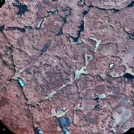
And a snapshot from some 2019 imagery. I'd feel comfortable that the bridge was gone by 2019 at least. The bridge should cross near the center of the image.


And a snapshot from some 2019 imagery. I'd feel comfortable that the bridge was gone by 2019 at least. The bridge should cross near the center of the image.

Thanks, Takk
09/11/2024 06:35PM
Takk, nope, wrong bridge. The bridge I had sent pictures of was at Isabella River where the river left Isabella Lake and crossed the Isabella North Road, probably about a mile north of the Pow Wow entry point in the former pulpyards of Forest Center. The walking bridge was put in at the very spot of the old culverts.
You've certainly done your homework with the neat aerial photos. The photo from 1998 shows the East Road/East Loop well. The truck bridge is, of course, gone as it was dismatled in the mid 70s. For a number of years we had to walk boulgder to bloulder to cross the Pernt River there. If there was a lot water there you just wen'tgoing to cross. I've sent a picture of part of the former truck bridge, very well-built and wide enough and stron enough for 2 pulp trucks to pass each other at the same time
You've certainly done your homework with the neat aerial photos. The photo from 1998 shows the East Road/East Loop well. The truck bridge is, of course, gone as it was dismatled in the mid 70s. For a number of years we had to walk boulgder to bloulder to cross the Pernt River there. If there was a lot water there you just wen'tgoing to cross. I've sent a picture of part of the former truck bridge, very well-built and wide enough and stron enough for 2 pulp trucks to pass each other at the same time
09/11/2024 06:50PM
Here's a continuation of the last posting (I hit the submit button too early) I was making with a picture of the truck bridge at Perent River, around 1975 or so just before it was taken out. 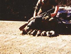 At the time I had no idea how well the bridge was anchored until it was removed. On the north side of the river there was a bald section of exposed ledge rock about 50' long by 30'wide. The rock face was completely smooth, probably worn that way by high water that rushed over it for so many years. On that rock face they had rock-drilled holes and sunk around 3"diameter solid steel shafts (4 of them) which they anchored the bridge timbers to. I have a picture of those shafts somewhere and am on the hunt for them.
If you look at your 1998 aerial photo, the walking bridge was just to the left of the truck bridge crossing about 75' or so.

 The photo with the grouse limit was taken in 1992 when the bridge was fairly new. 1997 was a very dry fall as shown in the photo with Perent River bone dry. There was nearly always water there but 1997 was a very odd year. The 1999 image shows a more common sight at the bridge, lots of water coming through.
 At the time I had no idea how well the bridge was anchored until it was removed. On the north side of the river there was a bald section of exposed ledge rock about 50' long by 30'wide. The rock face was completely smooth, probably worn that way by high water that rushed over it for so many years. On that rock face they had rock-drilled holes and sunk around 3"diameter solid steel shafts (4 of them) which they anchored the bridge timbers to. I have a picture of those shafts somewhere and am on the hunt for them.
If you look at your 1998 aerial photo, the walking bridge was just to the left of the truck bridge crossing about 75' or so.


 The photo with the grouse limit was taken in 1992 when the bridge was fairly new. 1997 was a very dry fall as shown in the photo with Perent River bone dry. There was nearly always water there but 1997 was a very odd year. The 1999 image shows a more common sight at the bridge, lots of water coming through.
09/11/2024 08:58PM
Thanks for sorting me out on the bridge, I was wondering about that. Still curious how they got the approval to drive that far out though. Every story I ever heard was that the SNF is pretty defensive about the no motors in wilderness rule.
Those are great pictures and great info! I've got a mossberg 20ga that looks a lot like the one you've got in the first photo. I keep telling myself every time I head out up there that I need to pick up bird hunting. Last month I had three that just sat there ten feet off the Sioux-Hustler. A hen and her two almost full-grown chicks. She was moving about some to distract me while they were waiting in a balsam perfectly still.
Those are great pictures and great info! I've got a mossberg 20ga that looks a lot like the one you've got in the first photo. I keep telling myself every time I head out up there that I need to pick up bird hunting. Last month I had three that just sat there ten feet off the Sioux-Hustler. A hen and her two almost full-grown chicks. She was moving about some to distract me while they were waiting in a balsam perfectly still.
Thanks, Takk
09/12/2024 12:01PM
When they replaced those culverts at Isabella River they drove not only a large excavator down the North Road but another smaller excavator, a D-6 dozer and at least 3 tandem axle dump trucks. I'm sure they would've liked to have taken the heavy equipment down that mile or so to the river on a low-boy but I don't believe they could've turned it around, there wasn't much room by the river. The walking bridge replaced huge culverts that had some outstanding, creative rock work around them put in by Tomahawk Timber back in the day.  I had never seen any work like that around a culvert before and thought it to be unique. Someone spent a lot of time on constructing it but someone else thought it shouldn't be there as it was now declared a "wilderness area". So, it was dug out at a cost of $80,000 to taxpayers and replaced by a walking bridge. Never made any sense to me, most people that came through that area never knew the culverts/rock work were even there. That was also a beautiful campsite there in the cedars, just south of the portage. It had a large fire ring there that many people used over time but it was also removed and a firegrate took its place. That fire ring had a real history to it, I knew of families that returned each year to relive memories that campsite held for them. Why they couldn't just leave the original fire ring is something else I never understood. You're wondering how they got the approval to do that in a "wilderness area", it's surprising how many things can be accomplished in the name of wilderness.
That's a 12 ga. Rem Wingmaster that I always carry during the bird season. You should give bird hunting a try, if you like to walk like I do you'll be surprised how many other things you may see. Moose, wolves are just some, no telling what's around the next corner.
Funny that you mention that hen ruffed grouse trying to draw you away from her young. I've had that happen at least a half dozen times now and it happened again in July. I was walking a trail near our cabin and she came out of nowhere, all fluffed up with her wings up and making all sorts of commotion trying to get me out of there. I've seen this sort of thing going on when she has chicks, little fuzz balls in June. But this was too late for that, her little ones should've been big enough by that time so she needn't have been that protective of them. But she could've lost her first brood in June and she had to re-nest. I never saw her chicks that day but they must've been mere fuzzballs the way she acted. She made circles around me, rolled on the ground not 3' from me and was making all sort of meowing noises like a cat. I had never heard that before but I suppose this one was trying every trick in the book to get me away from her covey. She did try the ol' broken wing trick, dragging a wing as she limped away, as well before she flew ahead of me and landed on a fairly busy road way. Then she laid down before I chased her off to the other side of the road. I'm hoping she made it back to her chicks and haven't seen hide nor hair (or even feathers) of any of them since.


Small world. As I talk about these encounters with an enraged hen grouse attempting to protect her young, the very first time this happened to me was at that exact spot where the portage from Isabella Lake crossed the North Road and went over to Isabella River, where the culverts were. It was June 1967 and we were moving from Isabella Lake to Bald Eagle Lake. I was carrying the canoe and on the west side of the North Road where the portage crossed, this hen comes out of nowhere and tries to drive me away. I had no idea what was going on and brought the canoe over to the river side of the portage. I came back for a second trip and she was still there but ran off to the side with her fuzzballs.
 I had never seen any work like that around a culvert before and thought it to be unique. Someone spent a lot of time on constructing it but someone else thought it shouldn't be there as it was now declared a "wilderness area". So, it was dug out at a cost of $80,000 to taxpayers and replaced by a walking bridge. Never made any sense to me, most people that came through that area never knew the culverts/rock work were even there. That was also a beautiful campsite there in the cedars, just south of the portage. It had a large fire ring there that many people used over time but it was also removed and a firegrate took its place. That fire ring had a real history to it, I knew of families that returned each year to relive memories that campsite held for them. Why they couldn't just leave the original fire ring is something else I never understood. You're wondering how they got the approval to do that in a "wilderness area", it's surprising how many things can be accomplished in the name of wilderness.
That's a 12 ga. Rem Wingmaster that I always carry during the bird season. You should give bird hunting a try, if you like to walk like I do you'll be surprised how many other things you may see. Moose, wolves are just some, no telling what's around the next corner.
Funny that you mention that hen ruffed grouse trying to draw you away from her young. I've had that happen at least a half dozen times now and it happened again in July. I was walking a trail near our cabin and she came out of nowhere, all fluffed up with her wings up and making all sorts of commotion trying to get me out of there. I've seen this sort of thing going on when she has chicks, little fuzz balls in June. But this was too late for that, her little ones should've been big enough by that time so she needn't have been that protective of them. But she could've lost her first brood in June and she had to re-nest. I never saw her chicks that day but they must've been mere fuzzballs the way she acted. She made circles around me, rolled on the ground not 3' from me and was making all sort of meowing noises like a cat. I had never heard that before but I suppose this one was trying every trick in the book to get me away from her covey. She did try the ol' broken wing trick, dragging a wing as she limped away, as well before she flew ahead of me and landed on a fairly busy road way. Then she laid down before I chased her off to the other side of the road. I'm hoping she made it back to her chicks and haven't seen hide nor hair (or even feathers) of any of them since.


Small world. As I talk about these encounters with an enraged hen grouse attempting to protect her young, the very first time this happened to me was at that exact spot where the portage from Isabella Lake crossed the North Road and went over to Isabella River, where the culverts were. It was June 1967 and we were moving from Isabella Lake to Bald Eagle Lake. I was carrying the canoe and on the west side of the North Road where the portage crossed, this hen comes out of nowhere and tries to drive me away. I had no idea what was going on and brought the canoe over to the river side of the portage. I came back for a second trip and she was still there but ran off to the side with her fuzzballs.
09/25/2024 06:02PM
Hey guys, its me, back again. This time with a new question.
Any memories of a small logging camp that was on the North Road about where Ahmoo Creek begins / about halfway between the 2nd Wye and Arrow Creek began. In the old 1961 photos (and you can still see it in recent photos) a turnoff to the north, and a small clearing with 8+ tiny buildings in two rows. The black line is a centerline I drew using laser imagery.


Any memories of a small logging camp that was on the North Road about where Ahmoo Creek begins / about halfway between the 2nd Wye and Arrow Creek began. In the old 1961 photos (and you can still see it in recent photos) a turnoff to the north, and a small clearing with 8+ tiny buildings in two rows. The black line is a centerline I drew using laser imagery.


Thanks, Takk
10/15/2024 09:18PM
takk: "Hey guys, its me, back again. This time with a new question.
Any memories of a small logging camp that was on the North Road about where Ahmoo Creek begins / about halfway between the 2nd Wye and Arrow Creek began. In the old 1961 photos (and you can still see it in recent photos) a turnoff to the north, and a small clearing with 8+ tiny buildings in two rows. The black line is a centerline I drew using laser imagery.
Takk,
I believe that camp is the small camp my dad referred to when he trapped that area in 1961.
This is an exerpt from one of my previous posts up this thread:
"And then [in 1961] me and old George Klaus, he wanted to go trapping. He'd made a two wheeled cart out of a home made axel, a couple bicycle wheels he bought, had a box built on it on it, and a piece of metal pipe bent into a u-shape for a handle. We put our traps in the box, and some groceries, a couple of sleeping bags, a piece of plastic for a tent, and we walked from Forest Center, up by the old the bridge there on the North Road, all the way up in to Calamity Camp. Well, we set a few traps that same day, built our selves up a tent. Too dumb to check the weather forecast when we went. Woke up about daylight when something plopped down on top of me. Here that son of a bitch had snowed about 7 inches during the night. So, the tent collapsed on us. Too much wet snow weight.
So we walked out. I'd break trail for a ways and the George would break trail for a ways. There was an old little camp site [of shacks], that's where Charlie Hommerding and Nick Jasper and Walt Knotts and four or five other people were living. We bummed a ride with Nick Jasper and got back to where we had parked the car. We gave him enough money to buy a case of beer. We had a hell of a time getting turned around. And went back to Camp 6 and we didn't go back for a week..."
Two of the loggers in the camp in your photo, Charlie Hommerding and Nick Jasper, moved to Camp 6 (47.705264, -91.734777) in 1962. Charlie then married the widow of Reino Hanninen, Louise. Reino and Louise owned the Happy Wanderer tavern before it was taken over by their daughter, Mary Lou and son-in-law Jule Foster. Charlie and Louise later owned and operated the bar/resort near the south end of Greenwood Lake.
To add more context to life up in The Woods. Reino was killed in a tragic accident on May 2nd, 1964, when the car he was riding in ran into one of the giant pines near the White Pine Picnic area on Highway 2. You can still see the scar on the white pine they hit.
To add yet more context, I remember me and my brother were playing outside the old Happy Wanderer when my mom and dad were inside BSing with Reino and Louise. The old Happy Wanderer was a beautiful log building with a bull moose head mounted inside above the door and a juke box with Hank Williams' "Hey Good Lookin' " and Patsy Cline, "Crazy" often playing. Reino kept a loaded rifle hanging on the wall behind the bar - a lever-action Winchester 30-30 as I recall, but I digress...
Anyway, we were playing in a big mud puddle outside the front door and a large black labrador walked around the building and bit my brother in the side of his face (he still has the scar). We ran in the bar crying and told them what happened. Without hesitating, Reino grabbed the rifle, stepped outside the front door, spotted the dog about 30 yards away, in front of one of the little white cabins they had, and shot it dead. He turned around and walked back inside the bar and put the rifle back in its place on the wall.
Some things are indelibly etched in my mind.
Wilderness both captivates your soul and sets it free :)
10/17/2024 12:57PM
Small world (sort of) of your memory of the country music you still remember hearing at the Wanderer. I may have posted it on this site or told you, Jim, about it in another email but back in 1968 my partner and I were headed for Perent Lake via Hog Creek. Another guy was going to give us a ride as far as Hog Creek, drop us off there and we'd make our way back to the South Kawishiwi Campground were he'd pick us up 10 days later. He said the halfway point on the trip would be Sawbill Landing.
There was a neat little cafe there which had the best caramel rolls around. I was 19 yrs. old at the time and I walked into a different world when we walked into that cafe. My music up until that time was 50s-60s rock and roll and when we walked into that bar it was the first time I recall hearing country music. I will never forget, "Stand by your Man" sung by Tammy Wynette was being belted out in the background (either off a juke box or radio, can't remember now). About 5 or 6 tables covered with white and red checkered tablecloths as well as a coffee bar. Plus a waitress that was a knockout. An easy "10" before that rating was ever thought of, about 50 yrs. before it's time. Today, each time I hear that song it takes me back to that memory. The waitress helps, too. Oh, yeah, almost forgot about the caramel rolls, top notch! One of those memories that is etched in my mind.
I never knew Reino but I knew Mary Lou and Jule Foster well. I never knew how Reino died just that he had died, tragic story. That story about the dog bite is one I never heard of either, sounded like how things were handled in the wild west.
I was hoping you'd respond to Takk's posting. I knew you had info on the Calamity Lake Camp, I knew it was in the area of Takk's photos. Did your family not live there for a time?
10/18/2024 08:45AM
Tomahawk, Calamity Camp was in this vicinity 47.854745, -91.237091 . That wasn't an official name, just what my dad called it. The shacks there were moved out in 1958 so only a clearing would be visible in takk's photo from '61. Takk, if you have a view around those coordinates, I'd like to see it.
Wilderness both captivates your soul and sets it free :)
10/23/2024 05:50PM
Tomahawk-JackpineJim
Could you tell us about the forest service role in the local operations? I grow up in the area and don't remember much talk about the forest service until 1964 and then more in 1974.I remember there were a lot of FS employees in Ely and the area in the 60s. I would never see them in the "park" until the 80s.
Was the FS onsite at Forest Center and Sawbill? Many of them? Were cutting permits hard to get? Did the FS work well with the loggers?
10/26/2024 11:56AM
Not sure how accurately I can answer your questions, you're going back around 60 yrs. The Forest Service operation in Ely was much greater back then than it is now. Downsizing seems to have affected almost everyone including the FS. If memory serves me correctly, FS employment out of Ely was around 250 including LaCroix (before they moved to Cook), Halfway and Kawishiwi Ranger Districts and also the Ely Service Center. Wouldn't be surprised if that total was now well below 100 with total employment across the entire Superior National Forest around 250 at best.
I don't know about Sawbill Landing but the FS had a direct presence at Forest Center. They had their own house there, a full 2 story house that reminded me of a railroad house that housed train crews at distant locations. It might've been a former railroad house, not sure or it may have been built right at Forest Center but it was well-built and even had a full block-wall basement. Someone else might be able to help answer origins of the house better than I. I believe it was called the MacDonald house, named for the folks that lived there. The guy in charge there was, I believe, Len "Mac" MacDonald from what I've gathered over the years. He would see day-to-day operations between Tomahawk Timber and the FS. To the best of my knowledge, his family also lived there. When Tomahawk ended its operations there, the MacDonald family moved to Ely and Mac became the Superintendent of the Ely Service Center until he retired. Forest Center was then dismantled, many houses were moved to Isabella in the early 60s where they still stand today. The MacDonald house was the only one that remained for may years after, it was used by rock-raking crews as well as crews building campsites and working on portages in the area.
I couldn't begin answer your question as to whether or not the FS and loggers got along, Jackpine Jim may be in a better place to answer that.
10/27/2024 07:08AM
Tomahawk: "Not sure how accurately I can answer your questions, you're going back around 60 yrs. The Forest Service operation in Ely was much greater back then than it is now. Downsizing seems to have affected almost everyone including the FS. If memory serves me correctly, FS employment out of Ely was around 250 including LaCroix (before they moved to Cook), Halfway and Kawishiwi Ranger Districts and also the Ely Service Center. Wouldn't be surprised if that total was now well below 100 with total employment across the entire Superior National Forest around 250 at best.
I don't know about Sawbill Landing but the FS had a direct presence at Forest Center. They had their own house there, a full 2 story house that reminded me of a railroad house that housed train crews at distant locations. It might've been a former railroad house, not sure or it may have been built right at Forest Center but it was well-built and even had a full block-wall basement. Someone else might be able to help answer origins of the house better than I. I believe it was called the MacDonald house, named for the folks that lived there. The guy in charge there was, I believe, Len "Mac" MacDonald from what I've gathered over the years. He would see day-to-day operations between Tomahawk Timber and the FS. To the best of my knowledge, his family also lived there. When Tomahawk ended its operations there, the MacDonald family moved to Ely and Mac became the Superintendent of the Ely Service Center until he retired. Forest Center was then dismantled, many houses were moved to Isabella in the early 60s where they still stand today. The MacDonald house was the only one that remained for may years after, it was used by rock-raking crews as well as crews building campsites and working on portages in the area.
I couldn't begin answer your question as to whether or not the FS and loggers got along, Jackpine Jim may be in a better place to answer that."
I don't have first hand information regarding if the loggers and FS employees got along. All the loggers I knew of were good, hard working salt of the earth folks that were respectful.
I do have a story my uncle, Frank, told more than a few times though. I'll preface it by noting that there were quite a few loggers who served in the military during and right after WWII so many were very skilled marksmen, if fact, most people I knew at the time and grew up with were/are very good shots, be it with a rifle, pistol, BB gun or home-made maple slingshot.
The section of each logger was given to cut was referred to as a "strip". One day (mid 1950's) a FS employee showed up to check on things at one of the logger's strip while they were back at the landing having a sandwich. I can't recall the name of the particular logger after all these years. The "ranger" was wearing a hardhat and had a pistol in a holster on his belt. As the story was told, the logger complimented the ranger on his pistol and asked if he could check it out. The ranger handed over the pistol and after a brief examination of the gun the logger reached up and grabbed the hardhat off the ranger, tossed it into the air, and shot a hole through it. Kind of like shooting skeet, I suppose. He then handed the ranger his gun back.
I can't say if this was just a BS story, but it's one I heard uncle Frank tell on more than one occasion.
Wilderness both captivates your soul and sets it free :)
10/27/2024 07:32AM
Also meant to say that MacDonald house was located up on the hill at the end of the pulpyard where the rail spurs came in from D.M.& I.R.'s main line. Some of you out there possibly remember it, it was hard to miss being the last building standing at Forest Center. I always wondered what became of it, was it moved somewhere (as I had hoped) or even burned as some structures there were? It seemed too nice of a building to be destroyed but stranger things have happened.
10/27/2024 10:10AM
Findian, now that I think more about your question of how much of an employment footprint the FS had in Ely back in the 50s-60s, I failed to mention the Soil Service, Watershed and Engineers that were not with the Ranger Districts or the Service Center that I mentioned before but were considered part of the FS in Ely.
Another thing I just thought of, when Tomahawk pulled out and the MacDonald family moved to Ely, Mac's son or nephew (not sure now what that relationship was) went to work for either for the Halfway Ranger District or the Engineers.
And Jackpine, that's one great story you told about the hole in the hardhat. I'll be giggling about that all day now................might be a BS story or part of a true one that got embellished by time. Now I'm laughing all over again! I never tire of the stories you have told about "livin' in the woods." Can't make that stuff up.
11/01/2024 03:58PM
This message has had HTML content edited out of it.
Not sure why this sign is at the wilderness shop (is it in Tofte now? because I was told FS has now presence at the former Isabella workstation, which now belongs to the fire department.) Here is a little background: For many years we have been told by FS ranger X (to protect his identity for now) that signs were not allowed in the wilderness. Yet almost every year someone got lost on the Powwow Trail. Eventually FS placed two small brown diamond shaped signs with arrows and the first "WYE" (about 2.7 miles N of EP#86) and I believe there were couple more at the 3rd "WYE" on the north loop, with wash bucket underneath. After the Pagami Creek Fire there was new wilderness ranger on the Tofte R.D. and she had several signs installed at the first "WYE" "Powwow Trail ^ and " and finally "Pose Lake" to campsite at the spur. "Safety" can be a useful tool to justify decisions one way or another. I believe this was around 2016 (would have to look at dates on photos) because BWAC team met with Rick Nolan's staffer Mark Privratsky and lobbied for letting BWAC volunteers clear the Powwow. Mark Privratsky met with FS in Duluth and came back saying "they were very friendly". Well, shortly thereafter USFS reneged and allowed BWAC to maintain 6 miles of PWT from trailhead to the Pose Lake. FS issued a statement that they were going to monitor the visitor usage and for "damage to the resource". Well, I never saw any report but to his credit, Jon Benson from Tofte USFS, to my surprise after 2-3 year or so the trail to Pose being reliably cleared said "Perhaps we should start looking at the south loop (west of 1st "WYE"). That was a pleasant surprise and rest is history. PWT west loop became hike able by ordinary mortals about 2-3 years ago. There are annual blowdowns but BWAC organizes 15-20 crews annually to take care of business. Back to the signs: I asked ranger "Y" at annual Duluth chapter of BWAC dinner this January what is the policy on signs in the BWCA. How come we were told that the law does not allow for signs in BWCA and now there are signs put up by the very USFS? He replied: "That is at the discretion of the district ranger." And there is your answer. In the photo: Returning from survey of East Loop at dusk on December 2023, at the 2nd "WYE" sign badly chewed by bears. PS Current ranger Tofte R.D. is opposed to replacing signs in the BW.
LindenTree: "Thought some of you might like this pic.
I worked out of the Tofte Ranger District wilderness shop last summer and this was on the wall. I didn't ask about it's history, just guessing it was taken down after the BWCA became a Wilderness.
Not sure why this sign is at the wilderness shop (is it in Tofte now? because I was told FS has now presence at the former Isabella workstation, which now belongs to the fire department.) Here is a little background: For many years we have been told by FS ranger X (to protect his identity for now) that signs were not allowed in the wilderness. Yet almost every year someone got lost on the Powwow Trail. Eventually FS placed two small brown diamond shaped signs with arrows and the first "WYE" (about 2.7 miles N of EP#86) and I believe there were couple more at the 3rd "WYE" on the north loop, with wash bucket underneath. After the Pagami Creek Fire there was new wilderness ranger on the Tofte R.D. and she had several signs installed at the first "WYE" "Powwow Trail ^ and " and finally "Pose Lake" to campsite at the spur. "Safety" can be a useful tool to justify decisions one way or another. I believe this was around 2016 (would have to look at dates on photos) because BWAC team met with Rick Nolan's staffer Mark Privratsky and lobbied for letting BWAC volunteers clear the Powwow. Mark Privratsky met with FS in Duluth and came back saying "they were very friendly". Well, shortly thereafter USFS reneged and allowed BWAC to maintain 6 miles of PWT from trailhead to the Pose Lake. FS issued a statement that they were going to monitor the visitor usage and for "damage to the resource". Well, I never saw any report but to his credit, Jon Benson from Tofte USFS, to my surprise after 2-3 year or so the trail to Pose being reliably cleared said "Perhaps we should start looking at the south loop (west of 1st "WYE"). That was a pleasant surprise and rest is history. PWT west loop became hike able by ordinary mortals about 2-3 years ago. There are annual blowdowns but BWAC organizes 15-20 crews annually to take care of business. Back to the signs: I asked ranger "Y" at annual Duluth chapter of BWAC dinner this January what is the policy on signs in the BWCA. How come we were told that the law does not allow for signs in BWCA and now there are signs put up by the very USFS? He replied: "That is at the discretion of the district ranger." And there is your answer. In the photo: Returning from survey of East Loop at dusk on December 2023, at the 2nd "WYE" sign badly chewed by bears. PS Current ranger Tofte R.D. is opposed to replacing signs in the BW.

11/02/2024 02:46PM
takk: "Hey guys, its me, back again. This time with a new question.
Any memories of a small logging camp that was on the North Road about where Ahmoo Creek begins / about halfway between the 2nd Wye and Arrow Creek began. In the old 1961 photos (and you can still see it in recent photos) a turnoff to the north, and a small clearing with 8+ tiny buildings in two rows. The black line is a centerline I drew using laser imagery.
Takk,
Here are some coordinates of some of the logging camps I know of and estimated dates they were occupied. (I hope I didn't make any copy/paste errors) The first series are all Tomahawk camps and the last grouping I believe were from other logging operations.
I'd love to see any arial photos you might be able to find of these.
Happy hunting :)
Camp 1 47.681702, -91.853631???1943 - 1948
Camp 2????? 47.731123, -91.638052???1943 - 1948
"Indian Camp"? 47.709409, -91.607407???1943 - 1944?
"Duck Camp"? 47.709522, -91.575899??? 1944
"Smithville" 47.743156, -91.539220 1944 - 1956
"Bear Lake Camp" 47.729130, -91.434701??? 1944 - 1945?
Camp 3 (Forest Center) 47.801244, -91.303160 1948 - 1965
Forest Center Village 47.794535, -91.306366 1948 - 1945
"Baskatong Camp" 47.866110, -91.127539 ~1950
Camp 4 (Polly Camp) 47.896667, -91.081759 1952 - 1956
Boze Camp 47.946234, -91.059939 1953 - 1955
"Bugo Camp" 47.921742, -91.149449 1954 -1955
Camp 5 47.872689, -91.181218 1956 - 1959
"Calamity Camp" 47.854745, -91.237091 1955 - 1959
"Ferne Camp" 47.825240, -91.215889 1955 - 1959
Un-named camp 47.851060, -91.283355
Camp 6?????? 47.705230, -91.734767??? 1959 - 1965
Sawbill Landing 47.715301, -91.268354 1949 - 1966
Camp on Mitawan Creek 47.754528, -91.395827 ~1960
Camp on Snake River 47.779479, -91.537235 ~1964
Camp Near August Lake 47.768792, -91.593008 ~1953
Wilderness both captivates your soul and sets it free :)
11/03/2024 07:53AM
Jackpine, thanks for posting the many different logging operations which brings up a question I've been meaning to ask you or anyone else about Sawbill Landing. I knew you briefly attended grade school there after also attending in Forest Center as well. Maybe that's why I pretty much assumed Sawbill was a Tomahawk operation. But maybe it wasn't at all and I incorrectly assumed it was. Afterall, the road that heads south down that way from Mitawan Crossing is the Northwest Road. I know Northwest Paper Co. had their office there on the NWR as well as a truck garage well into the 70s, was Sawbill a Northwest Paper operation?
11/03/2024 08:13AM
Katana, what a breath of fresh air after reading your posting here on the signs in the BW. I had always just assumed that was a decree of law after passage of the '78 Wilderness Act, no signs in the BW. At least, if not in that Act, I assumed it was a decree from the Dept of Ag in Washington and something that couldn't even be questioned. But we find out here it is at the ranger's discretion whether or not signs are allowed. Nearly unbelievable that the signs would not be put up to save so may problems. But I shouldn't be surprised, that is just common sense and it has been said that at times it appears to be lacking on the federal level.
My experience with the Pow Wow Trail in that area north of Isabella Lake is maybe more extensive than most other folks, we'd be walking those roads each grouse season. My hunting partners and I began walking the roads that Tomahawk had put in in the early 70s, watching them go from wide logging roads (wide enough for 2 meeting pulp trucks pass each other) to trails. That Isabella North Road junction (about 3 mi. north of Isabella Lake, the 1st "Y") where a road went west toward Quadga Lake and the main North Road went east toward Pose was a real road junction back then. There was no question there was a road split, both roads were just as wide at the time. However, as the roads grew in and became mere trails it became much easier for folks to miss that junction. Many times when I was on my way back from either Pose or Quadga, hikers on their way in toward Quadga were looking for Pose Lake and hikers on their way toward Pose were looking for Quadga. If you weren't paying close attention or looking at a map for the fork there was a good chance you'd miss it. I'd have to correct folks many times over the years going the wrong direction and explain to them where they'd missed the trail that they wanted. Someone out there please correct me if I'm wrong but I didn't believe those arrows on the small diamond signs showed up until after the hiker was lost up near Arrow Lakes. That was 2001 and I thought the arrowed signs came up shortly after the search. I had heard that putting the signs up came from pressure put on by the search crews looking for the hiker, but just what I heard.
I remember a towel hanging in a tree at the 3rd "Y" before the sign was posted there to let folks know that the PWT had then taken an abrupt 90 to the west and Pose Lake but I'm not sure how they would know what the towel meant. Maybe just to make hikers alert to the trail change? I'm not sure I remember a bucket there, it might've been there as the grass got so tall there at times it could've been completely covered or someone removed it, thought it to be 'out of place in a wilderness setting.' There were horse barns there at one time and a small settlement, long after they were gone it was a field of oak grass, usually a sign of horse barns. This was actually a little used campsite for the PWT at one time, later abandoned I suppose for its close proximity to Pose Lake. Moose hunters seemed to like the site more than hikers. The large field there hid the PWT perfectly, there was not even an idea of a trail there and looking to the west you had to look for a break in the trees (to indicate a trail was even there) which was near invisible. You had to know that the PWT forked there because the trail up to that point from the Isabella North Road ran almost straight NW but you could see the tree cut for the former roadbed continue in the same NW direction after the Pose fork. It just seemed to make sense for hikers to continue that way.
After the Pose fork, the old road continued on and if you looked NW from the fork you could still see the very noticeable break in the trees up ahead after all those years, indicating where the old road went. This was a confusing spot, even more so than at the 1st "Y". A lot of hikers continued on this way NW before the trail appeared to end (this was the abandoned North Loop of the PWT) not long after the Pose fork, then coming back to the fork later and finding the real trail toward Pose. The hiker that got lost near Arrow did exactly this, only the trail then was a bit more visible in 2001 so he kept following the abandoned trail until it completely vanished, by that time he was in big trouble. This part of the PWT was known as the North Loop of the PWT and was abandoned around the late 80s. I walked it a lot even after it was abandoned, we referred to this old road as the Insula-Hudson Road that ran close to each lake. About a mile north of the Pose fork, the road (later a mere trail) split, one trail went NW toward Zitkala and Hudson Lakes, the other trail went east, just south of Insula and over toward Arrow Lakes.
A trip on the Insula -Hudson Road would take us up to Arrow Lakes first then over toward Hudson later on. One day, after the Insula trail became overgrown, I was by myself happened to be bird hunting it. Never would you see anyone on it, it was so overgrown no one really knew it was even there, it no longer appeared on any maps. But I knew it well and whenever the trail disappeared I knew where it would reappear a bit later. I had been to Arrow Lakes that day and was on my way back to walk up toward Hudson. I looked ahead on the trail and saw 2 guys coming toward me. After never seeing anyone for many, many years back in here I was really surprised to see these 2 yahoos. Coming closer I could tell they were actually trotting or running. Yes, I can't make this up! No guns so they were not hunting. They had small backpacks and that was it. Clad in T shirts, shorts and running shoes. I stepped aside so they could pass and figured we could chat to find out what they were up to because the area they were headed in was where that hiker in 2001 got lost. They weren't even going to say anything to me, not even a thank you for giving them room as I stepped off the trail. They just kept on trotting and for being so rude I was about to let them keep going but something in me said to stop them and save the Rescue Squad a trip. I hollered to stop and they just stared at me but did stop. I asked them if they knew where they were headed and they said around the Pow Wow. I told them they missed the turn at the Pose Fork (they had actually run 2 extra miles at that point, 4 miles total after they got themselves back to the Pose fork) and were now headed into big trouble. If they continued on in the direction they were going they were headed exactly for the area where the missing hiker had ended up near Arrow Lakes. I really believe I saved the Rescue Squad a trip because these 2 were clueless and headed for deep trouble, they had NO idea where they really were. They thought they did but they were way off (2 miles off). I showed them on the map where they had gone wrong and their mission that day they told me was to make it all the way around the PWT in one day, by running! This was when there was still a moose season and I had plenty of upper body orange on just to be safe. I informed them it was also the opening day of moose season and wearing some orange might be a good idea. At thart point the lead runner said they were aware of that and turned in front of me, proudly displaying a 10" length of orange surveyor's ribbon attached to his backpack. Not sure if runner #2 had any ribbon or not but for something that idiotic I guess it didn't make any differnce. I can't make that up, either! I just shook my head in disbelief as they turned around and began running in the correct direction this time. Another no thank you from them for getting them straightened out.
Quite some time later I was attending one of Martin Kubik's presentations on the PWT at Hartley Nature Center in Duluth. Before the presentation started folks were milling around and looking at some of the displays set up. I was looking at some in the back of the room and I see a guy back there also doing the same as myself. I know this guy from somewhere, a familiar face but couldn't immediately place him. Usually things like this take a long time for me to figure out but this ID came to me rather quickly. I walked up to him and asked if he was one of the runners on the Insula trail that day. At first he was puzzled but then it came to him, he fessed up said it was him and his friend and then thanked me for saving them a lot of trouble. He said they had actually run the trail one other time and the day I saw them they were trying to beat their time. I think the 4 extra miles that day let the earlier record stand.
Once again, hats off to Matin for all the work and persistence he has put in on saving the PWT. Katana, in your post here you mention that Martin had just come back from the former East Loop of the PWT, any idea what he found out and any plans to reopen that loop? The last time I walked that there was a lot of water from beaver activity.
11/03/2024 06:20PM
Findian: "Could we get approximate location of the B-17 crash near Little Bear camp? I might go out with a metal detector some time. "
Findian,
I think the best I can do beyond the words of my dad further up the post is to show you where I've searched, keying off Dad's statement that; "..one of the engines and landing gear tumbled all the way down into the creek." I've walked all these old roads many times and bushwhacked all the areas marked in yellow and found nothing. I too have planned (hoped) to try covering some of the same ground with a metal detector but, sadly, events have kept me from the area for over 2 years now :(
Findian, I created a screenshot from google maps of the area and marked all the areas I've searched.
Suffice it to say, I've combed the banks of all the creeks around Little Bear Lake and come up empty.

Wilderness both captivates your soul and sets it free :)
11/04/2024 10:18AM
A forester I worked with out of the Tofte RD was familiar with the crash. He told me that all remnants of the plane were hauled away. I searched for a day with Jackpine Jim one time, we came up empty, but it was fun searching.
May the rivers be crooked and winding, and your portages lonesome, leading to the most amazing view.
11/04/2024 02:03PM
Tomahawk: "Katana, what a breath of fresh air after reading your posting and asked if he was one of the runners on the Insula trail that day. At first he was puzzled but then it came to him, he fessed up said it was him and his friend and then thanked me for saving them a lot of trouble. He said they had actually run the trail one other time and the day I saw them they were trying to beat their time. I think the 4 extra miles that day let the earlier record stand.
Once again, hats off to Matin for all the work and persistence he has put in on saving the PWT. Katana, in your post here you mention that Martin had just come back from the former East Loop of the PWT, any idea what he found out and any plans to reopen that loop? The last time I walked that there was a lot of water from beaver activity."
Tomahawk, thank you for sharing your thoughts about signage in BWCA. For better or worse rules appear to be flexible and the interpretation depends a lot on what the district ranger decides.
Regarding the East Loop, portions not impacted by the Pagami Creek Megafire are still and surprisingly quite hike-able, granted with occasional detours around tangles. I ventured on the North-East loop from the 2nd "WYE" early last winter. One can follow what used to be a road North of the 2nd WYE for about a 1/2 mile. There the road empties into a West-East beaver pond, with two lodges. Once ice was safe, we followed the pond east. Beaver dam at east end is about 3-4 feet high and below is much smaller beaver pond and a dam. On south side is huge gravel pit in the hillside, with boulders piled 6-8 feet on the left with a rusted remnant of a stove pipe on the ground. The stream that exits the beaver dam follows in the tracks of the logging road, with jack pines dotting the road. This scenario eventually ends in series of wetlands with the stream here and there being clearly defined by ice and snow on the top of it and leading the explorer ahead. Further east, the road is very well defined but now overgrown with dense alder brush. We were better off hiking through the frozen wetland next to the logging road, sometimes following a stretch of high land with logging road that until we got to intersection of a spur trail north to Arrow Lake campsite (spur trail being indistinct now). This was just at east end of small pond about 50 yds long that can be clearly seen in aerial photo some 200-300 yds west of Arrow Creek. We hoped to reach the Arrow Lake campsite but it was too late in the day and after lunch we turned back. We did make it to Arrow Lake campsite later, in February 2024, taking a different route: via Isabella Lake and following north going wetlands. That expedition took unexpected 20 hours and we were up for straight 24 hours that day. I will post a link to a photo essay next time.
Going the other way, on East Loop, south arm of the East Loop from the Forest Center is hike-able for about 3.5 miles. For a trail that has not been cleared for at least since the 1993 BWCAW Management Plan it is in remarkable condition (link to a photo essay in the end of message), especially in the "green zone" that was shaded from the PCF by Isabella Lake. However, about 3.5 miles from start at Forest Center, the second "tongue" of the fire extending from the Isabella Lake crossed the East Loop road and the "hiker's hell" ensues, with dead tree fall over dead tree fall - impenetrable by ordinary mortals. One hiker, much younger than me, reported making a progress (if you can call it that) of a quarter of a mile in 50 minutes, that translates into 1 mile taking 3.5 hours, and that is if you have the mental stamina to endure crawling over, under and around. Going around treefalls is useless because one will have to go around more treefalls and eventually lose a track of the road. Having GAIA app with a historic USFS map on the phone is a necessity here. The fire grate at the Perent River crossing is still there, the bridge is gone but several rebars and thick spike remain, along with coiled wire cable on the S shore. Campsite is designated for reopening since 2011 or so, but still has a sign on the fire grate that it is closed and jack pines have take over. As far as reopening the East Loop, one Tofte FS ranger I contacted sent me two emails communicating that East Loop is in PMA, that that is the Forest Plan, period. However, PWT is a historic trail, East Loop being built by YCC (Youth Conservation Corps) in 1980's after the passage of the BWAC Wilderness Act of 1978. I find it troubling that the USFS appears to be vehemently opposed restoring the very trail they built 44 years ago. Therefore, I have founded, with other like-minded outdoor enthusiasts, the "Boundary Waters Heritage Trails" 501c3 dedicated, among other things, to restoring these historic trails for use and enjoyment by future generations. When hiking these trails, one can't be but in awe about how much labor went into building these logging roads, and about how the men and women worked and lived in the logging camps. If you agree that we must preserve this history and these trails, my hope is that you will join me in this undertaking. Many thought that the Kek and PWT West Loop could not be brought back. History speaks for itself. Website: Boundary Waters Heritage Trails Here is a link to photo essay East Loop Powwow Trail - east loop survey
11/05/2024 01:41PM
Katana, that's quite a statement for the FS to make, that they regrettingly allowed the PWT to be recut after the Pagami but were going to monitor it for damage to the resource. This coming from the very people that allowed the Pagami to burn in the first place, over 92,000 acres up in smoke that cost all of us around $23 million, nearly killing their own crews on Insula Lake as well as campers on Kawasachong and Sqaure Lakes. On top of that, the FS took no hand in recutting the trails due to their own negligence, others like Martin had to open the trails back up.
11/05/2024 01:58PM
Yup, the East Loop has to be such a tangle in spots. It wasn't a real issue back in the late 80s when I walked it for the last time. At that time all the water was becoming a real issue from beaver activity. But there were areas in the Ferne-Nuthatch areas that you could've still driven a pulp truck down. It sounds like you still found some of those areas not long ago as well.
When the FS first decided to give up the East Loop, I contacted Tofte in an effort to keep it open. After all they had invested so much manpower and time in opening the trail in the first place. But they weren't interested, to me it sounded easy come, easy go with little thought into what they had invested in the trails with clearing, bridge building, etc.
Katana, if I were 20 yrs. younger I would've been a member of your group already but at this point in my life I can see that joining your group is a young person's venture, just no longer for me. I wish you the best in keeping the trails open. Thanks for your detailed recollection of your trip around the East Loop, the photos you included brought back many memories. Great job!
11/05/2024 02:40PM
Katana,
"Not sure why this sign is at the wilderness shop (is it in Tofte now? because I was told FS has now presence at the former Isabella workstation, which now belongs to the fire department."
Yes the sign is in at Tofte Ranger Station in the wilderness shop, hanging way up on a wall. I volunteered there the last two years.
Isabella used to be its own Ranger Station but was absorbed into the Tofte and Laurention RD's years ago. Since then it became the Isabella Work Station. (That is where I worked and lived in the early 2,000's it was my duty station). I ran the fire engine out of Isabella, but it is not a fire department. The fire crews staff the Isabella Work Station regularly from the Tofte Ranger Station.
FYI, many of the buildings were sold in the mid 2,000's up on the hill. The work Station still has a few buildings in the lower area by the helibase. Some were built by the CCC's, this is where the fire crews staff out of.
May the rivers be crooked and winding, and your portages lonesome, leading to the most amazing view.
02/20/2025 08:36AM
I haven’t noticed the following reference source in the thread, but that might be only because a single brain can’t keep it all in mind.
First the teaser:

Now the meat of the matter:
Logging Missabe Style – The Wales Branch
EDIT: For reasons that are opaque to me, the link to the “meat” has gone dead. Send me a request by email and I’ll reply with a copy of the article.
First the teaser:

Now the meat of the matter:
Logging Missabe Style – The Wales Branch
EDIT: For reasons that are opaque to me, the link to the “meat” has gone dead. Send me a request by email and I’ll reply with a copy of the article.
02/21/2025 12:45PM
Good work gravelroad, first the teaser then the meat of the matter. I'm interested in anything posted to this thread but swallowed the entire hook, line and sinker here. At first glance at the photo I thought it looked like the pulpyards at Forest Center, it must've looked much like that with the main line coming in along the loading track. Seeing the D.M.&I.R. diesel engine on what must've been the main line was something that really made me curious. I had always wondered if the diesel engines had come in all the way to Forest Center. I always thought the trestle at Island River not strong enough to support them, even the Mallet locomotives before them. But I find out that the steam engines picked up all the pulp cars at Forest Center and took them further south where the diesels picked them up from there. Anyone know how far the diesels came?
Great maps here gravelroad, you move right to the head of the class with this one!
Seeing all the switching devices make it all that more interesting.
Great maps here gravelroad, you move right to the head of the class with this one!
Seeing all the switching devices make it all that more interesting.
02/21/2025 01:10PM
I just took another look at the picture again of the D.M.&.I.R. diesel on the main line and approaching the loading track. I had not scrolled down far enough before, there is information below the picture that mentions this location at Isabella where the tracks crossed Hwy. 1. That's evidently where the diesels picked up the cars from Forest Center, Sawbill Landing, Kelly Landing as well as other landings along the tracks back to Two Harbors. Now I'm wondering where the wood was hauled? When Forest Center was operating and when Nekoosa-Edwards still owned it (Tomahawk Timber was a subsidiary of Nekoosa-Edwards), the wood was hauled to mills in Nekoosa, Edwards and Mosinee, WI on the Wisconsin River. After Tomahawk ended its MN operations I wonder if the wood went to places like LP in Two Harbors or Georgia Pacific in Duluth instead? Nekoosa-Edwards may have only taken wood from that area when Tomahawk was still there.
02/23/2025 09:58AM
I wonder if there were many deer present at the logging camp. I know by 1975 moose population was at 3 moose per sq mile which is very high for moose.
Many say deer were not present before logging.
But there is written documents of native Americans and others selling deer meat and moose on the streets of Ely in 1890.
So I always wonder if some deer were present.
Otherwise, the number by the 1930's seem so explosive to expand into the area so fast.
So much history missing?
02/23/2025 06:44PM
I believe there were always some deer around, maybe not many but some. The population really took off in the 50s-60s. I was told by a Forest Service employee in the late 60s that the moose population per square mile was much higher than 3. I believe he said between Maniwaki and Ferne lakes it was at 6 or 7. Supposedly that was where the heaviest population was, they were even thinking to go in with the DNR to have special hunts by canoe only in what is now the Fungus Primitive Area but that never came about. I don't know if he knew what he was talking about but that was what he said.
02/23/2025 07:05PM
Tomahawk: "I believe there were always some deer around, maybe not many but some. The population really took off in the 50s-60s. I was told by a Forest Service employee in the late 60s that the moose population per square mile was much higher than 3. I believe he said between Maniwaki and Ferne lakes it was at 6 or 7. Supposedly that was where the heaviest population was, they were even thinking to go in with the DNR to have special hunts by canoe only in what is now the Fungus Primitive Area but that never came about. I don't know if he knew what he was talking about but that was what he said."
I know Ferne Lake area was considered the highest in the state.
02/24/2025 07:32AM
Good question that you bring up Pinetree, wondering how great the deer population was around the logging camps. I've said earlier that I believe there were always some deer around but thinking more about that I think there may have been good deer populations after and during the cutting. Did they move into the area quickly as the cutting was being done? I'm guessing that may have happened just that way to add to deer that were already there. I've tried to recall Jackpine Jim's accounts of his dad's deer hunting around Smithtown (right on the Tomahawk Road) when they lived there. If I'm remembering correctly of Jackpine's telling of those stories there was some fairly incredible hunting at that time. Whether or not that happened year after year I don't know, only Jim can refresh our memory on that. Have you got your ears on Jim?
Yes, Pinetree, moose sightings and sign were almost outer-worldly around Ferne Lake. My 2 hunting partners and I would grouse hunt that area a lot, the birds were 'near thick as woodticks' and so were the moose at that time. Where the old road into the Ferne country off the Isabella North Road (to the southeast) skirted the north side of Ferne Lake itself, just to the north of the road would completely torn up by rutting bulls. The area had been apparently seeded (the jack pine were so thick in spots it appeared that it had been seeded by air but I'm not completely sure on that) or planted with jacks; the young jacks didn't have much of a life span around there much of the time. Not only would the gravel (a lot of gravel around there) be torn up but small trees would be uprooted, torn out of the ground by hooves, some trees a bit larger would be broken off and larger 6" jacks would have their bark rubbed off from antlers (some completely girdled). I recall walking back into the rutting areas more than once, (probably not more that 30-50 yds. off the road), it was a very eerie feeling. More than once I could even smell some of the strong odors given off by these love-seekers. Some of the upturned gravel was so fresh you never walked back in there blind, you never knew if the critter was still around and the last thing you ever wanted to come nose to nose with one of those ornery beasts. The tracks on the road itself were not only incredible in number but also in size. We never saw any of the big bulls when we came through there but saw a few that were very respectable. Mostly saw a lot of cows with calves. This heavy sign continued to the north up the road toward Nuthatch Lake where the sign became a bit less.
Yes, Pinetree, moose sightings and sign were almost outer-worldly around Ferne Lake. My 2 hunting partners and I would grouse hunt that area a lot, the birds were 'near thick as woodticks' and so were the moose at that time. Where the old road into the Ferne country off the Isabella North Road (to the southeast) skirted the north side of Ferne Lake itself, just to the north of the road would completely torn up by rutting bulls. The area had been apparently seeded (the jack pine were so thick in spots it appeared that it had been seeded by air but I'm not completely sure on that) or planted with jacks; the young jacks didn't have much of a life span around there much of the time. Not only would the gravel (a lot of gravel around there) be torn up but small trees would be uprooted, torn out of the ground by hooves, some trees a bit larger would be broken off and larger 6" jacks would have their bark rubbed off from antlers (some completely girdled). I recall walking back into the rutting areas more than once, (probably not more that 30-50 yds. off the road), it was a very eerie feeling. More than once I could even smell some of the strong odors given off by these love-seekers. Some of the upturned gravel was so fresh you never walked back in there blind, you never knew if the critter was still around and the last thing you ever wanted to come nose to nose with one of those ornery beasts. The tracks on the road itself were not only incredible in number but also in size. We never saw any of the big bulls when we came through there but saw a few that were very respectable. Mostly saw a lot of cows with calves. This heavy sign continued to the north up the road toward Nuthatch Lake where the sign became a bit less.
03/17/2025 08:56AM
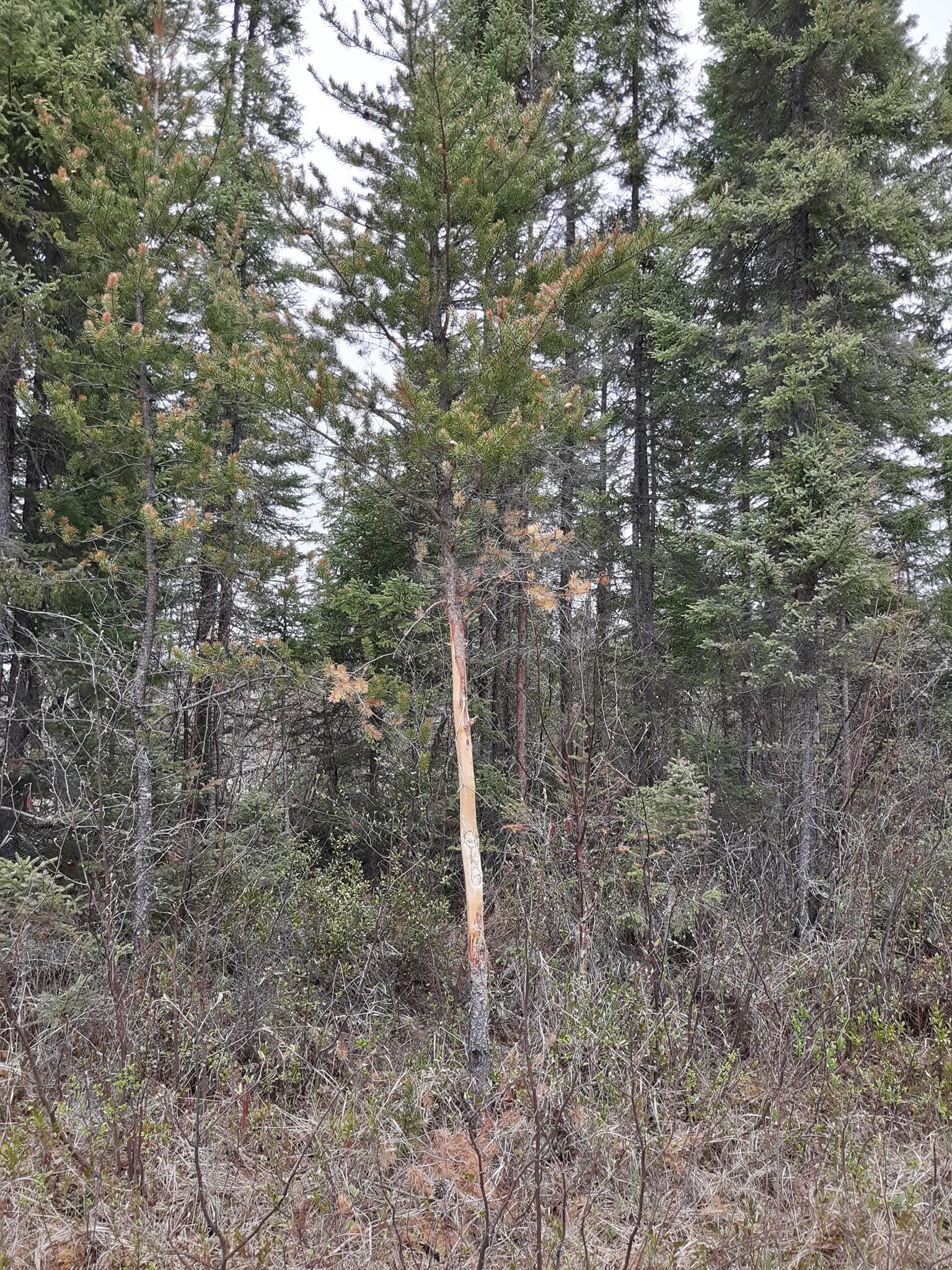

Picture of my dad next to a moose scrape taken in 2019 just at the convergance of the powwow and ferne creek.... still some moose in the area. I havent made it back into ferne but going to scout a route in early june.
~Work to live,don't live to work~
03/17/2025 01:25PM
Wintersguy80, that is a very impressive rub! Just curious, how tall is your dad there? Looks to be 6' or a bit taller? That was a good-sized critter that made that, most of the moose rubs I've seen are much closer to the ground. Only a few that I can recall being that far off the ground - impressive antlers made that rub. I know exactly where you are talking about, the intersection of Powwow and Ferne Creeks. Before the fire, about 6-8 of us fished Isabella Lake each June, when fishing was tough on the lake I'd usually be able to get 1 or 2 guys to come along with me into Ferne Lake. It was a long enough day trip, that portage from Ferne Creek into the lake didn't help either - I remember that being around a mile (anyone recall for sure?) and most of the time our party just wanted to fish Isabella. I'd say I've been into Ferne by canoe around 1/2 dozen times plus walking in from the Powwow Trail another 1/2 dozen times. Generally speaking, I think the walleyes were a bit larger than on Isabella. When we'd go in by canoe, the trail was well-kept up at first but then kept getting worse and worse. The last time I went in the portage was getting increasingly hard to follow and had a number of windfalls across. It was pretty apparent that moose appeared to be using the portage more than humans, in one spot the trail when around a big, downed spruce and as I carried the canoe I thought that I stayed on what I thought was the portage but was just a moose trail that mostly ended. I had to backtrack my way to that downed spruce to once again locate the portage. I knew a guy from Ely that fished Isabella a lot and also went into Ferne many more times that I ever did. He said he could almost walk that portage blindfolded but soon after I stopped going in there he said he tried to get in after a windstorm knocked over countless trees over the portage killed by a budworm infestation. Between trying to find the portage and stepping over and going around windfalls he just gave up and fished Isabella instead. Part of our June fishing crew tried to go in there and they had no luck finding the trail anymore. Coincidentally, that last time I was in there I also found out that it had become a PMA, that was the reason you couldn't find the trail any longer and lost interest in ever going back.
I wish you luck in going back in there this June if that trip pans out. I hope it does and I, along with so many others that post here, hope you will post the outcome of that trip.
 I found a picture of one of the prints left by of one of the bulls I had seen just north of Ferne Lake in the rutting area back in the mid 70s. Not a monster but shown here alongside a 2 3/4" 12 ga. shell.

Subscribe to Thread
Become a member of the bwca.com community to subscribe to thread and get email updates when new posts are added. Sign up Here
Community Links
 Search BWCA.com
 Donate
 Featured Sponsor
